時間帯:中国標準時
現地時間:2026年11月16日 月曜日 21:04
経度:84
緯度:36
今日の日の出時刻:09:02:22
今日の日の入時刻:19:17:51
今日の日長:10時間15分29秒
明日の日の出時刻:09:03:23
明日の日の入時刻:19:17:13
明日の日長:10時間13分50秒

: すべて表示する

日付 日出 日没 日長
2026年1月1日 09:35:34 19:20:29 9時間44分54秒
2026年2月1日 09:27:06 19:50:06 10時間22分59秒
2026年3月1日 08:57:42 20:18:31 11時間20分49秒
2026年4月1日 08:13:40 20:45:15 12時間31分35秒
2026年5月1日 07:34:19 21:10:37 13時間36分18秒
2026年6月1日 07:10:38 21:35:31 14時間24分52秒
2026年7月1日 07:11:26 21:46:00 14時間34分34秒
2026年8月1日 07:31:19 21:31:55 14時間0分35秒
2026年9月1日 07:56:01 20:55:59 12時間59分57秒
2026年10月1日 08:18:57 20:11:49 11時間52分51秒
2026年11月1日 08:46:13 19:31:29 10時間45分16秒
2026年11月16日 09:01:20 19:18:30 10時間17分9秒
2026年11月17日 09:02:22 19:17:51 10時間15分29秒
2026年12月1日 09:16:10 19:11:49 9時間55分38秒

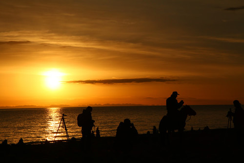
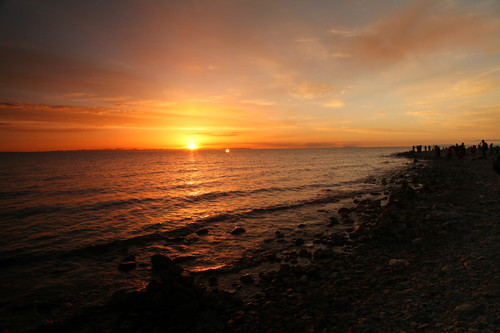
日の出と日の入りの写真

CHINA Sichuan Province Leshan Mount Emei  Waterfalls 2497 AJ20 by SDB Fine Art Travel of 2 Decades to 555+ Places Ph, ©All rights reserved © sundeepkullu.com ™©® SunDeep™©® Bhardwaj Kullu
Share this Photostory (As i ca
CHINA Sichuan Province Leshan Mount Emei Waterfalls 2497 AJ20 by SDB Fine Art Travel of 2 Decades to 555+ Places Ph
CHINA Sichuan Province Leshan Mount Emei  Waterfalls 2558 AJ20 by SDB Fine Art Travel of 2 Decades to 555+ Places Ph, ©All rights reserved © sundeepkullu.com ™©® SunDeep™©® Bhardwaj Kullu
Share this Photostory (As i ca
CHINA Sichuan Province Leshan Mount Emei Waterfalls 2558 AJ20 by SDB Fine Art Travel of 2 Decades to 555+ Places Ph
FUXI NÜWA & CHINESE MYTHOLOGY CLARIFIED BY MIAO LEGEND CONFIRMS NOAH’S FLOOD HISTORY!那誰會是伏羲呢?FU XI & Nü-WA – 伏羲 女媧...不周山 Bù zhōu Shān Buzhou Mountain by bernawy hugues kossi huo, Mount Buzhou (不周山), a pillar holding up the sky. The pillar collapsed and caused the sky to tilt tow
FUXI NÜWA & CHINESE MYTHOLOGY CLARIFIED BY MIAO LEGEND CONFIRMS NOAH’S FLOOD HISTORY!那誰會是伏羲呢?FU XI & Nü-WA – 伏羲 女媧...不周山 Bù zhōu Shān Buzhou Mountain by bernawy hugues kossi huo
CHINA Sichuan Province Chengdu Sichuan Giant Panda Sanctuaries Chongquing Tour 3204 AJ20 by SDB Fine Art Travel of 2 Decades to 555+ Places Ph, ©All rights reserved © sundeepkullu.com ™©® SunDeep™©® Bhardwaj Kullu
Share this Photostory (As i ca
CHINA Sichuan Province Chengdu Sichuan Giant Panda Sanctuaries Chongquing Tour 3204 AJ20 by SDB Fine Art Travel of 2 Decades to 555+ Places Ph
Passage to Shangri-La~City in the Clouds by TravellingTheBLU26, <b>This "Shangri-La" is my backyard, a view from the terrace!</b>

<b>Shangri-La</b> is a
Passage to Shangri-La~City in the Clouds by TravellingTheBLU26
CHINA Leshan Sichuan province Mount Emei Monastry 2793 AJ20 by SDB Fine Art Travel of 2 Decades to 555+ Places Ph, ©All rights reserved © sundeepkullu.com ™©® SunDeep™©® Bhardwaj Kullu
Share this Photostory (As i ca
CHINA Leshan Sichuan province Mount Emei Monastry 2793 AJ20 by SDB Fine Art Travel of 2 Decades to 555+ Places Ph
CHINA Leshan Sichuan province Mount Emei Monastry 2709 AJ20 by SDB Fine Art Travel of 2 Decades to 555+ Places Ph, ©All rights reserved © sundeepkullu.com ™©® SunDeep™©® Bhardwaj Kullu
Share this Photostory (As i ca
CHINA Leshan Sichuan province Mount Emei Monastry 2709 AJ20 by SDB Fine Art Travel of 2 Decades to 555+ Places Ph
Axis mundi...Obelisk..represented rays of light...also cosmic axis, world axis, world pillar, center of the world, world tree)..Wheel of Fortune  the Hermetic magical-religious system which was also b by bernawy hugues kossi huo, The Egyptian circle or ancient wheel of fortune is a Sphinx which represents the mystery of life.  I
Axis mundi...Obelisk..represented rays of light...also cosmic axis, world axis, world pillar, center of the world, world tree)..Wheel of Fortune the Hermetic magical-religious system which was also b by bernawy hugues kossi huo
CHINA Sichuan Province Chengdu Sichuan Giant Panda Sanctuaries Chongquing Tour 3273 AJ20 by SDB Fine Art Travel of 2 Decades to 555+ Places Ph, ©All rights reserved © sundeepkullu.com ™©® SunDeep™©® Bhardwaj Kullu
Share this Photostory (As i ca
CHINA Sichuan Province Chengdu Sichuan Giant Panda Sanctuaries Chongquing Tour 3273 AJ20 by SDB Fine Art Travel of 2 Decades to 555+ Places Ph
CHINA Sichuan Province Chengdu Sichuan Giant Panda Sanctuaries Chongquing Tour 2793 AJ20 by SDB Fine Art Travel of 2 Decades to 555+ Places Ph, ©All rights reserved © sundeepkullu.com ™©® SunDeep™©® Bhardwaj Kullu
Share this Photostory (As i ca
CHINA Sichuan Province Chengdu Sichuan Giant Panda Sanctuaries Chongquing Tour 2793 AJ20 by SDB Fine Art Travel of 2 Decades to 555+ Places Ph
Sunrise In the Karakorams, Diamer, Pakistan - June 2006 by SaffyH, 
<a href="https://en.wikipedia.org/wiki/Karakoram" rel="nofollow">en.wikipedia.org/wiki/Karakoram</a
Sunrise In the Karakorams, Diamer, Pakistan - June 2006 by SaffyH
Ladakh Sunset, India 2016 by reurinkjan, Ladakh ("land of high passes") (Ladakhi: ལ་དྭགས la'dwags; Hindi: लद्दाख़ laddākh; Urdu: لَ
Ladakh Sunset, India 2016 by reurinkjan
Dawn @ Pamir Mountains (Explore 1-3-2013) by Feng Wei Photography, 新疆-塔什库尔干-日出帕米尔

First sunlight shines over the snow-covered peak of Kunlun mountains on Pamir platea
Dawn @ Pamir Mountains (Explore 1-3-2013) by Feng Wei Photography
Sunrise Over Pamir Mountains (Explore 11-23-2012) by Feng Wei Photography, 新疆-塔什库尔干-帕米尔日出

Sunrise over snow-covered peak of Mt. Muztagh Ata on Pamir plateau, with houses of l
Sunrise Over Pamir Mountains (Explore 11-23-2012) by Feng Wei Photography
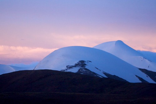
昆仑 / Kunlun by randomix, 中国 青海 玉树 不冻泉
Budongquan, Yushu, Qinghai, Chinachina sunset nature night canon landscapes outdoor bud
昆仑 / Kunlun by randomix
Morning Light Over Mt. Muztagh Ata by Feng Wei Photography, 新疆-塔什库尔干-帕米尔之晨

Morning light over snow-covered peak of Mount Muztagh Ata on Pamir plateau, with hou
Morning Light Over Mt. Muztagh Ata by Feng Wei Photography
Sunrise Reflection of Kongur Tagh on Karakul Lake by spearhawk, Kongur Tagh (7649m) is the highest peak of the Kunlun Mountains in China. It is just north of Muztag
Sunrise Reflection of Kongur Tagh on Karakul Lake by spearhawk
Kashgar: Karakul Lake and the Pamir Mountains by Teo Choong Ching Photography, The Pamir Mountains are a mountain range in Central Asia formed by the junction of the Himalayas wit
Kashgar: Karakul Lake and the Pamir Mountains by Teo Choong Ching Photography
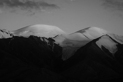
Kunlun Nightfall by Michael Bollino, Soft light falls on mountains in the Kunlun range of Tibet. light sunset mountain snow mountains ice
Kunlun Nightfall by Michael Bollino
Sunrise Reflection of Kongur Tagh on Karakul Lake by spearhawk, Kongur Tagh (7649m) is the highest peak of the Kunlun Mountains in China. It is just north of Muztag
Sunrise Reflection of Kongur Tagh on Karakul Lake by spearhawk
Afloat on a sea of clouds by Don Ski, Far Easteners and a British author called it Shangrila, thinking it was hidden in the Kunlun Mountai
Afloat on a sea of clouds by Don Ski
Reflection of Muztagh Ata on Karakul Lake by spearhawk, Muztagh Ata (7546m) is the second highest of the mountains which form the northern edge of the Tibet
Reflection of Muztagh Ata on Karakul Lake by spearhawk
Sunset over Kongur Tagh by spearhawk, Kongur Tagh (7649m) is the highest peak of the Kunlun Mountains in China. It is just north of Muztag
Sunset over Kongur Tagh by spearhawk
Sunrise Reflection of Kongur Tagh on Karakul Lake by spearhawk, Kongur Tagh (7649m) is the highest peak of the Kunlun Mountains in China. It is just north of Muztag
Sunrise Reflection of Kongur Tagh on Karakul Lake by spearhawk
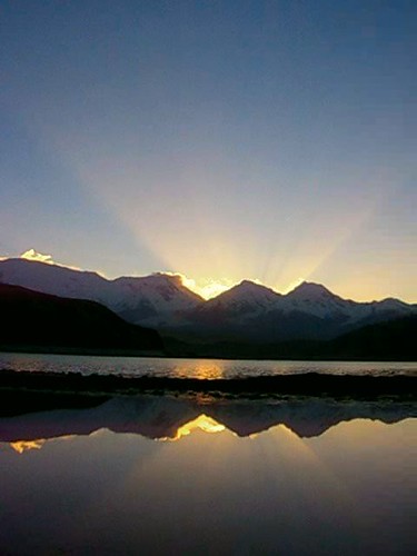
Sunrise At Kongur Tagh Over Karakul Lake by spearhawk, Kongur Tagh (7649m) is the highest peak of the Kunlun Mountains in China. It is just north of Muztag
Sunrise At Kongur Tagh Over Karakul Lake by spearhawk
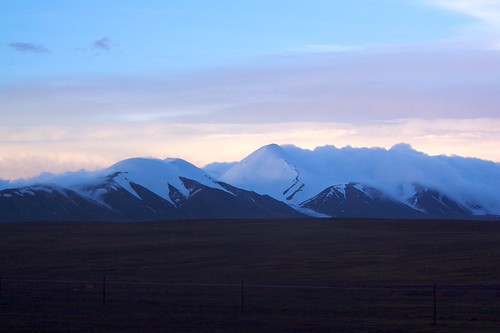
昆仑 / Kunlun by randomix, 中国 青海 玉树 不冻泉
Budongquan, Yushu, Qinghai, Chinachina sunset nature canon landscapes outdoor buddhism
昆仑 / Kunlun by randomix
Ladakh ("land of high passes") (Ladakhi: ལ་དྭགས la'dwags; Hindi: लद्दाख़; Urdu: لَدّاخ‎) is a region in Indian state of Jammu and Kashmir that currently extends from the Kunlun mountain range[3] to th by ballerina2811,  Aksai Chin is one of the disputed border areas between China and India.[6] It is administered by Ch
Ladakh ("land of high passes") (Ladakhi: ལ་དྭགས la'dwags; Hindi: लद्दाख़; Urdu: لَدّاخ‎) is a region in Indian state of Jammu and Kashmir that currently extends from the Kunlun mountain range[3] to th by ballerina2811
Kunlun Mountains,昆侖山脈 by The Real Kvass, Kunlun Mountains: <a href="http://en.wikipedia.org/wiki/Kunlun_Mountains" rel="nofollow">en.wikipedi
Kunlun Mountains,昆侖山脈 by The Real Kvass
Sunset over Muztagh Ata by spearhawk, Muztagh Ata (7546m) is the second highest of the mountains which form the northern edge of the Tibet
Sunset over Muztagh Ata by spearhawk
夕阳下的昆仑山脉 / Kunlun Mountains in the sunset by livepine, 2007 yuzhu kunlun 昆仑 玉珠峰
夕阳下的昆仑山脉 / Kunlun Mountains in the sunset by livepine
Sunrise over Muztagh Ata by spearhawk, Muztagh Ata (7546m) is the second highest of the mountains which form the northern edge of the Tibet
Sunrise over Muztagh Ata by spearhawk
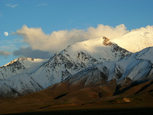
Qinghai, China by distantpeak, Moonrise in the Kunlun mountains on the Qinghai-Tibetan Plateauchina travel sunset mountains expedit
Qinghai, China by distantpeak
Qinghai, China by distantpeak, It was a spectacular evening at camp (4300m). The mountains behind reach 6000m or more, and forms th
Qinghai, China by distantpeak
Muztagh Ata,慕士塔格峰 by The Real Kvass !, Sunset over Kunlun Mountains
(seen from the slope of Muztagh Ata)

Muztagh Ata: <a href="http://en.w
Muztagh Ata,慕士塔格峰 by The Real Kvass !
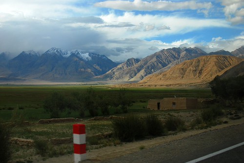
Sunset on the Kunlun Shan by KOKONIS, Tashkurgan Tajik Autonomous County, Xinjiang, China

This area, bordering Afghanistan is inhabited b
Sunset on the Kunlun Shan by KOKONIS
夕阳下的帐篷 / tents in the sunset by livepine, 2007 yuzhu kunlun 昆仑 玉珠峰
夕阳下的帐篷 / tents in the sunset by livepine
Sunrise Over Pamir Wetland by wetwetmoneymoney, 新疆-塔什库尔干-帕米尔湿地

Sunrise over Pamir wetland, with Kunlun mountains in the background. Shot in Tashkur
Sunrise Over Pamir Wetland by wetwetmoneymoney
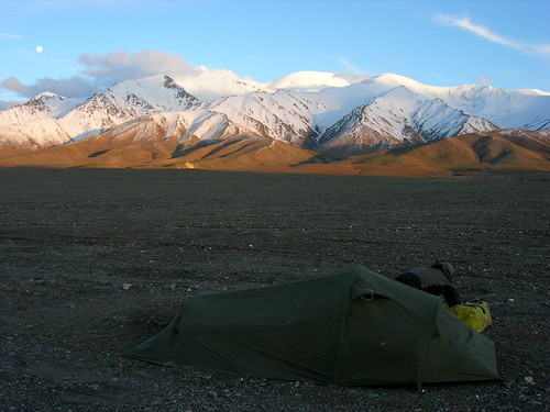
Qinghai, China by distantpeak, Jardar in camp, in front of the Kunlun Shan mountains.china travel sunset mountains expedition qingh
Qinghai, China by distantpeak
DSC_5542 by 满溪(Mr. William Zhang), Kunlun Mountains
Qinghai Province, China
State Road 109kunlunmountainsqinghaiprovince chinastateroad
DSC_5542 by 满溪(Mr. William Zhang)
Sunrise over Kongur Tagh by MrBlackSun, Kongur Tagh is the highest mountain of the Kunlun Shan. Altitude: 7,649 metres.
Sometimes also consi
Sunrise over Kongur Tagh by MrBlackSun
Muztagh Ata sunrise by MrBlackSun, Muztagh Ata (7546 m) at sunrise. Muztagh means Ice Mountain Father. It is the second highest peak of
Muztagh Ata sunrise by MrBlackSun
Qinghai Lake 22 by chinavacations, Qinghai Lake is the largest inland salt water lake in China covering an area of 4,573 square kilomet
Qinghai Lake 22 by chinavacations
Qinghai Lake 23 by chinavacations, Qinghai Lake is the largest inland salt water lake in China covering an area of 4,573 square kilomet
Qinghai Lake 23 by chinavacations
Qinghai Lake 19 by chinavacations, Qinghai Lake is the largest inland salt water lake in China covering an area of 4,573 square kilomet
Qinghai Lake 19 by chinavacations
Qinghai Lake 20 by chinavacations, Qinghai Lake is the largest inland salt water lake in China covering an area of 4,573 square kilomet
Qinghai Lake 20 by chinavacations
Qinghai Lake 21 by chinavacations, Qinghai Lake is the largest inland salt water lake in China covering an area of 4,573 square kilomet
Qinghai Lake 21 by chinavacations