Ihope Rd, Mountain View, HI, アメリカ合衆国Ihope Road日の出日の入り時間
Location: アメリカ合衆国 > ハワイ州 > ハワイ > アメリカ合衆国 ハワイ州 マウンテン・ビュー >
時間帯:
Pacific/Honolulu
現地時間:
2025-07-11 19:48:36
経度:
-155.1492337
緯度:
19.5698258
今日の日の出時刻:
05:49:46 AM
今日の日の入時刻:
07:02:59 PM
今日の日長:
13h 13m 13s
明日の日の出時刻:
05:50:08 AM
明日の日の入時刻:
07:02:50 PM
明日の日長:
13h 12m 42s
すべて表示する
| 日付 | 日出 | 日没 | 日長 |
|---|---|---|---|
| 2025年01月01日 | 06:55:21 AM | 05:54:27 PM | 10h 59m 6s |
| 2025年01月02日 | 06:55:39 AM | 05:55:05 PM | 10h 59m 26s |
| 2025年01月03日 | 06:55:55 AM | 05:55:42 PM | 10h 59m 47s |
| 2025年01月04日 | 06:56:10 AM | 05:56:20 PM | 11h 0m 10s |
| 2025年01月05日 | 06:56:24 AM | 05:56:59 PM | 11h 0m 35s |
| 2025年01月06日 | 06:56:37 AM | 05:57:37 PM | 11h 1m 0s |
| 2025年01月07日 | 06:56:49 AM | 05:58:16 PM | 11h 1m 27s |
| 2025年01月08日 | 06:56:59 AM | 05:58:55 PM | 11h 1m 56s |
| 2025年01月09日 | 06:57:08 AM | 05:59:34 PM | 11h 2m 26s |
| 2025年01月10日 | 06:57:16 AM | 06:00:13 PM | 11h 2m 57s |
| 2025年01月11日 | 06:57:23 AM | 06:00:52 PM | 11h 3m 29s |
| 2025年01月12日 | 06:57:28 AM | 06:01:31 PM | 11h 4m 3s |
| 2025年01月13日 | 06:57:32 AM | 06:02:10 PM | 11h 4m 38s |
| 2025年01月14日 | 06:57:35 AM | 06:02:49 PM | 11h 5m 14s |
| 2025年01月15日 | 06:57:37 AM | 06:03:28 PM | 11h 5m 51s |
| 2025年01月16日 | 06:57:37 AM | 06:04:07 PM | 11h 6m 30s |
| 2025年01月17日 | 06:57:36 AM | 06:04:46 PM | 11h 7m 10s |
| 2025年01月18日 | 06:57:34 AM | 06:05:24 PM | 11h 7m 50s |
| 2025年01月19日 | 06:57:30 AM | 06:06:03 PM | 11h 8m 33s |
| 2025年01月20日 | 06:57:25 AM | 06:06:41 PM | 11h 9m 16s |
| 2025年01月21日 | 06:57:19 AM | 06:07:19 PM | 11h 10m 0s |
| 2025年01月22日 | 06:57:11 AM | 06:07:56 PM | 11h 10m 45s |
| 2025年01月23日 | 06:57:03 AM | 06:08:33 PM | 11h 11m 30s |
| 2025年01月24日 | 06:56:53 AM | 06:09:10 PM | 11h 12m 17s |
| 2025年01月25日 | 06:56:41 AM | 06:09:47 PM | 11h 13m 6s |
| 2025年01月26日 | 06:56:29 AM | 06:10:23 PM | 11h 13m 54s |
| 2025年01月27日 | 06:56:15 AM | 06:10:59 PM | 11h 14m 44s |
| 2025年01月28日 | 06:56:00 AM | 06:11:35 PM | 11h 15m 35s |
| 2025年01月29日 | 06:55:44 AM | 06:12:10 PM | 11h 16m 26s |
| 2025年01月30日 | 06:55:26 AM | 06:12:45 PM | 11h 17m 19s |
| 2025年01月31日 | 06:55:08 AM | 06:13:19 PM | 11h 18m 11s |
| 2025年02月01日 | 06:54:48 AM | 06:13:53 PM | 11h 19m 5s |
| 2025年02月02日 | 06:54:27 AM | 06:14:26 PM | 11h 19m 59s |
| 2025年02月03日 | 06:54:04 AM | 06:14:59 PM | 11h 20m 55s |
| 2025年02月04日 | 06:53:41 AM | 06:15:31 PM | 11h 21m 50s |
| 2025年02月05日 | 06:53:17 AM | 06:16:03 PM | 11h 22m 46s |
| 2025年02月06日 | 06:52:51 AM | 06:16:35 PM | 11h 23m 44s |
| 2025年02月07日 | 06:52:24 AM | 06:17:06 PM | 11h 24m 42s |
| 2025年02月08日 | 06:51:57 AM | 06:17:36 PM | 11h 25m 39s |
| 2025年02月09日 | 06:51:28 AM | 06:18:06 PM | 11h 26m 38s |
| 2025年02月10日 | 06:50:58 AM | 06:18:36 PM | 11h 27m 38s |
| 2025年02月11日 | 06:50:27 AM | 06:19:05 PM | 11h 28m 38s |
| 2025年02月12日 | 06:49:55 AM | 06:19:33 PM | 11h 29m 38s |
| 2025年02月13日 | 06:49:23 AM | 06:20:01 PM | 11h 30m 38s |
| 2025年02月14日 | 06:48:49 AM | 06:20:29 PM | 11h 31m 40s |
| 2025年02月15日 | 06:48:14 AM | 06:20:56 PM | 11h 32m 42s |
| 2025年02月16日 | 06:47:39 AM | 06:21:22 PM | 11h 33m 43s |
| 2025年02月17日 | 06:47:02 AM | 06:21:48 PM | 11h 34m 46s |
| 2025年02月18日 | 06:46:25 AM | 06:22:14 PM | 11h 35m 49s |
| 2025年02月19日 | 06:45:47 AM | 06:22:39 PM | 11h 36m 52s |
| 2025年02月20日 | 06:45:08 AM | 06:23:03 PM | 11h 37m 55s |
| 2025年02月21日 | 06:44:28 AM | 06:23:28 PM | 11h 39m 0s |
| 2025年02月22日 | 06:43:47 AM | 06:23:51 PM | 11h 40m 4s |
| 2025年02月23日 | 06:43:06 AM | 06:24:14 PM | 11h 41m 8s |
| 2025年02月24日 | 06:42:24 AM | 06:24:37 PM | 11h 42m 13s |
| 2025年02月25日 | 06:41:42 AM | 06:24:59 PM | 11h 43m 17s |
| 2025年02月26日 | 06:40:58 AM | 06:25:21 PM | 11h 44m 23s |
| 2025年02月27日 | 06:40:14 AM | 06:25:43 PM | 11h 45m 29s |
| 2025年02月28日 | 06:39:30 AM | 06:26:04 PM | 11h 46m 34s |
| 2025年03月01日 | 06:38:44 AM | 06:26:25 PM | 11h 47m 41s |
| 2025年03月02日 | 06:37:59 AM | 06:26:45 PM | 11h 48m 46s |
| 2025年03月03日 | 06:37:12 AM | 06:27:05 PM | 11h 49m 53s |
| 2025年03月04日 | 06:36:26 AM | 06:27:24 PM | 11h 50m 58s |
| 2025年03月05日 | 06:35:38 AM | 06:27:44 PM | 11h 52m 6s |
| 2025年03月06日 | 06:34:51 AM | 06:28:03 PM | 11h 53m 12s |
| 2025年03月07日 | 06:34:02 AM | 06:28:21 PM | 11h 54m 19s |
| 2025年03月08日 | 06:33:14 AM | 06:28:40 PM | 11h 55m 26s |
| 2025年03月09日 | 06:32:25 AM | 06:28:58 PM | 11h 56m 33s |
| 2025年03月10日 | 06:31:35 AM | 06:29:15 PM | 11h 57m 40s |
| 2025年03月11日 | 06:30:46 AM | 06:29:33 PM | 11h 58m 47s |
| 2025年03月12日 | 06:29:56 AM | 06:29:50 PM | 11h 59m 54s |
| 2025年03月13日 | 06:29:05 AM | 06:30:07 PM | 12h 1m 2s |
| 2025年03月14日 | 06:28:15 AM | 06:30:24 PM | 12h 2m 9s |
| 2025年03月15日 | 06:27:24 AM | 06:30:41 PM | 12h 3m 17s |
| 2025年03月16日 | 06:26:33 AM | 06:30:57 PM | 12h 4m 24s |
| 2025年03月17日 | 06:25:42 AM | 06:31:13 PM | 12h 5m 31s |
| 2025年03月18日 | 06:24:51 AM | 06:31:29 PM | 12h 6m 38s |
| 2025年03月19日 | 06:23:59 AM | 06:31:45 PM | 12h 7m 46s |
| 2025年03月20日 | 06:23:08 AM | 06:32:01 PM | 12h 8m 53s |
| 2025年03月21日 | 06:22:16 AM | 06:32:17 PM | 12h 10m 1s |
| 2025年03月22日 | 06:21:24 AM | 06:32:33 PM | 12h 11m 9s |
| 2025年03月23日 | 06:20:33 AM | 06:32:48 PM | 12h 12m 15s |
| 2025年03月24日 | 06:19:41 AM | 06:33:04 PM | 12h 13m 23s |
| 2025年03月25日 | 06:18:49 AM | 06:33:19 PM | 12h 14m 30s |
| 2025年03月26日 | 06:17:58 AM | 06:33:34 PM | 12h 15m 36s |
| 2025年03月27日 | 06:17:06 AM | 06:33:50 PM | 12h 16m 44s |
| 2025年03月28日 | 06:16:15 AM | 06:34:05 PM | 12h 17m 50s |
| 2025年03月29日 | 06:15:23 AM | 06:34:21 PM | 12h 18m 58s |
| 2025年03月30日 | 06:14:32 AM | 06:34:36 PM | 12h 20m 4s |
| 2025年03月31日 | 06:13:41 AM | 06:34:52 PM | 12h 21m 11s |
| 2025年04月01日 | 06:12:50 AM | 06:35:07 PM | 12h 22m 17s |
| 2025年04月02日 | 06:12:00 AM | 06:35:23 PM | 12h 23m 23s |
| 2025年04月03日 | 06:11:09 AM | 06:35:38 PM | 12h 24m 29s |
| 2025年04月04日 | 06:10:19 AM | 06:35:54 PM | 12h 25m 35s |
| 2025年04月05日 | 06:09:29 AM | 06:36:10 PM | 12h 26m 41s |
| 2025年04月06日 | 06:08:40 AM | 06:36:26 PM | 12h 27m 46s |
| 2025年04月07日 | 06:07:51 AM | 06:36:42 PM | 12h 28m 51s |
| 2025年04月08日 | 06:07:02 AM | 06:36:58 PM | 12h 29m 56s |
| 2025年04月09日 | 06:06:14 AM | 06:37:15 PM | 12h 31m 1s |
| 2025年04月10日 | 06:05:26 AM | 06:37:31 PM | 12h 32m 5s |
| 2025年04月11日 | 06:04:38 AM | 06:37:48 PM | 12h 33m 10s |
| 2025年04月12日 | 06:03:51 AM | 06:38:05 PM | 12h 34m 14s |
| 2025年04月13日 | 06:03:05 AM | 06:38:22 PM | 12h 35m 17s |
| 2025年04月14日 | 06:02:19 AM | 06:38:39 PM | 12h 36m 20s |
| 2025年04月15日 | 06:01:33 AM | 06:38:57 PM | 12h 37m 24s |
| 2025年04月16日 | 06:00:48 AM | 06:39:14 PM | 12h 38m 26s |
| 2025年04月17日 | 06:00:04 AM | 06:39:32 PM | 12h 39m 28s |
| 2025年04月18日 | 05:59:20 AM | 06:39:50 PM | 12h 40m 30s |
| 2025年04月19日 | 05:58:37 AM | 06:40:09 PM | 12h 41m 32s |
| 2025年04月20日 | 05:57:55 AM | 06:40:27 PM | 12h 42m 32s |
| 2025年04月21日 | 05:57:13 AM | 06:40:46 PM | 12h 43m 33s |
| 2025年04月22日 | 05:56:31 AM | 06:41:05 PM | 12h 44m 34s |
| 2025年04月23日 | 05:55:51 AM | 06:41:24 PM | 12h 45m 33s |
| 2025年04月24日 | 05:55:11 AM | 06:41:44 PM | 12h 46m 33s |
| 2025年04月25日 | 05:54:32 AM | 06:42:04 PM | 12h 47m 32s |
| 2025年04月26日 | 05:53:54 AM | 06:42:24 PM | 12h 48m 30s |
| 2025年04月27日 | 05:53:16 AM | 06:42:44 PM | 12h 49m 28s |
| 2025年04月28日 | 05:52:40 AM | 06:43:05 PM | 12h 50m 25s |
| 2025年04月29日 | 05:52:04 AM | 06:43:25 PM | 12h 51m 21s |
| 2025年04月30日 | 05:51:29 AM | 06:43:46 PM | 12h 52m 17s |
| 2025年05月01日 | 05:50:54 AM | 06:44:08 PM | 12h 53m 14s |
| 2025年05月02日 | 05:50:21 AM | 06:44:29 PM | 12h 54m 8s |
| 2025年05月03日 | 05:49:49 AM | 06:44:51 PM | 12h 55m 2s |
| 2025年05月04日 | 05:49:17 AM | 06:45:13 PM | 12h 55m 56s |
| 2025年05月05日 | 05:48:46 AM | 06:45:35 PM | 12h 56m 49s |
| 2025年05月06日 | 05:48:16 AM | 06:45:57 PM | 12h 57m 41s |
| 2025年05月07日 | 05:47:48 AM | 06:46:20 PM | 12h 58m 32s |
| 2025年05月08日 | 05:47:20 AM | 06:46:43 PM | 12h 59m 23s |
| 2025年05月09日 | 05:46:53 AM | 06:47:06 PM | 13h 0m 13s |
| 2025年05月10日 | 05:46:27 AM | 06:47:29 PM | 13h 1m 2s |
| 2025年05月11日 | 05:46:02 AM | 06:47:52 PM | 13h 1m 50s |
| 2025年05月12日 | 05:45:38 AM | 06:48:15 PM | 13h 2m 37s |
| 2025年05月13日 | 05:45:15 AM | 06:48:39 PM | 13h 3m 24s |
| 2025年05月14日 | 05:44:53 AM | 06:49:03 PM | 13h 4m 10s |
| 2025年05月15日 | 05:44:32 AM | 06:49:27 PM | 13h 4m 55s |
| 2025年05月16日 | 05:44:12 AM | 06:49:50 PM | 13h 5m 38s |
| 2025年05月17日 | 05:43:53 AM | 06:50:14 PM | 13h 6m 21s |
| 2025年05月18日 | 05:43:35 AM | 06:50:38 PM | 13h 7m 3s |
| 2025年05月19日 | 05:43:18 AM | 06:51:03 PM | 13h 7m 45s |
| 2025年05月20日 | 05:43:03 AM | 06:51:27 PM | 13h 8m 24s |
| 2025年05月21日 | 05:42:48 AM | 06:51:51 PM | 13h 9m 3s |
| 2025年05月22日 | 05:42:34 AM | 06:52:15 PM | 13h 9m 41s |
| 2025年05月23日 | 05:42:22 AM | 06:52:39 PM | 13h 10m 17s |
| 2025年05月24日 | 05:42:10 AM | 06:53:03 PM | 13h 10m 53s |
| 2025年05月25日 | 05:42:00 AM | 06:53:27 PM | 13h 11m 27s |
| 2025年05月26日 | 05:41:50 AM | 06:53:51 PM | 13h 12m 1s |
| 2025年05月27日 | 05:41:42 AM | 06:54:14 PM | 13h 12m 32s |
| 2025年05月28日 | 05:41:34 AM | 06:54:38 PM | 13h 13m 4s |
| 2025年05月29日 | 05:41:28 AM | 06:55:01 PM | 13h 13m 33s |
| 2025年05月30日 | 05:41:22 AM | 06:55:24 PM | 13h 14m 2s |
| 2025年05月31日 | 05:41:18 AM | 06:55:47 PM | 13h 14m 29s |
| 2025年06月01日 | 05:41:15 AM | 06:56:10 PM | 13h 14m 55s |
| 2025年06月02日 | 05:41:13 AM | 06:56:32 PM | 13h 15m 19s |
| 2025年06月03日 | 05:41:11 AM | 06:56:54 PM | 13h 15m 43s |
| 2025年06月04日 | 05:41:11 AM | 06:57:16 PM | 13h 16m 5s |
| 2025年06月05日 | 05:41:12 AM | 06:57:38 PM | 13h 16m 26s |
| 2025年06月06日 | 05:41:13 AM | 06:57:59 PM | 13h 16m 46s |
| 2025年06月07日 | 05:41:16 AM | 06:58:19 PM | 13h 17m 3s |
| 2025年06月08日 | 05:41:19 AM | 06:58:39 PM | 13h 17m 20s |
| 2025年06月09日 | 05:41:24 AM | 06:58:59 PM | 13h 17m 35s |
| 2025年06月10日 | 05:41:29 AM | 06:59:18 PM | 13h 17m 49s |
| 2025年06月11日 | 05:41:35 AM | 06:59:37 PM | 13h 18m 2s |
| 2025年06月12日 | 05:41:42 AM | 06:59:55 PM | 13h 18m 13s |
| 2025年06月13日 | 05:41:50 AM | 07:00:13 PM | 13h 18m 23s |
| 2025年06月14日 | 05:41:59 AM | 07:00:30 PM | 13h 18m 31s |
| 2025年06月15日 | 05:42:08 AM | 07:00:46 PM | 13h 18m 38s |
| 2025年06月16日 | 05:42:19 AM | 07:01:02 PM | 13h 18m 43s |
| 2025年06月17日 | 05:42:30 AM | 07:01:17 PM | 13h 18m 47s |
| 2025年06月18日 | 05:42:42 AM | 07:01:31 PM | 13h 18m 49s |
| 2025年06月19日 | 05:42:54 AM | 07:01:45 PM | 13h 18m 51s |
| 2025年06月20日 | 05:43:07 AM | 07:01:58 PM | 13h 18m 51s |
| 2025年06月21日 | 05:43:21 AM | 07:02:10 PM | 13h 18m 49s |
| 2025年06月22日 | 05:43:36 AM | 07:02:21 PM | 13h 18m 45s |
| 2025年06月23日 | 05:43:51 AM | 07:02:32 PM | 13h 18m 41s |
| 2025年06月24日 | 05:44:07 AM | 07:02:41 PM | 13h 18m 34s |
| 2025年06月25日 | 05:44:23 AM | 07:02:50 PM | 13h 18m 27s |
| 2025年06月26日 | 05:44:40 AM | 07:02:58 PM | 13h 18m 18s |
| 2025年06月27日 | 05:44:57 AM | 07:03:05 PM | 13h 18m 8s |
| 2025年06月28日 | 05:45:15 AM | 07:03:11 PM | 13h 17m 56s |
| 2025年06月29日 | 05:45:34 AM | 07:03:16 PM | 13h 17m 42s |
| 2025年06月30日 | 05:45:52 AM | 07:03:21 PM | 13h 17m 29s |
| 2025年07月01日 | 05:46:12 AM | 07:03:24 PM | 13h 17m 12s |
| 2025年07月02日 | 05:46:31 AM | 07:03:26 PM | 13h 16m 55s |
| 2025年07月03日 | 05:46:51 AM | 07:03:28 PM | 13h 16m 37s |
| 2025年07月04日 | 05:47:11 AM | 07:03:28 PM | 13h 16m 17s |
| 2025年07月05日 | 05:47:32 AM | 07:03:27 PM | 13h 15m 55s |
| 2025年07月06日 | 05:47:53 AM | 07:03:25 PM | 13h 15m 32s |
| 2025年07月07日 | 05:48:14 AM | 07:03:22 PM | 13h 15m 8s |
| 2025年07月08日 | 05:48:35 AM | 07:03:19 PM | 13h 14m 44s |
| 2025年07月09日 | 05:48:57 AM | 07:03:14 PM | 13h 14m 17s |
| 2025年07月10日 | 05:49:18 AM | 07:03:08 PM | 13h 13m 50s |
| 2025年07月11日 | 05:49:40 AM | 07:03:01 PM | 13h 13m 21s |
| 2025年07月12日 | 05:50:02 AM | 07:02:53 PM | 13h 12m 51s |
| 2025年07月13日 | 05:50:24 AM | 07:02:43 PM | 13h 12m 19s |
| 2025年07月14日 | 05:50:46 AM | 07:02:33 PM | 13h 11m 47s |
| 2025年07月15日 | 05:51:09 AM | 07:02:22 PM | 13h 11m 13s |
| 2025年07月16日 | 05:51:31 AM | 07:02:09 PM | 13h 10m 38s |
| 2025年07月17日 | 05:51:53 AM | 07:01:56 PM | 13h 10m 3s |
| 2025年07月18日 | 05:52:15 AM | 07:01:41 PM | 13h 9m 26s |
| 2025年07月19日 | 05:52:38 AM | 07:01:25 PM | 13h 8m 47s |
| 2025年07月20日 | 05:53:00 AM | 07:01:09 PM | 13h 8m 9s |
| 2025年07月21日 | 05:53:22 AM | 07:00:51 PM | 13h 7m 29s |
| 2025年07月22日 | 05:53:44 AM | 07:00:32 PM | 13h 6m 48s |
| 2025年07月23日 | 05:54:06 AM | 07:00:12 PM | 13h 6m 6s |
| 2025年07月24日 | 05:54:28 AM | 06:59:51 PM | 13h 5m 23s |
| 2025年07月25日 | 05:54:49 AM | 06:59:29 PM | 13h 4m 40s |
| 2025年07月26日 | 05:55:11 AM | 06:59:05 PM | 13h 3m 54s |
| 2025年07月27日 | 05:55:32 AM | 06:58:41 PM | 13h 3m 9s |
| 2025年07月28日 | 05:55:53 AM | 06:58:16 PM | 13h 2m 23s |
| 2025年07月29日 | 05:56:14 AM | 06:57:50 PM | 13h 1m 36s |
| 2025年07月30日 | 05:56:35 AM | 06:57:22 PM | 13h 0m 47s |
| 2025年07月31日 | 05:56:55 AM | 06:56:54 PM | 12h 59m 59s |
| 2025年08月01日 | 05:57:16 AM | 06:56:25 PM | 12h 59m 9s |
| 2025年08月02日 | 05:57:36 AM | 06:55:54 PM | 12h 58m 18s |
| 2025年08月03日 | 05:57:56 AM | 06:55:23 PM | 12h 57m 27s |
| 2025年08月04日 | 05:58:15 AM | 06:54:51 PM | 12h 56m 36s |
| 2025年08月05日 | 05:58:34 AM | 06:54:18 PM | 12h 55m 44s |
| 2025年08月06日 | 05:58:54 AM | 06:53:44 PM | 12h 54m 50s |
| 2025年08月07日 | 05:59:12 AM | 06:53:09 PM | 12h 53m 57s |
| 2025年08月08日 | 05:59:31 AM | 06:52:33 PM | 12h 53m 2s |
| 2025年08月09日 | 05:59:49 AM | 06:51:56 PM | 12h 52m 7s |
| 2025年08月10日 | 06:00:07 AM | 06:51:19 PM | 12h 51m 12s |
| 2025年08月11日 | 06:00:25 AM | 06:50:40 PM | 12h 50m 15s |
| 2025年08月12日 | 06:00:42 AM | 06:50:01 PM | 12h 49m 19s |
| 2025年08月13日 | 06:00:59 AM | 06:49:21 PM | 12h 48m 22s |
| 2025年08月14日 | 06:01:16 AM | 06:48:40 PM | 12h 47m 24s |
| 2025年08月15日 | 06:01:33 AM | 06:47:58 PM | 12h 46m 25s |
| 2025年08月16日 | 06:01:49 AM | 06:47:16 PM | 12h 45m 27s |
| 2025年08月17日 | 06:02:05 AM | 06:46:33 PM | 12h 44m 28s |
| 2025年08月18日 | 06:02:21 AM | 06:45:49 PM | 12h 43m 28s |
| 2025年08月19日 | 06:02:36 AM | 06:45:05 PM | 12h 42m 29s |
| 2025年08月20日 | 06:02:51 AM | 06:44:20 PM | 12h 41m 29s |
| 2025年08月21日 | 06:03:06 AM | 06:43:34 PM | 12h 40m 28s |
| 2025年08月22日 | 06:03:21 AM | 06:42:48 PM | 12h 39m 27s |
| 2025年08月23日 | 06:03:35 AM | 06:42:01 PM | 12h 38m 26s |
| 2025年08月24日 | 06:03:50 AM | 06:41:13 PM | 12h 37m 23s |
| 2025年08月25日 | 06:04:04 AM | 06:40:25 PM | 12h 36m 21s |
| 2025年08月26日 | 06:04:17 AM | 06:39:36 PM | 12h 35m 19s |
| 2025年08月27日 | 06:04:31 AM | 06:38:47 PM | 12h 34m 16s |
| 2025年08月28日 | 06:04:44 AM | 06:37:57 PM | 12h 33m 13s |
| 2025年08月29日 | 06:04:57 AM | 06:37:07 PM | 12h 32m 10s |
| 2025年08月30日 | 06:05:10 AM | 06:36:17 PM | 12h 31m 7s |
| 2025年08月31日 | 06:05:23 AM | 06:35:26 PM | 12h 30m 3s |
| 2025年09月01日 | 06:05:36 AM | 06:34:34 PM | 12h 28m 58s |
| 2025年09月02日 | 06:05:48 AM | 06:33:42 PM | 12h 27m 54s |
| 2025年09月03日 | 06:06:00 AM | 06:32:50 PM | 12h 26m 50s |
| 2025年09月04日 | 06:06:12 AM | 06:31:58 PM | 12h 25m 46s |
| 2025年09月05日 | 06:06:24 AM | 06:31:05 PM | 12h 24m 41s |
| 2025年09月06日 | 06:06:36 AM | 06:30:12 PM | 12h 23m 36s |
| 2025年09月07日 | 06:06:48 AM | 06:29:19 PM | 12h 22m 31s |
| 2025年09月08日 | 06:07:00 AM | 06:28:25 PM | 12h 21m 25s |
| 2025年09月09日 | 06:07:12 AM | 06:27:31 PM | 12h 20m 19s |
| 2025年09月10日 | 06:07:23 AM | 06:26:37 PM | 12h 19m 14s |
| 2025年09月11日 | 06:07:35 AM | 06:25:43 PM | 12h 18m 8s |
| 2025年09月12日 | 06:07:46 AM | 06:24:49 PM | 12h 17m 3s |
| 2025年09月13日 | 06:07:58 AM | 06:23:55 PM | 12h 15m 57s |
| 2025年09月14日 | 06:08:10 AM | 06:23:00 PM | 12h 14m 50s |
| 2025年09月15日 | 06:08:21 AM | 06:22:06 PM | 12h 13m 45s |
| 2025年09月16日 | 06:08:33 AM | 06:21:11 PM | 12h 12m 38s |
| 2025年09月17日 | 06:08:45 AM | 06:20:17 PM | 12h 11m 32s |
| 2025年09月18日 | 06:08:56 AM | 06:19:22 PM | 12h 10m 26s |
| 2025年09月19日 | 06:09:08 AM | 06:18:28 PM | 12h 9m 20s |
| 2025年09月20日 | 06:09:20 AM | 06:17:33 PM | 12h 8m 13s |
| 2025年09月21日 | 06:09:32 AM | 06:16:39 PM | 12h 7m 7s |
| 2025年09月22日 | 06:09:44 AM | 06:15:45 PM | 12h 6m 1s |
| 2025年09月23日 | 06:09:57 AM | 06:14:51 PM | 12h 4m 54s |
| 2025年09月24日 | 06:10:09 AM | 06:13:57 PM | 12h 3m 48s |
| 2025年09月25日 | 06:10:22 AM | 06:13:03 PM | 12h 2m 41s |
| 2025年09月26日 | 06:10:34 AM | 06:12:09 PM | 12h 1m 35s |
| 2025年09月27日 | 06:10:47 AM | 06:11:16 PM | 12h 0m 29s |
| 2025年09月28日 | 06:11:01 AM | 06:10:23 PM | 11h 59m 22s |
| 2025年09月29日 | 06:11:14 AM | 06:09:30 PM | 11h 58m 16s |
| 2025年09月30日 | 06:11:28 AM | 06:08:38 PM | 11h 57m 10s |
| 2025年10月01日 | 06:11:42 AM | 06:07:46 PM | 11h 56m 4s |
| 2025年10月02日 | 06:11:56 AM | 06:06:54 PM | 11h 54m 58s |
| 2025年10月03日 | 06:12:11 AM | 06:06:03 PM | 11h 53m 52s |
| 2025年10月04日 | 06:12:26 AM | 06:05:12 PM | 11h 52m 46s |
| 2025年10月05日 | 06:12:41 AM | 06:04:22 PM | 11h 51m 41s |
| 2025年10月06日 | 06:12:57 AM | 06:03:32 PM | 11h 50m 35s |
| 2025年10月07日 | 06:13:13 AM | 06:02:43 PM | 11h 49m 30s |
| 2025年10月08日 | 06:13:29 AM | 06:01:54 PM | 11h 48m 25s |
| 2025年10月09日 | 06:13:46 AM | 06:01:05 PM | 11h 47m 19s |
| 2025年10月10日 | 06:14:03 AM | 06:00:17 PM | 11h 46m 14s |
| 2025年10月11日 | 06:14:20 AM | 05:59:30 PM | 11h 45m 10s |
| 2025年10月12日 | 06:14:38 AM | 05:58:44 PM | 11h 44m 6s |
| 2025年10月13日 | 06:14:56 AM | 05:57:58 PM | 11h 43m 2s |
| 2025年10月14日 | 06:15:15 AM | 05:57:12 PM | 11h 41m 57s |
| 2025年10月15日 | 06:15:34 AM | 05:56:28 PM | 11h 40m 54s |
| 2025年10月16日 | 06:15:54 AM | 05:55:44 PM | 11h 39m 50s |
| 2025年10月17日 | 06:16:14 AM | 05:55:01 PM | 11h 38m 47s |
| 2025年10月18日 | 06:16:35 AM | 05:54:19 PM | 11h 37m 44s |
| 2025年10月19日 | 06:16:56 AM | 05:53:37 PM | 11h 36m 41s |
| 2025年10月20日 | 06:17:17 AM | 05:52:57 PM | 11h 35m 40s |
| 2025年10月21日 | 06:17:40 AM | 05:52:17 PM | 11h 34m 37s |
| 2025年10月22日 | 06:18:02 AM | 05:51:38 PM | 11h 33m 36s |
| 2025年10月23日 | 06:18:25 AM | 05:51:00 PM | 11h 32m 35s |
| 2025年10月24日 | 06:18:49 AM | 05:50:22 PM | 11h 31m 33s |
| 2025年10月25日 | 06:19:13 AM | 05:49:46 PM | 11h 30m 33s |
| 2025年10月26日 | 06:19:38 AM | 05:49:11 PM | 11h 29m 33s |
| 2025年10月27日 | 06:20:03 AM | 05:48:37 PM | 11h 28m 34s |
| 2025年10月28日 | 06:20:29 AM | 05:48:03 PM | 11h 27m 34s |
| 2025年10月29日 | 06:20:55 AM | 05:47:31 PM | 11h 26m 36s |
| 2025年10月30日 | 06:21:22 AM | 05:47:00 PM | 11h 25m 38s |
| 2025年10月31日 | 06:21:49 AM | 05:46:30 PM | 11h 24m 41s |
| 2025年11月01日 | 06:22:17 AM | 05:46:00 PM | 11h 23m 43s |
| 2025年11月02日 | 06:22:46 AM | 05:45:32 PM | 11h 22m 46s |
| 2025年11月03日 | 06:23:14 AM | 05:45:06 PM | 11h 21m 52s |
| 2025年11月04日 | 06:23:44 AM | 05:44:40 PM | 11h 20m 56s |
| 2025年11月05日 | 06:24:14 AM | 05:44:15 PM | 11h 20m 1s |
| 2025年11月06日 | 06:24:44 AM | 05:43:52 PM | 11h 19m 8s |
| 2025年11月07日 | 06:25:15 AM | 05:43:30 PM | 11h 18m 15s |
| 2025年11月08日 | 06:25:47 AM | 05:43:09 PM | 11h 17m 22s |
| 2025年11月09日 | 06:26:19 AM | 05:42:49 PM | 11h 16m 30s |
| 2025年11月10日 | 06:26:51 AM | 05:42:30 PM | 11h 15m 39s |
| 2025年11月11日 | 06:27:24 AM | 05:42:13 PM | 11h 14m 49s |
| 2025年11月12日 | 06:27:57 AM | 05:41:57 PM | 11h 14m 0s |
| 2025年11月13日 | 06:28:31 AM | 05:41:42 PM | 11h 13m 11s |
| 2025年11月14日 | 06:29:05 AM | 05:41:29 PM | 11h 12m 24s |
| 2025年11月15日 | 06:29:39 AM | 05:41:16 PM | 11h 11m 37s |
| 2025年11月16日 | 06:30:14 AM | 05:41:06 PM | 11h 10m 52s |
| 2025年11月17日 | 06:30:49 AM | 05:40:56 PM | 11h 10m 7s |
| 2025年11月18日 | 06:31:25 AM | 05:40:48 PM | 11h 9m 23s |
| 2025年11月19日 | 06:32:01 AM | 05:40:41 PM | 11h 8m 40s |
| 2025年11月20日 | 06:32:37 AM | 05:40:35 PM | 11h 7m 58s |
| 2025年11月21日 | 06:33:13 AM | 05:40:31 PM | 11h 7m 18s |
| 2025年11月22日 | 06:33:50 AM | 05:40:28 PM | 11h 6m 38s |
| 2025年11月23日 | 06:34:27 AM | 05:40:26 PM | 11h 5m 59s |
| 2025年11月24日 | 06:35:04 AM | 05:40:26 PM | 11h 5m 22s |
| 2025年11月25日 | 06:35:41 AM | 05:40:27 PM | 11h 4m 46s |
| 2025年11月26日 | 06:36:18 AM | 05:40:29 PM | 11h 4m 11s |
| 2025年11月27日 | 06:36:56 AM | 05:40:33 PM | 11h 3m 37s |
| 2025年11月28日 | 06:37:33 AM | 05:40:38 PM | 11h 3m 5s |
| 2025年11月29日 | 06:38:11 AM | 05:40:44 PM | 11h 2m 33s |
| 2025年11月30日 | 06:38:48 AM | 05:40:51 PM | 11h 2m 3s |
| 2025年12月01日 | 06:39:26 AM | 05:41:00 PM | 11h 1m 34s |
| 2025年12月02日 | 06:40:03 AM | 05:41:10 PM | 11h 1m 7s |
| 2025年12月03日 | 06:40:41 AM | 05:41:22 PM | 11h 0m 41s |
| 2025年12月04日 | 06:41:18 AM | 05:41:34 PM | 11h 0m 16s |
| 2025年12月05日 | 06:41:55 AM | 05:41:48 PM | 10h 59m 53s |
| 2025年12月06日 | 06:42:32 AM | 05:42:03 PM | 10h 59m 31s |
| 2025年12月07日 | 06:43:08 AM | 05:42:20 PM | 10h 59m 12s |
| 2025年12月08日 | 06:43:45 AM | 05:42:37 PM | 10h 58m 52s |
| 2025年12月09日 | 06:44:21 AM | 05:42:56 PM | 10h 58m 35s |
| 2025年12月10日 | 06:44:56 AM | 05:43:15 PM | 10h 58m 19s |
| 2025年12月11日 | 06:45:31 AM | 05:43:36 PM | 10h 58m 5s |
| 2025年12月12日 | 06:46:06 AM | 05:43:58 PM | 10h 57m 52s |
| 2025年12月13日 | 06:46:41 AM | 05:44:21 PM | 10h 57m 40s |
| 2025年12月14日 | 06:47:14 AM | 05:44:45 PM | 10h 57m 31s |
| 2025年12月15日 | 06:47:48 AM | 05:45:10 PM | 10h 57m 22s |
| 2025年12月16日 | 06:48:20 AM | 05:45:36 PM | 10h 57m 16s |
| 2025年12月17日 | 06:48:53 AM | 05:46:03 PM | 10h 57m 10s |
| 2025年12月18日 | 06:49:24 AM | 05:46:31 PM | 10h 57m 7s |
| 2025年12月19日 | 06:49:55 AM | 05:47:00 PM | 10h 57m 5s |
| 2025年12月20日 | 06:50:25 AM | 05:47:29 PM | 10h 57m 4s |
| 2025年12月21日 | 06:50:54 AM | 05:48:00 PM | 10h 57m 6s |
| 2025年12月22日 | 06:51:22 AM | 05:48:31 PM | 10h 57m 9s |
| 2025年12月23日 | 06:51:50 AM | 05:49:03 PM | 10h 57m 13s |
| 2025年12月24日 | 06:52:17 AM | 05:49:35 PM | 10h 57m 18s |
| 2025年12月25日 | 06:52:43 AM | 05:50:09 PM | 10h 57m 26s |
| 2025年12月26日 | 06:53:08 AM | 05:50:43 PM | 10h 57m 35s |
| 2025年12月27日 | 06:53:32 AM | 05:51:17 PM | 10h 57m 45s |
| 2025年12月28日 | 06:53:55 AM | 05:51:52 PM | 10h 57m 57s |
| 2025年12月29日 | 06:54:17 AM | 05:52:28 PM | 10h 58m 11s |
| 2025年12月30日 | 06:54:38 AM | 05:53:04 PM | 10h 58m 26s |
| 2025年12月31日 | 06:54:58 AM | 05:53:41 PM | 10h 58m 43s |
写真

Kilauea Volcano Crater
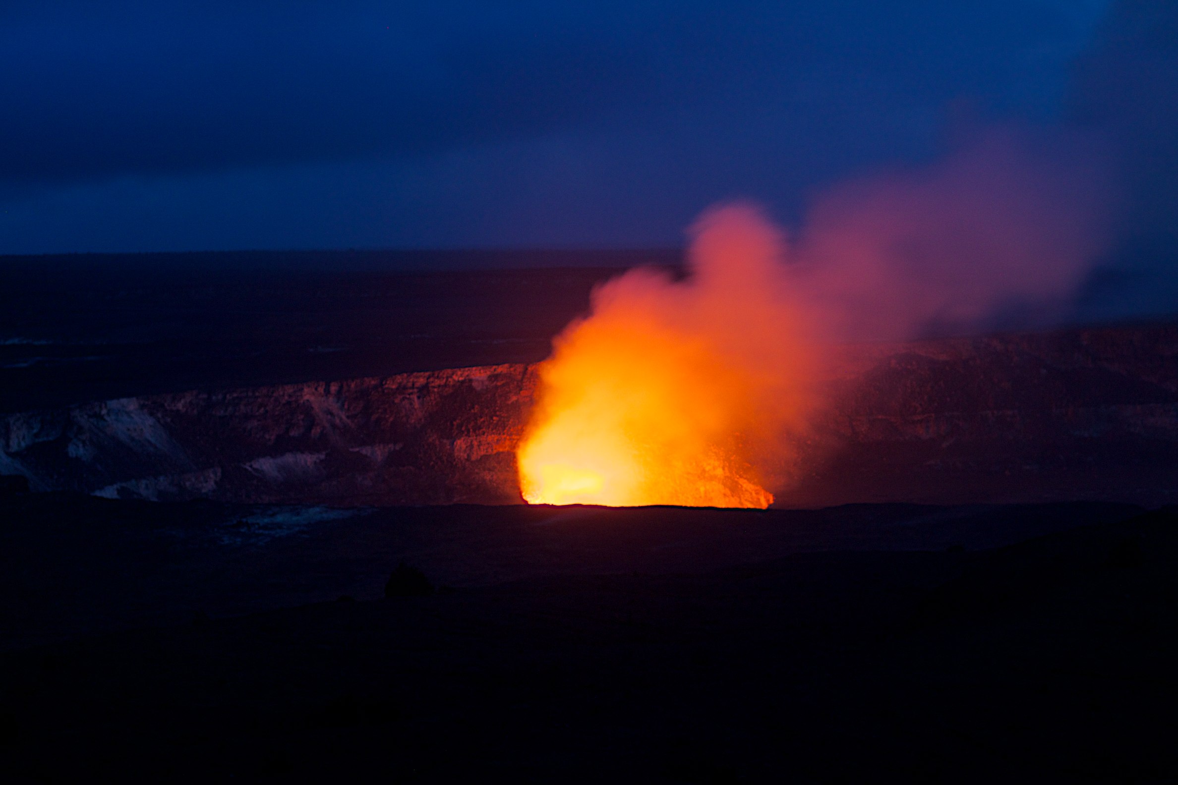
Kilauea Volcano Crater
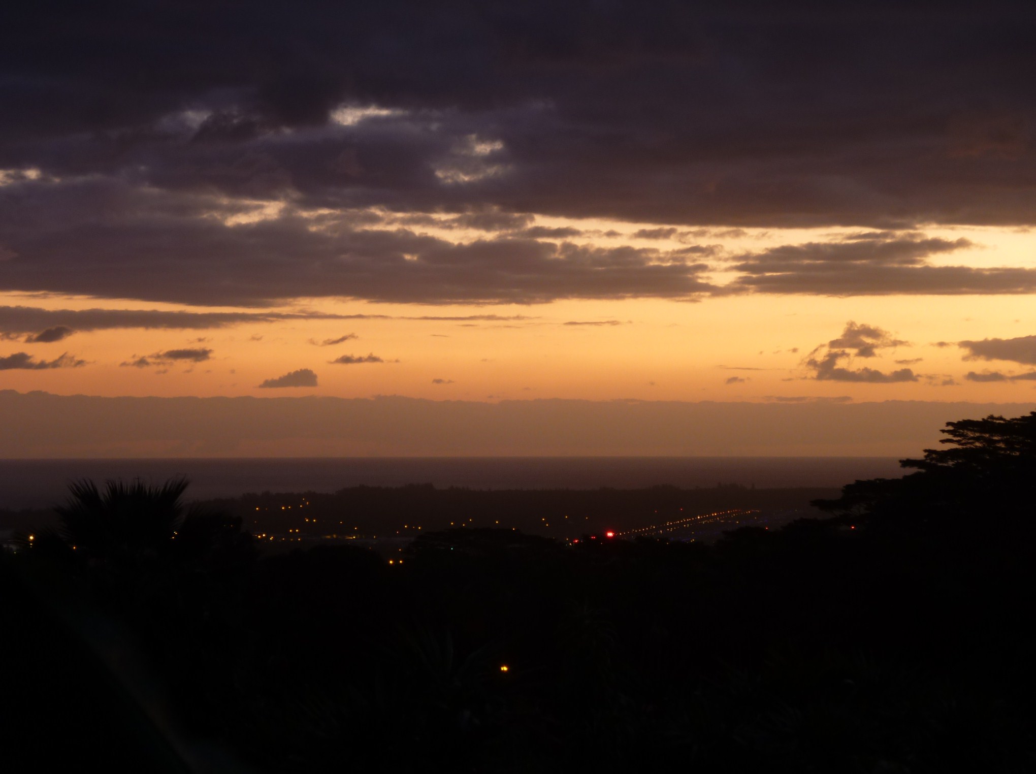
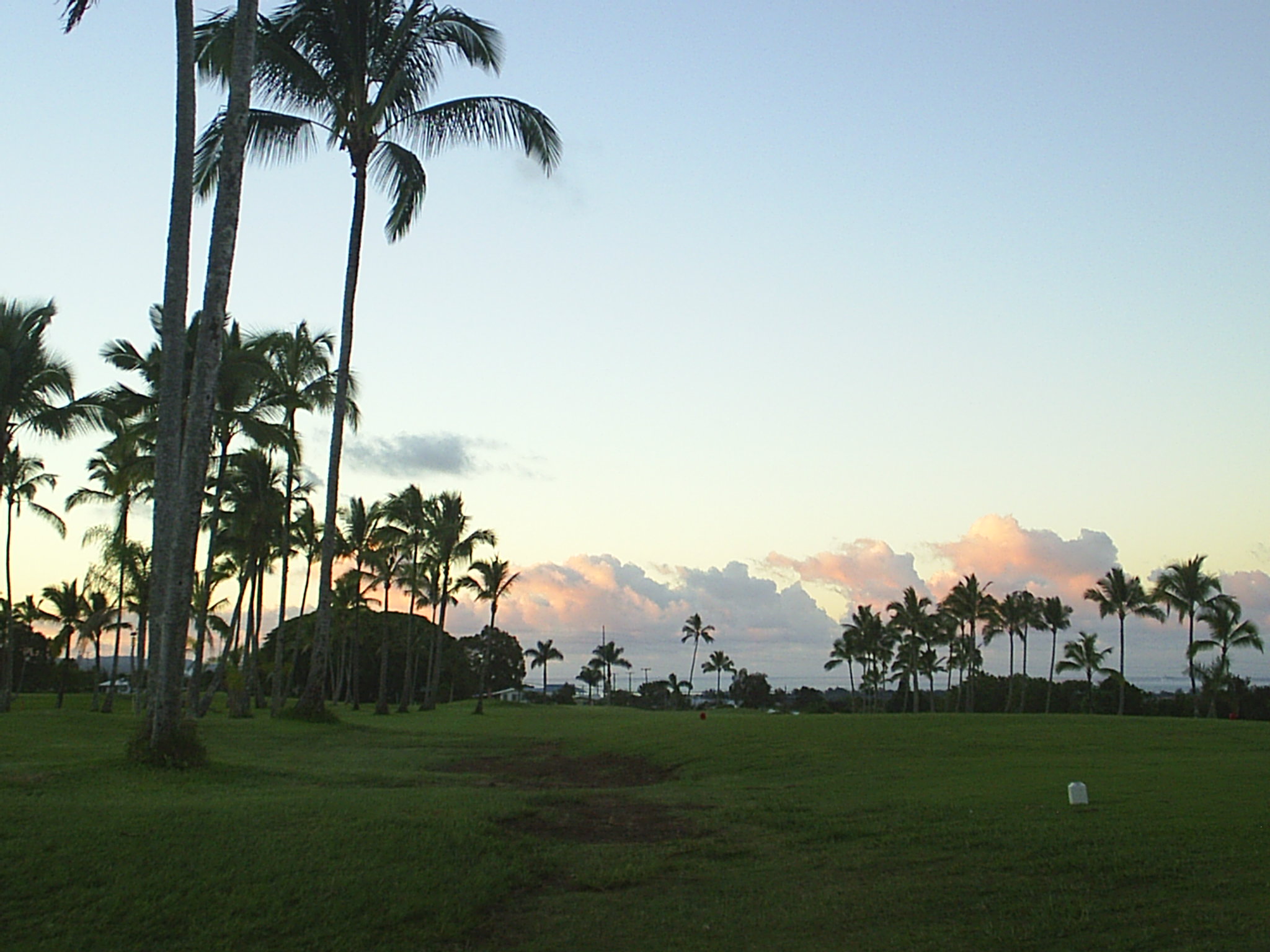
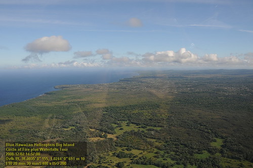
Hilo at Sunset from Kilikina Street
Hilo MUni @ sunset
Hilo Sunset from Kilikina Street
Hilo MUni @ sunset clouds
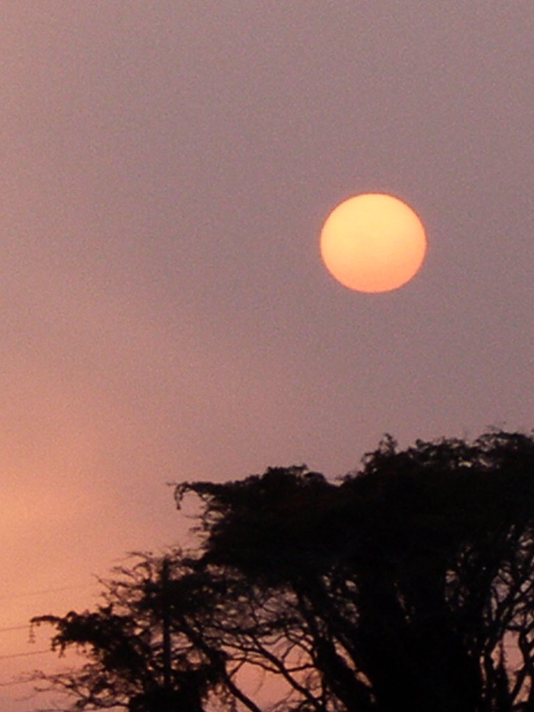
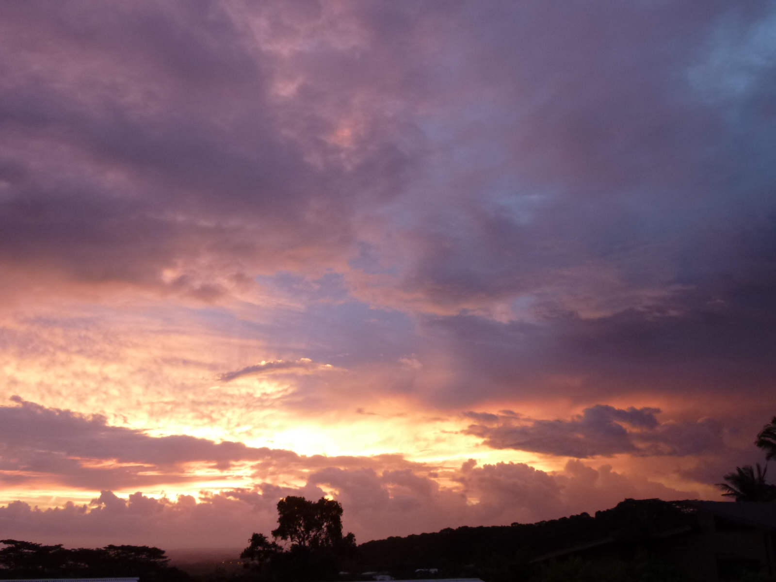
Voggy Sunrise, Keaau, Hawaii
HW7561VF2_5062.JPG

Sunup on a snowy Mauna Kea from Mountain View B&B, Hawaii
HW7481VF2_4982.JPG

view from inside lava tube
HW7559VF2_5060.JPG
The Caldera From Above (A View of Hell)
HW7567VF2_5068.JPG
HW6983VF2_4484.JPG
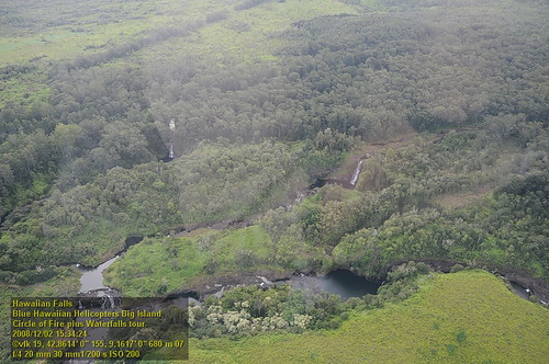
HW7526VF2_5027 Hawaiian Falls.JPG
HW6985VF2_4486.JPG

Rainbow falls - aerial view
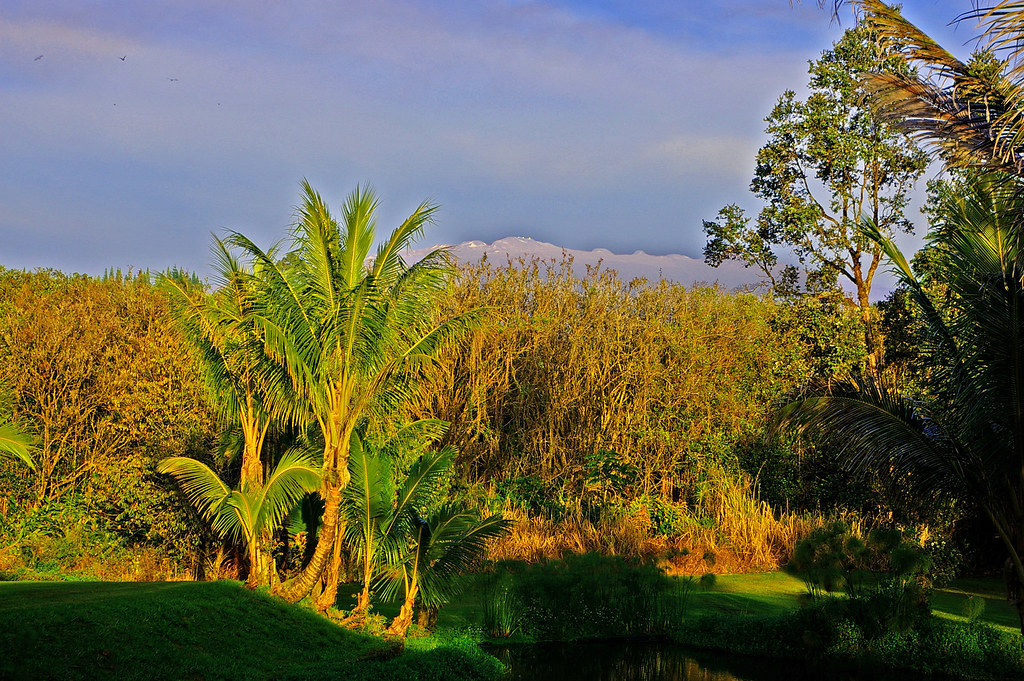
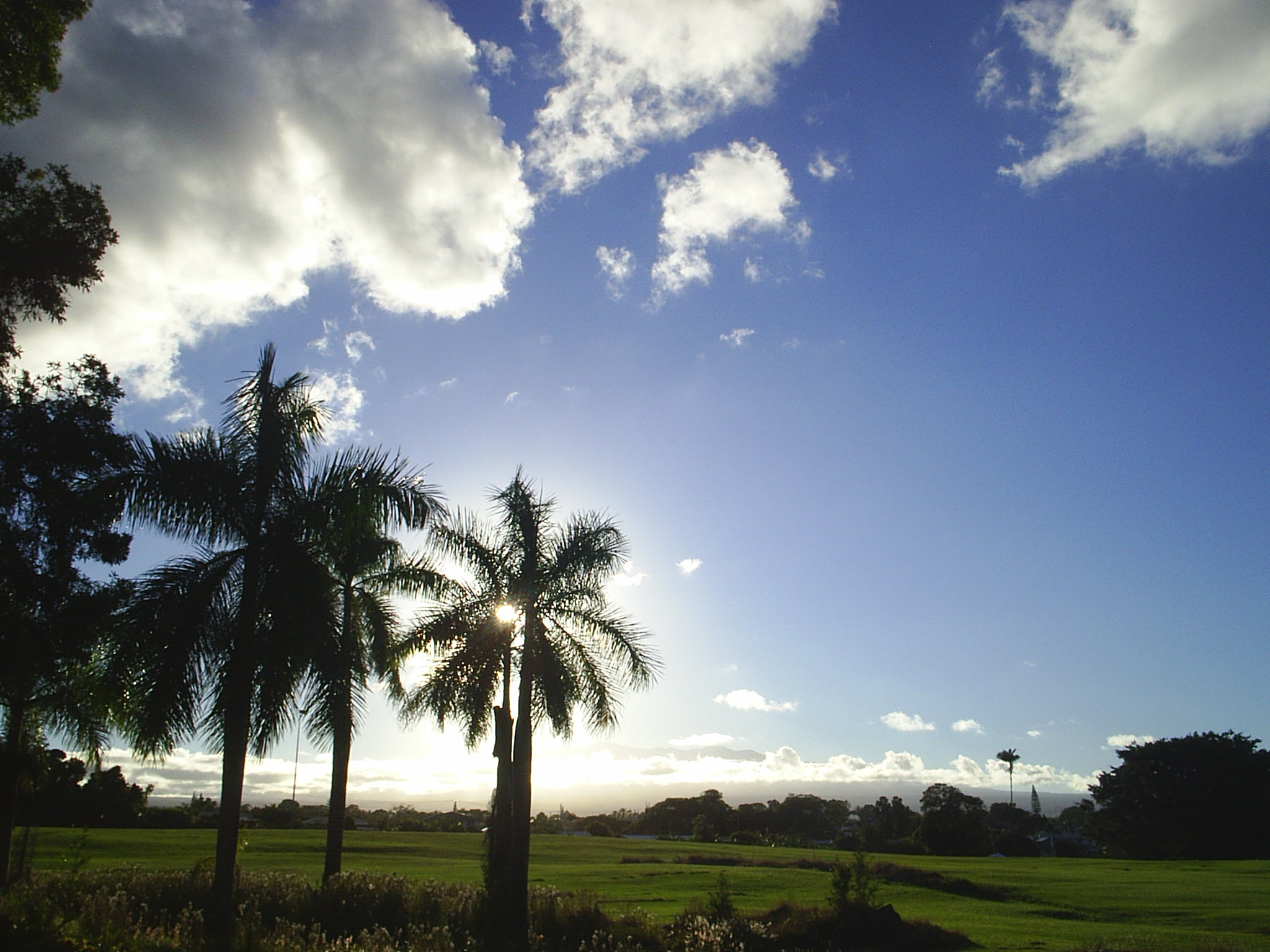
Mauna Kea in early morning light from Mountain View, Hawaii
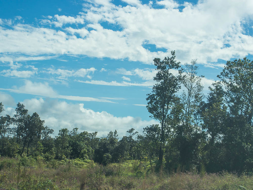
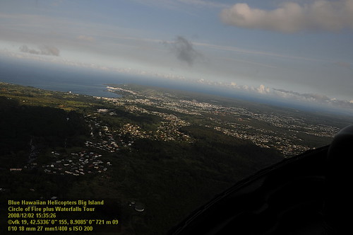
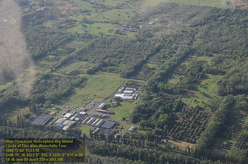
Saddle Road
HW7474VF2_4975.JPG
Saddle Road
HW6991VF2_4492.JPG
HW6988VF2_4489.JPG
HW6996VF2_4497.JPG
Saddle Road
HW7485VF2_4986.JPG
Saddle Road
Ihope Rd, Mountain View, HI, アメリカ合衆国Ihope Roadの地図
別の場所を検索
近所の場所
18- N Peck Rd, Mountain View, HI アメリカ合衆国
18- Ihope Rd, Mountain View, HI アメリカ合衆国
Ihope Pl, Mountain View, HI アメリカ合衆国Ihope Place
18- Mokehana, Mountain View, HI アメリカ合衆国
18- Mokihana St, Hilo, HI アメリカ合衆国
18- Ihope Rd, Mountain View, HI アメリカ合衆国
18- Ihope Rd, Mountain View, HI アメリカ合衆国
Palm Tree Dr, Mountain View, HI アメリカ合衆国パーム・ツリー・ドライブ
18- Palm Tree Dr, Mountain View, HI アメリカ合衆国
18- N Peck Rd, Mountain View, HI アメリカ合衆国
17- N Kulani Rd, Mountain View, HI アメリカ合衆国
18- N Peck Rd, Mountain View, HI アメリカ合衆国
18- Holana St, Volcano, HI アメリカ合衆国
Hinu Hinu St, Mountain View, HI アメリカ合衆国ハイヌ・ハイヌ・ストリート
18- Peleke Rd, Mountain View, HI アメリカ合衆国
18- Hui St, Mountain View, HI アメリカ合衆国
17- N Kulani Rd, Mountain View, HI アメリカ合衆国
アメリカ合衆国 ハワイ州 マウンテン・ビュー
18- Nichols Rd, Mountain View, HI アメリカ合衆国
18- Old Volcano Rd, Mountain View, HI アメリカ合衆国
最近の検索
- アメリカ合衆国 アラスカ州 レッド・ドッグ・マイン日の出日の入り時間
- Am bhf, Borken, ドイツアム・バーンホーフ日の出日の入り時間
- 4th St E, Sonoma, CA, USA日の出日の入り時間
- Oakland Ave, Williamsport, PA アメリカ合衆国日の出日の入り時間
- Via Roma, Pieranica CR, イタリアローマ通り日の出日の入り時間
- クロアチア 〒 ドゥブロブニク GradClock Tower of Dubrovnik日の出日の入り時間
- アルゼンチン チュブ州 トレリュー日の出日の入り時間
- Hartfords Bluff Cir, Mt Pleasant, SC アメリカ合衆国日の出日の入り時間
- 日本、熊本県熊本市北区日の出日の入り時間
- 中華人民共和国 福州市 平潭県 平潭島日の出日の入り時間