アメリカ合衆国 ウェスト・バージニア州 ハンタースヴィル日の出日の入り時間
Location: アメリカ合衆国 > ウェスト・バージニア州 > ポカホンタス >
時間帯:
America/New_York
現地時間:
2025-06-20 05:18:01
経度:
-79.9864071
緯度:
38.2038045
今日の日の出時刻:
05:56:53 AM
今日の日の入時刻:
08:46:29 PM
今日の日長:
14h 49m 36s
明日の日の出時刻:
05:57:06 AM
明日の日の入時刻:
08:46:42 PM
明日の日長:
14h 49m 36s
すべて表示する
| 日付 | 日出 | 日没 | 日長 |
|---|---|---|---|
| 2025年01月01日 | 07:36:37 AM | 05:11:30 PM | 9h 34m 53s |
| 2025年01月02日 | 07:36:42 AM | 05:12:20 PM | 9h 35m 38s |
| 2025年01月03日 | 07:36:45 AM | 05:13:11 PM | 9h 36m 26s |
| 2025年01月04日 | 07:36:46 AM | 05:14:04 PM | 9h 37m 18s |
| 2025年01月05日 | 07:36:45 AM | 05:14:58 PM | 9h 38m 13s |
| 2025年01月06日 | 07:36:42 AM | 05:15:53 PM | 9h 39m 11s |
| 2025年01月07日 | 07:36:36 AM | 05:16:49 PM | 9h 40m 13s |
| 2025年01月08日 | 07:36:29 AM | 05:17:47 PM | 9h 41m 18s |
| 2025年01月09日 | 07:36:19 AM | 05:18:45 PM | 9h 42m 26s |
| 2025年01月10日 | 07:36:07 AM | 05:19:44 PM | 9h 43m 37s |
| 2025年01月11日 | 07:35:54 AM | 05:20:44 PM | 9h 44m 50s |
| 2025年01月12日 | 07:35:38 AM | 05:21:45 PM | 9h 46m 7s |
| 2025年01月13日 | 07:35:20 AM | 05:22:47 PM | 9h 47m 27s |
| 2025年01月14日 | 07:35:00 AM | 05:23:49 PM | 9h 48m 49s |
| 2025年01月15日 | 07:34:38 AM | 05:24:52 PM | 9h 50m 14s |
| 2025年01月16日 | 07:34:14 AM | 05:25:56 PM | 9h 51m 42s |
| 2025年01月17日 | 07:33:48 AM | 05:27:00 PM | 9h 53m 12s |
| 2025年01月18日 | 07:33:20 AM | 05:28:05 PM | 9h 54m 45s |
| 2025年01月19日 | 07:32:50 AM | 05:29:10 PM | 9h 56m 20s |
| 2025年01月20日 | 07:32:18 AM | 05:30:16 PM | 9h 57m 58s |
| 2025年01月21日 | 07:31:44 AM | 05:31:22 PM | 9h 59m 38s |
| 2025年01月22日 | 07:31:08 AM | 05:32:29 PM | 10h 1m 21s |
| 2025年01月23日 | 07:30:30 AM | 05:33:36 PM | 10h 3m 6s |
| 2025年01月24日 | 07:29:51 AM | 05:34:43 PM | 10h 4m 52s |
| 2025年01月25日 | 07:29:09 AM | 05:35:50 PM | 10h 6m 41s |
| 2025年01月26日 | 07:28:26 AM | 05:36:58 PM | 10h 8m 32s |
| 2025年01月27日 | 07:27:41 AM | 05:38:06 PM | 10h 10m 25s |
| 2025年01月28日 | 07:26:55 AM | 05:39:14 PM | 10h 12m 19s |
| 2025年01月29日 | 07:26:06 AM | 05:40:21 PM | 10h 14m 15s |
| 2025年01月30日 | 07:25:16 AM | 05:41:29 PM | 10h 16m 13s |
| 2025年01月31日 | 07:24:24 AM | 05:42:37 PM | 10h 18m 13s |
| 2025年02月01日 | 07:23:31 AM | 05:43:45 PM | 10h 20m 14s |
| 2025年02月02日 | 07:22:36 AM | 05:44:53 PM | 10h 22m 17s |
| 2025年02月03日 | 07:21:40 AM | 05:46:01 PM | 10h 24m 21s |
| 2025年02月04日 | 07:20:42 AM | 05:47:09 PM | 10h 26m 27s |
| 2025年02月05日 | 07:19:42 AM | 05:48:17 PM | 10h 28m 35s |
| 2025年02月06日 | 07:18:41 AM | 05:49:24 PM | 10h 30m 43s |
| 2025年02月07日 | 07:17:39 AM | 05:50:32 PM | 10h 32m 53s |
| 2025年02月08日 | 07:16:35 AM | 05:51:39 PM | 10h 35m 4s |
| 2025年02月09日 | 07:15:30 AM | 05:52:46 PM | 10h 37m 16s |
| 2025年02月10日 | 07:14:23 AM | 05:53:53 PM | 10h 39m 30s |
| 2025年02月11日 | 07:13:16 AM | 05:54:59 PM | 10h 41m 43s |
| 2025年02月12日 | 07:12:07 AM | 05:56:06 PM | 10h 43m 59s |
| 2025年02月13日 | 07:10:56 AM | 05:57:12 PM | 10h 46m 16s |
| 2025年02月14日 | 07:09:45 AM | 05:58:17 PM | 10h 48m 32s |
| 2025年02月15日 | 07:08:32 AM | 05:59:23 PM | 10h 50m 51s |
| 2025年02月16日 | 07:07:18 AM | 06:00:28 PM | 10h 53m 10s |
| 2025年02月17日 | 07:06:04 AM | 06:01:33 PM | 10h 55m 29s |
| 2025年02月18日 | 07:04:48 AM | 06:02:38 PM | 10h 57m 50s |
| 2025年02月19日 | 07:03:31 AM | 06:03:42 PM | 11h 0m 11s |
| 2025年02月20日 | 07:02:13 AM | 06:04:46 PM | 11h 2m 33s |
| 2025年02月21日 | 07:00:54 AM | 06:05:50 PM | 11h 4m 56s |
| 2025年02月22日 | 06:59:34 AM | 06:06:53 PM | 11h 7m 19s |
| 2025年02月23日 | 06:58:14 AM | 06:07:56 PM | 11h 9m 42s |
| 2025年02月24日 | 06:56:52 AM | 06:08:59 PM | 11h 12m 7s |
| 2025年02月25日 | 06:55:30 AM | 06:10:02 PM | 11h 14m 32s |
| 2025年02月26日 | 06:54:07 AM | 06:11:04 PM | 11h 16m 57s |
| 2025年02月27日 | 06:52:43 AM | 06:12:06 PM | 11h 19m 23s |
| 2025年02月28日 | 06:51:18 AM | 06:13:07 PM | 11h 21m 49s |
| 2025年03月01日 | 06:49:53 AM | 06:14:08 PM | 11h 24m 15s |
| 2025年03月02日 | 06:48:27 AM | 06:15:09 PM | 11h 26m 42s |
| 2025年03月03日 | 06:47:00 AM | 06:16:10 PM | 11h 29m 10s |
| 2025年03月04日 | 06:45:33 AM | 06:17:10 PM | 11h 31m 37s |
| 2025年03月05日 | 06:44:05 AM | 06:18:10 PM | 11h 34m 5s |
| 2025年03月06日 | 06:42:37 AM | 06:19:10 PM | 11h 36m 33s |
| 2025年03月07日 | 06:41:08 AM | 06:20:09 PM | 11h 39m 1s |
| 2025年03月08日 | 06:39:39 AM | 06:21:09 PM | 11h 41m 30s |
| 2025年03月09日 | 07:38:13 AM | 07:22:05 PM | 11h 43m 52s |
| 2025年03月10日 | 07:36:43 AM | 07:23:04 PM | 11h 46m 21s |
| 2025年03月11日 | 07:35:13 AM | 07:24:02 PM | 11h 48m 49s |
| 2025年03月12日 | 07:33:42 AM | 07:25:01 PM | 11h 51m 19s |
| 2025年03月13日 | 07:32:11 AM | 07:25:59 PM | 11h 53m 48s |
| 2025年03月14日 | 07:30:40 AM | 07:26:57 PM | 11h 56m 17s |
| 2025年03月15日 | 07:29:08 AM | 07:27:54 PM | 11h 58m 46s |
| 2025年03月16日 | 07:27:36 AM | 07:28:52 PM | 12h 1m 16s |
| 2025年03月17日 | 07:26:04 AM | 07:29:49 PM | 12h 3m 45s |
| 2025年03月18日 | 07:24:32 AM | 07:30:46 PM | 12h 6m 14s |
| 2025年03月19日 | 07:22:59 AM | 07:31:43 PM | 12h 8m 44s |
| 2025年03月20日 | 07:21:27 AM | 07:32:40 PM | 12h 11m 13s |
| 2025年03月21日 | 07:19:55 AM | 07:33:37 PM | 12h 13m 42s |
| 2025年03月22日 | 07:18:22 AM | 07:34:33 PM | 12h 16m 11s |
| 2025年03月23日 | 07:16:49 AM | 07:35:30 PM | 12h 18m 41s |
| 2025年03月24日 | 07:15:17 AM | 07:36:26 PM | 12h 21m 9s |
| 2025年03月25日 | 07:13:44 AM | 07:37:22 PM | 12h 23m 38s |
| 2025年03月26日 | 07:12:12 AM | 07:38:18 PM | 12h 26m 6s |
| 2025年03月27日 | 07:10:40 AM | 07:39:15 PM | 12h 28m 35s |
| 2025年03月28日 | 07:09:08 AM | 07:40:11 PM | 12h 31m 3s |
| 2025年03月29日 | 07:07:36 AM | 07:41:07 PM | 12h 33m 31s |
| 2025年03月30日 | 07:06:04 AM | 07:42:03 PM | 12h 35m 59s |
| 2025年03月31日 | 07:04:32 AM | 07:42:58 PM | 12h 38m 26s |
| 2025年04月01日 | 07:03:01 AM | 07:43:54 PM | 12h 40m 53s |
| 2025年04月02日 | 07:01:30 AM | 07:44:50 PM | 12h 43m 20s |
| 2025年04月03日 | 06:59:59 AM | 07:45:46 PM | 12h 45m 47s |
| 2025年04月04日 | 06:58:29 AM | 07:46:42 PM | 12h 48m 13s |
| 2025年04月05日 | 06:56:59 AM | 07:47:38 PM | 12h 50m 39s |
| 2025年04月06日 | 06:55:29 AM | 07:48:34 PM | 12h 53m 5s |
| 2025年04月07日 | 06:54:00 AM | 07:49:30 PM | 12h 55m 30s |
| 2025年04月08日 | 06:52:32 AM | 07:50:25 PM | 12h 57m 53s |
| 2025年04月09日 | 06:51:04 AM | 07:51:21 PM | 13h 0m 17s |
| 2025年04月10日 | 06:49:36 AM | 07:52:17 PM | 13h 2m 41s |
| 2025年04月11日 | 06:48:09 AM | 07:53:13 PM | 13h 5m 4s |
| 2025年04月12日 | 06:46:42 AM | 07:54:09 PM | 13h 7m 27s |
| 2025年04月13日 | 06:45:17 AM | 07:55:05 PM | 13h 9m 48s |
| 2025年04月14日 | 06:43:51 AM | 07:56:02 PM | 13h 12m 11s |
| 2025年04月15日 | 06:42:27 AM | 07:56:58 PM | 13h 14m 31s |
| 2025年04月16日 | 06:41:03 AM | 07:57:54 PM | 13h 16m 51s |
| 2025年04月17日 | 06:39:40 AM | 07:58:50 PM | 13h 19m 10s |
| 2025年04月18日 | 06:38:18 AM | 07:59:46 PM | 13h 21m 28s |
| 2025年04月19日 | 06:36:56 AM | 08:00:43 PM | 13h 23m 47s |
| 2025年04月20日 | 06:35:36 AM | 08:01:39 PM | 13h 26m 3s |
| 2025年04月21日 | 06:34:16 AM | 08:02:35 PM | 13h 28m 19s |
| 2025年04月22日 | 06:32:57 AM | 08:03:32 PM | 13h 30m 35s |
| 2025年04月23日 | 06:31:39 AM | 08:04:28 PM | 13h 32m 49s |
| 2025年04月24日 | 06:30:22 AM | 08:05:24 PM | 13h 35m 2s |
| 2025年04月25日 | 06:29:06 AM | 08:06:21 PM | 13h 37m 15s |
| 2025年04月26日 | 06:27:51 AM | 08:07:17 PM | 13h 39m 26s |
| 2025年04月27日 | 06:26:37 AM | 08:08:13 PM | 13h 41m 36s |
| 2025年04月28日 | 06:25:24 AM | 08:09:09 PM | 13h 43m 45s |
| 2025年04月29日 | 06:24:12 AM | 08:10:06 PM | 13h 45m 54s |
| 2025年04月30日 | 06:23:01 AM | 08:11:02 PM | 13h 48m 1s |
| 2025年05月01日 | 06:21:52 AM | 08:11:58 PM | 13h 50m 6s |
| 2025年05月02日 | 06:20:43 AM | 08:12:54 PM | 13h 52m 11s |
| 2025年05月03日 | 06:19:36 AM | 08:13:50 PM | 13h 54m 14s |
| 2025年05月04日 | 06:18:30 AM | 08:14:45 PM | 13h 56m 15s |
| 2025年05月05日 | 06:17:26 AM | 08:15:41 PM | 13h 58m 15s |
| 2025年05月06日 | 06:16:23 AM | 08:16:36 PM | 14h 0m 13s |
| 2025年05月07日 | 06:15:21 AM | 08:17:31 PM | 14h 2m 10s |
| 2025年05月08日 | 06:14:20 AM | 08:18:26 PM | 14h 4m 6s |
| 2025年05月09日 | 06:13:21 AM | 08:19:21 PM | 14h 6m 0s |
| 2025年05月10日 | 06:12:23 AM | 08:20:16 PM | 14h 7m 53s |
| 2025年05月11日 | 06:11:27 AM | 08:21:10 PM | 14h 9m 43s |
| 2025年05月12日 | 06:10:32 AM | 08:22:03 PM | 14h 11m 31s |
| 2025年05月13日 | 06:09:38 AM | 08:22:57 PM | 14h 13m 19s |
| 2025年05月14日 | 06:08:47 AM | 08:23:50 PM | 14h 15m 3s |
| 2025年05月15日 | 06:07:56 AM | 08:24:43 PM | 14h 16m 47s |
| 2025年05月16日 | 06:07:08 AM | 08:25:35 PM | 14h 18m 27s |
| 2025年05月17日 | 06:06:20 AM | 08:26:27 PM | 14h 20m 7s |
| 2025年05月18日 | 06:05:35 AM | 08:27:18 PM | 14h 21m 43s |
| 2025年05月19日 | 06:04:51 AM | 08:28:08 PM | 14h 23m 17s |
| 2025年05月20日 | 06:04:09 AM | 08:28:58 PM | 14h 24m 49s |
| 2025年05月21日 | 06:03:28 AM | 08:29:48 PM | 14h 26m 20s |
| 2025年05月22日 | 06:02:49 AM | 08:30:37 PM | 14h 27m 48s |
| 2025年05月23日 | 06:02:12 AM | 08:31:25 PM | 14h 29m 13s |
| 2025年05月24日 | 06:01:37 AM | 08:32:12 PM | 14h 30m 35s |
| 2025年05月25日 | 06:01:03 AM | 08:32:59 PM | 14h 31m 56s |
| 2025年05月26日 | 06:00:31 AM | 08:33:45 PM | 14h 33m 14s |
| 2025年05月27日 | 06:00:01 AM | 08:34:30 PM | 14h 34m 29s |
| 2025年05月28日 | 05:59:33 AM | 08:35:14 PM | 14h 35m 41s |
| 2025年05月29日 | 05:59:06 AM | 08:35:57 PM | 14h 36m 51s |
| 2025年05月30日 | 05:58:41 AM | 08:36:39 PM | 14h 37m 58s |
| 2025年05月31日 | 05:58:18 AM | 08:37:20 PM | 14h 39m 2s |
| 2025年06月01日 | 05:57:57 AM | 08:38:00 PM | 14h 40m 3s |
| 2025年06月02日 | 05:57:38 AM | 08:38:40 PM | 14h 41m 2s |
| 2025年06月03日 | 05:57:20 AM | 08:39:18 PM | 14h 41m 58s |
| 2025年06月04日 | 05:57:05 AM | 08:39:54 PM | 14h 42m 49s |
| 2025年06月05日 | 05:56:51 AM | 08:40:30 PM | 14h 43m 39s |
| 2025年06月06日 | 05:56:39 AM | 08:41:04 PM | 14h 44m 25s |
| 2025年06月07日 | 05:56:29 AM | 08:41:37 PM | 14h 45m 8s |
| 2025年06月08日 | 05:56:20 AM | 08:42:09 PM | 14h 45m 49s |
| 2025年06月09日 | 05:56:14 AM | 08:42:40 PM | 14h 46m 26s |
| 2025年06月10日 | 05:56:09 AM | 08:43:09 PM | 14h 47m 0s |
| 2025年06月11日 | 05:56:06 AM | 08:43:36 PM | 14h 47m 30s |
| 2025年06月12日 | 05:56:05 AM | 08:44:02 PM | 14h 47m 57s |
| 2025年06月13日 | 05:56:06 AM | 08:44:27 PM | 14h 48m 21s |
| 2025年06月14日 | 05:56:08 AM | 08:44:50 PM | 14h 48m 42s |
| 2025年06月15日 | 05:56:13 AM | 08:45:12 PM | 14h 48m 59s |
| 2025年06月16日 | 05:56:19 AM | 08:45:32 PM | 14h 49m 13s |
| 2025年06月17日 | 05:56:26 AM | 08:45:50 PM | 14h 49m 24s |
| 2025年06月18日 | 05:56:36 AM | 08:46:07 PM | 14h 49m 31s |
| 2025年06月19日 | 05:56:47 AM | 08:46:22 PM | 14h 49m 35s |
| 2025年06月20日 | 05:56:59 AM | 08:46:36 PM | 14h 49m 37s |
| 2025年06月21日 | 05:57:14 AM | 08:46:47 PM | 14h 49m 33s |
| 2025年06月22日 | 05:57:30 AM | 08:46:57 PM | 14h 49m 27s |
| 2025年06月23日 | 05:57:47 AM | 08:47:06 PM | 14h 49m 19s |
| 2025年06月24日 | 05:58:06 AM | 08:47:12 PM | 14h 49m 6s |
| 2025年06月25日 | 05:58:27 AM | 08:47:17 PM | 14h 48m 50s |
| 2025年06月26日 | 05:58:49 AM | 08:47:19 PM | 14h 48m 30s |
| 2025年06月27日 | 05:59:13 AM | 08:47:21 PM | 14h 48m 8s |
| 2025年06月28日 | 05:59:38 AM | 08:47:20 PM | 14h 47m 42s |
| 2025年06月29日 | 06:00:04 AM | 08:47:17 PM | 14h 47m 13s |
| 2025年06月30日 | 06:00:32 AM | 08:47:13 PM | 14h 46m 41s |
| 2025年07月01日 | 06:01:01 AM | 08:47:06 PM | 14h 46m 5s |
| 2025年07月02日 | 06:01:31 AM | 08:46:58 PM | 14h 45m 27s |
| 2025年07月03日 | 06:02:03 AM | 08:46:48 PM | 14h 44m 45s |
| 2025年07月04日 | 06:02:36 AM | 08:46:36 PM | 14h 44m 0s |
| 2025年07月05日 | 06:03:10 AM | 08:46:22 PM | 14h 43m 12s |
| 2025年07月06日 | 06:03:45 AM | 08:46:06 PM | 14h 42m 21s |
| 2025年07月07日 | 06:04:21 AM | 08:45:49 PM | 14h 41m 28s |
| 2025年07月08日 | 06:04:59 AM | 08:45:29 PM | 14h 40m 30s |
| 2025年07月09日 | 06:05:37 AM | 08:45:08 PM | 14h 39m 31s |
| 2025年07月10日 | 06:06:16 AM | 08:44:45 PM | 14h 38m 29s |
| 2025年07月11日 | 06:06:56 AM | 08:44:20 PM | 14h 37m 24s |
| 2025年07月12日 | 06:07:38 AM | 08:43:53 PM | 14h 36m 15s |
| 2025年07月13日 | 06:08:20 AM | 08:43:24 PM | 14h 35m 4s |
| 2025年07月14日 | 06:09:02 AM | 08:42:54 PM | 14h 33m 52s |
| 2025年07月15日 | 06:09:46 AM | 08:42:21 PM | 14h 32m 35s |
| 2025年07月16日 | 06:10:31 AM | 08:41:47 PM | 14h 31m 16s |
| 2025年07月17日 | 06:11:16 AM | 08:41:11 PM | 14h 29m 55s |
| 2025年07月18日 | 06:12:01 AM | 08:40:34 PM | 14h 28m 33s |
| 2025年07月19日 | 06:12:48 AM | 08:39:54 PM | 14h 27m 6s |
| 2025年07月20日 | 06:13:35 AM | 08:39:13 PM | 14h 25m 38s |
| 2025年07月21日 | 06:14:22 AM | 08:38:30 PM | 14h 24m 8s |
| 2025年07月22日 | 06:15:10 AM | 08:37:46 PM | 14h 22m 36s |
| 2025年07月23日 | 06:15:59 AM | 08:37:00 PM | 14h 21m 1s |
| 2025年07月24日 | 06:16:48 AM | 08:36:12 PM | 14h 19m 24s |
| 2025年07月25日 | 06:17:38 AM | 08:35:22 PM | 14h 17m 44s |
| 2025年07月26日 | 06:18:27 AM | 08:34:31 PM | 14h 16m 4s |
| 2025年07月27日 | 06:19:18 AM | 08:33:39 PM | 14h 14m 21s |
| 2025年07月28日 | 06:20:08 AM | 08:32:45 PM | 14h 12m 37s |
| 2025年07月29日 | 06:20:59 AM | 08:31:49 PM | 14h 10m 50s |
| 2025年07月30日 | 06:21:50 AM | 08:30:52 PM | 14h 9m 2s |
| 2025年07月31日 | 06:22:42 AM | 08:29:53 PM | 14h 7m 11s |
| 2025年08月01日 | 06:23:33 AM | 08:28:53 PM | 14h 5m 20s |
| 2025年08月02日 | 06:24:25 AM | 08:27:52 PM | 14h 3m 27s |
| 2025年08月03日 | 06:25:17 AM | 08:26:49 PM | 14h 1m 32s |
| 2025年08月04日 | 06:26:09 AM | 08:25:45 PM | 13h 59m 36s |
| 2025年08月05日 | 06:27:02 AM | 08:24:39 PM | 13h 57m 37s |
| 2025年08月06日 | 06:27:54 AM | 08:23:32 PM | 13h 55m 38s |
| 2025年08月07日 | 06:28:46 AM | 08:22:24 PM | 13h 53m 38s |
| 2025年08月08日 | 06:29:39 AM | 08:21:15 PM | 13h 51m 36s |
| 2025年08月09日 | 06:30:32 AM | 08:20:04 PM | 13h 49m 32s |
| 2025年08月10日 | 06:31:24 AM | 08:18:52 PM | 13h 47m 28s |
| 2025年08月11日 | 06:32:17 AM | 08:17:39 PM | 13h 45m 22s |
| 2025年08月12日 | 06:33:10 AM | 08:16:25 PM | 13h 43m 15s |
| 2025年08月13日 | 06:34:03 AM | 08:15:10 PM | 13h 41m 7s |
| 2025年08月14日 | 06:34:55 AM | 08:13:54 PM | 13h 38m 59s |
| 2025年08月15日 | 06:35:48 AM | 08:12:37 PM | 13h 36m 49s |
| 2025年08月16日 | 06:36:41 AM | 08:11:18 PM | 13h 34m 37s |
| 2025年08月17日 | 06:37:33 AM | 08:09:59 PM | 13h 32m 26s |
| 2025年08月18日 | 06:38:26 AM | 08:08:39 PM | 13h 30m 13s |
| 2025年08月19日 | 06:39:18 AM | 08:07:18 PM | 13h 28m 0s |
| 2025年08月20日 | 06:40:11 AM | 08:05:56 PM | 13h 25m 45s |
| 2025年08月21日 | 06:41:03 AM | 08:04:33 PM | 13h 23m 30s |
| 2025年08月22日 | 06:41:56 AM | 08:03:09 PM | 13h 21m 13s |
| 2025年08月23日 | 06:42:48 AM | 08:01:45 PM | 13h 18m 57s |
| 2025年08月24日 | 06:43:40 AM | 08:00:20 PM | 13h 16m 40s |
| 2025年08月25日 | 06:44:32 AM | 07:58:54 PM | 13h 14m 22s |
| 2025年08月26日 | 06:45:24 AM | 07:57:27 PM | 13h 12m 3s |
| 2025年08月27日 | 06:46:16 AM | 07:56:00 PM | 13h 9m 44s |
| 2025年08月28日 | 06:47:08 AM | 07:54:32 PM | 13h 7m 24s |
| 2025年08月29日 | 06:48:00 AM | 07:53:03 PM | 13h 5m 3s |
| 2025年08月30日 | 06:48:52 AM | 07:51:34 PM | 13h 2m 42s |
| 2025年08月31日 | 06:49:44 AM | 07:50:04 PM | 13h 0m 20s |
| 2025年09月01日 | 06:50:35 AM | 07:48:34 PM | 12h 57m 59s |
| 2025年09月02日 | 06:51:27 AM | 07:47:03 PM | 12h 55m 36s |
| 2025年09月03日 | 06:52:19 AM | 07:45:32 PM | 12h 53m 13s |
| 2025年09月04日 | 06:53:10 AM | 07:44:00 PM | 12h 50m 50s |
| 2025年09月05日 | 06:54:02 AM | 07:42:28 PM | 12h 48m 26s |
| 2025年09月06日 | 06:54:53 AM | 07:40:56 PM | 12h 46m 3s |
| 2025年09月07日 | 06:55:45 AM | 07:39:23 PM | 12h 43m 38s |
| 2025年09月08日 | 06:56:36 AM | 07:37:50 PM | 12h 41m 14s |
| 2025年09月09日 | 06:57:28 AM | 07:36:16 PM | 12h 38m 48s |
| 2025年09月10日 | 06:58:19 AM | 07:34:43 PM | 12h 36m 24s |
| 2025年09月11日 | 06:59:11 AM | 07:33:09 PM | 12h 33m 58s |
| 2025年09月12日 | 07:00:02 AM | 07:31:34 PM | 12h 31m 32s |
| 2025年09月13日 | 07:00:54 AM | 07:30:00 PM | 12h 29m 6s |
| 2025年09月14日 | 07:01:46 AM | 07:28:26 PM | 12h 26m 40s |
| 2025年09月15日 | 07:02:37 AM | 07:26:51 PM | 12h 24m 14s |
| 2025年09月16日 | 07:03:29 AM | 07:25:16 PM | 12h 21m 47s |
| 2025年09月17日 | 07:04:21 AM | 07:23:42 PM | 12h 19m 21s |
| 2025年09月18日 | 07:05:13 AM | 07:22:07 PM | 12h 16m 54s |
| 2025年09月19日 | 07:06:05 AM | 07:20:32 PM | 12h 14m 27s |
| 2025年09月20日 | 07:06:57 AM | 07:18:57 PM | 12h 12m 0s |
| 2025年09月21日 | 07:07:49 AM | 07:17:23 PM | 12h 9m 34s |
| 2025年09月22日 | 07:08:42 AM | 07:15:48 PM | 12h 7m 6s |
| 2025年09月23日 | 07:09:34 AM | 07:14:14 PM | 12h 4m 40s |
| 2025年09月24日 | 07:10:27 AM | 07:12:39 PM | 12h 2m 12s |
| 2025年09月25日 | 07:11:20 AM | 07:11:05 PM | 11h 59m 45s |
| 2025年09月26日 | 07:12:13 AM | 07:09:31 PM | 11h 57m 18s |
| 2025年09月27日 | 07:13:06 AM | 07:07:58 PM | 11h 54m 52s |
| 2025年09月28日 | 07:14:00 AM | 07:06:24 PM | 11h 52m 24s |
| 2025年09月29日 | 07:14:53 AM | 07:04:51 PM | 11h 49m 58s |
| 2025年09月30日 | 07:15:47 AM | 07:03:18 PM | 11h 47m 31s |
| 2025年10月01日 | 07:16:42 AM | 07:01:46 PM | 11h 45m 4s |
| 2025年10月02日 | 07:17:36 AM | 07:00:14 PM | 11h 42m 38s |
| 2025年10月03日 | 07:18:31 AM | 06:58:42 PM | 11h 40m 11s |
| 2025年10月04日 | 07:19:26 AM | 06:57:11 PM | 11h 37m 45s |
| 2025年10月05日 | 07:20:21 AM | 06:55:40 PM | 11h 35m 19s |
| 2025年10月06日 | 07:21:16 AM | 06:54:10 PM | 11h 32m 54s |
| 2025年10月07日 | 07:22:12 AM | 06:52:40 PM | 11h 30m 28s |
| 2025年10月08日 | 07:23:08 AM | 06:51:11 PM | 11h 28m 3s |
| 2025年10月09日 | 07:24:04 AM | 06:49:43 PM | 11h 25m 39s |
| 2025年10月10日 | 07:25:01 AM | 06:48:15 PM | 11h 23m 14s |
| 2025年10月11日 | 07:25:58 AM | 06:46:48 PM | 11h 20m 50s |
| 2025年10月12日 | 07:26:56 AM | 06:45:21 PM | 11h 18m 25s |
| 2025年10月13日 | 07:27:53 AM | 06:43:55 PM | 11h 16m 2s |
| 2025年10月14日 | 07:28:51 AM | 06:42:30 PM | 11h 13m 39s |
| 2025年10月15日 | 07:29:50 AM | 06:41:06 PM | 11h 11m 16s |
| 2025年10月16日 | 07:30:48 AM | 06:39:43 PM | 11h 8m 55s |
| 2025年10月17日 | 07:31:47 AM | 06:38:20 PM | 11h 6m 33s |
| 2025年10月18日 | 07:32:47 AM | 06:36:58 PM | 11h 4m 11s |
| 2025年10月19日 | 07:33:46 AM | 06:35:38 PM | 11h 1m 52s |
| 2025年10月20日 | 07:34:46 AM | 06:34:18 PM | 10h 59m 32s |
| 2025年10月21日 | 07:35:47 AM | 06:32:59 PM | 10h 57m 12s |
| 2025年10月22日 | 07:36:48 AM | 06:31:41 PM | 10h 54m 53s |
| 2025年10月23日 | 07:37:49 AM | 06:30:25 PM | 10h 52m 36s |
| 2025年10月24日 | 07:38:50 AM | 06:29:09 PM | 10h 50m 19s |
| 2025年10月25日 | 07:39:52 AM | 06:27:55 PM | 10h 48m 3s |
| 2025年10月26日 | 07:40:54 AM | 06:26:41 PM | 10h 45m 47s |
| 2025年10月27日 | 07:41:56 AM | 06:25:29 PM | 10h 43m 33s |
| 2025年10月28日 | 07:42:59 AM | 06:24:18 PM | 10h 41m 19s |
| 2025年10月29日 | 07:44:02 AM | 06:23:09 PM | 10h 39m 7s |
| 2025年10月30日 | 07:45:05 AM | 06:22:00 PM | 10h 36m 55s |
| 2025年10月31日 | 07:46:08 AM | 06:20:53 PM | 10h 34m 45s |
| 2025年11月01日 | 07:47:12 AM | 06:19:48 PM | 10h 32m 36s |
| 2025年11月02日 | 06:48:18 AM | 05:18:41 PM | 10h 30m 23s |
| 2025年11月03日 | 06:49:23 AM | 05:17:38 PM | 10h 28m 15s |
| 2025年11月04日 | 06:50:27 AM | 05:16:37 PM | 10h 26m 10s |
| 2025年11月05日 | 06:51:31 AM | 05:15:37 PM | 10h 24m 6s |
| 2025年11月06日 | 06:52:36 AM | 05:14:39 PM | 10h 22m 3s |
| 2025年11月07日 | 06:53:41 AM | 05:13:42 PM | 10h 20m 1s |
| 2025年11月08日 | 06:54:45 AM | 05:12:47 PM | 10h 18m 2s |
| 2025年11月09日 | 06:55:50 AM | 05:11:54 PM | 10h 16m 4s |
| 2025年11月10日 | 06:56:55 AM | 05:11:02 PM | 10h 14m 7s |
| 2025年11月11日 | 06:58:00 AM | 05:10:12 PM | 10h 12m 12s |
| 2025年11月12日 | 06:59:05 AM | 05:09:23 PM | 10h 10m 18s |
| 2025年11月13日 | 07:00:10 AM | 05:08:37 PM | 10h 8m 27s |
| 2025年11月14日 | 07:01:15 AM | 05:07:52 PM | 10h 6m 37s |
| 2025年11月15日 | 07:02:19 AM | 05:07:09 PM | 10h 4m 50s |
| 2025年11月16日 | 07:03:24 AM | 05:06:28 PM | 10h 3m 4s |
| 2025年11月17日 | 07:04:28 AM | 05:05:48 PM | 10h 1m 20s |
| 2025年11月18日 | 07:05:32 AM | 05:05:11 PM | 9h 59m 39s |
| 2025年11月19日 | 07:06:36 AM | 05:04:35 PM | 9h 57m 59s |
| 2025年11月20日 | 07:07:39 AM | 05:04:02 PM | 9h 56m 23s |
| 2025年11月21日 | 07:08:42 AM | 05:03:30 PM | 9h 54m 48s |
| 2025年11月22日 | 07:09:45 AM | 05:03:00 PM | 9h 53m 15s |
| 2025年11月23日 | 07:10:47 AM | 05:02:33 PM | 9h 51m 46s |
| 2025年11月24日 | 07:11:49 AM | 05:02:07 PM | 9h 50m 18s |
| 2025年11月25日 | 07:12:50 AM | 05:01:44 PM | 9h 48m 54s |
| 2025年11月26日 | 07:13:51 AM | 05:01:22 PM | 9h 47m 31s |
| 2025年11月27日 | 07:14:50 AM | 05:01:03 PM | 9h 46m 13s |
| 2025年11月28日 | 07:15:50 AM | 05:00:45 PM | 9h 44m 55s |
| 2025年11月29日 | 07:16:48 AM | 05:00:30 PM | 9h 43m 42s |
| 2025年11月30日 | 07:17:46 AM | 05:00:17 PM | 9h 42m 31s |
| 2025年12月01日 | 07:18:43 AM | 05:00:06 PM | 9h 41m 23s |
| 2025年12月02日 | 07:19:38 AM | 04:59:57 PM | 9h 40m 19s |
| 2025年12月03日 | 07:20:33 AM | 04:59:50 PM | 9h 39m 17s |
| 2025年12月04日 | 07:21:27 AM | 04:59:46 PM | 9h 38m 19s |
| 2025年12月05日 | 07:22:20 AM | 04:59:43 PM | 9h 37m 23s |
| 2025年12月06日 | 07:23:12 AM | 04:59:43 PM | 9h 36m 31s |
| 2025年12月07日 | 07:24:02 AM | 04:59:45 PM | 9h 35m 43s |
| 2025年12月08日 | 07:24:52 AM | 04:59:49 PM | 9h 34m 57s |
| 2025年12月09日 | 07:25:40 AM | 04:59:55 PM | 9h 34m 15s |
| 2025年12月10日 | 07:26:27 AM | 05:00:04 PM | 9h 33m 37s |
| 2025年12月11日 | 07:27:12 AM | 05:00:14 PM | 9h 33m 2s |
| 2025年12月12日 | 07:27:56 AM | 05:00:26 PM | 9h 32m 30s |
| 2025年12月13日 | 07:28:39 AM | 05:00:41 PM | 9h 32m 2s |
| 2025年12月14日 | 07:29:20 AM | 05:00:58 PM | 9h 31m 38s |
| 2025年12月15日 | 07:29:59 AM | 05:01:16 PM | 9h 31m 17s |
| 2025年12月16日 | 07:30:37 AM | 05:01:37 PM | 9h 31m 0s |
| 2025年12月17日 | 07:31:13 AM | 05:02:00 PM | 9h 30m 47s |
| 2025年12月18日 | 07:31:48 AM | 05:02:24 PM | 9h 30m 36s |
| 2025年12月19日 | 07:32:21 AM | 05:02:51 PM | 9h 30m 30s |
| 2025年12月20日 | 07:32:52 AM | 05:03:19 PM | 9h 30m 27s |
| 2025年12月21日 | 07:33:21 AM | 05:03:50 PM | 9h 30m 29s |
| 2025年12月22日 | 07:33:48 AM | 05:04:22 PM | 9h 30m 34s |
| 2025年12月23日 | 07:34:14 AM | 05:04:56 PM | 9h 30m 42s |
| 2025年12月24日 | 07:34:37 AM | 05:05:32 PM | 9h 30m 55s |
| 2025年12月25日 | 07:34:59 AM | 05:06:10 PM | 9h 31m 11s |
| 2025年12月26日 | 07:35:19 AM | 05:06:49 PM | 9h 31m 30s |
| 2025年12月27日 | 07:35:37 AM | 05:07:30 PM | 9h 31m 53s |
| 2025年12月28日 | 07:35:53 AM | 05:08:12 PM | 9h 32m 19s |
| 2025年12月29日 | 07:36:06 AM | 05:08:56 PM | 9h 32m 50s |
| 2025年12月30日 | 07:36:18 AM | 05:09:42 PM | 9h 33m 24s |
| 2025年12月31日 | 07:36:28 AM | 05:10:29 PM | 9h 34m 1s |
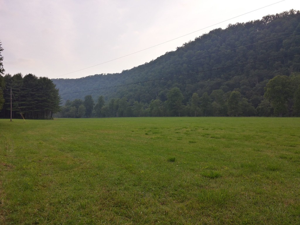
写真
Sunset over the Greenbrier river
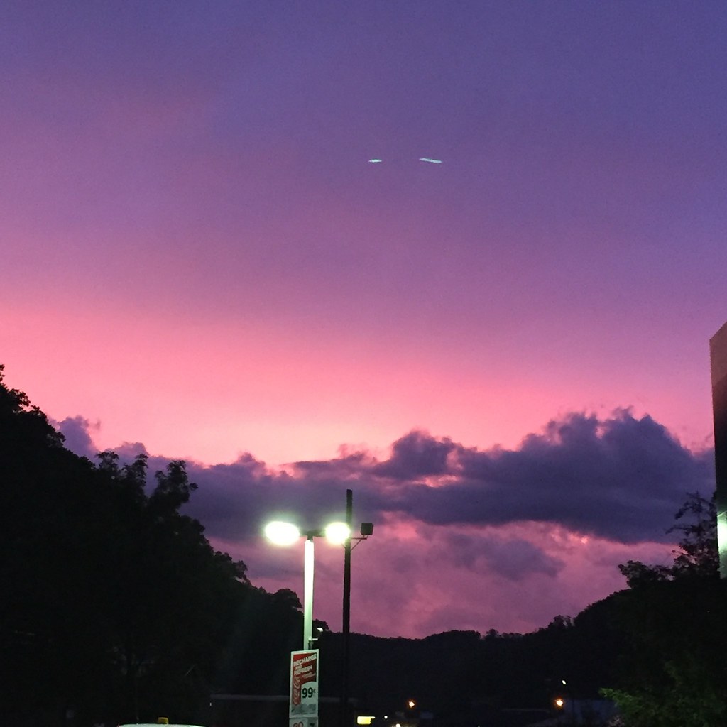
Sunset On The West Virginia Flooding

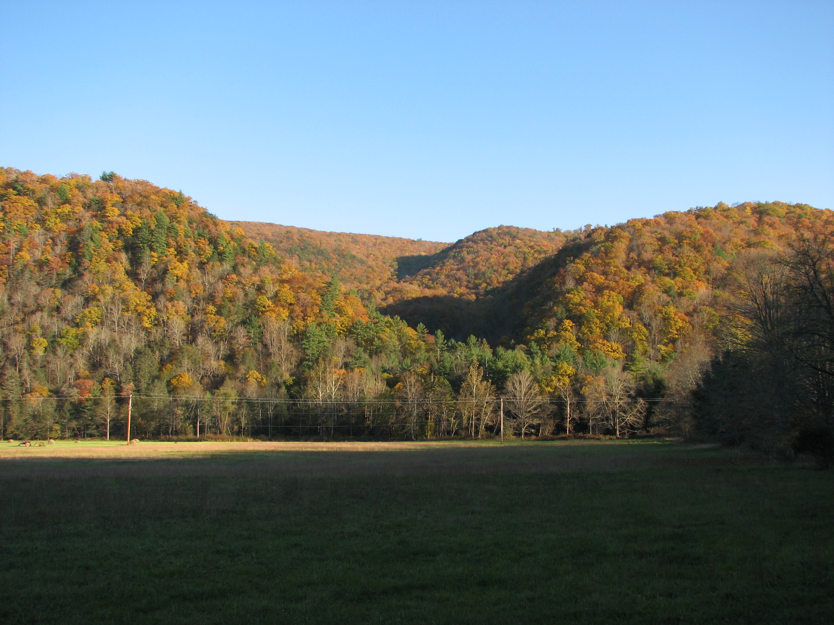
Marlinton WV

Sunrise Fog Over Marlinton
IMG_2730.JPG
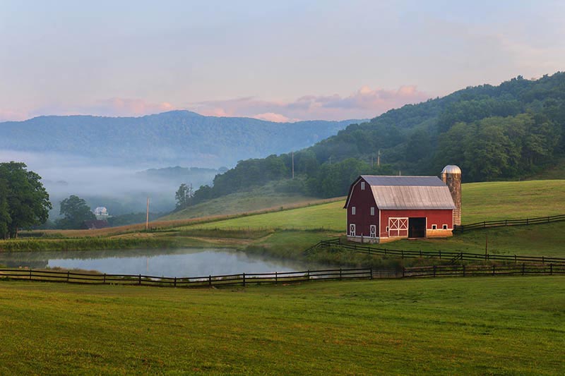
West Virginia Dawn

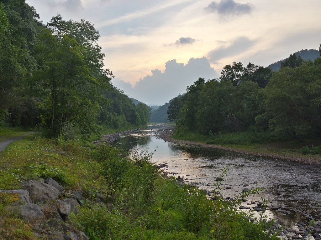
View of the Greenbrier River
What a pretty view

View of the Greenbrier River from the Watoga Bridge
アメリカ合衆国 ウェスト・バージニア州 ハンタースヴィルの地図
別の場所を検索
近所の場所
Locust Hill, Marlinton, WV アメリカ合衆国Locust Hill Inn, Cabin and Pub
アメリカ合衆国 ウェスト・バージニア州 ポカホンタス
アメリカ合衆国 ウェスト・バージニア州 マーリントン
2nd Ave, Marlinton, WV アメリカ合衆国
Violet Rd, Marlinton, WV アメリカ合衆国バイオレット・ロード
Seneca Trail, Marlinton, WV アメリカ合衆国
96 Caribbean Ln, Marlinton, WV アメリカ合衆国
Stoney Creek Rd, Edray, WV アメリカ合衆国ストーニー・クリーク・ロード
アメリカ合衆国 〒 バージニア州 マウンテン・グローブ
アメリカ合衆国 〒 ウェスト・バージニア州 ダンモア
Big Back Creek Rd, Warm Springs, VA アメリカ合衆国ビッグ・バック・クリーク・ロード
アメリカ合衆国 バージニア州 ワーム・スプリングス
Watoga Park Rd, Marlinton, WV アメリカ合衆国ワトガ州立公園
E Woodrow Branch Rd, Marlinton, WV アメリカ合衆国
アメリカ合衆国 〒 バージニア州 サンライズ
MINEHAHA SPGS, WV アメリカ合衆国
アメリカ合衆国 〒 ウェスト・バージニア州 ダンモア
Dinwiddie Trail, Warm Springs, VA アメリカ合衆国ディンウディー・トレイル
Hidden Valley Rd, Warm Springs, VA アメリカ合衆国ヒドゥン・バレー・キャンプグランド
アメリカ合衆国 〒 バージニア州 ワーム・スプリングス バック川
最近の検索
- アメリカ合衆国 アラスカ州 レッド・ドッグ・マイン日の出日の入り時間
- Am bhf, Borken, ドイツアム・バーンホーフ日の出日の入り時間
- 4th St E, Sonoma, CA, USA日の出日の入り時間
- Oakland Ave, Williamsport, PA アメリカ合衆国日の出日の入り時間
- Via Roma, Pieranica CR, イタリアローマ通り日の出日の入り時間
- クロアチア 〒 ドゥブロブニク GradClock Tower of Dubrovnik日の出日の入り時間
- アルゼンチン チュブ州 トレリュー日の出日の入り時間
- Hartfords Bluff Cir, Mt Pleasant, SC アメリカ合衆国日の出日の入り時間
- 日本、熊本県熊本市北区日の出日の入り時間
- 中華人民共和国 福州市 平潭県 平潭島日の出日の入り時間