Hoàng Văn Thụ, Chương Mỹ, Hà Nội, ベトナム日の出日の入り時間
Location: ベトナム > ハノイ > チュオンミー県 >
時間帯:
Asia/Saigon
現地時間:
2025-06-29 14:19:26
経度:
105.6353878
緯度:
20.8595873
今日の日の出時刻:
05:19:23 AM
今日の日の入時刻:
06:42:35 PM
今日の日長:
13h 23m 12s
明日の日の出時刻:
05:19:42 AM
明日の日の入時刻:
06:42:40 PM
明日の日長:
13h 22m 58s
すべて表示する
| 日付 | 日出 | 日没 | 日長 |
|---|---|---|---|
| 2025年01月01日 | 06:34:14 AM | 05:27:57 PM | 10h 53m 43s |
| 2025年01月02日 | 06:34:33 AM | 05:28:35 PM | 10h 54m 2s |
| 2025年01月03日 | 06:34:50 AM | 05:29:13 PM | 10h 54m 23s |
| 2025年01月04日 | 06:35:06 AM | 05:29:51 PM | 10h 54m 45s |
| 2025年01月05日 | 06:35:21 AM | 05:30:30 PM | 10h 55m 9s |
| 2025年01月06日 | 06:35:34 AM | 05:31:09 PM | 10h 55m 35s |
| 2025年01月07日 | 06:35:47 AM | 05:31:49 PM | 10h 56m 2s |
| 2025年01月08日 | 06:35:58 AM | 05:32:28 PM | 10h 56m 30s |
| 2025年01月09日 | 06:36:08 AM | 05:33:08 PM | 10h 57m 0s |
| 2025年01月10日 | 06:36:16 AM | 05:33:48 PM | 10h 57m 32s |
| 2025年01月11日 | 06:36:24 AM | 05:34:28 PM | 10h 58m 4s |
| 2025年01月12日 | 06:36:30 AM | 05:35:09 PM | 10h 58m 39s |
| 2025年01月13日 | 06:36:35 AM | 05:35:49 PM | 10h 59m 14s |
| 2025年01月14日 | 06:36:38 AM | 05:36:29 PM | 10h 59m 51s |
| 2025年01月15日 | 06:36:40 AM | 05:37:10 PM | 11h 0m 30s |
| 2025年01月16日 | 06:36:41 AM | 05:37:50 PM | 11h 1m 9s |
| 2025年01月17日 | 06:36:40 AM | 05:38:30 PM | 11h 1m 50s |
| 2025年01月18日 | 06:36:38 AM | 05:39:11 PM | 11h 2m 33s |
| 2025年01月19日 | 06:36:35 AM | 05:39:51 PM | 11h 3m 16s |
| 2025年01月20日 | 06:36:30 AM | 05:40:31 PM | 11h 4m 1s |
| 2025年01月21日 | 06:36:24 AM | 05:41:10 PM | 11h 4m 46s |
| 2025年01月22日 | 06:36:17 AM | 05:41:50 PM | 11h 5m 33s |
| 2025年01月23日 | 06:36:09 AM | 05:42:29 PM | 11h 6m 20s |
| 2025年01月24日 | 06:35:59 AM | 05:43:09 PM | 11h 7m 10s |
| 2025年01月25日 | 06:35:48 AM | 05:43:47 PM | 11h 7m 59s |
| 2025年01月26日 | 06:35:35 AM | 05:44:26 PM | 11h 8m 51s |
| 2025年01月27日 | 06:35:21 AM | 05:45:04 PM | 11h 9m 43s |
| 2025年01月28日 | 06:35:06 AM | 05:45:42 PM | 11h 10m 36s |
| 2025年01月29日 | 06:34:50 AM | 05:46:20 PM | 11h 11m 30s |
| 2025年01月30日 | 06:34:32 AM | 05:46:57 PM | 11h 12m 25s |
| 2025年01月31日 | 06:34:13 AM | 05:47:33 PM | 11h 13m 20s |
| 2025年02月01日 | 06:33:53 AM | 05:48:10 PM | 11h 14m 17s |
| 2025年02月02日 | 06:33:32 AM | 05:48:46 PM | 11h 15m 14s |
| 2025年02月03日 | 06:33:10 AM | 05:49:21 PM | 11h 16m 11s |
| 2025年02月04日 | 06:32:46 AM | 05:49:57 PM | 11h 17m 11s |
| 2025年02月05日 | 06:32:21 AM | 05:50:31 PM | 11h 18m 10s |
| 2025年02月06日 | 06:31:55 AM | 05:51:05 PM | 11h 19m 10s |
| 2025年02月07日 | 06:31:28 AM | 05:51:39 PM | 11h 20m 11s |
| 2025年02月08日 | 06:30:59 AM | 05:52:13 PM | 11h 21m 14s |
| 2025年02月09日 | 06:30:30 AM | 05:52:45 PM | 11h 22m 15s |
| 2025年02月10日 | 06:30:00 AM | 05:53:18 PM | 11h 23m 18s |
| 2025年02月11日 | 06:29:28 AM | 05:53:50 PM | 11h 24m 22s |
| 2025年02月12日 | 06:28:55 AM | 05:54:21 PM | 11h 25m 26s |
| 2025年02月13日 | 06:28:22 AM | 05:54:52 PM | 11h 26m 30s |
| 2025年02月14日 | 06:27:47 AM | 05:55:22 PM | 11h 27m 35s |
| 2025年02月15日 | 06:27:12 AM | 05:55:52 PM | 11h 28m 40s |
| 2025年02月16日 | 06:26:35 AM | 05:56:22 PM | 11h 29m 47s |
| 2025年02月17日 | 06:25:58 AM | 05:56:51 PM | 11h 30m 53s |
| 2025年02月18日 | 06:25:19 AM | 05:57:19 PM | 11h 32m 0s |
| 2025年02月19日 | 06:24:40 AM | 05:57:47 PM | 11h 33m 7s |
| 2025年02月20日 | 06:24:00 AM | 05:58:15 PM | 11h 34m 15s |
| 2025年02月21日 | 06:23:19 AM | 05:58:42 PM | 11h 35m 23s |
| 2025年02月22日 | 06:22:37 AM | 05:59:08 PM | 11h 36m 31s |
| 2025年02月23日 | 06:21:55 AM | 05:59:35 PM | 11h 37m 40s |
| 2025年02月24日 | 06:21:12 AM | 06:00:00 PM | 11h 38m 48s |
| 2025年02月25日 | 06:20:28 AM | 06:00:26 PM | 11h 39m 58s |
| 2025年02月26日 | 06:19:43 AM | 06:00:51 PM | 11h 41m 8s |
| 2025年02月27日 | 06:18:57 AM | 06:01:15 PM | 11h 42m 18s |
| 2025年02月28日 | 06:18:11 AM | 06:01:39 PM | 11h 43m 28s |
| 2025年03月01日 | 06:17:25 AM | 06:02:03 PM | 11h 44m 38s |
| 2025年03月02日 | 06:16:37 AM | 06:02:26 PM | 11h 45m 49s |
| 2025年03月03日 | 06:15:49 AM | 06:02:49 PM | 11h 47m 0s |
| 2025年03月04日 | 06:15:01 AM | 06:03:11 PM | 11h 48m 10s |
| 2025年03月05日 | 06:14:12 AM | 06:03:33 PM | 11h 49m 21s |
| 2025年03月06日 | 06:13:22 AM | 06:03:55 PM | 11h 50m 33s |
| 2025年03月07日 | 06:12:32 AM | 06:04:17 PM | 11h 51m 45s |
| 2025年03月08日 | 06:11:42 AM | 06:04:38 PM | 11h 52m 56s |
| 2025年03月09日 | 06:10:51 AM | 06:04:59 PM | 11h 54m 8s |
| 2025年03月10日 | 06:10:00 AM | 06:05:19 PM | 11h 55m 19s |
| 2025年03月11日 | 06:09:08 AM | 06:05:40 PM | 11h 56m 32s |
| 2025年03月12日 | 06:08:16 AM | 06:06:00 PM | 11h 57m 44s |
| 2025年03月13日 | 06:07:24 AM | 06:06:19 PM | 11h 58m 55s |
| 2025年03月14日 | 06:06:31 AM | 06:06:39 PM | 12h 0m 8s |
| 2025年03月15日 | 06:05:39 AM | 06:06:58 PM | 12h 1m 19s |
| 2025年03月16日 | 06:04:46 AM | 06:07:17 PM | 12h 2m 31s |
| 2025年03月17日 | 06:03:52 AM | 06:07:36 PM | 12h 3m 44s |
| 2025年03月18日 | 06:02:59 AM | 06:07:55 PM | 12h 4m 56s |
| 2025年03月19日 | 06:02:05 AM | 06:08:14 PM | 12h 6m 9s |
| 2025年03月20日 | 06:01:11 AM | 06:08:32 PM | 12h 7m 21s |
| 2025年03月21日 | 06:00:17 AM | 06:08:50 PM | 12h 8m 33s |
| 2025年03月22日 | 05:59:23 AM | 06:09:09 PM | 12h 9m 46s |
| 2025年03月23日 | 05:58:29 AM | 06:09:27 PM | 12h 10m 58s |
| 2025年03月24日 | 05:57:35 AM | 06:09:45 PM | 12h 12m 10s |
| 2025年03月25日 | 05:56:41 AM | 06:10:03 PM | 12h 13m 22s |
| 2025年03月26日 | 05:55:47 AM | 06:10:20 PM | 12h 14m 33s |
| 2025年03月27日 | 05:54:53 AM | 06:10:38 PM | 12h 15m 45s |
| 2025年03月28日 | 05:53:59 AM | 06:10:56 PM | 12h 16m 57s |
| 2025年03月29日 | 05:53:05 AM | 06:11:14 PM | 12h 18m 9s |
| 2025年03月30日 | 05:52:11 AM | 06:11:32 PM | 12h 19m 21s |
| 2025年03月31日 | 05:51:17 AM | 06:11:50 PM | 12h 20m 33s |
| 2025年04月01日 | 05:50:24 AM | 06:12:07 PM | 12h 21m 43s |
| 2025年04月02日 | 05:49:31 AM | 06:12:25 PM | 12h 22m 54s |
| 2025年04月03日 | 05:48:38 AM | 06:12:43 PM | 12h 24m 5s |
| 2025年04月04日 | 05:47:45 AM | 06:13:01 PM | 12h 25m 16s |
| 2025年04月05日 | 05:46:52 AM | 06:13:19 PM | 12h 26m 27s |
| 2025年04月06日 | 05:46:00 AM | 06:13:37 PM | 12h 27m 37s |
| 2025年04月07日 | 05:45:08 AM | 06:13:56 PM | 12h 28m 48s |
| 2025年04月08日 | 05:44:16 AM | 06:14:14 PM | 12h 29m 58s |
| 2025年04月09日 | 05:43:25 AM | 06:14:33 PM | 12h 31m 8s |
| 2025年04月10日 | 05:42:34 AM | 06:14:51 PM | 12h 32m 17s |
| 2025年04月11日 | 05:41:44 AM | 06:15:10 PM | 12h 33m 26s |
| 2025年04月12日 | 05:40:54 AM | 06:15:29 PM | 12h 34m 35s |
| 2025年04月13日 | 05:40:04 AM | 06:15:48 PM | 12h 35m 44s |
| 2025年04月14日 | 05:39:15 AM | 06:16:07 PM | 12h 36m 52s |
| 2025年04月15日 | 05:38:27 AM | 06:16:27 PM | 12h 38m 0s |
| 2025年04月16日 | 05:37:39 AM | 06:16:47 PM | 12h 39m 8s |
| 2025年04月17日 | 05:36:51 AM | 06:17:06 PM | 12h 40m 15s |
| 2025年04月18日 | 05:36:04 AM | 06:17:26 PM | 12h 41m 22s |
| 2025年04月19日 | 05:35:18 AM | 06:17:47 PM | 12h 42m 29s |
| 2025年04月20日 | 05:34:33 AM | 06:18:07 PM | 12h 43m 34s |
| 2025年04月21日 | 05:33:48 AM | 06:18:28 PM | 12h 44m 40s |
| 2025年04月22日 | 05:33:03 AM | 06:18:49 PM | 12h 45m 46s |
| 2025年04月23日 | 05:32:20 AM | 06:19:10 PM | 12h 46m 50s |
| 2025年04月24日 | 05:31:37 AM | 06:19:31 PM | 12h 47m 54s |
| 2025年04月25日 | 05:30:54 AM | 06:19:53 PM | 12h 48m 59s |
| 2025年04月26日 | 05:30:13 AM | 06:20:15 PM | 12h 50m 2s |
| 2025年04月27日 | 05:29:32 AM | 06:20:37 PM | 12h 51m 5s |
| 2025年04月28日 | 05:28:52 AM | 06:20:59 PM | 12h 52m 7s |
| 2025年04月29日 | 05:28:13 AM | 06:21:21 PM | 12h 53m 8s |
| 2025年04月30日 | 05:27:35 AM | 06:21:44 PM | 12h 54m 9s |
| 2025年05月01日 | 05:26:57 AM | 06:22:07 PM | 12h 55m 10s |
| 2025年05月02日 | 05:26:21 AM | 06:22:30 PM | 12h 56m 9s |
| 2025年05月03日 | 05:25:45 AM | 06:22:54 PM | 12h 57m 9s |
| 2025年05月04日 | 05:25:10 AM | 06:23:17 PM | 12h 58m 7s |
| 2025年05月05日 | 05:24:36 AM | 06:23:41 PM | 12h 59m 5s |
| 2025年05月06日 | 05:24:03 AM | 06:24:05 PM | 13h 0m 2s |
| 2025年05月07日 | 05:23:31 AM | 06:24:29 PM | 13h 0m 58s |
| 2025年05月08日 | 05:23:00 AM | 06:24:53 PM | 13h 1m 53s |
| 2025年05月09日 | 05:22:30 AM | 06:25:18 PM | 13h 2m 48s |
| 2025年05月10日 | 05:22:01 AM | 06:25:43 PM | 13h 3m 42s |
| 2025年05月11日 | 05:21:32 AM | 06:26:08 PM | 13h 4m 36s |
| 2025年05月12日 | 05:21:05 AM | 06:26:33 PM | 13h 5m 28s |
| 2025年05月13日 | 05:20:39 AM | 06:26:58 PM | 13h 6m 19s |
| 2025年05月14日 | 05:20:14 AM | 06:27:23 PM | 13h 7m 9s |
| 2025年05月15日 | 05:19:50 AM | 06:27:48 PM | 13h 7m 58s |
| 2025年05月16日 | 05:19:27 AM | 06:28:14 PM | 13h 8m 47s |
| 2025年05月17日 | 05:19:05 AM | 06:28:39 PM | 13h 9m 34s |
| 2025年05月18日 | 05:18:44 AM | 06:29:05 PM | 13h 10m 21s |
| 2025年05月19日 | 05:18:24 AM | 06:29:30 PM | 13h 11m 6s |
| 2025年05月20日 | 05:18:05 AM | 06:29:56 PM | 13h 11m 51s |
| 2025年05月21日 | 05:17:48 AM | 06:30:21 PM | 13h 12m 33s |
| 2025年05月22日 | 05:17:31 AM | 06:30:47 PM | 13h 13m 16s |
| 2025年05月23日 | 05:17:16 AM | 06:31:12 PM | 13h 13m 56s |
| 2025年05月24日 | 05:17:01 AM | 06:31:38 PM | 13h 14m 37s |
| 2025年05月25日 | 05:16:48 AM | 06:32:03 PM | 13h 15m 15s |
| 2025年05月26日 | 05:16:36 AM | 06:32:28 PM | 13h 15m 52s |
| 2025年05月27日 | 05:16:24 AM | 06:32:53 PM | 13h 16m 29s |
| 2025年05月28日 | 05:16:14 AM | 06:33:18 PM | 13h 17m 4s |
| 2025年05月29日 | 05:16:05 AM | 06:33:43 PM | 13h 17m 38s |
| 2025年05月30日 | 05:15:57 AM | 06:34:08 PM | 13h 18m 11s |
| 2025年05月31日 | 05:15:51 AM | 06:34:32 PM | 13h 18m 41s |
| 2025年06月01日 | 05:15:45 AM | 06:34:56 PM | 13h 19m 11s |
| 2025年06月02日 | 05:15:40 AM | 06:35:20 PM | 13h 19m 40s |
| 2025年06月03日 | 05:15:36 AM | 06:35:43 PM | 13h 20m 7s |
| 2025年06月04日 | 05:15:34 AM | 06:36:06 PM | 13h 20m 32s |
| 2025年06月05日 | 05:15:32 AM | 06:36:29 PM | 13h 20m 57s |
| 2025年06月06日 | 05:15:32 AM | 06:36:51 PM | 13h 21m 19s |
| 2025年06月07日 | 05:15:32 AM | 06:37:13 PM | 13h 21m 41s |
| 2025年06月08日 | 05:15:34 AM | 06:37:35 PM | 13h 22m 1s |
| 2025年06月09日 | 05:15:36 AM | 06:37:56 PM | 13h 22m 20s |
| 2025年06月10日 | 05:15:39 AM | 06:38:16 PM | 13h 22m 37s |
| 2025年06月11日 | 05:15:44 AM | 06:38:36 PM | 13h 22m 52s |
| 2025年06月12日 | 05:15:49 AM | 06:38:56 PM | 13h 23m 7s |
| 2025年06月13日 | 05:15:55 AM | 06:39:14 PM | 13h 23m 19s |
| 2025年06月14日 | 05:16:03 AM | 06:39:33 PM | 13h 23m 30s |
| 2025年06月15日 | 05:16:11 AM | 06:39:50 PM | 13h 23m 39s |
| 2025年06月16日 | 05:16:20 AM | 06:40:07 PM | 13h 23m 47s |
| 2025年06月17日 | 05:16:29 AM | 06:40:23 PM | 13h 23m 54s |
| 2025年06月18日 | 05:16:40 AM | 06:40:39 PM | 13h 23m 59s |
| 2025年06月19日 | 05:16:51 AM | 06:40:54 PM | 13h 24m 3s |
| 2025年06月20日 | 05:17:03 AM | 06:41:08 PM | 13h 24m 5s |
| 2025年06月21日 | 05:17:16 AM | 06:41:21 PM | 13h 24m 5s |
| 2025年06月22日 | 05:17:30 AM | 06:41:33 PM | 13h 24m 3s |
| 2025年06月23日 | 05:17:44 AM | 06:41:45 PM | 13h 24m 1s |
| 2025年06月24日 | 05:18:00 AM | 06:41:56 PM | 13h 23m 56s |
| 2025年06月25日 | 05:18:15 AM | 06:42:05 PM | 13h 23m 50s |
| 2025年06月26日 | 05:18:32 AM | 06:42:14 PM | 13h 23m 42s |
| 2025年06月27日 | 05:18:49 AM | 06:42:22 PM | 13h 23m 33s |
| 2025年06月28日 | 05:19:06 AM | 06:42:29 PM | 13h 23m 23s |
| 2025年06月29日 | 05:19:24 AM | 06:42:35 PM | 13h 23m 11s |
| 2025年06月30日 | 05:19:43 AM | 06:42:41 PM | 13h 22m 58s |
| 2025年07月01日 | 05:20:02 AM | 06:42:45 PM | 13h 22m 43s |
| 2025年07月02日 | 05:20:21 AM | 06:42:48 PM | 13h 22m 27s |
| 2025年07月03日 | 05:20:41 AM | 06:42:50 PM | 13h 22m 9s |
| 2025年07月04日 | 05:21:02 AM | 06:42:51 PM | 13h 21m 49s |
| 2025年07月05日 | 05:21:23 AM | 06:42:51 PM | 13h 21m 28s |
| 2025年07月06日 | 05:21:44 AM | 06:42:50 PM | 13h 21m 6s |
| 2025年07月07日 | 05:22:06 AM | 06:42:48 PM | 13h 20m 42s |
| 2025年07月08日 | 05:22:27 AM | 06:42:45 PM | 13h 20m 18s |
| 2025年07月09日 | 05:22:49 AM | 06:42:40 PM | 13h 19m 51s |
| 2025年07月10日 | 05:23:12 AM | 06:42:35 PM | 13h 19m 23s |
| 2025年07月11日 | 05:23:34 AM | 06:42:28 PM | 13h 18m 54s |
| 2025年07月12日 | 05:23:57 AM | 06:42:21 PM | 13h 18m 24s |
| 2025年07月13日 | 05:24:20 AM | 06:42:12 PM | 13h 17m 52s |
| 2025年07月14日 | 05:24:43 AM | 06:42:02 PM | 13h 17m 19s |
| 2025年07月15日 | 05:25:07 AM | 06:41:51 PM | 13h 16m 44s |
| 2025年07月16日 | 05:25:30 AM | 06:41:39 PM | 13h 16m 9s |
| 2025年07月17日 | 05:25:54 AM | 06:41:26 PM | 13h 15m 32s |
| 2025年07月18日 | 05:26:17 AM | 06:41:12 PM | 13h 14m 55s |
| 2025年07月19日 | 05:26:41 AM | 06:40:56 PM | 13h 14m 15s |
| 2025年07月20日 | 05:27:04 AM | 06:40:39 PM | 13h 13m 35s |
| 2025年07月21日 | 05:27:28 AM | 06:40:22 PM | 13h 12m 54s |
| 2025年07月22日 | 05:27:51 AM | 06:40:03 PM | 13h 12m 12s |
| 2025年07月23日 | 05:28:15 AM | 06:39:43 PM | 13h 11m 28s |
| 2025年07月24日 | 05:28:38 AM | 06:39:22 PM | 13h 10m 44s |
| 2025年07月25日 | 05:29:02 AM | 06:39:00 PM | 13h 9m 58s |
| 2025年07月26日 | 05:29:25 AM | 06:38:36 PM | 13h 9m 11s |
| 2025年07月27日 | 05:29:48 AM | 06:38:12 PM | 13h 8m 24s |
| 2025年07月28日 | 05:30:11 AM | 06:37:47 PM | 13h 7m 36s |
| 2025年07月29日 | 05:30:34 AM | 06:37:20 PM | 13h 6m 46s |
| 2025年07月30日 | 05:30:57 AM | 06:36:53 PM | 13h 5m 56s |
| 2025年07月31日 | 05:31:19 AM | 06:36:24 PM | 13h 5m 5s |
| 2025年08月01日 | 05:31:42 AM | 06:35:54 PM | 13h 4m 12s |
| 2025年08月02日 | 05:32:04 AM | 06:35:24 PM | 13h 3m 20s |
| 2025年08月03日 | 05:32:26 AM | 06:34:52 PM | 13h 2m 26s |
| 2025年08月04日 | 05:32:48 AM | 06:34:19 PM | 13h 1m 31s |
| 2025年08月05日 | 05:33:09 AM | 06:33:46 PM | 13h 0m 37s |
| 2025年08月06日 | 05:33:31 AM | 06:33:11 PM | 12h 59m 40s |
| 2025年08月07日 | 05:33:52 AM | 06:32:36 PM | 12h 58m 44s |
| 2025年08月08日 | 05:34:12 AM | 06:31:59 PM | 12h 57m 47s |
| 2025年08月09日 | 05:34:33 AM | 06:31:22 PM | 12h 56m 49s |
| 2025年08月10日 | 05:34:53 AM | 06:30:43 PM | 12h 55m 50s |
| 2025年08月11日 | 05:35:13 AM | 06:30:04 PM | 12h 54m 51s |
| 2025年08月12日 | 05:35:33 AM | 06:29:24 PM | 12h 53m 51s |
| 2025年08月13日 | 05:35:53 AM | 06:28:43 PM | 12h 52m 50s |
| 2025年08月14日 | 05:36:12 AM | 06:28:01 PM | 12h 51m 49s |
| 2025年08月15日 | 05:36:31 AM | 06:27:19 PM | 12h 50m 48s |
| 2025年08月16日 | 05:36:50 AM | 06:26:36 PM | 12h 49m 46s |
| 2025年08月17日 | 05:37:08 AM | 06:25:51 PM | 12h 48m 43s |
| 2025年08月18日 | 05:37:27 AM | 06:25:07 PM | 12h 47m 40s |
| 2025年08月19日 | 05:37:45 AM | 06:24:21 PM | 12h 46m 36s |
| 2025年08月20日 | 05:38:02 AM | 06:23:35 PM | 12h 45m 33s |
| 2025年08月21日 | 05:38:20 AM | 06:22:48 PM | 12h 44m 28s |
| 2025年08月22日 | 05:38:37 AM | 06:22:00 PM | 12h 43m 23s |
| 2025年08月23日 | 05:38:54 AM | 06:21:12 PM | 12h 42m 18s |
| 2025年08月24日 | 05:39:11 AM | 06:20:23 PM | 12h 41m 12s |
| 2025年08月25日 | 05:39:27 AM | 06:19:33 PM | 12h 40m 6s |
| 2025年08月26日 | 05:39:44 AM | 06:18:43 PM | 12h 38m 59s |
| 2025年08月27日 | 05:40:00 AM | 06:17:52 PM | 12h 37m 52s |
| 2025年08月28日 | 05:40:16 AM | 06:17:01 PM | 12h 36m 45s |
| 2025年08月29日 | 05:40:31 AM | 06:16:09 PM | 12h 35m 38s |
| 2025年08月30日 | 05:40:47 AM | 06:15:17 PM | 12h 34m 30s |
| 2025年08月31日 | 05:41:02 AM | 06:14:24 PM | 12h 33m 22s |
| 2025年09月01日 | 05:41:17 AM | 06:13:31 PM | 12h 32m 14s |
| 2025年09月02日 | 05:41:32 AM | 06:12:38 PM | 12h 31m 6s |
| 2025年09月03日 | 05:41:47 AM | 06:11:44 PM | 12h 29m 57s |
| 2025年09月04日 | 05:42:02 AM | 06:10:50 PM | 12h 28m 48s |
| 2025年09月05日 | 05:42:16 AM | 06:09:55 PM | 12h 27m 39s |
| 2025年09月06日 | 05:42:30 AM | 06:09:00 PM | 12h 26m 30s |
| 2025年09月07日 | 05:42:45 AM | 06:08:05 PM | 12h 25m 20s |
| 2025年09月08日 | 05:42:59 AM | 06:07:09 PM | 12h 24m 10s |
| 2025年09月09日 | 05:43:13 AM | 06:06:13 PM | 12h 23m 0s |
| 2025年09月10日 | 05:43:27 AM | 06:05:17 PM | 12h 21m 50s |
| 2025年09月11日 | 05:43:41 AM | 06:04:21 PM | 12h 20m 40s |
| 2025年09月12日 | 05:43:55 AM | 06:03:25 PM | 12h 19m 30s |
| 2025年09月13日 | 05:44:09 AM | 06:02:28 PM | 12h 18m 19s |
| 2025年09月14日 | 05:44:23 AM | 06:01:31 PM | 12h 17m 8s |
| 2025年09月15日 | 05:44:37 AM | 06:00:35 PM | 12h 15m 58s |
| 2025年09月16日 | 05:44:51 AM | 05:59:38 PM | 12h 14m 47s |
| 2025年09月17日 | 05:45:05 AM | 05:58:41 PM | 12h 13m 36s |
| 2025年09月18日 | 05:45:19 AM | 05:57:44 PM | 12h 12m 25s |
| 2025年09月19日 | 05:45:33 AM | 05:56:47 PM | 12h 11m 14s |
| 2025年09月20日 | 05:45:47 AM | 05:55:50 PM | 12h 10m 3s |
| 2025年09月21日 | 05:46:01 AM | 05:54:53 PM | 12h 8m 52s |
| 2025年09月22日 | 05:46:16 AM | 05:53:57 PM | 12h 7m 41s |
| 2025年09月23日 | 05:46:30 AM | 05:53:00 PM | 12h 6m 30s |
| 2025年09月24日 | 05:46:45 AM | 05:52:03 PM | 12h 5m 18s |
| 2025年09月25日 | 05:47:00 AM | 05:51:07 PM | 12h 4m 7s |
| 2025年09月26日 | 05:47:15 AM | 05:50:11 PM | 12h 2m 56s |
| 2025年09月27日 | 05:47:30 AM | 05:49:15 PM | 12h 1m 45s |
| 2025年09月28日 | 05:47:45 AM | 05:48:19 PM | 12h 0m 34s |
| 2025年09月29日 | 05:48:01 AM | 05:47:24 PM | 11h 59m 23s |
| 2025年09月30日 | 05:48:17 AM | 05:46:28 PM | 11h 58m 11s |
| 2025年10月01日 | 05:48:33 AM | 05:45:34 PM | 11h 57m 1s |
| 2025年10月02日 | 05:48:49 AM | 05:44:39 PM | 11h 55m 50s |
| 2025年10月03日 | 05:49:05 AM | 05:43:45 PM | 11h 54m 40s |
| 2025年10月04日 | 05:49:22 AM | 05:42:51 PM | 11h 53m 29s |
| 2025年10月05日 | 05:49:39 AM | 05:41:58 PM | 11h 52m 19s |
| 2025年10月06日 | 05:49:57 AM | 05:41:05 PM | 11h 51m 8s |
| 2025年10月07日 | 05:50:15 AM | 05:40:12 PM | 11h 49m 57s |
| 2025年10月08日 | 05:50:33 AM | 05:39:20 PM | 11h 48m 47s |
| 2025年10月09日 | 05:50:51 AM | 05:38:29 PM | 11h 47m 38s |
| 2025年10月10日 | 05:51:10 AM | 05:37:38 PM | 11h 46m 28s |
| 2025年10月11日 | 05:51:29 AM | 05:36:47 PM | 11h 45m 18s |
| 2025年10月12日 | 05:51:49 AM | 05:35:57 PM | 11h 44m 8s |
| 2025年10月13日 | 05:52:09 AM | 05:35:08 PM | 11h 42m 59s |
| 2025年10月14日 | 05:52:30 AM | 05:34:20 PM | 11h 41m 50s |
| 2025年10月15日 | 05:52:51 AM | 05:33:32 PM | 11h 40m 41s |
| 2025年10月16日 | 05:53:12 AM | 05:32:45 PM | 11h 39m 33s |
| 2025年10月17日 | 05:53:34 AM | 05:31:58 PM | 11h 38m 24s |
| 2025年10月18日 | 05:53:56 AM | 05:31:12 PM | 11h 37m 16s |
| 2025年10月19日 | 05:54:19 AM | 05:30:27 PM | 11h 36m 8s |
| 2025年10月20日 | 05:54:42 AM | 05:29:43 PM | 11h 35m 1s |
| 2025年10月21日 | 05:55:05 AM | 05:29:00 PM | 11h 33m 55s |
| 2025年10月22日 | 05:55:30 AM | 05:28:18 PM | 11h 32m 48s |
| 2025年10月23日 | 05:55:54 AM | 05:27:36 PM | 11h 31m 42s |
| 2025年10月24日 | 05:56:19 AM | 05:26:55 PM | 11h 30m 36s |
| 2025年10月25日 | 05:56:45 AM | 05:26:15 PM | 11h 29m 30s |
| 2025年10月26日 | 05:57:11 AM | 05:25:37 PM | 11h 28m 26s |
| 2025年10月27日 | 05:57:38 AM | 05:24:59 PM | 11h 27m 21s |
| 2025年10月28日 | 05:58:05 AM | 05:24:22 PM | 11h 26m 17s |
| 2025年10月29日 | 05:58:33 AM | 05:23:46 PM | 11h 25m 13s |
| 2025年10月30日 | 05:59:01 AM | 05:23:11 PM | 11h 24m 10s |
| 2025年10月31日 | 05:59:30 AM | 05:22:37 PM | 11h 23m 7s |
| 2025年11月01日 | 05:59:59 AM | 05:22:04 PM | 11h 22m 5s |
| 2025年11月02日 | 06:00:29 AM | 05:21:33 PM | 11h 21m 4s |
| 2025年11月03日 | 06:00:59 AM | 05:21:02 PM | 11h 20m 3s |
| 2025年11月04日 | 06:01:30 AM | 05:20:33 PM | 11h 19m 3s |
| 2025年11月05日 | 06:02:01 AM | 05:20:04 PM | 11h 18m 3s |
| 2025年11月06日 | 06:02:33 AM | 05:19:37 PM | 11h 17m 4s |
| 2025年11月07日 | 06:03:05 AM | 05:19:11 PM | 11h 16m 6s |
| 2025年11月08日 | 06:03:38 AM | 05:18:47 PM | 11h 15m 9s |
| 2025年11月09日 | 06:04:11 AM | 05:18:23 PM | 11h 14m 12s |
| 2025年11月10日 | 06:04:44 AM | 05:18:01 PM | 11h 13m 17s |
| 2025年11月11日 | 06:05:18 AM | 05:17:40 PM | 11h 12m 22s |
| 2025年11月12日 | 06:05:53 AM | 05:17:20 PM | 11h 11m 27s |
| 2025年11月13日 | 06:06:28 AM | 05:17:02 PM | 11h 10m 34s |
| 2025年11月14日 | 06:07:03 AM | 05:16:45 PM | 11h 9m 42s |
| 2025年11月15日 | 06:07:39 AM | 05:16:29 PM | 11h 8m 50s |
| 2025年11月16日 | 06:08:15 AM | 05:16:14 PM | 11h 7m 59s |
| 2025年11月17日 | 06:08:51 AM | 05:16:01 PM | 11h 7m 10s |
| 2025年11月18日 | 06:09:28 AM | 05:15:49 PM | 11h 6m 21s |
| 2025年11月19日 | 06:10:05 AM | 05:15:39 PM | 11h 5m 34s |
| 2025年11月20日 | 06:10:42 AM | 05:15:30 PM | 11h 4m 48s |
| 2025年11月21日 | 06:11:20 AM | 05:15:22 PM | 11h 4m 2s |
| 2025年11月22日 | 06:11:58 AM | 05:15:16 PM | 11h 3m 18s |
| 2025年11月23日 | 06:12:36 AM | 05:15:11 PM | 11h 2m 35s |
| 2025年11月24日 | 06:13:14 AM | 05:15:07 PM | 11h 1m 53s |
| 2025年11月25日 | 06:13:52 AM | 05:15:05 PM | 11h 1m 13s |
| 2025年11月26日 | 06:14:31 AM | 05:15:04 PM | 11h 0m 33s |
| 2025年11月27日 | 06:15:09 AM | 05:15:04 PM | 10h 59m 55s |
| 2025年11月28日 | 06:15:48 AM | 05:15:06 PM | 10h 59m 18s |
| 2025年11月29日 | 06:16:27 AM | 05:15:09 PM | 10h 58m 42s |
| 2025年11月30日 | 06:17:05 AM | 05:15:14 PM | 10h 58m 9s |
| 2025年12月01日 | 06:17:44 AM | 05:15:19 PM | 10h 57m 35s |
| 2025年12月02日 | 06:18:23 AM | 05:15:27 PM | 10h 57m 4s |
| 2025年12月03日 | 06:19:01 AM | 05:15:35 PM | 10h 56m 34s |
| 2025年12月04日 | 06:19:40 AM | 05:15:45 PM | 10h 56m 5s |
| 2025年12月05日 | 06:20:18 AM | 05:15:56 PM | 10h 55m 38s |
| 2025年12月06日 | 06:20:56 AM | 05:16:08 PM | 10h 55m 12s |
| 2025年12月07日 | 06:21:34 AM | 05:16:22 PM | 10h 54m 48s |
| 2025年12月08日 | 06:22:11 AM | 05:16:37 PM | 10h 54m 26s |
| 2025年12月09日 | 06:22:48 AM | 05:16:53 PM | 10h 54m 5s |
| 2025年12月10日 | 06:23:25 AM | 05:17:11 PM | 10h 53m 46s |
| 2025年12月11日 | 06:24:01 AM | 05:17:29 PM | 10h 53m 28s |
| 2025年12月12日 | 06:24:37 AM | 05:17:49 PM | 10h 53m 12s |
| 2025年12月13日 | 06:25:13 AM | 05:18:10 PM | 10h 52m 57s |
| 2025年12月14日 | 06:25:48 AM | 05:18:32 PM | 10h 52m 44s |
| 2025年12月15日 | 06:26:22 AM | 05:18:55 PM | 10h 52m 33s |
| 2025年12月16日 | 06:26:56 AM | 05:19:20 PM | 10h 52m 24s |
| 2025年12月17日 | 06:27:29 AM | 05:19:45 PM | 10h 52m 16s |
| 2025年12月18日 | 06:28:02 AM | 05:20:11 PM | 10h 52m 9s |
| 2025年12月19日 | 06:28:34 AM | 05:20:39 PM | 10h 52m 5s |
| 2025年12月20日 | 06:29:05 AM | 05:21:07 PM | 10h 52m 2s |
| 2025年12月21日 | 06:29:35 AM | 05:21:36 PM | 10h 52m 1s |
| 2025年12月22日 | 06:30:05 AM | 05:22:06 PM | 10h 52m 1s |
| 2025年12月23日 | 06:30:34 AM | 05:22:37 PM | 10h 52m 3s |
| 2025年12月24日 | 06:31:02 AM | 05:23:09 PM | 10h 52m 7s |
| 2025年12月25日 | 06:31:29 AM | 05:23:41 PM | 10h 52m 12s |
| 2025年12月26日 | 06:31:55 AM | 05:24:15 PM | 10h 52m 20s |
| 2025年12月27日 | 06:32:20 AM | 05:24:49 PM | 10h 52m 29s |
| 2025年12月28日 | 06:32:44 AM | 05:25:23 PM | 10h 52m 39s |
| 2025年12月29日 | 06:33:07 AM | 05:25:59 PM | 10h 52m 52s |
| 2025年12月30日 | 06:33:29 AM | 05:26:35 PM | 10h 53m 6s |
| 2025年12月31日 | 06:33:50 AM | 05:27:11 PM | 10h 53m 21s |
写真
Hoa gạo - Bombax

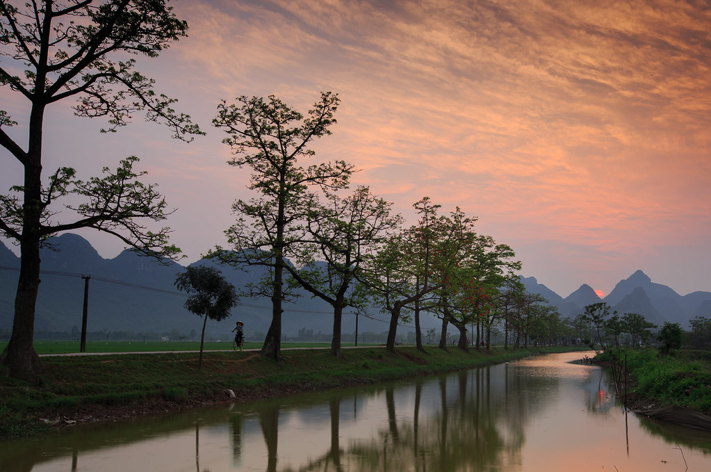
Doi Bu mountain in sunset

Sunset at 833

_MG_0314-Edit
_MG_0261-Edit
_MG_0287-Edit

_MG_0281-Edit
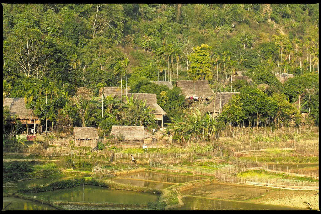
Village / Pù Luông National Reserve

boy walking in the ricefield
Bombax ceiba bloom season

2019-12-01_11-47-16

Giá kệ để pallet

So Village Children
Hoàng Văn Thụ, Chương Mỹ, Hà Nội, ベトナムの地図
別の場所を検索
近所の場所
Khu vực hồ Văn Sơn, Hoàng Văn Thụ, Chương Mỹ, Hà Nội ベトナムSky Lake Resort & Golf Club
ベトナム ハノイ チュオンミー県
ベトナム ハノイ ハドン区
Khu đô thị Nam An Khánh, An Khánh, Hoài Đức, Hà Nội, ベトナム
Khu đô thị Nam An Khánh, Hoài Đức, Hà Nội, ベトナムVinhomes Thăng Long
ベトナム ハノイ タックタット県
ベトナム ハノイ ホアイドゥク県
Mộ Lao, Hà Đông, Hà Nội, ベトナム
ベトナム ハノイ ナムトゥリエム区
Ngõ P2 Lê Quang Đạo, Mễ Trì, Từ Liêm, Hà Nội, ベトナムHanoi Street Circuit
Keangnam, Mễ Trì, Từ Liêm, Hanoi, ベトナム
1 Hoàng Minh Giám, Trung Hoà, Cầu Giấy, Hà Nội, ベトナムSân bóng Sơn Trang 2
Đồi Tròn, Thạch Thất, Hà Nội, ベトナム
Trung Hoà, Cầu Giấy, Hanoi, ベトナム
15 Ngõ - Yên Hòa, Yên Hoà, Cầu Giấy, Hà Nội, ベトナム
Đường Hồ Tùng Mậu, Goldmark City, Từ Liêm, Hà Nội ベトナムGoldmark City Hồ Tùng Mậu
Goldmark City, Phú Diễn, Từ Liêm, Hanoi, ベトナム
ベトナム ハノイ
ベトナム ハノイ カウザイ区
V3 Kim Mã, Ngọc Khánh, Ba Đình, Hà Nội, ベトナム
最近の検索
- アメリカ合衆国 アラスカ州 レッド・ドッグ・マイン日の出日の入り時間
- Am bhf, Borken, ドイツアム・バーンホーフ日の出日の入り時間
- 4th St E, Sonoma, CA, USA日の出日の入り時間
- Oakland Ave, Williamsport, PA アメリカ合衆国日の出日の入り時間
- Via Roma, Pieranica CR, イタリアローマ通り日の出日の入り時間
- クロアチア 〒 ドゥブロブニク GradClock Tower of Dubrovnik日の出日の入り時間
- アルゼンチン チュブ州 トレリュー日の出日の入り時間
- Hartfords Bluff Cir, Mt Pleasant, SC アメリカ合衆国日の出日の入り時間
- 日本、熊本県熊本市北区日の出日の入り時間
- 中華人民共和国 福州市 平潭県 平潭島日の出日の入り時間