アメリカ合衆国 〒 ニューヨーク州 ハイランド・レイク日の出日の入り時間
Location: アメリカ合衆国 > ニューヨーク州 > サリバン > アメリカ合衆国 ニューヨーク州 ハイランド > アメリカ合衆国 ニューヨーク州 エルドレド >
時間帯:
America/New_York
現地時間:
2025-06-23 14:50:16
経度:
-74.8512761
緯度:
41.5234238
今日の日の出時刻:
05:26:35 AM
今日の日の入時刻:
08:37:25 PM
今日の日長:
15h 10m 50s
明日の日の出時刻:
05:26:56 AM
明日の日の入時刻:
08:37:30 PM
明日の日長:
15h 10m 34s
すべて表示する
| 日付 | 日出 | 日没 | 日長 |
|---|---|---|---|
| 2025年01月01日 | 07:25:55 AM | 04:41:06 PM | 9h 15m 11s |
| 2025年01月02日 | 07:25:57 AM | 04:42:00 PM | 9h 16m 3s |
| 2025年01月03日 | 07:25:57 AM | 04:42:54 PM | 9h 16m 57s |
| 2025年01月04日 | 07:25:54 AM | 04:43:51 PM | 9h 17m 57s |
| 2025年01月05日 | 07:25:49 AM | 04:44:49 PM | 9h 19m 0s |
| 2025年01月06日 | 07:25:41 AM | 04:45:48 PM | 9h 20m 7s |
| 2025年01月07日 | 07:25:31 AM | 04:46:48 PM | 9h 21m 17s |
| 2025年01月08日 | 07:25:19 AM | 04:47:50 PM | 9h 22m 31s |
| 2025年01月09日 | 07:25:05 AM | 04:48:53 PM | 9h 23m 48s |
| 2025年01月10日 | 07:24:48 AM | 04:49:57 PM | 9h 25m 9s |
| 2025年01月11日 | 07:24:29 AM | 04:51:03 PM | 9h 26m 34s |
| 2025年01月12日 | 07:24:08 AM | 04:52:09 PM | 9h 28m 1s |
| 2025年01月13日 | 07:23:45 AM | 04:53:16 PM | 9h 29m 31s |
| 2025年01月14日 | 07:23:19 AM | 04:54:24 PM | 9h 31m 5s |
| 2025年01月15日 | 07:22:51 AM | 04:55:33 PM | 9h 32m 42s |
| 2025年01月16日 | 07:22:21 AM | 04:56:43 PM | 9h 34m 22s |
| 2025年01月17日 | 07:21:49 AM | 04:57:54 PM | 9h 36m 5s |
| 2025年01月18日 | 07:21:14 AM | 04:59:05 PM | 9h 37m 51s |
| 2025年01月19日 | 07:20:38 AM | 05:00:17 PM | 9h 39m 39s |
| 2025年01月20日 | 07:19:59 AM | 05:01:30 PM | 9h 41m 31s |
| 2025年01月21日 | 07:19:18 AM | 05:02:43 PM | 9h 43m 25s |
| 2025年01月22日 | 07:18:35 AM | 05:03:56 PM | 9h 45m 21s |
| 2025年01月23日 | 07:17:51 AM | 05:05:10 PM | 9h 47m 19s |
| 2025年01月24日 | 07:17:04 AM | 05:06:25 PM | 9h 49m 21s |
| 2025年01月25日 | 07:16:15 AM | 05:07:39 PM | 9h 51m 24s |
| 2025年01月26日 | 07:15:24 AM | 05:08:55 PM | 9h 53m 31s |
| 2025年01月27日 | 07:14:32 AM | 05:10:10 PM | 9h 55m 38s |
| 2025年01月28日 | 07:13:38 AM | 05:11:25 PM | 9h 57m 47s |
| 2025年01月29日 | 07:12:41 AM | 05:12:41 PM | 10h 0m 0s |
| 2025年01月30日 | 07:11:43 AM | 05:13:57 PM | 10h 2m 14s |
| 2025年01月31日 | 07:10:44 AM | 05:15:13 PM | 10h 4m 29s |
| 2025年02月01日 | 07:09:42 AM | 05:16:29 PM | 10h 6m 47s |
| 2025年02月02日 | 07:08:39 AM | 05:17:45 PM | 10h 9m 6s |
| 2025年02月03日 | 07:07:34 AM | 05:19:02 PM | 10h 11m 28s |
| 2025年02月04日 | 07:06:28 AM | 05:20:18 PM | 10h 13m 50s |
| 2025年02月05日 | 07:05:20 AM | 05:21:34 PM | 10h 16m 14s |
| 2025年02月06日 | 07:04:11 AM | 05:22:50 PM | 10h 18m 39s |
| 2025年02月07日 | 07:03:00 AM | 05:24:06 PM | 10h 21m 6s |
| 2025年02月08日 | 07:01:47 AM | 05:25:22 PM | 10h 23m 35s |
| 2025年02月09日 | 07:00:34 AM | 05:26:37 PM | 10h 26m 3s |
| 2025年02月10日 | 06:59:19 AM | 05:27:53 PM | 10h 28m 34s |
| 2025年02月11日 | 06:58:02 AM | 05:29:08 PM | 10h 31m 6s |
| 2025年02月12日 | 06:56:44 AM | 05:30:23 PM | 10h 33m 39s |
| 2025年02月13日 | 06:55:25 AM | 05:31:38 PM | 10h 36m 13s |
| 2025年02月14日 | 06:54:05 AM | 05:32:53 PM | 10h 38m 48s |
| 2025年02月15日 | 06:52:43 AM | 05:34:07 PM | 10h 41m 24s |
| 2025年02月16日 | 06:51:21 AM | 05:35:21 PM | 10h 44m 0s |
| 2025年02月17日 | 06:49:57 AM | 05:36:35 PM | 10h 46m 38s |
| 2025年02月18日 | 06:48:32 AM | 05:37:49 PM | 10h 49m 17s |
| 2025年02月19日 | 06:47:06 AM | 05:39:03 PM | 10h 51m 57s |
| 2025年02月20日 | 06:45:39 AM | 05:40:16 PM | 10h 54m 37s |
| 2025年02月21日 | 06:44:11 AM | 05:41:28 PM | 10h 57m 17s |
| 2025年02月22日 | 06:42:42 AM | 05:42:41 PM | 10h 59m 59s |
| 2025年02月23日 | 06:41:12 AM | 05:43:53 PM | 11h 2m 41s |
| 2025年02月24日 | 06:39:42 AM | 05:45:05 PM | 11h 5m 23s |
| 2025年02月25日 | 06:38:10 AM | 05:46:17 PM | 11h 8m 7s |
| 2025年02月26日 | 06:36:38 AM | 05:47:28 PM | 11h 10m 50s |
| 2025年02月27日 | 06:35:05 AM | 05:48:39 PM | 11h 13m 34s |
| 2025年02月28日 | 06:33:31 AM | 05:49:50 PM | 11h 16m 19s |
| 2025年03月01日 | 06:31:56 AM | 05:51:01 PM | 11h 19m 5s |
| 2025年03月02日 | 06:30:21 AM | 05:52:11 PM | 11h 21m 50s |
| 2025年03月03日 | 06:28:45 AM | 05:53:21 PM | 11h 24m 36s |
| 2025年03月04日 | 06:27:09 AM | 05:54:30 PM | 11h 27m 21s |
| 2025年03月05日 | 06:25:32 AM | 05:55:40 PM | 11h 30m 8s |
| 2025年03月06日 | 06:23:54 AM | 05:56:49 PM | 11h 32m 55s |
| 2025年03月07日 | 06:22:16 AM | 05:57:57 PM | 11h 35m 41s |
| 2025年03月08日 | 06:20:37 AM | 05:59:06 PM | 11h 38m 29s |
| 2025年03月09日 | 07:19:03 AM | 07:00:11 PM | 11h 41m 8s |
| 2025年03月10日 | 07:17:23 AM | 07:01:20 PM | 11h 43m 57s |
| 2025年03月11日 | 07:15:43 AM | 07:02:27 PM | 11h 46m 44s |
| 2025年03月12日 | 07:14:03 AM | 07:03:35 PM | 11h 49m 32s |
| 2025年03月13日 | 07:12:23 AM | 07:04:42 PM | 11h 52m 19s |
| 2025年03月14日 | 07:10:42 AM | 07:05:50 PM | 11h 55m 8s |
| 2025年03月15日 | 07:09:01 AM | 07:06:57 PM | 11h 57m 56s |
| 2025年03月16日 | 07:07:20 AM | 07:08:03 PM | 12h 0m 43s |
| 2025年03月17日 | 07:05:39 AM | 07:09:10 PM | 12h 3m 31s |
| 2025年03月18日 | 07:03:57 AM | 07:10:17 PM | 12h 6m 20s |
| 2025年03月19日 | 07:02:15 AM | 07:11:23 PM | 12h 9m 8s |
| 2025年03月20日 | 07:00:34 AM | 07:12:29 PM | 12h 11m 55s |
| 2025年03月21日 | 06:58:52 AM | 07:13:35 PM | 12h 14m 43s |
| 2025年03月22日 | 06:57:10 AM | 07:14:41 PM | 12h 17m 31s |
| 2025年03月23日 | 06:55:28 AM | 07:15:47 PM | 12h 20m 19s |
| 2025年03月24日 | 06:53:46 AM | 07:16:52 PM | 12h 23m 6s |
| 2025年03月25日 | 06:52:04 AM | 07:17:58 PM | 12h 25m 54s |
| 2025年03月26日 | 06:50:23 AM | 07:19:03 PM | 12h 28m 40s |
| 2025年03月27日 | 06:48:41 AM | 07:20:09 PM | 12h 31m 28s |
| 2025年03月28日 | 06:47:00 AM | 07:21:14 PM | 12h 34m 14s |
| 2025年03月29日 | 06:45:18 AM | 07:22:20 PM | 12h 37m 2s |
| 2025年03月30日 | 06:43:37 AM | 07:23:25 PM | 12h 39m 48s |
| 2025年03月31日 | 06:41:56 AM | 07:24:30 PM | 12h 42m 34s |
| 2025年04月01日 | 06:40:16 AM | 07:25:35 PM | 12h 45m 19s |
| 2025年04月02日 | 06:38:36 AM | 07:26:40 PM | 12h 48m 4s |
| 2025年04月03日 | 06:36:56 AM | 07:27:45 PM | 12h 50m 49s |
| 2025年04月04日 | 06:35:16 AM | 07:28:50 PM | 12h 53m 34s |
| 2025年04月05日 | 06:33:37 AM | 07:29:55 PM | 12h 56m 18s |
| 2025年04月06日 | 06:31:58 AM | 07:31:01 PM | 12h 59m 3s |
| 2025年04月07日 | 06:30:20 AM | 07:32:06 PM | 13h 1m 46s |
| 2025年04月08日 | 06:28:42 AM | 07:33:11 PM | 13h 4m 29s |
| 2025年04月09日 | 06:27:05 AM | 07:34:16 PM | 13h 7m 11s |
| 2025年04月10日 | 06:25:28 AM | 07:35:21 PM | 13h 9m 53s |
| 2025年04月11日 | 06:23:52 AM | 07:36:26 PM | 13h 12m 34s |
| 2025年04月12日 | 06:22:16 AM | 07:37:31 PM | 13h 15m 15s |
| 2025年04月13日 | 06:20:41 AM | 07:38:36 PM | 13h 17m 55s |
| 2025年04月14日 | 06:19:07 AM | 07:39:41 PM | 13h 20m 34s |
| 2025年04月15日 | 06:17:33 AM | 07:40:47 PM | 13h 23m 14s |
| 2025年04月16日 | 06:16:01 AM | 07:41:52 PM | 13h 25m 51s |
| 2025年04月17日 | 06:14:29 AM | 07:42:57 PM | 13h 28m 28s |
| 2025年04月18日 | 06:12:57 AM | 07:44:02 PM | 13h 31m 5s |
| 2025年04月19日 | 06:11:27 AM | 07:45:07 PM | 13h 33m 40s |
| 2025年04月20日 | 06:09:57 AM | 07:46:13 PM | 13h 36m 16s |
| 2025年04月21日 | 06:08:29 AM | 07:47:18 PM | 13h 38m 49s |
| 2025年04月22日 | 06:07:01 AM | 07:48:23 PM | 13h 41m 22s |
| 2025年04月23日 | 06:05:34 AM | 07:49:28 PM | 13h 43m 54s |
| 2025年04月24日 | 06:04:08 AM | 07:50:33 PM | 13h 46m 25s |
| 2025年04月25日 | 06:02:44 AM | 07:51:38 PM | 13h 48m 54s |
| 2025年04月26日 | 06:01:20 AM | 07:52:43 PM | 13h 51m 23s |
| 2025年04月27日 | 05:59:57 AM | 07:53:48 PM | 13h 53m 51s |
| 2025年04月28日 | 05:58:36 AM | 07:54:53 PM | 13h 56m 17s |
| 2025年04月29日 | 05:57:16 AM | 07:55:57 PM | 13h 58m 41s |
| 2025年04月30日 | 05:55:56 AM | 07:57:02 PM | 14h 1m 6s |
| 2025年05月01日 | 05:54:39 AM | 07:58:06 PM | 14h 3m 27s |
| 2025年05月02日 | 05:53:22 AM | 07:59:11 PM | 14h 5m 49s |
| 2025年05月03日 | 05:52:07 AM | 08:00:15 PM | 14h 8m 8s |
| 2025年05月04日 | 05:50:53 AM | 08:01:19 PM | 14h 10m 26s |
| 2025年05月05日 | 05:49:40 AM | 08:02:22 PM | 14h 12m 42s |
| 2025年05月06日 | 05:48:29 AM | 08:03:26 PM | 14h 14m 57s |
| 2025年05月07日 | 05:47:19 AM | 08:04:29 PM | 14h 17m 10s |
| 2025年05月08日 | 05:46:10 AM | 08:05:31 PM | 14h 19m 21s |
| 2025年05月09日 | 05:45:03 AM | 08:06:34 PM | 14h 21m 31s |
| 2025年05月10日 | 05:43:58 AM | 08:07:36 PM | 14h 23m 38s |
| 2025年05月11日 | 05:42:54 AM | 08:08:38 PM | 14h 25m 44s |
| 2025年05月12日 | 05:41:52 AM | 08:09:39 PM | 14h 27m 47s |
| 2025年05月13日 | 05:40:51 AM | 08:10:40 PM | 14h 29m 49s |
| 2025年05月14日 | 05:39:52 AM | 08:11:40 PM | 14h 31m 48s |
| 2025年05月15日 | 05:38:54 AM | 08:12:40 PM | 14h 33m 46s |
| 2025年05月16日 | 05:37:59 AM | 08:13:39 PM | 14h 35m 40s |
| 2025年05月17日 | 05:37:05 AM | 08:14:37 PM | 14h 37m 32s |
| 2025年05月18日 | 05:36:12 AM | 08:15:35 PM | 14h 39m 23s |
| 2025年05月19日 | 05:35:22 AM | 08:16:33 PM | 14h 41m 11s |
| 2025年05月20日 | 05:34:33 AM | 08:17:29 PM | 14h 42m 56s |
| 2025年05月21日 | 05:33:46 AM | 08:18:25 PM | 14h 44m 39s |
| 2025年05月22日 | 05:33:01 AM | 08:19:20 PM | 14h 46m 19s |
| 2025年05月23日 | 05:32:18 AM | 08:20:14 PM | 14h 47m 56s |
| 2025年05月24日 | 05:31:37 AM | 08:21:07 PM | 14h 49m 30s |
| 2025年05月25日 | 05:30:57 AM | 08:22:00 PM | 14h 51m 3s |
| 2025年05月26日 | 05:30:20 AM | 08:22:51 PM | 14h 52m 31s |
| 2025年05月27日 | 05:29:44 AM | 08:23:41 PM | 14h 53m 57s |
| 2025年05月28日 | 05:29:11 AM | 08:24:31 PM | 14h 55m 20s |
| 2025年05月29日 | 05:28:39 AM | 08:25:19 PM | 14h 56m 40s |
| 2025年05月30日 | 05:28:09 AM | 08:26:06 PM | 14h 57m 57s |
| 2025年05月31日 | 05:27:42 AM | 08:26:52 PM | 14h 59m 10s |
| 2025年06月01日 | 05:27:16 AM | 08:27:36 PM | 15h 0m 20s |
| 2025年06月02日 | 05:26:53 AM | 08:28:20 PM | 15h 1m 27s |
| 2025年06月03日 | 05:26:31 AM | 08:29:02 PM | 15h 2m 31s |
| 2025年06月04日 | 05:26:12 AM | 08:29:42 PM | 15h 3m 30s |
| 2025年06月05日 | 05:25:54 AM | 08:30:21 PM | 15h 4m 27s |
| 2025年06月06日 | 05:25:39 AM | 08:30:59 PM | 15h 5m 20s |
| 2025年06月07日 | 05:25:26 AM | 08:31:35 PM | 15h 6m 9s |
| 2025年06月08日 | 05:25:14 AM | 08:32:10 PM | 15h 6m 56s |
| 2025年06月09日 | 05:25:05 AM | 08:32:43 PM | 15h 7m 38s |
| 2025年06月10日 | 05:24:58 AM | 08:33:15 PM | 15h 8m 17s |
| 2025年06月11日 | 05:24:53 AM | 08:33:45 PM | 15h 8m 52s |
| 2025年06月12日 | 05:24:50 AM | 08:34:13 PM | 15h 9m 23s |
| 2025年06月13日 | 05:24:49 AM | 08:34:39 PM | 15h 9m 50s |
| 2025年06月14日 | 05:24:49 AM | 08:35:04 PM | 15h 10m 15s |
| 2025年06月15日 | 05:24:52 AM | 08:35:27 PM | 15h 10m 35s |
| 2025年06月16日 | 05:24:57 AM | 08:35:48 PM | 15h 10m 51s |
| 2025年06月17日 | 05:25:04 AM | 08:36:07 PM | 15h 11m 3s |
| 2025年06月18日 | 05:25:13 AM | 08:36:25 PM | 15h 11m 12s |
| 2025年06月19日 | 05:25:24 AM | 08:36:40 PM | 15h 11m 16s |
| 2025年06月20日 | 05:25:36 AM | 08:36:53 PM | 15h 11m 17s |
| 2025年06月21日 | 05:25:51 AM | 08:37:05 PM | 15h 11m 14s |
| 2025年06月22日 | 05:26:07 AM | 08:37:15 PM | 15h 11m 8s |
| 2025年06月23日 | 05:26:25 AM | 08:37:22 PM | 15h 10m 57s |
| 2025年06月24日 | 05:26:45 AM | 08:37:28 PM | 15h 10m 43s |
| 2025年06月25日 | 05:27:07 AM | 08:37:31 PM | 15h 10m 24s |
| 2025年06月26日 | 05:27:31 AM | 08:37:33 PM | 15h 10m 2s |
| 2025年06月27日 | 05:27:56 AM | 08:37:32 PM | 15h 9m 36s |
| 2025年06月28日 | 05:28:23 AM | 08:37:29 PM | 15h 9m 6s |
| 2025年06月29日 | 05:28:51 AM | 08:37:25 PM | 15h 8m 34s |
| 2025年06月30日 | 05:29:21 AM | 08:37:18 PM | 15h 7m 57s |
| 2025年07月01日 | 05:29:53 AM | 08:37:09 PM | 15h 7m 16s |
| 2025年07月02日 | 05:30:26 AM | 08:36:58 PM | 15h 6m 32s |
| 2025年07月03日 | 05:31:01 AM | 08:36:45 PM | 15h 5m 44s |
| 2025年07月04日 | 05:31:37 AM | 08:36:30 PM | 15h 4m 53s |
| 2025年07月05日 | 05:32:14 AM | 08:36:12 PM | 15h 3m 58s |
| 2025年07月06日 | 05:32:53 AM | 08:35:53 PM | 15h 3m 0s |
| 2025年07月07日 | 05:33:33 AM | 08:35:32 PM | 15h 1m 59s |
| 2025年07月08日 | 05:34:15 AM | 08:35:08 PM | 15h 0m 53s |
| 2025年07月09日 | 05:34:57 AM | 08:34:42 PM | 14h 59m 45s |
| 2025年07月10日 | 05:35:41 AM | 08:34:15 PM | 14h 58m 34s |
| 2025年07月11日 | 05:36:26 AM | 08:33:45 PM | 14h 57m 19s |
| 2025年07月12日 | 05:37:12 AM | 08:33:13 PM | 14h 56m 1s |
| 2025年07月13日 | 05:37:59 AM | 08:32:40 PM | 14h 54m 41s |
| 2025年07月14日 | 05:38:47 AM | 08:32:04 PM | 14h 53m 17s |
| 2025年07月15日 | 05:39:36 AM | 08:31:26 PM | 14h 51m 50s |
| 2025年07月16日 | 05:40:26 AM | 08:30:47 PM | 14h 50m 21s |
| 2025年07月17日 | 05:41:17 AM | 08:30:05 PM | 14h 48m 48s |
| 2025年07月18日 | 05:42:09 AM | 08:29:21 PM | 14h 47m 12s |
| 2025年07月19日 | 05:43:01 AM | 08:28:36 PM | 14h 45m 35s |
| 2025年07月20日 | 05:43:54 AM | 08:27:49 PM | 14h 43m 55s |
| 2025年07月21日 | 05:44:48 AM | 08:27:00 PM | 14h 42m 12s |
| 2025年07月22日 | 05:45:43 AM | 08:26:09 PM | 14h 40m 26s |
| 2025年07月23日 | 05:46:38 AM | 08:25:16 PM | 14h 38m 38s |
| 2025年07月24日 | 05:47:34 AM | 08:24:21 PM | 14h 36m 47s |
| 2025年07月25日 | 05:48:30 AM | 08:23:25 PM | 14h 34m 55s |
| 2025年07月26日 | 05:49:27 AM | 08:22:27 PM | 14h 33m 0s |
| 2025年07月27日 | 05:50:24 AM | 08:21:28 PM | 14h 31m 4s |
| 2025年07月28日 | 05:51:22 AM | 08:20:26 PM | 14h 29m 4s |
| 2025年07月29日 | 05:52:20 AM | 08:19:23 PM | 14h 27m 3s |
| 2025年07月30日 | 05:53:19 AM | 08:18:19 PM | 14h 25m 0s |
| 2025年07月31日 | 05:54:17 AM | 08:17:13 PM | 14h 22m 56s |
| 2025年08月01日 | 05:55:17 AM | 08:16:05 PM | 14h 20m 48s |
| 2025年08月02日 | 05:56:16 AM | 08:14:56 PM | 14h 18m 40s |
| 2025年08月03日 | 05:57:16 AM | 08:13:45 PM | 14h 16m 29s |
| 2025年08月04日 | 05:58:16 AM | 08:12:33 PM | 14h 14m 17s |
| 2025年08月05日 | 05:59:16 AM | 08:11:20 PM | 14h 12m 4s |
| 2025年08月06日 | 06:00:17 AM | 08:10:05 PM | 14h 9m 48s |
| 2025年08月07日 | 06:01:17 AM | 08:08:49 PM | 14h 7m 32s |
| 2025年08月08日 | 06:02:18 AM | 08:07:31 PM | 14h 5m 13s |
| 2025年08月09日 | 06:03:19 AM | 08:06:12 PM | 14h 2m 53s |
| 2025年08月10日 | 06:04:20 AM | 08:04:52 PM | 14h 0m 32s |
| 2025年08月11日 | 06:05:21 AM | 08:03:31 PM | 13h 58m 10s |
| 2025年08月12日 | 06:06:22 AM | 08:02:09 PM | 13h 55m 47s |
| 2025年08月13日 | 06:07:23 AM | 08:00:45 PM | 13h 53m 22s |
| 2025年08月14日 | 06:08:24 AM | 07:59:20 PM | 13h 50m 56s |
| 2025年08月15日 | 06:09:25 AM | 07:57:55 PM | 13h 48m 30s |
| 2025年08月16日 | 06:10:27 AM | 07:56:28 PM | 13h 46m 1s |
| 2025年08月17日 | 06:11:28 AM | 07:55:00 PM | 13h 43m 32s |
| 2025年08月18日 | 06:12:29 AM | 07:53:31 PM | 13h 41m 2s |
| 2025年08月19日 | 06:13:30 AM | 07:52:01 PM | 13h 38m 31s |
| 2025年08月20日 | 06:14:32 AM | 07:50:31 PM | 13h 35m 59s |
| 2025年08月21日 | 06:15:33 AM | 07:48:59 PM | 13h 33m 26s |
| 2025年08月22日 | 06:16:34 AM | 07:47:27 PM | 13h 30m 53s |
| 2025年08月23日 | 06:17:35 AM | 07:45:53 PM | 13h 28m 18s |
| 2025年08月24日 | 06:18:36 AM | 07:44:19 PM | 13h 25m 43s |
| 2025年08月25日 | 06:19:37 AM | 07:42:44 PM | 13h 23m 7s |
| 2025年08月26日 | 06:20:38 AM | 07:41:09 PM | 13h 20m 31s |
| 2025年08月27日 | 06:21:39 AM | 07:39:33 PM | 13h 17m 54s |
| 2025年08月28日 | 06:22:40 AM | 07:37:56 PM | 13h 15m 16s |
| 2025年08月29日 | 06:23:41 AM | 07:36:18 PM | 13h 12m 37s |
| 2025年08月30日 | 06:24:42 AM | 07:34:40 PM | 13h 9m 58s |
| 2025年08月31日 | 06:25:42 AM | 07:33:01 PM | 13h 7m 19s |
| 2025年09月01日 | 06:26:43 AM | 07:31:22 PM | 13h 4m 39s |
| 2025年09月02日 | 06:27:44 AM | 07:29:42 PM | 13h 1m 58s |
| 2025年09月03日 | 06:28:45 AM | 07:28:02 PM | 12h 59m 17s |
| 2025年09月04日 | 06:29:45 AM | 07:26:21 PM | 12h 56m 36s |
| 2025年09月05日 | 06:30:46 AM | 07:24:40 PM | 12h 53m 54s |
| 2025年09月06日 | 06:31:46 AM | 07:22:58 PM | 12h 51m 12s |
| 2025年09月07日 | 06:32:47 AM | 07:21:16 PM | 12h 48m 29s |
| 2025年09月08日 | 06:33:48 AM | 07:19:34 PM | 12h 45m 46s |
| 2025年09月09日 | 06:34:48 AM | 07:17:52 PM | 12h 43m 4s |
| 2025年09月10日 | 06:35:49 AM | 07:16:09 PM | 12h 40m 20s |
| 2025年09月11日 | 06:36:50 AM | 07:14:26 PM | 12h 37m 36s |
| 2025年09月12日 | 06:37:50 AM | 07:12:42 PM | 12h 34m 52s |
| 2025年09月13日 | 06:38:51 AM | 07:10:59 PM | 12h 32m 8s |
| 2025年09月14日 | 06:39:52 AM | 07:09:15 PM | 12h 29m 23s |
| 2025年09月15日 | 06:40:53 AM | 07:07:32 PM | 12h 26m 39s |
| 2025年09月16日 | 06:41:54 AM | 07:05:48 PM | 12h 23m 54s |
| 2025年09月17日 | 06:42:55 AM | 07:04:04 PM | 12h 21m 9s |
| 2025年09月18日 | 06:43:56 AM | 07:02:20 PM | 12h 18m 24s |
| 2025年09月19日 | 06:44:57 AM | 07:00:36 PM | 12h 15m 39s |
| 2025年09月20日 | 06:45:58 AM | 06:58:52 PM | 12h 12m 54s |
| 2025年09月21日 | 06:47:00 AM | 06:57:08 PM | 12h 10m 8s |
| 2025年09月22日 | 06:48:01 AM | 06:55:24 PM | 12h 7m 23s |
| 2025年09月23日 | 06:49:03 AM | 06:53:41 PM | 12h 4m 38s |
| 2025年09月24日 | 06:50:05 AM | 06:51:57 PM | 12h 1m 52s |
| 2025年09月25日 | 06:51:07 AM | 06:50:14 PM | 11h 59m 7s |
| 2025年09月26日 | 06:52:09 AM | 06:48:31 PM | 11h 56m 22s |
| 2025年09月27日 | 06:53:12 AM | 06:46:48 PM | 11h 53m 36s |
| 2025年09月28日 | 06:54:15 AM | 06:45:05 PM | 11h 50m 50s |
| 2025年09月29日 | 06:55:17 AM | 06:43:23 PM | 11h 48m 6s |
| 2025年09月30日 | 06:56:21 AM | 06:41:41 PM | 11h 45m 20s |
| 2025年10月01日 | 06:57:24 AM | 06:39:59 PM | 11h 42m 35s |
| 2025年10月02日 | 06:58:27 AM | 06:38:18 PM | 11h 39m 51s |
| 2025年10月03日 | 06:59:31 AM | 06:36:37 PM | 11h 37m 6s |
| 2025年10月04日 | 07:00:35 AM | 06:34:57 PM | 11h 34m 22s |
| 2025年10月05日 | 07:01:40 AM | 06:33:17 PM | 11h 31m 37s |
| 2025年10月06日 | 07:02:44 AM | 06:31:37 PM | 11h 28m 53s |
| 2025年10月07日 | 07:03:49 AM | 06:29:58 PM | 11h 26m 9s |
| 2025年10月08日 | 07:04:55 AM | 06:28:20 PM | 11h 23m 25s |
| 2025年10月09日 | 07:06:00 AM | 06:26:43 PM | 11h 20m 43s |
| 2025年10月10日 | 07:07:06 AM | 06:25:06 PM | 11h 18m 0s |
| 2025年10月11日 | 07:08:12 AM | 06:23:29 PM | 11h 15m 17s |
| 2025年10月12日 | 07:09:19 AM | 06:21:54 PM | 11h 12m 35s |
| 2025年10月13日 | 07:10:25 AM | 06:20:19 PM | 11h 9m 54s |
| 2025年10月14日 | 07:11:32 AM | 06:18:45 PM | 11h 7m 13s |
| 2025年10月15日 | 07:12:40 AM | 06:17:11 PM | 11h 4m 31s |
| 2025年10月16日 | 07:13:48 AM | 06:15:39 PM | 11h 1m 51s |
| 2025年10月17日 | 07:14:56 AM | 06:14:07 PM | 10h 59m 11s |
| 2025年10月18日 | 07:16:04 AM | 06:12:37 PM | 10h 56m 33s |
| 2025年10月19日 | 07:17:13 AM | 06:11:07 PM | 10h 53m 54s |
| 2025年10月20日 | 07:18:22 AM | 06:09:38 PM | 10h 51m 16s |
| 2025年10月21日 | 07:19:31 AM | 06:08:10 PM | 10h 48m 39s |
| 2025年10月22日 | 07:20:41 AM | 06:06:44 PM | 10h 46m 3s |
| 2025年10月23日 | 07:21:51 AM | 06:05:18 PM | 10h 43m 27s |
| 2025年10月24日 | 07:23:01 AM | 06:03:54 PM | 10h 40m 53s |
| 2025年10月25日 | 07:24:11 AM | 06:02:30 PM | 10h 38m 19s |
| 2025年10月26日 | 07:25:22 AM | 06:01:08 PM | 10h 35m 46s |
| 2025年10月27日 | 07:26:33 AM | 05:59:47 PM | 10h 33m 14s |
| 2025年10月28日 | 07:27:45 AM | 05:58:28 PM | 10h 30m 43s |
| 2025年10月29日 | 07:28:56 AM | 05:57:10 PM | 10h 28m 14s |
| 2025年10月30日 | 07:30:08 AM | 05:55:53 PM | 10h 25m 45s |
| 2025年10月31日 | 07:31:20 AM | 05:54:37 PM | 10h 23m 17s |
| 2025年11月01日 | 07:32:32 AM | 05:53:23 PM | 10h 20m 51s |
| 2025年11月02日 | 06:33:47 AM | 04:52:07 PM | 10h 18m 20s |
| 2025年11月03日 | 06:35:00 AM | 04:50:56 PM | 10h 15m 56s |
| 2025年11月04日 | 06:36:12 AM | 04:49:46 PM | 10h 13m 34s |
| 2025年11月05日 | 06:37:25 AM | 04:48:38 PM | 10h 11m 13s |
| 2025年11月06日 | 06:38:38 AM | 04:47:32 PM | 10h 8m 54s |
| 2025年11月07日 | 06:39:51 AM | 04:46:27 PM | 10h 6m 36s |
| 2025年11月08日 | 06:41:04 AM | 04:45:24 PM | 10h 4m 20s |
| 2025年11月09日 | 06:42:16 AM | 04:44:23 PM | 10h 2m 7s |
| 2025年11月10日 | 06:43:29 AM | 04:43:23 PM | 9h 59m 54s |
| 2025年11月11日 | 06:44:42 AM | 04:42:25 PM | 9h 57m 43s |
| 2025年11月12日 | 06:45:54 AM | 04:41:29 PM | 9h 55m 35s |
| 2025年11月13日 | 06:47:07 AM | 04:40:35 PM | 9h 53m 28s |
| 2025年11月14日 | 06:48:19 AM | 04:39:42 PM | 9h 51m 23s |
| 2025年11月15日 | 06:49:31 AM | 04:38:52 PM | 9h 49m 21s |
| 2025年11月16日 | 06:50:43 AM | 04:38:04 PM | 9h 47m 21s |
| 2025年11月17日 | 06:51:54 AM | 04:37:17 PM | 9h 45m 23s |
| 2025年11月18日 | 06:53:05 AM | 04:36:33 PM | 9h 43m 28s |
| 2025年11月19日 | 06:54:16 AM | 04:35:50 PM | 9h 41m 34s |
| 2025年11月20日 | 06:55:26 AM | 04:35:10 PM | 9h 39m 44s |
| 2025年11月21日 | 06:56:35 AM | 04:34:32 PM | 9h 37m 57s |
| 2025年11月22日 | 06:57:44 AM | 04:33:56 PM | 9h 36m 12s |
| 2025年11月23日 | 06:58:53 AM | 04:33:22 PM | 9h 34m 29s |
| 2025年11月24日 | 07:00:00 AM | 04:32:50 PM | 9h 32m 50s |
| 2025年11月25日 | 07:01:08 AM | 04:32:21 PM | 9h 31m 13s |
| 2025年11月26日 | 07:02:14 AM | 04:31:53 PM | 9h 29m 39s |
| 2025年11月27日 | 07:03:19 AM | 04:31:28 PM | 9h 28m 9s |
| 2025年11月28日 | 07:04:24 AM | 04:31:06 PM | 9h 26m 42s |
| 2025年11月29日 | 07:05:27 AM | 04:30:45 PM | 9h 25m 18s |
| 2025年11月30日 | 07:06:30 AM | 04:30:27 PM | 9h 23m 57s |
| 2025年12月01日 | 07:07:32 AM | 04:30:11 PM | 9h 22m 39s |
| 2025年12月02日 | 07:08:32 AM | 04:29:58 PM | 9h 21m 26s |
| 2025年12月03日 | 07:09:31 AM | 04:29:47 PM | 9h 20m 16s |
| 2025年12月04日 | 07:10:30 AM | 04:29:38 PM | 9h 19m 8s |
| 2025年12月05日 | 07:11:26 AM | 04:29:32 PM | 9h 18m 6s |
| 2025年12月06日 | 07:12:22 AM | 04:29:28 PM | 9h 17m 6s |
| 2025年12月07日 | 07:13:16 AM | 04:29:26 PM | 9h 16m 10s |
| 2025年12月08日 | 07:14:09 AM | 04:29:27 PM | 9h 15m 18s |
| 2025年12月09日 | 07:15:00 AM | 04:29:30 PM | 9h 14m 30s |
| 2025年12月10日 | 07:15:49 AM | 04:29:35 PM | 9h 13m 46s |
| 2025年12月11日 | 07:16:37 AM | 04:29:43 PM | 9h 13m 6s |
| 2025年12月12日 | 07:17:23 AM | 04:29:53 PM | 9h 12m 30s |
| 2025年12月13日 | 07:18:08 AM | 04:30:06 PM | 9h 11m 58s |
| 2025年12月14日 | 07:18:51 AM | 04:30:21 PM | 9h 11m 30s |
| 2025年12月15日 | 07:19:32 AM | 04:30:38 PM | 9h 11m 6s |
| 2025年12月16日 | 07:20:11 AM | 04:30:57 PM | 9h 10m 46s |
| 2025年12月17日 | 07:20:48 AM | 04:31:19 PM | 9h 10m 31s |
| 2025年12月18日 | 07:21:23 AM | 04:31:43 PM | 9h 10m 20s |
| 2025年12月19日 | 07:21:57 AM | 04:32:09 PM | 9h 10m 12s |
| 2025年12月20日 | 07:22:28 AM | 04:32:37 PM | 9h 10m 9s |
| 2025年12月21日 | 07:22:57 AM | 04:33:08 PM | 9h 10m 11s |
| 2025年12月22日 | 07:23:24 AM | 04:33:40 PM | 9h 10m 16s |
| 2025年12月23日 | 07:23:49 AM | 04:34:15 PM | 9h 10m 26s |
| 2025年12月24日 | 07:24:12 AM | 04:34:52 PM | 9h 10m 40s |
| 2025年12月25日 | 07:24:33 AM | 04:35:30 PM | 9h 10m 57s |
| 2025年12月26日 | 07:24:51 AM | 04:36:11 PM | 9h 11m 20s |
| 2025年12月27日 | 07:25:07 AM | 04:36:54 PM | 9h 11m 47s |
| 2025年12月28日 | 07:25:21 AM | 04:37:38 PM | 9h 12m 17s |
| 2025年12月29日 | 07:25:33 AM | 04:38:24 PM | 9h 12m 51s |
| 2025年12月30日 | 07:25:42 AM | 04:39:12 PM | 9h 13m 30s |
| 2025年12月31日 | 07:25:49 AM | 04:40:02 PM | 9h 14m 13s |
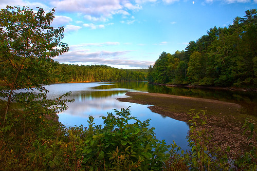
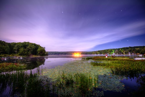
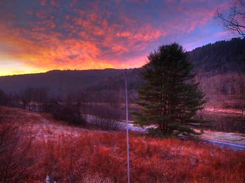
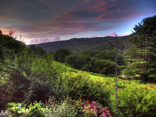
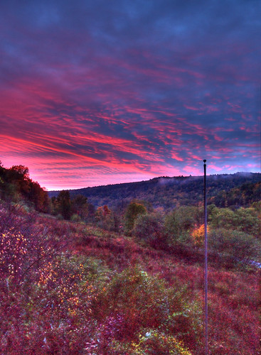
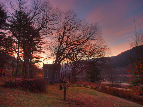
写真
アメリカ合衆国 〒 ニューヨーク州 ハイランド・レイクの地図
別の場所を検索
アメリカ合衆国 〒 ニューヨーク州 ハイランド・レイクでの場所
近所の場所
Lake View Dr, Highland, NY, アメリカ合衆国レイク・ビュー・ドライブ
Proctor Rd, Eldred, NY アメリカ合衆国
Proctor Rd, Eldred, NY アメリカ合衆国
Mud Pond Rd, Highland, NY, アメリカ合衆国マッド・ポンド・ロード
State Rte 55, Eldred, NY アメリカ合衆国Eldred Central School
76 Delaware Trail, Glen Spey, NY アメリカ合衆国
State Rte 55, Eldred, NY アメリカ合衆国
Sunflower Dr, Lumberland, NY アメリカ合衆国サンフラワー・ドライブ
72 Lebanon Rd, Glen Spey, NY アメリカ合衆国
NY-55, Eldred, NY アメリカ合衆国
74 Moscoe Rd, White Lake, NY アメリカ合衆国
アメリカ合衆国 〒 ニューヨーク州 ホワイト・レイク
37 Lake Ridge Rd, White Lake, NY アメリカ合衆国
アメリカ合衆国 〒 ニューヨーク州 フォレストバラ
アメリカ合衆国 ニューヨーク州 スモールウッド
アメリカ合衆国 〒 ニューヨーク州 スモールウッド
アメリカ合衆国 ニューヨーク州 フォレストバラ
St Josephs Hill Rd, Forestburgh, NY アメリカ合衆国
アメリカ合衆国 〒 ニューヨーク州 トンプソン サケット湖
St Josephs Rd, Forestburgh, NY アメリカ合衆国
最近の検索
- アメリカ合衆国 アラスカ州 レッド・ドッグ・マイン日の出日の入り時間
- Am bhf, Borken, ドイツアム・バーンホーフ日の出日の入り時間
- 4th St E, Sonoma, CA, USA日の出日の入り時間
- Oakland Ave, Williamsport, PA アメリカ合衆国日の出日の入り時間
- Via Roma, Pieranica CR, イタリアローマ通り日の出日の入り時間
- クロアチア 〒 ドゥブロブニク GradClock Tower of Dubrovnik日の出日の入り時間
- アルゼンチン チュブ州 トレリュー日の出日の入り時間
- Hartfords Bluff Cir, Mt Pleasant, SC アメリカ合衆国日の出日の入り時間
- 日本、熊本県熊本市北区日の出日の入り時間
- 中華人民共和国 福州市 平潭県 平潭島日の出日の入り時間
