Black Mesa Trail, Kenton, OK アメリカ合衆国Highest Point in Oklahoma日の出日の入り時間
Location: アメリカ合衆国 > オクラホマ州 > シマロン > アメリカ合衆国 〒 オクラホマ州 ケントン >
時間帯:
America/Chicago
現地時間:
2025-07-01 02:48:57
経度:
-102.9978522
緯度:
36.9318846
今日の日の出時刻:
06:36:36 AM
今日の日の入時刻:
09:15:27 PM
今日の日長:
14h 38m 51s
明日の日の出時刻:
06:37:05 AM
明日の日の入時刻:
09:15:20 PM
明日の日長:
14h 38m 15s
すべて表示する
| 日付 | 日出 | 日没 | 日長 |
|---|---|---|---|
| 2025年01月01日 | 08:05:11 AM | 05:47:08 PM | 9h 41m 57s |
| 2025年01月02日 | 08:05:17 AM | 05:47:57 PM | 9h 42m 40s |
| 2025年01月03日 | 08:05:21 AM | 05:48:47 PM | 9h 43m 26s |
| 2025年01月04日 | 08:05:23 AM | 05:49:39 PM | 9h 44m 16s |
| 2025年01月05日 | 08:05:23 AM | 05:50:31 PM | 9h 45m 8s |
| 2025年01月06日 | 08:05:20 AM | 05:51:25 PM | 9h 46m 5s |
| 2025年01月07日 | 08:05:16 AM | 05:52:20 PM | 9h 47m 4s |
| 2025年01月08日 | 08:05:10 AM | 05:53:16 PM | 9h 48m 6s |
| 2025年01月09日 | 08:05:02 AM | 05:54:12 PM | 9h 49m 10s |
| 2025年01月10日 | 08:04:52 AM | 05:55:10 PM | 9h 50m 18s |
| 2025年01月11日 | 08:04:40 AM | 05:56:08 PM | 9h 51m 28s |
| 2025年01月12日 | 08:04:26 AM | 05:57:07 PM | 9h 52m 41s |
| 2025年01月13日 | 08:04:09 AM | 05:58:07 PM | 9h 53m 58s |
| 2025年01月14日 | 08:03:51 AM | 05:59:08 PM | 9h 55m 17s |
| 2025年01月15日 | 08:03:31 AM | 06:00:09 PM | 9h 56m 38s |
| 2025年01月16日 | 08:03:09 AM | 06:01:10 PM | 9h 58m 1s |
| 2025年01月17日 | 08:02:45 AM | 06:02:13 PM | 9h 59m 28s |
| 2025年01月18日 | 08:02:19 AM | 06:03:15 PM | 10h 0m 56s |
| 2025年01月19日 | 08:01:51 AM | 06:04:18 PM | 10h 2m 27s |
| 2025年01月20日 | 08:01:21 AM | 06:05:22 PM | 10h 4m 1s |
| 2025年01月21日 | 08:00:49 AM | 06:06:26 PM | 10h 5m 37s |
| 2025年01月22日 | 08:00:16 AM | 06:07:30 PM | 10h 7m 14s |
| 2025年01月23日 | 07:59:41 AM | 06:08:34 PM | 10h 8m 53s |
| 2025年01月24日 | 07:59:03 AM | 06:09:39 PM | 10h 10m 36s |
| 2025年01月25日 | 07:58:24 AM | 06:10:44 PM | 10h 12m 20s |
| 2025年01月26日 | 07:57:44 AM | 06:11:48 PM | 10h 14m 4s |
| 2025年01月27日 | 07:57:01 AM | 06:12:54 PM | 10h 15m 53s |
| 2025年01月28日 | 07:56:17 AM | 06:13:59 PM | 10h 17m 42s |
| 2025年01月29日 | 07:55:31 AM | 06:15:04 PM | 10h 19m 33s |
| 2025年01月30日 | 07:54:44 AM | 06:16:09 PM | 10h 21m 25s |
| 2025年01月31日 | 07:53:55 AM | 06:17:14 PM | 10h 23m 19s |
| 2025年02月01日 | 07:53:04 AM | 06:18:19 PM | 10h 25m 15s |
| 2025年02月02日 | 07:52:12 AM | 06:19:24 PM | 10h 27m 12s |
| 2025年02月03日 | 07:51:18 AM | 06:20:29 PM | 10h 29m 11s |
| 2025年02月04日 | 07:50:23 AM | 06:21:34 PM | 10h 31m 11s |
| 2025年02月05日 | 07:49:26 AM | 06:22:39 PM | 10h 33m 13s |
| 2025年02月06日 | 07:48:28 AM | 06:23:43 PM | 10h 35m 15s |
| 2025年02月07日 | 07:47:29 AM | 06:24:48 PM | 10h 37m 19s |
| 2025年02月08日 | 07:46:28 AM | 06:25:52 PM | 10h 39m 24s |
| 2025年02月09日 | 07:45:26 AM | 06:26:56 PM | 10h 41m 30s |
| 2025年02月10日 | 07:44:22 AM | 06:27:59 PM | 10h 43m 37s |
| 2025年02月11日 | 07:43:17 AM | 06:29:03 PM | 10h 45m 46s |
| 2025年02月12日 | 07:42:11 AM | 06:30:06 PM | 10h 47m 55s |
| 2025年02月13日 | 07:41:04 AM | 06:31:09 PM | 10h 50m 5s |
| 2025年02月14日 | 07:39:56 AM | 06:32:11 PM | 10h 52m 15s |
| 2025年02月15日 | 07:38:46 AM | 06:33:14 PM | 10h 54m 28s |
| 2025年02月16日 | 07:37:36 AM | 06:34:16 PM | 10h 56m 40s |
| 2025年02月17日 | 07:36:24 AM | 06:35:17 PM | 10h 58m 53s |
| 2025年02月18日 | 07:35:11 AM | 06:36:19 PM | 11h 1m 8s |
| 2025年02月19日 | 07:33:57 AM | 06:37:20 PM | 11h 3m 23s |
| 2025年02月20日 | 07:32:43 AM | 06:38:21 PM | 11h 5m 38s |
| 2025年02月21日 | 07:31:27 AM | 06:39:21 PM | 11h 7m 54s |
| 2025年02月22日 | 07:30:10 AM | 06:40:21 PM | 11h 10m 11s |
| 2025年02月23日 | 07:28:53 AM | 06:41:21 PM | 11h 12m 28s |
| 2025年02月24日 | 07:27:34 AM | 06:42:20 PM | 11h 14m 46s |
| 2025年02月25日 | 07:26:15 AM | 06:43:19 PM | 11h 17m 4s |
| 2025年02月26日 | 07:24:55 AM | 06:44:18 PM | 11h 19m 23s |
| 2025年02月27日 | 07:23:35 AM | 06:45:17 PM | 11h 21m 42s |
| 2025年02月28日 | 07:22:13 AM | 06:46:15 PM | 11h 24m 2s |
| 2025年03月01日 | 07:20:51 AM | 06:47:13 PM | 11h 26m 22s |
| 2025年03月02日 | 07:19:29 AM | 06:48:10 PM | 11h 28m 41s |
| 2025年03月03日 | 07:18:05 AM | 06:49:08 PM | 11h 31m 3s |
| 2025年03月04日 | 07:16:41 AM | 06:50:04 PM | 11h 33m 23s |
| 2025年03月05日 | 07:15:17 AM | 06:51:01 PM | 11h 35m 44s |
| 2025年03月06日 | 07:13:52 AM | 06:51:58 PM | 11h 38m 6s |
| 2025年03月07日 | 07:12:27 AM | 06:52:54 PM | 11h 40m 27s |
| 2025年03月08日 | 07:11:01 AM | 06:53:50 PM | 11h 42m 49s |
| 2025年03月09日 | 08:09:38 AM | 07:54:43 PM | 11h 45m 5s |
| 2025年03月10日 | 08:08:11 AM | 07:55:38 PM | 11h 47m 27s |
| 2025年03月11日 | 08:06:44 AM | 07:56:33 PM | 11h 49m 49s |
| 2025年03月12日 | 08:05:17 AM | 07:57:28 PM | 11h 52m 11s |
| 2025年03月13日 | 08:03:49 AM | 07:58:23 PM | 11h 54m 34s |
| 2025年03月14日 | 08:02:21 AM | 07:59:17 PM | 11h 56m 56s |
| 2025年03月15日 | 08:00:52 AM | 08:00:12 PM | 11h 59m 20s |
| 2025年03月16日 | 07:59:24 AM | 08:01:06 PM | 12h 1m 42s |
| 2025年03月17日 | 07:57:55 AM | 08:02:00 PM | 12h 4m 5s |
| 2025年03月18日 | 07:56:26 AM | 08:02:53 PM | 12h 6m 27s |
| 2025年03月19日 | 07:54:57 AM | 08:03:47 PM | 12h 8m 50s |
| 2025年03月20日 | 07:53:28 AM | 08:04:40 PM | 12h 11m 12s |
| 2025年03月21日 | 07:51:59 AM | 08:05:34 PM | 12h 13m 35s |
| 2025年03月22日 | 07:50:30 AM | 08:06:27 PM | 12h 15m 57s |
| 2025年03月23日 | 07:49:01 AM | 08:07:20 PM | 12h 18m 19s |
| 2025年03月24日 | 07:47:32 AM | 08:08:13 PM | 12h 20m 41s |
| 2025年03月25日 | 07:46:02 AM | 08:09:06 PM | 12h 23m 4s |
| 2025年03月26日 | 07:44:33 AM | 08:09:59 PM | 12h 25m 26s |
| 2025年03月27日 | 07:43:04 AM | 08:10:52 PM | 12h 27m 48s |
| 2025年03月28日 | 07:41:36 AM | 08:11:44 PM | 12h 30m 8s |
| 2025年03月29日 | 07:40:07 AM | 08:12:37 PM | 12h 32m 30s |
| 2025年03月30日 | 07:38:39 AM | 08:13:30 PM | 12h 34m 51s |
| 2025年03月31日 | 07:37:10 AM | 08:14:22 PM | 12h 37m 12s |
| 2025年04月01日 | 07:35:42 AM | 08:15:15 PM | 12h 39m 33s |
| 2025年04月02日 | 07:34:15 AM | 08:16:07 PM | 12h 41m 52s |
| 2025年04月03日 | 07:32:47 AM | 08:17:00 PM | 12h 44m 13s |
| 2025年04月04日 | 07:31:20 AM | 08:17:52 PM | 12h 46m 32s |
| 2025年04月05日 | 07:29:54 AM | 08:18:45 PM | 12h 48m 51s |
| 2025年04月06日 | 07:28:28 AM | 08:19:38 PM | 12h 51m 10s |
| 2025年04月07日 | 07:27:02 AM | 08:20:30 PM | 12h 53m 28s |
| 2025年04月08日 | 07:25:36 AM | 08:21:23 PM | 12h 55m 47s |
| 2025年04月09日 | 07:24:12 AM | 08:22:15 PM | 12h 58m 3s |
| 2025年04月10日 | 07:22:47 AM | 08:23:08 PM | 13h 0m 21s |
| 2025年04月11日 | 07:21:24 AM | 08:24:01 PM | 13h 2m 37s |
| 2025年04月12日 | 07:20:00 AM | 08:24:54 PM | 13h 4m 54s |
| 2025年04月13日 | 07:18:38 AM | 08:25:46 PM | 13h 7m 8s |
| 2025年04月14日 | 07:17:16 AM | 08:26:39 PM | 13h 9m 23s |
| 2025年04月15日 | 07:15:55 AM | 08:27:32 PM | 13h 11m 37s |
| 2025年04月16日 | 07:14:34 AM | 08:28:25 PM | 13h 13m 51s |
| 2025年04月17日 | 07:13:14 AM | 08:29:18 PM | 13h 16m 4s |
| 2025年04月18日 | 07:11:55 AM | 08:30:11 PM | 13h 18m 16s |
| 2025年04月19日 | 07:10:37 AM | 08:31:04 PM | 13h 20m 27s |
| 2025年04月20日 | 07:09:20 AM | 08:31:58 PM | 13h 22m 38s |
| 2025年04月21日 | 07:08:03 AM | 08:32:51 PM | 13h 24m 48s |
| 2025年04月22日 | 07:06:48 AM | 08:33:44 PM | 13h 26m 56s |
| 2025年04月23日 | 07:05:33 AM | 08:34:37 PM | 13h 29m 4s |
| 2025年04月24日 | 07:04:19 AM | 08:35:30 PM | 13h 31m 11s |
| 2025年04月25日 | 07:03:06 AM | 08:36:24 PM | 13h 33m 18s |
| 2025年04月26日 | 07:01:54 AM | 08:37:17 PM | 13h 35m 23s |
| 2025年04月27日 | 07:00:43 AM | 08:38:10 PM | 13h 37m 27s |
| 2025年04月28日 | 06:59:34 AM | 08:39:03 PM | 13h 39m 29s |
| 2025年04月29日 | 06:58:25 AM | 08:39:57 PM | 13h 41m 32s |
| 2025年04月30日 | 06:57:17 AM | 08:40:50 PM | 13h 43m 33s |
| 2025年05月01日 | 06:56:11 AM | 08:41:43 PM | 13h 45m 32s |
| 2025年05月02日 | 06:55:06 AM | 08:42:36 PM | 13h 47m 30s |
| 2025年05月03日 | 06:54:01 AM | 08:43:29 PM | 13h 49m 28s |
| 2025年05月04日 | 06:52:59 AM | 08:44:22 PM | 13h 51m 23s |
| 2025年05月05日 | 06:51:57 AM | 08:45:14 PM | 13h 53m 17s |
| 2025年05月06日 | 06:50:57 AM | 08:46:07 PM | 13h 55m 10s |
| 2025年05月07日 | 06:49:58 AM | 08:46:59 PM | 13h 57m 1s |
| 2025年05月08日 | 06:49:00 AM | 08:47:51 PM | 13h 58m 51s |
| 2025年05月09日 | 06:48:04 AM | 08:48:43 PM | 14h 0m 39s |
| 2025年05月10日 | 06:47:09 AM | 08:49:35 PM | 14h 2m 26s |
| 2025年05月11日 | 06:46:15 AM | 08:50:27 PM | 14h 4m 12s |
| 2025年05月12日 | 06:45:23 AM | 08:51:18 PM | 14h 5m 55s |
| 2025年05月13日 | 06:44:32 AM | 08:52:09 PM | 14h 7m 37s |
| 2025年05月14日 | 06:43:43 AM | 08:52:59 PM | 14h 9m 16s |
| 2025年05月15日 | 06:42:56 AM | 08:53:49 PM | 14h 10m 53s |
| 2025年05月16日 | 06:42:10 AM | 08:54:39 PM | 14h 12m 29s |
| 2025年05月17日 | 06:41:25 AM | 08:55:28 PM | 14h 14m 3s |
| 2025年05月18日 | 06:40:42 AM | 08:56:17 PM | 14h 15m 35s |
| 2025年05月19日 | 06:40:01 AM | 08:57:05 PM | 14h 17m 4s |
| 2025年05月20日 | 06:39:21 AM | 08:57:53 PM | 14h 18m 32s |
| 2025年05月21日 | 06:38:43 AM | 08:58:40 PM | 14h 19m 57s |
| 2025年05月22日 | 06:38:06 AM | 08:59:27 PM | 14h 21m 21s |
| 2025年05月23日 | 06:37:31 AM | 09:00:13 PM | 14h 22m 42s |
| 2025年05月24日 | 06:36:58 AM | 09:00:58 PM | 14h 24m 0s |
| 2025年05月25日 | 06:36:26 AM | 09:01:43 PM | 14h 25m 17s |
| 2025年05月26日 | 06:35:57 AM | 09:02:26 PM | 14h 26m 29s |
| 2025年05月27日 | 06:35:28 AM | 09:03:09 PM | 14h 27m 41s |
| 2025年05月28日 | 06:35:02 AM | 09:03:52 PM | 14h 28m 50s |
| 2025年05月29日 | 06:34:37 AM | 09:04:33 PM | 14h 29m 56s |
| 2025年05月30日 | 06:34:14 AM | 09:05:13 PM | 14h 30m 59s |
| 2025年05月31日 | 06:33:53 AM | 09:05:53 PM | 14h 32m 0s |
| 2025年06月01日 | 06:33:34 AM | 09:06:31 PM | 14h 32m 57s |
| 2025年06月02日 | 06:33:16 AM | 09:07:09 PM | 14h 33m 53s |
| 2025年06月03日 | 06:33:00 AM | 09:07:45 PM | 14h 34m 45s |
| 2025年06月04日 | 06:32:46 AM | 09:08:21 PM | 14h 35m 35s |
| 2025年06月05日 | 06:32:34 AM | 09:08:55 PM | 14h 36m 21s |
| 2025年06月06日 | 06:32:23 AM | 09:09:28 PM | 14h 37m 5s |
| 2025年06月07日 | 06:32:14 AM | 09:10:00 PM | 14h 37m 46s |
| 2025年06月08日 | 06:32:07 AM | 09:10:31 PM | 14h 38m 24s |
| 2025年06月09日 | 06:32:02 AM | 09:11:00 PM | 14h 38m 58s |
| 2025年06月10日 | 06:31:58 AM | 09:11:28 PM | 14h 39m 30s |
| 2025年06月11日 | 06:31:56 AM | 09:11:55 PM | 14h 39m 59s |
| 2025年06月12日 | 06:31:56 AM | 09:12:20 PM | 14h 40m 24s |
| 2025年06月13日 | 06:31:57 AM | 09:12:44 PM | 14h 40m 47s |
| 2025年06月14日 | 06:32:00 AM | 09:13:06 PM | 14h 41m 6s |
| 2025年06月15日 | 06:32:05 AM | 09:13:27 PM | 14h 41m 22s |
| 2025年06月16日 | 06:32:12 AM | 09:13:47 PM | 14h 41m 35s |
| 2025年06月17日 | 06:32:20 AM | 09:14:05 PM | 14h 41m 45s |
| 2025年06月18日 | 06:32:30 AM | 09:14:21 PM | 14h 41m 51s |
| 2025年06月19日 | 06:32:41 AM | 09:14:36 PM | 14h 41m 55s |
| 2025年06月20日 | 06:32:54 AM | 09:14:49 PM | 14h 41m 55s |
| 2025年06月21日 | 06:33:08 AM | 09:15:01 PM | 14h 41m 53s |
| 2025年06月22日 | 06:33:24 AM | 09:15:11 PM | 14h 41m 47s |
| 2025年06月23日 | 06:33:42 AM | 09:15:19 PM | 14h 41m 37s |
| 2025年06月24日 | 06:34:01 AM | 09:15:26 PM | 14h 41m 25s |
| 2025年06月25日 | 06:34:21 AM | 09:15:31 PM | 14h 41m 10s |
| 2025年06月26日 | 06:34:43 AM | 09:15:34 PM | 14h 40m 51s |
| 2025年06月27日 | 06:35:06 AM | 09:15:35 PM | 14h 40m 29s |
| 2025年06月28日 | 06:35:31 AM | 09:15:35 PM | 14h 40m 4s |
| 2025年06月29日 | 06:35:56 AM | 09:15:33 PM | 14h 39m 37s |
| 2025年06月30日 | 06:36:23 AM | 09:15:29 PM | 14h 39m 6s |
| 2025年07月01日 | 06:36:52 AM | 09:15:23 PM | 14h 38m 31s |
| 2025年07月02日 | 06:37:21 AM | 09:15:16 PM | 14h 37m 55s |
| 2025年07月03日 | 06:37:52 AM | 09:15:07 PM | 14h 37m 15s |
| 2025年07月04日 | 06:38:24 AM | 09:14:56 PM | 14h 36m 32s |
| 2025年07月05日 | 06:38:57 AM | 09:14:43 PM | 14h 35m 46s |
| 2025年07月06日 | 06:39:31 AM | 09:14:28 PM | 14h 34m 57s |
| 2025年07月07日 | 06:40:06 AM | 09:14:12 PM | 14h 34m 6s |
| 2025年07月08日 | 06:40:42 AM | 09:13:53 PM | 14h 33m 11s |
| 2025年07月09日 | 06:41:19 AM | 09:13:33 PM | 14h 32m 14s |
| 2025年07月10日 | 06:41:56 AM | 09:13:12 PM | 14h 31m 16s |
| 2025年07月11日 | 06:42:35 AM | 09:12:48 PM | 14h 30m 13s |
| 2025年07月12日 | 06:43:15 AM | 09:12:23 PM | 14h 29m 8s |
| 2025年07月13日 | 06:43:55 AM | 09:11:56 PM | 14h 28m 1s |
| 2025年07月14日 | 06:44:36 AM | 09:11:27 PM | 14h 26m 51s |
| 2025年07月15日 | 06:45:18 AM | 09:10:56 PM | 14h 25m 38s |
| 2025年07月16日 | 06:46:01 AM | 09:10:24 PM | 14h 24m 23s |
| 2025年07月17日 | 06:46:44 AM | 09:09:50 PM | 14h 23m 6s |
| 2025年07月18日 | 06:47:28 AM | 09:09:14 PM | 14h 21m 46s |
| 2025年07月19日 | 06:48:12 AM | 09:08:36 PM | 14h 20m 24s |
| 2025年07月20日 | 06:48:57 AM | 09:07:57 PM | 14h 19m 0s |
| 2025年07月21日 | 06:49:42 AM | 09:07:16 PM | 14h 17m 34s |
| 2025年07月22日 | 06:50:28 AM | 09:06:34 PM | 14h 16m 6s |
| 2025年07月23日 | 06:51:14 AM | 09:05:50 PM | 14h 14m 36s |
| 2025年07月24日 | 06:52:01 AM | 09:05:04 PM | 14h 13m 3s |
| 2025年07月25日 | 06:52:48 AM | 09:04:17 PM | 14h 11m 29s |
| 2025年07月26日 | 06:53:36 AM | 09:03:28 PM | 14h 9m 52s |
| 2025年07月27日 | 06:54:23 AM | 09:02:38 PM | 14h 8m 15s |
| 2025年07月28日 | 06:55:12 AM | 09:01:46 PM | 14h 6m 34s |
| 2025年07月29日 | 06:56:00 AM | 09:00:53 PM | 14h 4m 53s |
| 2025年07月30日 | 06:56:48 AM | 08:59:58 PM | 14h 3m 10s |
| 2025年07月31日 | 06:57:37 AM | 08:59:02 PM | 14h 1m 25s |
| 2025年08月01日 | 06:58:26 AM | 08:58:05 PM | 13h 59m 39s |
| 2025年08月02日 | 06:59:15 AM | 08:57:06 PM | 13h 57m 51s |
| 2025年08月03日 | 07:00:05 AM | 08:56:06 PM | 13h 56m 1s |
| 2025年08月04日 | 07:00:54 AM | 08:55:04 PM | 13h 54m 10s |
| 2025年08月05日 | 07:01:44 AM | 08:54:01 PM | 13h 52m 17s |
| 2025年08月06日 | 07:02:33 AM | 08:52:57 PM | 13h 50m 24s |
| 2025年08月07日 | 07:03:23 AM | 08:51:51 PM | 13h 48m 28s |
| 2025年08月08日 | 07:04:12 AM | 08:50:45 PM | 13h 46m 33s |
| 2025年08月09日 | 07:05:02 AM | 08:49:37 PM | 13h 44m 35s |
| 2025年08月10日 | 07:05:52 AM | 08:48:28 PM | 13h 42m 36s |
| 2025年08月11日 | 07:06:42 AM | 08:47:18 PM | 13h 40m 36s |
| 2025年08月12日 | 07:07:31 AM | 08:46:07 PM | 13h 38m 36s |
| 2025年08月13日 | 07:08:21 AM | 08:44:54 PM | 13h 36m 33s |
| 2025年08月14日 | 07:09:11 AM | 08:43:41 PM | 13h 34m 30s |
| 2025年08月15日 | 07:10:01 AM | 08:42:27 PM | 13h 32m 26s |
| 2025年08月16日 | 07:10:50 AM | 08:41:12 PM | 13h 30m 22s |
| 2025年08月17日 | 07:11:40 AM | 08:39:55 PM | 13h 28m 15s |
| 2025年08月18日 | 07:12:29 AM | 08:38:38 PM | 13h 26m 9s |
| 2025年08月19日 | 07:13:19 AM | 08:37:20 PM | 13h 24m 1s |
| 2025年08月20日 | 07:14:08 AM | 08:36:01 PM | 13h 21m 53s |
| 2025年08月21日 | 07:14:57 AM | 08:34:41 PM | 13h 19m 44s |
| 2025年08月22日 | 07:15:47 AM | 08:33:21 PM | 13h 17m 34s |
| 2025年08月23日 | 07:16:36 AM | 08:31:59 PM | 13h 15m 23s |
| 2025年08月24日 | 07:17:25 AM | 08:30:37 PM | 13h 13m 12s |
| 2025年08月25日 | 07:18:14 AM | 08:29:14 PM | 13h 11m 0s |
| 2025年08月26日 | 07:19:03 AM | 08:27:51 PM | 13h 8m 48s |
| 2025年08月27日 | 07:19:51 AM | 08:26:26 PM | 13h 6m 35s |
| 2025年08月28日 | 07:20:40 AM | 08:25:02 PM | 13h 4m 22s |
| 2025年08月29日 | 07:21:29 AM | 08:23:36 PM | 13h 2m 7s |
| 2025年08月30日 | 07:22:17 AM | 08:22:10 PM | 12h 59m 53s |
| 2025年08月31日 | 07:23:06 AM | 08:20:43 PM | 12h 57m 37s |
| 2025年09月01日 | 07:23:54 AM | 08:19:16 PM | 12h 55m 22s |
| 2025年09月02日 | 07:24:43 AM | 08:17:49 PM | 12h 53m 6s |
| 2025年09月03日 | 07:25:31 AM | 08:16:21 PM | 12h 50m 50s |
| 2025年09月04日 | 07:26:20 AM | 08:14:52 PM | 12h 48m 32s |
| 2025年09月05日 | 07:27:08 AM | 08:13:23 PM | 12h 46m 15s |
| 2025年09月06日 | 07:27:56 AM | 08:11:54 PM | 12h 43m 58s |
| 2025年09月07日 | 07:28:44 AM | 08:10:24 PM | 12h 41m 40s |
| 2025年09月08日 | 07:29:33 AM | 08:08:55 PM | 12h 39m 22s |
| 2025年09月09日 | 07:30:21 AM | 08:07:24 PM | 12h 37m 3s |
| 2025年09月10日 | 07:31:09 AM | 08:05:54 PM | 12h 34m 45s |
| 2025年09月11日 | 07:31:57 AM | 08:04:23 PM | 12h 32m 26s |
| 2025年09月12日 | 07:32:46 AM | 08:02:52 PM | 12h 30m 6s |
| 2025年09月13日 | 07:33:34 AM | 08:01:21 PM | 12h 27m 47s |
| 2025年09月14日 | 07:34:22 AM | 07:59:50 PM | 12h 25m 28s |
| 2025年09月15日 | 07:35:11 AM | 07:58:19 PM | 12h 23m 8s |
| 2025年09月16日 | 07:35:59 AM | 07:56:47 PM | 12h 20m 48s |
| 2025年09月17日 | 07:36:48 AM | 07:55:16 PM | 12h 18m 28s |
| 2025年09月18日 | 07:37:36 AM | 07:53:45 PM | 12h 16m 9s |
| 2025年09月19日 | 07:38:25 AM | 07:52:13 PM | 12h 13m 48s |
| 2025年09月20日 | 07:39:14 AM | 07:50:42 PM | 12h 11m 28s |
| 2025年09月21日 | 07:40:03 AM | 07:49:10 PM | 12h 9m 7s |
| 2025年09月22日 | 07:40:52 AM | 07:47:39 PM | 12h 6m 47s |
| 2025年09月23日 | 07:41:41 AM | 07:46:08 PM | 12h 4m 27s |
| 2025年09月24日 | 07:42:31 AM | 07:44:37 PM | 12h 2m 6s |
| 2025年09月25日 | 07:43:20 AM | 07:43:06 PM | 11h 59m 46s |
| 2025年09月26日 | 07:44:10 AM | 07:41:35 PM | 11h 57m 25s |
| 2025年09月27日 | 07:45:00 AM | 07:40:05 PM | 11h 55m 5s |
| 2025年09月28日 | 07:45:50 AM | 07:38:35 PM | 11h 52m 45s |
| 2025年09月29日 | 07:46:41 AM | 07:37:05 PM | 11h 50m 24s |
| 2025年09月30日 | 07:47:31 AM | 07:35:36 PM | 11h 48m 5s |
| 2025年10月01日 | 07:48:22 AM | 07:34:07 PM | 11h 45m 45s |
| 2025年10月02日 | 07:49:13 AM | 07:32:38 PM | 11h 43m 25s |
| 2025年10月03日 | 07:50:05 AM | 07:31:10 PM | 11h 41m 5s |
| 2025年10月04日 | 07:50:56 AM | 07:29:42 PM | 11h 38m 46s |
| 2025年10月05日 | 07:51:48 AM | 07:28:14 PM | 11h 36m 26s |
| 2025年10月06日 | 07:52:41 AM | 07:26:47 PM | 11h 34m 6s |
| 2025年10月07日 | 07:53:33 AM | 07:25:21 PM | 11h 31m 48s |
| 2025年10月08日 | 07:54:26 AM | 07:23:55 PM | 11h 29m 29s |
| 2025年10月09日 | 07:55:19 AM | 07:22:30 PM | 11h 27m 11s |
| 2025年10月10日 | 07:56:13 AM | 07:21:06 PM | 11h 24m 53s |
| 2025年10月11日 | 07:57:06 AM | 07:19:42 PM | 11h 22m 36s |
| 2025年10月12日 | 07:58:01 AM | 07:18:19 PM | 11h 20m 18s |
| 2025年10月13日 | 07:58:55 AM | 07:16:56 PM | 11h 18m 1s |
| 2025年10月14日 | 07:59:50 AM | 07:15:34 PM | 11h 15m 44s |
| 2025年10月15日 | 08:00:45 AM | 07:14:14 PM | 11h 13m 29s |
| 2025年10月16日 | 08:01:40 AM | 07:12:53 PM | 11h 11m 13s |
| 2025年10月17日 | 08:02:36 AM | 07:11:34 PM | 11h 8m 58s |
| 2025年10月18日 | 08:03:32 AM | 07:10:16 PM | 11h 6m 44s |
| 2025年10月19日 | 08:04:29 AM | 07:08:59 PM | 11h 4m 30s |
| 2025年10月20日 | 08:05:26 AM | 07:07:42 PM | 11h 2m 16s |
| 2025年10月21日 | 08:06:23 AM | 07:06:27 PM | 11h 0m 4s |
| 2025年10月22日 | 08:07:21 AM | 07:05:12 PM | 10h 57m 51s |
| 2025年10月23日 | 08:08:19 AM | 07:03:59 PM | 10h 55m 40s |
| 2025年10月24日 | 08:09:17 AM | 07:02:46 PM | 10h 53m 29s |
| 2025年10月25日 | 08:10:15 AM | 07:01:35 PM | 10h 51m 20s |
| 2025年10月26日 | 08:11:14 AM | 07:00:25 PM | 10h 49m 11s |
| 2025年10月27日 | 08:12:14 AM | 06:59:16 PM | 10h 47m 2s |
| 2025年10月28日 | 08:13:13 AM | 06:58:09 PM | 10h 44m 56s |
| 2025年10月29日 | 08:14:13 AM | 06:57:02 PM | 10h 42m 49s |
| 2025年10月30日 | 08:15:13 AM | 06:55:57 PM | 10h 40m 44s |
| 2025年10月31日 | 08:16:14 AM | 06:54:53 PM | 10h 38m 39s |
| 2025年11月01日 | 08:17:14 AM | 06:53:51 PM | 10h 36m 37s |
| 2025年11月02日 | 07:18:18 AM | 05:52:47 PM | 10h 34m 29s |
| 2025年11月03日 | 07:19:19 AM | 05:51:48 PM | 10h 32m 29s |
| 2025年11月04日 | 07:20:20 AM | 05:50:49 PM | 10h 30m 29s |
| 2025年11月05日 | 07:21:22 AM | 05:49:53 PM | 10h 28m 31s |
| 2025年11月06日 | 07:22:24 AM | 05:48:57 PM | 10h 26m 33s |
| 2025年11月07日 | 07:23:25 AM | 05:48:04 PM | 10h 24m 39s |
| 2025年11月08日 | 07:24:27 AM | 05:47:12 PM | 10h 22m 45s |
| 2025年11月09日 | 07:25:30 AM | 05:46:21 PM | 10h 20m 51s |
| 2025年11月10日 | 07:26:32 AM | 05:45:32 PM | 10h 19m 0s |
| 2025年11月11日 | 07:27:34 AM | 05:44:45 PM | 10h 17m 11s |
| 2025年11月12日 | 07:28:36 AM | 05:44:00 PM | 10h 15m 24s |
| 2025年11月13日 | 07:29:38 AM | 05:43:16 PM | 10h 13m 38s |
| 2025年11月14日 | 07:30:40 AM | 05:42:34 PM | 10h 11m 54s |
| 2025年11月15日 | 07:31:42 AM | 05:41:54 PM | 10h 10m 12s |
| 2025年11月16日 | 07:32:44 AM | 05:41:15 PM | 10h 8m 31s |
| 2025年11月17日 | 07:33:46 AM | 05:40:38 PM | 10h 6m 52s |
| 2025年11月18日 | 07:34:48 AM | 05:40:04 PM | 10h 5m 16s |
| 2025年11月19日 | 07:35:49 AM | 05:39:31 PM | 10h 3m 42s |
| 2025年11月20日 | 07:36:50 AM | 05:39:00 PM | 10h 2m 10s |
| 2025年11月21日 | 07:37:51 AM | 05:38:30 PM | 10h 0m 39s |
| 2025年11月22日 | 07:38:51 AM | 05:38:03 PM | 9h 59m 12s |
| 2025年11月23日 | 07:39:51 AM | 05:37:38 PM | 9h 57m 47s |
| 2025年11月24日 | 07:40:51 AM | 05:37:15 PM | 9h 56m 24s |
| 2025年11月25日 | 07:41:50 AM | 05:36:53 PM | 9h 55m 3s |
| 2025年11月26日 | 07:42:48 AM | 05:36:34 PM | 9h 53m 46s |
| 2025年11月27日 | 07:43:46 AM | 05:36:17 PM | 9h 52m 31s |
| 2025年11月28日 | 07:44:43 AM | 05:36:02 PM | 9h 51m 19s |
| 2025年11月29日 | 07:45:40 AM | 05:35:48 PM | 9h 50m 8s |
| 2025年11月30日 | 07:46:36 AM | 05:35:37 PM | 9h 49m 1s |
| 2025年12月01日 | 07:47:31 AM | 05:35:28 PM | 9h 47m 57s |
| 2025年12月02日 | 07:48:25 AM | 05:35:21 PM | 9h 46m 56s |
| 2025年12月03日 | 07:49:18 AM | 05:35:16 PM | 9h 45m 58s |
| 2025年12月04日 | 07:50:11 AM | 05:35:13 PM | 9h 45m 2s |
| 2025年12月05日 | 07:51:02 AM | 05:35:13 PM | 9h 44m 11s |
| 2025年12月06日 | 07:51:52 AM | 05:35:14 PM | 9h 43m 22s |
| 2025年12月07日 | 07:52:41 AM | 05:35:17 PM | 9h 42m 36s |
| 2025年12月08日 | 07:53:30 AM | 05:35:22 PM | 9h 41m 52s |
| 2025年12月09日 | 07:54:16 AM | 05:35:30 PM | 9h 41m 14s |
| 2025年12月10日 | 07:55:02 AM | 05:35:39 PM | 9h 40m 37s |
| 2025年12月11日 | 07:55:47 AM | 05:35:51 PM | 9h 40m 4s |
| 2025年12月12日 | 07:56:30 AM | 05:36:04 PM | 9h 39m 34s |
| 2025年12月13日 | 07:57:11 AM | 05:36:20 PM | 9h 39m 9s |
| 2025年12月14日 | 07:57:52 AM | 05:36:37 PM | 9h 38m 45s |
| 2025年12月15日 | 07:58:30 AM | 05:36:57 PM | 9h 38m 27s |
| 2025年12月16日 | 07:59:08 AM | 05:37:18 PM | 9h 38m 10s |
| 2025年12月17日 | 07:59:43 AM | 05:37:41 PM | 9h 37m 58s |
| 2025年12月18日 | 08:00:17 AM | 05:38:06 PM | 9h 37m 49s |
| 2025年12月19日 | 08:00:50 AM | 05:38:33 PM | 9h 37m 43s |
| 2025年12月20日 | 08:01:21 AM | 05:39:02 PM | 9h 37m 41s |
| 2025年12月21日 | 08:01:50 AM | 05:39:33 PM | 9h 37m 43s |
| 2025年12月22日 | 08:02:17 AM | 05:40:05 PM | 9h 37m 48s |
| 2025年12月23日 | 08:02:43 AM | 05:40:39 PM | 9h 37m 56s |
| 2025年12月24日 | 08:03:07 AM | 05:41:15 PM | 9h 38m 8s |
| 2025年12月25日 | 08:03:29 AM | 05:41:52 PM | 9h 38m 23s |
| 2025年12月26日 | 08:03:49 AM | 05:42:31 PM | 9h 38m 42s |
| 2025年12月27日 | 08:04:07 AM | 05:43:11 PM | 9h 39m 4s |
| 2025年12月28日 | 08:04:23 AM | 05:43:53 PM | 9h 39m 30s |
| 2025年12月29日 | 08:04:37 AM | 05:44:37 PM | 9h 40m 0s |
| 2025年12月30日 | 08:04:50 AM | 05:45:22 PM | 9h 40m 32s |
| 2025年12月31日 | 08:05:00 AM | 05:46:08 PM | 9h 41m 8s |
写真
Sunset Over Black Mesa State Park
Black Mesa State Park
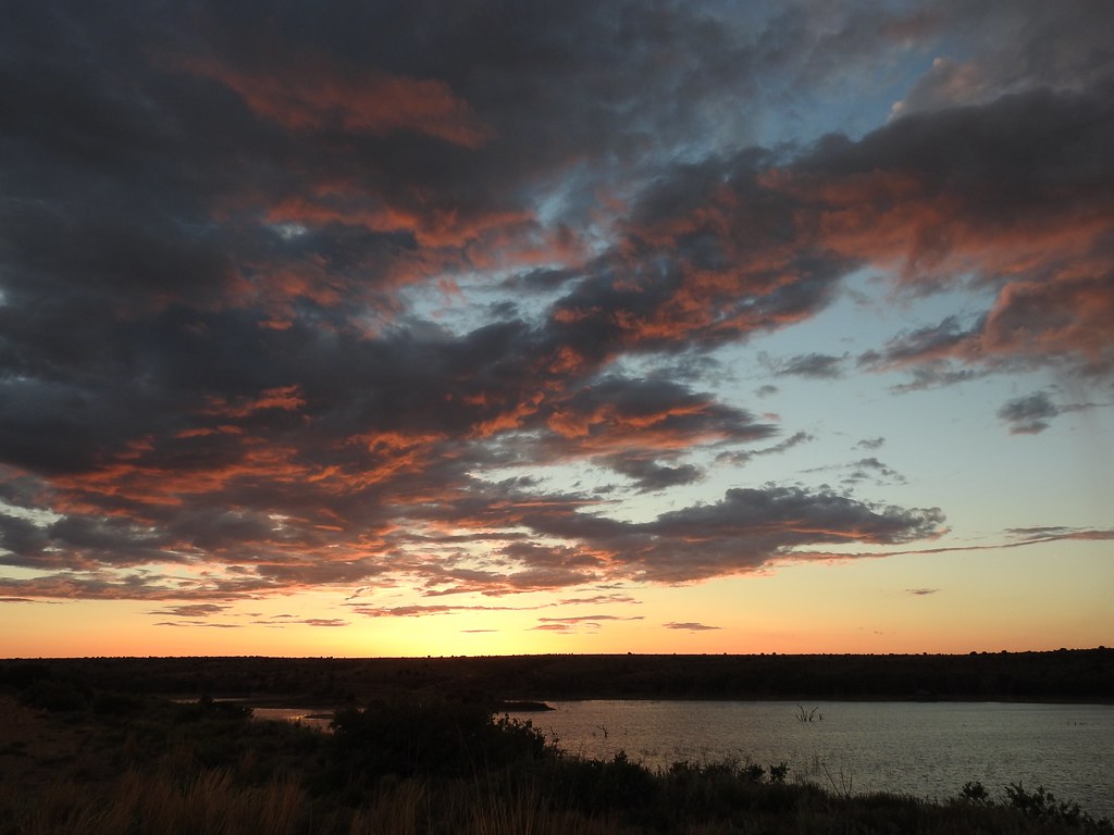
Black Mesa SP, Oklahoma
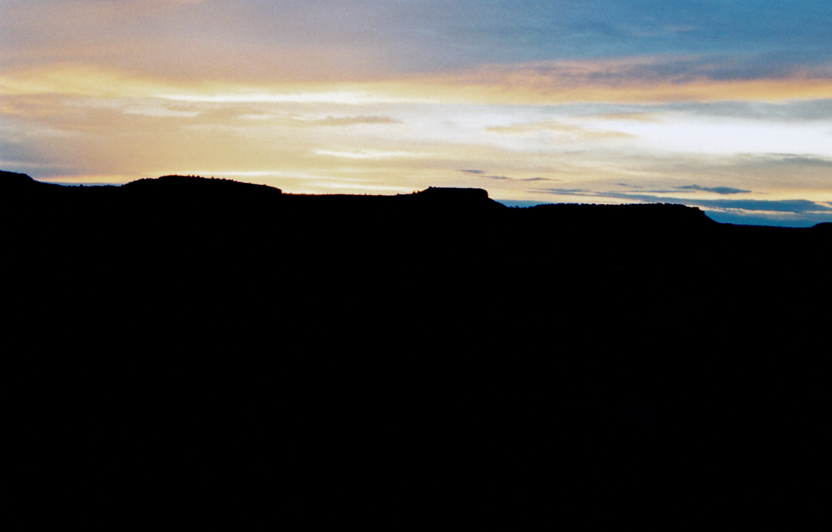
near sunset
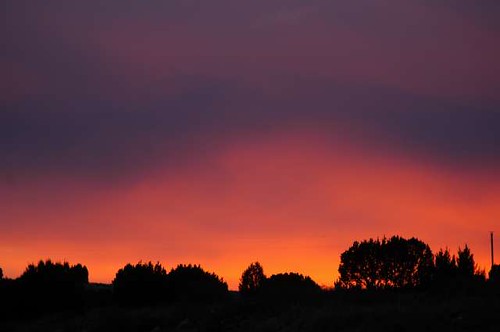
Cimarron Sunset
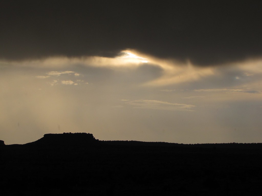
Sun behind the thunderclouds near Black Mesa State Park
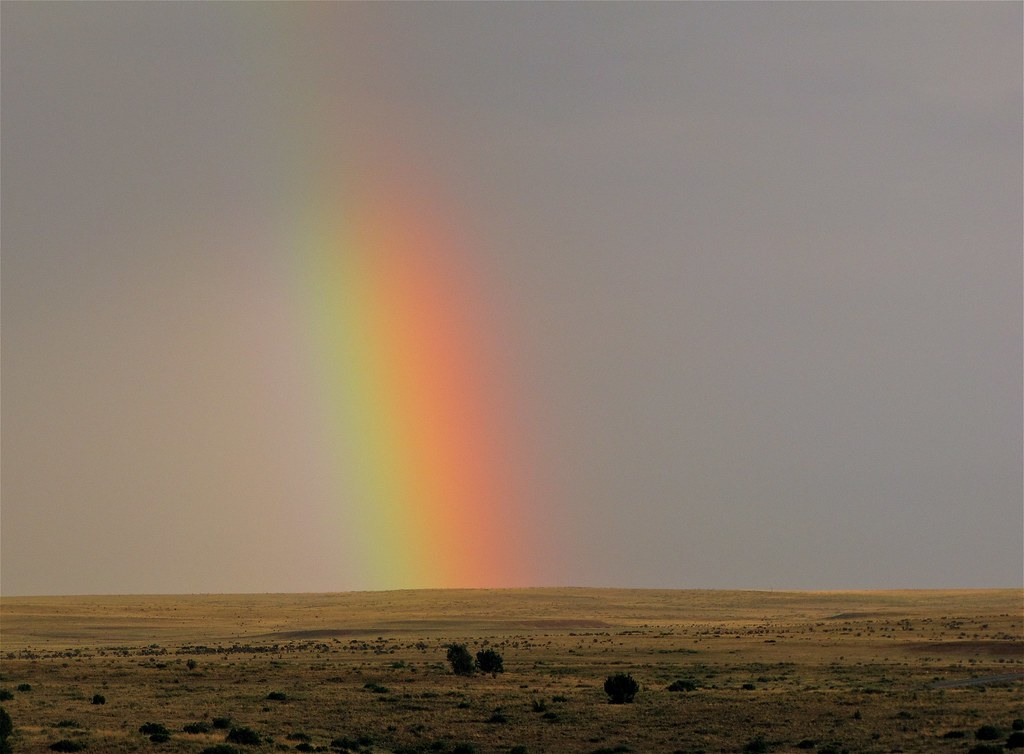
A rainbow after the storm in Black Mesa State Park
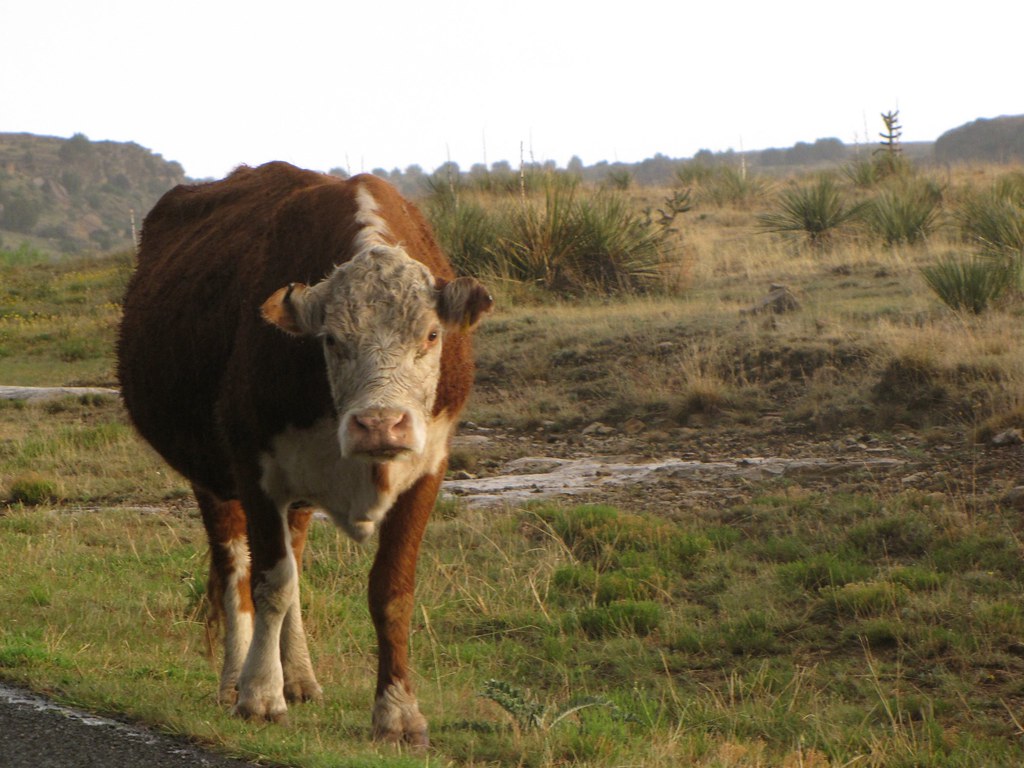
More cows than people on the way to Black Mesa State Park in the Oklahoma panhandle
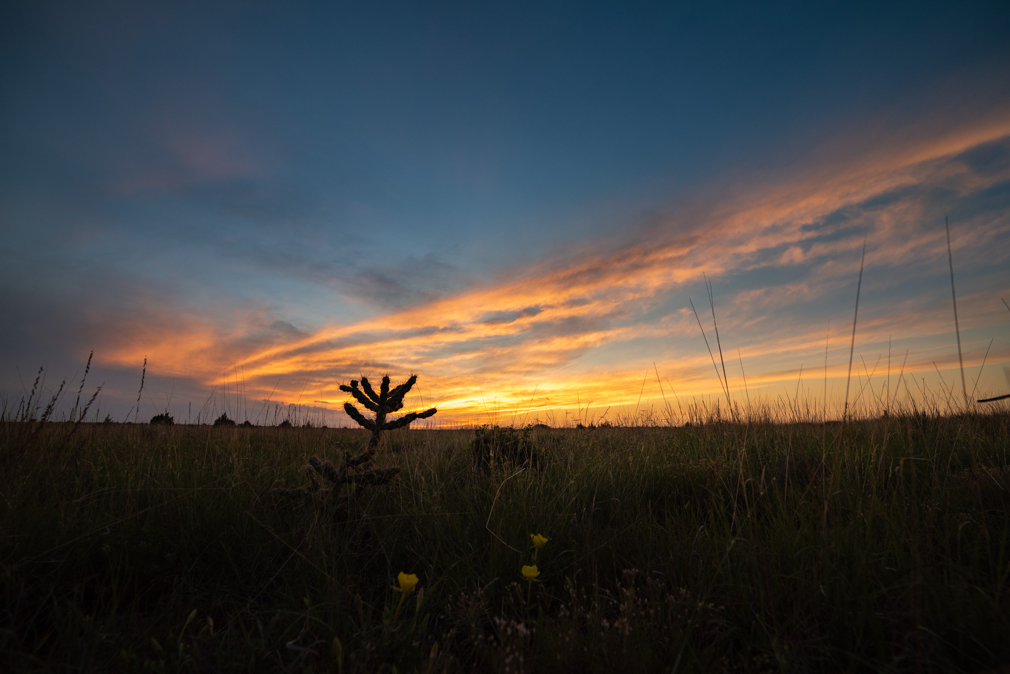
Sunrise at Black Mesa
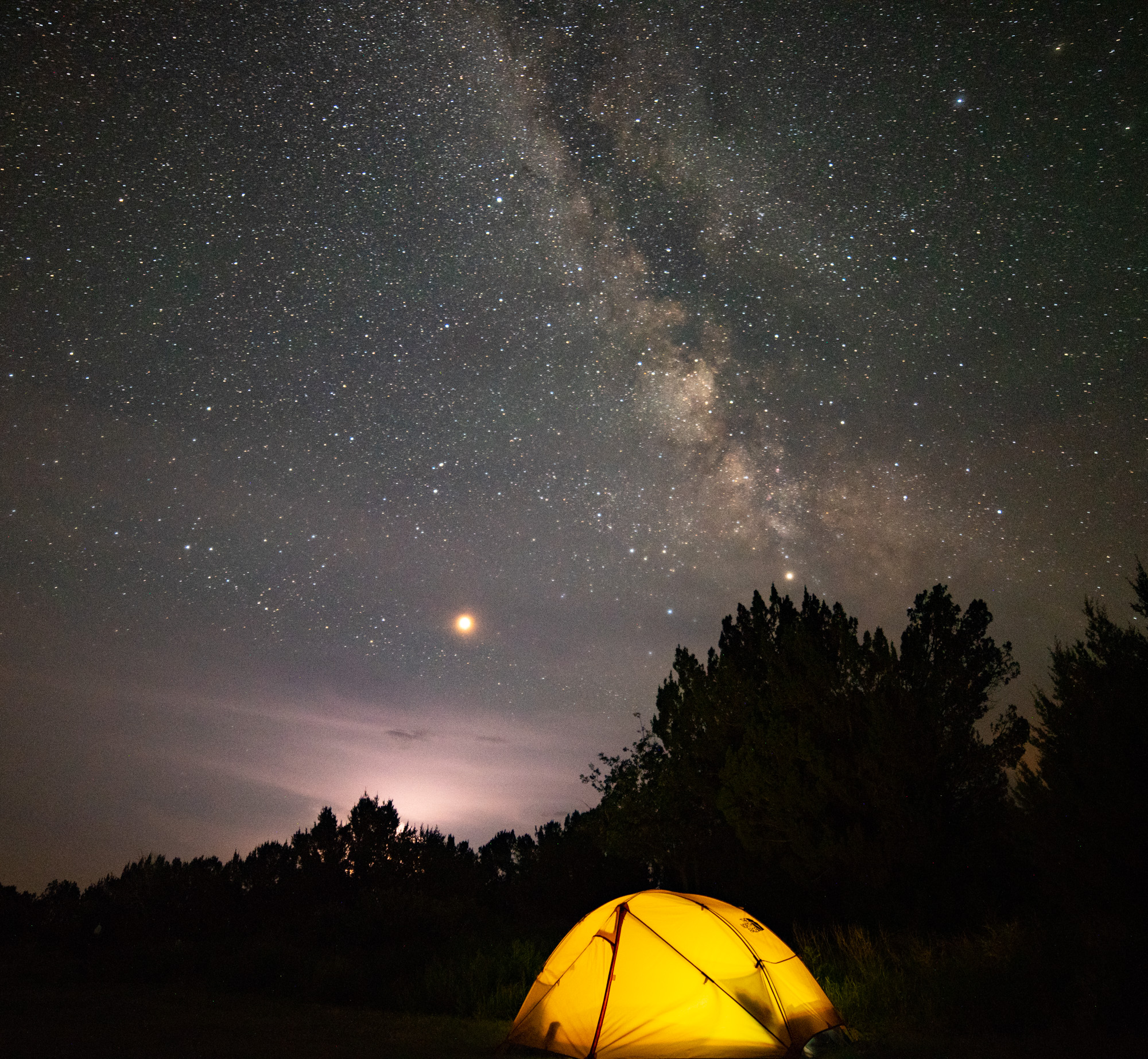
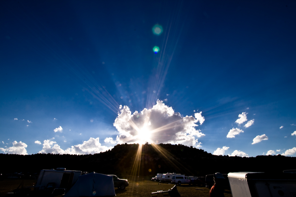
Camping Under Galaxy, Mars, and Thunderstorms
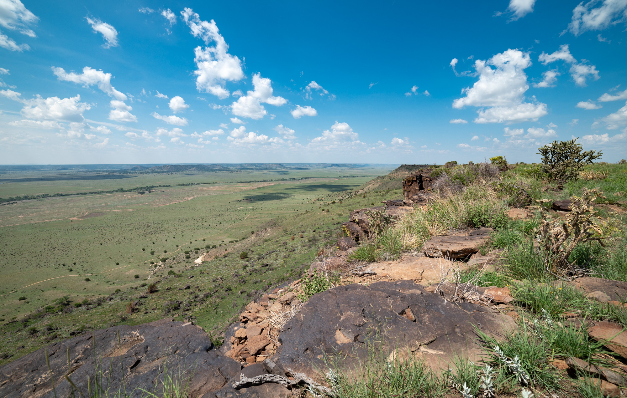
Looking Down at New Mexico
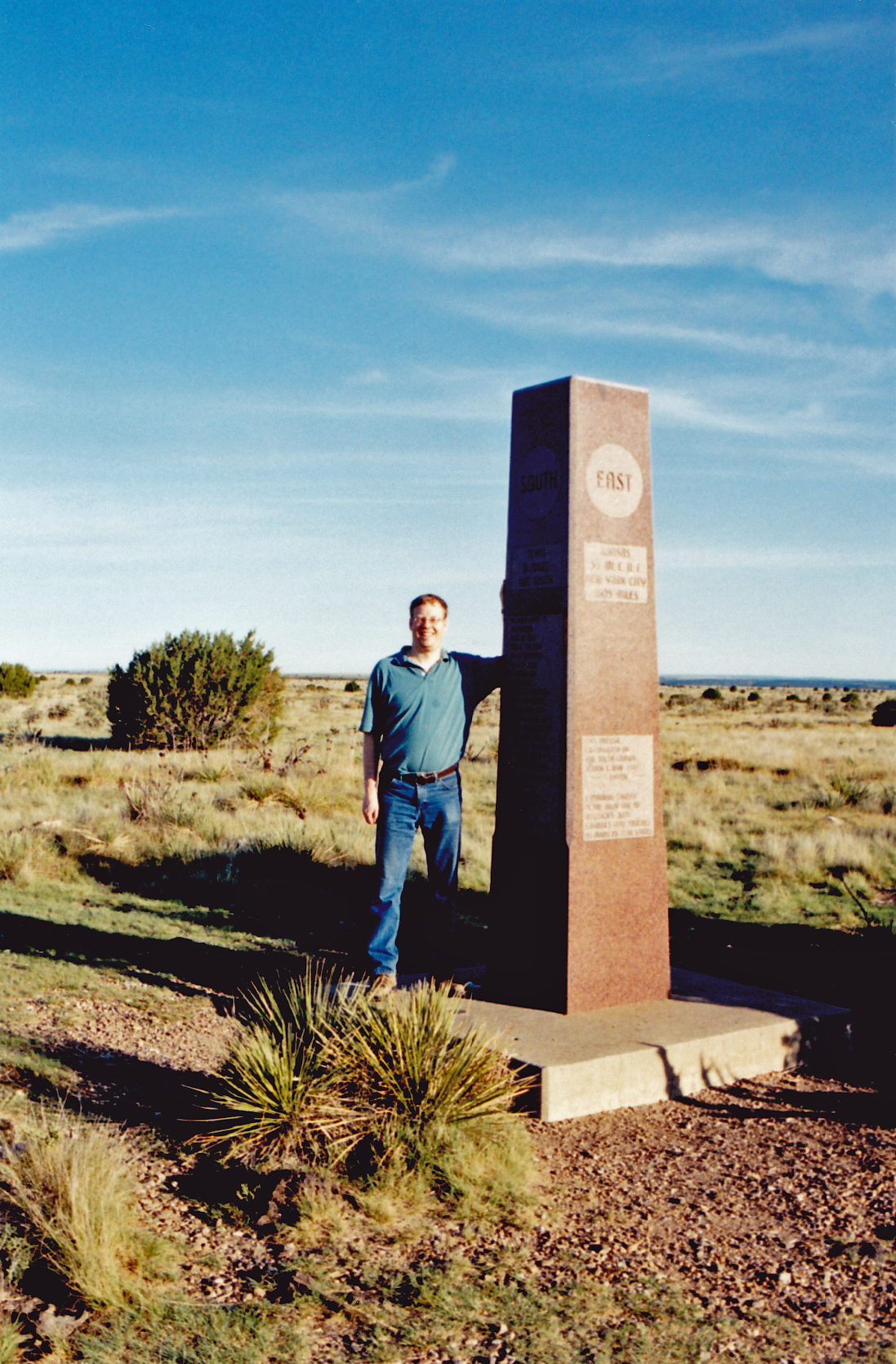
Summit marker

Black Mesa, Oklahoma

Black Mesa, Oklahoma

Top of Black Mesa
Top of Black Mesa

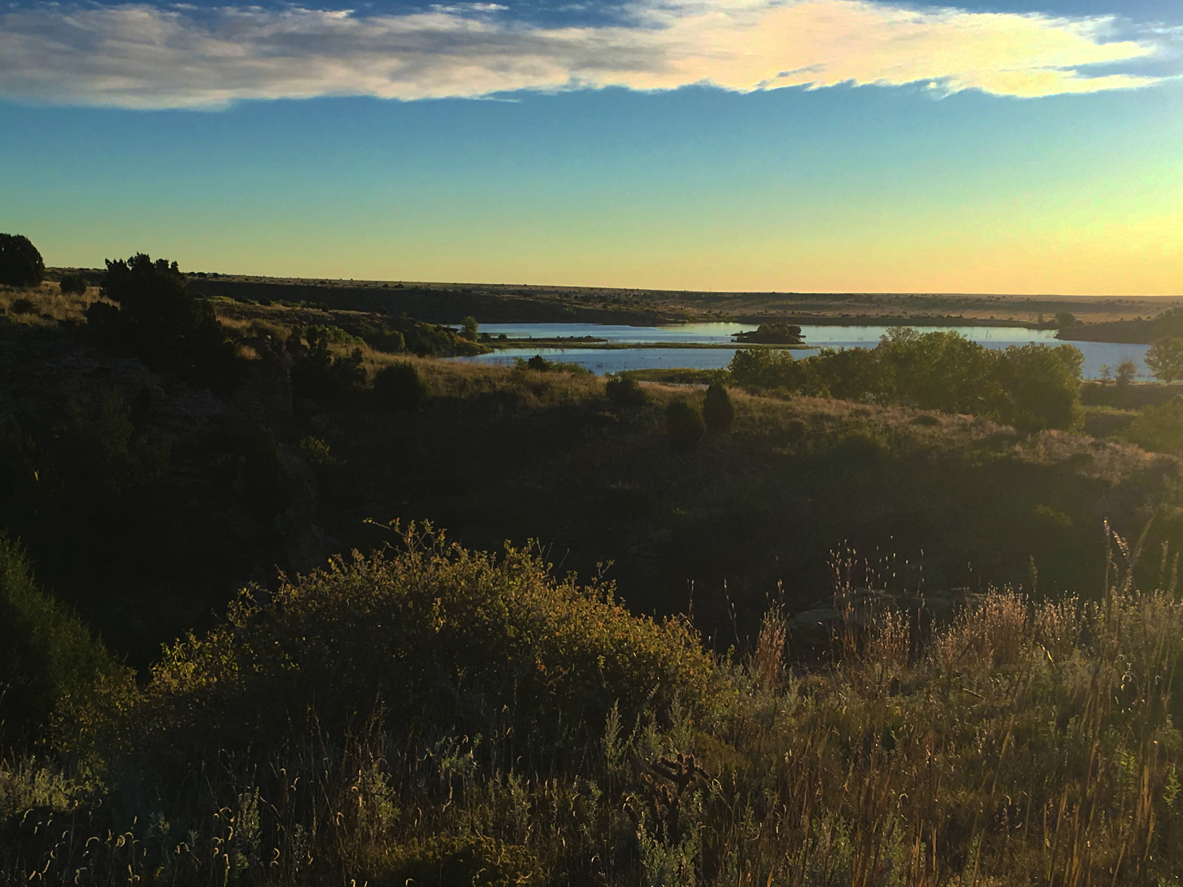
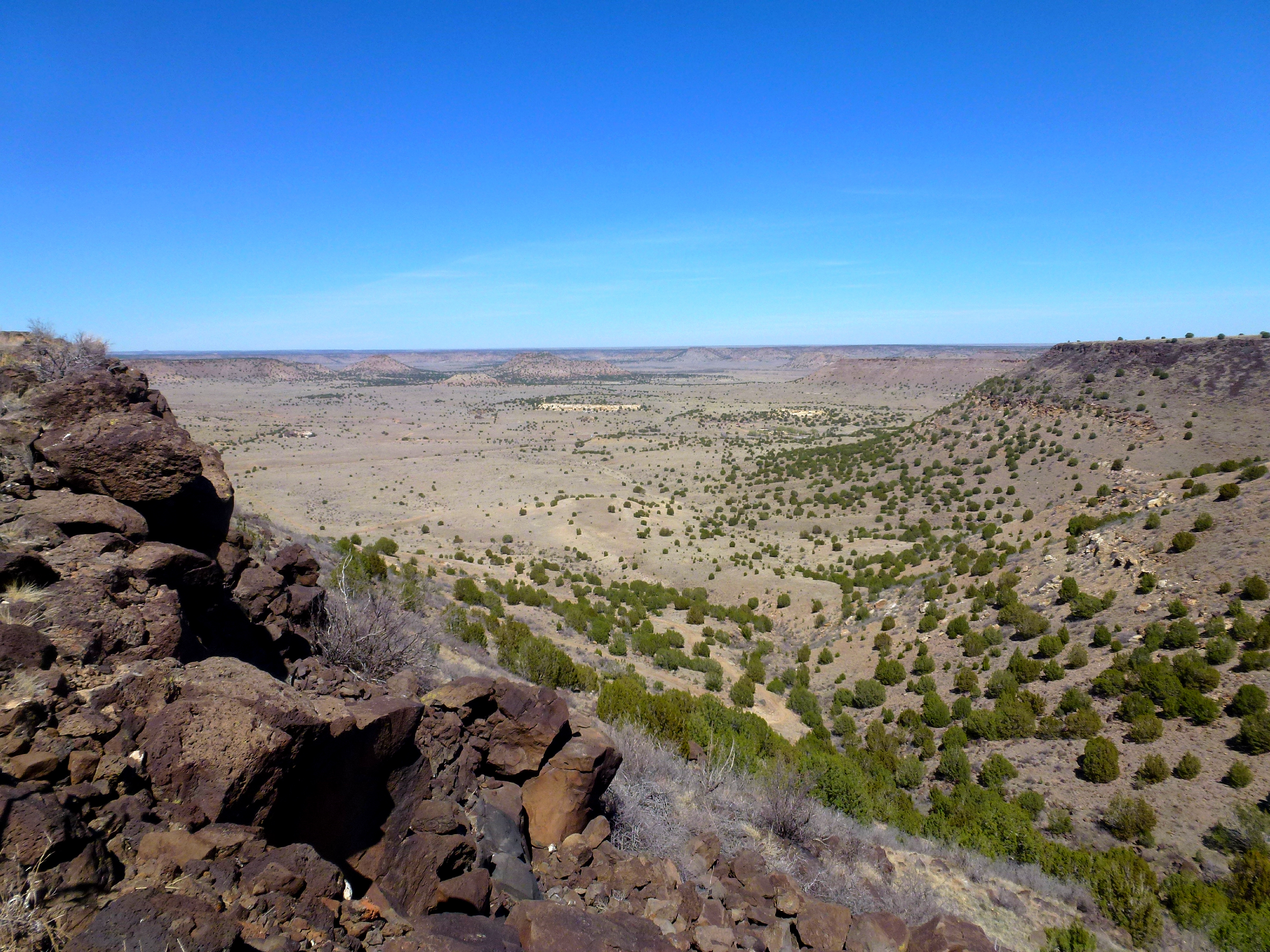
View from Black Mesa
Top of Black Mesa

Summit marker

Top of Black Mesa

View from Black Mesa

Top of Black Mesa

View from Black Mesa
Black Mesa Northern View Panorama
Panoramic View from the Edge of Black Mesa

Summit marker

View from Black Mesa
View from Atop Black Mesa

Summit marker
Black Mesa Trail, Kenton, OK アメリカ合衆国Highest Point in Oklahomaの地図
別の場所を検索
近所の場所
アメリカ合衆国 〒 オクラホマ州 ケントン
County Rd 3.1, Pritchett, CO アメリカ合衆国
アメリカ合衆国 〒 コロラド州 ユーシービル
アメリカ合衆国 〒 コロラド州 プリチットコマンチ・ナショナル・グラスランド
アメリカ合衆国 コロラド州 プリチット
Co Rd 90, Las Animas, CO アメリカ合衆国
アメリカ合衆国 〒 ニューメキシコ州 デ・モイン
46 Volcano, Capulin, NM アメリカ合衆国キャプリン・ボルケーノ国定公園
アメリカ合衆国 〒 ニューメキシコ州 キャプリン
アメリカ合衆国 〒 コロラド州 トリンチェラ
2nd St, Model, CO アメリカ合衆国
アメリカ合衆国 コロラド州 オテロ
US-, Model, CO アメリカ合衆国
最近の検索
- アメリカ合衆国 アラスカ州 レッド・ドッグ・マイン日の出日の入り時間
- Am bhf, Borken, ドイツアム・バーンホーフ日の出日の入り時間
- 4th St E, Sonoma, CA, USA日の出日の入り時間
- Oakland Ave, Williamsport, PA アメリカ合衆国日の出日の入り時間
- Via Roma, Pieranica CR, イタリアローマ通り日の出日の入り時間
- クロアチア 〒 ドゥブロブニク GradClock Tower of Dubrovnik日の出日の入り時間
- アルゼンチン チュブ州 トレリュー日の出日の入り時間
- Hartfords Bluff Cir, Mt Pleasant, SC アメリカ合衆国日の出日の入り時間
- 日本、熊本県熊本市北区日の出日の入り時間
- 中華人民共和国 福州市 平潭県 平潭島日の出日の入り時間