カナダ 〒V0A ブリティッシュコロンビア州 コロンビア=シャスワップ A ヘルメット山日の出日の入り時間
Location: カナダ > ブリティッシュコロンビア州 > カナダ 〒V0A ブリティッシュコロンビア州 フィールド >
時間帯:
America/Edmonton
現地時間:
2025-07-04 19:50:24
経度:
-116.34
緯度:
51.175
今日の日の出時刻:
05:38:04 AM
今日の日の入時刻:
10:02:09 PM
今日の日長:
16h 24m 5s
明日の日の出時刻:
05:38:58 AM
明日の日の入時刻:
10:01:36 PM
明日の日長:
16h 22m 38s
すべて表示する
| 日付 | 日出 | 日没 | 日長 |
|---|---|---|---|
| 2025年01月01日 | 08:49:00 AM | 04:50:07 PM | 8h 1m 7s |
| 2025年01月02日 | 08:48:47 AM | 04:51:14 PM | 8h 2m 27s |
| 2025年01月03日 | 08:48:32 AM | 04:52:24 PM | 8h 3m 52s |
| 2025年01月04日 | 08:48:14 AM | 04:53:36 PM | 8h 5m 22s |
| 2025年01月05日 | 08:47:52 AM | 04:54:51 PM | 8h 6m 59s |
| 2025年01月06日 | 08:47:27 AM | 04:56:07 PM | 8h 8m 40s |
| 2025年01月07日 | 08:46:58 AM | 04:57:26 PM | 8h 10m 28s |
| 2025年01月08日 | 08:46:27 AM | 04:58:47 PM | 8h 12m 20s |
| 2025年01月09日 | 08:45:52 AM | 05:00:10 PM | 8h 14m 18s |
| 2025年01月10日 | 08:45:15 AM | 05:01:35 PM | 8h 16m 20s |
| 2025年01月11日 | 08:44:34 AM | 05:03:02 PM | 8h 18m 28s |
| 2025年01月12日 | 08:43:51 AM | 05:04:30 PM | 8h 20m 39s |
| 2025年01月13日 | 08:43:04 AM | 05:06:00 PM | 8h 22m 56s |
| 2025年01月14日 | 08:42:15 AM | 05:07:32 PM | 8h 25m 17s |
| 2025年01月15日 | 08:41:22 AM | 05:09:05 PM | 8h 27m 43s |
| 2025年01月16日 | 08:40:27 AM | 05:10:40 PM | 8h 30m 13s |
| 2025年01月17日 | 08:39:29 AM | 05:12:15 PM | 8h 32m 46s |
| 2025年01月18日 | 08:38:28 AM | 05:13:53 PM | 8h 35m 25s |
| 2025年01月19日 | 08:37:25 AM | 05:15:31 PM | 8h 38m 6s |
| 2025年01月20日 | 08:36:19 AM | 05:17:11 PM | 8h 40m 52s |
| 2025年01月21日 | 08:35:11 AM | 05:18:51 PM | 8h 43m 40s |
| 2025年01月22日 | 08:34:00 AM | 05:20:32 PM | 8h 46m 32s |
| 2025年01月23日 | 08:32:46 AM | 05:22:15 PM | 8h 49m 29s |
| 2025年01月24日 | 08:31:31 AM | 05:23:58 PM | 8h 52m 27s |
| 2025年01月25日 | 08:30:12 AM | 05:25:42 PM | 8h 55m 30s |
| 2025年01月26日 | 08:28:52 AM | 05:27:26 PM | 8h 58m 34s |
| 2025年01月27日 | 08:27:29 AM | 05:29:12 PM | 9h 1m 43s |
| 2025年01月28日 | 08:26:04 AM | 05:30:57 PM | 9h 4m 53s |
| 2025年01月29日 | 08:24:37 AM | 05:32:43 PM | 9h 8m 6s |
| 2025年01月30日 | 08:23:08 AM | 05:34:30 PM | 9h 11m 22s |
| 2025年01月31日 | 08:21:37 AM | 05:36:17 PM | 9h 14m 40s |
| 2025年02月01日 | 08:20:04 AM | 05:38:04 PM | 9h 18m 0s |
| 2025年02月02日 | 08:18:29 AM | 05:39:52 PM | 9h 21m 23s |
| 2025年02月03日 | 08:16:53 AM | 05:41:40 PM | 9h 24m 47s |
| 2025年02月04日 | 08:15:14 AM | 05:43:28 PM | 9h 28m 14s |
| 2025年02月05日 | 08:13:34 AM | 05:45:16 PM | 9h 31m 42s |
| 2025年02月06日 | 08:11:52 AM | 05:47:05 PM | 9h 35m 13s |
| 2025年02月07日 | 08:10:08 AM | 05:48:53 PM | 9h 38m 45s |
| 2025年02月08日 | 08:08:23 AM | 05:50:41 PM | 9h 42m 18s |
| 2025年02月09日 | 08:06:36 AM | 05:52:30 PM | 9h 45m 54s |
| 2025年02月10日 | 08:04:48 AM | 05:54:18 PM | 9h 49m 30s |
| 2025年02月11日 | 08:02:58 AM | 05:56:06 PM | 9h 53m 8s |
| 2025年02月12日 | 08:01:07 AM | 05:57:55 PM | 9h 56m 48s |
| 2025年02月13日 | 07:59:14 AM | 05:59:43 PM | 10h 0m 29s |
| 2025年02月14日 | 07:57:20 AM | 06:01:31 PM | 10h 4m 11s |
| 2025年02月15日 | 07:55:25 AM | 06:03:18 PM | 10h 7m 53s |
| 2025年02月16日 | 07:53:29 AM | 06:05:06 PM | 10h 11m 37s |
| 2025年02月17日 | 07:51:31 AM | 06:06:53 PM | 10h 15m 22s |
| 2025年02月18日 | 07:49:33 AM | 06:08:41 PM | 10h 19m 8s |
| 2025年02月19日 | 07:47:33 AM | 06:10:28 PM | 10h 22m 55s |
| 2025年02月20日 | 07:45:32 AM | 06:12:14 PM | 10h 26m 42s |
| 2025年02月21日 | 07:43:30 AM | 06:14:01 PM | 10h 30m 31s |
| 2025年02月22日 | 07:41:27 AM | 06:15:47 PM | 10h 34m 20s |
| 2025年02月23日 | 07:39:24 AM | 06:17:33 PM | 10h 38m 9s |
| 2025年02月24日 | 07:37:19 AM | 06:19:19 PM | 10h 42m 0s |
| 2025年02月25日 | 07:35:13 AM | 06:21:04 PM | 10h 45m 51s |
| 2025年02月26日 | 07:33:07 AM | 06:22:49 PM | 10h 49m 42s |
| 2025年02月27日 | 07:31:00 AM | 06:24:34 PM | 10h 53m 34s |
| 2025年02月28日 | 07:28:52 AM | 06:26:19 PM | 10h 57m 27s |
| 2025年03月01日 | 07:26:43 AM | 06:28:03 PM | 11h 1m 20s |
| 2025年03月02日 | 07:24:34 AM | 06:29:47 PM | 11h 5m 13s |
| 2025年03月03日 | 07:22:24 AM | 06:31:31 PM | 11h 9m 7s |
| 2025年03月04日 | 07:20:14 AM | 06:33:14 PM | 11h 13m 0s |
| 2025年03月05日 | 07:18:03 AM | 06:34:57 PM | 11h 16m 54s |
| 2025年03月06日 | 07:15:51 AM | 06:36:40 PM | 11h 20m 49s |
| 2025年03月07日 | 07:13:39 AM | 06:38:23 PM | 11h 24m 44s |
| 2025年03月08日 | 07:11:27 AM | 06:40:05 PM | 11h 28m 38s |
| 2025年03月09日 | 08:09:19 AM | 07:41:43 PM | 11h 32m 24s |
| 2025年03月10日 | 08:07:06 AM | 07:43:25 PM | 11h 36m 19s |
| 2025年03月11日 | 08:04:52 AM | 07:45:07 PM | 11h 40m 15s |
| 2025年03月12日 | 08:02:38 AM | 07:46:48 PM | 11h 44m 10s |
| 2025年03月13日 | 08:00:23 AM | 07:48:30 PM | 11h 48m 7s |
| 2025年03月14日 | 07:58:09 AM | 07:50:11 PM | 11h 52m 2s |
| 2025年03月15日 | 07:55:54 AM | 07:51:52 PM | 11h 55m 58s |
| 2025年03月16日 | 07:53:39 AM | 07:53:32 PM | 11h 59m 53s |
| 2025年03月17日 | 07:51:23 AM | 07:55:13 PM | 12h 3m 50s |
| 2025年03月18日 | 07:49:08 AM | 07:56:53 PM | 12h 7m 45s |
| 2025年03月19日 | 07:46:52 AM | 07:58:33 PM | 12h 11m 41s |
| 2025年03月20日 | 07:44:37 AM | 08:00:13 PM | 12h 15m 36s |
| 2025年03月21日 | 07:42:21 AM | 08:01:53 PM | 12h 19m 32s |
| 2025年03月22日 | 07:40:05 AM | 08:03:33 PM | 12h 23m 28s |
| 2025年03月23日 | 07:37:49 AM | 08:05:13 PM | 12h 27m 24s |
| 2025年03月24日 | 07:35:34 AM | 08:06:52 PM | 12h 31m 18s |
| 2025年03月25日 | 07:33:18 AM | 08:08:32 PM | 12h 35m 14s |
| 2025年03月26日 | 07:31:03 AM | 08:10:11 PM | 12h 39m 8s |
| 2025年03月27日 | 07:28:47 AM | 08:11:50 PM | 12h 43m 3s |
| 2025年03月28日 | 07:26:32 AM | 08:13:29 PM | 12h 46m 57s |
| 2025年03月29日 | 07:24:17 AM | 08:15:09 PM | 12h 50m 52s |
| 2025年03月30日 | 07:22:02 AM | 08:16:48 PM | 12h 54m 46s |
| 2025年03月31日 | 07:19:47 AM | 08:18:27 PM | 12h 58m 40s |
| 2025年04月01日 | 07:17:33 AM | 08:20:06 PM | 13h 2m 33s |
| 2025年04月02日 | 07:15:19 AM | 08:21:45 PM | 13h 6m 26s |
| 2025年04月03日 | 07:13:05 AM | 08:23:24 PM | 13h 10m 19s |
| 2025年04月04日 | 07:10:52 AM | 08:25:03 PM | 13h 14m 11s |
| 2025年04月05日 | 07:08:39 AM | 08:26:41 PM | 13h 18m 2s |
| 2025年04月06日 | 07:06:26 AM | 08:28:20 PM | 13h 21m 54s |
| 2025年04月07日 | 07:04:14 AM | 08:29:59 PM | 13h 25m 45s |
| 2025年04月08日 | 07:02:03 AM | 08:31:38 PM | 13h 29m 35s |
| 2025年04月09日 | 06:59:52 AM | 08:33:17 PM | 13h 33m 25s |
| 2025年04月10日 | 06:57:41 AM | 08:34:56 PM | 13h 37m 15s |
| 2025年04月11日 | 06:55:32 AM | 08:36:35 PM | 13h 41m 3s |
| 2025年04月12日 | 06:53:22 AM | 08:38:14 PM | 13h 44m 52s |
| 2025年04月13日 | 06:51:14 AM | 08:39:52 PM | 13h 48m 38s |
| 2025年04月14日 | 06:49:06 AM | 08:41:31 PM | 13h 52m 25s |
| 2025年04月15日 | 06:46:59 AM | 08:43:10 PM | 13h 56m 11s |
| 2025年04月16日 | 06:44:53 AM | 08:44:49 PM | 13h 59m 56s |
| 2025年04月17日 | 06:42:47 AM | 08:46:28 PM | 14h 3m 41s |
| 2025年04月18日 | 06:40:43 AM | 08:48:06 PM | 14h 7m 23s |
| 2025年04月19日 | 06:38:39 AM | 08:49:45 PM | 14h 11m 6s |
| 2025年04月20日 | 06:36:36 AM | 08:51:23 PM | 14h 14m 47s |
| 2025年04月21日 | 06:34:35 AM | 08:53:02 PM | 14h 18m 27s |
| 2025年04月22日 | 06:32:34 AM | 08:54:40 PM | 14h 22m 6s |
| 2025年04月23日 | 06:30:34 AM | 08:56:19 PM | 14h 25m 45s |
| 2025年04月24日 | 06:28:35 AM | 08:57:57 PM | 14h 29m 22s |
| 2025年04月25日 | 06:26:38 AM | 08:59:35 PM | 14h 32m 57s |
| 2025年04月26日 | 06:24:41 AM | 09:01:13 PM | 14h 36m 32s |
| 2025年04月27日 | 06:22:46 AM | 09:02:50 PM | 14h 40m 4s |
| 2025年04月28日 | 06:20:52 AM | 09:04:28 PM | 14h 43m 36s |
| 2025年04月29日 | 06:19:00 AM | 09:06:05 PM | 14h 47m 5s |
| 2025年04月30日 | 06:17:09 AM | 09:07:42 PM | 14h 50m 33s |
| 2025年05月01日 | 06:15:19 AM | 09:09:18 PM | 14h 53m 59s |
| 2025年05月02日 | 06:13:30 AM | 09:10:55 PM | 14h 57m 25s |
| 2025年05月03日 | 06:11:43 AM | 09:12:30 PM | 15h 0m 47s |
| 2025年05月04日 | 06:09:58 AM | 09:14:06 PM | 15h 4m 8s |
| 2025年05月05日 | 06:08:14 AM | 09:15:41 PM | 15h 7m 27s |
| 2025年05月06日 | 06:06:32 AM | 09:17:16 PM | 15h 10m 44s |
| 2025年05月07日 | 06:04:51 AM | 09:18:50 PM | 15h 13m 59s |
| 2025年05月08日 | 06:03:12 AM | 09:20:23 PM | 15h 17m 11s |
| 2025年05月09日 | 06:01:35 AM | 09:21:56 PM | 15h 20m 21s |
| 2025年05月10日 | 06:00:00 AM | 09:23:28 PM | 15h 23m 28s |
| 2025年05月11日 | 05:58:26 AM | 09:25:00 PM | 15h 26m 34s |
| 2025年05月12日 | 05:56:55 AM | 09:26:30 PM | 15h 29m 35s |
| 2025年05月13日 | 05:55:25 AM | 09:28:00 PM | 15h 32m 35s |
| 2025年05月14日 | 05:53:57 AM | 09:29:29 PM | 15h 35m 32s |
| 2025年05月15日 | 05:52:32 AM | 09:30:58 PM | 15h 38m 26s |
| 2025年05月16日 | 05:51:08 AM | 09:32:25 PM | 15h 41m 17s |
| 2025年05月17日 | 05:49:47 AM | 09:33:51 PM | 15h 44m 4s |
| 2025年05月18日 | 05:48:28 AM | 09:35:16 PM | 15h 46m 48s |
| 2025年05月19日 | 05:47:11 AM | 09:36:40 PM | 15h 49m 29s |
| 2025年05月20日 | 05:45:56 AM | 09:38:02 PM | 15h 52m 6s |
| 2025年05月21日 | 05:44:44 AM | 09:39:24 PM | 15h 54m 40s |
| 2025年05月22日 | 05:43:34 AM | 09:40:44 PM | 15h 57m 10s |
| 2025年05月23日 | 05:42:27 AM | 09:42:02 PM | 15h 59m 35s |
| 2025年05月24日 | 05:41:22 AM | 09:43:19 PM | 16h 1m 57s |
| 2025年05月25日 | 05:40:19 AM | 09:44:35 PM | 16h 4m 16s |
| 2025年05月26日 | 05:39:19 AM | 09:45:49 PM | 16h 6m 30s |
| 2025年05月27日 | 05:38:22 AM | 09:47:01 PM | 16h 8m 39s |
| 2025年05月28日 | 05:37:27 AM | 09:48:12 PM | 16h 10m 45s |
| 2025年05月29日 | 05:36:36 AM | 09:49:20 PM | 16h 12m 44s |
| 2025年05月30日 | 05:35:46 AM | 09:50:27 PM | 16h 14m 41s |
| 2025年05月31日 | 05:35:00 AM | 09:51:32 PM | 16h 16m 32s |
| 2025年06月01日 | 05:34:16 AM | 09:52:35 PM | 16h 18m 19s |
| 2025年06月02日 | 05:33:36 AM | 09:53:35 PM | 16h 19m 59s |
| 2025年06月03日 | 05:32:58 AM | 09:54:34 PM | 16h 21m 36s |
| 2025年06月04日 | 05:32:23 AM | 09:55:30 PM | 16h 23m 7s |
| 2025年06月05日 | 05:31:51 AM | 09:56:24 PM | 16h 24m 33s |
| 2025年06月06日 | 05:31:22 AM | 09:57:16 PM | 16h 25m 54s |
| 2025年06月07日 | 05:30:55 AM | 09:58:05 PM | 16h 27m 10s |
| 2025年06月08日 | 05:30:32 AM | 09:58:51 PM | 16h 28m 19s |
| 2025年06月09日 | 05:30:12 AM | 09:59:36 PM | 16h 29m 24s |
| 2025年06月10日 | 05:29:55 AM | 10:00:17 PM | 16h 30m 22s |
| 2025年06月11日 | 05:29:41 AM | 10:00:56 PM | 16h 31m 15s |
| 2025年06月12日 | 05:29:30 AM | 10:01:32 PM | 16h 32m 2s |
| 2025年06月13日 | 05:29:22 AM | 10:02:06 PM | 16h 32m 44s |
| 2025年06月14日 | 05:29:17 AM | 10:02:36 PM | 16h 33m 19s |
| 2025年06月15日 | 05:29:15 AM | 10:03:04 PM | 16h 33m 49s |
| 2025年06月16日 | 05:29:16 AM | 10:03:29 PM | 16h 34m 13s |
| 2025年06月17日 | 05:29:20 AM | 10:03:51 PM | 16h 34m 31s |
| 2025年06月18日 | 05:29:27 AM | 10:04:10 PM | 16h 34m 43s |
| 2025年06月19日 | 05:29:37 AM | 10:04:27 PM | 16h 34m 50s |
| 2025年06月20日 | 05:29:50 AM | 10:04:40 PM | 16h 34m 50s |
| 2025年06月21日 | 05:30:06 AM | 10:04:50 PM | 16h 34m 44s |
| 2025年06月22日 | 05:30:25 AM | 10:04:57 PM | 16h 34m 32s |
| 2025年06月23日 | 05:30:46 AM | 10:05:01 PM | 16h 34m 15s |
| 2025年06月24日 | 05:31:11 AM | 10:05:02 PM | 16h 33m 51s |
| 2025年06月25日 | 05:31:38 AM | 10:05:00 PM | 16h 33m 22s |
| 2025年06月26日 | 05:32:08 AM | 10:04:55 PM | 16h 32m 47s |
| 2025年06月27日 | 05:32:41 AM | 10:04:46 PM | 16h 32m 5s |
| 2025年06月28日 | 05:33:17 AM | 10:04:35 PM | 16h 31m 18s |
| 2025年06月29日 | 05:33:55 AM | 10:04:21 PM | 16h 30m 26s |
| 2025年06月30日 | 05:34:35 AM | 10:04:03 PM | 16h 29m 28s |
| 2025年07月01日 | 05:35:19 AM | 10:03:42 PM | 16h 28m 23s |
| 2025年07月02日 | 05:36:04 AM | 10:03:19 PM | 16h 27m 15s |
| 2025年07月03日 | 05:36:52 AM | 10:02:52 PM | 16h 26m 0s |
| 2025年07月04日 | 05:37:43 AM | 10:02:23 PM | 16h 24m 40s |
| 2025年07月05日 | 05:38:35 AM | 10:01:50 PM | 16h 23m 15s |
| 2025年07月06日 | 05:39:30 AM | 10:01:14 PM | 16h 21m 44s |
| 2025年07月07日 | 05:40:27 AM | 10:00:36 PM | 16h 20m 9s |
| 2025年07月08日 | 05:41:26 AM | 09:59:55 PM | 16h 18m 29s |
| 2025年07月09日 | 05:42:27 AM | 09:59:10 PM | 16h 16m 43s |
| 2025年07月10日 | 05:43:30 AM | 09:58:23 PM | 16h 14m 53s |
| 2025年07月11日 | 05:44:35 AM | 09:57:33 PM | 16h 12m 58s |
| 2025年07月12日 | 05:45:42 AM | 09:56:41 PM | 16h 10m 59s |
| 2025年07月13日 | 05:46:50 AM | 09:55:45 PM | 16h 8m 55s |
| 2025年07月14日 | 05:48:01 AM | 09:54:47 PM | 16h 6m 46s |
| 2025年07月15日 | 05:49:12 AM | 09:53:47 PM | 16h 4m 35s |
| 2025年07月16日 | 05:50:26 AM | 09:52:44 PM | 16h 2m 18s |
| 2025年07月17日 | 05:51:40 AM | 09:51:38 PM | 15h 59m 58s |
| 2025年07月18日 | 05:52:57 AM | 09:50:29 PM | 15h 57m 32s |
| 2025年07月19日 | 05:54:14 AM | 09:49:19 PM | 15h 55m 5s |
| 2025年07月20日 | 05:55:33 AM | 09:48:06 PM | 15h 52m 33s |
| 2025年07月21日 | 05:56:53 AM | 09:46:50 PM | 15h 49m 57s |
| 2025年07月22日 | 05:58:14 AM | 09:45:32 PM | 15h 47m 18s |
| 2025年07月23日 | 05:59:36 AM | 09:44:12 PM | 15h 44m 36s |
| 2025年07月24日 | 06:00:59 AM | 09:42:50 PM | 15h 41m 51s |
| 2025年07月25日 | 06:02:24 AM | 09:41:26 PM | 15h 39m 2s |
| 2025年07月26日 | 06:03:49 AM | 09:39:59 PM | 15h 36m 10s |
| 2025年07月27日 | 06:05:15 AM | 09:38:31 PM | 15h 33m 16s |
| 2025年07月28日 | 06:06:41 AM | 09:37:00 PM | 15h 30m 19s |
| 2025年07月29日 | 06:08:09 AM | 09:35:28 PM | 15h 27m 19s |
| 2025年07月30日 | 06:09:37 AM | 09:33:54 PM | 15h 24m 17s |
| 2025年07月31日 | 06:11:06 AM | 09:32:17 PM | 15h 21m 11s |
| 2025年08月01日 | 06:12:35 AM | 09:30:39 PM | 15h 18m 4s |
| 2025年08月02日 | 06:14:05 AM | 09:28:59 PM | 15h 14m 54s |
| 2025年08月03日 | 06:15:36 AM | 09:27:18 PM | 15h 11m 42s |
| 2025年08月04日 | 06:17:06 AM | 09:25:35 PM | 15h 8m 29s |
| 2025年08月05日 | 06:18:38 AM | 09:23:50 PM | 15h 5m 12s |
| 2025年08月06日 | 06:20:10 AM | 09:22:03 PM | 15h 1m 53s |
| 2025年08月07日 | 06:21:42 AM | 09:20:16 PM | 14h 58m 34s |
| 2025年08月08日 | 06:23:14 AM | 09:18:26 PM | 14h 55m 12s |
| 2025年08月09日 | 06:24:47 AM | 09:16:35 PM | 14h 51m 48s |
| 2025年08月10日 | 06:26:20 AM | 09:14:43 PM | 14h 48m 23s |
| 2025年08月11日 | 06:27:53 AM | 09:12:50 PM | 14h 44m 57s |
| 2025年08月12日 | 06:29:26 AM | 09:10:55 PM | 14h 41m 29s |
| 2025年08月13日 | 06:31:00 AM | 09:08:59 PM | 14h 37m 59s |
| 2025年08月14日 | 06:32:33 AM | 09:07:01 PM | 14h 34m 28s |
| 2025年08月15日 | 06:34:07 AM | 09:05:03 PM | 14h 30m 56s |
| 2025年08月16日 | 06:35:41 AM | 09:03:03 PM | 14h 27m 22s |
| 2025年08月17日 | 06:37:15 AM | 09:01:02 PM | 14h 23m 47s |
| 2025年08月18日 | 06:38:49 AM | 08:59:01 PM | 14h 20m 12s |
| 2025年08月19日 | 06:40:23 AM | 08:56:58 PM | 14h 16m 35s |
| 2025年08月20日 | 06:41:57 AM | 08:54:54 PM | 14h 12m 57s |
| 2025年08月21日 | 06:43:31 AM | 08:52:49 PM | 14h 9m 18s |
| 2025年08月22日 | 06:45:05 AM | 08:50:44 PM | 14h 5m 39s |
| 2025年08月23日 | 06:46:39 AM | 08:48:37 PM | 14h 1m 58s |
| 2025年08月24日 | 06:48:14 AM | 08:46:30 PM | 13h 58m 16s |
| 2025年08月25日 | 06:49:48 AM | 08:44:22 PM | 13h 54m 34s |
| 2025年08月26日 | 06:51:22 AM | 08:42:13 PM | 13h 50m 51s |
| 2025年08月27日 | 06:52:56 AM | 08:40:03 PM | 13h 47m 7s |
| 2025年08月28日 | 06:54:30 AM | 08:37:53 PM | 13h 43m 23s |
| 2025年08月29日 | 06:56:04 AM | 08:35:42 PM | 13h 39m 38s |
| 2025年08月30日 | 06:57:38 AM | 08:33:30 PM | 13h 35m 52s |
| 2025年08月31日 | 06:59:12 AM | 08:31:18 PM | 13h 32m 6s |
| 2025年09月01日 | 07:00:46 AM | 08:29:06 PM | 13h 28m 20s |
| 2025年09月02日 | 07:02:20 AM | 08:26:52 PM | 13h 24m 32s |
| 2025年09月03日 | 07:03:54 AM | 08:24:39 PM | 13h 20m 45s |
| 2025年09月04日 | 07:05:28 AM | 08:22:24 PM | 13h 16m 56s |
| 2025年09月05日 | 07:07:02 AM | 08:20:10 PM | 13h 13m 8s |
| 2025年09月06日 | 07:08:36 AM | 08:17:55 PM | 13h 9m 19s |
| 2025年09月07日 | 07:10:10 AM | 08:15:40 PM | 13h 5m 30s |
| 2025年09月08日 | 07:11:44 AM | 08:13:24 PM | 13h 1m 40s |
| 2025年09月09日 | 07:13:18 AM | 08:11:08 PM | 12h 57m 50s |
| 2025年09月10日 | 07:14:52 AM | 08:08:52 PM | 12h 54m 0s |
| 2025年09月11日 | 07:16:26 AM | 08:06:35 PM | 12h 50m 9s |
| 2025年09月12日 | 07:18:00 AM | 08:04:19 PM | 12h 46m 19s |
| 2025年09月13日 | 07:19:34 AM | 08:02:02 PM | 12h 42m 28s |
| 2025年09月14日 | 07:21:08 AM | 07:59:45 PM | 12h 38m 37s |
| 2025年09月15日 | 07:22:43 AM | 07:57:28 PM | 12h 34m 45s |
| 2025年09月16日 | 07:24:17 AM | 07:55:10 PM | 12h 30m 53s |
| 2025年09月17日 | 07:25:51 AM | 07:52:53 PM | 12h 27m 2s |
| 2025年09月18日 | 07:27:26 AM | 07:50:36 PM | 12h 23m 10s |
| 2025年09月19日 | 07:29:00 AM | 07:48:18 PM | 12h 19m 18s |
| 2025年09月20日 | 07:30:35 AM | 07:46:01 PM | 12h 15m 26s |
| 2025年09月21日 | 07:32:10 AM | 07:43:44 PM | 12h 11m 34s |
| 2025年09月22日 | 07:33:45 AM | 07:41:27 PM | 12h 7m 42s |
| 2025年09月23日 | 07:35:20 AM | 07:39:10 PM | 12h 3m 50s |
| 2025年09月24日 | 07:36:56 AM | 07:36:53 PM | 11h 59m 57s |
| 2025年09月25日 | 07:38:31 AM | 07:34:36 PM | 11h 56m 5s |
| 2025年09月26日 | 07:40:07 AM | 07:32:20 PM | 11h 52m 13s |
| 2025年09月27日 | 07:41:43 AM | 07:30:04 PM | 11h 48m 21s |
| 2025年09月28日 | 07:43:19 AM | 07:27:48 PM | 11h 44m 29s |
| 2025年09月29日 | 07:44:55 AM | 07:25:32 PM | 11h 40m 37s |
| 2025年09月30日 | 07:46:32 AM | 07:23:17 PM | 11h 36m 45s |
| 2025年10月01日 | 07:48:08 AM | 07:21:02 PM | 11h 32m 54s |
| 2025年10月02日 | 07:49:46 AM | 07:18:47 PM | 11h 29m 1s |
| 2025年10月03日 | 07:51:23 AM | 07:16:33 PM | 11h 25m 10s |
| 2025年10月04日 | 07:53:00 AM | 07:14:19 PM | 11h 21m 19s |
| 2025年10月05日 | 07:54:38 AM | 07:12:06 PM | 11h 17m 28s |
| 2025年10月06日 | 07:56:16 AM | 07:09:53 PM | 11h 13m 37s |
| 2025年10月07日 | 07:57:55 AM | 07:07:41 PM | 11h 9m 46s |
| 2025年10月08日 | 07:59:33 AM | 07:05:30 PM | 11h 5m 57s |
| 2025年10月09日 | 08:01:12 AM | 07:03:19 PM | 11h 2m 7s |
| 2025年10月10日 | 08:02:52 AM | 07:01:08 PM | 10h 58m 16s |
| 2025年10月11日 | 08:04:31 AM | 06:58:59 PM | 10h 54m 28s |
| 2025年10月12日 | 08:06:11 AM | 06:56:50 PM | 10h 50m 39s |
| 2025年10月13日 | 08:07:51 AM | 06:54:42 PM | 10h 46m 51s |
| 2025年10月14日 | 08:09:32 AM | 06:52:34 PM | 10h 43m 2s |
| 2025年10月15日 | 08:11:13 AM | 06:50:28 PM | 10h 39m 15s |
| 2025年10月16日 | 08:12:54 AM | 06:48:22 PM | 10h 35m 28s |
| 2025年10月17日 | 08:14:35 AM | 06:46:18 PM | 10h 31m 43s |
| 2025年10月18日 | 08:16:17 AM | 06:44:14 PM | 10h 27m 57s |
| 2025年10月19日 | 08:17:59 AM | 06:42:11 PM | 10h 24m 12s |
| 2025年10月20日 | 08:19:41 AM | 06:40:09 PM | 10h 20m 28s |
| 2025年10月21日 | 08:21:24 AM | 06:38:09 PM | 10h 16m 45s |
| 2025年10月22日 | 08:23:07 AM | 06:36:09 PM | 10h 13m 2s |
| 2025年10月23日 | 08:24:50 AM | 06:34:11 PM | 10h 9m 21s |
| 2025年10月24日 | 08:26:33 AM | 06:32:14 PM | 10h 5m 41s |
| 2025年10月25日 | 08:28:16 AM | 06:30:18 PM | 10h 2m 2s |
| 2025年10月26日 | 08:30:00 AM | 06:28:23 PM | 9h 58m 23s |
| 2025年10月27日 | 08:31:44 AM | 06:26:30 PM | 9h 54m 46s |
| 2025年10月28日 | 08:33:28 AM | 06:24:38 PM | 9h 51m 10s |
| 2025年10月29日 | 08:35:12 AM | 06:22:47 PM | 9h 47m 35s |
| 2025年10月30日 | 08:36:56 AM | 06:20:58 PM | 9h 44m 2s |
| 2025年10月31日 | 08:38:40 AM | 06:19:11 PM | 9h 40m 31s |
| 2025年11月01日 | 08:40:25 AM | 06:17:25 PM | 9h 37m 0s |
| 2025年11月02日 | 07:42:14 AM | 05:15:36 PM | 9h 33m 22s |
| 2025年11月03日 | 07:43:58 AM | 05:13:53 PM | 9h 29m 55s |
| 2025年11月04日 | 07:45:42 AM | 05:12:12 PM | 9h 26m 30s |
| 2025年11月05日 | 07:47:26 AM | 05:10:33 PM | 9h 23m 7s |
| 2025年11月06日 | 07:49:10 AM | 05:08:56 PM | 9h 19m 46s |
| 2025年11月07日 | 07:50:54 AM | 05:07:20 PM | 9h 16m 26s |
| 2025年11月08日 | 07:52:38 AM | 05:05:46 PM | 9h 13m 8s |
| 2025年11月09日 | 07:54:21 AM | 05:04:15 PM | 9h 9m 54s |
| 2025年11月10日 | 07:56:04 AM | 05:02:45 PM | 9h 6m 41s |
| 2025年11月11日 | 07:57:47 AM | 05:01:18 PM | 9h 3m 31s |
| 2025年11月12日 | 07:59:29 AM | 04:59:52 PM | 9h 0m 23s |
| 2025年11月13日 | 08:01:11 AM | 04:58:29 PM | 8h 57m 18s |
| 2025年11月14日 | 08:02:52 AM | 04:57:08 PM | 8h 54m 16s |
| 2025年11月15日 | 08:04:33 AM | 04:55:49 PM | 8h 51m 16s |
| 2025年11月16日 | 08:06:12 AM | 04:54:33 PM | 8h 48m 21s |
| 2025年11月17日 | 08:07:52 AM | 04:53:19 PM | 8h 45m 27s |
| 2025年11月18日 | 08:09:30 AM | 04:52:08 PM | 8h 42m 38s |
| 2025年11月19日 | 08:11:07 AM | 04:50:59 PM | 8h 39m 52s |
| 2025年11月20日 | 08:12:44 AM | 04:49:53 PM | 8h 37m 9s |
| 2025年11月21日 | 08:14:19 AM | 04:48:49 PM | 8h 34m 30s |
| 2025年11月22日 | 08:15:54 AM | 04:47:48 PM | 8h 31m 54s |
| 2025年11月23日 | 08:17:27 AM | 04:46:50 PM | 8h 29m 23s |
| 2025年11月24日 | 08:18:59 AM | 04:45:54 PM | 8h 26m 55s |
| 2025年11月25日 | 08:20:29 AM | 04:45:01 PM | 8h 24m 32s |
| 2025年11月26日 | 08:21:58 AM | 04:44:12 PM | 8h 22m 14s |
| 2025年11月27日 | 08:23:26 AM | 04:43:25 PM | 8h 19m 59s |
| 2025年11月28日 | 08:24:52 AM | 04:42:41 PM | 8h 17m 49s |
| 2025年11月29日 | 08:26:16 AM | 04:42:00 PM | 8h 15m 44s |
| 2025年11月30日 | 08:27:39 AM | 04:41:22 PM | 8h 13m 43s |
| 2025年12月01日 | 08:28:59 AM | 04:40:47 PM | 8h 11m 48s |
| 2025年12月02日 | 08:30:18 AM | 04:40:16 PM | 8h 9m 58s |
| 2025年12月03日 | 08:31:35 AM | 04:39:48 PM | 8h 8m 13s |
| 2025年12月04日 | 08:32:50 AM | 04:39:22 PM | 8h 6m 32s |
| 2025年12月05日 | 08:34:02 AM | 04:39:01 PM | 8h 4m 59s |
| 2025年12月06日 | 08:35:12 AM | 04:38:42 PM | 8h 3m 30s |
| 2025年12月07日 | 08:36:20 AM | 04:38:27 PM | 8h 2m 7s |
| 2025年12月08日 | 08:37:26 AM | 04:38:15 PM | 8h 0m 49s |
| 2025年12月09日 | 08:38:29 AM | 04:38:06 PM | 7h 59m 37s |
| 2025年12月10日 | 08:39:29 AM | 04:38:01 PM | 7h 58m 32s |
| 2025年12月11日 | 08:40:27 AM | 04:37:59 PM | 7h 57m 32s |
| 2025年12月12日 | 08:41:22 AM | 04:38:00 PM | 7h 56m 38s |
| 2025年12月13日 | 08:42:15 AM | 04:38:05 PM | 7h 55m 50s |
| 2025年12月14日 | 08:43:04 AM | 04:38:13 PM | 7h 55m 9s |
| 2025年12月15日 | 08:43:51 AM | 04:38:25 PM | 7h 54m 34s |
| 2025年12月16日 | 08:44:35 AM | 04:38:40 PM | 7h 54m 5s |
| 2025年12月17日 | 08:45:15 AM | 04:38:58 PM | 7h 53m 43s |
| 2025年12月18日 | 08:45:53 AM | 04:39:20 PM | 7h 53m 27s |
| 2025年12月19日 | 08:46:28 AM | 04:39:44 PM | 7h 53m 16s |
| 2025年12月20日 | 08:46:59 AM | 04:40:13 PM | 7h 53m 14s |
| 2025年12月21日 | 08:47:27 AM | 04:40:44 PM | 7h 53m 17s |
| 2025年12月22日 | 08:47:52 AM | 04:41:19 PM | 7h 53m 27s |
| 2025年12月23日 | 08:48:14 AM | 04:41:57 PM | 7h 53m 43s |
| 2025年12月24日 | 08:48:33 AM | 04:42:37 PM | 7h 54m 4s |
| 2025年12月25日 | 08:48:48 AM | 04:43:21 PM | 7h 54m 33s |
| 2025年12月26日 | 08:49:00 AM | 04:44:09 PM | 7h 55m 9s |
| 2025年12月27日 | 08:49:08 AM | 04:44:59 PM | 7h 55m 51s |
| 2025年12月28日 | 08:49:14 AM | 04:45:52 PM | 7h 56m 38s |
| 2025年12月29日 | 08:49:16 AM | 04:46:47 PM | 7h 57m 31s |
| 2025年12月30日 | 08:49:14 AM | 04:47:46 PM | 7h 58m 32s |
| 2025年12月31日 | 08:49:10 AM | 04:48:47 PM | 7h 59m 37s |
写真
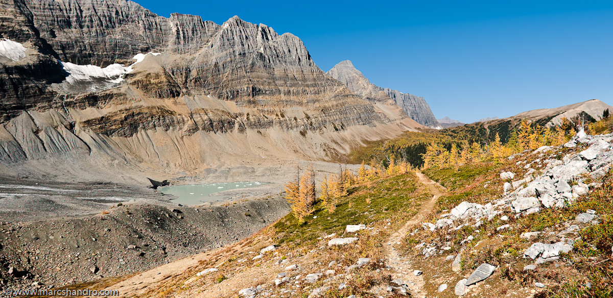
Tumbling Pass - Rockwall Trail
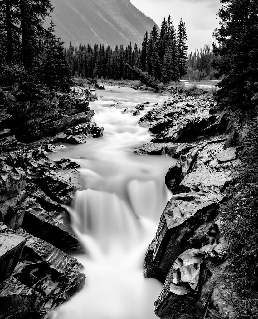
The Silent Tree Falling in the Forest.
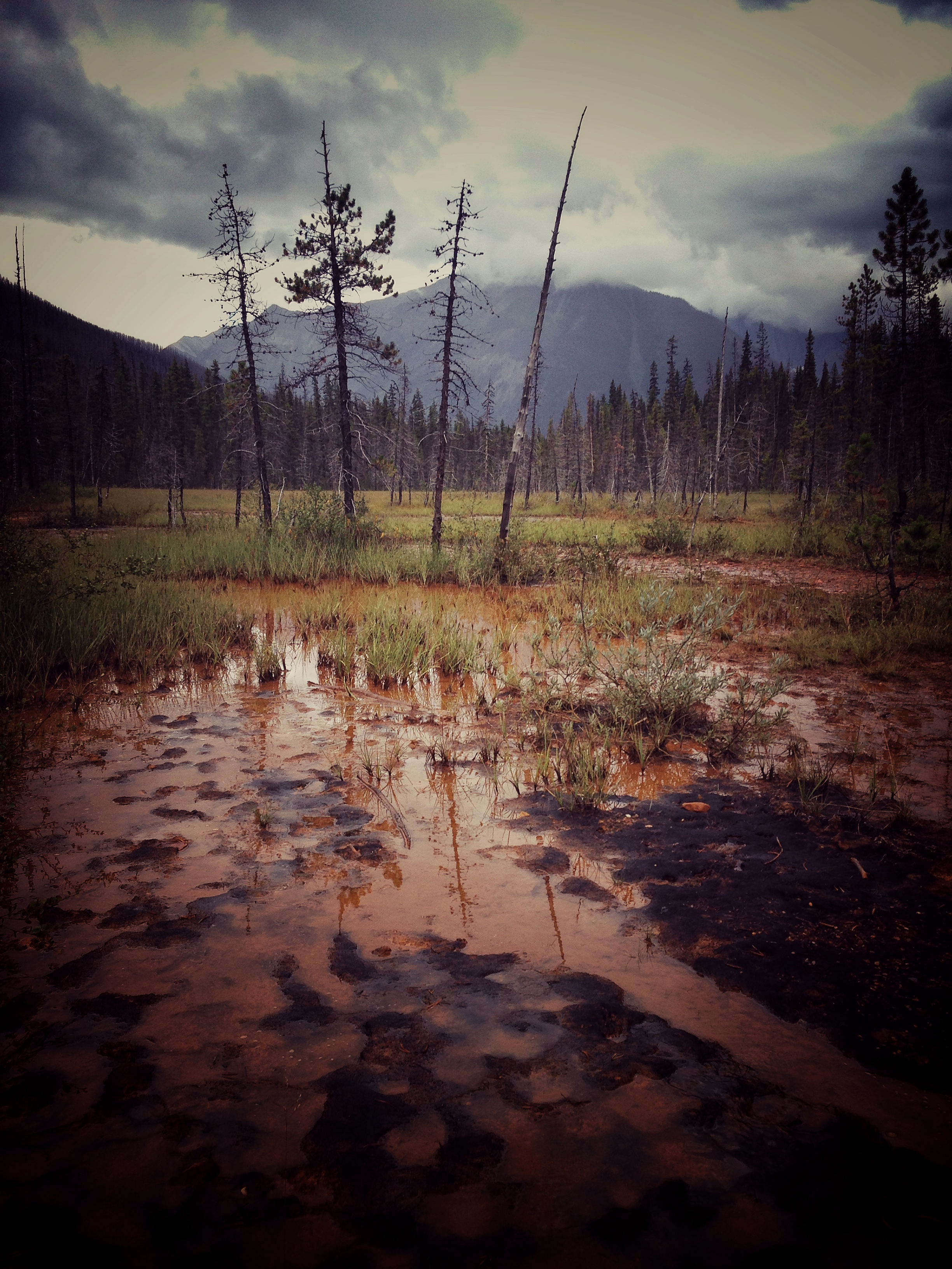
Paint Pots

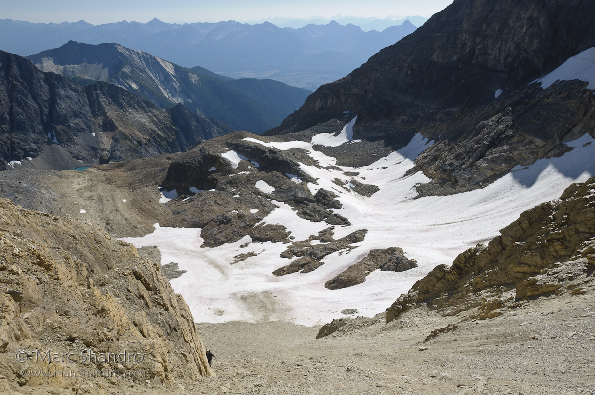
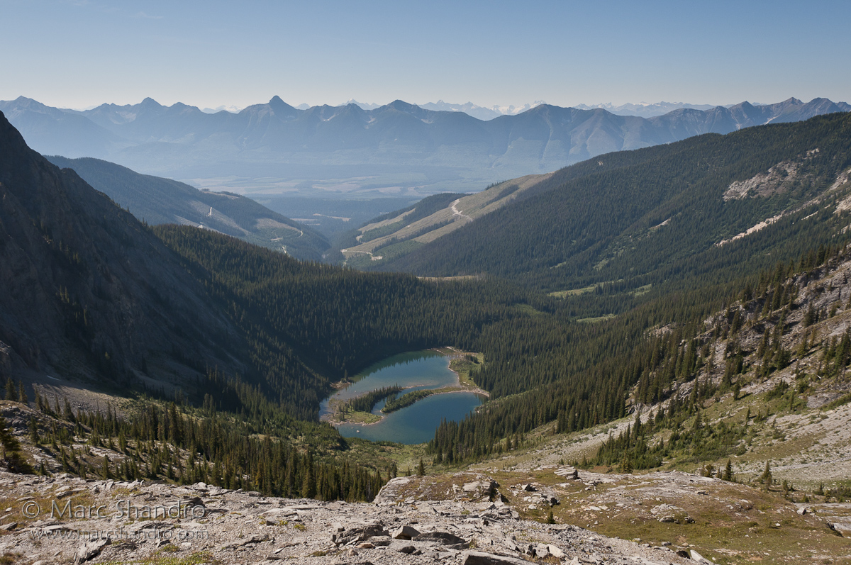
High Lake Behind The Rockwall
Exploring Near Mt. Gray and High Lake

Exploration Above High Lake

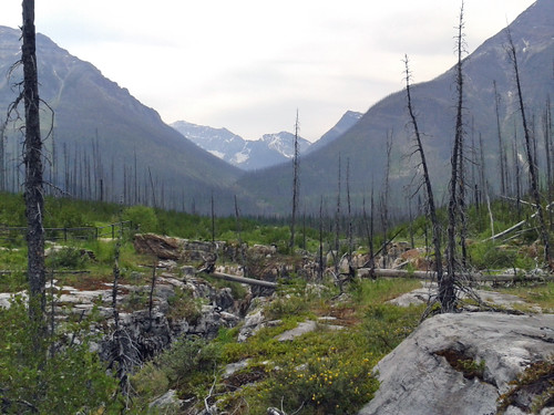
Logging Road Camp
Dainard Lake
2014-07-14 12.23.16_edited-1

Alpine view
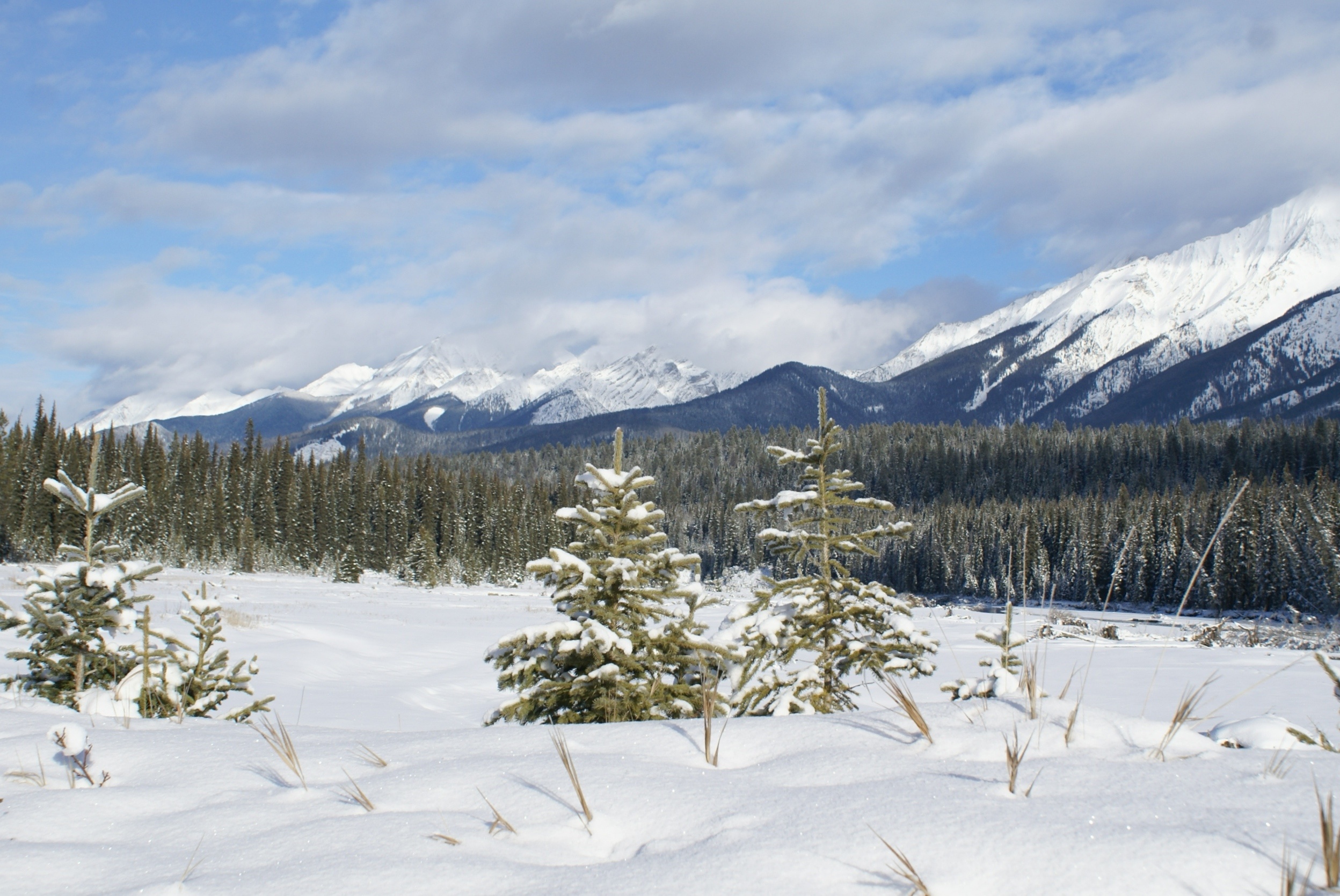
Alpine view
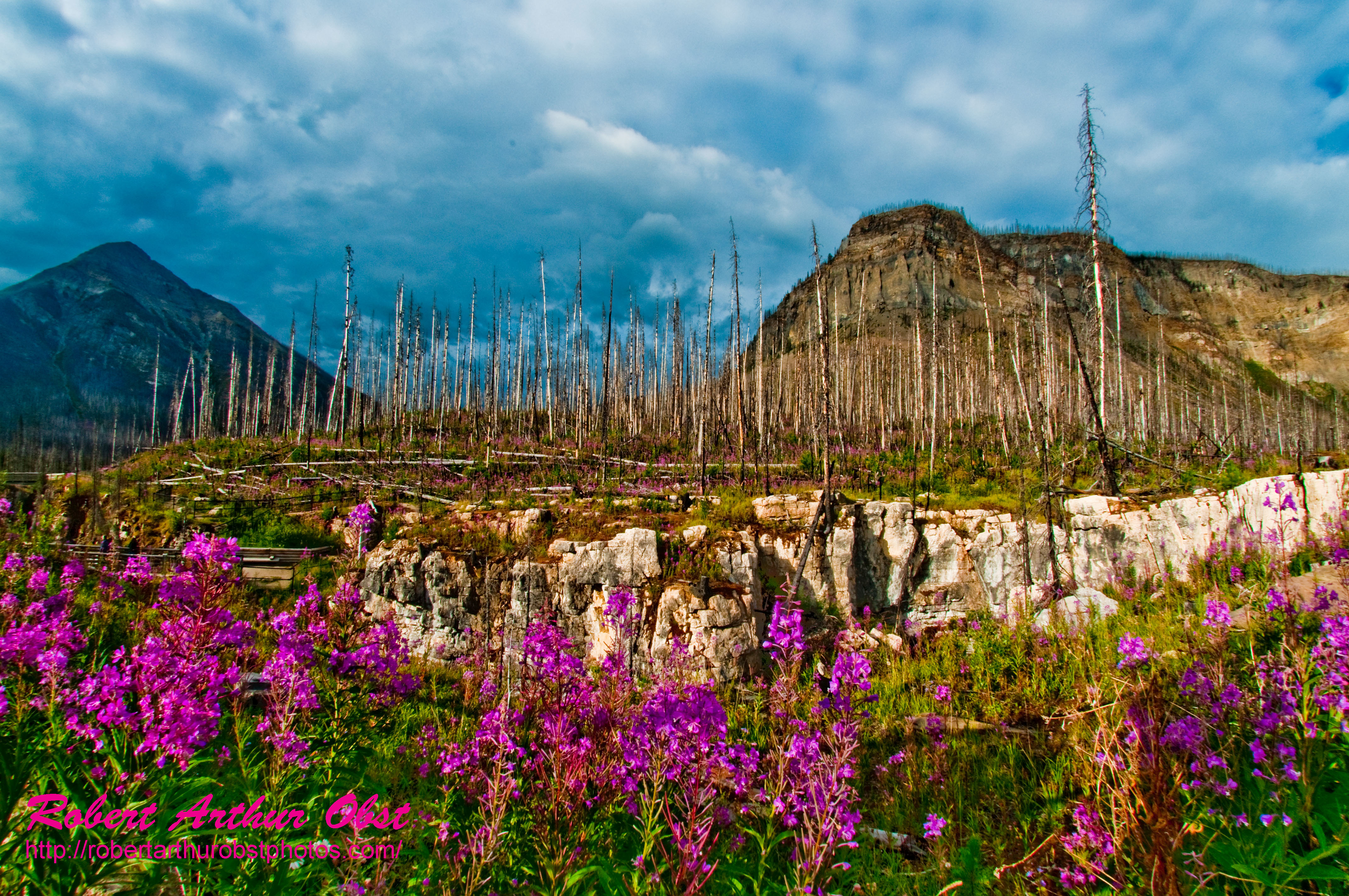
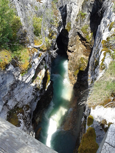
Fireweed Trail hiker's view of Fireweed also known as Great Willow-herb or Epilobium angustifolium growing near Tokumm Creek and Marble Canyon within Kootenay National Park (Canada BC Radium Hot Springs)

PhotoContest-TNC12_3057.W_NEFFF.LIM.ATO2010-CAN.BC.RHS.KootenayNPFlowers.MarbleCanyon-B

2014-07-14 12.18.46_edited-1
2014-07-14 12.07.46_edited-1
カナダ 〒V0A ブリティッシュコロンビア州 コロンビア=シャスワップ A ヘルメット山の地図
別の場所を検索
近所の場所
カナダ 〒V0A ブリティッシュコロンビア州 コロンビア=シャスワップ A シャープ山
カナダ 〒V0A ブリティッシュコロンビア州 イースト・クーテネイ G ライムストーン・ピーク
カナダ 〒V0A ブリティッシュコロンビア州 イースト・クーテネイ G ドライズデール NE4
Mount Oke, East Kootenay G, BC V0A カナダ
カナダ 〒V0A ブリティッシュコロンビア州 イースト・クーテネイ G カーティス・ピーク
カナダ 〒V0A ブリティッシュコロンビア州 コロンビア=シャスワップ A ビドル山
カナダ 〒V0A ブリティッシュコロンビア州 コロンビア=シャスワップ A パーク山
カナダ 〒V0A ブリティッシュコロンビア州 イースト・クーテネイ G ネプチュアック山
カナダ 〒V0A イースト・クーテネイ G デルタフォーム山
カナダ 〒V0A ブリティッシュコロンビア州 イースト・クーテネイ G アレン山
カナダ 〒V0A ブリティッシュコロンビア州 イースト・クーテネイ G タゾ山
カナダ 〒T0L アルバータ インプルーヴメント・ディストリクト No. 9 エイフェル湖
カナダ 〒V0A ブリティッシュコロンビア州 イースト・クーテネイ G チムニー S1
カナダ 〒T0L アルバータ インプルーヴメント・ディストリクト No. 9 モレーン湖
カナダ 〒T0L アルバータ インプルーヴメント・ディストリクト No. 9 フェイ山
カナダ 〒V0A ブリティッシュコロンビア州 イースト・クーテネイ G クアドラ山
1 Moraine Lake Rd, Lake Louise, AB T0L 1E0 カナダMoraine Lake Lodge
カナダ 〒T0L アルバータ インプルーヴメント・ディストリクト No. 9 バベル山
カナダ 〒T0L アルバータ インプルーヴメント・ディストリクト No. 9 チムニー E1
カナダ 〒T0L アルバータ インプルーヴメント・ディストリクト No. 9 タワー・オブ・バベル
最近の検索
- アメリカ合衆国 アラスカ州 レッド・ドッグ・マイン日の出日の入り時間
- Am bhf, Borken, ドイツアム・バーンホーフ日の出日の入り時間
- 4th St E, Sonoma, CA, USA日の出日の入り時間
- Oakland Ave, Williamsport, PA アメリカ合衆国日の出日の入り時間
- Via Roma, Pieranica CR, イタリアローマ通り日の出日の入り時間
- クロアチア 〒 ドゥブロブニク GradClock Tower of Dubrovnik日の出日の入り時間
- アルゼンチン チュブ州 トレリュー日の出日の入り時間
- Hartfords Bluff Cir, Mt Pleasant, SC アメリカ合衆国日の出日の入り時間
- 日本、熊本県熊本市北区日の出日の入り時間
- 中華人民共和国 福州市 平潭県 平潭島日の出日の入り時間