アメリカ合衆国 〒 メイン州 キャッスル・ヒル ヘイスタック山日の出日の入り時間
Location: アメリカ合衆国 > メイン州 > アルーストック > アメリカ合衆国 メイン州 セントラル・アルーストック > アメリカ合衆国 メイン州 キャッスル・ヒル >
時間帯:
America/New_York
現地時間:
2025-05-15 14:56:31
経度:
-68.2314251
緯度:
46.667264
今日の日の出時刻:
04:56:28 AM
今日の日の入時刻:
08:02:10 PM
今日の日長:
15h 5m 42s
明日の日の出時刻:
04:55:20 AM
明日の日の入時刻:
08:03:22 PM
明日の日長:
15h 8m 2s
すべて表示する
| 日付 | 日出 | 日没 | 日長 |
|---|---|---|---|
| 2025年01月01日 | 07:17:16 AM | 03:56:47 PM | 8h 39m 31s |
| 2025年01月02日 | 07:17:11 AM | 03:57:47 PM | 8h 40m 36s |
| 2025年01月03日 | 07:17:04 AM | 03:58:48 PM | 8h 41m 44s |
| 2025年01月04日 | 07:16:55 AM | 03:59:51 PM | 8h 42m 56s |
| 2025年01月05日 | 07:16:42 AM | 04:00:57 PM | 8h 44m 15s |
| 2025年01月06日 | 07:16:27 AM | 04:02:04 PM | 8h 45m 37s |
| 2025年01月07日 | 07:16:09 AM | 04:03:13 PM | 8h 47m 4s |
| 2025年01月08日 | 07:15:48 AM | 04:04:23 PM | 8h 48m 35s |
| 2025年01月09日 | 07:15:25 AM | 04:05:35 PM | 8h 50m 10s |
| 2025年01月10日 | 07:14:59 AM | 04:06:49 PM | 8h 51m 50s |
| 2025年01月11日 | 07:14:30 AM | 04:08:04 PM | 8h 53m 34s |
| 2025年01月12日 | 07:13:59 AM | 04:09:20 PM | 8h 55m 21s |
| 2025年01月13日 | 07:13:25 AM | 04:10:38 PM | 8h 57m 13s |
| 2025年01月14日 | 07:12:49 AM | 04:11:57 PM | 8h 59m 8s |
| 2025年01月15日 | 07:12:10 AM | 04:13:17 PM | 9h 1m 7s |
| 2025年01月16日 | 07:11:28 AM | 04:14:38 PM | 9h 3m 10s |
| 2025年01月17日 | 07:10:44 AM | 04:16:00 PM | 9h 5m 16s |
| 2025年01月18日 | 07:09:58 AM | 04:17:24 PM | 9h 7m 26s |
| 2025年01月19日 | 07:09:09 AM | 04:18:48 PM | 9h 9m 39s |
| 2025年01月20日 | 07:08:18 AM | 04:20:13 PM | 9h 11m 55s |
| 2025年01月21日 | 07:07:24 AM | 04:21:39 PM | 9h 14m 15s |
| 2025年01月22日 | 07:06:28 AM | 04:23:05 PM | 9h 16m 37s |
| 2025年01月23日 | 07:05:30 AM | 04:24:32 PM | 9h 19m 2s |
| 2025年01月24日 | 07:04:30 AM | 04:26:00 PM | 9h 21m 30s |
| 2025年01月25日 | 07:03:28 AM | 04:27:29 PM | 9h 24m 1s |
| 2025年01月26日 | 07:02:23 AM | 04:28:58 PM | 9h 26m 35s |
| 2025年01月27日 | 07:01:17 AM | 04:30:27 PM | 9h 29m 10s |
| 2025年01月28日 | 07:00:08 AM | 04:31:57 PM | 9h 31m 49s |
| 2025年01月29日 | 06:58:58 AM | 04:33:27 PM | 9h 34m 29s |
| 2025年01月30日 | 06:57:45 AM | 04:34:57 PM | 9h 37m 12s |
| 2025年01月31日 | 06:56:31 AM | 04:36:28 PM | 9h 39m 57s |
| 2025年02月01日 | 06:55:15 AM | 04:37:59 PM | 9h 42m 44s |
| 2025年02月02日 | 06:53:57 AM | 04:39:30 PM | 9h 45m 33s |
| 2025年02月03日 | 06:52:37 AM | 04:41:01 PM | 9h 48m 24s |
| 2025年02月04日 | 06:51:15 AM | 04:42:33 PM | 9h 51m 18s |
| 2025年02月05日 | 06:49:52 AM | 04:44:04 PM | 9h 54m 12s |
| 2025年02月06日 | 06:48:27 AM | 04:45:36 PM | 9h 57m 9s |
| 2025年02月07日 | 06:47:01 AM | 04:47:07 PM | 10h 0m 6s |
| 2025年02月08日 | 06:45:33 AM | 04:48:39 PM | 10h 3m 6s |
| 2025年02月09日 | 06:44:03 AM | 04:50:10 PM | 10h 6m 7s |
| 2025年02月10日 | 06:42:32 AM | 04:51:41 PM | 10h 9m 9s |
| 2025年02月11日 | 06:41:00 AM | 04:53:12 PM | 10h 12m 12s |
| 2025年02月12日 | 06:39:26 AM | 04:54:43 PM | 10h 15m 17s |
| 2025年02月13日 | 06:37:51 AM | 04:56:14 PM | 10h 18m 23s |
| 2025年02月14日 | 06:36:15 AM | 04:57:45 PM | 10h 21m 30s |
| 2025年02月15日 | 06:34:37 AM | 04:59:16 PM | 10h 24m 39s |
| 2025年02月16日 | 06:32:59 AM | 05:00:46 PM | 10h 27m 47s |
| 2025年02月17日 | 06:31:19 AM | 05:02:16 PM | 10h 30m 57s |
| 2025年02月18日 | 06:29:37 AM | 05:03:46 PM | 10h 34m 9s |
| 2025年02月19日 | 06:27:55 AM | 05:05:16 PM | 10h 37m 21s |
| 2025年02月20日 | 06:26:12 AM | 05:06:45 PM | 10h 40m 33s |
| 2025年02月21日 | 06:24:28 AM | 05:08:14 PM | 10h 43m 46s |
| 2025年02月22日 | 06:22:43 AM | 05:09:43 PM | 10h 47m 0s |
| 2025年02月23日 | 06:20:56 AM | 05:11:12 PM | 10h 50m 16s |
| 2025年02月24日 | 06:19:09 AM | 05:12:40 PM | 10h 53m 31s |
| 2025年02月25日 | 06:17:21 AM | 05:14:08 PM | 10h 56m 47s |
| 2025年02月26日 | 06:15:33 AM | 05:15:36 PM | 11h 0m 3s |
| 2025年02月27日 | 06:13:43 AM | 05:17:04 PM | 11h 3m 21s |
| 2025年02月28日 | 06:11:53 AM | 05:18:31 PM | 11h 6m 38s |
| 2025年03月01日 | 06:10:02 AM | 05:19:58 PM | 11h 9m 56s |
| 2025年03月02日 | 06:08:10 AM | 05:21:25 PM | 11h 13m 15s |
| 2025年03月03日 | 06:06:18 AM | 05:22:51 PM | 11h 16m 33s |
| 2025年03月04日 | 06:04:25 AM | 05:24:17 PM | 11h 19m 52s |
| 2025年03月05日 | 06:02:31 AM | 05:25:43 PM | 11h 23m 12s |
| 2025年03月06日 | 06:00:37 AM | 05:27:09 PM | 11h 26m 32s |
| 2025年03月07日 | 05:58:42 AM | 05:28:34 PM | 11h 29m 52s |
| 2025年03月08日 | 05:56:47 AM | 05:29:59 PM | 11h 33m 12s |
| 2025年03月09日 | 06:54:57 AM | 06:31:21 PM | 11h 36m 24s |
| 2025年03月10日 | 06:53:01 AM | 06:32:45 PM | 11h 39m 44s |
| 2025年03月11日 | 06:51:04 AM | 06:34:10 PM | 11h 43m 6s |
| 2025年03月12日 | 06:49:08 AM | 06:35:34 PM | 11h 46m 26s |
| 2025年03月13日 | 06:47:11 AM | 06:36:58 PM | 11h 49m 47s |
| 2025年03月14日 | 06:45:13 AM | 06:38:22 PM | 11h 53m 9s |
| 2025年03月15日 | 06:43:16 AM | 06:39:45 PM | 11h 56m 29s |
| 2025年03月16日 | 06:41:18 AM | 06:41:08 PM | 11h 59m 50s |
| 2025年03月17日 | 06:39:20 AM | 06:42:32 PM | 12h 3m 12s |
| 2025年03月18日 | 06:37:22 AM | 06:43:55 PM | 12h 6m 33s |
| 2025年03月19日 | 06:35:24 AM | 06:45:18 PM | 12h 9m 54s |
| 2025年03月20日 | 06:33:25 AM | 06:46:40 PM | 12h 13m 15s |
| 2025年03月21日 | 06:31:27 AM | 06:48:03 PM | 12h 16m 36s |
| 2025年03月22日 | 06:29:29 AM | 06:49:25 PM | 12h 19m 56s |
| 2025年03月23日 | 06:27:30 AM | 06:50:48 PM | 12h 23m 18s |
| 2025年03月24日 | 06:25:32 AM | 06:52:10 PM | 12h 26m 38s |
| 2025年03月25日 | 06:23:34 AM | 06:53:32 PM | 12h 29m 58s |
| 2025年03月26日 | 06:21:35 AM | 06:54:54 PM | 12h 33m 19s |
| 2025年03月27日 | 06:19:37 AM | 06:56:16 PM | 12h 36m 39s |
| 2025年03月28日 | 06:17:39 AM | 06:57:38 PM | 12h 39m 59s |
| 2025年03月29日 | 06:15:41 AM | 06:59:00 PM | 12h 43m 19s |
| 2025年03月30日 | 06:13:44 AM | 07:00:21 PM | 12h 46m 37s |
| 2025年03月31日 | 06:11:46 AM | 07:01:43 PM | 12h 49m 57s |
| 2025年04月01日 | 06:09:49 AM | 07:03:05 PM | 12h 53m 16s |
| 2025年04月02日 | 06:07:53 AM | 07:04:26 PM | 12h 56m 33s |
| 2025年04月03日 | 06:05:56 AM | 07:05:48 PM | 12h 59m 52s |
| 2025年04月04日 | 06:04:00 AM | 07:07:09 PM | 13h 3m 9s |
| 2025年04月05日 | 06:02:05 AM | 07:08:31 PM | 13h 6m 26s |
| 2025年04月06日 | 06:00:09 AM | 07:09:52 PM | 13h 9m 43s |
| 2025年04月07日 | 05:58:15 AM | 07:11:14 PM | 13h 12m 59s |
| 2025年04月08日 | 05:56:20 AM | 07:12:35 PM | 13h 16m 15s |
| 2025年04月09日 | 05:54:27 AM | 07:13:57 PM | 13h 19m 30s |
| 2025年04月10日 | 05:52:34 AM | 07:15:18 PM | 13h 22m 44s |
| 2025年04月11日 | 05:50:41 AM | 07:16:40 PM | 13h 25m 59s |
| 2025年04月12日 | 05:48:49 AM | 07:18:01 PM | 13h 29m 12s |
| 2025年04月13日 | 05:46:58 AM | 07:19:23 PM | 13h 32m 25s |
| 2025年04月14日 | 05:45:07 AM | 07:20:44 PM | 13h 35m 37s |
| 2025年04月15日 | 05:43:17 AM | 07:22:06 PM | 13h 38m 49s |
| 2025年04月16日 | 05:41:28 AM | 07:23:27 PM | 13h 41m 59s |
| 2025年04月17日 | 05:39:40 AM | 07:24:48 PM | 13h 45m 8s |
| 2025年04月18日 | 05:37:53 AM | 07:26:10 PM | 13h 48m 17s |
| 2025年04月19日 | 05:36:06 AM | 07:27:31 PM | 13h 51m 25s |
| 2025年04月20日 | 05:34:21 AM | 07:28:52 PM | 13h 54m 31s |
| 2025年04月21日 | 05:32:36 AM | 07:30:13 PM | 13h 57m 37s |
| 2025年04月22日 | 05:30:52 AM | 07:31:35 PM | 14h 0m 43s |
| 2025年04月23日 | 05:29:09 AM | 07:32:56 PM | 14h 3m 47s |
| 2025年04月24日 | 05:27:28 AM | 07:34:16 PM | 14h 6m 48s |
| 2025年04月25日 | 05:25:47 AM | 07:35:37 PM | 14h 9m 50s |
| 2025年04月26日 | 05:24:08 AM | 07:36:58 PM | 14h 12m 50s |
| 2025年04月27日 | 05:22:30 AM | 07:38:19 PM | 14h 15m 49s |
| 2025年04月28日 | 05:20:52 AM | 07:39:39 PM | 14h 18m 47s |
| 2025年04月29日 | 05:19:17 AM | 07:40:59 PM | 14h 21m 42s |
| 2025年04月30日 | 05:17:42 AM | 07:42:19 PM | 14h 24m 37s |
| 2025年05月01日 | 05:16:09 AM | 07:43:39 PM | 14h 27m 30s |
| 2025年05月02日 | 05:14:37 AM | 07:44:58 PM | 14h 30m 21s |
| 2025年05月03日 | 05:13:06 AM | 07:46:18 PM | 14h 33m 12s |
| 2025年05月04日 | 05:11:37 AM | 07:47:36 PM | 14h 35m 59s |
| 2025年05月05日 | 05:10:10 AM | 07:48:55 PM | 14h 38m 45s |
| 2025年05月06日 | 05:08:44 AM | 07:50:13 PM | 14h 41m 29s |
| 2025年05月07日 | 05:07:19 AM | 07:51:31 PM | 14h 44m 12s |
| 2025年05月08日 | 05:05:56 AM | 07:52:48 PM | 14h 46m 52s |
| 2025年05月09日 | 05:04:35 AM | 07:54:05 PM | 14h 49m 30s |
| 2025年05月10日 | 05:03:15 AM | 07:55:21 PM | 14h 52m 6s |
| 2025年05月11日 | 05:01:57 AM | 07:56:37 PM | 14h 54m 40s |
| 2025年05月12日 | 05:00:41 AM | 07:57:52 PM | 14h 57m 11s |
| 2025年05月13日 | 04:59:26 AM | 07:59:07 PM | 14h 59m 41s |
| 2025年05月14日 | 04:58:14 AM | 08:00:20 PM | 15h 2m 6s |
| 2025年05月15日 | 04:57:03 AM | 08:01:34 PM | 15h 4m 31s |
| 2025年05月16日 | 04:55:54 AM | 08:02:46 PM | 15h 6m 52s |
| 2025年05月17日 | 04:54:47 AM | 08:03:57 PM | 15h 9m 10s |
| 2025年05月18日 | 04:53:42 AM | 08:05:08 PM | 15h 11m 26s |
| 2025年05月19日 | 04:52:39 AM | 08:06:18 PM | 15h 13m 39s |
| 2025年05月20日 | 04:51:38 AM | 08:07:27 PM | 15h 15m 49s |
| 2025年05月21日 | 04:50:39 AM | 08:08:34 PM | 15h 17m 55s |
| 2025年05月22日 | 04:49:42 AM | 08:09:41 PM | 15h 19m 59s |
| 2025年05月23日 | 04:48:48 AM | 08:10:47 PM | 15h 21m 59s |
| 2025年05月24日 | 04:47:55 AM | 08:11:51 PM | 15h 23m 56s |
| 2025年05月25日 | 04:47:05 AM | 08:12:54 PM | 15h 25m 49s |
| 2025年05月26日 | 04:46:17 AM | 08:13:56 PM | 15h 27m 39s |
| 2025年05月27日 | 04:45:31 AM | 08:14:57 PM | 15h 29m 26s |
| 2025年05月28日 | 04:44:48 AM | 08:15:56 PM | 15h 31m 8s |
| 2025年05月29日 | 04:44:07 AM | 08:16:54 PM | 15h 32m 47s |
| 2025年05月30日 | 04:43:28 AM | 08:17:50 PM | 15h 34m 22s |
| 2025年05月31日 | 04:42:51 AM | 08:18:44 PM | 15h 35m 53s |
| 2025年06月01日 | 04:42:17 AM | 08:19:38 PM | 15h 37m 21s |
| 2025年06月02日 | 04:41:45 AM | 08:20:29 PM | 15h 38m 44s |
| 2025年06月03日 | 04:41:16 AM | 08:21:19 PM | 15h 40m 3s |
| 2025年06月04日 | 04:40:49 AM | 08:22:07 PM | 15h 41m 18s |
| 2025年06月05日 | 04:40:25 AM | 08:22:53 PM | 15h 42m 28s |
| 2025年06月06日 | 04:40:03 AM | 08:23:37 PM | 15h 43m 34s |
| 2025年06月07日 | 04:39:44 AM | 08:24:19 PM | 15h 44m 35s |
| 2025年06月08日 | 04:39:27 AM | 08:25:00 PM | 15h 45m 33s |
| 2025年06月09日 | 04:39:12 AM | 08:25:38 PM | 15h 46m 26s |
| 2025年06月10日 | 04:39:00 AM | 08:26:15 PM | 15h 47m 15s |
| 2025年06月11日 | 04:38:51 AM | 08:26:49 PM | 15h 47m 58s |
| 2025年06月12日 | 04:38:44 AM | 08:27:21 PM | 15h 48m 37s |
| 2025年06月13日 | 04:38:39 AM | 08:27:51 PM | 15h 49m 12s |
| 2025年06月14日 | 04:38:37 AM | 08:28:19 PM | 15h 49m 42s |
| 2025年06月15日 | 04:38:37 AM | 08:28:44 PM | 15h 50m 7s |
| 2025年06月16日 | 04:38:40 AM | 08:29:07 PM | 15h 50m 27s |
| 2025年06月17日 | 04:38:45 AM | 08:29:28 PM | 15h 50m 43s |
| 2025年06月18日 | 04:38:53 AM | 08:29:46 PM | 15h 50m 53s |
| 2025年06月19日 | 04:39:03 AM | 08:30:02 PM | 15h 50m 59s |
| 2025年06月20日 | 04:39:16 AM | 08:30:16 PM | 15h 51m 0s |
| 2025年06月21日 | 04:39:31 AM | 08:30:27 PM | 15h 50m 56s |
| 2025年06月22日 | 04:39:48 AM | 08:30:36 PM | 15h 50m 48s |
| 2025年06月23日 | 04:40:07 AM | 08:30:42 PM | 15h 50m 35s |
| 2025年06月24日 | 04:40:29 AM | 08:30:46 PM | 15h 50m 17s |
| 2025年06月25日 | 04:40:53 AM | 08:30:47 PM | 15h 49m 54s |
| 2025年06月26日 | 04:41:19 AM | 08:30:46 PM | 15h 49m 27s |
| 2025年06月27日 | 04:41:47 AM | 08:30:43 PM | 15h 48m 56s |
| 2025年06月28日 | 04:42:18 AM | 08:30:36 PM | 15h 48m 18s |
| 2025年06月29日 | 04:42:51 AM | 08:30:27 PM | 15h 47m 36s |
| 2025年06月30日 | 04:43:25 AM | 08:30:16 PM | 15h 46m 51s |
| 2025年07月01日 | 04:44:02 AM | 08:30:02 PM | 15h 46m 0s |
| 2025年07月02日 | 04:44:40 AM | 08:29:46 PM | 15h 45m 6s |
| 2025年07月03日 | 04:45:21 AM | 08:29:27 PM | 15h 44m 6s |
| 2025年07月04日 | 04:46:03 AM | 08:29:06 PM | 15h 43m 3s |
| 2025年07月05日 | 04:46:47 AM | 08:28:42 PM | 15h 41m 55s |
| 2025年07月06日 | 04:47:33 AM | 08:28:15 PM | 15h 40m 42s |
| 2025年07月07日 | 04:48:21 AM | 08:27:46 PM | 15h 39m 25s |
| 2025年07月08日 | 04:49:10 AM | 08:27:15 PM | 15h 38m 5s |
| 2025年07月09日 | 04:50:01 AM | 08:26:41 PM | 15h 36m 40s |
| 2025年07月10日 | 04:50:53 AM | 08:26:05 PM | 15h 35m 12s |
| 2025年07月11日 | 04:51:47 AM | 08:25:26 PM | 15h 33m 39s |
| 2025年07月12日 | 04:52:42 AM | 08:24:45 PM | 15h 32m 3s |
| 2025年07月13日 | 04:53:39 AM | 08:24:02 PM | 15h 30m 23s |
| 2025年07月14日 | 04:54:37 AM | 08:23:16 PM | 15h 28m 39s |
| 2025年07月15日 | 04:55:36 AM | 08:22:28 PM | 15h 26m 52s |
| 2025年07月16日 | 04:56:37 AM | 08:21:38 PM | 15h 25m 1s |
| 2025年07月17日 | 04:57:38 AM | 08:20:46 PM | 15h 23m 8s |
| 2025年07月18日 | 04:58:41 AM | 08:19:51 PM | 15h 21m 10s |
| 2025年07月19日 | 04:59:45 AM | 08:18:54 PM | 15h 19m 9s |
| 2025年07月20日 | 05:00:50 AM | 08:17:55 PM | 15h 17m 5s |
| 2025年07月21日 | 05:01:56 AM | 08:16:54 PM | 15h 14m 58s |
| 2025年07月22日 | 05:03:03 AM | 08:15:51 PM | 15h 12m 48s |
| 2025年07月23日 | 05:04:10 AM | 08:14:46 PM | 15h 10m 36s |
| 2025年07月24日 | 05:05:19 AM | 08:13:39 PM | 15h 8m 20s |
| 2025年07月25日 | 05:06:28 AM | 08:12:30 PM | 15h 6m 2s |
| 2025年07月26日 | 05:07:38 AM | 08:11:19 PM | 15h 3m 41s |
| 2025年07月27日 | 05:08:48 AM | 08:10:06 PM | 15h 1m 18s |
| 2025年07月28日 | 05:10:00 AM | 08:08:51 PM | 14h 58m 51s |
| 2025年07月29日 | 05:11:11 AM | 08:07:34 PM | 14h 56m 23s |
| 2025年07月30日 | 05:12:24 AM | 08:06:16 PM | 14h 53m 52s |
| 2025年07月31日 | 05:13:37 AM | 08:04:56 PM | 14h 51m 19s |
| 2025年08月01日 | 05:14:50 AM | 08:03:34 PM | 14h 48m 44s |
| 2025年08月02日 | 05:16:04 AM | 08:02:11 PM | 14h 46m 7s |
| 2025年08月03日 | 05:17:18 AM | 08:00:46 PM | 14h 43m 28s |
| 2025年08月04日 | 05:18:32 AM | 07:59:19 PM | 14h 40m 47s |
| 2025年08月05日 | 05:19:47 AM | 07:57:51 PM | 14h 38m 4s |
| 2025年08月06日 | 05:21:02 AM | 07:56:22 PM | 14h 35m 20s |
| 2025年08月07日 | 05:22:18 AM | 07:54:51 PM | 14h 32m 33s |
| 2025年08月08日 | 05:23:34 AM | 07:53:18 PM | 14h 29m 44s |
| 2025年08月09日 | 05:24:50 AM | 07:51:44 PM | 14h 26m 54s |
| 2025年08月10日 | 05:26:06 AM | 07:50:09 PM | 14h 24m 3s |
| 2025年08月11日 | 05:27:22 AM | 07:48:33 PM | 14h 21m 11s |
| 2025年08月12日 | 05:28:38 AM | 07:46:55 PM | 14h 18m 17s |
| 2025年08月13日 | 05:29:55 AM | 07:45:16 PM | 14h 15m 21s |
| 2025年08月14日 | 05:31:12 AM | 07:43:36 PM | 14h 12m 24s |
| 2025年08月15日 | 05:32:28 AM | 07:41:55 PM | 14h 9m 27s |
| 2025年08月16日 | 05:33:45 AM | 07:40:12 PM | 14h 6m 27s |
| 2025年08月17日 | 05:35:02 AM | 07:38:29 PM | 14h 3m 27s |
| 2025年08月18日 | 05:36:19 AM | 07:36:44 PM | 14h 0m 25s |
| 2025年08月19日 | 05:37:36 AM | 07:34:59 PM | 13h 57m 23s |
| 2025年08月20日 | 05:38:53 AM | 07:33:12 PM | 13h 54m 19s |
| 2025年08月21日 | 05:40:10 AM | 07:31:25 PM | 13h 51m 15s |
| 2025年08月22日 | 05:41:27 AM | 07:29:36 PM | 13h 48m 9s |
| 2025年08月23日 | 05:42:44 AM | 07:27:47 PM | 13h 45m 3s |
| 2025年08月24日 | 05:44:01 AM | 07:25:57 PM | 13h 41m 56s |
| 2025年08月25日 | 05:45:18 AM | 07:24:06 PM | 13h 38m 48s |
| 2025年08月26日 | 05:46:35 AM | 07:22:15 PM | 13h 35m 40s |
| 2025年08月27日 | 05:47:52 AM | 07:20:23 PM | 13h 32m 31s |
| 2025年08月28日 | 05:49:09 AM | 07:18:30 PM | 13h 29m 21s |
| 2025年08月29日 | 05:50:26 AM | 07:16:36 PM | 13h 26m 10s |
| 2025年08月30日 | 05:51:43 AM | 07:14:42 PM | 13h 22m 59s |
| 2025年08月31日 | 05:53:00 AM | 07:12:47 PM | 13h 19m 47s |
| 2025年09月01日 | 05:54:17 AM | 07:10:51 PM | 13h 16m 34s |
| 2025年09月02日 | 05:55:34 AM | 07:08:55 PM | 13h 13m 21s |
| 2025年09月03日 | 05:56:51 AM | 07:06:59 PM | 13h 10m 8s |
| 2025年09月04日 | 05:58:07 AM | 07:05:02 PM | 13h 6m 55s |
| 2025年09月05日 | 05:59:24 AM | 07:03:05 PM | 13h 3m 41s |
| 2025年09月06日 | 06:00:41 AM | 07:01:07 PM | 13h 0m 26s |
| 2025年09月07日 | 06:01:58 AM | 06:59:09 PM | 12h 57m 11s |
| 2025年09月08日 | 06:03:15 AM | 06:57:10 PM | 12h 53m 55s |
| 2025年09月09日 | 06:04:32 AM | 06:55:11 PM | 12h 50m 39s |
| 2025年09月10日 | 06:05:48 AM | 06:53:12 PM | 12h 47m 24s |
| 2025年09月11日 | 06:07:05 AM | 06:51:13 PM | 12h 44m 8s |
| 2025年09月12日 | 06:08:22 AM | 06:49:13 PM | 12h 40m 51s |
| 2025年09月13日 | 06:09:39 AM | 06:47:14 PM | 12h 37m 35s |
| 2025年09月14日 | 06:10:56 AM | 06:45:14 PM | 12h 34m 18s |
| 2025年09月15日 | 06:12:14 AM | 06:43:14 PM | 12h 31m 0s |
| 2025年09月16日 | 06:13:31 AM | 06:41:14 PM | 12h 27m 43s |
| 2025年09月17日 | 06:14:48 AM | 06:39:14 PM | 12h 24m 26s |
| 2025年09月18日 | 06:16:06 AM | 06:37:13 PM | 12h 21m 7s |
| 2025年09月19日 | 06:17:23 AM | 06:35:13 PM | 12h 17m 50s |
| 2025年09月20日 | 06:18:41 AM | 06:33:13 PM | 12h 14m 32s |
| 2025年09月21日 | 06:19:58 AM | 06:31:13 PM | 12h 11m 15s |
| 2025年09月22日 | 06:21:16 AM | 06:29:13 PM | 12h 7m 57s |
| 2025年09月23日 | 06:22:34 AM | 06:27:13 PM | 12h 4m 39s |
| 2025年09月24日 | 06:23:53 AM | 06:25:13 PM | 12h 1m 20s |
| 2025年09月25日 | 06:25:11 AM | 06:23:13 PM | 11h 58m 2s |
| 2025年09月26日 | 06:26:30 AM | 06:21:14 PM | 11h 54m 44s |
| 2025年09月27日 | 06:27:48 AM | 06:19:14 PM | 11h 51m 26s |
| 2025年09月28日 | 06:29:07 AM | 06:17:16 PM | 11h 48m 9s |
| 2025年09月29日 | 06:30:27 AM | 06:15:17 PM | 11h 44m 50s |
| 2025年09月30日 | 06:31:46 AM | 06:13:19 PM | 11h 41m 33s |
| 2025年10月01日 | 06:33:06 AM | 06:11:21 PM | 11h 38m 15s |
| 2025年10月02日 | 06:34:26 AM | 06:09:23 PM | 11h 34m 57s |
| 2025年10月03日 | 06:35:46 AM | 06:07:26 PM | 11h 31m 40s |
| 2025年10月04日 | 06:37:06 AM | 06:05:29 PM | 11h 28m 23s |
| 2025年10月05日 | 06:38:27 AM | 06:03:33 PM | 11h 25m 6s |
| 2025年10月06日 | 06:39:48 AM | 06:01:37 PM | 11h 21m 49s |
| 2025年10月07日 | 06:41:09 AM | 05:59:42 PM | 11h 18m 33s |
| 2025年10月08日 | 06:42:30 AM | 05:57:47 PM | 11h 15m 17s |
| 2025年10月09日 | 06:43:52 AM | 05:55:54 PM | 11h 12m 2s |
| 2025年10月10日 | 06:45:14 AM | 05:54:00 PM | 11h 8m 46s |
| 2025年10月11日 | 06:46:37 AM | 05:52:08 PM | 11h 5m 31s |
| 2025年10月12日 | 06:47:59 AM | 05:50:16 PM | 11h 2m 17s |
| 2025年10月13日 | 06:49:22 AM | 05:48:25 PM | 10h 59m 3s |
| 2025年10月14日 | 06:50:46 AM | 05:46:34 PM | 10h 55m 48s |
| 2025年10月15日 | 06:52:09 AM | 05:44:45 PM | 10h 52m 36s |
| 2025年10月16日 | 06:53:33 AM | 05:42:56 PM | 10h 49m 23s |
| 2025年10月17日 | 06:54:57 AM | 05:41:08 PM | 10h 46m 11s |
| 2025年10月18日 | 06:56:22 AM | 05:39:22 PM | 10h 43m 0s |
| 2025年10月19日 | 06:57:47 AM | 05:37:36 PM | 10h 39m 49s |
| 2025年10月20日 | 06:59:12 AM | 05:35:51 PM | 10h 36m 39s |
| 2025年10月21日 | 07:00:37 AM | 05:34:07 PM | 10h 33m 30s |
| 2025年10月22日 | 07:02:03 AM | 05:32:24 PM | 10h 30m 21s |
| 2025年10月23日 | 07:03:29 AM | 05:30:43 PM | 10h 27m 14s |
| 2025年10月24日 | 07:04:55 AM | 05:29:03 PM | 10h 24m 8s |
| 2025年10月25日 | 07:06:21 AM | 05:27:23 PM | 10h 21m 2s |
| 2025年10月26日 | 07:07:48 AM | 05:25:45 PM | 10h 17m 57s |
| 2025年10月27日 | 07:09:15 AM | 05:24:09 PM | 10h 14m 54s |
| 2025年10月28日 | 07:10:42 AM | 05:22:33 PM | 10h 11m 51s |
| 2025年10月29日 | 07:12:09 AM | 05:20:59 PM | 10h 8m 50s |
| 2025年10月30日 | 07:13:36 AM | 05:19:27 PM | 10h 5m 51s |
| 2025年10月31日 | 07:15:04 AM | 05:17:56 PM | 10h 2m 52s |
| 2025年11月01日 | 07:16:31 AM | 05:16:26 PM | 9h 59m 55s |
| 2025年11月02日 | 06:18:03 AM | 04:14:54 PM | 9h 56m 51s |
| 2025年11月03日 | 06:19:30 AM | 04:13:28 PM | 9h 53m 58s |
| 2025年11月04日 | 06:20:58 AM | 04:12:03 PM | 9h 51m 5s |
| 2025年11月05日 | 06:22:26 AM | 04:10:40 PM | 9h 48m 14s |
| 2025年11月06日 | 06:23:53 AM | 04:09:19 PM | 9h 45m 26s |
| 2025年11月07日 | 06:25:21 AM | 04:07:59 PM | 9h 42m 38s |
| 2025年11月08日 | 06:26:49 AM | 04:06:41 PM | 9h 39m 52s |
| 2025年11月09日 | 06:28:16 AM | 04:05:25 PM | 9h 37m 9s |
| 2025年11月10日 | 06:29:43 AM | 04:04:11 PM | 9h 34m 28s |
| 2025年11月11日 | 06:31:10 AM | 04:02:59 PM | 9h 31m 49s |
| 2025年11月12日 | 06:32:37 AM | 04:01:49 PM | 9h 29m 12s |
| 2025年11月13日 | 06:34:03 AM | 04:00:41 PM | 9h 26m 38s |
| 2025年11月14日 | 06:35:29 AM | 03:59:35 PM | 9h 24m 6s |
| 2025年11月15日 | 06:36:54 AM | 03:58:31 PM | 9h 21m 37s |
| 2025年11月16日 | 06:38:20 AM | 03:57:29 PM | 9h 19m 9s |
| 2025年11月17日 | 06:39:44 AM | 03:56:29 PM | 9h 16m 45s |
| 2025年11月18日 | 06:41:08 AM | 03:55:32 PM | 9h 14m 24s |
| 2025年11月19日 | 06:42:31 AM | 03:54:37 PM | 9h 12m 6s |
| 2025年11月20日 | 06:43:54 AM | 03:53:44 PM | 9h 9m 50s |
| 2025年11月21日 | 06:45:16 AM | 03:52:53 PM | 9h 7m 37s |
| 2025年11月22日 | 06:46:37 AM | 03:52:05 PM | 9h 5m 28s |
| 2025年11月23日 | 06:47:57 AM | 03:51:20 PM | 9h 3m 23s |
| 2025年11月24日 | 06:49:16 AM | 03:50:36 PM | 9h 1m 20s |
| 2025年11月25日 | 06:50:34 AM | 03:49:56 PM | 8h 59m 22s |
| 2025年11月26日 | 06:51:51 AM | 03:49:18 PM | 8h 57m 27s |
| 2025年11月27日 | 06:53:07 AM | 03:48:42 PM | 8h 55m 35s |
| 2025年11月28日 | 06:54:22 AM | 03:48:09 PM | 8h 53m 47s |
| 2025年11月29日 | 06:55:35 AM | 03:47:39 PM | 8h 52m 4s |
| 2025年11月30日 | 06:56:47 AM | 03:47:12 PM | 8h 50m 25s |
| 2025年12月01日 | 06:57:58 AM | 03:46:47 PM | 8h 48m 49s |
| 2025年12月02日 | 06:59:07 AM | 03:46:25 PM | 8h 47m 18s |
| 2025年12月03日 | 07:00:15 AM | 03:46:05 PM | 8h 45m 50s |
| 2025年12月04日 | 07:01:21 AM | 03:45:49 PM | 8h 44m 28s |
| 2025年12月05日 | 07:02:25 AM | 03:45:35 PM | 8h 43m 10s |
| 2025年12月06日 | 07:03:27 AM | 03:45:24 PM | 8h 41m 57s |
| 2025年12月07日 | 07:04:28 AM | 03:45:15 PM | 8h 40m 47s |
| 2025年12月08日 | 07:05:27 AM | 03:45:10 PM | 8h 39m 43s |
| 2025年12月09日 | 07:06:24 AM | 03:45:07 PM | 8h 38m 43s |
| 2025年12月10日 | 07:07:19 AM | 03:45:07 PM | 8h 37m 48s |
| 2025年12月11日 | 07:08:11 AM | 03:45:10 PM | 8h 36m 59s |
| 2025年12月12日 | 07:09:02 AM | 03:45:16 PM | 8h 36m 14s |
| 2025年12月13日 | 07:09:50 AM | 03:45:25 PM | 8h 35m 35s |
| 2025年12月14日 | 07:10:37 AM | 03:45:36 PM | 8h 34m 59s |
| 2025年12月15日 | 07:11:21 AM | 03:45:50 PM | 8h 34m 29s |
| 2025年12月16日 | 07:12:02 AM | 03:46:07 PM | 8h 34m 5s |
| 2025年12月17日 | 07:12:41 AM | 03:46:27 PM | 8h 33m 46s |
| 2025年12月18日 | 07:13:18 AM | 03:46:50 PM | 8h 33m 32s |
| 2025年12月19日 | 07:13:52 AM | 03:47:15 PM | 8h 33m 23s |
| 2025年12月20日 | 07:14:24 AM | 03:47:43 PM | 8h 33m 19s |
| 2025年12月21日 | 07:14:53 AM | 03:48:13 PM | 8h 33m 20s |
| 2025年12月22日 | 07:15:19 AM | 03:48:47 PM | 8h 33m 28s |
| 2025年12月23日 | 07:15:43 AM | 03:49:22 PM | 8h 33m 39s |
| 2025年12月24日 | 07:16:05 AM | 03:50:01 PM | 8h 33m 56s |
| 2025年12月25日 | 07:16:23 AM | 03:50:41 PM | 8h 34m 18s |
| 2025年12月26日 | 07:16:39 AM | 03:51:25 PM | 8h 34m 46s |
| 2025年12月27日 | 07:16:52 AM | 03:52:10 PM | 8h 35m 18s |
| 2025年12月28日 | 07:17:02 AM | 03:52:58 PM | 8h 35m 56s |
| 2025年12月29日 | 07:17:10 AM | 03:53:49 PM | 8h 36m 39s |
| 2025年12月30日 | 07:17:15 AM | 03:54:41 PM | 8h 37m 26s |
| 2025年12月31日 | 07:17:17 AM | 03:55:36 PM | 8h 38m 19s |
写真

2012-08-26-99163
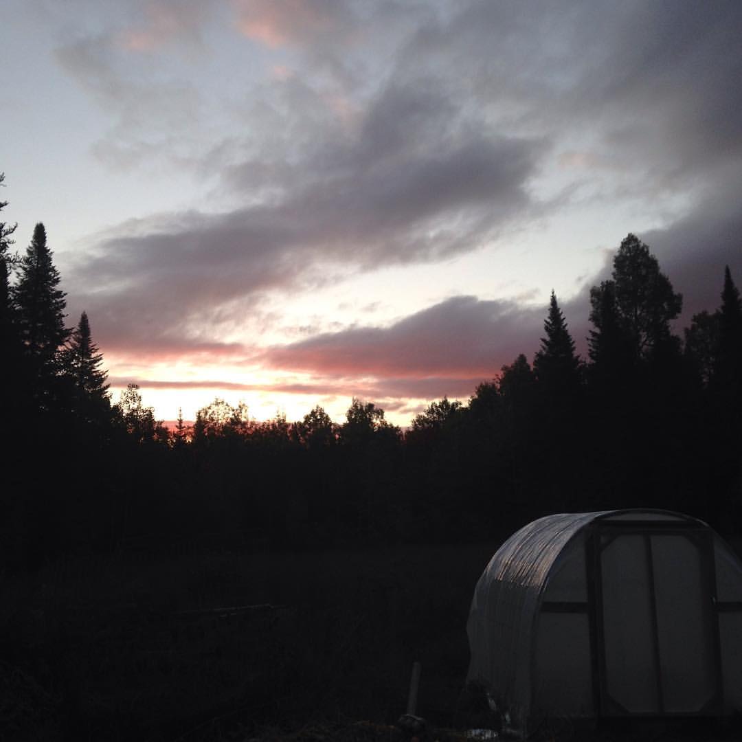
Sunrise over the greenhouse. Hard frosts and falling leaves, autumn in the happy valley.

Field school pond and field, guide shack on the left.

First day canoeing, paddle stroke demo on the dock & wood canvas boat in the water.
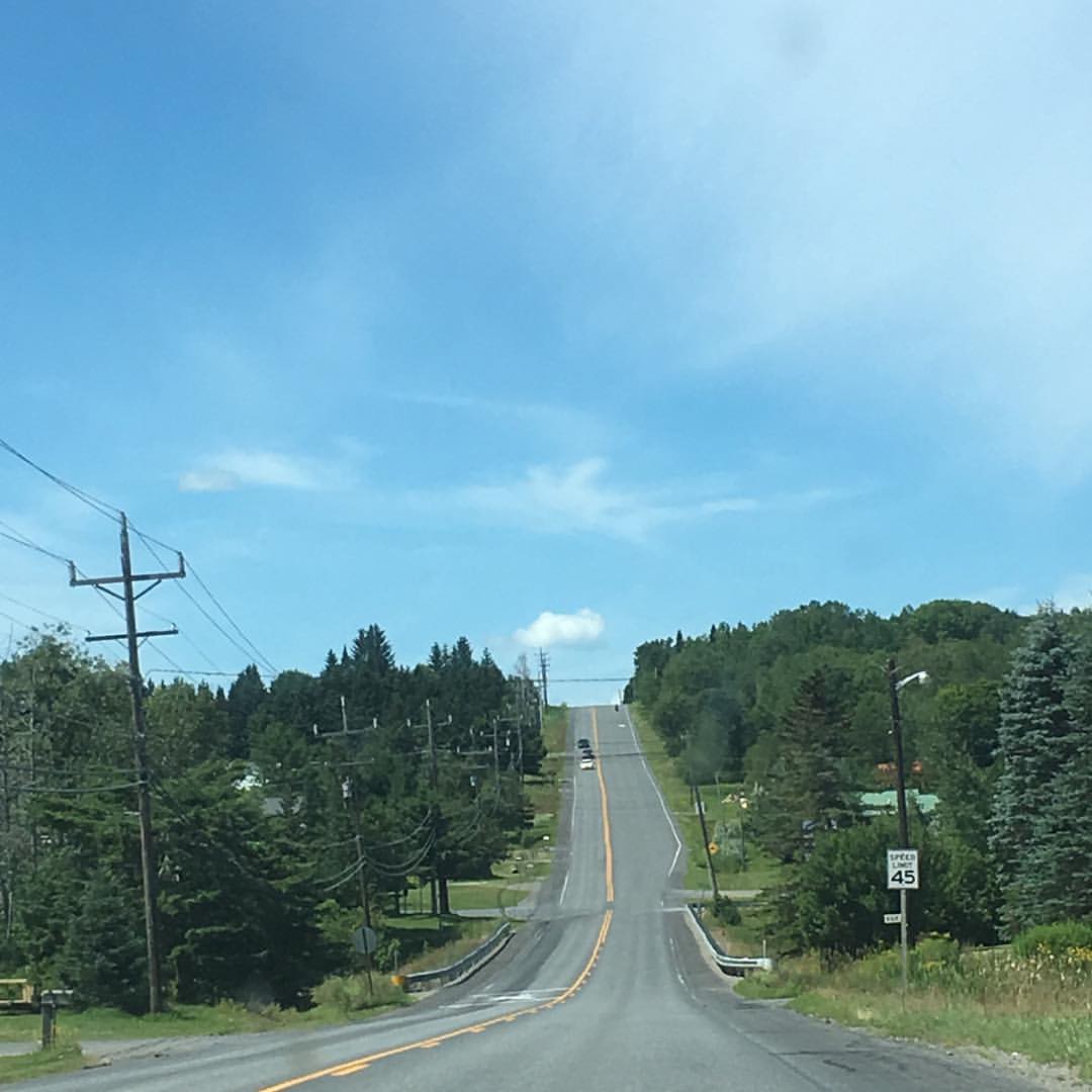
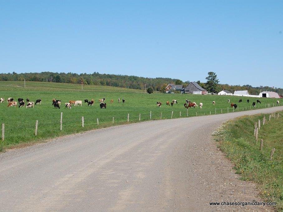
Aroostook County intimates great vastness of scale. #northernmaine #aroostook #hills #summer

Yep, gear yer kids up for MUTTON BUSTIN'!!! #sheep #madmaxwoolyroad
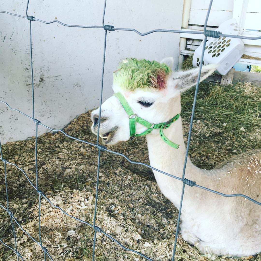
Manic Panic alpacas at the Presque Isle fair. #agricultural #alpaca
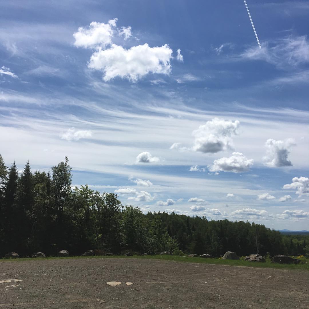
The view from Haystack trailhead lot. #maine #hiking
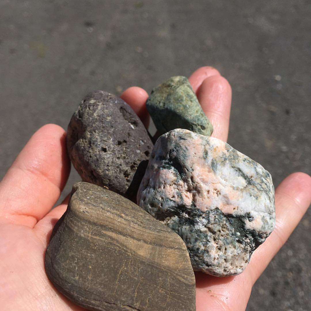
Also lots of crazy rocks. So many glacial #erratics in #northern #Maine! #rocks #geology
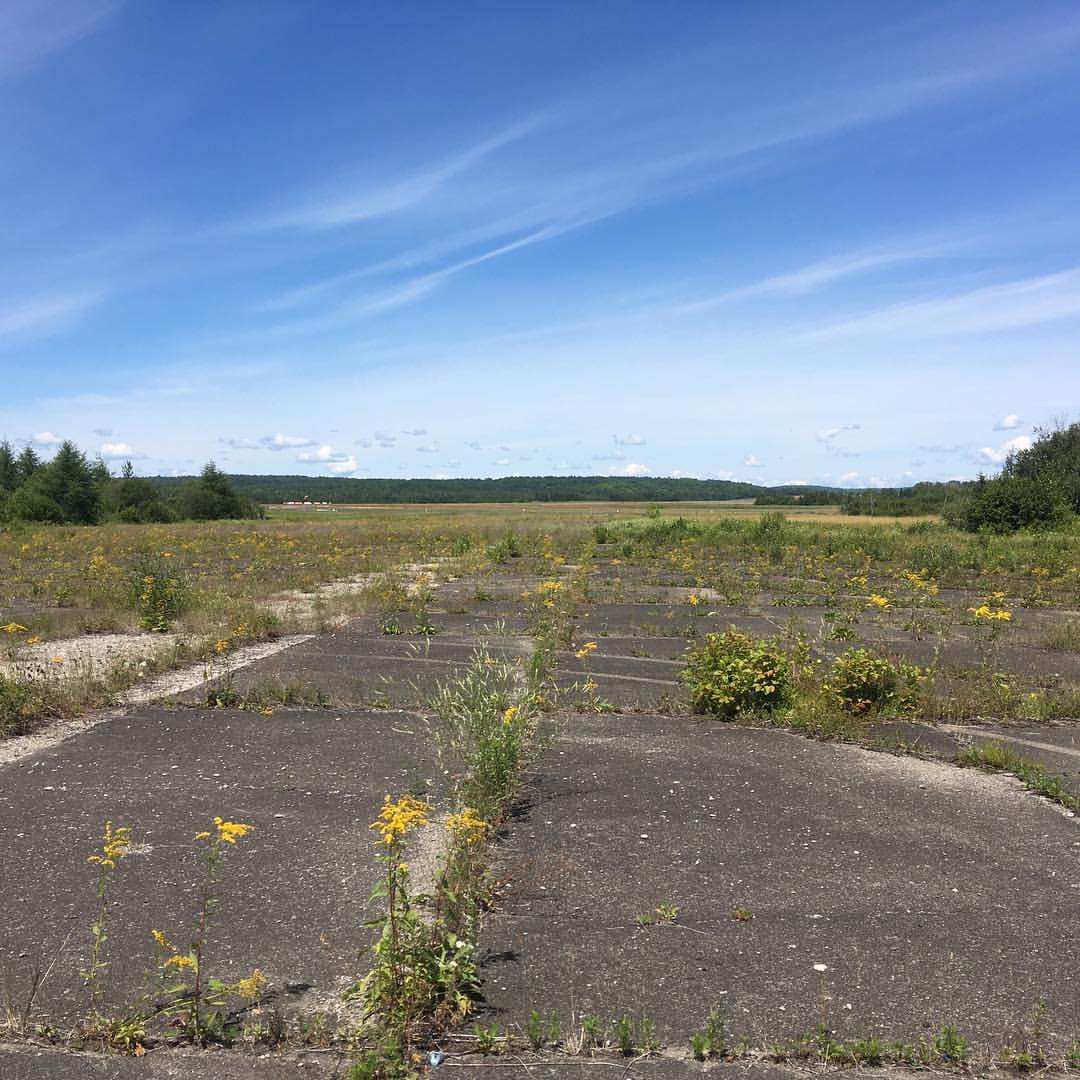
Found part of an #abandoned #airfield (near active one w/windsock in distance) behind railroad tracks. #presqueisle #maine

Hiking the trails at the field school.
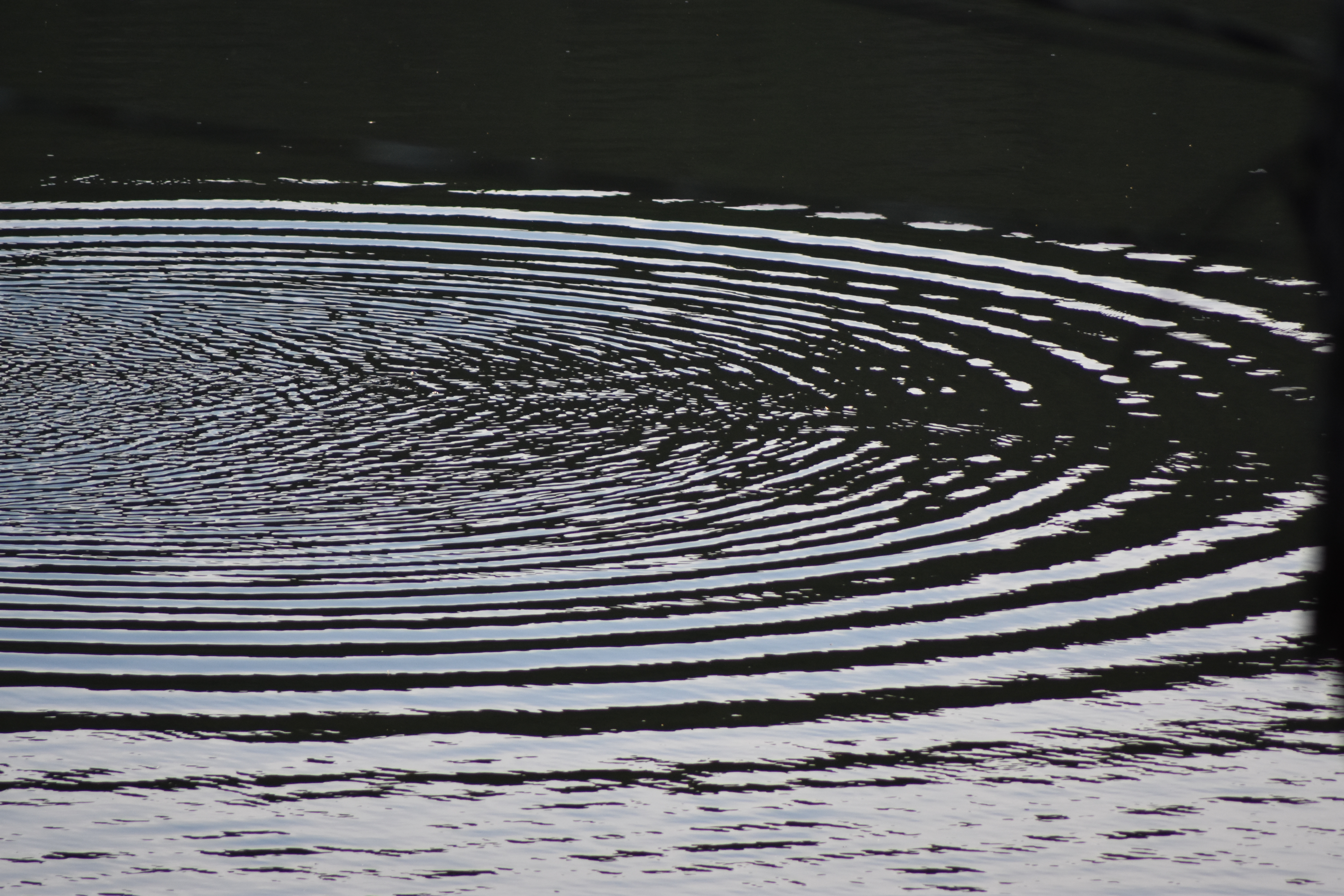
circling the lake
Mass Accent Presque Island ME 8/28/2015 6am
ph-10088
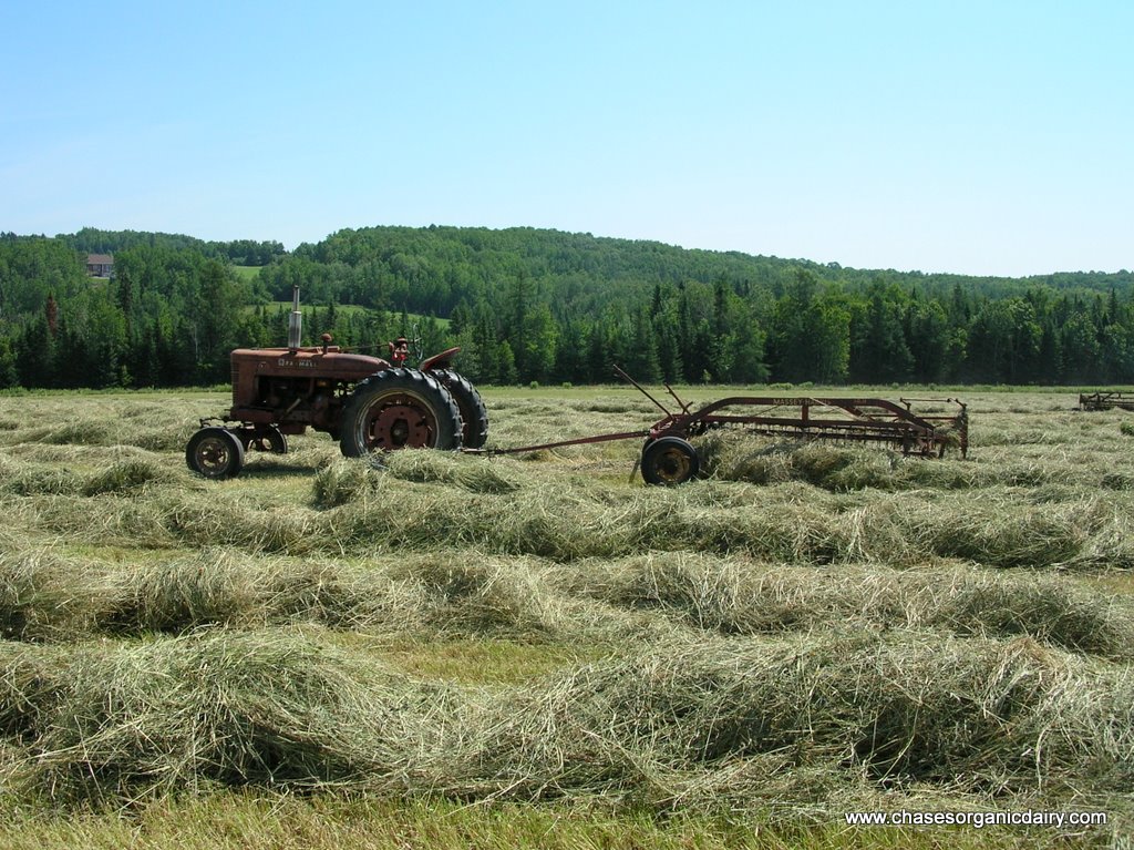
DSCN7089.JPG
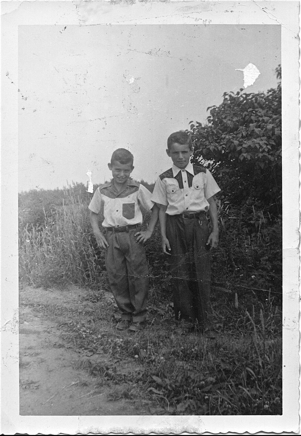
Vern & Jerry next to the lilac bush
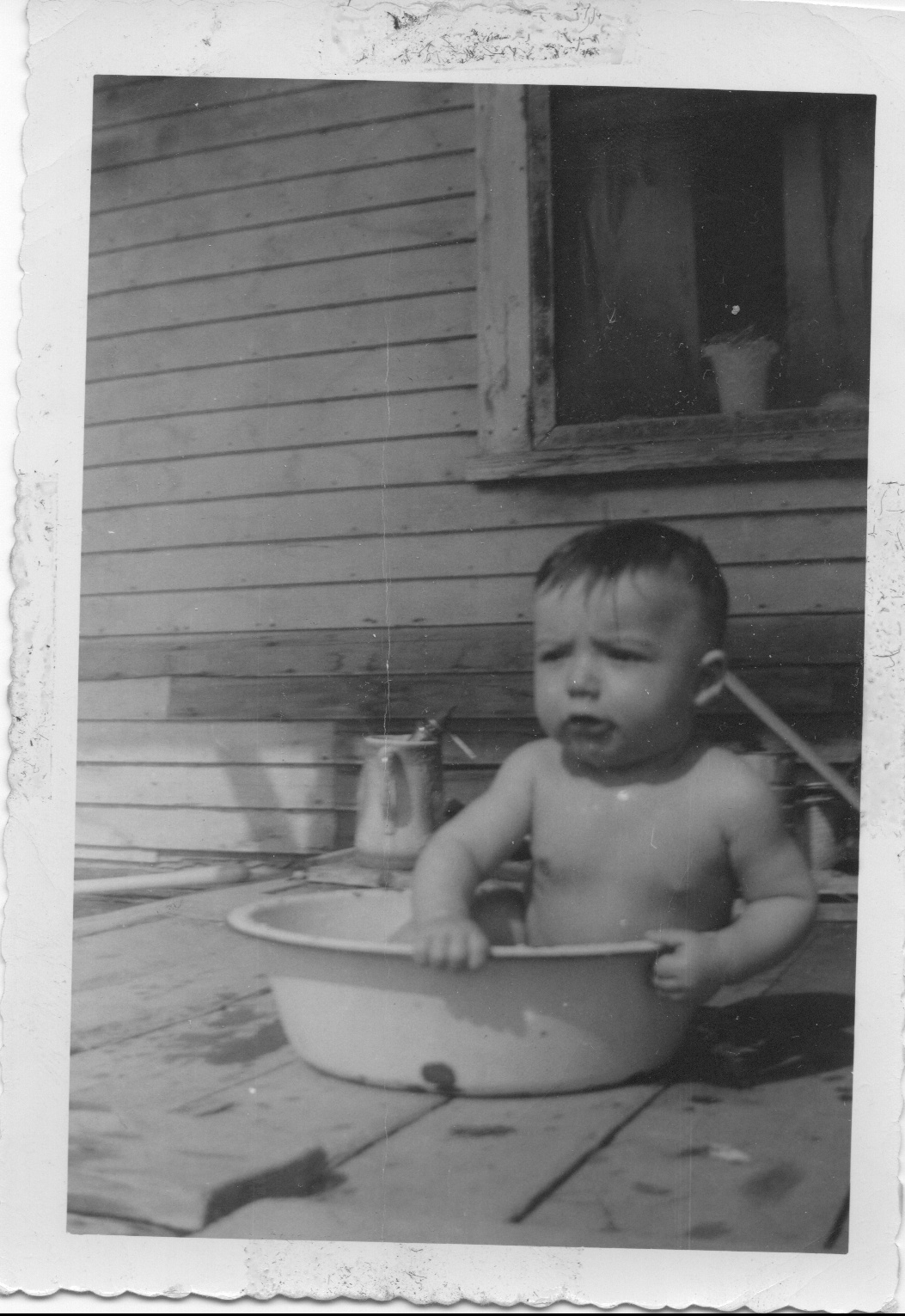
Kevin in his bath
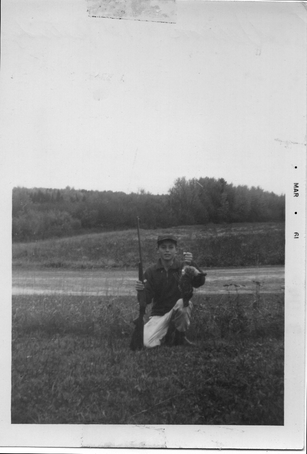
Vern with the .410 & his first partridge at age 15

Vern & Kevin dressed for a swim in the cold pond
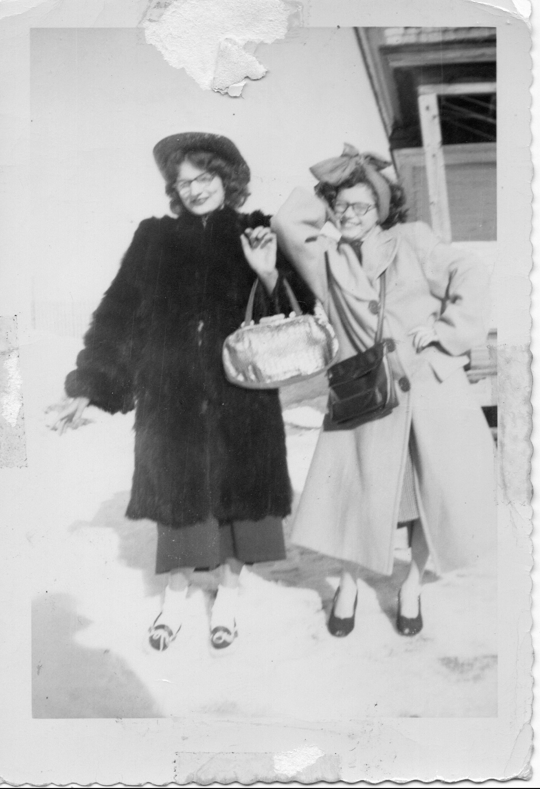
Patty & Marilynn posing
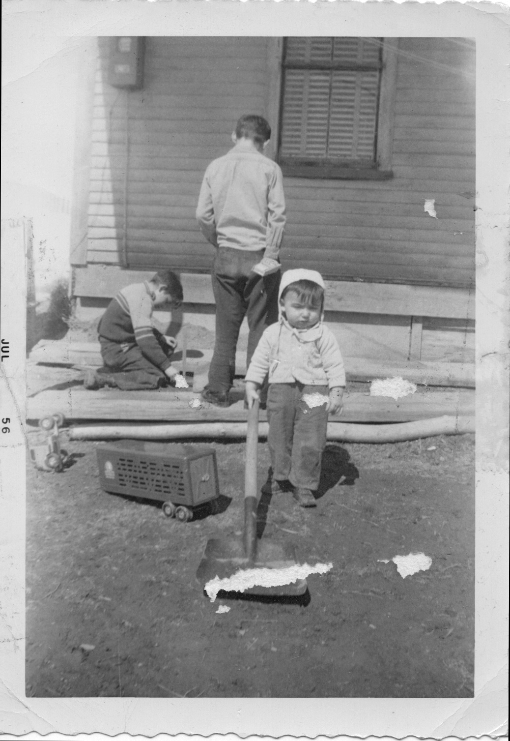
Vern, Jerry, & Kevin playing in the dirt

Tom, Jerry, & Vern next to the green '41 Chevy
アメリカ合衆国 〒 メイン州 キャッスル・ヒル ヘイスタック山の地図
別の場所を検索
近所の場所
アメリカ合衆国 メイン州 キャッスル・ヒル
アメリカ合衆国 メイン州 メープルトン
アメリカ合衆国 〒 メイン州 チャップマン
アメリカ合衆国 〒 メイン州 メープルトン ステート・ロード
Carvell Rd, Mapleton, ME アメリカ合衆国
31 Riverside Dr, Washburn, ME アメリカ合衆国
State Rd, Mapleton, ME アメリカ合衆国State Road Advent Christian Church
アメリカ合衆国 メイン州 ウォッシュバーン
アメリカ合衆国 〒 メイン州 アシュランド
Sheridan Rd, Ashland, ME アメリカ合衆国
Chapman Rd, Chapman, ME アメリカ合衆国
Aroostook Scenic Hwy, Ashland, ME アメリカ合衆国
アメリカ合衆国 メイン州 パーハム
89 State St, Presque Isle, ME アメリカ合衆国
アメリカ合衆国 〒 メイン州 マサーディス
ME-11, Masardis, ME アメリカ合衆国
High Meadow Rd, Perham, ME アメリカ合衆国
アメリカ合衆国 メイン州 プレスク・アイル
Spragueville Rd, Presque Isle, ME アメリカ合衆国
24 Barton St, Presque Isle, ME アメリカ合衆国
最近の検索
- アメリカ合衆国 アラスカ州 レッド・ドッグ・マイン日の出日の入り時間
- Am bhf, Borken, ドイツアム・バーンホーフ日の出日の入り時間
- 4th St E, Sonoma, CA, USA日の出日の入り時間
- Oakland Ave, Williamsport, PA アメリカ合衆国日の出日の入り時間
- Via Roma, Pieranica CR, イタリアローマ通り日の出日の入り時間
- クロアチア 〒 ドゥブロブニク GradClock Tower of Dubrovnik日の出日の入り時間
- アルゼンチン チュブ州 トレリュー日の出日の入り時間
- Hartfords Bluff Cir, Mt Pleasant, SC アメリカ合衆国日の出日の入り時間
- 日本、熊本県熊本市北区日の出日の入り時間
- 中華人民共和国 福州市 平潭県 平潭島日の出日の入り時間