George Washington Hwy, Oakland, MD アメリカ合衆国日の出日の入り時間
Location: アメリカ合衆国 > メリーランド州 > ガレット > アメリカ合衆国 〒 メリーランド州 オークランド >
時間帯:
America/New_York
現地時間:
2025-06-30 05:44:28
経度:
-79.437535
緯度:
39.295657
今日の日の出時刻:
05:54:44 AM
今日の日の入時刻:
08:48:25 PM
今日の日長:
14h 53m 41s
明日の日の出時刻:
05:55:13 AM
明日の日の入時刻:
08:48:19 PM
明日の日長:
14h 53m 6s
すべて表示する
| 日付 | 日出 | 日没 | 日長 |
|---|---|---|---|
| 2025年01月01日 | 07:37:33 AM | 05:06:11 PM | 9h 28m 38s |
| 2025年01月02日 | 07:37:37 AM | 05:07:02 PM | 9h 29m 25s |
| 2025年01月03日 | 07:37:39 AM | 05:07:54 PM | 9h 30m 15s |
| 2025年01月04日 | 07:37:38 AM | 05:08:48 PM | 9h 31m 10s |
| 2025年01月05日 | 07:37:36 AM | 05:09:44 PM | 9h 32m 8s |
| 2025年01月06日 | 07:37:31 AM | 05:10:40 PM | 9h 33m 9s |
| 2025年01月07日 | 07:37:25 AM | 05:11:38 PM | 9h 34m 13s |
| 2025年01月08日 | 07:37:16 AM | 05:12:36 PM | 9h 35m 20s |
| 2025年01月09日 | 07:37:04 AM | 05:13:36 PM | 9h 36m 32s |
| 2025年01月10日 | 07:36:51 AM | 05:14:37 PM | 9h 37m 46s |
| 2025年01月11日 | 07:36:36 AM | 05:15:38 PM | 9h 39m 2s |
| 2025年01月12日 | 07:36:18 AM | 05:16:41 PM | 9h 40m 23s |
| 2025年01月13日 | 07:35:58 AM | 05:17:44 PM | 9h 41m 46s |
| 2025年01月14日 | 07:35:37 AM | 05:18:49 PM | 9h 43m 12s |
| 2025年01月15日 | 07:35:13 AM | 05:19:54 PM | 9h 44m 41s |
| 2025年01月16日 | 07:34:47 AM | 05:20:59 PM | 9h 46m 12s |
| 2025年01月17日 | 07:34:19 AM | 05:22:06 PM | 9h 47m 47s |
| 2025年01月18日 | 07:33:49 AM | 05:23:13 PM | 9h 49m 24s |
| 2025年01月19日 | 07:33:17 AM | 05:24:20 PM | 9h 51m 3s |
| 2025年01月20日 | 07:32:43 AM | 05:25:28 PM | 9h 52m 45s |
| 2025年01月21日 | 07:32:06 AM | 05:26:36 PM | 9h 54m 30s |
| 2025年01月22日 | 07:31:28 AM | 05:27:45 PM | 9h 56m 17s |
| 2025年01月23日 | 07:30:49 AM | 05:28:54 PM | 9h 58m 5s |
| 2025年01月24日 | 07:30:07 AM | 05:30:04 PM | 9h 59m 57s |
| 2025年01月25日 | 07:29:23 AM | 05:31:13 PM | 10h 1m 50s |
| 2025年01月26日 | 07:28:38 AM | 05:32:23 PM | 10h 3m 45s |
| 2025年01月27日 | 07:27:50 AM | 05:33:33 PM | 10h 5m 43s |
| 2025年01月28日 | 07:27:01 AM | 05:34:44 PM | 10h 7m 43s |
| 2025年01月29日 | 07:26:10 AM | 05:35:54 PM | 10h 9m 44s |
| 2025年01月30日 | 07:25:18 AM | 05:37:05 PM | 10h 11m 47s |
| 2025年01月31日 | 07:24:23 AM | 05:38:15 PM | 10h 13m 52s |
| 2025年02月01日 | 07:23:28 AM | 05:39:26 PM | 10h 15m 58s |
| 2025年02月02日 | 07:22:30 AM | 05:40:36 PM | 10h 18m 6s |
| 2025年02月03日 | 07:21:31 AM | 05:41:47 PM | 10h 20m 16s |
| 2025年02月04日 | 07:20:30 AM | 05:42:57 PM | 10h 22m 27s |
| 2025年02月05日 | 07:19:28 AM | 05:44:07 PM | 10h 24m 39s |
| 2025年02月06日 | 07:18:24 AM | 05:45:18 PM | 10h 26m 54s |
| 2025年02月07日 | 07:17:19 AM | 05:46:28 PM | 10h 29m 9s |
| 2025年02月08日 | 07:16:13 AM | 05:47:38 PM | 10h 31m 25s |
| 2025年02月09日 | 07:15:05 AM | 05:48:47 PM | 10h 33m 42s |
| 2025年02月10日 | 07:13:56 AM | 05:49:57 PM | 10h 36m 1s |
| 2025年02月11日 | 07:12:45 AM | 05:51:06 PM | 10h 38m 21s |
| 2025年02月12日 | 07:11:33 AM | 05:52:15 PM | 10h 40m 42s |
| 2025年02月13日 | 07:10:20 AM | 05:53:24 PM | 10h 43m 4s |
| 2025年02月14日 | 07:09:06 AM | 05:54:33 PM | 10h 45m 27s |
| 2025年02月15日 | 07:07:50 AM | 05:55:41 PM | 10h 47m 51s |
| 2025年02月16日 | 07:06:34 AM | 05:56:49 PM | 10h 50m 15s |
| 2025年02月17日 | 07:05:16 AM | 05:57:57 PM | 10h 52m 41s |
| 2025年02月18日 | 07:03:57 AM | 05:59:05 PM | 10h 55m 8s |
| 2025年02月19日 | 07:02:38 AM | 06:00:12 PM | 10h 57m 34s |
| 2025年02月20日 | 07:01:17 AM | 06:01:19 PM | 11h 0m 2s |
| 2025年02月21日 | 06:59:55 AM | 06:02:25 PM | 11h 2m 30s |
| 2025年02月22日 | 06:58:32 AM | 06:03:32 PM | 11h 5m 0s |
| 2025年02月23日 | 06:57:09 AM | 06:04:38 PM | 11h 7m 29s |
| 2025年02月24日 | 06:55:44 AM | 06:05:43 PM | 11h 9m 59s |
| 2025年02月25日 | 06:54:19 AM | 06:06:49 PM | 11h 12m 30s |
| 2025年02月26日 | 06:52:53 AM | 06:07:54 PM | 11h 15m 1s |
| 2025年02月27日 | 06:51:26 AM | 06:08:59 PM | 11h 17m 33s |
| 2025年02月28日 | 06:49:59 AM | 06:10:03 PM | 11h 20m 4s |
| 2025年03月01日 | 06:48:31 AM | 06:11:07 PM | 11h 22m 36s |
| 2025年03月02日 | 06:47:02 AM | 06:12:11 PM | 11h 25m 9s |
| 2025年03月03日 | 06:45:32 AM | 06:13:15 PM | 11h 27m 43s |
| 2025年03月04日 | 06:44:02 AM | 06:14:18 PM | 11h 30m 16s |
| 2025年03月05日 | 06:42:31 AM | 06:15:21 PM | 11h 32m 50s |
| 2025年03月06日 | 06:41:00 AM | 06:16:24 PM | 11h 35m 24s |
| 2025年03月07日 | 06:39:28 AM | 06:17:26 PM | 11h 37m 58s |
| 2025年03月08日 | 06:37:56 AM | 06:18:28 PM | 11h 40m 32s |
| 2025年03月09日 | 07:36:27 AM | 07:19:28 PM | 11h 43m 1s |
| 2025年03月10日 | 07:34:54 AM | 07:20:29 PM | 11h 45m 35s |
| 2025年03月11日 | 07:33:21 AM | 07:21:31 PM | 11h 48m 10s |
| 2025年03月12日 | 07:31:47 AM | 07:22:32 PM | 11h 50m 45s |
| 2025年03月13日 | 07:30:13 AM | 07:23:33 PM | 11h 53m 20s |
| 2025年03月14日 | 07:28:39 AM | 07:24:34 PM | 11h 55m 55s |
| 2025年03月15日 | 07:27:04 AM | 07:25:35 PM | 11h 58m 31s |
| 2025年03月16日 | 07:25:29 AM | 07:26:35 PM | 12h 1m 6s |
| 2025年03月17日 | 07:23:54 AM | 07:27:35 PM | 12h 3m 41s |
| 2025年03月18日 | 07:22:19 AM | 07:28:35 PM | 12h 6m 16s |
| 2025年03月19日 | 07:20:44 AM | 07:29:35 PM | 12h 8m 51s |
| 2025年03月20日 | 07:19:08 AM | 07:30:35 PM | 12h 11m 27s |
| 2025年03月21日 | 07:17:33 AM | 07:31:35 PM | 12h 14m 2s |
| 2025年03月22日 | 07:15:57 AM | 07:32:34 PM | 12h 16m 37s |
| 2025年03月23日 | 07:14:22 AM | 07:33:34 PM | 12h 19m 12s |
| 2025年03月24日 | 07:12:46 AM | 07:34:33 PM | 12h 21m 47s |
| 2025年03月25日 | 07:11:11 AM | 07:35:32 PM | 12h 24m 21s |
| 2025年03月26日 | 07:09:36 AM | 07:36:31 PM | 12h 26m 55s |
| 2025年03月27日 | 07:08:00 AM | 07:37:31 PM | 12h 29m 31s |
| 2025年03月28日 | 07:06:25 AM | 07:38:30 PM | 12h 32m 5s |
| 2025年03月29日 | 07:04:50 AM | 07:39:28 PM | 12h 34m 38s |
| 2025年03月30日 | 07:03:16 AM | 07:40:27 PM | 12h 37m 11s |
| 2025年03月31日 | 07:01:41 AM | 07:41:26 PM | 12h 39m 45s |
| 2025年04月01日 | 07:00:07 AM | 07:42:25 PM | 12h 42m 18s |
| 2025年04月02日 | 06:58:33 AM | 07:43:24 PM | 12h 44m 51s |
| 2025年04月03日 | 06:56:59 AM | 07:44:23 PM | 12h 47m 24s |
| 2025年04月04日 | 06:55:26 AM | 07:45:21 PM | 12h 49m 55s |
| 2025年04月05日 | 06:53:53 AM | 07:46:20 PM | 12h 52m 27s |
| 2025年04月06日 | 06:52:21 AM | 07:47:19 PM | 12h 54m 58s |
| 2025年04月07日 | 06:50:49 AM | 07:48:18 PM | 12h 57m 29s |
| 2025年04月08日 | 06:49:17 AM | 07:49:17 PM | 13h 0m 0s |
| 2025年04月09日 | 06:47:46 AM | 07:50:16 PM | 13h 2m 30s |
| 2025年04月10日 | 06:46:15 AM | 07:51:14 PM | 13h 4m 59s |
| 2025年04月11日 | 06:44:45 AM | 07:52:13 PM | 13h 7m 28s |
| 2025年04月12日 | 06:43:16 AM | 07:53:12 PM | 13h 9m 56s |
| 2025年04月13日 | 06:41:47 AM | 07:54:11 PM | 13h 12m 24s |
| 2025年04月14日 | 06:40:19 AM | 07:55:10 PM | 13h 14m 51s |
| 2025年04月15日 | 06:38:52 AM | 07:56:09 PM | 13h 17m 17s |
| 2025年04月16日 | 06:37:25 AM | 07:57:08 PM | 13h 19m 43s |
| 2025年04月17日 | 06:35:59 AM | 07:58:07 PM | 13h 22m 8s |
| 2025年04月18日 | 06:34:34 AM | 07:59:06 PM | 13h 24m 32s |
| 2025年04月19日 | 06:33:10 AM | 08:00:05 PM | 13h 26m 55s |
| 2025年04月20日 | 06:31:46 AM | 08:01:05 PM | 13h 29m 19s |
| 2025年04月21日 | 06:30:24 AM | 08:02:04 PM | 13h 31m 40s |
| 2025年04月22日 | 06:29:02 AM | 08:03:03 PM | 13h 34m 1s |
| 2025年04月23日 | 06:27:41 AM | 08:04:02 PM | 13h 36m 21s |
| 2025年04月24日 | 06:26:22 AM | 08:05:01 PM | 13h 38m 39s |
| 2025年04月25日 | 06:25:03 AM | 08:06:00 PM | 13h 40m 57s |
| 2025年04月26日 | 06:23:45 AM | 08:06:59 PM | 13h 43m 14s |
| 2025年04月27日 | 06:22:28 AM | 08:07:58 PM | 13h 45m 30s |
| 2025年04月28日 | 06:21:13 AM | 08:08:57 PM | 13h 47m 44s |
| 2025年04月29日 | 06:19:58 AM | 08:09:56 PM | 13h 49m 58s |
| 2025年04月30日 | 06:18:45 AM | 08:10:55 PM | 13h 52m 10s |
| 2025年05月01日 | 06:17:33 AM | 08:11:54 PM | 13h 54m 21s |
| 2025年05月02日 | 06:16:22 AM | 08:12:52 PM | 13h 56m 30s |
| 2025年05月03日 | 06:15:12 AM | 08:13:51 PM | 13h 58m 39s |
| 2025年05月04日 | 06:14:04 AM | 08:14:49 PM | 14h 0m 45s |
| 2025年05月05日 | 06:12:56 AM | 08:15:47 PM | 14h 2m 51s |
| 2025年05月06日 | 06:11:51 AM | 08:16:45 PM | 14h 4m 54s |
| 2025年05月07日 | 06:10:46 AM | 08:17:42 PM | 14h 6m 56s |
| 2025年05月08日 | 06:09:43 AM | 08:18:40 PM | 14h 8m 57s |
| 2025年05月09日 | 06:08:41 AM | 08:19:37 PM | 14h 10m 56s |
| 2025年05月10日 | 06:07:41 AM | 08:20:34 PM | 14h 12m 53s |
| 2025年05月11日 | 06:06:43 AM | 08:21:30 PM | 14h 14m 47s |
| 2025年05月12日 | 06:05:45 AM | 08:22:27 PM | 14h 16m 42s |
| 2025年05月13日 | 06:04:50 AM | 08:23:22 PM | 14h 18m 32s |
| 2025年05月14日 | 06:03:56 AM | 08:24:18 PM | 14h 20m 22s |
| 2025年05月15日 | 06:03:03 AM | 08:25:12 PM | 14h 22m 9s |
| 2025年05月16日 | 06:02:12 AM | 08:26:07 PM | 14h 23m 55s |
| 2025年05月17日 | 06:01:23 AM | 08:27:01 PM | 14h 25m 38s |
| 2025年05月18日 | 06:00:35 AM | 08:27:54 PM | 14h 27m 19s |
| 2025年05月19日 | 05:59:49 AM | 08:28:47 PM | 14h 28m 58s |
| 2025年05月20日 | 05:59:05 AM | 08:29:39 PM | 14h 30m 34s |
| 2025年05月21日 | 05:58:22 AM | 08:30:30 PM | 14h 32m 8s |
| 2025年05月22日 | 05:57:42 AM | 08:31:21 PM | 14h 33m 39s |
| 2025年05月23日 | 05:57:02 AM | 08:32:11 PM | 14h 35m 9s |
| 2025年05月24日 | 05:56:25 AM | 08:33:00 PM | 14h 36m 35s |
| 2025年05月25日 | 05:55:50 AM | 08:33:49 PM | 14h 37m 59s |
| 2025年05月26日 | 05:55:16 AM | 08:34:36 PM | 14h 39m 20s |
| 2025年05月27日 | 05:54:44 AM | 08:35:23 PM | 14h 40m 39s |
| 2025年05月28日 | 05:54:14 AM | 08:36:09 PM | 14h 41m 55s |
| 2025年05月29日 | 05:53:46 AM | 08:36:53 PM | 14h 43m 7s |
| 2025年05月30日 | 05:53:20 AM | 08:37:37 PM | 14h 44m 17s |
| 2025年05月31日 | 05:52:55 AM | 08:38:20 PM | 14h 45m 25s |
| 2025年06月01日 | 05:52:33 AM | 08:39:01 PM | 14h 46m 28s |
| 2025年06月02日 | 05:52:12 AM | 08:39:42 PM | 14h 47m 30s |
| 2025年06月03日 | 05:51:54 AM | 08:40:21 PM | 14h 48m 27s |
| 2025年06月04日 | 05:51:37 AM | 08:40:59 PM | 14h 49m 22s |
| 2025年06月05日 | 05:51:22 AM | 08:41:36 PM | 14h 50m 14s |
| 2025年06月06日 | 05:51:09 AM | 08:42:11 PM | 14h 51m 2s |
| 2025年06月07日 | 05:50:58 AM | 08:42:45 PM | 14h 51m 47s |
| 2025年06月08日 | 05:50:48 AM | 08:43:18 PM | 14h 52m 30s |
| 2025年06月09日 | 05:50:41 AM | 08:43:49 PM | 14h 53m 8s |
| 2025年06月10日 | 05:50:36 AM | 08:44:19 PM | 14h 53m 43s |
| 2025年06月11日 | 05:50:32 AM | 08:44:47 PM | 14h 54m 15s |
| 2025年06月12日 | 05:50:30 AM | 08:45:14 PM | 14h 54m 44s |
| 2025年06月13日 | 05:50:30 AM | 08:45:39 PM | 14h 55m 9s |
| 2025年06月14日 | 05:50:32 AM | 08:46:03 PM | 14h 55m 31s |
| 2025年06月15日 | 05:50:36 AM | 08:46:25 PM | 14h 55m 49s |
| 2025年06月16日 | 05:50:42 AM | 08:46:45 PM | 14h 56m 3s |
| 2025年06月17日 | 05:50:49 AM | 08:47:04 PM | 14h 56m 15s |
| 2025年06月18日 | 05:50:58 AM | 08:47:21 PM | 14h 56m 23s |
| 2025年06月19日 | 05:51:09 AM | 08:47:36 PM | 14h 56m 27s |
| 2025年06月20日 | 05:51:22 AM | 08:47:49 PM | 14h 56m 27s |
| 2025年06月21日 | 05:51:36 AM | 08:48:01 PM | 14h 56m 25s |
| 2025年06月22日 | 05:51:53 AM | 08:48:11 PM | 14h 56m 18s |
| 2025年06月23日 | 05:52:10 AM | 08:48:19 PM | 14h 56m 9s |
| 2025年06月24日 | 05:52:30 AM | 08:48:25 PM | 14h 55m 55s |
| 2025年06月25日 | 05:52:51 AM | 08:48:29 PM | 14h 55m 38s |
| 2025年06月26日 | 05:53:13 AM | 08:48:32 PM | 14h 55m 19s |
| 2025年06月27日 | 05:53:37 AM | 08:48:32 PM | 14h 54m 55s |
| 2025年06月28日 | 05:54:03 AM | 08:48:31 PM | 14h 54m 28s |
| 2025年06月29日 | 05:54:30 AM | 08:48:28 PM | 14h 53m 58s |
| 2025年06月30日 | 05:54:58 AM | 08:48:22 PM | 14h 53m 24s |
| 2025年07月01日 | 05:55:28 AM | 08:48:15 PM | 14h 52m 47s |
| 2025年07月02日 | 05:56:00 AM | 08:48:06 PM | 14h 52m 6s |
| 2025年07月03日 | 05:56:32 AM | 08:47:55 PM | 14h 51m 23s |
| 2025年07月04日 | 05:57:06 AM | 08:47:42 PM | 14h 50m 36s |
| 2025年07月05日 | 05:57:41 AM | 08:47:27 PM | 14h 49m 46s |
| 2025年07月06日 | 05:58:17 AM | 08:47:10 PM | 14h 48m 53s |
| 2025年07月07日 | 05:58:55 AM | 08:46:52 PM | 14h 47m 57s |
| 2025年07月08日 | 05:59:34 AM | 08:46:31 PM | 14h 46m 57s |
| 2025年07月09日 | 06:00:13 AM | 08:46:08 PM | 14h 45m 55s |
| 2025年07月10日 | 06:00:54 AM | 08:45:44 PM | 14h 44m 50s |
| 2025年07月11日 | 06:01:36 AM | 08:45:17 PM | 14h 43m 41s |
| 2025年07月12日 | 06:02:18 AM | 08:44:49 PM | 14h 42m 31s |
| 2025年07月13日 | 06:03:02 AM | 08:44:18 PM | 14h 41m 16s |
| 2025年07月14日 | 06:03:46 AM | 08:43:46 PM | 14h 40m 0s |
| 2025年07月15日 | 06:04:32 AM | 08:43:12 PM | 14h 38m 40s |
| 2025年07月16日 | 06:05:18 AM | 08:42:36 PM | 14h 37m 18s |
| 2025年07月17日 | 06:06:05 AM | 08:41:59 PM | 14h 35m 54s |
| 2025年07月18日 | 06:06:52 AM | 08:41:19 PM | 14h 34m 27s |
| 2025年07月19日 | 06:07:41 AM | 08:40:38 PM | 14h 32m 57s |
| 2025年07月20日 | 06:08:30 AM | 08:39:55 PM | 14h 31m 25s |
| 2025年07月21日 | 06:09:19 AM | 08:39:10 PM | 14h 29m 51s |
| 2025年07月22日 | 06:10:09 AM | 08:38:23 PM | 14h 28m 14s |
| 2025年07月23日 | 06:11:00 AM | 08:37:35 PM | 14h 26m 35s |
| 2025年07月24日 | 06:11:51 AM | 08:36:45 PM | 14h 24m 54s |
| 2025年07月25日 | 06:12:43 AM | 08:35:54 PM | 14h 23m 11s |
| 2025年07月26日 | 06:13:35 AM | 08:35:00 PM | 14h 21m 25s |
| 2025年07月27日 | 06:14:27 AM | 08:34:06 PM | 14h 19m 39s |
| 2025年07月28日 | 06:15:20 AM | 08:33:09 PM | 14h 17m 49s |
| 2025年07月29日 | 06:16:13 AM | 08:32:11 PM | 14h 15m 58s |
| 2025年07月30日 | 06:17:07 AM | 08:31:12 PM | 14h 14m 5s |
| 2025年07月31日 | 06:18:01 AM | 08:30:11 PM | 14h 12m 10s |
| 2025年08月01日 | 06:18:55 AM | 08:29:08 PM | 14h 10m 13s |
| 2025年08月02日 | 06:19:49 AM | 08:28:04 PM | 14h 8m 15s |
| 2025年08月03日 | 06:20:43 AM | 08:26:59 PM | 14h 6m 16s |
| 2025年08月04日 | 06:21:38 AM | 08:25:52 PM | 14h 4m 14s |
| 2025年08月05日 | 06:22:33 AM | 08:24:44 PM | 14h 2m 11s |
| 2025年08月06日 | 06:23:28 AM | 08:23:35 PM | 14h 0m 7s |
| 2025年08月07日 | 06:24:23 AM | 08:22:24 PM | 13h 58m 1s |
| 2025年08月08日 | 06:25:18 AM | 08:21:12 PM | 13h 55m 54s |
| 2025年08月09日 | 06:26:13 AM | 08:19:59 PM | 13h 53m 46s |
| 2025年08月10日 | 06:27:08 AM | 08:18:45 PM | 13h 51m 37s |
| 2025年08月11日 | 06:28:04 AM | 08:17:29 PM | 13h 49m 25s |
| 2025年08月12日 | 06:28:59 AM | 08:16:13 PM | 13h 47m 14s |
| 2025年08月13日 | 06:29:54 AM | 08:14:55 PM | 13h 45m 1s |
| 2025年08月14日 | 06:30:50 AM | 08:13:36 PM | 13h 42m 46s |
| 2025年08月15日 | 06:31:45 AM | 08:12:16 PM | 13h 40m 31s |
| 2025年08月16日 | 06:32:41 AM | 08:10:55 PM | 13h 38m 14s |
| 2025年08月17日 | 06:33:36 AM | 08:09:33 PM | 13h 35m 57s |
| 2025年08月18日 | 06:34:31 AM | 08:08:10 PM | 13h 33m 39s |
| 2025年08月19日 | 06:35:27 AM | 08:06:46 PM | 13h 31m 19s |
| 2025年08月20日 | 06:36:22 AM | 08:05:21 PM | 13h 28m 59s |
| 2025年08月21日 | 06:37:17 AM | 08:03:56 PM | 13h 26m 39s |
| 2025年08月22日 | 06:38:12 AM | 08:02:29 PM | 13h 24m 17s |
| 2025年08月23日 | 06:39:07 AM | 08:01:02 PM | 13h 21m 55s |
| 2025年08月24日 | 06:40:02 AM | 07:59:34 PM | 13h 19m 32s |
| 2025年08月25日 | 06:40:57 AM | 07:58:05 PM | 13h 17m 8s |
| 2025年08月26日 | 06:41:52 AM | 07:56:36 PM | 13h 14m 44s |
| 2025年08月27日 | 06:42:47 AM | 07:55:06 PM | 13h 12m 19s |
| 2025年08月28日 | 06:43:42 AM | 07:53:35 PM | 13h 9m 53s |
| 2025年08月29日 | 06:44:37 AM | 07:52:03 PM | 13h 7m 26s |
| 2025年08月30日 | 06:45:31 AM | 07:50:31 PM | 13h 5m 0s |
| 2025年08月31日 | 06:46:26 AM | 07:48:59 PM | 13h 2m 33s |
| 2025年09月01日 | 06:47:20 AM | 07:47:26 PM | 13h 0m 6s |
| 2025年09月02日 | 06:48:15 AM | 07:45:52 PM | 12h 57m 37s |
| 2025年09月03日 | 06:49:09 AM | 07:44:18 PM | 12h 55m 9s |
| 2025年09月04日 | 06:50:04 AM | 07:42:43 PM | 12h 52m 39s |
| 2025年09月05日 | 06:50:58 AM | 07:41:08 PM | 12h 50m 10s |
| 2025年09月06日 | 06:51:53 AM | 07:39:33 PM | 12h 47m 40s |
| 2025年09月07日 | 06:52:47 AM | 07:37:57 PM | 12h 45m 10s |
| 2025年09月08日 | 06:53:42 AM | 07:36:21 PM | 12h 42m 39s |
| 2025年09月09日 | 06:54:36 AM | 07:34:45 PM | 12h 40m 9s |
| 2025年09月10日 | 06:55:30 AM | 07:33:08 PM | 12h 37m 38s |
| 2025年09月11日 | 06:56:25 AM | 07:31:31 PM | 12h 35m 6s |
| 2025年09月12日 | 06:57:19 AM | 07:29:54 PM | 12h 32m 35s |
| 2025年09月13日 | 06:58:14 AM | 07:28:17 PM | 12h 30m 3s |
| 2025年09月14日 | 06:59:08 AM | 07:26:40 PM | 12h 27m 32s |
| 2025年09月15日 | 07:00:03 AM | 07:25:02 PM | 12h 24m 59s |
| 2025年09月16日 | 07:00:58 AM | 07:23:25 PM | 12h 22m 27s |
| 2025年09月17日 | 07:01:52 AM | 07:21:47 PM | 12h 19m 55s |
| 2025年09月18日 | 07:02:47 AM | 07:20:09 PM | 12h 17m 22s |
| 2025年09月19日 | 07:03:42 AM | 07:18:32 PM | 12h 14m 50s |
| 2025年09月20日 | 07:04:37 AM | 07:16:54 PM | 12h 12m 17s |
| 2025年09月21日 | 07:05:32 AM | 07:15:16 PM | 12h 9m 44s |
| 2025年09月22日 | 07:06:28 AM | 07:13:39 PM | 12h 7m 11s |
| 2025年09月23日 | 07:07:23 AM | 07:12:01 PM | 12h 4m 38s |
| 2025年09月24日 | 07:08:19 AM | 07:10:24 PM | 12h 2m 5s |
| 2025年09月25日 | 07:09:15 AM | 07:08:47 PM | 11h 59m 32s |
| 2025年09月26日 | 07:10:11 AM | 07:07:10 PM | 11h 56m 59s |
| 2025年09月27日 | 07:11:07 AM | 07:05:34 PM | 11h 54m 27s |
| 2025年09月28日 | 07:12:03 AM | 07:03:57 PM | 11h 51m 54s |
| 2025年09月29日 | 07:13:00 AM | 07:02:21 PM | 11h 49m 21s |
| 2025年09月30日 | 07:13:57 AM | 07:00:45 PM | 11h 46m 48s |
| 2025年10月01日 | 07:14:54 AM | 06:59:10 PM | 11h 44m 16s |
| 2025年10月02日 | 07:15:51 AM | 06:57:35 PM | 11h 41m 44s |
| 2025年10月03日 | 07:16:49 AM | 06:56:00 PM | 11h 39m 11s |
| 2025年10月04日 | 07:17:47 AM | 06:54:26 PM | 11h 36m 39s |
| 2025年10月05日 | 07:18:45 AM | 06:52:53 PM | 11h 34m 8s |
| 2025年10月06日 | 07:19:43 AM | 06:51:20 PM | 11h 31m 37s |
| 2025年10月07日 | 07:20:42 AM | 06:49:47 PM | 11h 29m 5s |
| 2025年10月08日 | 07:21:41 AM | 06:48:15 PM | 11h 26m 34s |
| 2025年10月09日 | 07:22:40 AM | 06:46:44 PM | 11h 24m 4s |
| 2025年10月10日 | 07:23:40 AM | 06:45:13 PM | 11h 21m 33s |
| 2025年10月11日 | 07:24:40 AM | 06:43:43 PM | 11h 19m 3s |
| 2025年10月12日 | 07:25:40 AM | 06:42:13 PM | 11h 16m 33s |
| 2025年10月13日 | 07:26:41 AM | 06:40:45 PM | 11h 14m 4s |
| 2025年10月14日 | 07:27:41 AM | 06:39:17 PM | 11h 11m 36s |
| 2025年10月15日 | 07:28:43 AM | 06:37:50 PM | 11h 9m 7s |
| 2025年10月16日 | 07:29:44 AM | 06:36:23 PM | 11h 6m 39s |
| 2025年10月17日 | 07:30:46 AM | 06:34:58 PM | 11h 4m 12s |
| 2025年10月18日 | 07:31:48 AM | 06:33:33 PM | 11h 1m 45s |
| 2025年10月19日 | 07:32:51 AM | 06:32:10 PM | 10h 59m 19s |
| 2025年10月20日 | 07:33:54 AM | 06:30:47 PM | 10h 56m 53s |
| 2025年10月21日 | 07:34:57 AM | 06:29:26 PM | 10h 54m 29s |
| 2025年10月22日 | 07:36:01 AM | 06:28:05 PM | 10h 52m 4s |
| 2025年10月23日 | 07:37:04 AM | 06:26:46 PM | 10h 49m 42s |
| 2025年10月24日 | 07:38:09 AM | 06:25:27 PM | 10h 47m 18s |
| 2025年10月25日 | 07:39:13 AM | 06:24:10 PM | 10h 44m 57s |
| 2025年10月26日 | 07:40:18 AM | 06:22:54 PM | 10h 42m 36s |
| 2025年10月27日 | 07:41:23 AM | 06:21:39 PM | 10h 40m 16s |
| 2025年10月28日 | 07:42:28 AM | 06:20:25 PM | 10h 37m 57s |
| 2025年10月29日 | 07:43:34 AM | 06:19:13 PM | 10h 35m 39s |
| 2025年10月30日 | 07:44:40 AM | 06:18:02 PM | 10h 33m 22s |
| 2025年10月31日 | 07:45:46 AM | 06:16:52 PM | 10h 31m 6s |
| 2025年11月01日 | 07:46:53 AM | 06:15:44 PM | 10h 28m 51s |
| 2025年11月02日 | 06:48:02 AM | 05:14:34 PM | 10h 26m 32s |
| 2025年11月03日 | 06:49:09 AM | 05:13:29 PM | 10h 24m 20s |
| 2025年11月04日 | 06:50:16 AM | 05:12:25 PM | 10h 22m 9s |
| 2025年11月05日 | 06:51:23 AM | 05:11:22 PM | 10h 19m 59s |
| 2025年11月06日 | 06:52:30 AM | 05:10:22 PM | 10h 17m 52s |
| 2025年11月07日 | 06:53:37 AM | 05:09:22 PM | 10h 15m 45s |
| 2025年11月08日 | 06:54:44 AM | 05:08:25 PM | 10h 13m 41s |
| 2025年11月09日 | 06:55:52 AM | 05:07:29 PM | 10h 11m 37s |
| 2025年11月10日 | 06:56:59 AM | 05:06:34 PM | 10h 9m 35s |
| 2025年11月11日 | 06:58:07 AM | 05:05:42 PM | 10h 7m 35s |
| 2025年11月12日 | 06:59:14 AM | 05:04:51 PM | 10h 5m 37s |
| 2025年11月13日 | 07:00:21 AM | 05:04:02 PM | 10h 3m 41s |
| 2025年11月14日 | 07:01:28 AM | 05:03:15 PM | 10h 1m 47s |
| 2025年11月15日 | 07:02:35 AM | 05:02:29 PM | 9h 59m 54s |
| 2025年11月16日 | 07:03:42 AM | 05:01:46 PM | 9h 58m 4s |
| 2025年11月17日 | 07:04:48 AM | 05:01:04 PM | 9h 56m 16s |
| 2025年11月18日 | 07:05:55 AM | 05:00:25 PM | 9h 54m 30s |
| 2025年11月19日 | 07:07:01 AM | 04:59:47 PM | 9h 52m 46s |
| 2025年11月20日 | 07:08:06 AM | 04:59:11 PM | 9h 51m 5s |
| 2025年11月21日 | 07:09:11 AM | 04:58:38 PM | 9h 49m 27s |
| 2025年11月22日 | 07:10:16 AM | 04:58:06 PM | 9h 47m 50s |
| 2025年11月23日 | 07:11:20 AM | 04:57:36 PM | 9h 46m 16s |
| 2025年11月24日 | 07:12:24 AM | 04:57:09 PM | 9h 44m 45s |
| 2025年11月25日 | 07:13:27 AM | 04:56:43 PM | 9h 43m 16s |
| 2025年11月26日 | 07:14:29 AM | 04:56:20 PM | 9h 41m 51s |
| 2025年11月27日 | 07:15:31 AM | 04:55:59 PM | 9h 40m 28s |
| 2025年11月28日 | 07:16:32 AM | 04:55:40 PM | 9h 39m 8s |
| 2025年11月29日 | 07:17:32 AM | 04:55:23 PM | 9h 37m 51s |
| 2025年11月30日 | 07:18:31 AM | 04:55:08 PM | 9h 36m 37s |
| 2025年12月01日 | 07:19:29 AM | 04:54:56 PM | 9h 35m 27s |
| 2025年12月02日 | 07:20:26 AM | 04:54:46 PM | 9h 34m 20s |
| 2025年12月03日 | 07:21:23 AM | 04:54:38 PM | 9h 33m 15s |
| 2025年12月04日 | 07:22:18 AM | 04:54:32 PM | 9h 32m 14s |
| 2025年12月05日 | 07:23:12 AM | 04:54:28 PM | 9h 31m 16s |
| 2025年12月06日 | 07:24:05 AM | 04:54:27 PM | 9h 30m 22s |
| 2025年12月07日 | 07:24:57 AM | 04:54:27 PM | 9h 29m 30s |
| 2025年12月08日 | 07:25:47 AM | 04:54:30 PM | 9h 28m 43s |
| 2025年12月09日 | 07:26:36 AM | 04:54:36 PM | 9h 28m 0s |
| 2025年12月10日 | 07:27:24 AM | 04:54:43 PM | 9h 27m 19s |
| 2025年12月11日 | 07:28:10 AM | 04:54:53 PM | 9h 26m 43s |
| 2025年12月12日 | 07:28:55 AM | 04:55:04 PM | 9h 26m 9s |
| 2025年12月13日 | 07:29:38 AM | 04:55:18 PM | 9h 25m 40s |
| 2025年12月14日 | 07:30:19 AM | 04:55:34 PM | 9h 25m 15s |
| 2025年12月15日 | 07:30:59 AM | 04:55:53 PM | 9h 24m 54s |
| 2025年12月16日 | 07:31:37 AM | 04:56:13 PM | 9h 24m 36s |
| 2025年12月17日 | 07:32:14 AM | 04:56:35 PM | 9h 24m 21s |
| 2025年12月18日 | 07:32:49 AM | 04:57:00 PM | 9h 24m 11s |
| 2025年12月19日 | 07:33:22 AM | 04:57:26 PM | 9h 24m 4s |
| 2025年12月20日 | 07:33:53 AM | 04:57:55 PM | 9h 24m 2s |
| 2025年12月21日 | 07:34:22 AM | 04:58:25 PM | 9h 24m 3s |
| 2025年12月22日 | 07:34:49 AM | 04:58:57 PM | 9h 24m 8s |
| 2025年12月23日 | 07:35:15 AM | 04:59:32 PM | 9h 24m 17s |
| 2025年12月24日 | 07:35:38 AM | 05:00:08 PM | 9h 24m 30s |
| 2025年12月25日 | 07:36:00 AM | 05:00:46 PM | 9h 24m 46s |
| 2025年12月26日 | 07:36:19 AM | 05:01:25 PM | 9h 25m 6s |
| 2025年12月27日 | 07:36:36 AM | 05:02:07 PM | 9h 25m 31s |
| 2025年12月28日 | 07:36:51 AM | 05:02:50 PM | 9h 25m 59s |
| 2025年12月29日 | 07:37:05 AM | 05:03:35 PM | 9h 26m 30s |
| 2025年12月30日 | 07:37:16 AM | 05:04:21 PM | 9h 27m 5s |
| 2025年12月31日 | 07:37:24 AM | 05:05:09 PM | 9h 27m 45s |
写真

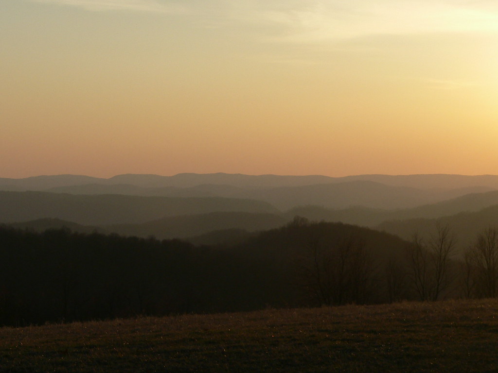
Oakland MD ~ sunset sky - HCS!

West Virginia in the Fall

red skies at night

Cheat River III, Sunset

Wind generators near Oakland, MD

from stemple ridge
as far as the eye can see

good night sunshine

Rural Idyll

A Fall View at Laurel Falls

Hoye-Crest ~ Highest point in Maryland

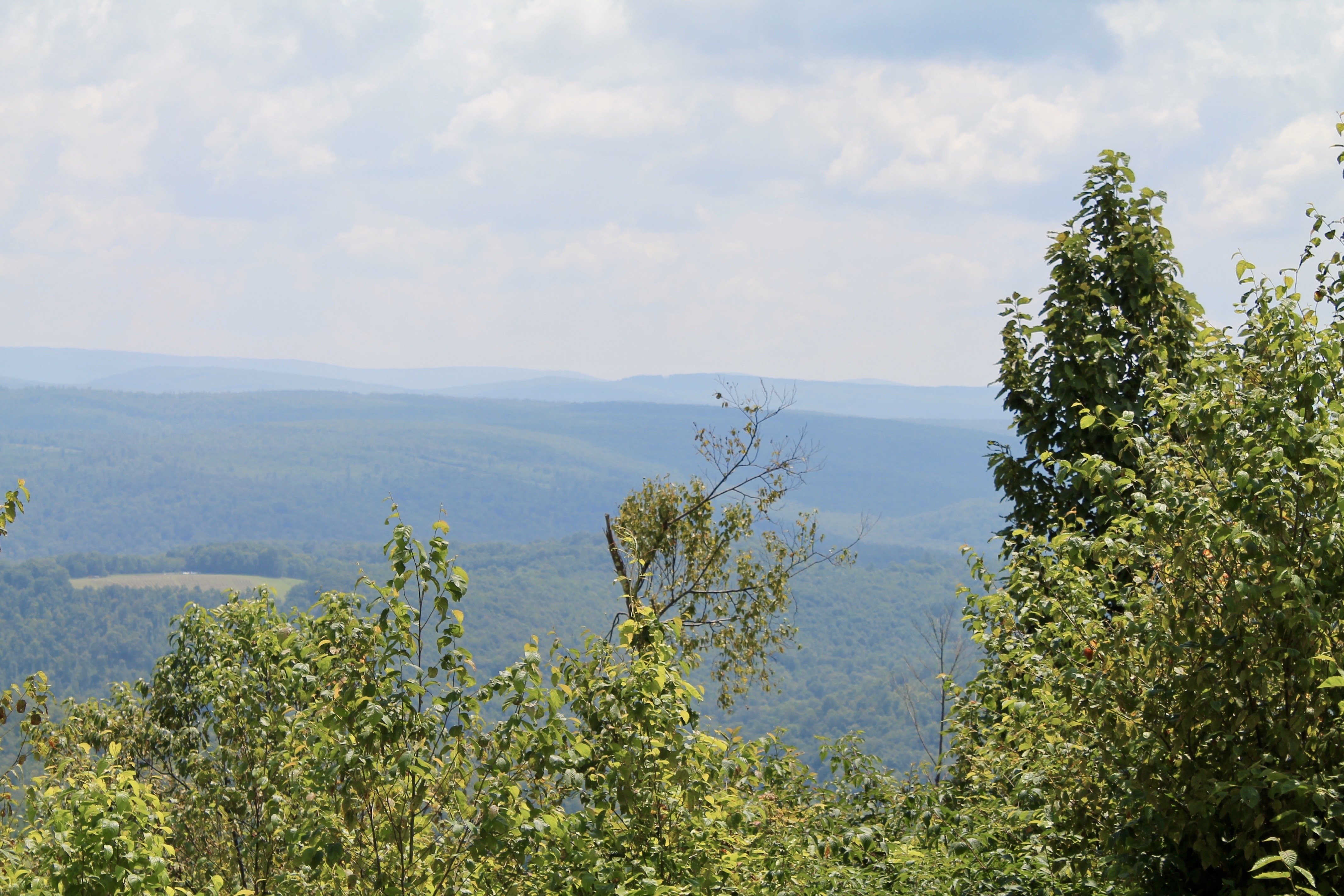
West from 219

View to the south from Backbone Mt.

View of Oakland from the cemetery

View to the south from Backbone Mt.
View to the south from Hoye-Crest

View to the southeast from Hoye-Crest

Backbone Mountain, 2018_05_08
George Washington Hwy, Oakland, MD アメリカ合衆国の地図
別の場所を検索
近所の場所
アメリカ合衆国 〒 メリーランド州 8, レッド・ハウス
Backbone Dr, Oakland, MD アメリカ合衆国Backbone Drive
アメリカ合衆国 〒 ウェスト・バージニア州 ホース・シュー・ラン
Lady Slipper Ln, Oakland, MD アメリカ合衆国
George Washington Hwy, Oakland, MD アメリカ合衆国
HORSE SHOE RN, WV アメリカ合衆国
アメリカ合衆国 〒 ウェスト・バージニア州 エグロン
George Washington Hwy, West Virginia, アメリカ合衆国ジョージ・ワシントン・ハイウェイ
Turner Douglas Rd, Terra Alta, WV アメリカ合衆国
Hogback Rd, Eglon, WV アメリカ合衆国
Slaubaugh Rd, Eglon, WV アメリカ合衆国
White Church Steyer Rd, Oakland, MD アメリカ合衆国
アメリカ合衆国 〒 ウェスト・バージニア州 オーロラ
White Church Steyer Rd, Oakland, MD アメリカ合衆国
56 White Church Steyer Rd, Oakland, MD アメリカ合衆国
アメリカ合衆国 〒 ウェスト・バージニア州 デイビス
Steyer Mine Rd, Oakland, MD アメリカ合衆国
アメリカ合衆国 〒 ウェスト・バージニア州 デイビス カナーン・バレー
アメリカ合衆国 〒 ウェスト・バージニア州 デイビス
アメリカ合衆国 ウェスト・バージニア州 フェアファックス
最近の検索
- アメリカ合衆国 アラスカ州 レッド・ドッグ・マイン日の出日の入り時間
- Am bhf, Borken, ドイツアム・バーンホーフ日の出日の入り時間
- 4th St E, Sonoma, CA, USA日の出日の入り時間
- Oakland Ave, Williamsport, PA アメリカ合衆国日の出日の入り時間
- Via Roma, Pieranica CR, イタリアローマ通り日の出日の入り時間
- クロアチア 〒 ドゥブロブニク GradClock Tower of Dubrovnik日の出日の入り時間
- アルゼンチン チュブ州 トレリュー日の出日の入り時間
- Hartfords Bluff Cir, Mt Pleasant, SC アメリカ合衆国日の出日の入り時間
- 日本、熊本県熊本市北区日の出日の入り時間
- 中華人民共和国 福州市 平潭県 平潭島日の出日の入り時間