E Cedar Canyon Dr, Mayer, AZ アメリカ合衆国日の出日の入り時間
Location: アメリカ合衆国 > アリゾナ州 > ヤヴァパイ > アメリカ合衆国 〒 アリゾナ州 コーデス・レイクス >
時間帯:
America/Phoenix
現地時間:
2025-06-27 12:10:33
経度:
-112.1028464
緯度:
34.3076898
今日の日の出時刻:
05:19:05 AM
今日の日の入時刻:
07:44:38 PM
今日の日長:
14h 25m 33s
明日の日の出時刻:
05:19:29 AM
明日の日の入時刻:
07:44:38 PM
明日の日長:
14h 25m 9s
すべて表示する
| 日付 | 日出 | 日没 | 日長 |
|---|---|---|---|
| 2025年01月01日 | 07:34:47 AM | 05:30:26 PM | 9h 55m 39s |
| 2025年01月02日 | 07:34:55 AM | 05:31:13 PM | 9h 56m 18s |
| 2025年01月03日 | 07:35:01 AM | 05:32:01 PM | 9h 57m 0s |
| 2025年01月04日 | 07:35:05 AM | 05:32:50 PM | 9h 57m 45s |
| 2025年01月05日 | 07:35:08 AM | 05:33:40 PM | 9h 58m 32s |
| 2025年01月06日 | 07:35:08 AM | 05:34:31 PM | 9h 59m 23s |
| 2025年01月07日 | 07:35:07 AM | 05:35:23 PM | 10h 0m 16s |
| 2025年01月08日 | 07:35:04 AM | 05:36:16 PM | 10h 1m 12s |
| 2025年01月09日 | 07:34:59 AM | 05:37:09 PM | 10h 2m 10s |
| 2025年01月10日 | 07:34:52 AM | 05:38:03 PM | 10h 3m 11s |
| 2025年01月11日 | 07:34:43 AM | 05:38:58 PM | 10h 4m 15s |
| 2025年01月12日 | 07:34:33 AM | 05:39:54 PM | 10h 5m 21s |
| 2025年01月13日 | 07:34:20 AM | 05:40:50 PM | 10h 6m 30s |
| 2025年01月14日 | 07:34:06 AM | 05:41:46 PM | 10h 7m 40s |
| 2025年01月15日 | 07:33:49 AM | 05:42:43 PM | 10h 8m 54s |
| 2025年01月16日 | 07:33:31 AM | 05:43:41 PM | 10h 10m 10s |
| 2025年01月17日 | 07:33:11 AM | 05:44:39 PM | 10h 11m 28s |
| 2025年01月18日 | 07:32:50 AM | 05:45:37 PM | 10h 12m 47s |
| 2025年01月19日 | 07:32:26 AM | 05:46:36 PM | 10h 14m 10s |
| 2025年01月20日 | 07:32:01 AM | 05:47:35 PM | 10h 15m 34s |
| 2025年01月21日 | 07:31:34 AM | 05:48:34 PM | 10h 17m 0s |
| 2025年01月22日 | 07:31:05 AM | 05:49:33 PM | 10h 18m 28s |
| 2025年01月23日 | 07:30:34 AM | 05:50:33 PM | 10h 19m 59s |
| 2025年01月24日 | 07:30:02 AM | 05:51:32 PM | 10h 21m 30s |
| 2025年01月25日 | 07:29:28 AM | 05:52:32 PM | 10h 23m 4s |
| 2025年01月26日 | 07:28:52 AM | 05:53:32 PM | 10h 24m 40s |
| 2025年01月27日 | 07:28:15 AM | 05:54:32 PM | 10h 26m 17s |
| 2025年01月28日 | 07:27:36 AM | 05:55:32 PM | 10h 27m 56s |
| 2025年01月29日 | 07:26:55 AM | 05:56:31 PM | 10h 29m 36s |
| 2025年01月30日 | 07:26:13 AM | 05:57:31 PM | 10h 31m 18s |
| 2025年01月31日 | 07:25:30 AM | 05:58:31 PM | 10h 33m 1s |
| 2025年02月01日 | 07:24:45 AM | 05:59:30 PM | 10h 34m 45s |
| 2025年02月02日 | 07:23:58 AM | 06:00:30 PM | 10h 36m 32s |
| 2025年02月03日 | 07:23:10 AM | 06:01:29 PM | 10h 38m 19s |
| 2025年02月04日 | 07:22:20 AM | 06:02:28 PM | 10h 40m 8s |
| 2025年02月05日 | 07:21:29 AM | 06:03:27 PM | 10h 41m 58s |
| 2025年02月06日 | 07:20:37 AM | 06:04:25 PM | 10h 43m 48s |
| 2025年02月07日 | 07:19:43 AM | 06:05:24 PM | 10h 45m 41s |
| 2025年02月08日 | 07:18:48 AM | 06:06:22 PM | 10h 47m 34s |
| 2025年02月09日 | 07:17:52 AM | 06:07:20 PM | 10h 49m 28s |
| 2025年02月10日 | 07:16:54 AM | 06:08:17 PM | 10h 51m 23s |
| 2025年02月11日 | 07:15:56 AM | 06:09:15 PM | 10h 53m 19s |
| 2025年02月12日 | 07:14:56 AM | 06:10:12 PM | 10h 55m 16s |
| 2025年02月13日 | 07:13:55 AM | 06:11:08 PM | 10h 57m 13s |
| 2025年02月14日 | 07:12:52 AM | 06:12:05 PM | 10h 59m 13s |
| 2025年02月15日 | 07:11:49 AM | 06:13:01 PM | 11h 1m 12s |
| 2025年02月16日 | 07:10:44 AM | 06:13:57 PM | 11h 3m 13s |
| 2025年02月17日 | 07:09:39 AM | 06:14:52 PM | 11h 5m 13s |
| 2025年02月18日 | 07:08:32 AM | 06:15:47 PM | 11h 7m 15s |
| 2025年02月19日 | 07:07:25 AM | 06:16:42 PM | 11h 9m 17s |
| 2025年02月20日 | 07:06:16 AM | 06:17:36 PM | 11h 11m 20s |
| 2025年02月21日 | 07:05:07 AM | 06:18:30 PM | 11h 13m 23s |
| 2025年02月22日 | 07:03:57 AM | 06:19:24 PM | 11h 15m 27s |
| 2025年02月23日 | 07:02:46 AM | 06:20:17 PM | 11h 17m 31s |
| 2025年02月24日 | 07:01:34 AM | 06:21:10 PM | 11h 19m 36s |
| 2025年02月25日 | 07:00:21 AM | 06:22:03 PM | 11h 21m 42s |
| 2025年02月26日 | 06:59:08 AM | 06:22:55 PM | 11h 23m 47s |
| 2025年02月27日 | 06:57:53 AM | 06:23:47 PM | 11h 25m 54s |
| 2025年02月28日 | 06:56:38 AM | 06:24:39 PM | 11h 28m 1s |
| 2025年03月01日 | 06:55:23 AM | 06:25:30 PM | 11h 30m 7s |
| 2025年03月02日 | 06:54:07 AM | 06:26:21 PM | 11h 32m 14s |
| 2025年03月03日 | 06:52:50 AM | 06:27:12 PM | 11h 34m 22s |
| 2025年03月04日 | 06:51:32 AM | 06:28:02 PM | 11h 36m 30s |
| 2025年03月05日 | 06:50:14 AM | 06:28:52 PM | 11h 38m 38s |
| 2025年03月06日 | 06:48:56 AM | 06:29:42 PM | 11h 40m 46s |
| 2025年03月07日 | 06:47:37 AM | 06:30:32 PM | 11h 42m 55s |
| 2025年03月08日 | 06:46:18 AM | 06:31:21 PM | 11h 45m 3s |
| 2025年03月09日 | 06:44:58 AM | 06:32:10 PM | 11h 47m 12s |
| 2025年03月10日 | 06:43:37 AM | 06:32:59 PM | 11h 49m 22s |
| 2025年03月11日 | 06:42:17 AM | 06:33:47 PM | 11h 51m 30s |
| 2025年03月12日 | 06:40:56 AM | 06:34:36 PM | 11h 53m 40s |
| 2025年03月13日 | 06:39:35 AM | 06:35:24 PM | 11h 55m 49s |
| 2025年03月14日 | 06:38:13 AM | 06:36:12 PM | 11h 57m 59s |
| 2025年03月15日 | 06:36:52 AM | 06:36:59 PM | 12h 0m 7s |
| 2025年03月16日 | 06:35:30 AM | 06:37:47 PM | 12h 2m 17s |
| 2025年03月17日 | 06:34:07 AM | 06:38:34 PM | 12h 4m 27s |
| 2025年03月18日 | 06:32:45 AM | 06:39:21 PM | 12h 6m 36s |
| 2025年03月19日 | 06:31:23 AM | 06:40:08 PM | 12h 8m 45s |
| 2025年03月20日 | 06:30:00 AM | 06:40:55 PM | 12h 10m 55s |
| 2025年03月21日 | 06:28:38 AM | 06:41:42 PM | 12h 13m 4s |
| 2025年03月22日 | 06:27:15 AM | 06:42:28 PM | 12h 15m 13s |
| 2025年03月23日 | 06:25:52 AM | 06:43:15 PM | 12h 17m 23s |
| 2025年03月24日 | 06:24:30 AM | 06:44:01 PM | 12h 19m 31s |
| 2025年03月25日 | 06:23:07 AM | 06:44:48 PM | 12h 21m 41s |
| 2025年03月26日 | 06:21:45 AM | 06:45:34 PM | 12h 23m 49s |
| 2025年03月27日 | 06:20:22 AM | 06:46:20 PM | 12h 25m 58s |
| 2025年03月28日 | 06:19:00 AM | 06:47:06 PM | 12h 28m 6s |
| 2025年03月29日 | 06:17:38 AM | 06:47:52 PM | 12h 30m 14s |
| 2025年03月30日 | 06:16:16 AM | 06:48:39 PM | 12h 32m 23s |
| 2025年03月31日 | 06:14:54 AM | 06:49:25 PM | 12h 34m 31s |
| 2025年04月01日 | 06:13:33 AM | 06:50:11 PM | 12h 36m 38s |
| 2025年04月02日 | 06:12:12 AM | 06:50:57 PM | 12h 38m 45s |
| 2025年04月03日 | 06:10:51 AM | 06:51:43 PM | 12h 40m 52s |
| 2025年04月04日 | 06:09:31 AM | 06:52:29 PM | 12h 42m 58s |
| 2025年04月05日 | 06:08:10 AM | 06:53:15 PM | 12h 45m 5s |
| 2025年04月06日 | 06:06:51 AM | 06:54:01 PM | 12h 47m 10s |
| 2025年04月07日 | 06:05:31 AM | 06:54:47 PM | 12h 49m 16s |
| 2025年04月08日 | 06:04:13 AM | 06:55:33 PM | 12h 51m 20s |
| 2025年04月09日 | 06:02:54 AM | 06:56:20 PM | 12h 53m 26s |
| 2025年04月10日 | 06:01:36 AM | 06:57:06 PM | 12h 55m 30s |
| 2025年04月11日 | 06:00:19 AM | 06:57:52 PM | 12h 57m 33s |
| 2025年04月12日 | 05:59:02 AM | 06:58:39 PM | 12h 59m 37s |
| 2025年04月13日 | 05:57:46 AM | 06:59:25 PM | 13h 1m 39s |
| 2025年04月14日 | 05:56:31 AM | 07:00:12 PM | 13h 3m 41s |
| 2025年04月15日 | 05:55:16 AM | 07:00:59 PM | 13h 5m 43s |
| 2025年04月16日 | 05:54:02 AM | 07:01:45 PM | 13h 7m 43s |
| 2025年04月17日 | 05:52:48 AM | 07:02:32 PM | 13h 9m 44s |
| 2025年04月18日 | 05:51:35 AM | 07:03:19 PM | 13h 11m 44s |
| 2025年04月19日 | 05:50:23 AM | 07:04:06 PM | 13h 13m 43s |
| 2025年04月20日 | 05:49:12 AM | 07:04:53 PM | 13h 15m 41s |
| 2025年04月21日 | 05:48:02 AM | 07:05:40 PM | 13h 17m 38s |
| 2025年04月22日 | 05:46:52 AM | 07:06:27 PM | 13h 19m 35s |
| 2025年04月23日 | 05:45:44 AM | 07:07:14 PM | 13h 21m 30s |
| 2025年04月24日 | 05:44:36 AM | 07:08:01 PM | 13h 23m 25s |
| 2025年04月25日 | 05:43:29 AM | 07:08:49 PM | 13h 25m 20s |
| 2025年04月26日 | 05:42:24 AM | 07:09:36 PM | 13h 27m 12s |
| 2025年04月27日 | 05:41:19 AM | 07:10:23 PM | 13h 29m 4s |
| 2025年04月28日 | 05:40:15 AM | 07:11:11 PM | 13h 30m 56s |
| 2025年04月29日 | 05:39:12 AM | 07:11:58 PM | 13h 32m 46s |
| 2025年04月30日 | 05:38:10 AM | 07:12:46 PM | 13h 34m 36s |
| 2025年05月01日 | 05:37:10 AM | 07:13:33 PM | 13h 36m 23s |
| 2025年05月02日 | 05:36:10 AM | 07:14:20 PM | 13h 38m 10s |
| 2025年05月03日 | 05:35:12 AM | 07:15:07 PM | 13h 39m 55s |
| 2025年05月04日 | 05:34:15 AM | 07:15:55 PM | 13h 41m 40s |
| 2025年05月05日 | 05:33:19 AM | 07:16:42 PM | 13h 43m 23s |
| 2025年05月06日 | 05:32:24 AM | 07:17:29 PM | 13h 45m 5s |
| 2025年05月07日 | 05:31:31 AM | 07:18:16 PM | 13h 46m 45s |
| 2025年05月08日 | 05:30:39 AM | 07:19:03 PM | 13h 48m 24s |
| 2025年05月09日 | 05:29:48 AM | 07:19:49 PM | 13h 50m 1s |
| 2025年05月10日 | 05:28:58 AM | 07:20:36 PM | 13h 51m 38s |
| 2025年05月11日 | 05:28:10 AM | 07:21:22 PM | 13h 53m 12s |
| 2025年05月12日 | 05:27:23 AM | 07:22:08 PM | 13h 54m 45s |
| 2025年05月13日 | 05:26:37 AM | 07:22:54 PM | 13h 56m 17s |
| 2025年05月14日 | 05:25:53 AM | 07:23:40 PM | 13h 57m 47s |
| 2025年05月15日 | 05:25:11 AM | 07:24:25 PM | 13h 59m 14s |
| 2025年05月16日 | 05:24:29 AM | 07:25:10 PM | 14h 0m 41s |
| 2025年05月17日 | 05:23:50 AM | 07:25:54 PM | 14h 2m 4s |
| 2025年05月18日 | 05:23:11 AM | 07:26:39 PM | 14h 3m 28s |
| 2025年05月19日 | 05:22:34 AM | 07:27:23 PM | 14h 4m 49s |
| 2025年05月20日 | 05:21:59 AM | 07:28:06 PM | 14h 6m 7s |
| 2025年05月21日 | 05:21:25 AM | 07:28:49 PM | 14h 7m 24s |
| 2025年05月22日 | 05:20:53 AM | 07:29:31 PM | 14h 8m 38s |
| 2025年05月23日 | 05:20:22 AM | 07:30:13 PM | 14h 9m 51s |
| 2025年05月24日 | 05:19:53 AM | 07:30:54 PM | 14h 11m 1s |
| 2025年05月25日 | 05:19:26 AM | 07:31:35 PM | 14h 12m 9s |
| 2025年05月26日 | 05:19:00 AM | 07:32:15 PM | 14h 13m 15s |
| 2025年05月27日 | 05:18:35 AM | 07:32:55 PM | 14h 14m 20s |
| 2025年05月28日 | 05:18:13 AM | 07:33:33 PM | 14h 15m 20s |
| 2025年05月29日 | 05:17:51 AM | 07:34:11 PM | 14h 16m 20s |
| 2025年05月30日 | 05:17:32 AM | 07:34:48 PM | 14h 17m 16s |
| 2025年05月31日 | 05:17:14 AM | 07:35:25 PM | 14h 18m 11s |
| 2025年06月01日 | 05:16:58 AM | 07:36:00 PM | 14h 19m 2s |
| 2025年06月02日 | 05:16:43 AM | 07:36:35 PM | 14h 19m 52s |
| 2025年06月03日 | 05:16:30 AM | 07:37:09 PM | 14h 20m 39s |
| 2025年06月04日 | 05:16:18 AM | 07:37:41 PM | 14h 21m 23s |
| 2025年06月05日 | 05:16:08 AM | 07:38:13 PM | 14h 22m 5s |
| 2025年06月06日 | 05:16:00 AM | 07:38:44 PM | 14h 22m 44s |
| 2025年06月07日 | 05:15:53 AM | 07:39:14 PM | 14h 23m 21s |
| 2025年06月08日 | 05:15:48 AM | 07:39:42 PM | 14h 23m 54s |
| 2025年06月09日 | 05:15:45 AM | 07:40:10 PM | 14h 24m 25s |
| 2025年06月10日 | 05:15:43 AM | 07:40:36 PM | 14h 24m 53s |
| 2025年06月11日 | 05:15:43 AM | 07:41:01 PM | 14h 25m 18s |
| 2025年06月12日 | 05:15:44 AM | 07:41:25 PM | 14h 25m 41s |
| 2025年06月13日 | 05:15:47 AM | 07:41:48 PM | 14h 26m 1s |
| 2025年06月14日 | 05:15:51 AM | 07:42:09 PM | 14h 26m 18s |
| 2025年06月15日 | 05:15:57 AM | 07:42:29 PM | 14h 26m 32s |
| 2025年06月16日 | 05:16:04 AM | 07:42:48 PM | 14h 26m 44s |
| 2025年06月17日 | 05:16:13 AM | 07:43:05 PM | 14h 26m 52s |
| 2025年06月18日 | 05:16:23 AM | 07:43:21 PM | 14h 26m 58s |
| 2025年06月19日 | 05:16:35 AM | 07:43:35 PM | 14h 27m 0s |
| 2025年06月20日 | 05:16:48 AM | 07:43:48 PM | 14h 27m 0s |
| 2025年06月21日 | 05:17:02 AM | 07:44:00 PM | 14h 26m 58s |
| 2025年06月22日 | 05:17:18 AM | 07:44:10 PM | 14h 26m 52s |
| 2025年06月23日 | 05:17:35 AM | 07:44:19 PM | 14h 26m 44s |
| 2025年06月24日 | 05:17:54 AM | 07:44:26 PM | 14h 26m 32s |
| 2025年06月25日 | 05:18:14 AM | 07:44:31 PM | 14h 26m 17s |
| 2025年06月26日 | 05:18:35 AM | 07:44:35 PM | 14h 26m 0s |
| 2025年06月27日 | 05:18:57 AM | 07:44:38 PM | 14h 25m 41s |
| 2025年06月28日 | 05:19:20 AM | 07:44:38 PM | 14h 25m 18s |
| 2025年06月29日 | 05:19:45 AM | 07:44:37 PM | 14h 24m 52s |
| 2025年06月30日 | 05:20:10 AM | 07:44:35 PM | 14h 24m 25s |
| 2025年07月01日 | 05:20:37 AM | 07:44:31 PM | 14h 23m 54s |
| 2025年07月02日 | 05:21:05 AM | 07:44:25 PM | 14h 23m 20s |
| 2025年07月03日 | 05:21:33 AM | 07:44:18 PM | 14h 22m 45s |
| 2025年07月04日 | 05:22:03 AM | 07:44:09 PM | 14h 22m 6s |
| 2025年07月05日 | 05:22:34 AM | 07:43:58 PM | 14h 21m 24s |
| 2025年07月06日 | 05:23:06 AM | 07:43:46 PM | 14h 20m 40s |
| 2025年07月07日 | 05:23:38 AM | 07:43:32 PM | 14h 19m 54s |
| 2025年07月08日 | 05:24:11 AM | 07:43:16 PM | 14h 19m 5s |
| 2025年07月09日 | 05:24:46 AM | 07:42:59 PM | 14h 18m 13s |
| 2025年07月10日 | 05:25:21 AM | 07:42:40 PM | 14h 17m 19s |
| 2025年07月11日 | 05:25:56 AM | 07:42:19 PM | 14h 16m 23s |
| 2025年07月12日 | 05:26:33 AM | 07:41:57 PM | 14h 15m 24s |
| 2025年07月13日 | 05:27:10 AM | 07:41:33 PM | 14h 14m 23s |
| 2025年07月14日 | 05:27:47 AM | 07:41:07 PM | 14h 13m 20s |
| 2025年07月15日 | 05:28:26 AM | 07:40:40 PM | 14h 12m 14s |
| 2025年07月16日 | 05:29:04 AM | 07:40:11 PM | 14h 11m 7s |
| 2025年07月17日 | 05:29:44 AM | 07:39:41 PM | 14h 9m 57s |
| 2025年07月18日 | 05:30:24 AM | 07:39:09 PM | 14h 8m 45s |
| 2025年07月19日 | 05:31:04 AM | 07:38:35 PM | 14h 7m 31s |
| 2025年07月20日 | 05:31:45 AM | 07:38:00 PM | 14h 6m 15s |
| 2025年07月21日 | 05:32:26 AM | 07:37:23 PM | 14h 4m 57s |
| 2025年07月22日 | 05:33:07 AM | 07:36:45 PM | 14h 3m 38s |
| 2025年07月23日 | 05:33:49 AM | 07:36:05 PM | 14h 2m 16s |
| 2025年07月24日 | 05:34:32 AM | 07:35:24 PM | 14h 0m 52s |
| 2025年07月25日 | 05:35:14 AM | 07:34:42 PM | 13h 59m 28s |
| 2025年07月26日 | 05:35:57 AM | 07:33:57 PM | 13h 58m 0s |
| 2025年07月27日 | 05:36:40 AM | 07:33:12 PM | 13h 56m 32s |
| 2025年07月28日 | 05:37:23 AM | 07:32:25 PM | 13h 55m 2s |
| 2025年07月29日 | 05:38:06 AM | 07:31:36 PM | 13h 53m 30s |
| 2025年07月30日 | 05:38:50 AM | 07:30:46 PM | 13h 51m 56s |
| 2025年07月31日 | 05:39:34 AM | 07:29:55 PM | 13h 50m 21s |
| 2025年08月01日 | 05:40:17 AM | 07:29:03 PM | 13h 48m 46s |
| 2025年08月02日 | 05:41:01 AM | 07:28:09 PM | 13h 47m 8s |
| 2025年08月03日 | 05:41:45 AM | 07:27:14 PM | 13h 45m 29s |
| 2025年08月04日 | 05:42:29 AM | 07:26:18 PM | 13h 43m 49s |
| 2025年08月05日 | 05:43:13 AM | 07:25:20 PM | 13h 42m 7s |
| 2025年08月06日 | 05:43:58 AM | 07:24:21 PM | 13h 40m 23s |
| 2025年08月07日 | 05:44:42 AM | 07:23:21 PM | 13h 38m 39s |
| 2025年08月08日 | 05:45:26 AM | 07:22:20 PM | 13h 36m 54s |
| 2025年08月09日 | 05:46:10 AM | 07:21:18 PM | 13h 35m 8s |
| 2025年08月10日 | 05:46:54 AM | 07:20:14 PM | 13h 33m 20s |
| 2025年08月11日 | 05:47:38 AM | 07:19:10 PM | 13h 31m 32s |
| 2025年08月12日 | 05:48:22 AM | 07:18:04 PM | 13h 29m 42s |
| 2025年08月13日 | 05:49:06 AM | 07:16:58 PM | 13h 27m 52s |
| 2025年08月14日 | 05:49:50 AM | 07:15:50 PM | 13h 26m 0s |
| 2025年08月15日 | 05:50:33 AM | 07:14:42 PM | 13h 24m 9s |
| 2025年08月16日 | 05:51:17 AM | 07:13:32 PM | 13h 22m 15s |
| 2025年08月17日 | 05:52:01 AM | 07:12:22 PM | 13h 20m 21s |
| 2025年08月18日 | 05:52:44 AM | 07:11:10 PM | 13h 18m 26s |
| 2025年08月19日 | 05:53:28 AM | 07:09:58 PM | 13h 16m 30s |
| 2025年08月20日 | 05:54:11 AM | 07:08:45 PM | 13h 14m 34s |
| 2025年08月21日 | 05:54:54 AM | 07:07:31 PM | 13h 12m 37s |
| 2025年08月22日 | 05:55:37 AM | 07:06:17 PM | 13h 10m 40s |
| 2025年08月23日 | 05:56:20 AM | 07:05:02 PM | 13h 8m 42s |
| 2025年08月24日 | 05:57:03 AM | 07:03:46 PM | 13h 6m 43s |
| 2025年08月25日 | 05:57:46 AM | 07:02:29 PM | 13h 4m 43s |
| 2025年08月26日 | 05:58:28 AM | 07:01:11 PM | 13h 2m 43s |
| 2025年08月27日 | 05:59:11 AM | 06:59:53 PM | 13h 0m 42s |
| 2025年08月28日 | 05:59:54 AM | 06:58:35 PM | 12h 58m 41s |
| 2025年08月29日 | 06:00:36 AM | 06:57:15 PM | 12h 56m 39s |
| 2025年08月30日 | 06:01:18 AM | 06:55:56 PM | 12h 54m 38s |
| 2025年08月31日 | 06:02:00 AM | 06:54:35 PM | 12h 52m 35s |
| 2025年09月01日 | 06:02:43 AM | 06:53:14 PM | 12h 50m 31s |
| 2025年09月02日 | 06:03:25 AM | 06:51:53 PM | 12h 48m 28s |
| 2025年09月03日 | 06:04:07 AM | 06:50:31 PM | 12h 46m 24s |
| 2025年09月04日 | 06:04:49 AM | 06:49:09 PM | 12h 44m 20s |
| 2025年09月05日 | 06:05:31 AM | 06:47:47 PM | 12h 42m 16s |
| 2025年09月06日 | 06:06:12 AM | 06:46:24 PM | 12h 40m 12s |
| 2025年09月07日 | 06:06:54 AM | 06:45:00 PM | 12h 38m 6s |
| 2025年09月08日 | 06:07:36 AM | 06:43:37 PM | 12h 36m 1s |
| 2025年09月09日 | 06:08:18 AM | 06:42:13 PM | 12h 33m 55s |
| 2025年09月10日 | 06:09:00 AM | 06:40:49 PM | 12h 31m 49s |
| 2025年09月11日 | 06:09:42 AM | 06:39:25 PM | 12h 29m 43s |
| 2025年09月12日 | 06:10:23 AM | 06:38:00 PM | 12h 27m 37s |
| 2025年09月13日 | 06:11:05 AM | 06:36:36 PM | 12h 25m 31s |
| 2025年09月14日 | 06:11:47 AM | 06:35:11 PM | 12h 23m 24s |
| 2025年09月15日 | 06:12:29 AM | 06:33:46 PM | 12h 21m 17s |
| 2025年09月16日 | 06:13:11 AM | 06:32:21 PM | 12h 19m 10s |
| 2025年09月17日 | 06:13:53 AM | 06:30:56 PM | 12h 17m 3s |
| 2025年09月18日 | 06:14:35 AM | 06:29:31 PM | 12h 14m 56s |
| 2025年09月19日 | 06:15:18 AM | 06:28:06 PM | 12h 12m 48s |
| 2025年09月20日 | 06:16:00 AM | 06:26:41 PM | 12h 10m 41s |
| 2025年09月21日 | 06:16:43 AM | 06:25:16 PM | 12h 8m 33s |
| 2025年09月22日 | 06:17:25 AM | 06:23:52 PM | 12h 6m 27s |
| 2025年09月23日 | 06:18:08 AM | 06:22:27 PM | 12h 4m 19s |
| 2025年09月24日 | 06:18:51 AM | 06:21:02 PM | 12h 2m 11s |
| 2025年09月25日 | 06:19:34 AM | 06:19:38 PM | 12h 0m 4s |
| 2025年09月26日 | 06:20:18 AM | 06:18:14 PM | 11h 57m 56s |
| 2025年09月27日 | 06:21:01 AM | 06:16:50 PM | 11h 55m 49s |
| 2025年09月28日 | 06:21:45 AM | 06:15:26 PM | 11h 53m 41s |
| 2025年09月29日 | 06:22:29 AM | 06:14:03 PM | 11h 51m 34s |
| 2025年09月30日 | 06:23:13 AM | 06:12:40 PM | 11h 49m 27s |
| 2025年10月01日 | 06:23:57 AM | 06:11:18 PM | 11h 47m 21s |
| 2025年10月02日 | 06:24:42 AM | 06:09:55 PM | 11h 45m 13s |
| 2025年10月03日 | 06:25:27 AM | 06:08:34 PM | 11h 43m 7s |
| 2025年10月04日 | 06:26:12 AM | 06:07:12 PM | 11h 41m 0s |
| 2025年10月05日 | 06:26:58 AM | 06:05:51 PM | 11h 38m 53s |
| 2025年10月06日 | 06:27:44 AM | 06:04:31 PM | 11h 36m 47s |
| 2025年10月07日 | 06:28:30 AM | 06:03:11 PM | 11h 34m 41s |
| 2025年10月08日 | 06:29:16 AM | 06:01:52 PM | 11h 32m 36s |
| 2025年10月09日 | 06:30:03 AM | 06:00:33 PM | 11h 30m 30s |
| 2025年10月10日 | 06:30:50 AM | 05:59:15 PM | 11h 28m 25s |
| 2025年10月11日 | 06:31:38 AM | 05:57:58 PM | 11h 26m 20s |
| 2025年10月12日 | 06:32:25 AM | 05:56:41 PM | 11h 24m 16s |
| 2025年10月13日 | 06:33:13 AM | 05:55:25 PM | 11h 22m 12s |
| 2025年10月14日 | 06:34:02 AM | 05:54:10 PM | 11h 20m 8s |
| 2025年10月15日 | 06:34:51 AM | 05:52:55 PM | 11h 18m 4s |
| 2025年10月16日 | 06:35:40 AM | 05:51:42 PM | 11h 16m 2s |
| 2025年10月17日 | 06:36:29 AM | 05:50:29 PM | 11h 14m 0s |
| 2025年10月18日 | 06:37:19 AM | 05:49:17 PM | 11h 11m 58s |
| 2025年10月19日 | 06:38:10 AM | 05:48:06 PM | 11h 9m 56s |
| 2025年10月20日 | 06:39:00 AM | 05:46:56 PM | 11h 7m 56s |
| 2025年10月21日 | 06:39:51 AM | 05:45:47 PM | 11h 5m 56s |
| 2025年10月22日 | 06:40:43 AM | 05:44:39 PM | 11h 3m 56s |
| 2025年10月23日 | 06:41:35 AM | 05:43:32 PM | 11h 1m 57s |
| 2025年10月24日 | 06:42:27 AM | 05:42:26 PM | 10h 59m 59s |
| 2025年10月25日 | 06:43:19 AM | 05:41:21 PM | 10h 58m 2s |
| 2025年10月26日 | 06:44:12 AM | 05:40:17 PM | 10h 56m 5s |
| 2025年10月27日 | 06:45:05 AM | 05:39:14 PM | 10h 54m 9s |
| 2025年10月28日 | 06:45:59 AM | 05:38:13 PM | 10h 52m 14s |
| 2025年10月29日 | 06:46:53 AM | 05:37:12 PM | 10h 50m 19s |
| 2025年10月30日 | 06:47:47 AM | 05:36:13 PM | 10h 48m 26s |
| 2025年10月31日 | 06:48:42 AM | 05:35:15 PM | 10h 46m 33s |
| 2025年11月01日 | 06:49:36 AM | 05:34:19 PM | 10h 44m 43s |
| 2025年11月02日 | 06:50:32 AM | 05:33:24 PM | 10h 42m 52s |
| 2025年11月03日 | 06:51:27 AM | 05:32:30 PM | 10h 41m 3s |
| 2025年11月04日 | 06:52:23 AM | 05:31:38 PM | 10h 39m 15s |
| 2025年11月05日 | 06:53:18 AM | 05:30:47 PM | 10h 37m 29s |
| 2025年11月06日 | 06:54:15 AM | 05:29:57 PM | 10h 35m 42s |
| 2025年11月07日 | 06:55:11 AM | 05:29:09 PM | 10h 33m 58s |
| 2025年11月08日 | 06:56:07 AM | 05:28:23 PM | 10h 32m 16s |
| 2025年11月09日 | 06:57:04 AM | 05:27:38 PM | 10h 30m 34s |
| 2025年11月10日 | 06:58:01 AM | 05:26:55 PM | 10h 28m 54s |
| 2025年11月11日 | 06:58:58 AM | 05:26:13 PM | 10h 27m 15s |
| 2025年11月12日 | 06:59:55 AM | 05:25:33 PM | 10h 25m 38s |
| 2025年11月13日 | 07:00:52 AM | 05:24:54 PM | 10h 24m 2s |
| 2025年11月14日 | 07:01:49 AM | 05:24:17 PM | 10h 22m 28s |
| 2025年11月15日 | 07:02:46 AM | 05:23:42 PM | 10h 20m 56s |
| 2025年11月16日 | 07:03:43 AM | 05:23:09 PM | 10h 19m 26s |
| 2025年11月17日 | 07:04:40 AM | 05:22:37 PM | 10h 17m 57s |
| 2025年11月18日 | 07:05:37 AM | 05:22:07 PM | 10h 16m 30s |
| 2025年11月19日 | 07:06:33 AM | 05:21:39 PM | 10h 15m 6s |
| 2025年11月20日 | 07:07:30 AM | 05:21:12 PM | 10h 13m 42s |
| 2025年11月21日 | 07:08:26 AM | 05:20:48 PM | 10h 12m 22s |
| 2025年11月22日 | 07:09:22 AM | 05:20:25 PM | 10h 11m 3s |
| 2025年11月23日 | 07:10:18 AM | 05:20:04 PM | 10h 9m 46s |
| 2025年11月24日 | 07:11:13 AM | 05:19:45 PM | 10h 8m 32s |
| 2025年11月25日 | 07:12:08 AM | 05:19:28 PM | 10h 7m 20s |
| 2025年11月26日 | 07:13:03 AM | 05:19:13 PM | 10h 6m 10s |
| 2025年11月27日 | 07:13:57 AM | 05:18:59 PM | 10h 5m 2s |
| 2025年11月28日 | 07:14:51 AM | 05:18:48 PM | 10h 3m 57s |
| 2025年11月29日 | 07:15:44 AM | 05:18:38 PM | 10h 2m 54s |
| 2025年11月30日 | 07:16:36 AM | 05:18:30 PM | 10h 1m 54s |
| 2025年12月01日 | 07:17:28 AM | 05:18:25 PM | 10h 0m 57s |
| 2025年12月02日 | 07:18:19 AM | 05:18:21 PM | 10h 0m 2s |
| 2025年12月03日 | 07:19:09 AM | 05:18:19 PM | 9h 59m 10s |
| 2025年12月04日 | 07:19:59 AM | 05:18:19 PM | 9h 58m 20s |
| 2025年12月05日 | 07:20:47 AM | 05:18:21 PM | 9h 57m 34s |
| 2025年12月06日 | 07:21:35 AM | 05:18:25 PM | 9h 56m 50s |
| 2025年12月07日 | 07:22:22 AM | 05:18:30 PM | 9h 56m 8s |
| 2025年12月08日 | 07:23:08 AM | 05:18:38 PM | 9h 55m 30s |
| 2025年12月09日 | 07:23:53 AM | 05:18:48 PM | 9h 54m 55s |
| 2025年12月10日 | 07:24:37 AM | 05:18:59 PM | 9h 54m 22s |
| 2025年12月11日 | 07:25:19 AM | 05:19:12 PM | 9h 53m 53s |
| 2025年12月12日 | 07:26:01 AM | 05:19:27 PM | 9h 53m 26s |
| 2025年12月13日 | 07:26:41 AM | 05:19:44 PM | 9h 53m 3s |
| 2025年12月14日 | 07:27:20 AM | 05:20:03 PM | 9h 52m 43s |
| 2025年12月15日 | 07:27:58 AM | 05:20:24 PM | 9h 52m 26s |
| 2025年12月16日 | 07:28:34 AM | 05:20:46 PM | 9h 52m 12s |
| 2025年12月17日 | 07:29:09 AM | 05:21:10 PM | 9h 52m 1s |
| 2025年12月18日 | 07:29:43 AM | 05:21:35 PM | 9h 51m 52s |
| 2025年12月19日 | 07:30:15 AM | 05:22:03 PM | 9h 51m 48s |
| 2025年12月20日 | 07:30:45 AM | 05:22:32 PM | 9h 51m 47s |
| 2025年12月21日 | 07:31:14 AM | 05:23:02 PM | 9h 51m 48s |
| 2025年12月22日 | 07:31:42 AM | 05:23:35 PM | 9h 51m 53s |
| 2025年12月23日 | 07:32:08 AM | 05:24:08 PM | 9h 52m 0s |
| 2025年12月24日 | 07:32:32 AM | 05:24:43 PM | 9h 52m 11s |
| 2025年12月25日 | 07:32:55 AM | 05:25:20 PM | 9h 52m 25s |
| 2025年12月26日 | 07:33:16 AM | 05:25:58 PM | 9h 52m 42s |
| 2025年12月27日 | 07:33:35 AM | 05:26:38 PM | 9h 53m 3s |
| 2025年12月28日 | 07:33:52 AM | 05:27:18 PM | 9h 53m 26s |
| 2025年12月29日 | 07:34:08 AM | 05:28:01 PM | 9h 53m 53s |
| 2025年12月30日 | 07:34:22 AM | 05:28:44 PM | 9h 54m 22s |
| 2025年12月31日 | 07:34:34 AM | 05:29:28 PM | 9h 54m 54s |
写真
Panorama from the Sunset Point Rest Area
Arizona sky
Adventure!
West Facing Sunset Point

Adventure!

Adventure!

Adventure!

Adventure!

Adventure!

Adventure!
Panorama from Sunset Point Rest Area
Adventure!
47 / 365 - Pit Stop

Adventure!

Adventure!

Adventure!

Adventure!

Adventure!

Adventure!

Adventure!

Adventure!
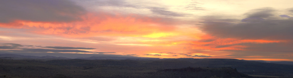
Blue Skies Over Arizona
Grasslands Sunrise
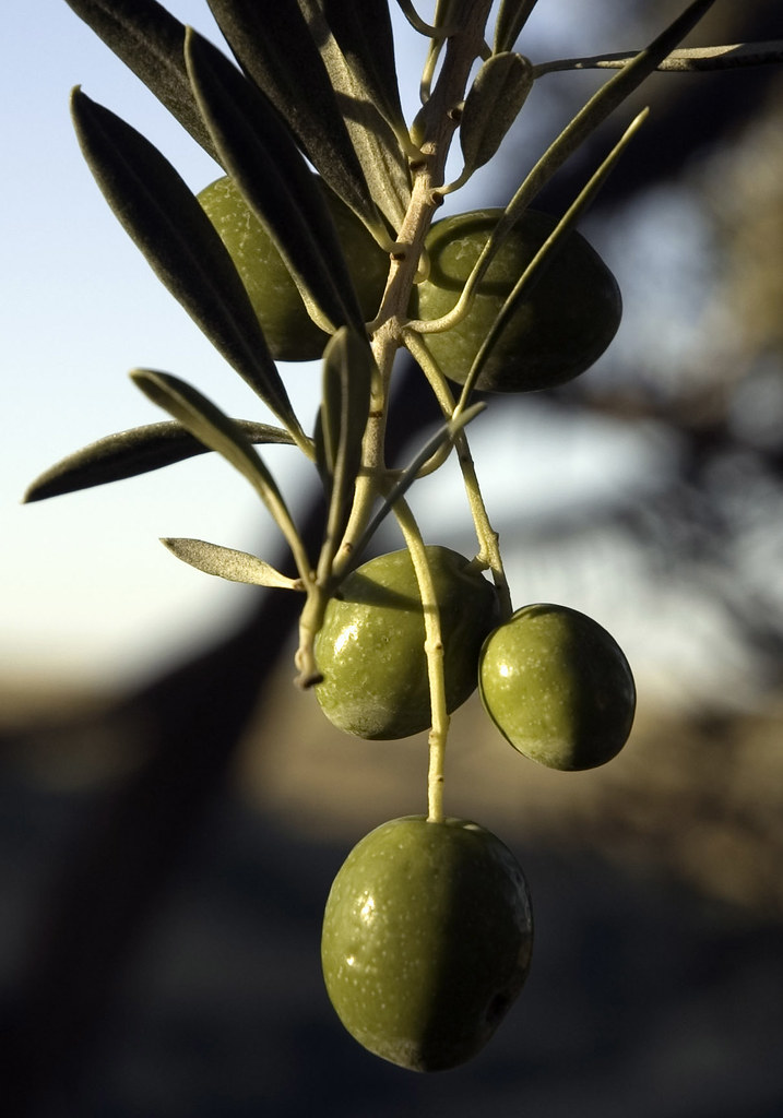
Olive Morning
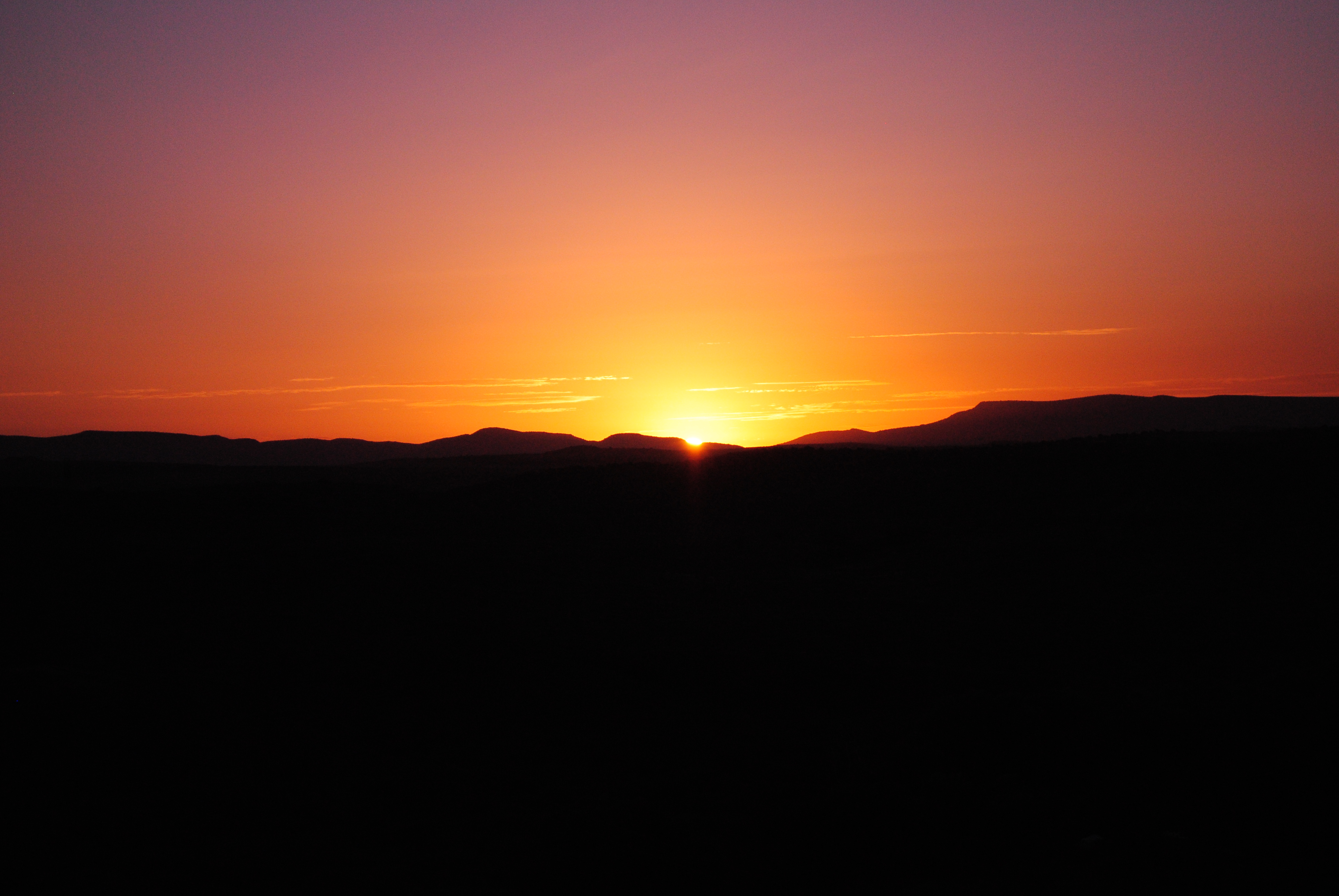
Arcosanti Sunrise
E Cedar Canyon Dr, Mayer, AZ アメリカ合衆国の地図
別の場所を検索
近所の場所
アメリカ合衆国 〒 アリゾナ州 コーデス・レイクス
S Red Rock Ln, Mayer, AZ アメリカ合衆国
E Larry Ln, Mayer, AZ アメリカ合衆国イースト・ラリー・レーン
E Cedar Dr, Mayer, AZ アメリカ合衆国
E Conestoga Dr, Mayer, AZ アメリカ合衆国
E Mingus Dr, Mayer, AZ アメリカ合衆国
E Pinto Dr, Mayer, AZ アメリカ合衆国
Tonelea Trail, Cordes Lakes, AZ アメリカ合衆国トーンリー・トレイル
アメリカ合衆国 〒 アリゾナ州 メイヤー
アメリカ合衆国 〒 アリゾナ州 コーデス・レイクス コーデス・ジャンクション
Copper Star Rd, Arizona アメリカ合衆国Copper Star Road
S Old Black Canyon Hwy, Mayer, AZ アメリカ合衆国
アメリカ合衆国 〒 アリゾナ州 バンブレ・ビー
Sunset Point, Black Canyon City, AZ アメリカ合衆国
AZ-69, Mayer, AZ アメリカ合衆国
I-17, Arizona, アメリカ合衆国Interstate 17
アメリカ合衆国 〒 アリゾナ州 メイヤー
E Main St, Humboldt, AZ アメリカ合衆国
Fifth St, Mayer, AZ アメリカ合衆国Mayer Community Church
S Thoroughbred Ln, Mayer, AZ アメリカ合衆国
最近の検索
- アメリカ合衆国 アラスカ州 レッド・ドッグ・マイン日の出日の入り時間
- Am bhf, Borken, ドイツアム・バーンホーフ日の出日の入り時間
- 4th St E, Sonoma, CA, USA日の出日の入り時間
- Oakland Ave, Williamsport, PA アメリカ合衆国日の出日の入り時間
- Via Roma, Pieranica CR, イタリアローマ通り日の出日の入り時間
- クロアチア 〒 ドゥブロブニク GradClock Tower of Dubrovnik日の出日の入り時間
- アルゼンチン チュブ州 トレリュー日の出日の入り時間
- Hartfords Bluff Cir, Mt Pleasant, SC アメリカ合衆国日の出日の入り時間
- 日本、熊本県熊本市北区日の出日の入り時間
- 中華人民共和国 福州市 平潭県 平潭島日の出日の入り時間