E Bell Wayside St, Independence, KS アメリカ合衆国日の出日の入り時間
Location: アメリカ合衆国 > カンザス州 > モントゴメリー > アメリカ合衆国 〒 カンザス州 キャニー >
時間帯:
America/Chicago
現地時間:
2025-07-08 11:51:07
経度:
-95.8717964
緯度:
37.1235721
今日の日の出時刻:
06:11:56 AM
今日の日の入時刻:
08:45:47 PM
今日の日長:
14h 33m 51s
明日の日の出時刻:
06:12:33 AM
明日の日の入時刻:
08:45:26 PM
明日の日長:
14h 32m 53s
すべて表示する
| 日付 | 日出 | 日没 | 日長 |
|---|---|---|---|
| 2025年01月01日 | 07:37:11 AM | 05:18:05 PM | 9h 40m 54s |
| 2025年01月02日 | 07:37:17 AM | 05:18:55 PM | 9h 41m 38s |
| 2025年01月03日 | 07:37:21 AM | 05:19:45 PM | 9h 42m 24s |
| 2025年01月04日 | 07:37:23 AM | 05:20:37 PM | 9h 43m 14s |
| 2025年01月05日 | 07:37:23 AM | 05:21:30 PM | 9h 44m 7s |
| 2025年01月06日 | 07:37:20 AM | 05:22:24 PM | 9h 45m 4s |
| 2025年01月07日 | 07:37:16 AM | 05:23:19 PM | 9h 46m 3s |
| 2025年01月08日 | 07:37:10 AM | 05:24:15 PM | 9h 47m 5s |
| 2025年01月09日 | 07:37:01 AM | 05:25:12 PM | 9h 48m 11s |
| 2025年01月10日 | 07:36:51 AM | 05:26:09 PM | 9h 49m 18s |
| 2025年01月11日 | 07:36:39 AM | 05:27:08 PM | 9h 50m 29s |
| 2025年01月12日 | 07:36:24 AM | 05:28:07 PM | 9h 51m 43s |
| 2025年01月13日 | 07:36:08 AM | 05:29:07 PM | 9h 52m 59s |
| 2025年01月14日 | 07:35:49 AM | 05:30:08 PM | 9h 54m 19s |
| 2025年01月15日 | 07:35:29 AM | 05:31:10 PM | 9h 55m 41s |
| 2025年01月16日 | 07:35:07 AM | 05:32:11 PM | 9h 57m 4s |
| 2025年01月17日 | 07:34:42 AM | 05:33:14 PM | 9h 58m 32s |
| 2025年01月18日 | 07:34:16 AM | 05:34:17 PM | 10h 0m 1s |
| 2025年01月19日 | 07:33:48 AM | 05:35:20 PM | 10h 1m 32s |
| 2025年01月20日 | 07:33:18 AM | 05:36:24 PM | 10h 3m 6s |
| 2025年01月21日 | 07:32:46 AM | 05:37:28 PM | 10h 4m 42s |
| 2025年01月22日 | 07:32:12 AM | 05:38:33 PM | 10h 6m 21s |
| 2025年01月23日 | 07:31:36 AM | 05:39:38 PM | 10h 8m 2s |
| 2025年01月24日 | 07:30:58 AM | 05:40:43 PM | 10h 9m 45s |
| 2025年01月25日 | 07:30:19 AM | 05:41:48 PM | 10h 11m 29s |
| 2025年01月26日 | 07:29:38 AM | 05:42:53 PM | 10h 13m 15s |
| 2025年01月27日 | 07:28:55 AM | 05:43:59 PM | 10h 15m 4s |
| 2025年01月28日 | 07:28:11 AM | 05:45:04 PM | 10h 16m 53s |
| 2025年01月29日 | 07:27:25 AM | 05:46:10 PM | 10h 18m 45s |
| 2025年01月30日 | 07:26:37 AM | 05:47:15 PM | 10h 20m 38s |
| 2025年01月31日 | 07:25:47 AM | 05:48:21 PM | 10h 22m 34s |
| 2025年02月01日 | 07:24:56 AM | 05:49:26 PM | 10h 24m 30s |
| 2025年02月02日 | 07:24:04 AM | 05:50:32 PM | 10h 26m 28s |
| 2025年02月03日 | 07:23:10 AM | 05:51:37 PM | 10h 28m 27s |
| 2025年02月04日 | 07:22:14 AM | 05:52:42 PM | 10h 30m 28s |
| 2025年02月05日 | 07:21:17 AM | 05:53:48 PM | 10h 32m 31s |
| 2025年02月06日 | 07:20:18 AM | 05:54:53 PM | 10h 34m 35s |
| 2025年02月07日 | 07:19:19 AM | 05:55:57 PM | 10h 36m 38s |
| 2025年02月08日 | 07:18:17 AM | 05:57:02 PM | 10h 38m 45s |
| 2025年02月09日 | 07:17:15 AM | 05:58:06 PM | 10h 40m 51s |
| 2025年02月10日 | 07:16:11 AM | 05:59:10 PM | 10h 42m 59s |
| 2025年02月11日 | 07:15:05 AM | 06:00:14 PM | 10h 45m 9s |
| 2025年02月12日 | 07:13:59 AM | 06:01:18 PM | 10h 47m 19s |
| 2025年02月13日 | 07:12:51 AM | 06:02:21 PM | 10h 49m 30s |
| 2025年02月14日 | 07:11:42 AM | 06:03:24 PM | 10h 51m 42s |
| 2025年02月15日 | 07:10:32 AM | 06:04:27 PM | 10h 53m 55s |
| 2025年02月16日 | 07:09:21 AM | 06:05:30 PM | 10h 56m 9s |
| 2025年02月17日 | 07:08:09 AM | 06:06:32 PM | 10h 58m 23s |
| 2025年02月18日 | 07:06:56 AM | 06:07:34 PM | 11h 0m 38s |
| 2025年02月19日 | 07:05:42 AM | 06:08:35 PM | 11h 2m 53s |
| 2025年02月20日 | 07:04:26 AM | 06:09:36 PM | 11h 5m 10s |
| 2025年02月21日 | 07:03:10 AM | 06:10:37 PM | 11h 7m 27s |
| 2025年02月22日 | 07:01:53 AM | 06:11:38 PM | 11h 9m 45s |
| 2025年02月23日 | 07:00:35 AM | 06:12:38 PM | 11h 12m 3s |
| 2025年02月24日 | 06:59:16 AM | 06:13:38 PM | 11h 14m 22s |
| 2025年02月25日 | 06:57:57 AM | 06:14:38 PM | 11h 16m 41s |
| 2025年02月26日 | 06:56:37 AM | 06:15:37 PM | 11h 19m 0s |
| 2025年02月27日 | 06:55:15 AM | 06:16:36 PM | 11h 21m 21s |
| 2025年02月28日 | 06:53:54 AM | 06:17:35 PM | 11h 23m 41s |
| 2025年03月01日 | 06:52:31 AM | 06:18:33 PM | 11h 26m 2s |
| 2025年03月02日 | 06:51:08 AM | 06:19:31 PM | 11h 28m 23s |
| 2025年03月03日 | 06:49:44 AM | 06:20:29 PM | 11h 30m 45s |
| 2025年03月04日 | 06:48:20 AM | 06:21:26 PM | 11h 33m 6s |
| 2025年03月05日 | 06:46:55 AM | 06:22:24 PM | 11h 35m 29s |
| 2025年03月06日 | 06:45:29 AM | 06:23:20 PM | 11h 37m 51s |
| 2025年03月07日 | 06:44:03 AM | 06:24:17 PM | 11h 40m 14s |
| 2025年03月08日 | 06:42:37 AM | 06:25:13 PM | 11h 42m 36s |
| 2025年03月09日 | 07:41:14 AM | 07:26:07 PM | 11h 44m 53s |
| 2025年03月10日 | 07:39:46 AM | 07:27:03 PM | 11h 47m 17s |
| 2025年03月11日 | 07:38:19 AM | 07:27:59 PM | 11h 49m 40s |
| 2025年03月12日 | 07:36:51 AM | 07:28:54 PM | 11h 52m 3s |
| 2025年03月13日 | 07:35:23 AM | 07:29:49 PM | 11h 54m 26s |
| 2025年03月14日 | 07:33:54 AM | 07:30:44 PM | 11h 56m 50s |
| 2025年03月15日 | 07:32:25 AM | 07:31:39 PM | 11h 59m 14s |
| 2025年03月16日 | 07:30:56 AM | 07:32:34 PM | 12h 1m 38s |
| 2025年03月17日 | 07:29:27 AM | 07:33:28 PM | 12h 4m 1s |
| 2025年03月18日 | 07:27:58 AM | 07:34:22 PM | 12h 6m 24s |
| 2025年03月19日 | 07:26:28 AM | 07:35:16 PM | 12h 8m 48s |
| 2025年03月20日 | 07:24:59 AM | 07:36:10 PM | 12h 11m 11s |
| 2025年03月21日 | 07:23:29 AM | 07:37:04 PM | 12h 13m 35s |
| 2025年03月22日 | 07:21:59 AM | 07:37:58 PM | 12h 15m 59s |
| 2025年03月23日 | 07:20:30 AM | 07:38:51 PM | 12h 18m 21s |
| 2025年03月24日 | 07:19:00 AM | 07:39:45 PM | 12h 20m 45s |
| 2025年03月25日 | 07:17:30 AM | 07:40:38 PM | 12h 23m 8s |
| 2025年03月26日 | 07:16:01 AM | 07:41:32 PM | 12h 25m 31s |
| 2025年03月27日 | 07:14:31 AM | 07:42:25 PM | 12h 27m 54s |
| 2025年03月28日 | 07:13:02 AM | 07:43:18 PM | 12h 30m 16s |
| 2025年03月29日 | 07:11:33 AM | 07:44:11 PM | 12h 32m 38s |
| 2025年03月30日 | 07:10:04 AM | 07:45:04 PM | 12h 35m 0s |
| 2025年03月31日 | 07:08:35 AM | 07:45:58 PM | 12h 37m 23s |
| 2025年04月01日 | 07:07:07 AM | 07:46:51 PM | 12h 39m 44s |
| 2025年04月02日 | 07:05:39 AM | 07:47:44 PM | 12h 42m 5s |
| 2025年04月03日 | 07:04:11 AM | 07:48:37 PM | 12h 44m 26s |
| 2025年04月04日 | 07:02:43 AM | 07:49:30 PM | 12h 46m 47s |
| 2025年04月05日 | 07:01:16 AM | 07:50:23 PM | 12h 49m 7s |
| 2025年04月06日 | 06:59:49 AM | 07:51:16 PM | 12h 51m 27s |
| 2025年04月07日 | 06:58:23 AM | 07:52:09 PM | 12h 53m 46s |
| 2025年04月08日 | 06:56:57 AM | 07:53:02 PM | 12h 56m 5s |
| 2025年04月09日 | 06:55:32 AM | 07:53:55 PM | 12h 58m 23s |
| 2025年04月10日 | 06:54:07 AM | 07:54:48 PM | 13h 0m 41s |
| 2025年04月11日 | 06:52:43 AM | 07:55:42 PM | 13h 2m 59s |
| 2025年04月12日 | 06:51:19 AM | 07:56:35 PM | 13h 5m 16s |
| 2025年04月13日 | 06:49:56 AM | 07:57:28 PM | 13h 7m 32s |
| 2025年04月14日 | 06:48:34 AM | 07:58:21 PM | 13h 9m 47s |
| 2025年04月15日 | 06:47:12 AM | 07:59:15 PM | 13h 12m 3s |
| 2025年04月16日 | 06:45:51 AM | 08:00:08 PM | 13h 14m 17s |
| 2025年04月17日 | 06:44:31 AM | 08:01:02 PM | 13h 16m 31s |
| 2025年04月18日 | 06:43:11 AM | 08:01:55 PM | 13h 18m 44s |
| 2025年04月19日 | 06:41:53 AM | 08:02:49 PM | 13h 20m 56s |
| 2025年04月20日 | 06:40:35 AM | 08:03:43 PM | 13h 23m 8s |
| 2025年04月21日 | 06:39:18 AM | 08:04:36 PM | 13h 25m 18s |
| 2025年04月22日 | 06:38:02 AM | 08:05:30 PM | 13h 27m 28s |
| 2025年04月23日 | 06:36:46 AM | 08:06:24 PM | 13h 29m 38s |
| 2025年04月24日 | 06:35:32 AM | 08:07:17 PM | 13h 31m 45s |
| 2025年04月25日 | 06:34:19 AM | 08:08:11 PM | 13h 33m 52s |
| 2025年04月26日 | 06:33:06 AM | 08:09:05 PM | 13h 35m 59s |
| 2025年04月27日 | 06:31:55 AM | 08:09:58 PM | 13h 38m 3s |
| 2025年04月28日 | 06:30:45 AM | 08:10:52 PM | 13h 40m 7s |
| 2025年04月29日 | 06:29:36 AM | 08:11:46 PM | 13h 42m 10s |
| 2025年04月30日 | 06:28:27 AM | 08:12:39 PM | 13h 44m 12s |
| 2025年05月01日 | 06:27:21 AM | 08:13:33 PM | 13h 46m 12s |
| 2025年05月02日 | 06:26:15 AM | 08:14:26 PM | 13h 48m 11s |
| 2025年05月03日 | 06:25:10 AM | 08:15:20 PM | 13h 50m 10s |
| 2025年05月04日 | 06:24:07 AM | 08:16:13 PM | 13h 52m 6s |
| 2025年05月05日 | 06:23:05 AM | 08:17:06 PM | 13h 54m 1s |
| 2025年05月06日 | 06:22:04 AM | 08:17:59 PM | 13h 55m 55s |
| 2025年05月07日 | 06:21:05 AM | 08:18:52 PM | 13h 57m 47s |
| 2025年05月08日 | 06:20:07 AM | 08:19:44 PM | 13h 59m 37s |
| 2025年05月09日 | 06:19:10 AM | 08:20:37 PM | 14h 1m 27s |
| 2025年05月10日 | 06:18:14 AM | 08:21:29 PM | 14h 3m 15s |
| 2025年05月11日 | 06:17:21 AM | 08:22:21 PM | 14h 5m 0s |
| 2025年05月12日 | 06:16:28 AM | 08:23:12 PM | 14h 6m 44s |
| 2025年05月13日 | 06:15:37 AM | 08:24:03 PM | 14h 8m 26s |
| 2025年05月14日 | 06:14:47 AM | 08:24:54 PM | 14h 10m 7s |
| 2025年05月15日 | 06:13:59 AM | 08:25:45 PM | 14h 11m 46s |
| 2025年05月16日 | 06:13:13 AM | 08:26:35 PM | 14h 13m 22s |
| 2025年05月17日 | 06:12:28 AM | 08:27:25 PM | 14h 14m 57s |
| 2025年05月18日 | 06:11:45 AM | 08:28:14 PM | 14h 16m 29s |
| 2025年05月19日 | 06:11:03 AM | 08:29:02 PM | 14h 17m 59s |
| 2025年05月20日 | 06:10:23 AM | 08:29:50 PM | 14h 19m 27s |
| 2025年05月21日 | 06:09:44 AM | 08:30:38 PM | 14h 20m 54s |
| 2025年05月22日 | 06:09:07 AM | 08:31:25 PM | 14h 22m 18s |
| 2025年05月23日 | 06:08:32 AM | 08:32:11 PM | 14h 23m 39s |
| 2025年05月24日 | 06:07:58 AM | 08:32:57 PM | 14h 24m 59s |
| 2025年05月25日 | 06:07:26 AM | 08:33:42 PM | 14h 26m 16s |
| 2025年05月26日 | 06:06:56 AM | 08:34:26 PM | 14h 27m 30s |
| 2025年05月27日 | 06:06:28 AM | 08:35:09 PM | 14h 28m 41s |
| 2025年05月28日 | 06:06:01 AM | 08:35:52 PM | 14h 29m 51s |
| 2025年05月29日 | 06:05:36 AM | 08:36:33 PM | 14h 30m 57s |
| 2025年05月30日 | 06:05:13 AM | 08:37:14 PM | 14h 32m 1s |
| 2025年05月31日 | 06:04:52 AM | 08:37:54 PM | 14h 33m 2s |
| 2025年06月01日 | 06:04:32 AM | 08:38:32 PM | 14h 34m 0s |
| 2025年06月02日 | 06:04:14 AM | 08:39:10 PM | 14h 34m 56s |
| 2025年06月03日 | 06:03:58 AM | 08:39:47 PM | 14h 35m 49s |
| 2025年06月04日 | 06:03:44 AM | 08:40:22 PM | 14h 36m 38s |
| 2025年06月05日 | 06:03:31 AM | 08:40:57 PM | 14h 37m 26s |
| 2025年06月06日 | 06:03:20 AM | 08:41:30 PM | 14h 38m 10s |
| 2025年06月07日 | 06:03:11 AM | 08:42:02 PM | 14h 38m 51s |
| 2025年06月08日 | 06:03:04 AM | 08:42:33 PM | 14h 39m 29s |
| 2025年06月09日 | 06:02:58 AM | 08:43:02 PM | 14h 40m 4s |
| 2025年06月10日 | 06:02:54 AM | 08:43:31 PM | 14h 40m 37s |
| 2025年06月11日 | 06:02:52 AM | 08:43:58 PM | 14h 41m 6s |
| 2025年06月12日 | 06:02:52 AM | 08:44:23 PM | 14h 41m 31s |
| 2025年06月13日 | 06:02:53 AM | 08:44:47 PM | 14h 41m 54s |
| 2025年06月14日 | 06:02:56 AM | 08:45:10 PM | 14h 42m 14s |
| 2025年06月15日 | 06:03:01 AM | 08:45:31 PM | 14h 42m 30s |
| 2025年06月16日 | 06:03:07 AM | 08:45:50 PM | 14h 42m 43s |
| 2025年06月17日 | 06:03:15 AM | 08:46:08 PM | 14h 42m 53s |
| 2025年06月18日 | 06:03:25 AM | 08:46:25 PM | 14h 43m 0s |
| 2025年06月19日 | 06:03:36 AM | 08:46:40 PM | 14h 43m 4s |
| 2025年06月20日 | 06:03:49 AM | 08:46:53 PM | 14h 43m 4s |
| 2025年06月21日 | 06:04:04 AM | 08:47:05 PM | 14h 43m 1s |
| 2025年06月22日 | 06:04:20 AM | 08:47:15 PM | 14h 42m 55s |
| 2025年06月23日 | 06:04:37 AM | 08:47:23 PM | 14h 42m 46s |
| 2025年06月24日 | 06:04:56 AM | 08:47:29 PM | 14h 42m 33s |
| 2025年06月25日 | 06:05:16 AM | 08:47:34 PM | 14h 42m 18s |
| 2025年06月26日 | 06:05:38 AM | 08:47:37 PM | 14h 41m 59s |
| 2025年06月27日 | 06:06:02 AM | 08:47:39 PM | 14h 41m 37s |
| 2025年06月28日 | 06:06:26 AM | 08:47:38 PM | 14h 41m 12s |
| 2025年06月29日 | 06:06:52 AM | 08:47:36 PM | 14h 40m 44s |
| 2025年06月30日 | 06:07:19 AM | 08:47:32 PM | 14h 40m 13s |
| 2025年07月01日 | 06:07:48 AM | 08:47:26 PM | 14h 39m 38s |
| 2025年07月02日 | 06:08:17 AM | 08:47:19 PM | 14h 39m 2s |
| 2025年07月03日 | 06:08:48 AM | 08:47:10 PM | 14h 38m 22s |
| 2025年07月04日 | 06:09:20 AM | 08:46:58 PM | 14h 37m 38s |
| 2025年07月05日 | 06:09:53 AM | 08:46:45 PM | 14h 36m 52s |
| 2025年07月06日 | 06:10:27 AM | 08:46:31 PM | 14h 36m 4s |
| 2025年07月07日 | 06:11:02 AM | 08:46:14 PM | 14h 35m 12s |
| 2025年07月08日 | 06:11:39 AM | 08:45:56 PM | 14h 34m 17s |
| 2025年07月09日 | 06:12:16 AM | 08:45:35 PM | 14h 33m 19s |
| 2025年07月10日 | 06:12:54 AM | 08:45:13 PM | 14h 32m 19s |
| 2025年07月11日 | 06:13:33 AM | 08:44:50 PM | 14h 31m 17s |
| 2025年07月12日 | 06:14:13 AM | 08:44:24 PM | 14h 30m 11s |
| 2025年07月13日 | 06:14:53 AM | 08:43:57 PM | 14h 29m 4s |
| 2025年07月14日 | 06:15:35 AM | 08:43:28 PM | 14h 27m 53s |
| 2025年07月15日 | 06:16:17 AM | 08:42:57 PM | 14h 26m 40s |
| 2025年07月16日 | 06:16:59 AM | 08:42:24 PM | 14h 25m 25s |
| 2025年07月17日 | 06:17:43 AM | 08:41:50 PM | 14h 24m 7s |
| 2025年07月18日 | 06:18:27 AM | 08:41:14 PM | 14h 22m 47s |
| 2025年07月19日 | 06:19:12 AM | 08:40:36 PM | 14h 21m 24s |
| 2025年07月20日 | 06:19:57 AM | 08:39:56 PM | 14h 19m 59s |
| 2025年07月21日 | 06:20:43 AM | 08:39:15 PM | 14h 18m 32s |
| 2025年07月22日 | 06:21:29 AM | 08:38:33 PM | 14h 17m 4s |
| 2025年07月23日 | 06:22:15 AM | 08:37:48 PM | 14h 15m 33s |
| 2025年07月24日 | 06:23:02 AM | 08:37:02 PM | 14h 14m 0s |
| 2025年07月25日 | 06:23:50 AM | 08:36:15 PM | 14h 12m 25s |
| 2025年07月26日 | 06:24:38 AM | 08:35:26 PM | 14h 10m 48s |
| 2025年07月27日 | 06:25:26 AM | 08:34:35 PM | 14h 9m 9s |
| 2025年07月28日 | 06:26:14 AM | 08:33:43 PM | 14h 7m 29s |
| 2025年07月29日 | 06:27:03 AM | 08:32:49 PM | 14h 5m 46s |
| 2025年07月30日 | 06:27:52 AM | 08:31:54 PM | 14h 4m 2s |
| 2025年07月31日 | 06:28:41 AM | 08:30:58 PM | 14h 2m 17s |
| 2025年08月01日 | 06:29:31 AM | 08:30:00 PM | 14h 0m 29s |
| 2025年08月02日 | 06:30:20 AM | 08:29:01 PM | 13h 58m 41s |
| 2025年08月03日 | 06:31:10 AM | 08:28:00 PM | 13h 56m 50s |
| 2025年08月04日 | 06:32:00 AM | 08:26:58 PM | 13h 54m 58s |
| 2025年08月05日 | 06:32:49 AM | 08:25:55 PM | 13h 53m 6s |
| 2025年08月06日 | 06:33:39 AM | 08:24:50 PM | 13h 51m 11s |
| 2025年08月07日 | 06:34:30 AM | 08:23:44 PM | 13h 49m 14s |
| 2025年08月08日 | 06:35:20 AM | 08:22:37 PM | 13h 47m 17s |
| 2025年08月09日 | 06:36:10 AM | 08:21:29 PM | 13h 45m 19s |
| 2025年08月10日 | 06:37:00 AM | 08:20:20 PM | 13h 43m 20s |
| 2025年08月11日 | 06:37:50 AM | 08:19:09 PM | 13h 41m 19s |
| 2025年08月12日 | 06:38:40 AM | 08:17:58 PM | 13h 39m 18s |
| 2025年08月13日 | 06:39:31 AM | 08:16:45 PM | 13h 37m 14s |
| 2025年08月14日 | 06:40:21 AM | 08:15:31 PM | 13h 35m 10s |
| 2025年08月15日 | 06:41:11 AM | 08:14:17 PM | 13h 33m 6s |
| 2025年08月16日 | 06:42:01 AM | 08:13:01 PM | 13h 31m 0s |
| 2025年08月17日 | 06:42:51 AM | 08:11:44 PM | 13h 28m 53s |
| 2025年08月18日 | 06:43:41 AM | 08:10:26 PM | 13h 26m 45s |
| 2025年08月19日 | 06:44:31 AM | 08:09:08 PM | 13h 24m 37s |
| 2025年08月20日 | 06:45:21 AM | 08:07:48 PM | 13h 22m 27s |
| 2025年08月21日 | 06:46:10 AM | 08:06:28 PM | 13h 20m 18s |
| 2025年08月22日 | 06:47:00 AM | 08:05:07 PM | 13h 18m 7s |
| 2025年08月23日 | 06:47:50 AM | 08:03:45 PM | 13h 15m 55s |
| 2025年08月24日 | 06:48:39 AM | 08:02:23 PM | 13h 13m 44s |
| 2025年08月25日 | 06:49:29 AM | 08:00:59 PM | 13h 11m 30s |
| 2025年08月26日 | 06:50:18 AM | 07:59:35 PM | 13h 9m 17s |
| 2025年08月27日 | 06:51:07 AM | 07:58:11 PM | 13h 7m 4s |
| 2025年08月28日 | 06:51:57 AM | 07:56:45 PM | 13h 4m 48s |
| 2025年08月29日 | 06:52:46 AM | 07:55:19 PM | 13h 2m 33s |
| 2025年08月30日 | 06:53:35 AM | 07:53:53 PM | 13h 0m 18s |
| 2025年08月31日 | 06:54:24 AM | 07:52:26 PM | 12h 58m 2s |
| 2025年09月01日 | 06:55:13 AM | 07:50:58 PM | 12h 55m 45s |
| 2025年09月02日 | 06:56:02 AM | 07:49:30 PM | 12h 53m 28s |
| 2025年09月03日 | 06:56:50 AM | 07:48:02 PM | 12h 51m 12s |
| 2025年09月04日 | 06:57:39 AM | 07:46:33 PM | 12h 48m 54s |
| 2025年09月05日 | 06:58:28 AM | 07:45:03 PM | 12h 46m 35s |
| 2025年09月06日 | 06:59:17 AM | 07:43:34 PM | 12h 44m 17s |
| 2025年09月07日 | 07:00:05 AM | 07:42:04 PM | 12h 41m 59s |
| 2025年09月08日 | 07:00:54 AM | 07:40:33 PM | 12h 39m 39s |
| 2025年09月09日 | 07:01:43 AM | 07:39:03 PM | 12h 37m 20s |
| 2025年09月10日 | 07:02:32 AM | 07:37:32 PM | 12h 35m 0s |
| 2025年09月11日 | 07:03:20 AM | 07:36:00 PM | 12h 32m 40s |
| 2025年09月12日 | 07:04:09 AM | 07:34:29 PM | 12h 30m 20s |
| 2025年09月13日 | 07:04:58 AM | 07:32:58 PM | 12h 28m 0s |
| 2025年09月14日 | 07:05:47 AM | 07:31:26 PM | 12h 25m 39s |
| 2025年09月15日 | 07:06:36 AM | 07:29:54 PM | 12h 23m 18s |
| 2025年09月16日 | 07:07:25 AM | 07:28:22 PM | 12h 20m 57s |
| 2025年09月17日 | 07:08:14 AM | 07:26:50 PM | 12h 18m 36s |
| 2025年09月18日 | 07:09:03 AM | 07:25:18 PM | 12h 16m 15s |
| 2025年09月19日 | 07:09:52 AM | 07:23:46 PM | 12h 13m 54s |
| 2025年09月20日 | 07:10:41 AM | 07:22:14 PM | 12h 11m 33s |
| 2025年09月21日 | 07:11:31 AM | 07:20:43 PM | 12h 9m 12s |
| 2025年09月22日 | 07:12:20 AM | 07:19:11 PM | 12h 6m 51s |
| 2025年09月23日 | 07:13:10 AM | 07:17:39 PM | 12h 4m 29s |
| 2025年09月24日 | 07:14:00 AM | 07:16:08 PM | 12h 2m 8s |
| 2025年09月25日 | 07:14:50 AM | 07:14:36 PM | 11h 59m 46s |
| 2025年09月26日 | 07:15:41 AM | 07:13:05 PM | 11h 57m 24s |
| 2025年09月27日 | 07:16:31 AM | 07:11:34 PM | 11h 55m 3s |
| 2025年09月28日 | 07:17:22 AM | 07:10:04 PM | 11h 52m 42s |
| 2025年09月29日 | 07:18:13 AM | 07:08:34 PM | 11h 50m 21s |
| 2025年09月30日 | 07:19:04 AM | 07:07:04 PM | 11h 48m 0s |
| 2025年10月01日 | 07:19:55 AM | 07:05:34 PM | 11h 45m 39s |
| 2025年10月02日 | 07:20:47 AM | 07:04:05 PM | 11h 43m 18s |
| 2025年10月03日 | 07:21:39 AM | 07:02:36 PM | 11h 40m 57s |
| 2025年10月04日 | 07:22:31 AM | 07:01:08 PM | 11h 38m 37s |
| 2025年10月05日 | 07:23:23 AM | 06:59:40 PM | 11h 36m 17s |
| 2025年10月06日 | 07:24:16 AM | 06:58:12 PM | 11h 33m 56s |
| 2025年10月07日 | 07:25:09 AM | 06:56:45 PM | 11h 31m 36s |
| 2025年10月08日 | 07:26:02 AM | 06:55:19 PM | 11h 29m 17s |
| 2025年10月09日 | 07:26:56 AM | 06:53:54 PM | 11h 26m 58s |
| 2025年10月10日 | 07:27:50 AM | 06:52:28 PM | 11h 24m 38s |
| 2025年10月11日 | 07:28:44 AM | 06:51:04 PM | 11h 22m 20s |
| 2025年10月12日 | 07:29:39 AM | 06:49:40 PM | 11h 20m 1s |
| 2025年10月13日 | 07:30:34 AM | 06:48:18 PM | 11h 17m 44s |
| 2025年10月14日 | 07:31:29 AM | 06:46:55 PM | 11h 15m 26s |
| 2025年10月15日 | 07:32:24 AM | 06:45:34 PM | 11h 13m 10s |
| 2025年10月16日 | 07:33:20 AM | 06:44:13 PM | 11h 10m 53s |
| 2025年10月17日 | 07:34:17 AM | 06:42:54 PM | 11h 8m 37s |
| 2025年10月18日 | 07:35:13 AM | 06:41:35 PM | 11h 6m 22s |
| 2025年10月19日 | 07:36:10 AM | 06:40:17 PM | 11h 4m 7s |
| 2025年10月20日 | 07:37:08 AM | 06:39:00 PM | 11h 1m 52s |
| 2025年10月21日 | 07:38:06 AM | 06:37:44 PM | 10h 59m 38s |
| 2025年10月22日 | 07:39:04 AM | 06:36:29 PM | 10h 57m 25s |
| 2025年10月23日 | 07:40:02 AM | 06:35:15 PM | 10h 55m 13s |
| 2025年10月24日 | 07:41:01 AM | 06:34:02 PM | 10h 53m 1s |
| 2025年10月25日 | 07:42:00 AM | 06:32:51 PM | 10h 50m 51s |
| 2025年10月26日 | 07:42:59 AM | 06:31:40 PM | 10h 48m 41s |
| 2025年10月27日 | 07:43:59 AM | 06:30:31 PM | 10h 46m 32s |
| 2025年10月28日 | 07:44:59 AM | 06:29:23 PM | 10h 44m 24s |
| 2025年10月29日 | 07:45:59 AM | 06:28:16 PM | 10h 42m 17s |
| 2025年10月30日 | 07:47:00 AM | 06:27:10 PM | 10h 40m 10s |
| 2025年10月31日 | 07:48:01 AM | 06:26:06 PM | 10h 38m 5s |
| 2025年11月01日 | 07:49:02 AM | 06:25:03 PM | 10h 36m 1s |
| 2025年11月02日 | 06:50:06 AM | 05:23:59 PM | 10h 33m 53s |
| 2025年11月03日 | 06:51:07 AM | 05:22:59 PM | 10h 31m 52s |
| 2025年11月04日 | 06:52:09 AM | 05:22:00 PM | 10h 29m 51s |
| 2025年11月05日 | 06:53:11 AM | 05:21:03 PM | 10h 27m 52s |
| 2025年11月06日 | 06:54:13 AM | 05:20:07 PM | 10h 25m 54s |
| 2025年11月07日 | 06:55:15 AM | 05:19:13 PM | 10h 23m 58s |
| 2025年11月08日 | 06:56:18 AM | 05:18:21 PM | 10h 22m 3s |
| 2025年11月09日 | 06:57:20 AM | 05:17:30 PM | 10h 20m 10s |
| 2025年11月10日 | 06:58:23 AM | 05:16:40 PM | 10h 18m 17s |
| 2025年11月11日 | 06:59:26 AM | 05:15:53 PM | 10h 16m 27s |
| 2025年11月12日 | 07:00:28 AM | 05:15:07 PM | 10h 14m 39s |
| 2025年11月13日 | 07:01:31 AM | 05:14:23 PM | 10h 12m 52s |
| 2025年11月14日 | 07:02:33 AM | 05:13:40 PM | 10h 11m 7s |
| 2025年11月15日 | 07:03:36 AM | 05:12:59 PM | 10h 9m 23s |
| 2025年11月16日 | 07:04:38 AM | 05:12:20 PM | 10h 7m 42s |
| 2025年11月17日 | 07:05:40 AM | 05:11:43 PM | 10h 6m 3s |
| 2025年11月18日 | 07:06:42 AM | 05:11:08 PM | 10h 4m 26s |
| 2025年11月19日 | 07:07:44 AM | 05:10:35 PM | 10h 2m 51s |
| 2025年11月20日 | 07:08:45 AM | 05:10:03 PM | 10h 1m 18s |
| 2025年11月21日 | 07:09:46 AM | 05:09:34 PM | 9h 59m 48s |
| 2025年11月22日 | 07:10:47 AM | 05:09:06 PM | 9h 58m 19s |
| 2025年11月23日 | 07:11:47 AM | 05:08:41 PM | 9h 56m 54s |
| 2025年11月24日 | 07:12:47 AM | 05:08:17 PM | 9h 55m 30s |
| 2025年11月25日 | 07:13:46 AM | 05:07:55 PM | 9h 54m 9s |
| 2025年11月26日 | 07:14:45 AM | 05:07:36 PM | 9h 52m 51s |
| 2025年11月27日 | 07:15:43 AM | 05:07:18 PM | 9h 51m 35s |
| 2025年11月28日 | 07:16:41 AM | 05:07:03 PM | 9h 50m 22s |
| 2025年11月29日 | 07:17:38 AM | 05:06:49 PM | 9h 49m 11s |
| 2025年11月30日 | 07:18:34 AM | 05:06:38 PM | 9h 48m 4s |
| 2025年12月01日 | 07:19:29 AM | 05:06:28 PM | 9h 46m 59s |
| 2025年12月02日 | 07:20:24 AM | 05:06:21 PM | 9h 45m 57s |
| 2025年12月03日 | 07:21:17 AM | 05:06:16 PM | 9h 44m 59s |
| 2025年12月04日 | 07:22:10 AM | 05:06:13 PM | 9h 44m 3s |
| 2025年12月05日 | 07:23:01 AM | 05:06:12 PM | 9h 43m 11s |
| 2025年12月06日 | 07:23:52 AM | 05:06:13 PM | 9h 42m 21s |
| 2025年12月07日 | 07:24:41 AM | 05:06:16 PM | 9h 41m 35s |
| 2025年12月08日 | 07:25:30 AM | 05:06:21 PM | 9h 40m 51s |
| 2025年12月09日 | 07:26:17 AM | 05:06:28 PM | 9h 40m 11s |
| 2025年12月10日 | 07:27:02 AM | 05:06:37 PM | 9h 39m 35s |
| 2025年12月11日 | 07:27:47 AM | 05:06:49 PM | 9h 39m 2s |
| 2025年12月12日 | 07:28:30 AM | 05:07:02 PM | 9h 38m 32s |
| 2025年12月13日 | 07:29:12 AM | 05:07:17 PM | 9h 38m 5s |
| 2025年12月14日 | 07:29:52 AM | 05:07:35 PM | 9h 37m 43s |
| 2025年12月15日 | 07:30:31 AM | 05:07:54 PM | 9h 37m 23s |
| 2025年12月16日 | 07:31:09 AM | 05:08:15 PM | 9h 37m 6s |
| 2025年12月17日 | 07:31:44 AM | 05:08:38 PM | 9h 36m 54s |
| 2025年12月18日 | 07:32:19 AM | 05:09:03 PM | 9h 36m 44s |
| 2025年12月19日 | 07:32:51 AM | 05:09:30 PM | 9h 36m 39s |
| 2025年12月20日 | 07:33:22 AM | 05:09:59 PM | 9h 36m 37s |
| 2025年12月21日 | 07:33:51 AM | 05:10:30 PM | 9h 36m 39s |
| 2025年12月22日 | 07:34:19 AM | 05:11:02 PM | 9h 36m 43s |
| 2025年12月23日 | 07:34:44 AM | 05:11:36 PM | 9h 36m 52s |
| 2025年12月24日 | 07:35:08 AM | 05:12:12 PM | 9h 37m 4s |
| 2025年12月25日 | 07:35:30 AM | 05:12:49 PM | 9h 37m 19s |
| 2025年12月26日 | 07:35:50 AM | 05:13:28 PM | 9h 37m 38s |
| 2025年12月27日 | 07:36:08 AM | 05:14:09 PM | 9h 38m 1s |
| 2025年12月28日 | 07:36:24 AM | 05:14:51 PM | 9h 38m 27s |
| 2025年12月29日 | 07:36:39 AM | 05:15:34 PM | 9h 38m 55s |
| 2025年12月30日 | 07:36:51 AM | 05:16:19 PM | 9h 39m 28s |
| 2025年12月31日 | 07:37:01 AM | 05:17:06 PM | 9h 40m 5s |
写真

Cemetery at Sunset
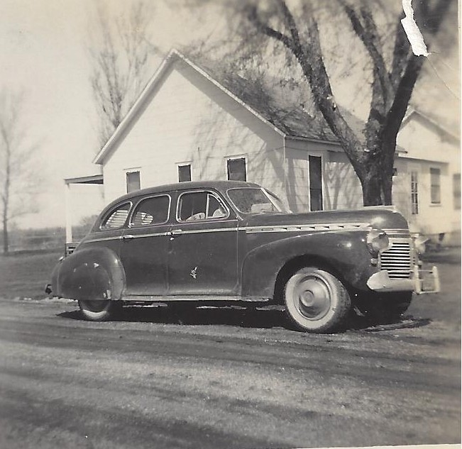
Ted Bennetts 41 Chevy-1952

Old Wall
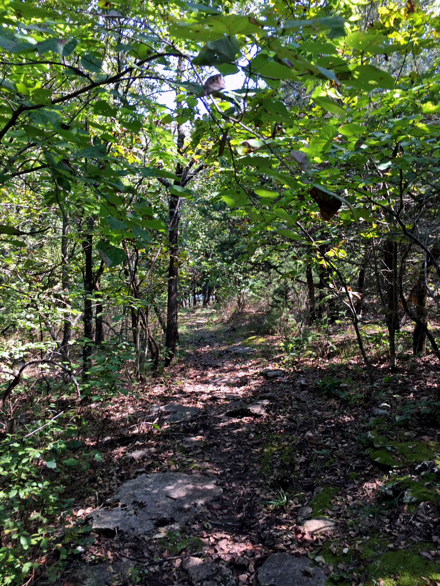
Elk River Center Section Access Trail
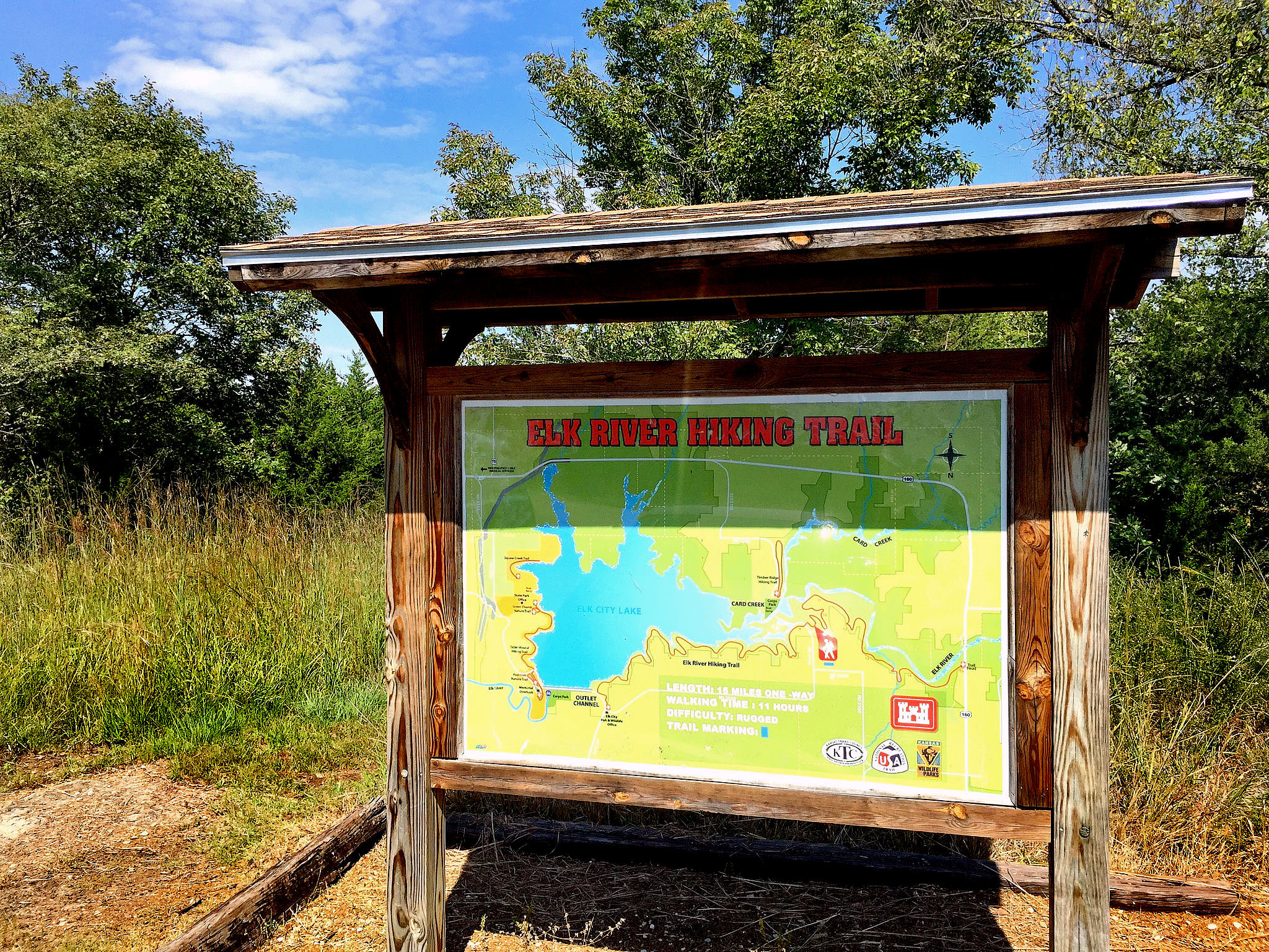
Trailhead Sign
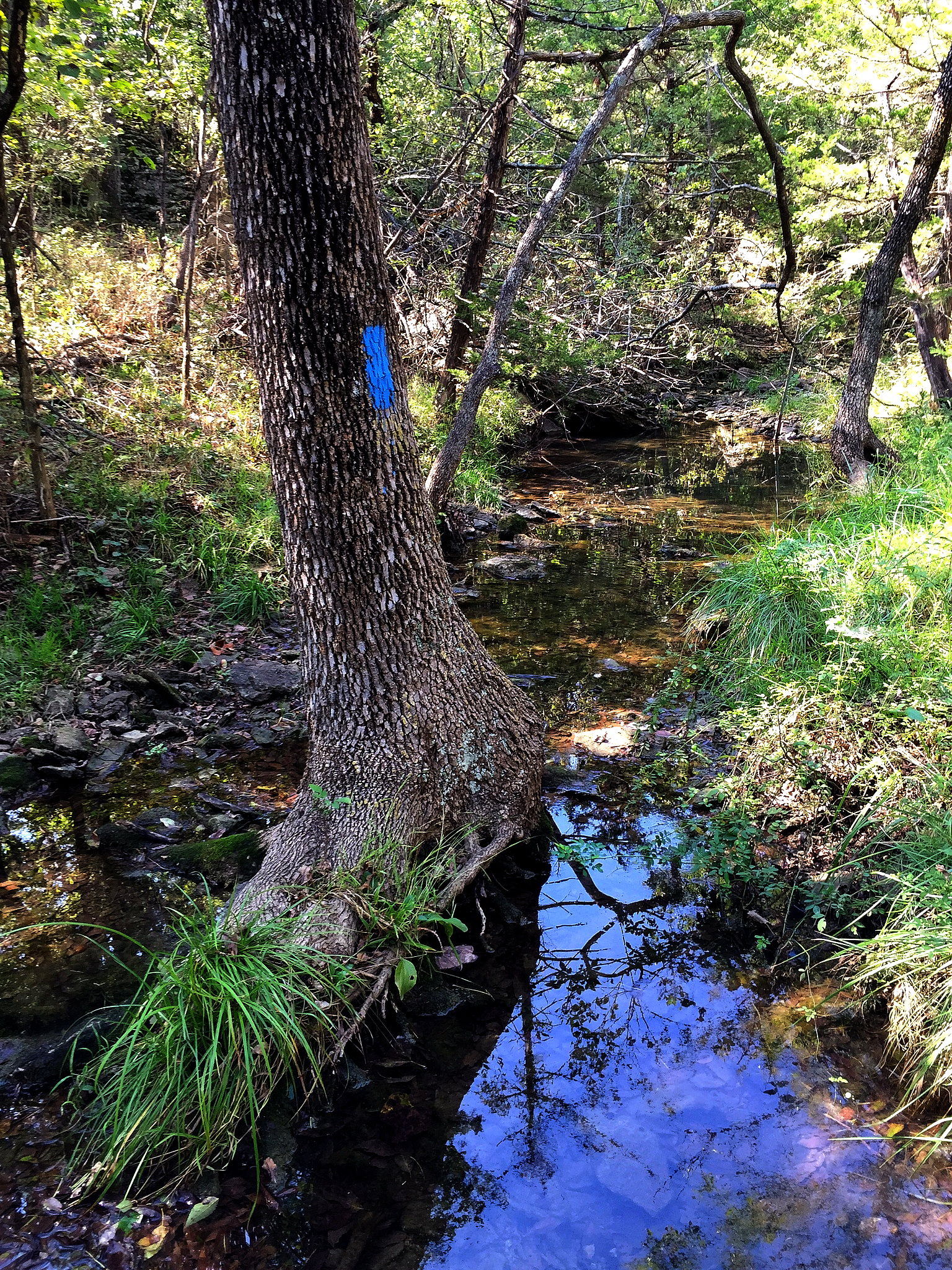
In the stream
Small bluff

Nature's Corner

Car Sticks
E Bell Wayside St, Independence, KS アメリカ合衆国の地図
別の場所を検索
近所の場所
County Rd, Independence, KS アメリカ合衆国大草原の小さな家博物館
アメリカ合衆国 カンザス州 ラットランド
Rd, Independence, KS アメリカ合衆国 Road
Rt 4, Independence, KS アメリカ合衆国カンザス・ステート=ワイルドライフ & パークス
アメリカ合衆国 〒 カンザス州 インディペンデンス ウォーカー・マウンド
アメリカ合衆国 〒 カンザス州 インディペンデンス
アメリカ合衆国 カンザス州 モントゴメリー
St, Independence, KS アメリカ合衆国Cashmere
Legionville Rd, Independence, KS アメリカ合衆国Testo Boost In Usa
Jl. Cendrawasih IV GKA Suci, Kec. Manyar GRESIK, Independence, KS アメリカ合衆国Mars Appreciation All The G
Corsair Avenue Tiyan GU, Fawn Creek, KS アメリカ合衆国The Salvation Army Lighthouse Recovery Center
South Australia Ninety Mile Desert
アメリカ合衆国 〒 カンザス州 インディペンデンスサンセット・ポイント・キャンプグランド
Independence, KS アメリカ合衆国Alexandra Edwards, PSYD
Independence, KS アメリカ合衆国Dennis Horn, CRNA
Independence, KS アメリカ合衆国Studio 6 North Richland Hills
Independence, KS アメリカ合衆国ユニオンステーション
Independence, KS アメリカ合衆国Bethany Sullens, LCSW
Independence, KS アメリカ合衆国Dan King Plumbing Heating & A/C
Independence, KS アメリカ合衆国Jackson's Hole Sports Grill
最近の検索
- アメリカ合衆国 アラスカ州 レッド・ドッグ・マイン日の出日の入り時間
- Am bhf, Borken, ドイツアム・バーンホーフ日の出日の入り時間
- 4th St E, Sonoma, CA, USA日の出日の入り時間
- Oakland Ave, Williamsport, PA アメリカ合衆国日の出日の入り時間
- Via Roma, Pieranica CR, イタリアローマ通り日の出日の入り時間
- クロアチア 〒 ドゥブロブニク GradClock Tower of Dubrovnik日の出日の入り時間
- アルゼンチン チュブ州 トレリュー日の出日の入り時間
- Hartfords Bluff Cir, Mt Pleasant, SC アメリカ合衆国日の出日の入り時間
- 日本、熊本県熊本市北区日の出日の入り時間
- 中華人民共和国 福州市 平潭県 平潭島日の出日の入り時間