Dorfstraße 34, Rietzel, ドイツ日の出日の入り時間
Location: ドイツ > ザクセン・アンハルト州 > ドイツ イェリホーファー・ラント > ドイツ 〒 リーツェル >
時間帯:
Europe/Berlin
現地時間:
2025-06-20 04:21:33
経度:
12.0159
緯度:
52.27756
今日の日の出時刻:
04:49:56 AM
今日の日の入時刻:
09:37:18 PM
今日の日長:
16h 47m 22s
明日の日の出時刻:
04:50:09 AM
明日の日の入時刻:
09:37:31 PM
明日の日長:
16h 47m 22s
すべて表示する
| 日付 | 日出 | 日没 | 日長 |
|---|---|---|---|
| 2025年01月01日 | 08:21:09 AM | 04:10:28 PM | 7h 49m 19s |
| 2025年01月02日 | 08:20:57 AM | 04:11:36 PM | 7h 50m 39s |
| 2025年01月03日 | 08:20:42 AM | 04:12:46 PM | 7h 52m 4s |
| 2025年01月04日 | 08:20:23 AM | 04:13:59 PM | 7h 53m 36s |
| 2025年01月05日 | 08:20:01 AM | 04:15:14 PM | 7h 55m 13s |
| 2025年01月06日 | 08:19:36 AM | 04:16:32 PM | 7h 56m 56s |
| 2025年01月07日 | 08:19:07 AM | 04:17:52 PM | 7h 58m 45s |
| 2025年01月08日 | 08:18:35 AM | 04:19:14 PM | 8h 0m 39s |
| 2025年01月09日 | 08:17:59 AM | 04:20:39 PM | 8h 2m 40s |
| 2025年01月10日 | 08:17:21 AM | 04:22:06 PM | 8h 4m 45s |
| 2025年01月11日 | 08:16:39 AM | 04:23:35 PM | 8h 6m 56s |
| 2025年01月12日 | 08:15:54 AM | 04:25:05 PM | 8h 9m 11s |
| 2025年01月13日 | 08:15:06 AM | 04:26:38 PM | 8h 11m 32s |
| 2025年01月14日 | 08:14:15 AM | 04:28:12 PM | 8h 13m 57s |
| 2025年01月15日 | 08:13:21 AM | 04:29:48 PM | 8h 16m 27s |
| 2025年01月16日 | 08:12:24 AM | 04:31:25 PM | 8h 19m 1s |
| 2025年01月17日 | 08:11:24 AM | 04:33:04 PM | 8h 21m 40s |
| 2025年01月18日 | 08:10:21 AM | 04:34:44 PM | 8h 24m 23s |
| 2025年01月19日 | 08:09:15 AM | 04:36:26 PM | 8h 27m 11s |
| 2025年01月20日 | 08:08:07 AM | 04:38:09 PM | 8h 30m 2s |
| 2025年01月21日 | 08:06:56 AM | 04:39:53 PM | 8h 32m 57s |
| 2025年01月22日 | 08:05:43 AM | 04:41:38 PM | 8h 35m 55s |
| 2025年01月23日 | 08:04:27 AM | 04:43:24 PM | 8h 38m 57s |
| 2025年01月24日 | 08:03:08 AM | 04:45:11 PM | 8h 42m 3s |
| 2025年01月25日 | 08:01:47 AM | 04:46:58 PM | 8h 45m 11s |
| 2025年01月26日 | 08:00:24 AM | 04:48:47 PM | 8h 48m 23s |
| 2025年01月27日 | 07:58:58 AM | 04:50:36 PM | 8h 51m 38s |
| 2025年01月28日 | 07:57:31 AM | 04:52:26 PM | 8h 54m 55s |
| 2025年01月29日 | 07:56:00 AM | 04:54:17 PM | 8h 58m 17s |
| 2025年01月30日 | 07:54:28 AM | 04:56:07 PM | 9h 1m 39s |
| 2025年01月31日 | 07:52:54 AM | 04:57:59 PM | 9h 5m 5s |
| 2025年02月01日 | 07:51:18 AM | 04:59:51 PM | 9h 8m 33s |
| 2025年02月02日 | 07:49:39 AM | 05:01:43 PM | 9h 12m 4s |
| 2025年02月03日 | 07:47:59 AM | 05:03:35 PM | 9h 15m 36s |
| 2025年02月04日 | 07:46:17 AM | 05:05:28 PM | 9h 19m 11s |
| 2025年02月05日 | 07:44:33 AM | 05:07:21 PM | 9h 22m 48s |
| 2025年02月06日 | 07:42:48 AM | 05:09:14 PM | 9h 26m 26s |
| 2025年02月07日 | 07:41:00 AM | 05:11:07 PM | 9h 30m 7s |
| 2025年02月08日 | 07:39:11 AM | 05:13:00 PM | 9h 33m 49s |
| 2025年02月09日 | 07:37:21 AM | 05:14:53 PM | 9h 37m 32s |
| 2025年02月10日 | 07:35:29 AM | 05:16:46 PM | 9h 41m 17s |
| 2025年02月11日 | 07:33:35 AM | 05:18:39 PM | 9h 45m 4s |
| 2025年02月12日 | 07:31:40 AM | 05:20:33 PM | 9h 48m 53s |
| 2025年02月13日 | 07:29:44 AM | 05:22:26 PM | 9h 52m 42s |
| 2025年02月14日 | 07:27:46 AM | 05:24:18 PM | 9h 56m 32s |
| 2025年02月15日 | 07:25:47 AM | 05:26:11 PM | 10h 0m 24s |
| 2025年02月16日 | 07:23:46 AM | 05:28:04 PM | 10h 4m 18s |
| 2025年02月17日 | 07:21:45 AM | 05:29:56 PM | 10h 8m 11s |
| 2025年02月18日 | 07:19:42 AM | 05:31:48 PM | 10h 12m 6s |
| 2025年02月19日 | 07:17:38 AM | 05:33:40 PM | 10h 16m 2s |
| 2025年02月20日 | 07:15:33 AM | 05:35:32 PM | 10h 19m 59s |
| 2025年02月21日 | 07:13:27 AM | 05:37:23 PM | 10h 23m 56s |
| 2025年02月22日 | 07:11:20 AM | 05:39:15 PM | 10h 27m 55s |
| 2025年02月23日 | 07:09:12 AM | 05:41:06 PM | 10h 31m 54s |
| 2025年02月24日 | 07:07:04 AM | 05:42:56 PM | 10h 35m 52s |
| 2025年02月25日 | 07:04:54 AM | 05:44:47 PM | 10h 39m 53s |
| 2025年02月26日 | 07:02:43 AM | 05:46:37 PM | 10h 43m 54s |
| 2025年02月27日 | 07:00:32 AM | 05:48:27 PM | 10h 47m 55s |
| 2025年02月28日 | 06:58:20 AM | 05:50:16 PM | 10h 51m 56s |
| 2025年03月01日 | 06:56:07 AM | 05:52:06 PM | 10h 55m 59s |
| 2025年03月02日 | 06:53:53 AM | 05:53:55 PM | 11h 0m 2s |
| 2025年03月03日 | 06:51:39 AM | 05:55:43 PM | 11h 4m 4s |
| 2025年03月04日 | 06:49:24 AM | 05:57:32 PM | 11h 8m 8s |
| 2025年03月05日 | 06:47:09 AM | 05:59:20 PM | 11h 12m 11s |
| 2025年03月06日 | 06:44:53 AM | 06:01:08 PM | 11h 16m 15s |
| 2025年03月07日 | 06:42:36 AM | 06:02:56 PM | 11h 20m 20s |
| 2025年03月08日 | 06:40:19 AM | 06:04:43 PM | 11h 24m 24s |
| 2025年03月09日 | 06:38:02 AM | 06:06:30 PM | 11h 28m 28s |
| 2025年03月10日 | 06:35:44 AM | 06:08:17 PM | 11h 32m 33s |
| 2025年03月11日 | 06:33:25 AM | 06:10:04 PM | 11h 36m 39s |
| 2025年03月12日 | 06:31:07 AM | 06:11:50 PM | 11h 40m 43s |
| 2025年03月13日 | 06:28:48 AM | 06:13:36 PM | 11h 44m 48s |
| 2025年03月14日 | 06:26:29 AM | 06:15:22 PM | 11h 48m 53s |
| 2025年03月15日 | 06:24:09 AM | 06:17:08 PM | 11h 52m 59s |
| 2025年03月16日 | 06:21:49 AM | 06:18:53 PM | 11h 57m 4s |
| 2025年03月17日 | 06:19:29 AM | 06:20:39 PM | 12h 1m 10s |
| 2025年03月18日 | 06:17:09 AM | 06:22:24 PM | 12h 5m 15s |
| 2025年03月19日 | 06:14:49 AM | 06:24:09 PM | 12h 9m 20s |
| 2025年03月20日 | 06:12:29 AM | 06:25:54 PM | 12h 13m 25s |
| 2025年03月21日 | 06:10:08 AM | 06:27:39 PM | 12h 17m 31s |
| 2025年03月22日 | 06:07:48 AM | 06:29:23 PM | 12h 21m 35s |
| 2025年03月23日 | 06:05:27 AM | 06:31:08 PM | 12h 25m 41s |
| 2025年03月24日 | 06:03:07 AM | 06:32:52 PM | 12h 29m 45s |
| 2025年03月25日 | 06:00:46 AM | 06:34:36 PM | 12h 33m 50s |
| 2025年03月26日 | 05:58:26 AM | 06:36:21 PM | 12h 37m 55s |
| 2025年03月27日 | 05:56:05 AM | 06:38:05 PM | 12h 42m 0s |
| 2025年03月28日 | 05:53:45 AM | 06:39:49 PM | 12h 46m 4s |
| 2025年03月29日 | 05:51:25 AM | 06:41:33 PM | 12h 50m 8s |
| 2025年03月30日 | 06:49:11 AM | 07:43:12 PM | 12h 54m 1s |
| 2025年03月31日 | 06:46:52 AM | 07:44:56 PM | 12h 58m 4s |
| 2025年04月01日 | 06:44:32 AM | 07:46:40 PM | 13h 2m 8s |
| 2025年04月02日 | 06:42:13 AM | 07:48:24 PM | 13h 6m 11s |
| 2025年04月03日 | 06:39:54 AM | 07:50:07 PM | 13h 10m 13s |
| 2025年04月04日 | 06:37:36 AM | 07:51:51 PM | 13h 14m 15s |
| 2025年04月05日 | 06:35:18 AM | 07:53:35 PM | 13h 18m 17s |
| 2025年04月06日 | 06:33:00 AM | 07:55:19 PM | 13h 22m 19s |
| 2025年04月07日 | 06:30:43 AM | 07:57:02 PM | 13h 26m 19s |
| 2025年04月08日 | 06:28:27 AM | 07:58:46 PM | 13h 30m 19s |
| 2025年04月09日 | 06:26:10 AM | 08:00:30 PM | 13h 34m 20s |
| 2025年04月10日 | 06:23:55 AM | 08:02:13 PM | 13h 38m 18s |
| 2025年04月11日 | 06:21:40 AM | 08:03:57 PM | 13h 42m 17s |
| 2025年04月12日 | 06:19:25 AM | 08:05:41 PM | 13h 46m 16s |
| 2025年04月13日 | 06:17:11 AM | 08:07:24 PM | 13h 50m 13s |
| 2025年04月14日 | 06:14:58 AM | 08:09:08 PM | 13h 54m 10s |
| 2025年04月15日 | 06:12:46 AM | 08:10:52 PM | 13h 58m 6s |
| 2025年04月16日 | 06:10:34 AM | 08:12:35 PM | 14h 2m 1s |
| 2025年04月17日 | 06:08:23 AM | 08:14:19 PM | 14h 5m 56s |
| 2025年04月18日 | 06:06:13 AM | 08:16:03 PM | 14h 9m 50s |
| 2025年04月19日 | 06:04:04 AM | 08:17:46 PM | 14h 13m 42s |
| 2025年04月20日 | 06:01:56 AM | 08:19:30 PM | 14h 17m 34s |
| 2025年04月21日 | 05:59:49 AM | 08:21:13 PM | 14h 21m 24s |
| 2025年04月22日 | 05:57:42 AM | 08:22:56 PM | 14h 25m 14s |
| 2025年04月23日 | 05:55:37 AM | 08:24:40 PM | 14h 29m 3s |
| 2025年04月24日 | 05:53:33 AM | 08:26:23 PM | 14h 32m 50s |
| 2025年04月25日 | 05:51:29 AM | 08:28:06 PM | 14h 36m 37s |
| 2025年04月26日 | 05:49:27 AM | 08:29:49 PM | 14h 40m 22s |
| 2025年04月27日 | 05:47:26 AM | 08:31:31 PM | 14h 44m 5s |
| 2025年04月28日 | 05:45:27 AM | 08:33:14 PM | 14h 47m 47s |
| 2025年04月29日 | 05:43:28 AM | 08:34:56 PM | 14h 51m 28s |
| 2025年04月30日 | 05:41:31 AM | 08:36:38 PM | 14h 55m 7s |
| 2025年05月01日 | 05:39:36 AM | 08:38:19 PM | 14h 58m 43s |
| 2025年05月02日 | 05:37:42 AM | 08:40:01 PM | 15h 2m 19s |
| 2025年05月03日 | 05:35:49 AM | 08:41:42 PM | 15h 5m 53s |
| 2025年05月04日 | 05:33:57 AM | 08:43:22 PM | 15h 9m 25s |
| 2025年05月05日 | 05:32:08 AM | 08:45:02 PM | 15h 12m 54s |
| 2025年05月06日 | 05:30:19 AM | 08:46:42 PM | 15h 16m 23s |
| 2025年05月07日 | 05:28:33 AM | 08:48:21 PM | 15h 19m 48s |
| 2025年05月08日 | 05:26:48 AM | 08:50:00 PM | 15h 23m 12s |
| 2025年05月09日 | 05:25:05 AM | 08:51:38 PM | 15h 26m 33s |
| 2025年05月10日 | 05:23:24 AM | 08:53:15 PM | 15h 29m 51s |
| 2025年05月11日 | 05:21:44 AM | 08:54:52 PM | 15h 33m 8s |
| 2025年05月12日 | 05:20:07 AM | 08:56:28 PM | 15h 36m 21s |
| 2025年05月13日 | 05:18:31 AM | 08:58:03 PM | 15h 39m 32s |
| 2025年05月14日 | 05:16:58 AM | 08:59:37 PM | 15h 42m 39s |
| 2025年05月15日 | 05:15:26 AM | 09:01:10 PM | 15h 45m 44s |
| 2025年05月16日 | 05:13:57 AM | 09:02:43 PM | 15h 48m 46s |
| 2025年05月17日 | 05:12:30 AM | 09:04:14 PM | 15h 51m 44s |
| 2025年05月18日 | 05:11:05 AM | 09:05:44 PM | 15h 54m 39s |
| 2025年05月19日 | 05:09:42 AM | 09:07:13 PM | 15h 57m 31s |
| 2025年05月20日 | 05:08:21 AM | 09:08:41 PM | 16h 0m 20s |
| 2025年05月21日 | 05:07:03 AM | 09:10:07 PM | 16h 3m 4s |
| 2025年05月22日 | 05:05:48 AM | 09:11:32 PM | 16h 5m 44s |
| 2025年05月23日 | 05:04:34 AM | 09:12:56 PM | 16h 8m 22s |
| 2025年05月24日 | 05:03:24 AM | 09:14:18 PM | 16h 10m 54s |
| 2025年05月25日 | 05:02:16 AM | 09:15:38 PM | 16h 13m 22s |
| 2025年05月26日 | 05:01:10 AM | 09:16:57 PM | 16h 15m 47s |
| 2025年05月27日 | 05:00:08 AM | 09:18:14 PM | 16h 18m 6s |
| 2025年05月28日 | 04:59:08 AM | 09:19:30 PM | 16h 20m 22s |
| 2025年05月29日 | 04:58:10 AM | 09:20:43 PM | 16h 22m 33s |
| 2025年05月30日 | 04:57:16 AM | 09:21:54 PM | 16h 24m 38s |
| 2025年05月31日 | 04:56:24 AM | 09:23:04 PM | 16h 26m 40s |
| 2025年06月01日 | 04:55:36 AM | 09:24:11 PM | 16h 28m 35s |
| 2025年06月02日 | 04:54:50 AM | 09:25:16 PM | 16h 30m 26s |
| 2025年06月03日 | 04:54:07 AM | 09:26:19 PM | 16h 32m 12s |
| 2025年06月04日 | 04:53:28 AM | 09:27:20 PM | 16h 33m 52s |
| 2025年06月05日 | 04:52:51 AM | 09:28:18 PM | 16h 35m 27s |
| 2025年06月06日 | 04:52:17 AM | 09:29:14 PM | 16h 36m 57s |
| 2025年06月07日 | 04:51:47 AM | 09:30:07 PM | 16h 38m 20s |
| 2025年06月08日 | 04:51:19 AM | 09:30:57 PM | 16h 39m 38s |
| 2025年06月09日 | 04:50:55 AM | 09:31:45 PM | 16h 40m 50s |
| 2025年06月10日 | 04:50:34 AM | 09:32:30 PM | 16h 41m 56s |
| 2025年06月11日 | 04:50:16 AM | 09:33:13 PM | 16h 42m 57s |
| 2025年06月12日 | 04:50:01 AM | 09:33:53 PM | 16h 43m 52s |
| 2025年06月13日 | 04:49:50 AM | 09:34:29 PM | 16h 44m 39s |
| 2025年06月14日 | 04:49:42 AM | 09:35:03 PM | 16h 45m 21s |
| 2025年06月15日 | 04:49:36 AM | 09:35:34 PM | 16h 45m 58s |
| 2025年06月16日 | 04:49:35 AM | 09:36:02 PM | 16h 46m 27s |
| 2025年06月17日 | 04:49:36 AM | 09:36:26 PM | 16h 46m 50s |
| 2025年06月18日 | 04:49:40 AM | 09:36:48 PM | 16h 47m 8s |
| 2025年06月19日 | 04:49:48 AM | 09:37:07 PM | 16h 47m 19s |
| 2025年06月20日 | 04:49:59 AM | 09:37:22 PM | 16h 47m 23s |
| 2025年06月21日 | 04:50:13 AM | 09:37:34 PM | 16h 47m 21s |
| 2025年06月22日 | 04:50:30 AM | 09:37:43 PM | 16h 47m 13s |
| 2025年06月23日 | 04:50:50 AM | 09:37:49 PM | 16h 46m 59s |
| 2025年06月24日 | 04:51:13 AM | 09:37:51 PM | 16h 46m 38s |
| 2025年06月25日 | 04:51:39 AM | 09:37:50 PM | 16h 46m 11s |
| 2025年06月26日 | 04:52:08 AM | 09:37:46 PM | 16h 45m 38s |
| 2025年06月27日 | 04:52:41 AM | 09:37:39 PM | 16h 44m 58s |
| 2025年06月28日 | 04:53:15 AM | 09:37:29 PM | 16h 44m 14s |
| 2025年06月29日 | 04:53:53 AM | 09:37:15 PM | 16h 43m 22s |
| 2025年06月30日 | 04:54:34 AM | 09:36:58 PM | 16h 42m 24s |
| 2025年07月01日 | 04:55:17 AM | 09:36:38 PM | 16h 41m 21s |
| 2025年07月02日 | 04:56:03 AM | 09:36:14 PM | 16h 40m 11s |
| 2025年07月03日 | 04:56:51 AM | 09:35:48 PM | 16h 38m 57s |
| 2025年07月04日 | 04:57:42 AM | 09:35:18 PM | 16h 37m 36s |
| 2025年07月05日 | 04:58:36 AM | 09:34:45 PM | 16h 36m 9s |
| 2025年07月06日 | 04:59:32 AM | 09:34:09 PM | 16h 34m 37s |
| 2025年07月07日 | 05:00:30 AM | 09:33:30 PM | 16h 33m 0s |
| 2025年07月08日 | 05:01:30 AM | 09:32:47 PM | 16h 31m 17s |
| 2025年07月09日 | 05:02:33 AM | 09:32:02 PM | 16h 29m 29s |
| 2025年07月10日 | 05:03:38 AM | 09:31:14 PM | 16h 27m 36s |
| 2025年07月11日 | 05:04:45 AM | 09:30:23 PM | 16h 25m 38s |
| 2025年07月12日 | 05:05:53 AM | 09:29:29 PM | 16h 23m 36s |
| 2025年07月13日 | 05:07:04 AM | 09:28:32 PM | 16h 21m 28s |
| 2025年07月14日 | 05:08:17 AM | 09:27:32 PM | 16h 19m 15s |
| 2025年07月15日 | 05:09:31 AM | 09:26:30 PM | 16h 16m 59s |
| 2025年07月16日 | 05:10:47 AM | 09:25:25 PM | 16h 14m 38s |
| 2025年07月17日 | 05:12:04 AM | 09:24:17 PM | 16h 12m 13s |
| 2025年07月18日 | 05:13:23 AM | 09:23:06 PM | 16h 9m 43s |
| 2025年07月19日 | 05:14:44 AM | 09:21:54 PM | 16h 7m 10s |
| 2025年07月20日 | 05:16:06 AM | 09:20:38 PM | 16h 4m 32s |
| 2025年07月21日 | 05:17:29 AM | 09:19:20 PM | 16h 1m 51s |
| 2025年07月22日 | 05:18:54 AM | 09:18:00 PM | 15h 59m 6s |
| 2025年07月23日 | 05:20:19 AM | 09:16:37 PM | 15h 56m 18s |
| 2025年07月24日 | 05:21:46 AM | 09:15:12 PM | 15h 53m 26s |
| 2025年07月25日 | 05:23:14 AM | 09:13:45 PM | 15h 50m 31s |
| 2025年07月26日 | 05:24:43 AM | 09:12:15 PM | 15h 47m 32s |
| 2025年07月27日 | 05:26:13 AM | 09:10:44 PM | 15h 44m 31s |
| 2025年07月28日 | 05:27:43 AM | 09:09:10 PM | 15h 41m 27s |
| 2025年07月29日 | 05:29:15 AM | 09:07:35 PM | 15h 38m 20s |
| 2025年07月30日 | 05:30:47 AM | 09:05:57 PM | 15h 35m 10s |
| 2025年07月31日 | 05:32:20 AM | 09:04:17 PM | 15h 31m 57s |
| 2025年08月01日 | 05:33:54 AM | 09:02:36 PM | 15h 28m 42s |
| 2025年08月02日 | 05:35:28 AM | 09:00:53 PM | 15h 25m 25s |
| 2025年08月03日 | 05:37:03 AM | 08:59:08 PM | 15h 22m 5s |
| 2025年08月04日 | 05:38:38 AM | 08:57:21 PM | 15h 18m 43s |
| 2025年08月05日 | 05:40:14 AM | 08:55:33 PM | 15h 15m 19s |
| 2025年08月06日 | 05:41:50 AM | 08:53:43 PM | 15h 11m 53s |
| 2025年08月07日 | 05:43:26 AM | 08:51:51 PM | 15h 8m 25s |
| 2025年08月08日 | 05:45:03 AM | 08:49:58 PM | 15h 4m 55s |
| 2025年08月09日 | 05:46:41 AM | 08:48:03 PM | 15h 1m 22s |
| 2025年08月10日 | 05:48:18 AM | 08:46:07 PM | 14h 57m 49s |
| 2025年08月11日 | 05:49:56 AM | 08:44:10 PM | 14h 54m 14s |
| 2025年08月12日 | 05:51:34 AM | 08:42:11 PM | 14h 50m 37s |
| 2025年08月13日 | 05:53:12 AM | 08:40:11 PM | 14h 46m 59s |
| 2025年08月14日 | 05:54:50 AM | 08:38:10 PM | 14h 43m 20s |
| 2025年08月15日 | 05:56:29 AM | 08:36:07 PM | 14h 39m 38s |
| 2025年08月16日 | 05:58:08 AM | 08:34:03 PM | 14h 35m 55s |
| 2025年08月17日 | 05:59:46 AM | 08:31:59 PM | 14h 32m 13s |
| 2025年08月18日 | 06:01:25 AM | 08:29:53 PM | 14h 28m 28s |
| 2025年08月19日 | 06:03:04 AM | 08:27:46 PM | 14h 24m 42s |
| 2025年08月20日 | 06:04:43 AM | 08:25:38 PM | 14h 20m 55s |
| 2025年08月21日 | 06:06:22 AM | 08:23:29 PM | 14h 17m 7s |
| 2025年08月22日 | 06:08:01 AM | 08:21:19 PM | 14h 13m 18s |
| 2025年08月23日 | 06:09:40 AM | 08:19:08 PM | 14h 9m 28s |
| 2025年08月24日 | 06:11:19 AM | 08:16:57 PM | 14h 5m 38s |
| 2025年08月25日 | 06:12:58 AM | 08:14:45 PM | 14h 1m 47s |
| 2025年08月26日 | 06:14:37 AM | 08:12:31 PM | 13h 57m 54s |
| 2025年08月27日 | 06:16:15 AM | 08:10:17 PM | 13h 54m 2s |
| 2025年08月28日 | 06:17:54 AM | 08:08:03 PM | 13h 50m 9s |
| 2025年08月29日 | 06:19:33 AM | 08:05:48 PM | 13h 46m 15s |
| 2025年08月30日 | 06:21:12 AM | 08:03:32 PM | 13h 42m 20s |
| 2025年08月31日 | 06:22:51 AM | 08:01:15 PM | 13h 38m 24s |
| 2025年09月01日 | 06:24:30 AM | 07:58:58 PM | 13h 34m 28s |
| 2025年09月02日 | 06:26:08 AM | 07:56:41 PM | 13h 30m 33s |
| 2025年09月03日 | 06:27:47 AM | 07:54:22 PM | 13h 26m 35s |
| 2025年09月04日 | 06:29:26 AM | 07:52:04 PM | 13h 22m 38s |
| 2025年09月05日 | 06:31:05 AM | 07:49:45 PM | 13h 18m 40s |
| 2025年09月06日 | 06:32:43 AM | 07:47:25 PM | 13h 14m 42s |
| 2025年09月07日 | 06:34:22 AM | 07:45:06 PM | 13h 10m 44s |
| 2025年09月08日 | 06:36:01 AM | 07:42:45 PM | 13h 6m 44s |
| 2025年09月09日 | 06:37:39 AM | 07:40:25 PM | 13h 2m 46s |
| 2025年09月10日 | 06:39:18 AM | 07:38:04 PM | 12h 58m 46s |
| 2025年09月11日 | 06:40:57 AM | 07:35:43 PM | 12h 54m 46s |
| 2025年09月12日 | 06:42:35 AM | 07:33:22 PM | 12h 50m 47s |
| 2025年09月13日 | 06:44:14 AM | 07:31:00 PM | 12h 46m 46s |
| 2025年09月14日 | 06:45:53 AM | 07:28:39 PM | 12h 42m 46s |
| 2025年09月15日 | 06:47:32 AM | 07:26:17 PM | 12h 38m 45s |
| 2025年09月16日 | 06:49:11 AM | 07:23:55 PM | 12h 34m 44s |
| 2025年09月17日 | 06:50:50 AM | 07:21:33 PM | 12h 30m 43s |
| 2025年09月18日 | 06:52:29 AM | 07:19:11 PM | 12h 26m 42s |
| 2025年09月19日 | 06:54:08 AM | 07:16:49 PM | 12h 22m 41s |
| 2025年09月20日 | 06:55:48 AM | 07:14:27 PM | 12h 18m 39s |
| 2025年09月21日 | 06:57:27 AM | 07:12:05 PM | 12h 14m 38s |
| 2025年09月22日 | 06:59:07 AM | 07:09:43 PM | 12h 10m 36s |
| 2025年09月23日 | 07:00:46 AM | 07:07:22 PM | 12h 6m 36s |
| 2025年09月24日 | 07:02:26 AM | 07:05:00 PM | 12h 2m 34s |
| 2025年09月25日 | 07:04:06 AM | 07:02:39 PM | 11h 58m 33s |
| 2025年09月26日 | 07:05:47 AM | 07:00:17 PM | 11h 54m 30s |
| 2025年09月27日 | 07:07:27 AM | 06:57:56 PM | 11h 50m 29s |
| 2025年09月28日 | 07:09:08 AM | 06:55:35 PM | 11h 46m 27s |
| 2025年09月29日 | 07:10:49 AM | 06:53:15 PM | 11h 42m 26s |
| 2025年09月30日 | 07:12:30 AM | 06:50:54 PM | 11h 38m 24s |
| 2025年10月01日 | 07:14:11 AM | 06:48:35 PM | 11h 34m 24s |
| 2025年10月02日 | 07:15:53 AM | 06:46:15 PM | 11h 30m 22s |
| 2025年10月03日 | 07:17:34 AM | 06:43:56 PM | 11h 26m 22s |
| 2025年10月04日 | 07:19:16 AM | 06:41:37 PM | 11h 22m 21s |
| 2025年10月05日 | 07:20:59 AM | 06:39:19 PM | 11h 18m 20s |
| 2025年10月06日 | 07:22:41 AM | 06:37:01 PM | 11h 14m 20s |
| 2025年10月07日 | 07:24:24 AM | 06:34:44 PM | 11h 10m 20s |
| 2025年10月08日 | 07:26:08 AM | 06:32:27 PM | 11h 6m 19s |
| 2025年10月09日 | 07:27:51 AM | 06:30:11 PM | 11h 2m 20s |
| 2025年10月10日 | 07:29:35 AM | 06:27:56 PM | 10h 58m 21s |
| 2025年10月11日 | 07:31:19 AM | 06:25:41 PM | 10h 54m 22s |
| 2025年10月12日 | 07:33:03 AM | 06:23:27 PM | 10h 50m 24s |
| 2025年10月13日 | 07:34:48 AM | 06:21:13 PM | 10h 46m 25s |
| 2025年10月14日 | 07:36:33 AM | 06:19:01 PM | 10h 42m 28s |
| 2025年10月15日 | 07:38:19 AM | 06:16:49 PM | 10h 38m 30s |
| 2025年10月16日 | 07:40:04 AM | 06:14:38 PM | 10h 34m 34s |
| 2025年10月17日 | 07:41:50 AM | 06:12:28 PM | 10h 30m 38s |
| 2025年10月18日 | 07:43:36 AM | 06:10:19 PM | 10h 26m 43s |
| 2025年10月19日 | 07:45:23 AM | 06:08:10 PM | 10h 22m 47s |
| 2025年10月20日 | 07:47:10 AM | 06:06:03 PM | 10h 18m 53s |
| 2025年10月21日 | 07:48:57 AM | 06:03:57 PM | 10h 15m 0s |
| 2025年10月22日 | 07:50:44 AM | 06:01:52 PM | 10h 11m 8s |
| 2025年10月23日 | 07:52:32 AM | 05:59:48 PM | 10h 7m 16s |
| 2025年10月24日 | 07:54:20 AM | 05:57:45 PM | 10h 3m 25s |
| 2025年10月25日 | 07:56:08 AM | 05:55:44 PM | 9h 59m 36s |
| 2025年10月26日 | 06:58:01 AM | 04:53:38 PM | 9h 55m 37s |
| 2025年10月27日 | 06:59:49 AM | 04:51:39 PM | 9h 51m 50s |
| 2025年10月28日 | 07:01:38 AM | 04:49:42 PM | 9h 48m 4s |
| 2025年10月29日 | 07:03:27 AM | 04:47:46 PM | 9h 44m 19s |
| 2025年10月30日 | 07:05:16 AM | 04:45:51 PM | 9h 40m 35s |
| 2025年10月31日 | 07:07:05 AM | 04:43:57 PM | 9h 36m 52s |
| 2025年11月01日 | 07:08:54 AM | 04:42:06 PM | 9h 33m 12s |
| 2025年11月02日 | 07:10:43 AM | 04:40:16 PM | 9h 29m 33s |
| 2025年11月03日 | 07:12:32 AM | 04:38:27 PM | 9h 25m 55s |
| 2025年11月04日 | 07:14:21 AM | 04:36:40 PM | 9h 22m 19s |
| 2025年11月05日 | 07:16:10 AM | 04:34:55 PM | 9h 18m 45s |
| 2025年11月06日 | 07:17:59 AM | 04:33:12 PM | 9h 15m 13s |
| 2025年11月07日 | 07:19:47 AM | 04:31:30 PM | 9h 11m 43s |
| 2025年11月08日 | 07:21:36 AM | 04:29:51 PM | 9h 8m 15s |
| 2025年11月09日 | 07:23:24 AM | 04:28:13 PM | 9h 4m 49s |
| 2025年11月10日 | 07:25:12 AM | 04:26:37 PM | 9h 1m 25s |
| 2025年11月11日 | 07:26:59 AM | 04:25:04 PM | 8h 58m 5s |
| 2025年11月12日 | 07:28:46 AM | 04:23:33 PM | 8h 54m 47s |
| 2025年11月13日 | 07:30:33 AM | 04:22:03 PM | 8h 51m 30s |
| 2025年11月14日 | 07:32:19 AM | 04:20:36 PM | 8h 48m 17s |
| 2025年11月15日 | 07:34:04 AM | 04:19:12 PM | 8h 45m 8s |
| 2025年11月16日 | 07:35:49 AM | 04:17:49 PM | 8h 42m 0s |
| 2025年11月17日 | 07:37:33 AM | 04:16:30 PM | 8h 38m 57s |
| 2025年11月18日 | 07:39:16 AM | 04:15:12 PM | 8h 35m 56s |
| 2025年11月19日 | 07:40:58 AM | 04:13:57 PM | 8h 32m 59s |
| 2025年11月20日 | 07:42:39 AM | 04:12:45 PM | 8h 30m 6s |
| 2025年11月21日 | 07:44:20 AM | 04:11:35 PM | 8h 27m 15s |
| 2025年11月22日 | 07:45:59 AM | 04:10:29 PM | 8h 24m 30s |
| 2025年11月23日 | 07:47:37 AM | 04:09:24 PM | 8h 21m 47s |
| 2025年11月24日 | 07:49:13 AM | 04:08:23 PM | 8h 19m 10s |
| 2025年11月25日 | 07:50:49 AM | 04:07:25 PM | 8h 16m 36s |
| 2025年11月26日 | 07:52:22 AM | 04:06:29 PM | 8h 14m 7s |
| 2025年11月27日 | 07:53:55 AM | 04:05:37 PM | 8h 11m 42s |
| 2025年11月28日 | 07:55:25 AM | 04:04:47 PM | 8h 9m 22s |
| 2025年11月29日 | 07:56:54 AM | 04:04:01 PM | 8h 7m 7s |
| 2025年11月30日 | 07:58:21 AM | 04:03:18 PM | 8h 4m 57s |
| 2025年12月01日 | 07:59:46 AM | 04:02:38 PM | 8h 2m 52s |
| 2025年12月02日 | 08:01:09 AM | 04:02:01 PM | 8h 0m 52s |
| 2025年12月03日 | 08:02:31 AM | 04:01:28 PM | 7h 58m 57s |
| 2025年12月04日 | 08:03:49 AM | 04:00:57 PM | 7h 57m 8s |
| 2025年12月05日 | 08:05:06 AM | 04:00:31 PM | 7h 55m 25s |
| 2025年12月06日 | 08:06:21 AM | 04:00:07 PM | 7h 53m 46s |
| 2025年12月07日 | 08:07:33 AM | 03:59:47 PM | 7h 52m 14s |
| 2025年12月08日 | 08:08:42 AM | 03:59:31 PM | 7h 50m 49s |
| 2025年12月09日 | 08:09:49 AM | 03:59:18 PM | 7h 49m 29s |
| 2025年12月10日 | 08:10:53 AM | 03:59:08 PM | 7h 48m 15s |
| 2025年12月11日 | 08:11:54 AM | 03:59:02 PM | 7h 47m 8s |
| 2025年12月12日 | 08:12:53 AM | 03:59:00 PM | 7h 46m 7s |
| 2025年12月13日 | 08:13:49 AM | 03:59:01 PM | 7h 45m 12s |
| 2025年12月14日 | 08:14:42 AM | 03:59:05 PM | 7h 44m 23s |
| 2025年12月15日 | 08:15:31 AM | 03:59:13 PM | 7h 43m 42s |
| 2025年12月16日 | 08:16:18 AM | 03:59:25 PM | 7h 43m 7s |
| 2025年12月17日 | 08:17:02 AM | 03:59:40 PM | 7h 42m 38s |
| 2025年12月18日 | 08:17:42 AM | 03:59:59 PM | 7h 42m 17s |
| 2025年12月19日 | 08:18:19 AM | 04:00:21 PM | 7h 42m 2s |
| 2025年12月20日 | 08:18:53 AM | 04:00:47 PM | 7h 41m 54s |
| 2025年12月21日 | 08:19:23 AM | 04:01:16 PM | 7h 41m 53s |
| 2025年12月22日 | 08:19:50 AM | 04:01:49 PM | 7h 41m 59s |
| 2025年12月23日 | 08:20:14 AM | 04:02:25 PM | 7h 42m 11s |
| 2025年12月24日 | 08:20:34 AM | 04:03:04 PM | 7h 42m 30s |
| 2025年12月25日 | 08:20:51 AM | 04:03:46 PM | 7h 42m 55s |
| 2025年12月26日 | 08:21:05 AM | 04:04:32 PM | 7h 43m 27s |
| 2025年12月27日 | 08:21:14 AM | 04:05:21 PM | 7h 44m 7s |
| 2025年12月28日 | 08:21:21 AM | 04:06:13 PM | 7h 44m 52s |
| 2025年12月29日 | 08:21:24 AM | 04:07:09 PM | 7h 45m 45s |
| 2025年12月30日 | 08:21:23 AM | 04:08:07 PM | 7h 46m 44s |
| 2025年12月31日 | 08:21:19 AM | 04:09:08 PM | 7h 47m 49s |
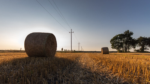
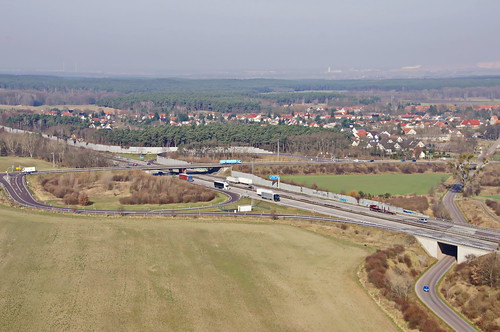
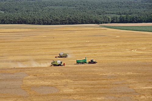
写真
Dorfstraße 34, Rietzel, ドイツの地図
別の場所を検索
近所の場所
ドイツ 〒 リーツェル
An der Ihle 12, Möckern, ドイツ
Str. der DSF 14, Elbe-Parey, ドイツ
ドイツ 〒 メッカーン フリーデンスアウ
ドイツ 〒 エルベ=パライ ギュセン
Dorfstraße 24, Möckern, ドイツ
ドイツ エルベ=パライ
ドイツ イェリホーファー・ラント
Hauptstraße 43, Elbe-Parey, ドイツ
ドイツ メッカーン
ドイツ 〒 エルベ=パライ ダーベン
Hauptstraße 13, Möckern, ドイツ
ドイツ 〒 メッカーン ダルハウ
ドイツ 〒 ゲンティン ヒュッテルミューレ
Dorfstraße 7, Genthin, ドイツ
ドイツ ピエッツプール
Dorfstraße 4, Pietzpuhl, ドイツ
ドイツ ゲンティン
ドイツ 〒 コプベル
Dorfpl. 4A, Cobbel, ドイツ
最近の検索
- アメリカ合衆国 アラスカ州 レッド・ドッグ・マイン日の出日の入り時間
- Am bhf, Borken, ドイツアム・バーンホーフ日の出日の入り時間
- 4th St E, Sonoma, CA, USA日の出日の入り時間
- Oakland Ave, Williamsport, PA アメリカ合衆国日の出日の入り時間
- Via Roma, Pieranica CR, イタリアローマ通り日の出日の入り時間
- クロアチア 〒 ドゥブロブニク GradClock Tower of Dubrovnik日の出日の入り時間
- アルゼンチン チュブ州 トレリュー日の出日の入り時間
- Hartfords Bluff Cir, Mt Pleasant, SC アメリカ合衆国日の出日の入り時間
- 日本、熊本県熊本市北区日の出日の入り時間
- 中華人民共和国 福州市 平潭県 平潭島日の出日の入り時間
