時間帯:アメリカ中部標準時
現地時間:2026年11月9日 月曜日 20:31
経度:-85.6023643
緯度:12.7690126
今日の日の出時刻:05:39:46
今日の日の入時刻:17:15:23
今日の日長:11時間35分36秒
明日の日の出時刻:05:40:09
明日の日の入時刻:17:15:12
明日の日長:11時間35分3秒

: すべて表示する

日付 日出 日没 日長
2026年1月1日 06:05:05 17:28:13 11時間23分8秒
2026年2月1日 06:09:45 17:44:26 11時間34分40秒
2026年3月1日 06:00:13 17:52:38 11時間52分25秒
2026年4月1日 05:40:30 17:54:57 12時間14分27秒
2026年5月1日 05:23:33 17:58:05 12時間34分32秒
2026年6月1日 05:16:55 18:06:11 12時間49分16秒
2026年7月1日 05:21:13 18:13:13 12時間51分59秒
2026年8月1日 05:29:15 18:10:45 12時間41分29秒
2026年9月1日 05:32:56 17:55:35 12時間22分39秒
2026年10月1日 05:32:47 17:34:30 12時間1分42秒
2026年11月1日 05:36:48 17:17:42 11時間40分53秒
2026年11月10日 05:39:46 17:15:23 11時間35分36秒
2026年11月11日 05:40:09 17:15:12 11時間35分3秒
2026年12月1日 05:49:32 17:15:36 11時間26分4秒

日の出と日の入りの写真

Sunrise from the Summit at Pico da Bandeira (Flag Peak) at 2,892 m (9,488 ft) MSL, Caparaó National Park, on the border between the municipalities of Ibitirama (Espírito Santo State) and Alto Caparaó  by ER's Eyes - Our planet is so beautiful., legends and history

Pico da Bandeira is considered the highest point in exclusively Brazilian terri
Sunrise from the Summit at Pico da Bandeira (Flag Peak) at 2,892 m (9,488 ft) MSL, Caparaó National Park, on the border between the municipalities of Ibitirama (Espírito Santo State) and Alto Caparaó by ER's Eyes - Our planet is so beautiful.
Sunset Over Lick Creek by myoldpostcards, Explore #106 on January 24, 2016.road winter sunset snow water rural america creek season landscape
Sunset Over Lick Creek by myoldpostcards
Climbing down Pico do Cristal (Crystal Peak) at 2,770 m (9,087 ft) MSL, Caparaó National Park, Alto Caparaó, Minas Gerais State, Brazil. by ER's Eyes - Our planet is so beautiful.,  
In this photograph, you will have the exact idea of the trail to reach the third highest in Brazil
Climbing down Pico do Cristal (Crystal Peak) at 2,770 m (9,087 ft) MSL, Caparaó National Park, Alto Caparaó, Minas Gerais State, Brazil. by ER's Eyes - Our planet is so beautiful.
Fresh Coat by Tom Mortenson, Evergreen branches with a fresh coat of snow and sun peeking through at Marathon Park, Wausau, Wisco
Fresh Coat by Tom Mortenson
Camp Casa Queimada at 2,190 m (7,185 ft) MSL, Caparaó National Park, Dores do Rio Preto, Espírito Santo, Brazil. by ER's Eyes - Our planet is so beautiful., Trail by way of Caparaó-Capixaba.


Trail reconnaissance training to climb to Pico da Bandeira (thir
Camp Casa Queimada at 2,190 m (7,185 ft) MSL, Caparaó National Park, Dores do Rio Preto, Espírito Santo, Brazil. by ER's Eyes - Our planet is so beautiful.
Twilight from the Summit at Pico da Bandeira (Flag Peak) at 2,892 m (9,488 ft) MSL, Caparaó National Park, on the border between the municipalities of Ibitirama (Espírito Santo State) and Alto Caparaó by ER's Eyes - Our planet is so beautiful., It is the third highest mountain in Brazil, situated on the border of Espírito Santo and Minas Gerai
Twilight from the Summit at Pico da Bandeira (Flag Peak) at 2,892 m (9,488 ft) MSL, Caparaó National Park, on the border between the municipalities of Ibitirama (Espírito Santo State) and Alto Caparaó by ER's Eyes - Our planet is so beautiful.
Sunrise from the Summit at Pico da Bandeira (Flag Peak) at 2,892 m (9,488 ft) MSL, Caparaó National Park, on the border between the municipalities of Ibitirama (Espírito Santo State) and Alto Caparaó  by ER's Eyes - Our planet is so beautiful., Pico da Bandeira (2,892 m / 9,488 ft) is the highest point in the region. Other peaks also worth men
Sunrise from the Summit at Pico da Bandeira (Flag Peak) at 2,892 m (9,488 ft) MSL, Caparaó National Park, on the border between the municipalities of Ibitirama (Espírito Santo State) and Alto Caparaó by ER's Eyes - Our planet is so beautiful.
Sunrise from the Summit at Pico da Bandeira (Flag Peak) at 2,892 m (9,488 ft) MSL, Caparaó National Park, on the border between the municipalities of Ibitirama (Espírito Santo State) and Alto Caparaó  by ER's Eyes - Our planet is so beautiful., The Serra do Caparaó has a very representative area of Atlantic Forest, with unique examples of alpi
Sunrise from the Summit at Pico da Bandeira (Flag Peak) at 2,892 m (9,488 ft) MSL, Caparaó National Park, on the border between the municipalities of Ibitirama (Espírito Santo State) and Alto Caparaó by ER's Eyes - Our planet is so beautiful.
MEXICO - Isla Mujeres - Quintana Roo by Infinita Highway!,                    <a href="http://www.infinitahighway.com.br" rel="nofollow">www.infinitahighway.co
MEXICO - Isla Mujeres - Quintana Roo by Infinita Highway!
Sunrise from the Summit at Pico da Bandeira (Flag Peak) at 2,892 m (9,488 ft) MSL, Caparaó National Park, on the border between the municipalities of Ibitirama (Espírito Santo State) and Alto Caparaó  by ER's Eyes - Our planet is so beautiful., My eldest nephew and his girlfriend in their moments of affection and contemplation, after the arduo
Sunrise from the Summit at Pico da Bandeira (Flag Peak) at 2,892 m (9,488 ft) MSL, Caparaó National Park, on the border between the municipalities of Ibitirama (Espírito Santo State) and Alto Caparaó by ER's Eyes - Our planet is so beautiful.
Pedra Duas Irmãs (Two Sisters Stone) at 2,390 m (7,841 ft) MSL, Trail by way of Caparaó-Capixaba, Caparaó National Park, Alto Caparaó, Minas Gerais State, Brazil. by ER's Eyes - Our planet is so beautiful., Rocky massif with a summit at an altitude of 2,600 m (8,530 ft) MSL, located near the Casa Queimada
Pedra Duas Irmãs (Two Sisters Stone) at 2,390 m (7,841 ft) MSL, Trail by way of Caparaó-Capixaba, Caparaó National Park, Alto Caparaó, Minas Gerais State, Brazil. by ER's Eyes - Our planet is so beautiful.
Sunrise from the Cruzeiro at the Summit at Pico da Bandeira (Flag Peak) at 2,892 m (9,488 ft) MSL, Caparaó National Park, on the border between the municipalities of Ibitirama (Espírito Santo State) a by ER's Eyes - Our planet is so beautiful., – Pico da Bandeira: 2,892 m / 9,488 ft;
– Peak 2 or Pico do Cruzeiro: 2,852 m / 9,356 ft;


Around 5
Sunrise from the Cruzeiro at the Summit at Pico da Bandeira (Flag Peak) at 2,892 m (9,488 ft) MSL, Caparaó National Park, on the border between the municipalities of Ibitirama (Espírito Santo State) a by ER's Eyes - Our planet is so beautiful.
Sunrise from the Summit at Pico da Bandeira (Flag Peak) at 2,892 m (9,488 ft) MSL, Caparaó National Park, on the border between the municipalities of Ibitirama (Espírito Santo State) and Alto Caparaó  by ER's Eyes - Our planet is so beautiful., The peak of Cristal is a massive point that has this denomination due to its abundant rock formation
Sunrise from the Summit at Pico da Bandeira (Flag Peak) at 2,892 m (9,488 ft) MSL, Caparaó National Park, on the border between the municipalities of Ibitirama (Espírito Santo State) and Alto Caparaó by ER's Eyes - Our planet is so beautiful.
View of Mt Adams and field of lupine in Wasco county, Oregon by Bonnie Moreland (free images), This was taken about 4 miles north of Kent on highway 97.  The last week of May into the first two w
View of Mt Adams and field of lupine in Wasco county, Oregon by Bonnie Moreland (free images)
Trail by way of Caparaó-Capixaba at 2,480 m (8,136 ft) MSL, Caparaó National Park, Dores do Rio Preto, Espírito Santo State, Brazil. by ER's Eyes - Our planet is so beautiful., Calçado and Cristal Peaks covered by fog at the end of the afternoon and without sunset.

We tested
Trail by way of Caparaó-Capixaba at 2,480 m (8,136 ft) MSL, Caparaó National Park, Dores do Rio Preto, Espírito Santo State, Brazil. by ER's Eyes - Our planet is so beautiful.
Casa da Serra Caparaó (Caparao Mountain Range House) at 1,220 m (4,002 ft) MSL, Forquilha do Rio, Minas Gerais State, Brazil. by ER's Eyes - Our planet is so beautiful., There are several balconies to watch the sunset from hammocks or/and wooden benches, a deck to see a
Casa da Serra Caparaó (Caparao Mountain Range House) at 1,220 m (4,002 ft) MSL, Forquilha do Rio, Minas Gerais State, Brazil. by ER's Eyes - Our planet is so beautiful.
Red Sky at Morning: Washington Monument Glory! by suhail0001, An almost surreal morning at the Reflecting Pool in front of the Lincoln Memorial. I walked from the
Red Sky at Morning: Washington Monument Glory! by suhail0001
Louvre  - Paris - France  ~   I.M. Pei's glass pyramid in 1989 ~ Courtyard by Bill Badzo, The Louvre Pyramid (Pyramide du Louvre) is a large glass and metal pyramid designed by Chinese-Ameri
Louvre - Paris - France ~ I.M. Pei's glass pyramid in 1989 ~ Courtyard by Bill Badzo
*Garden of the Gods @ sunrise* by Albert Wirtz @ Landscape and Nature Photography, The rocks of the Garden of the Gods light up shortly after sunrise.
The day before I scouted a bit t
*Garden of the Gods @ sunrise* by Albert Wirtz @ Landscape and Nature Photography
Fiery Sunrise Among the Cacti by Dan@propeakphotography, Standing in the midst of Teddy-bear Chollas staring into the sunrise is an amazing experience.  The
Fiery Sunrise Among the Cacti by Dan@propeakphotography
Visitor Center at 1,420 m (4,658 ft) MSL, Caparaó National Park, Pedra Menina, Espírito Santo, Brazil. by ER's Eyes - Our planet is so beautiful., There is an entrance to the park in the municipality of Alto Caparaó, Minas Gerais, where the park h
Visitor Center at 1,420 m (4,658 ft) MSL, Caparaó National Park, Pedra Menina, Espírito Santo, Brazil. by ER's Eyes - Our planet is so beautiful.
Stare-Down by SDRPhoto321, Eastern Meadowlark -

Note - other shots from this 'sitting' are in the comments below.

From Audubo
Stare-Down by SDRPhoto321
Sunflower Field by Tom Mortenson, Marathon, Wisconsin

More of my photographs may be seen at:
<a href="http://www.fluidr.com/photos/63
Sunflower Field by Tom Mortenson
Casa da Serra Caparaó (Caparao Mountain Range House) at 1,220 m (4,002 ft) MSL, Forquilha do Rio, Minas Gerais State, Brazil. by ER's Eyes - Our planet is so beautiful., We had the option of renting one of the guest houses (the white house) fully equipped or the space i
Casa da Serra Caparaó (Caparao Mountain Range House) at 1,220 m (4,002 ft) MSL, Forquilha do Rio, Minas Gerais State, Brazil. by ER's Eyes - Our planet is so beautiful.
Belvedere Castle & San Remo Building at Sunset Central Park Upper West Side UWS Manhattan New York City NY P00674 DSC_9833 by incognito7nyc, Belvedere Castle & San Remo Building at Sunset Central Park Upper West Side UWS Manhattan New Yo
Belvedere Castle & San Remo Building at Sunset Central Park Upper West Side UWS Manhattan New York City NY P00674 DSC_9833 by incognito7nyc
Lake Peten Itza'. Guatemala by ravalli1, nature maya guatemala lakes sunsets centralamerica elremate lakepetenitza
Lake Peten Itza'. Guatemala by ravalli1
Hyacinth Macaw Pair in Nest by aivar.mikko, The hyacinth macaw (anodorhynchus hyacinthinus) is a parrot native to central and eastern South Amer
Hyacinth Macaw Pair in Nest by aivar.mikko
Waiting for sunrise at Chichén Itzá Mayan pyramid, Yucatán Mexico by Gail K E, Chichén Itzá is located in the Yucatán Peninsula on the eastern side of Mexico.  It was a pre-Columb
Waiting for sunrise at Chichén Itzá Mayan pyramid, Yucatán Mexico by Gail K E
Together by departing(YYZ), -----------------------------------------------------------------------------------------
 <a href="
Together by departing(YYZ)
"Start The Day With A Song" by Gary Helm,  The Eastern Meadowlark provides a bright splash of color on Florida's open grassy fields and prairi
"Start The Day With A Song" by Gary Helm
Anglin's Fishing Pier, 2 Commercial Boulevard, town of Lauderdale-by-the-Sea, Broward County, Florida, USA by Urban Florida Photographer, Anglin's Flishing Pier is the longest pier in South Florida. It is open 24/7 for fishing & featu
Anglin's Fishing Pier, 2 Commercial Boulevard, town of Lauderdale-by-the-Sea, Broward County, Florida, USA by Urban Florida Photographer
Blue Hour from the West Shore by Dan@propeakphotography, To the people of Central Pennsylvania, the Susquehanna River is the dividing line of the world, sepe
Blue Hour from the West Shore by Dan@propeakphotography
Jewel of the rainforest by Jan 130, A Morpho Butterfly (Morpho menelaus), is one of over 80 species of butterfy that live in the rainfor
Jewel of the rainforest by Jan 130
Arequipe, Plaza de Armas by marko.erman, Arequipa’s main plaza, unblemished by modern interference, is a museum of the city’s sillar (volcani
Arequipe, Plaza de Armas by marko.erman
Tricolored Heron (Egretta tricolor) by Frank Shufelt, January 6, 2025, at Merritt Island National Wildlife Refuge, Titusville, Florida, USA.
A Tricolored
Tricolored Heron (Egretta tricolor) by Frank Shufelt
"Early Morning Black-crowned Night Heron" by Gary Helm,   Why don’t you see them more often? The black-crowned night heron mainly feeds after dark. You are
"Early Morning Black-crowned Night Heron" by Gary Helm
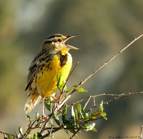
Greeting A New Day by Gary Helm,          Eastern meadowlark is a songbird that belongs to the blackbird family. There are 17 subspec
Greeting A New Day by Gary Helm
Nearing Sunset at the Pond by myoldpostcards, road winter sunset water rural america season landscape illinois pond country goldenhour bunn centra
Nearing Sunset at the Pond by myoldpostcards
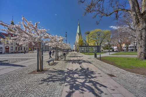
The square in Kristiansand by gormjarl, Christian IV (renowned for having founded many towns) visited the location in 1630 and 1635, and on
The square in Kristiansand by gormjarl
Brooklyn New York City - New York - Luna Park - Coney Island  - Archives by Bill Badzo, Luna Park is the name of an amusement park in the neighborhood of Coney Island, Brooklyn in New York
Brooklyn New York City - New York - Luna Park - Coney Island - Archives by Bill Badzo
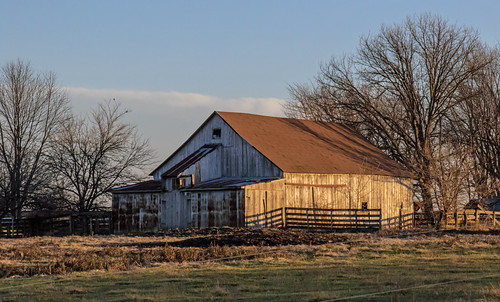
Old Barn on Oak Grove Road by myoldpostcards, road winter sunset barn rural america season farm weathered agriculture goldenhour oakgrove farmbuil
Old Barn on Oak Grove Road by myoldpostcards
Prairie Creek at Richland Elevator Road by myoldpostcards, road winter sunset water rural america creek season landscape illinois stream country goldenhour cen
Prairie Creek at Richland Elevator Road by myoldpostcards
Sundown in Viñales by kurtwolf303, Cuba 2015 - Valle de Viñales sunset sky woman reflection topf25 water pool clouds topf50 topf75 sonn
Sundown in Viñales by kurtwolf303
Taratahi Sunrise. Dahlia by Bernard Spragg, Taratahi Sunrise. Dahlia is a genus of bushy, tuberous, herbaceous perennial plants native mainly in
Taratahi Sunrise. Dahlia by Bernard Spragg
Archer Creek Sunset by myoldpostcards, road autumn sunset water rural america creek season landscape illinois stream country late bunkerhil
Archer Creek Sunset by myoldpostcards
Sunrise fishing by leewoods106, Fisherman as the sun rises over Cubatrip travel blue vacation orange cloud sun holiday man beach lat
Sunrise fishing by leewoods106
Lazy Hazy by BoneFishPhotography, This post-storm hazy fireball sunset from a few days ago sure was a marvelous one to witness!

📷: T
Lazy Hazy by BoneFishPhotography
Around the River Sao Francisco, Brazil by MadonnaJ, The Sao Francisco  is a river in Brazil. With a length of 2,914 kilometres (1,811 mi), it is the lon
Around the River Sao Francisco, Brazil by MadonnaJ
Veterans Memorial Bridge by Dan@propeakphotography, Originally called the Columbia-Wrightsville Bridge, because it connects the two towns across the Sus
Veterans Memorial Bridge by Dan@propeakphotography
Mar del Sur by malcolm harris, When Vasco Nunez de Balboa  crossed the Isthmus Panama and first looked upon the Pacific Ocean in 15
Mar del Sur by malcolm harris
El Tabo by lugar.citadino, <b>Lugar Citadino</b>  
<u>{Todos Somos La Ciudad}</u>
<b>2,221</b>

<u><b>En</b></u>
 
<u><b>Es</b>
El Tabo by lugar.citadino
Central Park, NYC, USA / 2016 by onuruye, sunsetphotography sunset sky clouds gununfotografi gununfotosu gununkaresi instagram flickr specialp
Central Park, NYC, USA / 2016 by onuruye
“Dic dic cis cis” by PNWheat, This is a young Dickcissel siting atop a ripe sunflower. They migrate from South America and spend t
“Dic dic cis cis” by PNWheat
Sand Dunes Flanked by Alpenglow on Mountain Peak by rigpa8, Great Sand Dunes National Park and Preserve is an American national park that conserves an area of l
Sand Dunes Flanked by Alpenglow on Mountain Peak by rigpa8
Sunset at Sagamore by Vincent Colombo, Moments before sunset, MC 2026 (ex-NH FL9M) passes through Sagamore with the Cape Cod Dinner Train.
Sunset at Sagamore by Vincent Colombo
Sierra Nevada Mountains by Alan Greenberg Photography, The Sierra Nevada is a mountain range in the Western United States, between the Central Valley of Ca
Sierra Nevada Mountains by Alan Greenberg Photography
American coot by randyherring, Cosumnes River Preserve near Elk Grove, California.ca california wetland elkgrove americancoot centr
American coot by randyherring
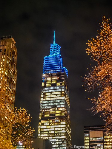
New York City by Themarrero, The fourth tallest skyscraper in New York City for now as something is coming to that Central Park t
New York City by Themarrero
Waves at Roatan, Honduras by ` Toshio ', Waves at sunset at Roatan, Honduras.

<a href="https://www.flickr.com/redirect?url=http://www.facebo
Waves at Roatan, Honduras by ` Toshio '
Least Tern - Sternula antillarum | 2019 - 5 by RGL Photography, "Least Tern at sunrise at the Jersey Shore."

Least Tern

The Least Tern (Sternula antilla
Least Tern - Sternula antillarum | 2019 - 5 by RGL Photography