アメリカ合衆国 〒 ネバダ州 バウンダリー山日の出日の入り時間
Location: アメリカ合衆国 > カリフォルニア州 > モノ >
時間帯:
America/Los_Angeles
現地時間:
2025-07-04 10:37:58
経度:
-118.3509812
緯度:
37.8468312
今日の日の出時刻:
05:37:27 AM
今日の日の入時刻:
08:18:52 PM
今日の日長:
14h 41m 25s
明日の日の出時刻:
05:38:01 AM
明日の日の入時刻:
08:18:38 PM
明日の日長:
14h 40m 37s
すべて表示する
| 日付 | 日出 | 日没 | 日長 |
|---|---|---|---|
| 2025年01月01日 | 07:09:06 AM | 04:46:08 PM | 9h 37m 2s |
| 2025年01月02日 | 07:09:11 AM | 04:46:58 PM | 9h 37m 47s |
| 2025年01月03日 | 07:09:14 AM | 04:47:50 PM | 9h 38m 36s |
| 2025年01月04日 | 07:09:15 AM | 04:48:43 PM | 9h 39m 28s |
| 2025年01月05日 | 07:09:14 AM | 04:49:36 PM | 9h 40m 22s |
| 2025年01月06日 | 07:09:10 AM | 04:50:31 PM | 9h 41m 21s |
| 2025年01月07日 | 07:09:05 AM | 04:51:27 PM | 9h 42m 22s |
| 2025年01月08日 | 07:08:57 AM | 04:52:24 PM | 9h 43m 27s |
| 2025年01月09日 | 07:08:48 AM | 04:53:22 PM | 9h 44m 34s |
| 2025年01月10日 | 07:08:36 AM | 04:54:21 PM | 9h 45m 45s |
| 2025年01月11日 | 07:08:22 AM | 04:55:21 PM | 9h 46m 59s |
| 2025年01月12日 | 07:08:06 AM | 04:56:22 PM | 9h 48m 16s |
| 2025年01月13日 | 07:07:49 AM | 04:57:23 PM | 9h 49m 34s |
| 2025年01月14日 | 07:07:29 AM | 04:58:25 PM | 9h 50m 56s |
| 2025年01月15日 | 07:07:07 AM | 04:59:28 PM | 9h 52m 21s |
| 2025年01月16日 | 07:06:43 AM | 05:00:31 PM | 9h 53m 48s |
| 2025年01月17日 | 07:06:17 AM | 05:01:35 PM | 9h 55m 18s |
| 2025年01月18日 | 07:05:49 AM | 05:02:39 PM | 9h 56m 50s |
| 2025年01月19日 | 07:05:19 AM | 05:03:44 PM | 9h 58m 25s |
| 2025年01月20日 | 07:04:48 AM | 05:04:49 PM | 10h 0m 1s |
| 2025年01月21日 | 07:04:14 AM | 05:05:55 PM | 10h 1m 41s |
| 2025年01月22日 | 07:03:38 AM | 05:07:01 PM | 10h 3m 23s |
| 2025年01月23日 | 07:03:01 AM | 05:08:07 PM | 10h 5m 6s |
| 2025年01月24日 | 07:02:22 AM | 05:09:13 PM | 10h 6m 51s |
| 2025年01月25日 | 07:01:41 AM | 05:10:20 PM | 10h 8m 39s |
| 2025年01月26日 | 07:00:58 AM | 05:11:27 PM | 10h 10m 29s |
| 2025年01月27日 | 07:00:13 AM | 05:12:34 PM | 10h 12m 21s |
| 2025年01月28日 | 06:59:27 AM | 05:13:41 PM | 10h 14m 14s |
| 2025年01月29日 | 06:58:39 AM | 05:14:48 PM | 10h 16m 9s |
| 2025年01月30日 | 06:57:49 AM | 05:15:55 PM | 10h 18m 6s |
| 2025年01月31日 | 06:56:58 AM | 05:17:02 PM | 10h 20m 4s |
| 2025年02月01日 | 06:56:05 AM | 05:18:09 PM | 10h 22m 4s |
| 2025年02月02日 | 06:55:11 AM | 05:19:17 PM | 10h 24m 6s |
| 2025年02月03日 | 06:54:15 AM | 05:20:24 PM | 10h 26m 9s |
| 2025年02月04日 | 06:53:17 AM | 05:21:31 PM | 10h 28m 14s |
| 2025年02月05日 | 06:52:18 AM | 05:22:37 PM | 10h 30m 19s |
| 2025年02月06日 | 06:51:18 AM | 05:23:44 PM | 10h 32m 26s |
| 2025年02月07日 | 06:50:16 AM | 05:24:50 PM | 10h 34m 34s |
| 2025年02月08日 | 06:49:13 AM | 05:25:57 PM | 10h 36m 44s |
| 2025年02月09日 | 06:48:08 AM | 05:27:03 PM | 10h 38m 55s |
| 2025年02月10日 | 06:47:02 AM | 05:28:09 PM | 10h 41m 7s |
| 2025年02月11日 | 06:45:55 AM | 05:29:14 PM | 10h 43m 19s |
| 2025年02月12日 | 06:44:47 AM | 05:30:20 PM | 10h 45m 33s |
| 2025年02月13日 | 06:43:37 AM | 05:31:25 PM | 10h 47m 48s |
| 2025年02月14日 | 06:42:26 AM | 05:32:30 PM | 10h 50m 4s |
| 2025年02月15日 | 06:41:14 AM | 05:33:34 PM | 10h 52m 20s |
| 2025年02月16日 | 06:40:01 AM | 05:34:38 PM | 10h 54m 37s |
| 2025年02月17日 | 06:38:47 AM | 05:35:42 PM | 10h 56m 55s |
| 2025年02月18日 | 06:37:32 AM | 05:36:46 PM | 10h 59m 14s |
| 2025年02月19日 | 06:36:16 AM | 05:37:49 PM | 11h 1m 33s |
| 2025年02月20日 | 06:34:58 AM | 05:38:52 PM | 11h 3m 54s |
| 2025年02月21日 | 06:33:40 AM | 05:39:55 PM | 11h 6m 15s |
| 2025年02月22日 | 06:32:21 AM | 05:40:58 PM | 11h 8m 37s |
| 2025年02月23日 | 06:31:01 AM | 05:42:00 PM | 11h 10m 59s |
| 2025年02月24日 | 06:29:40 AM | 05:43:01 PM | 11h 13m 21s |
| 2025年02月25日 | 06:28:19 AM | 05:44:03 PM | 11h 15m 44s |
| 2025年02月26日 | 06:26:56 AM | 05:45:04 PM | 11h 18m 8s |
| 2025年02月27日 | 06:25:33 AM | 05:46:05 PM | 11h 20m 32s |
| 2025年02月28日 | 06:24:10 AM | 05:47:05 PM | 11h 22m 55s |
| 2025年03月01日 | 06:22:45 AM | 05:48:05 PM | 11h 25m 20s |
| 2025年03月02日 | 06:21:20 AM | 05:49:05 PM | 11h 27m 45s |
| 2025年03月03日 | 06:19:54 AM | 05:50:05 PM | 11h 30m 11s |
| 2025年03月04日 | 06:18:28 AM | 05:51:04 PM | 11h 32m 36s |
| 2025年03月05日 | 06:17:01 AM | 05:52:03 PM | 11h 35m 2s |
| 2025年03月06日 | 06:15:33 AM | 05:53:02 PM | 11h 37m 29s |
| 2025年03月07日 | 06:14:05 AM | 05:54:01 PM | 11h 39m 56s |
| 2025年03月08日 | 06:12:37 AM | 05:54:59 PM | 11h 42m 22s |
| 2025年03月09日 | 07:11:12 AM | 06:55:54 PM | 11h 44m 42s |
| 2025年03月10日 | 07:09:43 AM | 06:56:52 PM | 11h 47m 9s |
| 2025年03月11日 | 07:08:13 AM | 06:57:50 PM | 11h 49m 37s |
| 2025年03月12日 | 07:06:43 AM | 06:58:47 PM | 11h 52m 4s |
| 2025年03月13日 | 07:05:13 AM | 06:59:44 PM | 11h 54m 31s |
| 2025年03月14日 | 07:03:43 AM | 07:00:41 PM | 11h 56m 58s |
| 2025年03月15日 | 07:02:12 AM | 07:01:37 PM | 11h 59m 25s |
| 2025年03月16日 | 07:00:41 AM | 07:02:34 PM | 12h 1m 53s |
| 2025年03月17日 | 06:59:10 AM | 07:03:30 PM | 12h 4m 20s |
| 2025年03月18日 | 06:57:39 AM | 07:04:26 PM | 12h 6m 47s |
| 2025年03月19日 | 06:56:07 AM | 07:05:22 PM | 12h 9m 15s |
| 2025年03月20日 | 06:54:36 AM | 07:06:18 PM | 12h 11m 42s |
| 2025年03月21日 | 06:53:04 AM | 07:07:14 PM | 12h 14m 10s |
| 2025年03月22日 | 06:51:32 AM | 07:08:09 PM | 12h 16m 37s |
| 2025年03月23日 | 06:50:01 AM | 07:09:05 PM | 12h 19m 4s |
| 2025年03月24日 | 06:48:29 AM | 07:10:00 PM | 12h 21m 31s |
| 2025年03月25日 | 06:46:58 AM | 07:10:56 PM | 12h 23m 58s |
| 2025年03月26日 | 06:45:26 AM | 07:11:51 PM | 12h 26m 25s |
| 2025年03月27日 | 06:43:55 AM | 07:12:46 PM | 12h 28m 51s |
| 2025年03月28日 | 06:42:24 AM | 07:13:41 PM | 12h 31m 17s |
| 2025年03月29日 | 06:40:53 AM | 07:14:36 PM | 12h 33m 43s |
| 2025年03月30日 | 06:39:22 AM | 07:15:31 PM | 12h 36m 9s |
| 2025年03月31日 | 06:37:52 AM | 07:16:26 PM | 12h 38m 34s |
| 2025年04月01日 | 06:36:21 AM | 07:17:21 PM | 12h 41m 0s |
| 2025年04月02日 | 06:34:51 AM | 07:18:16 PM | 12h 43m 25s |
| 2025年04月03日 | 06:33:22 AM | 07:19:11 PM | 12h 45m 49s |
| 2025年04月04日 | 06:31:52 AM | 07:20:06 PM | 12h 48m 14s |
| 2025年04月05日 | 06:30:23 AM | 07:21:01 PM | 12h 50m 38s |
| 2025年04月06日 | 06:28:55 AM | 07:21:56 PM | 12h 53m 1s |
| 2025年04月07日 | 06:27:27 AM | 07:22:50 PM | 12h 55m 23s |
| 2025年04月08日 | 06:25:59 AM | 07:23:45 PM | 12h 57m 46s |
| 2025年04月09日 | 06:24:32 AM | 07:24:40 PM | 13h 0m 8s |
| 2025年04月10日 | 06:23:06 AM | 07:25:36 PM | 13h 2m 30s |
| 2025年04月11日 | 06:21:40 AM | 07:26:31 PM | 13h 4m 51s |
| 2025年04月12日 | 06:20:14 AM | 07:27:26 PM | 13h 7m 12s |
| 2025年04月13日 | 06:18:49 AM | 07:28:21 PM | 13h 9m 32s |
| 2025年04月14日 | 06:17:25 AM | 07:29:16 PM | 13h 11m 51s |
| 2025年04月15日 | 06:16:02 AM | 07:30:11 PM | 13h 14m 9s |
| 2025年04月16日 | 06:14:39 AM | 07:31:07 PM | 13h 16m 28s |
| 2025年04月17日 | 06:13:17 AM | 07:32:02 PM | 13h 18m 45s |
| 2025年04月18日 | 06:11:56 AM | 07:32:57 PM | 13h 21m 1s |
| 2025年04月19日 | 06:10:35 AM | 07:33:53 PM | 13h 23m 18s |
| 2025年04月20日 | 06:09:16 AM | 07:34:48 PM | 13h 25m 32s |
| 2025年04月21日 | 06:07:57 AM | 07:35:43 PM | 13h 27m 46s |
| 2025年04月22日 | 06:06:39 AM | 07:36:39 PM | 13h 30m 0s |
| 2025年04月23日 | 06:05:22 AM | 07:37:34 PM | 13h 32m 12s |
| 2025年04月24日 | 06:04:07 AM | 07:38:30 PM | 13h 34m 23s |
| 2025年04月25日 | 06:02:52 AM | 07:39:25 PM | 13h 36m 33s |
| 2025年04月26日 | 06:01:38 AM | 07:40:21 PM | 13h 38m 43s |
| 2025年04月27日 | 06:00:25 AM | 07:41:16 PM | 13h 40m 51s |
| 2025年04月28日 | 05:59:13 AM | 07:42:12 PM | 13h 42m 59s |
| 2025年04月29日 | 05:58:02 AM | 07:43:07 PM | 13h 45m 5s |
| 2025年04月30日 | 05:56:53 AM | 07:44:02 PM | 13h 47m 9s |
| 2025年05月01日 | 05:55:44 AM | 07:44:57 PM | 13h 49m 13s |
| 2025年05月02日 | 05:54:37 AM | 07:45:52 PM | 13h 51m 15s |
| 2025年05月03日 | 05:53:31 AM | 07:46:47 PM | 13h 53m 16s |
| 2025年05月04日 | 05:52:26 AM | 07:47:42 PM | 13h 55m 16s |
| 2025年05月05日 | 05:51:23 AM | 07:48:37 PM | 13h 57m 14s |
| 2025年05月06日 | 05:50:21 AM | 07:49:32 PM | 13h 59m 11s |
| 2025年05月07日 | 05:49:20 AM | 07:50:26 PM | 14h 1m 6s |
| 2025年05月08日 | 05:48:20 AM | 07:51:20 PM | 14h 3m 0s |
| 2025年05月09日 | 05:47:22 AM | 07:52:14 PM | 14h 4m 52s |
| 2025年05月10日 | 05:46:26 AM | 07:53:07 PM | 14h 6m 41s |
| 2025年05月11日 | 05:45:30 AM | 07:54:01 PM | 14h 8m 31s |
| 2025年05月12日 | 05:44:37 AM | 07:54:54 PM | 14h 10m 17s |
| 2025年05月13日 | 05:43:44 AM | 07:55:46 PM | 14h 12m 2s |
| 2025年05月14日 | 05:42:53 AM | 07:56:39 PM | 14h 13m 46s |
| 2025年05月15日 | 05:42:04 AM | 07:57:30 PM | 14h 15m 26s |
| 2025年05月16日 | 05:41:17 AM | 07:58:22 PM | 14h 17m 5s |
| 2025年05月17日 | 05:40:30 AM | 07:59:13 PM | 14h 18m 43s |
| 2025年05月18日 | 05:39:46 AM | 08:00:03 PM | 14h 20m 17s |
| 2025年05月19日 | 05:39:03 AM | 08:00:53 PM | 14h 21m 50s |
| 2025年05月20日 | 05:38:22 AM | 08:01:42 PM | 14h 23m 20s |
| 2025年05月21日 | 05:37:42 AM | 08:02:31 PM | 14h 24m 49s |
| 2025年05月22日 | 05:37:05 AM | 08:03:19 PM | 14h 26m 14s |
| 2025年05月23日 | 05:36:28 AM | 08:04:06 PM | 14h 27m 38s |
| 2025年05月24日 | 05:35:54 AM | 08:04:53 PM | 14h 28m 59s |
| 2025年05月25日 | 05:35:21 AM | 08:05:39 PM | 14h 30m 18s |
| 2025年05月26日 | 05:34:50 AM | 08:06:24 PM | 14h 31m 34s |
| 2025年05月27日 | 05:34:21 AM | 08:07:08 PM | 14h 32m 47s |
| 2025年05月28日 | 05:33:54 AM | 08:07:52 PM | 14h 33m 58s |
| 2025年05月29日 | 05:33:28 AM | 08:08:34 PM | 14h 35m 6s |
| 2025年05月30日 | 05:33:04 AM | 08:09:16 PM | 14h 36m 12s |
| 2025年05月31日 | 05:32:42 AM | 08:09:56 PM | 14h 37m 14s |
| 2025年06月01日 | 05:32:22 AM | 08:10:36 PM | 14h 38m 14s |
| 2025年06月02日 | 05:32:03 AM | 08:11:14 PM | 14h 39m 11s |
| 2025年06月03日 | 05:31:46 AM | 08:11:51 PM | 14h 40m 5s |
| 2025年06月04日 | 05:31:32 AM | 08:12:27 PM | 14h 40m 55s |
| 2025年06月05日 | 05:31:19 AM | 08:13:02 PM | 14h 41m 43s |
| 2025年06月06日 | 05:31:07 AM | 08:13:36 PM | 14h 42m 29s |
| 2025年06月07日 | 05:30:58 AM | 08:14:09 PM | 14h 43m 11s |
| 2025年06月08日 | 05:30:50 AM | 08:14:40 PM | 14h 43m 50s |
| 2025年06月09日 | 05:30:44 AM | 08:15:10 PM | 14h 44m 26s |
| 2025年06月10日 | 05:30:40 AM | 08:15:38 PM | 14h 44m 58s |
| 2025年06月11日 | 05:30:38 AM | 08:16:05 PM | 14h 45m 27s |
| 2025年06月12日 | 05:30:38 AM | 08:16:31 PM | 14h 45m 53s |
| 2025年06月13日 | 05:30:39 AM | 08:16:55 PM | 14h 46m 16s |
| 2025年06月14日 | 05:30:42 AM | 08:17:18 PM | 14h 46m 36s |
| 2025年06月15日 | 05:30:47 AM | 08:17:39 PM | 14h 46m 52s |
| 2025年06月16日 | 05:30:53 AM | 08:17:58 PM | 14h 47m 5s |
| 2025年06月17日 | 05:31:01 AM | 08:18:16 PM | 14h 47m 15s |
| 2025年06月18日 | 05:31:11 AM | 08:18:33 PM | 14h 47m 22s |
| 2025年06月19日 | 05:31:23 AM | 08:18:47 PM | 14h 47m 24s |
| 2025年06月20日 | 05:31:36 AM | 08:19:00 PM | 14h 47m 24s |
| 2025年06月21日 | 05:31:50 AM | 08:19:12 PM | 14h 47m 22s |
| 2025年06月22日 | 05:32:07 AM | 08:19:21 PM | 14h 47m 14s |
| 2025年06月23日 | 05:32:25 AM | 08:19:29 PM | 14h 47m 4s |
| 2025年06月24日 | 05:32:44 AM | 08:19:35 PM | 14h 46m 51s |
| 2025年06月25日 | 05:33:05 AM | 08:19:40 PM | 14h 46m 35s |
| 2025年06月26日 | 05:33:27 AM | 08:19:42 PM | 14h 46m 15s |
| 2025年06月27日 | 05:33:51 AM | 08:19:43 PM | 14h 45m 52s |
| 2025年06月28日 | 05:34:16 AM | 08:19:42 PM | 14h 45m 26s |
| 2025年06月29日 | 05:34:42 AM | 08:19:39 PM | 14h 44m 57s |
| 2025年06月30日 | 05:35:10 AM | 08:19:34 PM | 14h 44m 24s |
| 2025年07月01日 | 05:35:39 AM | 08:19:28 PM | 14h 43m 49s |
| 2025年07月02日 | 05:36:10 AM | 08:19:20 PM | 14h 43m 10s |
| 2025年07月03日 | 05:36:41 AM | 08:19:09 PM | 14h 42m 28s |
| 2025年07月04日 | 05:37:14 AM | 08:18:57 PM | 14h 41m 43s |
| 2025年07月05日 | 05:37:48 AM | 08:18:43 PM | 14h 40m 55s |
| 2025年07月06日 | 05:38:23 AM | 08:18:28 PM | 14h 40m 5s |
| 2025年07月07日 | 05:38:59 AM | 08:18:10 PM | 14h 39m 11s |
| 2025年07月08日 | 05:39:36 AM | 08:17:50 PM | 14h 38m 14s |
| 2025年07月09日 | 05:40:15 AM | 08:17:29 PM | 14h 37m 14s |
| 2025年07月10日 | 05:40:54 AM | 08:17:06 PM | 14h 36m 12s |
| 2025年07月11日 | 05:41:34 AM | 08:16:41 PM | 14h 35m 7s |
| 2025年07月12日 | 05:42:14 AM | 08:16:14 PM | 14h 34m 0s |
| 2025年07月13日 | 05:42:56 AM | 08:15:46 PM | 14h 32m 50s |
| 2025年07月14日 | 05:43:39 AM | 08:15:15 PM | 14h 31m 36s |
| 2025年07月15日 | 05:44:22 AM | 08:14:43 PM | 14h 30m 21s |
| 2025年07月16日 | 05:45:06 AM | 08:14:09 PM | 14h 29m 3s |
| 2025年07月17日 | 05:45:51 AM | 08:13:33 PM | 14h 27m 42s |
| 2025年07月18日 | 05:46:36 AM | 08:12:56 PM | 14h 26m 20s |
| 2025年07月19日 | 05:47:22 AM | 08:12:17 PM | 14h 24m 55s |
| 2025年07月20日 | 05:48:08 AM | 08:11:36 PM | 14h 23m 28s |
| 2025年07月21日 | 05:48:56 AM | 08:10:53 PM | 14h 21m 57s |
| 2025年07月22日 | 05:49:43 AM | 08:10:09 PM | 14h 20m 26s |
| 2025年07月23日 | 05:50:31 AM | 08:09:23 PM | 14h 18m 52s |
| 2025年07月24日 | 05:51:20 AM | 08:08:35 PM | 14h 17m 15s |
| 2025年07月25日 | 05:52:08 AM | 08:07:46 PM | 14h 15m 38s |
| 2025年07月26日 | 05:52:58 AM | 08:06:56 PM | 14h 13m 58s |
| 2025年07月27日 | 05:53:47 AM | 08:06:03 PM | 14h 12m 16s |
| 2025年07月28日 | 05:54:37 AM | 08:05:10 PM | 14h 10m 33s |
| 2025年07月29日 | 05:55:27 AM | 08:04:14 PM | 14h 8m 47s |
| 2025年07月30日 | 05:56:18 AM | 08:03:18 PM | 14h 7m 0s |
| 2025年07月31日 | 05:57:09 AM | 08:02:19 PM | 14h 5m 10s |
| 2025年08月01日 | 05:58:00 AM | 08:01:20 PM | 14h 3m 20s |
| 2025年08月02日 | 05:58:51 AM | 08:00:19 PM | 14h 1m 28s |
| 2025年08月03日 | 05:59:42 AM | 07:59:16 PM | 13h 59m 34s |
| 2025年08月04日 | 06:00:33 AM | 07:58:13 PM | 13h 57m 40s |
| 2025年08月05日 | 06:01:25 AM | 07:57:07 PM | 13h 55m 42s |
| 2025年08月06日 | 06:02:16 AM | 07:56:01 PM | 13h 53m 45s |
| 2025年08月07日 | 06:03:08 AM | 07:54:54 PM | 13h 51m 46s |
| 2025年08月08日 | 06:04:00 AM | 07:53:45 PM | 13h 49m 45s |
| 2025年08月09日 | 06:04:52 AM | 07:52:35 PM | 13h 47m 43s |
| 2025年08月10日 | 06:05:44 AM | 07:51:23 PM | 13h 45m 39s |
| 2025年08月11日 | 06:06:35 AM | 07:50:11 PM | 13h 43m 36s |
| 2025年08月12日 | 06:07:27 AM | 07:48:58 PM | 13h 41m 31s |
| 2025年08月13日 | 06:08:19 AM | 07:47:43 PM | 13h 39m 24s |
| 2025年08月14日 | 06:09:11 AM | 07:46:27 PM | 13h 37m 16s |
| 2025年08月15日 | 06:10:03 AM | 07:45:11 PM | 13h 35m 8s |
| 2025年08月16日 | 06:10:55 AM | 07:43:53 PM | 13h 32m 58s |
| 2025年08月17日 | 06:11:46 AM | 07:42:35 PM | 13h 30m 49s |
| 2025年08月18日 | 06:12:38 AM | 07:41:15 PM | 13h 28m 37s |
| 2025年08月19日 | 06:13:30 AM | 07:39:55 PM | 13h 26m 25s |
| 2025年08月20日 | 06:14:21 AM | 07:38:33 PM | 13h 24m 12s |
| 2025年08月21日 | 06:15:13 AM | 07:37:11 PM | 13h 21m 58s |
| 2025年08月22日 | 06:16:04 AM | 07:35:48 PM | 13h 19m 44s |
| 2025年08月23日 | 06:16:56 AM | 07:34:25 PM | 13h 17m 29s |
| 2025年08月24日 | 06:17:47 AM | 07:33:00 PM | 13h 15m 13s |
| 2025年08月25日 | 06:18:38 AM | 07:31:35 PM | 13h 12m 57s |
| 2025年08月26日 | 06:19:29 AM | 07:30:09 PM | 13h 10m 40s |
| 2025年08月27日 | 06:20:20 AM | 07:28:42 PM | 13h 8m 22s |
| 2025年08月28日 | 06:21:11 AM | 07:27:15 PM | 13h 6m 4s |
| 2025年08月29日 | 06:22:02 AM | 07:25:47 PM | 13h 3m 45s |
| 2025年08月30日 | 06:22:53 AM | 07:24:19 PM | 13h 1m 26s |
| 2025年08月31日 | 06:23:44 AM | 07:22:50 PM | 12h 59m 6s |
| 2025年09月01日 | 06:24:35 AM | 07:21:20 PM | 12h 56m 45s |
| 2025年09月02日 | 06:25:26 AM | 07:19:50 PM | 12h 54m 24s |
| 2025年09月03日 | 06:26:16 AM | 07:18:20 PM | 12h 52m 4s |
| 2025年09月04日 | 06:27:07 AM | 07:16:49 PM | 12h 49m 42s |
| 2025年09月05日 | 06:27:58 AM | 07:15:18 PM | 12h 47m 20s |
| 2025年09月06日 | 06:28:48 AM | 07:13:46 PM | 12h 44m 58s |
| 2025年09月07日 | 06:29:39 AM | 07:12:14 PM | 12h 42m 35s |
| 2025年09月08日 | 06:30:29 AM | 07:10:42 PM | 12h 40m 13s |
| 2025年09月09日 | 06:31:20 AM | 07:09:09 PM | 12h 37m 49s |
| 2025年09月10日 | 06:32:10 AM | 07:07:37 PM | 12h 35m 27s |
| 2025年09月11日 | 06:33:01 AM | 07:06:04 PM | 12h 33m 3s |
| 2025年09月12日 | 06:33:52 AM | 07:04:30 PM | 12h 30m 38s |
| 2025年09月13日 | 06:34:42 AM | 07:02:57 PM | 12h 28m 15s |
| 2025年09月14日 | 06:35:33 AM | 07:01:23 PM | 12h 25m 50s |
| 2025年09月15日 | 06:36:24 AM | 06:59:50 PM | 12h 23m 26s |
| 2025年09月16日 | 06:37:15 AM | 06:58:16 PM | 12h 21m 1s |
| 2025年09月17日 | 06:38:06 AM | 06:56:42 PM | 12h 18m 36s |
| 2025年09月18日 | 06:38:57 AM | 06:55:08 PM | 12h 16m 11s |
| 2025年09月19日 | 06:39:48 AM | 06:53:34 PM | 12h 13m 46s |
| 2025年09月20日 | 06:40:39 AM | 06:52:01 PM | 12h 11m 22s |
| 2025年09月21日 | 06:41:30 AM | 06:50:27 PM | 12h 8m 57s |
| 2025年09月22日 | 06:42:22 AM | 06:48:53 PM | 12h 6m 31s |
| 2025年09月23日 | 06:43:14 AM | 06:47:20 PM | 12h 4m 6s |
| 2025年09月24日 | 06:44:05 AM | 06:45:47 PM | 12h 1m 42s |
| 2025年09月25日 | 06:44:57 AM | 06:44:13 PM | 11h 59m 16s |
| 2025年09月26日 | 06:45:50 AM | 06:42:40 PM | 11h 56m 50s |
| 2025年09月27日 | 06:46:42 AM | 06:41:08 PM | 11h 54m 26s |
| 2025年09月28日 | 06:47:34 AM | 06:39:35 PM | 11h 52m 1s |
| 2025年09月29日 | 06:48:27 AM | 06:38:03 PM | 11h 49m 36s |
| 2025年09月30日 | 06:49:20 AM | 06:36:31 PM | 11h 47m 11s |
| 2025年10月01日 | 06:50:14 AM | 06:35:00 PM | 11h 44m 46s |
| 2025年10月02日 | 06:51:07 AM | 06:33:29 PM | 11h 42m 22s |
| 2025年10月03日 | 06:52:01 AM | 06:31:58 PM | 11h 39m 57s |
| 2025年10月04日 | 06:52:55 AM | 06:30:28 PM | 11h 37m 33s |
| 2025年10月05日 | 06:53:49 AM | 06:28:58 PM | 11h 35m 9s |
| 2025年10月06日 | 06:54:44 AM | 06:27:29 PM | 11h 32m 45s |
| 2025年10月07日 | 06:55:39 AM | 06:26:01 PM | 11h 30m 22s |
| 2025年10月08日 | 06:56:34 AM | 06:24:33 PM | 11h 27m 59s |
| 2025年10月09日 | 06:57:30 AM | 06:23:05 PM | 11h 25m 35s |
| 2025年10月10日 | 06:58:25 AM | 06:21:38 PM | 11h 23m 13s |
| 2025年10月11日 | 06:59:22 AM | 06:20:12 PM | 11h 20m 50s |
| 2025年10月12日 | 07:00:18 AM | 06:18:47 PM | 11h 18m 29s |
| 2025年10月13日 | 07:01:15 AM | 06:17:22 PM | 11h 16m 7s |
| 2025年10月14日 | 07:02:12 AM | 06:15:58 PM | 11h 13m 46s |
| 2025年10月15日 | 07:03:10 AM | 06:14:35 PM | 11h 11m 25s |
| 2025年10月16日 | 07:04:07 AM | 06:13:13 PM | 11h 9m 6s |
| 2025年10月17日 | 07:05:06 AM | 06:11:51 PM | 11h 6m 45s |
| 2025年10月18日 | 07:06:04 AM | 06:10:31 PM | 11h 4m 27s |
| 2025年10月19日 | 07:07:03 AM | 06:09:11 PM | 11h 2m 8s |
| 2025年10月20日 | 07:08:02 AM | 06:07:53 PM | 10h 59m 51s |
| 2025年10月21日 | 07:09:02 AM | 06:06:35 PM | 10h 57m 33s |
| 2025年10月22日 | 07:10:02 AM | 06:05:19 PM | 10h 55m 17s |
| 2025年10月23日 | 07:11:02 AM | 06:04:03 PM | 10h 53m 1s |
| 2025年10月24日 | 07:12:03 AM | 06:02:49 PM | 10h 50m 46s |
| 2025年10月25日 | 07:13:03 AM | 06:01:35 PM | 10h 48m 32s |
| 2025年10月26日 | 07:14:05 AM | 06:00:23 PM | 10h 46m 18s |
| 2025年10月27日 | 07:15:06 AM | 05:59:12 PM | 10h 44m 6s |
| 2025年10月28日 | 07:16:08 AM | 05:58:02 PM | 10h 41m 54s |
| 2025年10月29日 | 07:17:10 AM | 05:56:54 PM | 10h 39m 44s |
| 2025年10月30日 | 07:18:12 AM | 05:55:47 PM | 10h 37m 35s |
| 2025年10月31日 | 07:19:15 AM | 05:54:41 PM | 10h 35m 26s |
| 2025年11月01日 | 07:20:18 AM | 05:53:37 PM | 10h 33m 19s |
| 2025年11月02日 | 06:21:24 AM | 04:52:31 PM | 10h 31m 7s |
| 2025年11月03日 | 06:22:27 AM | 04:51:29 PM | 10h 29m 2s |
| 2025年11月04日 | 06:23:30 AM | 04:50:29 PM | 10h 26m 59s |
| 2025年11月05日 | 06:24:34 AM | 04:49:31 PM | 10h 24m 57s |
| 2025年11月06日 | 06:25:38 AM | 04:48:34 PM | 10h 22m 56s |
| 2025年11月07日 | 06:26:42 AM | 04:47:38 PM | 10h 20m 56s |
| 2025年11月08日 | 06:27:46 AM | 04:46:44 PM | 10h 18m 58s |
| 2025年11月09日 | 06:28:50 AM | 04:45:52 PM | 10h 17m 2s |
| 2025年11月10日 | 06:29:54 AM | 04:45:01 PM | 10h 15m 7s |
| 2025年11月11日 | 06:30:58 AM | 04:44:12 PM | 10h 13m 14s |
| 2025年11月12日 | 06:32:02 AM | 04:43:25 PM | 10h 11m 23s |
| 2025年11月13日 | 06:33:07 AM | 04:42:40 PM | 10h 9m 33s |
| 2025年11月14日 | 06:34:11 AM | 04:41:56 PM | 10h 7m 45s |
| 2025年11月15日 | 06:35:14 AM | 04:41:14 PM | 10h 6m 0s |
| 2025年11月16日 | 06:36:18 AM | 04:40:34 PM | 10h 4m 16s |
| 2025年11月17日 | 06:37:22 AM | 04:39:56 PM | 10h 2m 34s |
| 2025年11月18日 | 06:38:25 AM | 04:39:19 PM | 10h 0m 54s |
| 2025年11月19日 | 06:39:28 AM | 04:38:45 PM | 9h 59m 17s |
| 2025年11月20日 | 06:40:31 AM | 04:38:12 PM | 9h 57m 41s |
| 2025年11月21日 | 06:41:33 AM | 04:37:42 PM | 9h 56m 9s |
| 2025年11月22日 | 06:42:35 AM | 04:37:13 PM | 9h 54m 38s |
| 2025年11月23日 | 06:43:36 AM | 04:36:47 PM | 9h 53m 11s |
| 2025年11月24日 | 06:44:37 AM | 04:36:22 PM | 9h 51m 45s |
| 2025年11月25日 | 06:45:38 AM | 04:36:00 PM | 9h 50m 22s |
| 2025年11月26日 | 06:46:37 AM | 04:35:39 PM | 9h 49m 2s |
| 2025年11月27日 | 06:47:37 AM | 04:35:21 PM | 9h 47m 44s |
| 2025年11月28日 | 06:48:35 AM | 04:35:05 PM | 9h 46m 30s |
| 2025年11月29日 | 06:49:33 AM | 04:34:50 PM | 9h 45m 17s |
| 2025年11月30日 | 06:50:30 AM | 04:34:38 PM | 9h 44m 8s |
| 2025年12月01日 | 06:51:26 AM | 04:34:28 PM | 9h 43m 2s |
| 2025年12月02日 | 06:52:21 AM | 04:34:20 PM | 9h 41m 59s |
| 2025年12月03日 | 06:53:15 AM | 04:34:15 PM | 9h 41m 0s |
| 2025年12月04日 | 06:54:09 AM | 04:34:11 PM | 9h 40m 2s |
| 2025年12月05日 | 06:55:01 AM | 04:34:10 PM | 9h 39m 9s |
| 2025年12月06日 | 06:55:52 AM | 04:34:10 PM | 9h 38m 18s |
| 2025年12月07日 | 06:56:42 AM | 04:34:13 PM | 9h 37m 31s |
| 2025年12月08日 | 06:57:31 AM | 04:34:18 PM | 9h 36m 47s |
| 2025年12月09日 | 06:58:18 AM | 04:34:25 PM | 9h 36m 7s |
| 2025年12月10日 | 06:59:04 AM | 04:34:34 PM | 9h 35m 30s |
| 2025年12月11日 | 06:59:49 AM | 04:34:45 PM | 9h 34m 56s |
| 2025年12月12日 | 07:00:33 AM | 04:34:58 PM | 9h 34m 25s |
| 2025年12月13日 | 07:01:15 AM | 04:35:13 PM | 9h 33m 58s |
| 2025年12月14日 | 07:01:55 AM | 04:35:30 PM | 9h 33m 35s |
| 2025年12月15日 | 07:02:34 AM | 04:35:50 PM | 9h 33m 16s |
| 2025年12月16日 | 07:03:11 AM | 04:36:11 PM | 9h 33m 0s |
| 2025年12月17日 | 07:03:47 AM | 04:36:34 PM | 9h 32m 47s |
| 2025年12月18日 | 07:04:21 AM | 04:36:59 PM | 9h 32m 38s |
| 2025年12月19日 | 07:04:54 AM | 04:37:26 PM | 9h 32m 32s |
| 2025年12月20日 | 07:05:24 AM | 04:37:55 PM | 9h 32m 31s |
| 2025年12月21日 | 07:05:53 AM | 04:38:26 PM | 9h 32m 33s |
| 2025年12月22日 | 07:06:20 AM | 04:38:59 PM | 9h 32m 39s |
| 2025年12月23日 | 07:06:45 AM | 04:39:33 PM | 9h 32m 48s |
| 2025年12月24日 | 07:07:09 AM | 04:40:09 PM | 9h 33m 0s |
| 2025年12月25日 | 07:07:30 AM | 04:40:47 PM | 9h 33m 17s |
| 2025年12月26日 | 07:07:50 AM | 04:41:27 PM | 9h 33m 37s |
| 2025年12月27日 | 07:08:07 AM | 04:42:08 PM | 9h 34m 1s |
| 2025年12月28日 | 07:08:23 AM | 04:42:51 PM | 9h 34m 28s |
| 2025年12月29日 | 07:08:36 AM | 04:43:35 PM | 9h 34m 59s |
| 2025年12月30日 | 07:08:48 AM | 04:44:21 PM | 9h 35m 33s |
| 2025年12月31日 | 07:08:57 AM | 04:45:08 PM | 9h 36m 11s |
写真

Bristlecone 49
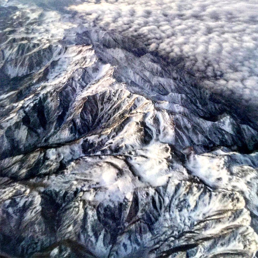
Sunrise #flying #imagesforyoursenses

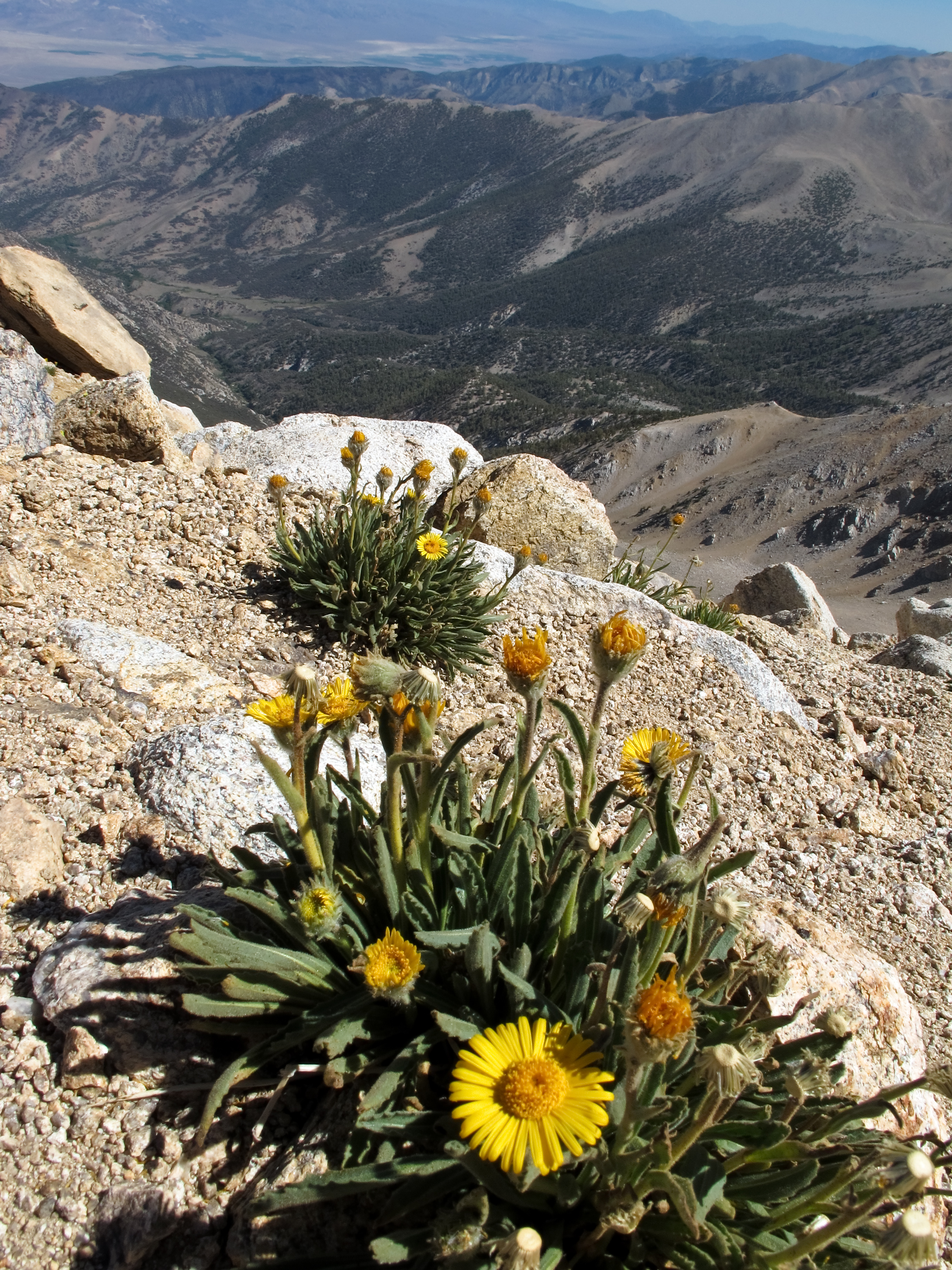
Montgomery Peak and alpine flowers
View west to California

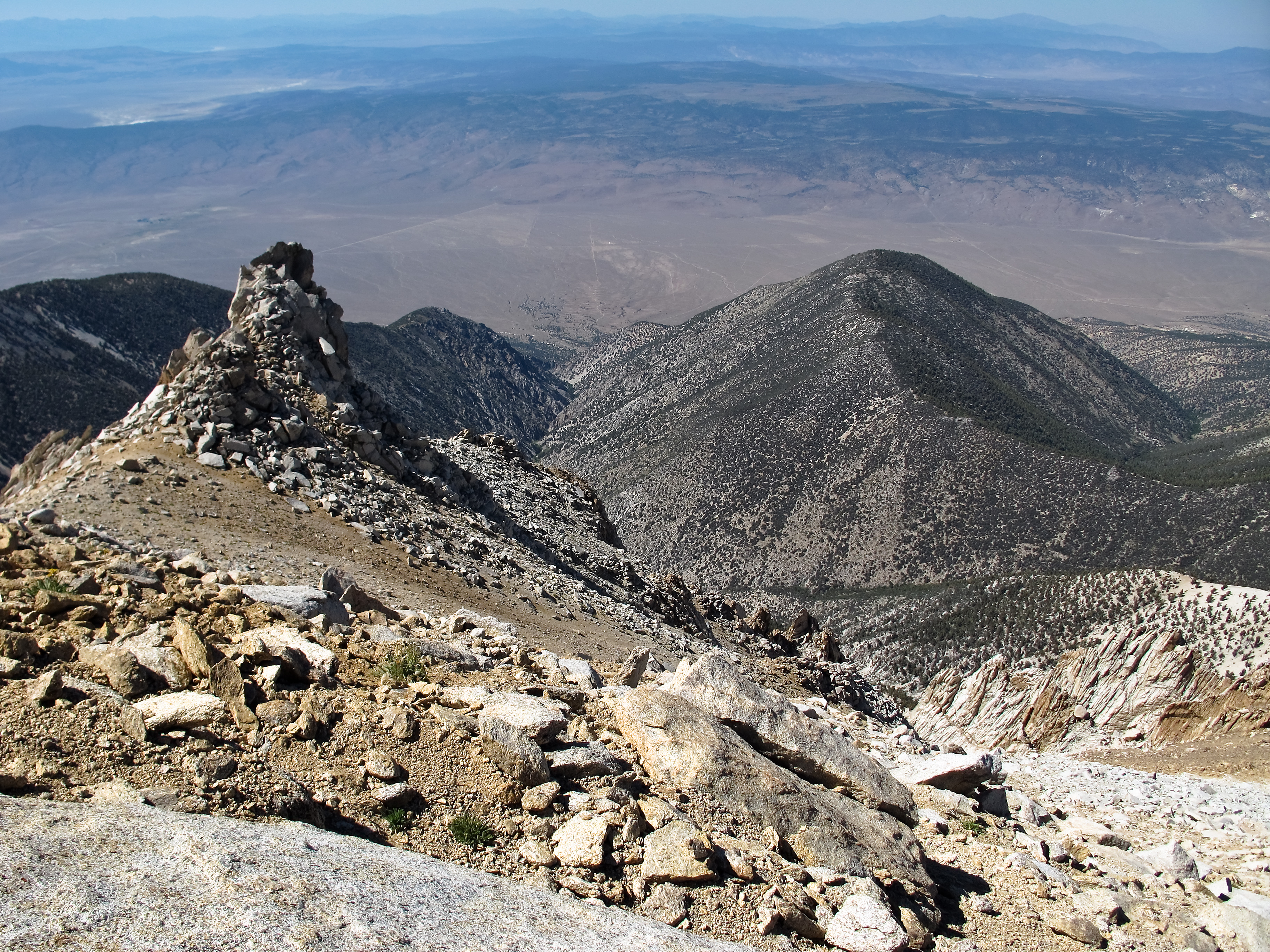
View east from Boundary Peak

View towards the Benton Valley
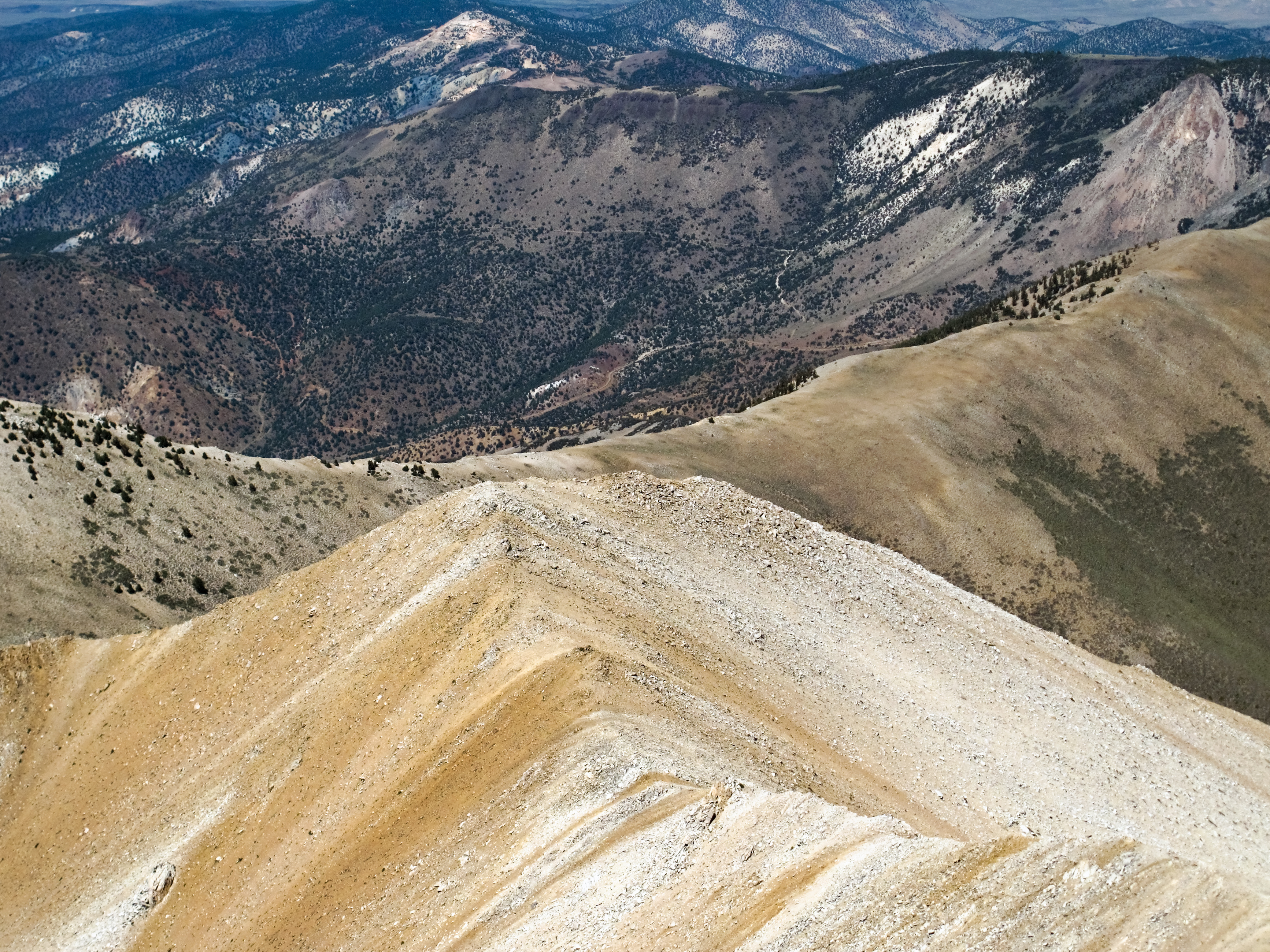
Boundary Peak's rugged western slopes

View north from Boundary Peak

View northeast from Boundary Peak

Alpine flowers on Boundary Peak
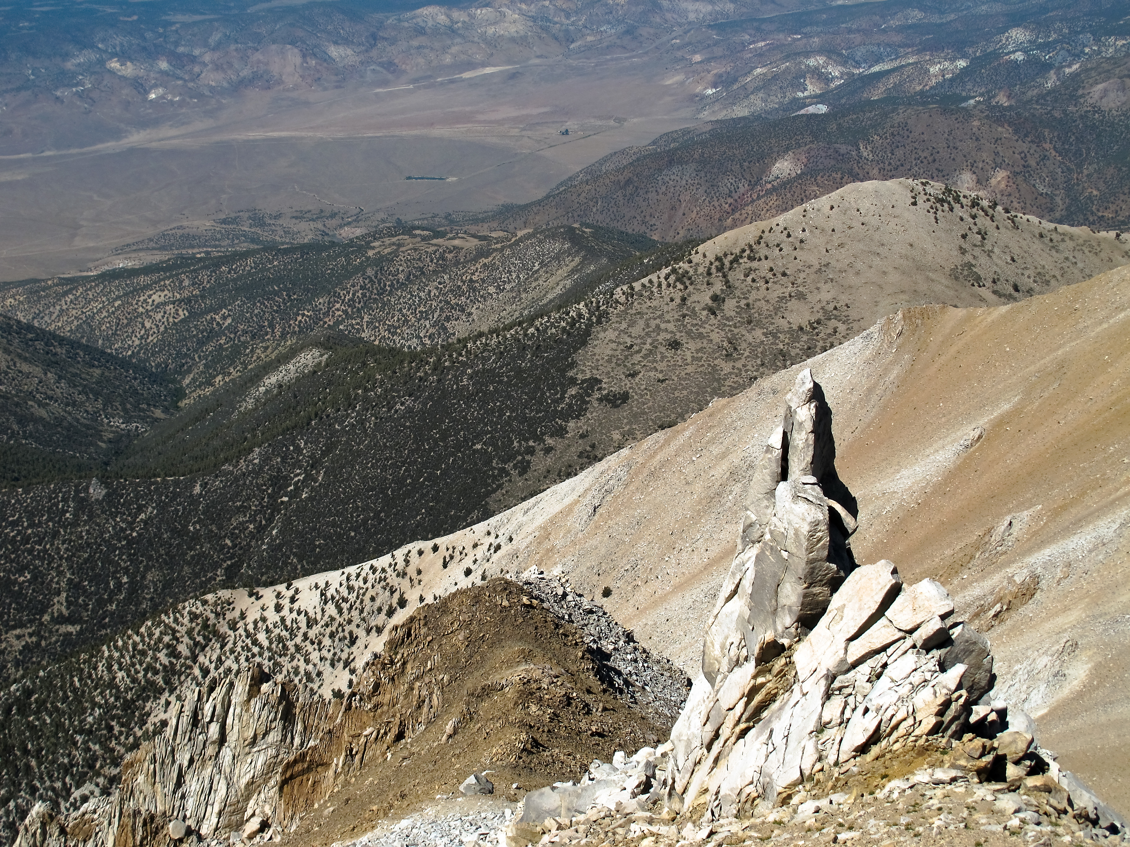
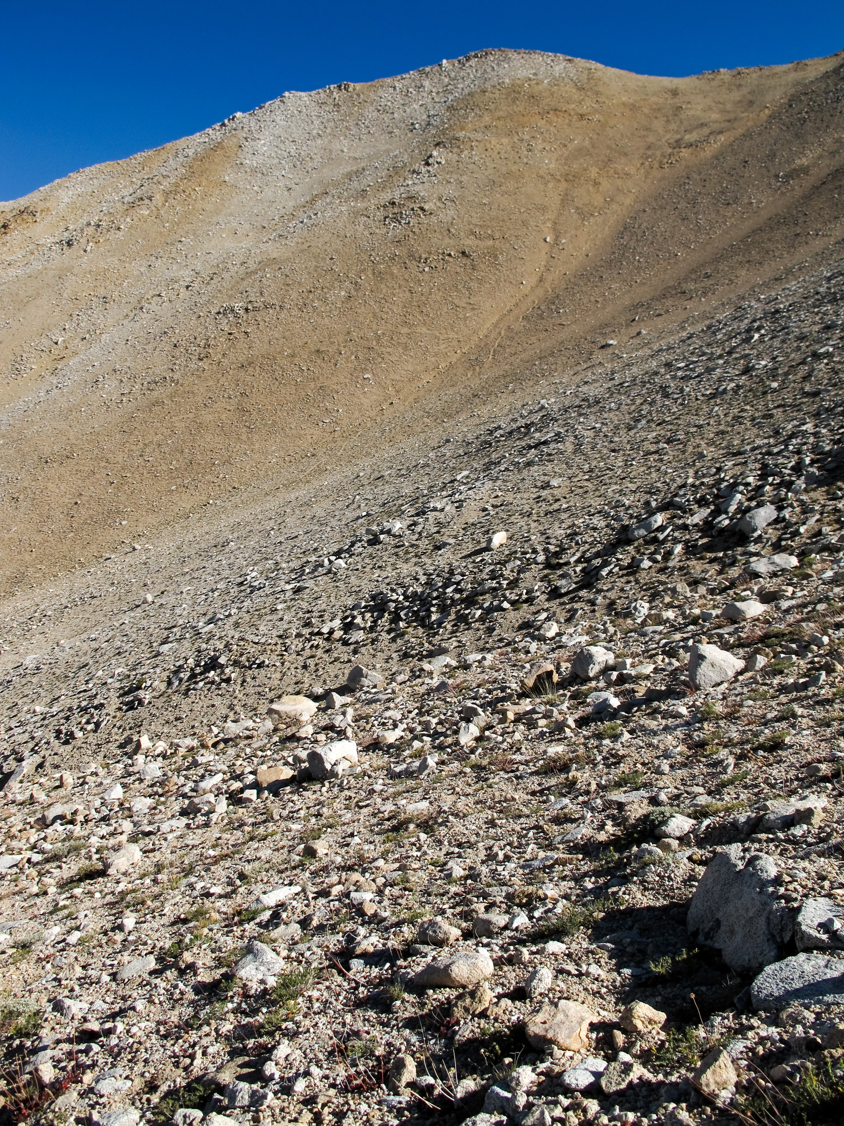
View down towards Trail Canyon
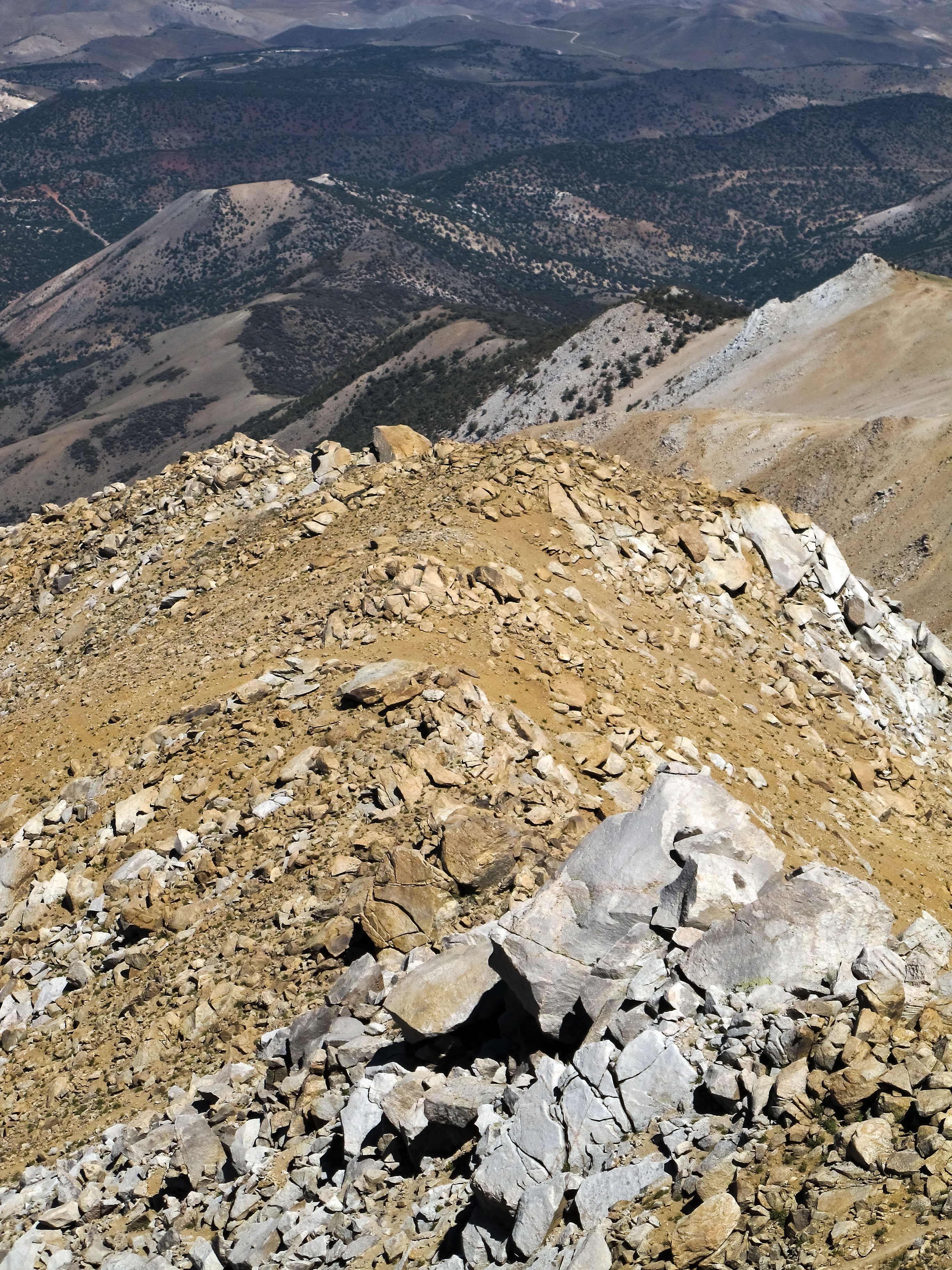
Boundary Peak ridge line
Growing up high

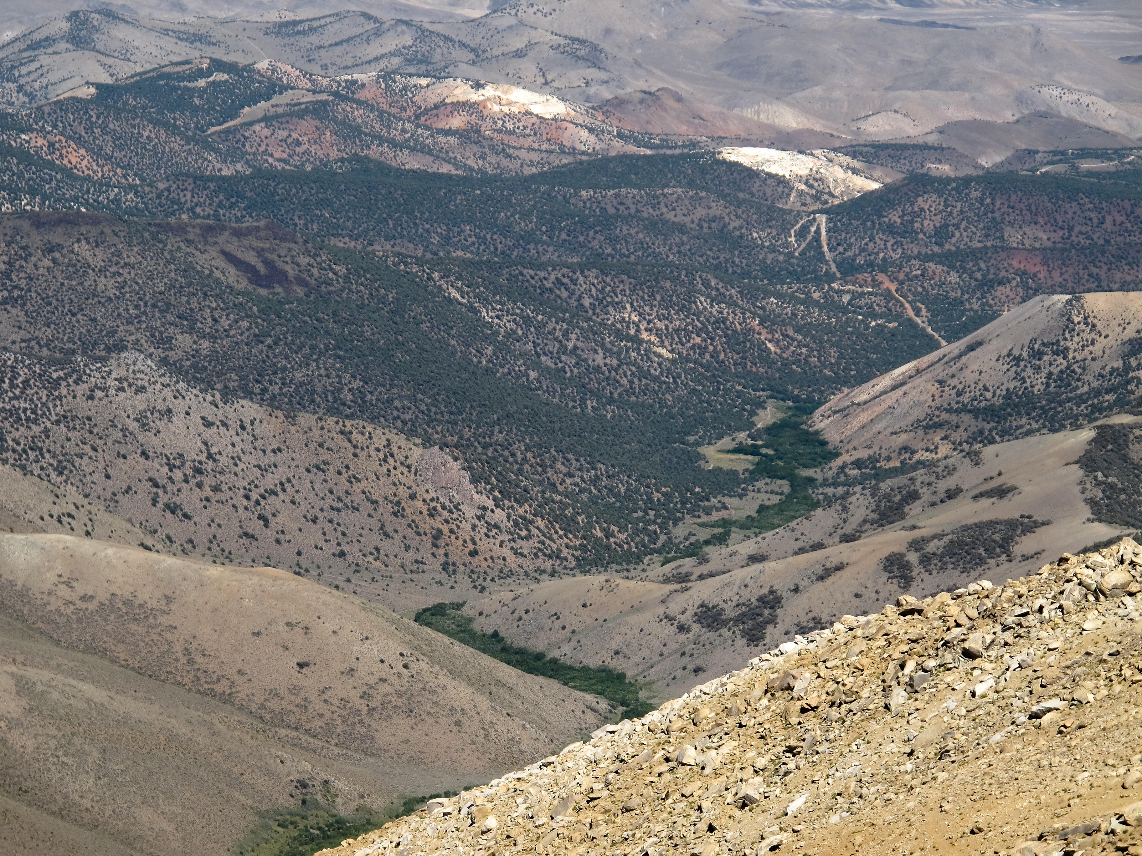
Trail Canyon with the Volcanic Hills beyond

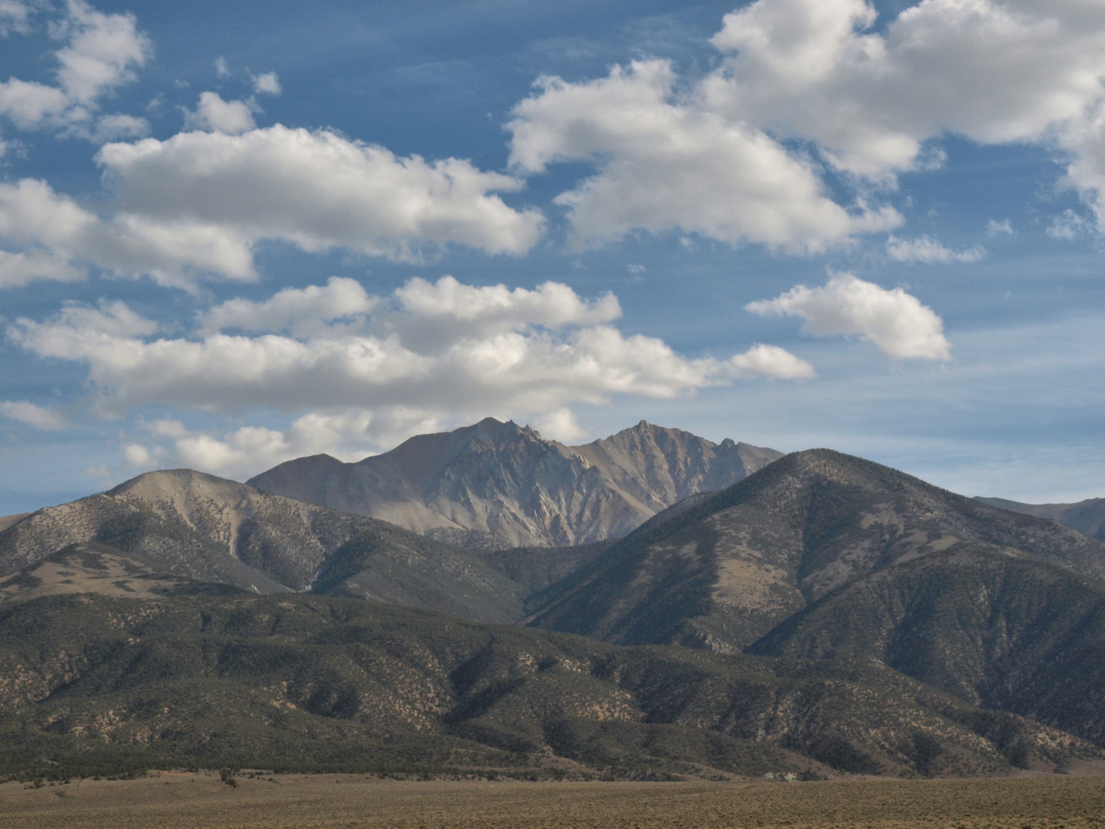
Montgomery Peak from Boundary Peak
Looking down from Boundary
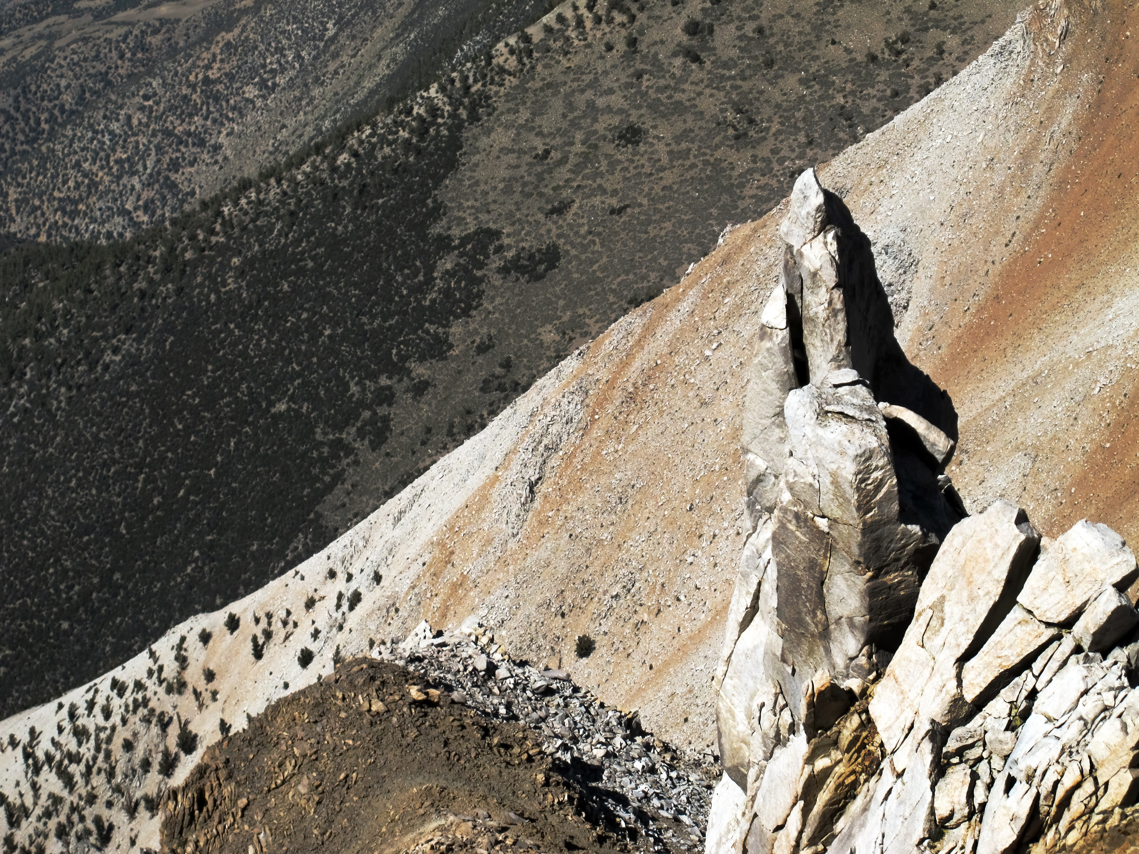
Steep west face of Boundary Peak
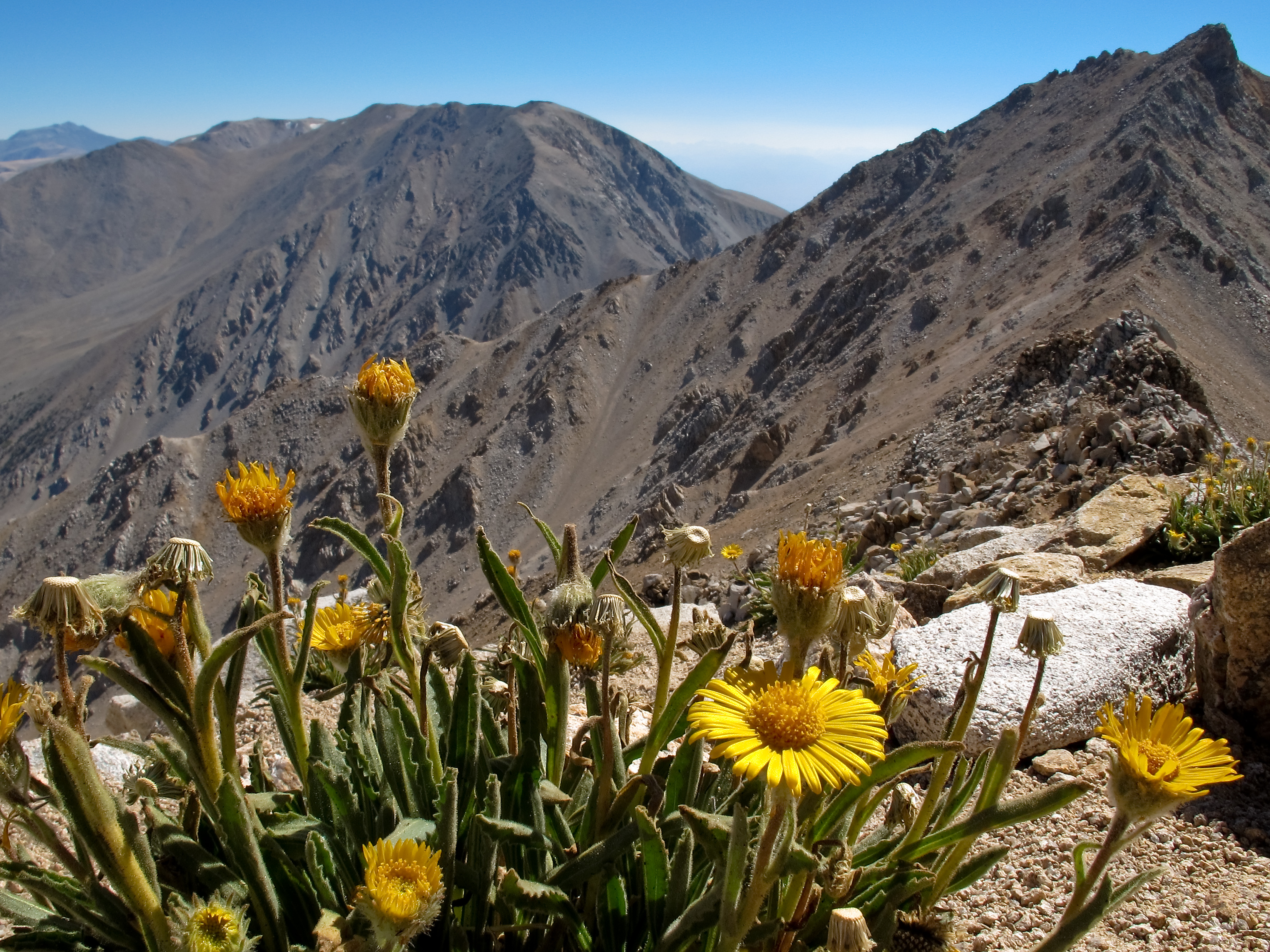
Alpine flowers and the White Mountains
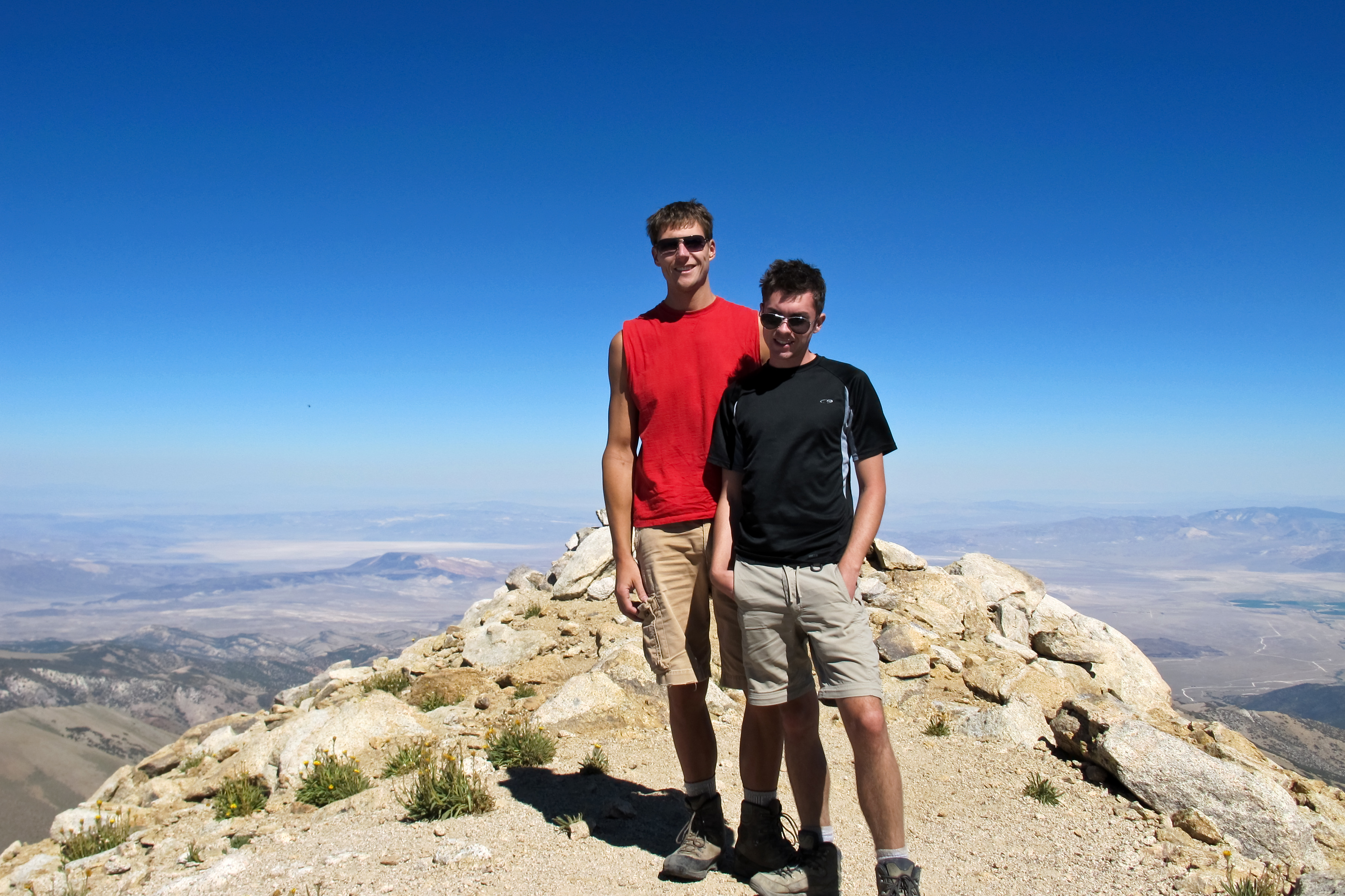
Boundary Peak summit photo
Boundary Peak slopes
Sky over Boundary Peak

Boundary and Montgomery Peak
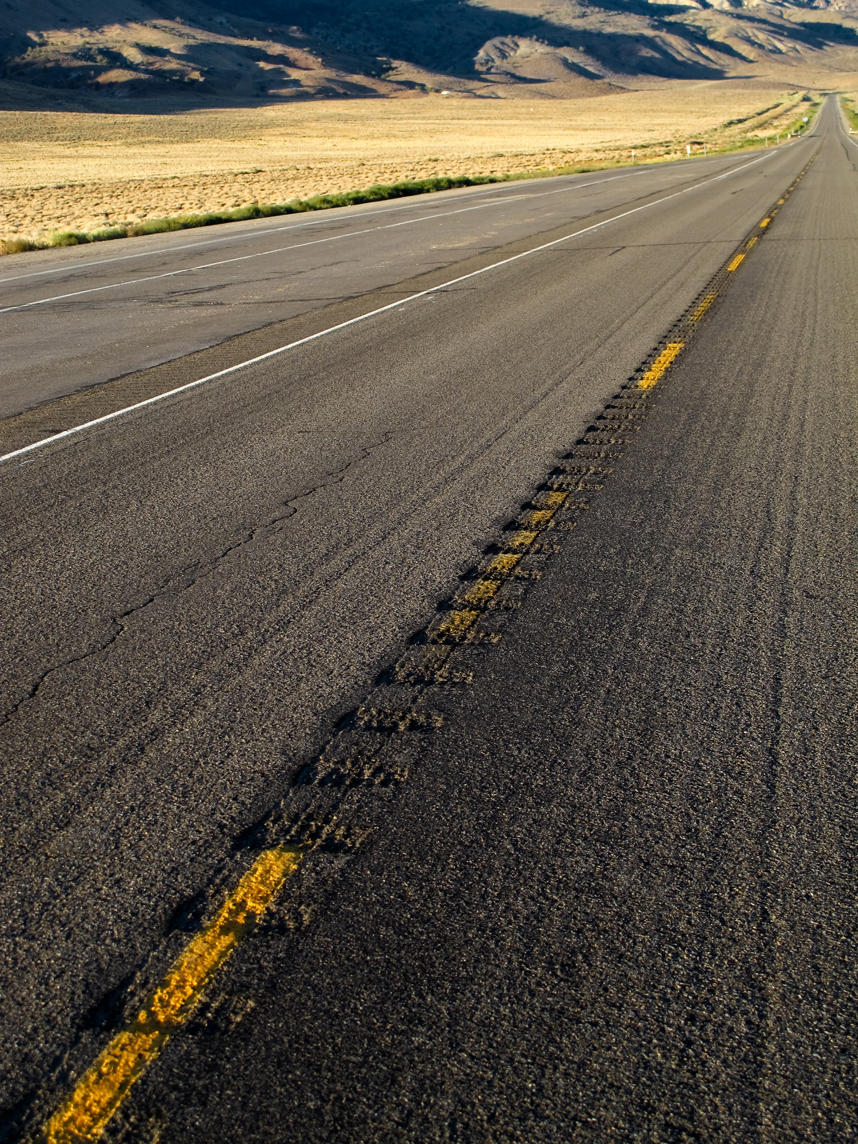
Lonesome Highway
アメリカ合衆国 〒 ネバダ州 バウンダリー山の地図
別の場所を検索
近所の場所
アメリカ合衆国 〒 カリフォルニア州 デュボア山
アメリカ合衆国 〒 カリフォルニア州 ベントン
41 Christie Ln, Benton, CA アメリカ合衆国
Hammil Rd, Bishop, CA アメリカ合衆国
CA-, Benton, CA アメリカ合衆国
アメリカ合衆国 〒 カリフォルニア州 ホワイト・マウンテン・ピーク
アメリカ合衆国 〒 カリフォルニア州 パイウート山
アメリカ合衆国 〒 カリフォルニア州 シープ山
アメリカ合衆国 〒 カリフォルニア州 ヴォルケーノ・テーブルランド
アメリカ合衆国 〒 カリフォルニア州 トムズ・プレイス
Mammoth Lakes, CA アメリカ合衆国ホリデー・キャンプグランド
1 Cougar Run, Bishop, CA アメリカ合衆国
Silver Canyon Rd, Bishop, CA アメリカ合衆国
Swall Meadows, CA アメリカ合衆国
アメリカ合衆国 カリフォルニア州 クローリー湖
Aspen Spring Ranch Rd, Mammoth Lakes, CA アメリカ合衆国
アメリカ合衆国 〒 カリフォルニア州 ディクソン・レーン=メドー・クリーク
S Landing Rd, Mammoth Lakes, CA アメリカ合衆国
アメリカ合衆国 〒 カリフォルニア州 メサ
Cherry Ln, Bishop, CA アメリカ合衆国
最近の検索
- アメリカ合衆国 アラスカ州 レッド・ドッグ・マイン日の出日の入り時間
- Am bhf, Borken, ドイツアム・バーンホーフ日の出日の入り時間
- 4th St E, Sonoma, CA, USA日の出日の入り時間
- Oakland Ave, Williamsport, PA アメリカ合衆国日の出日の入り時間
- Via Roma, Pieranica CR, イタリアローマ通り日の出日の入り時間
- クロアチア 〒 ドゥブロブニク GradClock Tower of Dubrovnik日の出日の入り時間
- アルゼンチン チュブ州 トレリュー日の出日の入り時間
- Hartfords Bluff Cir, Mt Pleasant, SC アメリカ合衆国日の出日の入り時間
- 日本、熊本県熊本市北区日の出日の入り時間
- 中華人民共和国 福州市 平潭県 平潭島日の出日の入り時間