Bear Run Rd, Lansing, NC アメリカ合衆国日の出日の入り時間
Location: アメリカ合衆国 > ノース・カロライナ州 > アッシュ > アメリカ合衆国 〒 ノース・カロライナ州 パイニー・クリーク > アメリカ合衆国 〒 ノース・カロライナ州 ランシング >
時間帯:
America/New_York
現地時間:
2025-06-25 17:12:01
経度:
-81.4721604
緯度:
36.553109
今日の日の出時刻:
06:09:30 AM
今日の日の入時刻:
08:48:20 PM
今日の日長:
14h 38m 50s
明日の日の出時刻:
06:09:52 AM
明日の日の入時刻:
08:48:22 PM
明日の日長:
14h 38m 30s
すべて表示する
| 日付 | 日出 | 日没 | 日長 |
|---|---|---|---|
| 2025年01月01日 | 07:38:03 AM | 05:21:58 PM | 9h 43m 55s |
| 2025年01月02日 | 07:38:09 AM | 05:22:46 PM | 9h 44m 37s |
| 2025年01月03日 | 07:38:14 AM | 05:23:36 PM | 9h 45m 22s |
| 2025年01月04日 | 07:38:16 AM | 05:24:27 PM | 9h 46m 11s |
| 2025年01月05日 | 07:38:17 AM | 05:25:19 PM | 9h 47m 2s |
| 2025年01月06日 | 07:38:15 AM | 05:26:13 PM | 9h 47m 58s |
| 2025年01月07日 | 07:38:12 AM | 05:27:07 PM | 9h 48m 55s |
| 2025年01月08日 | 07:38:06 AM | 05:28:02 PM | 9h 49m 56s |
| 2025年01月09日 | 07:37:59 AM | 05:28:58 PM | 9h 50m 59s |
| 2025年01月10日 | 07:37:50 AM | 05:29:55 PM | 9h 52m 5s |
| 2025年01月11日 | 07:37:38 AM | 05:30:53 PM | 9h 53m 15s |
| 2025年01月12日 | 07:37:25 AM | 05:31:51 PM | 9h 54m 26s |
| 2025年01月13日 | 07:37:09 AM | 05:32:51 PM | 9h 55m 42s |
| 2025年01月14日 | 07:36:52 AM | 05:33:50 PM | 9h 56m 58s |
| 2025年01月15日 | 07:36:32 AM | 05:34:51 PM | 9h 58m 19s |
| 2025年01月16日 | 07:36:11 AM | 05:35:52 PM | 9h 59m 41s |
| 2025年01月17日 | 07:35:48 AM | 05:36:53 PM | 10h 1m 5s |
| 2025年01月18日 | 07:35:23 AM | 05:37:55 PM | 10h 2m 32s |
| 2025年01月19日 | 07:34:56 AM | 05:38:58 PM | 10h 4m 2s |
| 2025年01月20日 | 07:34:27 AM | 05:40:00 PM | 10h 5m 33s |
| 2025年01月21日 | 07:33:56 AM | 05:41:04 PM | 10h 7m 8s |
| 2025年01月22日 | 07:33:23 AM | 05:42:07 PM | 10h 8m 44s |
| 2025年01月23日 | 07:32:49 AM | 05:43:11 PM | 10h 10m 22s |
| 2025年01月24日 | 07:32:13 AM | 05:44:14 PM | 10h 12m 1s |
| 2025年01月25日 | 07:31:35 AM | 05:45:18 PM | 10h 13m 43s |
| 2025年01月26日 | 07:30:55 AM | 05:46:23 PM | 10h 15m 28s |
| 2025年01月27日 | 07:30:14 AM | 05:47:27 PM | 10h 17m 13s |
| 2025年01月28日 | 07:29:30 AM | 05:48:31 PM | 10h 19m 1s |
| 2025年01月29日 | 07:28:46 AM | 05:49:35 PM | 10h 20m 49s |
| 2025年01月30日 | 07:27:59 AM | 05:50:40 PM | 10h 22m 41s |
| 2025年01月31日 | 07:27:11 AM | 05:51:44 PM | 10h 24m 33s |
| 2025年02月01日 | 07:26:21 AM | 05:52:48 PM | 10h 26m 27s |
| 2025年02月02日 | 07:25:30 AM | 05:53:53 PM | 10h 28m 23s |
| 2025年02月03日 | 07:24:37 AM | 05:54:57 PM | 10h 30m 20s |
| 2025年02月04日 | 07:23:43 AM | 05:56:01 PM | 10h 32m 18s |
| 2025年02月05日 | 07:22:48 AM | 05:57:05 PM | 10h 34m 17s |
| 2025年02月06日 | 07:21:50 AM | 05:58:08 PM | 10h 36m 18s |
| 2025年02月07日 | 07:20:52 AM | 05:59:12 PM | 10h 38m 20s |
| 2025年02月08日 | 07:19:52 AM | 06:00:15 PM | 10h 40m 23s |
| 2025年02月09日 | 07:18:51 AM | 06:01:18 PM | 10h 42m 27s |
| 2025年02月10日 | 07:17:48 AM | 06:02:21 PM | 10h 44m 33s |
| 2025年02月11日 | 07:16:45 AM | 06:03:23 PM | 10h 46m 38s |
| 2025年02月12日 | 07:15:40 AM | 06:04:26 PM | 10h 48m 46s |
| 2025年02月13日 | 07:14:34 AM | 06:05:28 PM | 10h 50m 54s |
| 2025年02月14日 | 07:13:26 AM | 06:06:29 PM | 10h 53m 3s |
| 2025年02月15日 | 07:12:18 AM | 06:07:31 PM | 10h 55m 13s |
| 2025年02月16日 | 07:11:08 AM | 06:08:32 PM | 10h 57m 24s |
| 2025年02月17日 | 07:09:57 AM | 06:09:33 PM | 10h 59m 36s |
| 2025年02月18日 | 07:08:46 AM | 06:10:33 PM | 11h 1m 47s |
| 2025年02月19日 | 07:07:33 AM | 06:11:33 PM | 11h 4m 0s |
| 2025年02月20日 | 07:06:19 AM | 06:12:33 PM | 11h 6m 14s |
| 2025年02月21日 | 07:05:05 AM | 06:13:33 PM | 11h 8m 28s |
| 2025年02月22日 | 07:03:49 AM | 06:14:32 PM | 11h 10m 43s |
| 2025年02月23日 | 07:02:33 AM | 06:15:31 PM | 11h 12m 58s |
| 2025年02月24日 | 07:01:15 AM | 06:16:29 PM | 11h 15m 14s |
| 2025年02月25日 | 06:59:57 AM | 06:17:27 PM | 11h 17m 30s |
| 2025年02月26日 | 06:58:38 AM | 06:18:25 PM | 11h 19m 47s |
| 2025年02月27日 | 06:57:19 AM | 06:19:23 PM | 11h 22m 4s |
| 2025年02月28日 | 06:55:58 AM | 06:20:20 PM | 11h 24m 22s |
| 2025年03月01日 | 06:54:37 AM | 06:21:17 PM | 11h 26m 40s |
| 2025年03月02日 | 06:53:16 AM | 06:22:14 PM | 11h 28m 58s |
| 2025年03月03日 | 06:51:53 AM | 06:23:10 PM | 11h 31m 17s |
| 2025年03月04日 | 06:50:31 AM | 06:24:06 PM | 11h 33m 35s |
| 2025年03月05日 | 06:49:07 AM | 06:25:02 PM | 11h 35m 55s |
| 2025年03月06日 | 06:47:43 AM | 06:25:57 PM | 11h 38m 14s |
| 2025年03月07日 | 06:46:19 AM | 06:26:52 PM | 11h 40m 33s |
| 2025年03月08日 | 06:44:54 AM | 06:27:47 PM | 11h 42m 53s |
| 2025年03月09日 | 07:43:32 AM | 07:28:39 PM | 11h 45m 7s |
| 2025年03月10日 | 07:42:06 AM | 07:29:34 PM | 11h 47m 28s |
| 2025年03月11日 | 07:40:40 AM | 07:30:28 PM | 11h 49m 48s |
| 2025年03月12日 | 07:39:14 AM | 07:31:22 PM | 11h 52m 8s |
| 2025年03月13日 | 07:37:47 AM | 07:32:16 PM | 11h 54m 29s |
| 2025年03月14日 | 07:36:20 AM | 07:33:09 PM | 11h 56m 49s |
| 2025年03月15日 | 07:34:53 AM | 07:34:03 PM | 11h 59m 10s |
| 2025年03月16日 | 07:33:25 AM | 07:34:56 PM | 12h 1m 31s |
| 2025年03月17日 | 07:31:57 AM | 07:35:49 PM | 12h 3m 52s |
| 2025年03月18日 | 07:30:29 AM | 07:36:41 PM | 12h 6m 12s |
| 2025年03月19日 | 07:29:01 AM | 07:37:34 PM | 12h 8m 33s |
| 2025年03月20日 | 07:27:33 AM | 07:38:27 PM | 12h 10m 54s |
| 2025年03月21日 | 07:26:05 AM | 07:39:19 PM | 12h 13m 14s |
| 2025年03月22日 | 07:24:37 AM | 07:40:11 PM | 12h 15m 34s |
| 2025年03月23日 | 07:23:09 AM | 07:41:03 PM | 12h 17m 54s |
| 2025年03月24日 | 07:21:41 AM | 07:41:55 PM | 12h 20m 14s |
| 2025年03月25日 | 07:20:12 AM | 07:42:47 PM | 12h 22m 35s |
| 2025年03月26日 | 07:18:44 AM | 07:43:39 PM | 12h 24m 55s |
| 2025年03月27日 | 07:17:16 AM | 07:44:31 PM | 12h 27m 15s |
| 2025年03月28日 | 07:15:48 AM | 07:45:23 PM | 12h 29m 35s |
| 2025年03月29日 | 07:14:21 AM | 07:46:14 PM | 12h 31m 53s |
| 2025年03月30日 | 07:12:53 AM | 07:47:06 PM | 12h 34m 13s |
| 2025年03月31日 | 07:11:26 AM | 07:47:58 PM | 12h 36m 32s |
| 2025年04月01日 | 07:09:59 AM | 07:48:49 PM | 12h 38m 50s |
| 2025年04月02日 | 07:08:32 AM | 07:49:41 PM | 12h 41m 9s |
| 2025年04月03日 | 07:07:06 AM | 07:50:32 PM | 12h 43m 26s |
| 2025年04月04日 | 07:05:40 AM | 07:51:24 PM | 12h 45m 44s |
| 2025年04月05日 | 07:04:14 AM | 07:52:16 PM | 12h 48m 2s |
| 2025年04月06日 | 07:02:49 AM | 07:53:07 PM | 12h 50m 18s |
| 2025年04月07日 | 07:01:24 AM | 07:53:59 PM | 12h 52m 35s |
| 2025年04月08日 | 07:00:00 AM | 07:54:51 PM | 12h 54m 51s |
| 2025年04月09日 | 06:58:36 AM | 07:55:42 PM | 12h 57m 6s |
| 2025年04月10日 | 06:57:12 AM | 07:56:34 PM | 12h 59m 22s |
| 2025年04月11日 | 06:55:49 AM | 07:57:26 PM | 13h 1m 37s |
| 2025年04月12日 | 06:54:27 AM | 07:58:18 PM | 13h 3m 51s |
| 2025年04月13日 | 06:53:06 AM | 07:59:10 PM | 13h 6m 4s |
| 2025年04月14日 | 06:51:44 AM | 08:00:01 PM | 13h 8m 17s |
| 2025年04月15日 | 06:50:24 AM | 08:00:53 PM | 13h 10m 29s |
| 2025年04月16日 | 06:49:04 AM | 08:01:45 PM | 13h 12m 41s |
| 2025年04月17日 | 06:47:46 AM | 08:02:38 PM | 13h 14m 52s |
| 2025年04月18日 | 06:46:27 AM | 08:03:30 PM | 13h 17m 3s |
| 2025年04月19日 | 06:45:10 AM | 08:04:22 PM | 13h 19m 12s |
| 2025年04月20日 | 06:43:53 AM | 08:05:14 PM | 13h 21m 21s |
| 2025年04月21日 | 06:42:38 AM | 08:06:06 PM | 13h 23m 28s |
| 2025年04月22日 | 06:41:23 AM | 08:06:59 PM | 13h 25m 36s |
| 2025年04月23日 | 06:40:09 AM | 08:07:51 PM | 13h 27m 42s |
| 2025年04月24日 | 06:38:56 AM | 08:08:43 PM | 13h 29m 47s |
| 2025年04月25日 | 06:37:44 AM | 08:09:36 PM | 13h 31m 52s |
| 2025年04月26日 | 06:36:33 AM | 08:10:28 PM | 13h 33m 55s |
| 2025年04月27日 | 06:35:23 AM | 08:11:20 PM | 13h 35m 57s |
| 2025年04月28日 | 06:34:14 AM | 08:12:13 PM | 13h 37m 59s |
| 2025年04月29日 | 06:33:06 AM | 08:13:05 PM | 13h 39m 59s |
| 2025年04月30日 | 06:31:59 AM | 08:13:57 PM | 13h 41m 58s |
| 2025年05月01日 | 06:30:53 AM | 08:14:50 PM | 13h 43m 57s |
| 2025年05月02日 | 06:29:48 AM | 08:15:42 PM | 13h 45m 54s |
| 2025年05月03日 | 06:28:45 AM | 08:16:34 PM | 13h 47m 49s |
| 2025年05月04日 | 06:27:43 AM | 08:17:26 PM | 13h 49m 43s |
| 2025年05月05日 | 06:26:42 AM | 08:18:18 PM | 13h 51m 36s |
| 2025年05月06日 | 06:25:42 AM | 08:19:10 PM | 13h 53m 28s |
| 2025年05月07日 | 06:24:44 AM | 08:20:01 PM | 13h 55m 17s |
| 2025年05月08日 | 06:23:47 AM | 08:20:53 PM | 13h 57m 6s |
| 2025年05月09日 | 06:22:51 AM | 08:21:44 PM | 13h 58m 53s |
| 2025年05月10日 | 06:21:57 AM | 08:22:35 PM | 14h 0m 38s |
| 2025年05月11日 | 06:21:04 AM | 08:23:25 PM | 14h 2m 21s |
| 2025年05月12日 | 06:20:13 AM | 08:24:16 PM | 14h 4m 3s |
| 2025年05月13日 | 06:19:23 AM | 08:25:06 PM | 14h 5m 43s |
| 2025年05月14日 | 06:18:34 AM | 08:25:56 PM | 14h 7m 22s |
| 2025年05月15日 | 06:17:47 AM | 08:26:45 PM | 14h 8m 58s |
| 2025年05月16日 | 06:17:01 AM | 08:27:34 PM | 14h 10m 33s |
| 2025年05月17日 | 06:16:17 AM | 08:28:23 PM | 14h 12m 6s |
| 2025年05月18日 | 06:15:35 AM | 08:29:11 PM | 14h 13m 36s |
| 2025年05月19日 | 06:14:54 AM | 08:29:59 PM | 14h 15m 5s |
| 2025年05月20日 | 06:14:15 AM | 08:30:46 PM | 14h 16m 31s |
| 2025年05月21日 | 06:13:37 AM | 08:31:32 PM | 14h 17m 55s |
| 2025年05月22日 | 06:13:01 AM | 08:32:18 PM | 14h 19m 17s |
| 2025年05月23日 | 06:12:26 AM | 08:33:04 PM | 14h 20m 38s |
| 2025年05月24日 | 06:11:54 AM | 08:33:49 PM | 14h 21m 55s |
| 2025年05月25日 | 06:11:22 AM | 08:34:33 PM | 14h 23m 11s |
| 2025年05月26日 | 06:10:53 AM | 08:35:16 PM | 14h 24m 23s |
| 2025年05月27日 | 06:10:25 AM | 08:35:59 PM | 14h 25m 34s |
| 2025年05月28日 | 06:09:59 AM | 08:36:40 PM | 14h 26m 41s |
| 2025年05月29日 | 06:09:35 AM | 08:37:21 PM | 14h 27m 46s |
| 2025年05月30日 | 06:09:12 AM | 08:38:01 PM | 14h 28m 49s |
| 2025年05月31日 | 06:08:51 AM | 08:38:41 PM | 14h 29m 50s |
| 2025年06月01日 | 06:08:32 AM | 08:39:19 PM | 14h 30m 47s |
| 2025年06月02日 | 06:08:15 AM | 08:39:56 PM | 14h 31m 41s |
| 2025年06月03日 | 06:07:59 AM | 08:40:32 PM | 14h 32m 33s |
| 2025年06月04日 | 06:07:45 AM | 08:41:07 PM | 14h 33m 22s |
| 2025年06月05日 | 06:07:33 AM | 08:41:41 PM | 14h 34m 8s |
| 2025年06月06日 | 06:07:22 AM | 08:42:14 PM | 14h 34m 52s |
| 2025年06月07日 | 06:07:14 AM | 08:42:46 PM | 14h 35m 32s |
| 2025年06月08日 | 06:07:07 AM | 08:43:16 PM | 14h 36m 9s |
| 2025年06月09日 | 06:07:01 AM | 08:43:45 PM | 14h 36m 44s |
| 2025年06月10日 | 06:06:58 AM | 08:44:13 PM | 14h 37m 15s |
| 2025年06月11日 | 06:06:56 AM | 08:44:40 PM | 14h 37m 44s |
| 2025年06月12日 | 06:06:56 AM | 08:45:05 PM | 14h 38m 9s |
| 2025年06月13日 | 06:06:57 AM | 08:45:29 PM | 14h 38m 32s |
| 2025年06月14日 | 06:07:00 AM | 08:45:52 PM | 14h 38m 52s |
| 2025年06月15日 | 06:07:05 AM | 08:46:13 PM | 14h 39m 8s |
| 2025年06月16日 | 06:07:12 AM | 08:46:32 PM | 14h 39m 20s |
| 2025年06月17日 | 06:07:20 AM | 08:46:50 PM | 14h 39m 30s |
| 2025年06月18日 | 06:07:29 AM | 08:47:07 PM | 14h 39m 38s |
| 2025年06月19日 | 06:07:40 AM | 08:47:22 PM | 14h 39m 42s |
| 2025年06月20日 | 06:07:53 AM | 08:47:35 PM | 14h 39m 42s |
| 2025年06月21日 | 06:08:07 AM | 08:47:47 PM | 14h 39m 40s |
| 2025年06月22日 | 06:08:23 AM | 08:47:57 PM | 14h 39m 34s |
| 2025年06月23日 | 06:08:40 AM | 08:48:06 PM | 14h 39m 26s |
| 2025年06月24日 | 06:08:59 AM | 08:48:12 PM | 14h 39m 13s |
| 2025年06月25日 | 06:09:19 AM | 08:48:18 PM | 14h 38m 59s |
| 2025年06月26日 | 06:09:41 AM | 08:48:21 PM | 14h 38m 40s |
| 2025年06月27日 | 06:10:04 AM | 08:48:23 PM | 14h 38m 19s |
| 2025年06月28日 | 06:10:28 AM | 08:48:23 PM | 14h 37m 55s |
| 2025年06月29日 | 06:10:53 AM | 08:48:21 PM | 14h 37m 28s |
| 2025年06月30日 | 06:11:20 AM | 08:48:18 PM | 14h 36m 58s |
| 2025年07月01日 | 06:11:48 AM | 08:48:13 PM | 14h 36m 25s |
| 2025年07月02日 | 06:12:17 AM | 08:48:06 PM | 14h 35m 49s |
| 2025年07月03日 | 06:12:47 AM | 08:47:57 PM | 14h 35m 10s |
| 2025年07月04日 | 06:13:19 AM | 08:47:46 PM | 14h 34m 27s |
| 2025年07月05日 | 06:13:51 AM | 08:47:34 PM | 14h 33m 43s |
| 2025年07月06日 | 06:14:25 AM | 08:47:20 PM | 14h 32m 55s |
| 2025年07月07日 | 06:14:59 AM | 08:47:04 PM | 14h 32m 5s |
| 2025年07月08日 | 06:15:35 AM | 08:46:46 PM | 14h 31m 11s |
| 2025年07月09日 | 06:16:11 AM | 08:46:27 PM | 14h 30m 16s |
| 2025年07月10日 | 06:16:48 AM | 08:46:06 PM | 14h 29m 18s |
| 2025年07月11日 | 06:17:27 AM | 08:45:43 PM | 14h 28m 16s |
| 2025年07月12日 | 06:18:06 AM | 08:45:18 PM | 14h 27m 12s |
| 2025年07月13日 | 06:18:45 AM | 08:44:52 PM | 14h 26m 7s |
| 2025年07月14日 | 06:19:26 AM | 08:44:23 PM | 14h 24m 57s |
| 2025年07月15日 | 06:20:07 AM | 08:43:54 PM | 14h 23m 47s |
| 2025年07月16日 | 06:20:49 AM | 08:43:22 PM | 14h 22m 33s |
| 2025年07月17日 | 06:21:31 AM | 08:42:49 PM | 14h 21m 18s |
| 2025年07月18日 | 06:22:15 AM | 08:42:14 PM | 14h 19m 59s |
| 2025年07月19日 | 06:22:58 AM | 08:41:37 PM | 14h 18m 39s |
| 2025年07月20日 | 06:23:43 AM | 08:40:59 PM | 14h 17m 16s |
| 2025年07月21日 | 06:24:27 AM | 08:40:19 PM | 14h 15m 52s |
| 2025年07月22日 | 06:25:12 AM | 08:39:37 PM | 14h 14m 25s |
| 2025年07月23日 | 06:25:58 AM | 08:38:54 PM | 14h 12m 56s |
| 2025年07月24日 | 06:26:44 AM | 08:38:09 PM | 14h 11m 25s |
| 2025年07月25日 | 06:27:30 AM | 08:37:23 PM | 14h 9m 53s |
| 2025年07月26日 | 06:28:17 AM | 08:36:35 PM | 14h 8m 18s |
| 2025年07月27日 | 06:29:04 AM | 08:35:45 PM | 14h 6m 41s |
| 2025年07月28日 | 06:29:51 AM | 08:34:54 PM | 14h 5m 3s |
| 2025年07月29日 | 06:30:39 AM | 08:34:02 PM | 14h 3m 23s |
| 2025年07月30日 | 06:31:27 AM | 08:33:08 PM | 14h 1m 41s |
| 2025年07月31日 | 06:32:15 AM | 08:32:13 PM | 13h 59m 58s |
| 2025年08月01日 | 06:33:03 AM | 08:31:16 PM | 13h 58m 13s |
| 2025年08月02日 | 06:33:51 AM | 08:30:18 PM | 13h 56m 27s |
| 2025年08月03日 | 06:34:40 AM | 08:29:19 PM | 13h 54m 39s |
| 2025年08月04日 | 06:35:28 AM | 08:28:18 PM | 13h 52m 50s |
| 2025年08月05日 | 06:36:17 AM | 08:27:17 PM | 13h 51m 0s |
| 2025年08月06日 | 06:37:06 AM | 08:26:13 PM | 13h 49m 7s |
| 2025年08月07日 | 06:37:55 AM | 08:25:09 PM | 13h 47m 14s |
| 2025年08月08日 | 06:38:44 AM | 08:24:03 PM | 13h 45m 19s |
| 2025年08月09日 | 06:39:32 AM | 08:22:56 PM | 13h 43m 24s |
| 2025年08月10日 | 06:40:21 AM | 08:21:48 PM | 13h 41m 27s |
| 2025年08月11日 | 06:41:10 AM | 08:20:39 PM | 13h 39m 29s |
| 2025年08月12日 | 06:41:59 AM | 08:19:29 PM | 13h 37m 30s |
| 2025年08月13日 | 06:42:48 AM | 08:18:18 PM | 13h 35m 30s |
| 2025年08月14日 | 06:43:37 AM | 08:17:05 PM | 13h 33m 28s |
| 2025年08月15日 | 06:44:26 AM | 08:15:52 PM | 13h 31m 26s |
| 2025年08月16日 | 06:45:14 AM | 08:14:38 PM | 13h 29m 24s |
| 2025年08月17日 | 06:46:03 AM | 08:13:22 PM | 13h 27m 19s |
| 2025年08月18日 | 06:46:52 AM | 08:12:06 PM | 13h 25m 14s |
| 2025年08月19日 | 06:47:40 AM | 08:10:49 PM | 13h 23m 9s |
| 2025年08月20日 | 06:48:29 AM | 08:09:31 PM | 13h 21m 2s |
| 2025年08月21日 | 06:49:17 AM | 08:08:12 PM | 13h 18m 55s |
| 2025年08月22日 | 06:50:05 AM | 08:06:53 PM | 13h 16m 48s |
| 2025年08月23日 | 06:50:54 AM | 08:05:32 PM | 13h 14m 38s |
| 2025年08月24日 | 06:51:42 AM | 08:04:11 PM | 13h 12m 29s |
| 2025年08月25日 | 06:52:30 AM | 08:02:49 PM | 13h 10m 19s |
| 2025年08月26日 | 06:53:18 AM | 08:01:27 PM | 13h 8m 9s |
| 2025年08月27日 | 06:54:06 AM | 08:00:03 PM | 13h 5m 57s |
| 2025年08月28日 | 06:54:53 AM | 07:58:40 PM | 13h 3m 47s |
| 2025年08月29日 | 06:55:41 AM | 07:57:15 PM | 13h 1m 34s |
| 2025年08月30日 | 06:56:29 AM | 07:55:50 PM | 12h 59m 21s |
| 2025年08月31日 | 06:57:17 AM | 07:54:24 PM | 12h 57m 7s |
| 2025年09月01日 | 06:58:04 AM | 07:52:58 PM | 12h 54m 54s |
| 2025年09月02日 | 06:58:52 AM | 07:51:32 PM | 12h 52m 40s |
| 2025年09月03日 | 06:59:39 AM | 07:50:05 PM | 12h 50m 26s |
| 2025年09月04日 | 07:00:26 AM | 07:48:37 PM | 12h 48m 11s |
| 2025年09月05日 | 07:01:14 AM | 07:47:09 PM | 12h 45m 55s |
| 2025年09月06日 | 07:02:01 AM | 07:45:41 PM | 12h 43m 40s |
| 2025年09月07日 | 07:02:48 AM | 07:44:12 PM | 12h 41m 24s |
| 2025年09月08日 | 07:03:36 AM | 07:42:43 PM | 12h 39m 7s |
| 2025年09月09日 | 07:04:23 AM | 07:41:14 PM | 12h 36m 51s |
| 2025年09月10日 | 07:05:10 AM | 07:39:45 PM | 12h 34m 35s |
| 2025年09月11日 | 07:05:57 AM | 07:38:15 PM | 12h 32m 18s |
| 2025年09月12日 | 07:06:45 AM | 07:36:45 PM | 12h 30m 0s |
| 2025年09月13日 | 07:07:32 AM | 07:35:15 PM | 12h 27m 43s |
| 2025年09月14日 | 07:08:19 AM | 07:33:45 PM | 12h 25m 26s |
| 2025年09月15日 | 07:09:07 AM | 07:32:15 PM | 12h 23m 8s |
| 2025年09月16日 | 07:09:54 AM | 07:30:44 PM | 12h 20m 50s |
| 2025年09月17日 | 07:10:42 AM | 07:29:14 PM | 12h 18m 32s |
| 2025年09月18日 | 07:11:30 AM | 07:27:43 PM | 12h 16m 13s |
| 2025年09月19日 | 07:12:17 AM | 07:26:13 PM | 12h 13m 56s |
| 2025年09月20日 | 07:13:05 AM | 07:24:42 PM | 12h 11m 37s |
| 2025年09月21日 | 07:13:53 AM | 07:23:12 PM | 12h 9m 19s |
| 2025年09月22日 | 07:14:41 AM | 07:21:41 PM | 12h 7m 0s |
| 2025年09月23日 | 07:15:30 AM | 07:20:11 PM | 12h 4m 41s |
| 2025年09月24日 | 07:16:18 AM | 07:18:41 PM | 12h 2m 23s |
| 2025年09月25日 | 07:17:07 AM | 07:17:11 PM | 12h 0m 4s |
| 2025年09月26日 | 07:17:56 AM | 07:15:42 PM | 11h 57m 46s |
| 2025年09月27日 | 07:18:45 AM | 07:14:12 PM | 11h 55m 27s |
| 2025年09月28日 | 07:19:34 AM | 07:12:43 PM | 11h 53m 9s |
| 2025年09月29日 | 07:20:23 AM | 07:11:14 PM | 11h 50m 51s |
| 2025年09月30日 | 07:21:13 AM | 07:09:46 PM | 11h 48m 33s |
| 2025年10月01日 | 07:22:03 AM | 07:08:17 PM | 11h 46m 14s |
| 2025年10月02日 | 07:22:53 AM | 07:06:50 PM | 11h 43m 57s |
| 2025年10月03日 | 07:23:43 AM | 07:05:22 PM | 11h 41m 39s |
| 2025年10月04日 | 07:24:34 AM | 07:03:55 PM | 11h 39m 21s |
| 2025年10月05日 | 07:25:25 AM | 07:02:29 PM | 11h 37m 4s |
| 2025年10月06日 | 07:26:16 AM | 07:01:03 PM | 11h 34m 47s |
| 2025年10月07日 | 07:27:08 AM | 06:59:37 PM | 11h 32m 29s |
| 2025年10月08日 | 07:28:00 AM | 06:58:13 PM | 11h 30m 13s |
| 2025年10月09日 | 07:28:52 AM | 06:56:48 PM | 11h 27m 56s |
| 2025年10月10日 | 07:29:44 AM | 06:55:25 PM | 11h 25m 41s |
| 2025年10月11日 | 07:30:37 AM | 06:54:02 PM | 11h 23m 25s |
| 2025年10月12日 | 07:31:30 AM | 06:52:39 PM | 11h 21m 9s |
| 2025年10月13日 | 07:32:24 AM | 06:51:18 PM | 11h 18m 54s |
| 2025年10月14日 | 07:33:18 AM | 06:49:57 PM | 11h 16m 39s |
| 2025年10月15日 | 07:34:12 AM | 06:48:37 PM | 11h 14m 25s |
| 2025年10月16日 | 07:35:06 AM | 06:47:18 PM | 11h 12m 12s |
| 2025年10月17日 | 07:36:01 AM | 06:45:59 PM | 11h 9m 58s |
| 2025年10月18日 | 07:36:56 AM | 06:44:42 PM | 11h 7m 46s |
| 2025年10月19日 | 07:37:52 AM | 06:43:25 PM | 11h 5m 33s |
| 2025年10月20日 | 07:38:48 AM | 06:42:10 PM | 11h 3m 22s |
| 2025年10月21日 | 07:39:44 AM | 06:40:55 PM | 11h 1m 11s |
| 2025年10月22日 | 07:40:41 AM | 06:39:41 PM | 10h 59m 0s |
| 2025年10月23日 | 07:41:38 AM | 06:38:29 PM | 10h 56m 51s |
| 2025年10月24日 | 07:42:35 AM | 06:37:17 PM | 10h 54m 42s |
| 2025年10月25日 | 07:43:33 AM | 06:36:07 PM | 10h 52m 34s |
| 2025年10月26日 | 07:44:31 AM | 06:34:58 PM | 10h 50m 27s |
| 2025年10月27日 | 07:45:29 AM | 06:33:50 PM | 10h 48m 21s |
| 2025年10月28日 | 07:46:28 AM | 06:32:43 PM | 10h 46m 15s |
| 2025年10月29日 | 07:47:27 AM | 06:31:37 PM | 10h 44m 10s |
| 2025年10月30日 | 07:48:26 AM | 06:30:33 PM | 10h 42m 7s |
| 2025年10月31日 | 07:49:25 AM | 06:29:30 PM | 10h 40m 5s |
| 2025年11月01日 | 07:50:25 AM | 06:28:28 PM | 10h 38m 3s |
| 2025年11月02日 | 06:51:28 AM | 05:27:25 PM | 10h 35m 57s |
| 2025年11月03日 | 06:52:28 AM | 05:26:26 PM | 10h 33m 58s |
| 2025年11月04日 | 06:53:28 AM | 05:25:29 PM | 10h 32m 1s |
| 2025年11月05日 | 06:54:29 AM | 05:24:33 PM | 10h 30m 4s |
| 2025年11月06日 | 06:55:30 AM | 05:23:38 PM | 10h 28m 8s |
| 2025年11月07日 | 06:56:31 AM | 05:22:45 PM | 10h 26m 14s |
| 2025年11月08日 | 06:57:32 AM | 05:21:54 PM | 10h 24m 22s |
| 2025年11月09日 | 06:58:33 AM | 05:21:04 PM | 10h 22m 31s |
| 2025年11月10日 | 06:59:35 AM | 05:20:16 PM | 10h 20m 41s |
| 2025年11月11日 | 07:00:36 AM | 05:19:29 PM | 10h 18m 53s |
| 2025年11月12日 | 07:01:38 AM | 05:18:44 PM | 10h 17m 6s |
| 2025年11月13日 | 07:02:39 AM | 05:18:01 PM | 10h 15m 22s |
| 2025年11月14日 | 07:03:40 AM | 05:17:19 PM | 10h 13m 39s |
| 2025年11月15日 | 07:04:42 AM | 05:16:40 PM | 10h 11m 58s |
| 2025年11月16日 | 07:05:43 AM | 05:16:02 PM | 10h 10m 19s |
| 2025年11月17日 | 07:06:44 AM | 05:15:26 PM | 10h 8m 42s |
| 2025年11月18日 | 07:07:45 AM | 05:14:51 PM | 10h 7m 6s |
| 2025年11月19日 | 07:08:45 AM | 05:14:19 PM | 10h 5m 34s |
| 2025年11月20日 | 07:09:46 AM | 05:13:48 PM | 10h 4m 2s |
| 2025年11月21日 | 07:10:46 AM | 05:13:20 PM | 10h 2m 34s |
| 2025年11月22日 | 07:11:46 AM | 05:12:53 PM | 10h 1m 7s |
| 2025年11月23日 | 07:12:45 AM | 05:12:28 PM | 9h 59m 43s |
| 2025年11月24日 | 07:13:44 AM | 05:12:05 PM | 9h 58m 21s |
| 2025年11月25日 | 07:14:42 AM | 05:11:44 PM | 9h 57m 2s |
| 2025年11月26日 | 07:15:40 AM | 05:11:26 PM | 9h 55m 46s |
| 2025年11月27日 | 07:16:38 AM | 05:11:09 PM | 9h 54m 31s |
| 2025年11月28日 | 07:17:35 AM | 05:10:54 PM | 9h 53m 19s |
| 2025年11月29日 | 07:18:31 AM | 05:10:41 PM | 9h 52m 10s |
| 2025年11月30日 | 07:19:26 AM | 05:10:30 PM | 9h 51m 4s |
| 2025年12月01日 | 07:20:21 AM | 05:10:21 PM | 9h 50m 0s |
| 2025年12月02日 | 07:21:15 AM | 05:10:14 PM | 9h 48m 59s |
| 2025年12月03日 | 07:22:07 AM | 05:10:10 PM | 9h 48m 3s |
| 2025年12月04日 | 07:22:59 AM | 05:10:07 PM | 9h 47m 8s |
| 2025年12月05日 | 07:23:51 AM | 05:10:06 PM | 9h 46m 15s |
| 2025年12月06日 | 07:24:41 AM | 05:10:08 PM | 9h 45m 27s |
| 2025年12月07日 | 07:25:30 AM | 05:10:11 PM | 9h 44m 41s |
| 2025年12月08日 | 07:26:18 AM | 05:10:17 PM | 9h 43m 59s |
| 2025年12月09日 | 07:27:04 AM | 05:10:24 PM | 9h 43m 20s |
| 2025年12月10日 | 07:27:50 AM | 05:10:34 PM | 9h 42m 44s |
| 2025年12月11日 | 07:28:34 AM | 05:10:45 PM | 9h 42m 11s |
| 2025年12月12日 | 07:29:17 AM | 05:10:59 PM | 9h 41m 42s |
| 2025年12月13日 | 07:29:59 AM | 05:11:14 PM | 9h 41m 15s |
| 2025年12月14日 | 07:30:39 AM | 05:11:32 PM | 9h 40m 53s |
| 2025年12月15日 | 07:31:18 AM | 05:11:51 PM | 9h 40m 33s |
| 2025年12月16日 | 07:31:55 AM | 05:12:12 PM | 9h 40m 17s |
| 2025年12月17日 | 07:32:31 AM | 05:12:35 PM | 9h 40m 4s |
| 2025年12月18日 | 07:33:05 AM | 05:13:00 PM | 9h 39m 55s |
| 2025年12月19日 | 07:33:38 AM | 05:13:27 PM | 9h 39m 49s |
| 2025年12月20日 | 07:34:09 AM | 05:13:56 PM | 9h 39m 47s |
| 2025年12月21日 | 07:34:38 AM | 05:14:26 PM | 9h 39m 48s |
| 2025年12月22日 | 07:35:05 AM | 05:14:58 PM | 9h 39m 53s |
| 2025年12月23日 | 07:35:31 AM | 05:15:32 PM | 9h 40m 1s |
| 2025年12月24日 | 07:35:55 AM | 05:16:07 PM | 9h 40m 12s |
| 2025年12月25日 | 07:36:18 AM | 05:16:45 PM | 9h 40m 27s |
| 2025年12月26日 | 07:36:38 AM | 05:17:23 PM | 9h 40m 45s |
| 2025年12月27日 | 07:36:57 AM | 05:18:03 PM | 9h 41m 6s |
| 2025年12月28日 | 07:37:13 AM | 05:18:45 PM | 9h 41m 32s |
| 2025年12月29日 | 07:37:28 AM | 05:19:28 PM | 9h 42m 0s |
| 2025年12月30日 | 07:37:41 AM | 05:20:13 PM | 9h 42m 32s |
| 2025年12月31日 | 07:37:52 AM | 05:20:59 PM | 9h 43m 7s |
写真

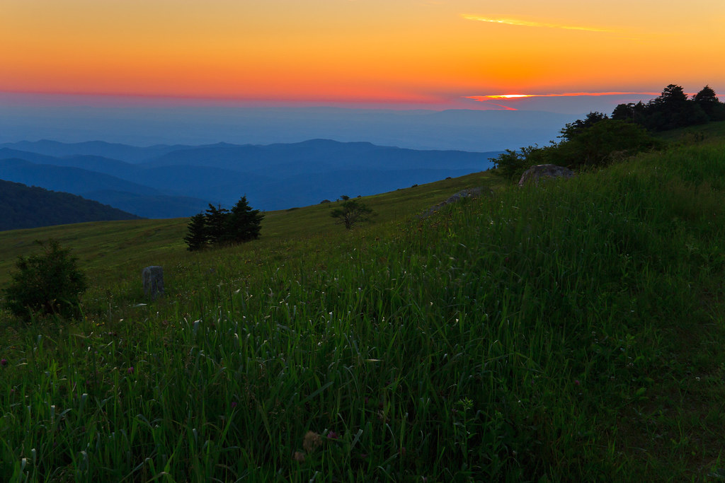
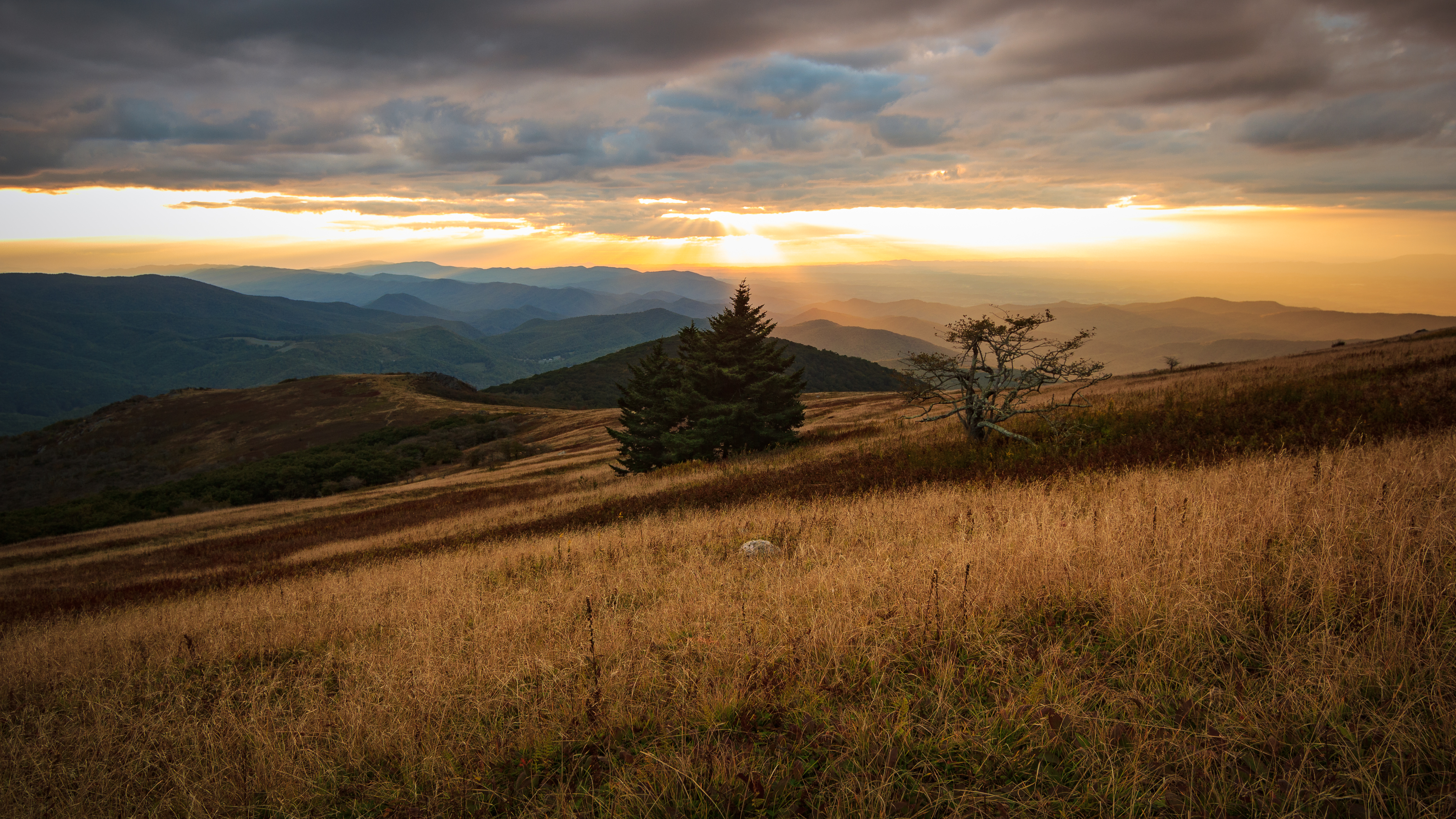
Wilburn Ridge Sunset

Wilburn Ridge Sunrise

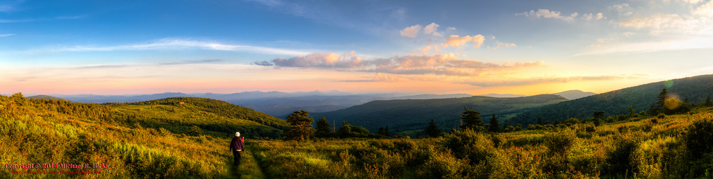
Wilburn Ridge Pano

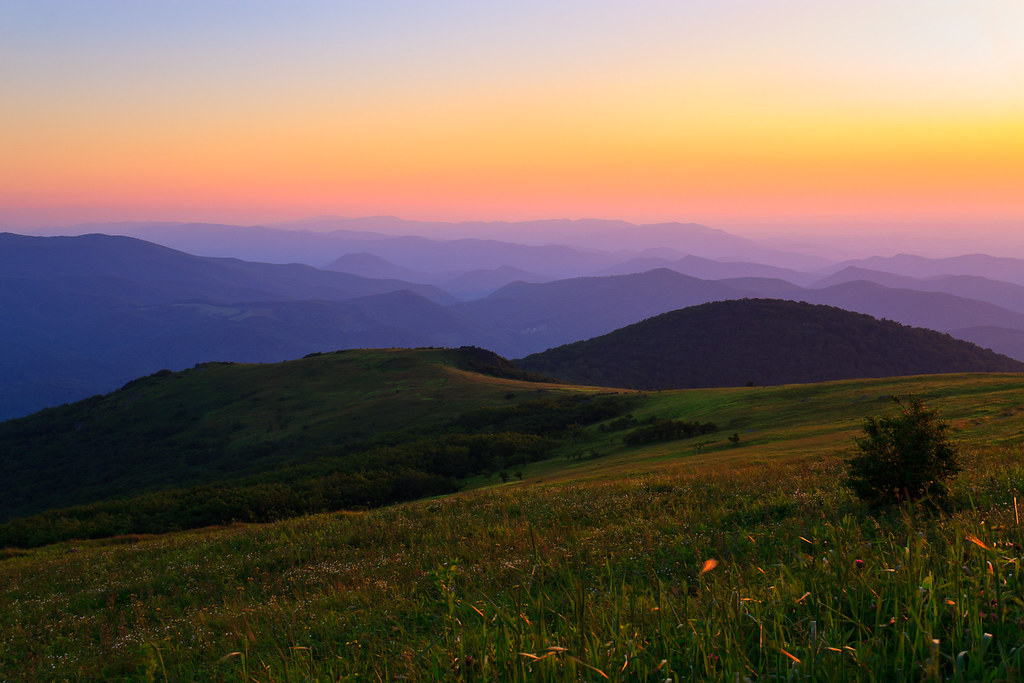
Grayson Highlands Sunset
Mt Rogers Backpack - On the AT - Golden Hour at Thomas Knob - July 5, 2014
Sunset on White Top
Sunset on White Top

Wilburn Ridge Sunset

Nuclear Blast

Sunset from Pine Mountain

grayson hiker sunset

Mt Rogers Sunset
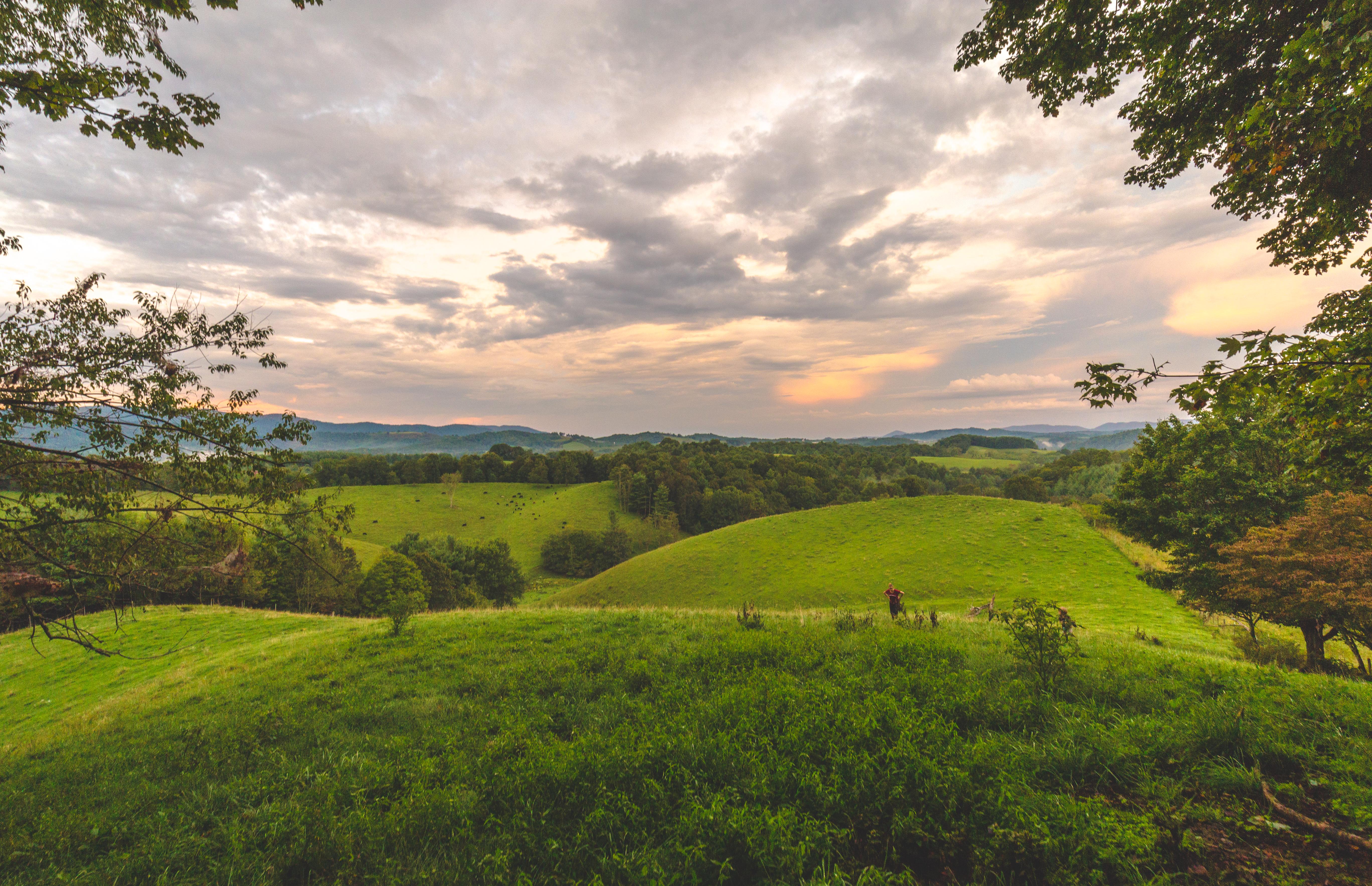
Virginia Hills Sunset

Fire in the Sky
Whitetop Sunset 2016

Whitetop Sunset 2016

Tough Times

Mountain pony

Lookg for food

Highland Pony

The end of the day

Wilburn Ridge Trail
Mount Rogers Sunrise 3

Mt Rogers Backpack - Sunrise on Thomas Knob - July 6, 2014

sunrise pony foal

Fabio and the sunrise

Wilburn Ridge

Harvest Moon

Mt Rogers Backpack Day 3 - Sunrise on Rhododendron Gap

Morning on Wilburn Ridge

Mount Rogers Summit through sunrise fog

Waiting for the Sun

Mount Rogers Sunrise 1

sunrise over Wilburn Ridge

Grayson Sunrise
Sunrise on Whitetop Mountain

Mount Rogers Sunrise 4

Sunbeam 2
Sunrise on Whitetop Mountain
Bear Run Rd, Lansing, NC アメリカ合衆国の地図
別の場所を検索
近所の場所
アメリカ合衆国 〒 ノース・カロライナ州 ヘルトン
NC-, Grassy Creek, NC アメリカ合衆国
NC-, Grassy Creek, NC アメリカ合衆国
アメリカ合衆国 ノース・カロライナ州 ヘルトン
Ray Davis Rd, Lansing, NC アメリカ合衆国
John Griffith Rd, Lansing, NC アメリカ合衆国ジョン・グリフィス・ロード
Walnut Creek Dr, Lansing, NC アメリカ合衆国
Silas Creek Rd, Lansing, NC アメリカ合衆国
NC-, Lansing, NC アメリカ合衆国
Claude Dickson Rd, Grassy Creek, NC アメリカ合衆国
Little Piney Rd, Lansing, NC アメリカ合衆国
Walking Stick Rd, Grassy Creek, NC アメリカ合衆国
アメリカ合衆国 〒 ノース・カロライナ州 パイニー・クリーク
NC-, Lansing, NC アメリカ合衆国
Low Notch Rd, Grassy Creek, NC アメリカ合衆国
John Halsey Rd, Grassy Creek, NC アメリカ合衆国
Woods on New River Rd, Lansing, NC アメリカ合衆国
Woods on New River Rd, Lansing, NC アメリカ合衆国
Sunset View Dr, Grassy Creek, NC アメリカ合衆国
Mouth of Silas Creek Rd, Lansing, NC アメリカ合衆国
最近の検索
- アメリカ合衆国 アラスカ州 レッド・ドッグ・マイン日の出日の入り時間
- Am bhf, Borken, ドイツアム・バーンホーフ日の出日の入り時間
- 4th St E, Sonoma, CA, USA日の出日の入り時間
- Oakland Ave, Williamsport, PA アメリカ合衆国日の出日の入り時間
- Via Roma, Pieranica CR, イタリアローマ通り日の出日の入り時間
- クロアチア 〒 ドゥブロブニク GradClock Tower of Dubrovnik日の出日の入り時間
- アルゼンチン チュブ州 トレリュー日の出日の入り時間
- Hartfords Bluff Cir, Mt Pleasant, SC アメリカ合衆国日の出日の入り時間
- 日本、熊本県熊本市北区日の出日の入り時間
- 中華人民共和国 福州市 平潭県 平潭島日の出日の入り時間