A Rabbit Island Rd, Wikwemikong, ON P0P 2J0 カナダ日の出日の入り時間
Location: カナダ > オンタリオ > マニトゥーリン地区 > カナダ 〒P0P オンタリオ ウィクウェミコン >
時間帯:
America/Toronto
現地時間:
2025-06-28 20:17:33
経度:
-81.7166158
緯度:
45.838828
今日の日の出時刻:
05:39:59 AM
今日の日の入時刻:
09:21:01 PM
今日の日長:
15h 41m 2s
明日の日の出時刻:
05:40:32 AM
明日の日の入時刻:
09:20:52 PM
明日の日長:
15h 40m 20s
すべて表示する
| 日付 | 日出 | 日没 | 日長 |
|---|---|---|---|
| 2025年01月01日 | 08:08:04 AM | 04:53:53 PM | 8h 45m 49s |
| 2025年01月02日 | 08:08:01 AM | 04:54:52 PM | 8h 46m 51s |
| 2025年01月03日 | 08:07:55 AM | 04:55:52 PM | 8h 47m 57s |
| 2025年01月04日 | 08:07:47 AM | 04:56:54 PM | 8h 49m 7s |
| 2025年01月05日 | 08:07:35 AM | 04:57:58 PM | 8h 50m 23s |
| 2025年01月06日 | 08:07:21 AM | 04:59:04 PM | 8h 51m 43s |
| 2025年01月07日 | 08:07:05 AM | 05:00:11 PM | 8h 53m 6s |
| 2025年01月08日 | 08:06:46 AM | 05:01:20 PM | 8h 54m 34s |
| 2025年01月09日 | 08:06:24 AM | 05:02:31 PM | 8h 56m 7s |
| 2025年01月10日 | 08:05:59 AM | 05:03:43 PM | 8h 57m 44s |
| 2025年01月11日 | 08:05:32 AM | 05:04:56 PM | 8h 59m 24s |
| 2025年01月12日 | 08:05:03 AM | 05:06:11 PM | 9h 1m 8s |
| 2025年01月13日 | 08:04:31 AM | 05:07:27 PM | 9h 2m 56s |
| 2025年01月14日 | 08:03:56 AM | 05:08:44 PM | 9h 4m 48s |
| 2025年01月15日 | 08:03:19 AM | 05:10:02 PM | 9h 6m 43s |
| 2025年01月16日 | 08:02:39 AM | 05:11:21 PM | 9h 8m 42s |
| 2025年01月17日 | 08:01:57 AM | 05:12:41 PM | 9h 10m 44s |
| 2025年01月18日 | 08:01:13 AM | 05:14:02 PM | 9h 12m 49s |
| 2025年01月19日 | 08:00:26 AM | 05:15:24 PM | 9h 14m 58s |
| 2025年01月20日 | 07:59:37 AM | 05:16:47 PM | 9h 17m 10s |
| 2025年01月21日 | 07:58:46 AM | 05:18:11 PM | 9h 19m 25s |
| 2025年01月22日 | 07:57:52 AM | 05:19:35 PM | 9h 21m 43s |
| 2025年01月23日 | 07:56:57 AM | 05:21:00 PM | 9h 24m 3s |
| 2025年01月24日 | 07:55:59 AM | 05:22:26 PM | 9h 26m 27s |
| 2025年01月25日 | 07:54:59 AM | 05:23:52 PM | 9h 28m 53s |
| 2025年01月26日 | 07:53:57 AM | 05:25:18 PM | 9h 31m 21s |
| 2025年01月27日 | 07:52:53 AM | 05:26:45 PM | 9h 33m 52s |
| 2025年01月28日 | 07:51:47 AM | 05:28:12 PM | 9h 36m 25s |
| 2025年01月29日 | 07:50:38 AM | 05:29:40 PM | 9h 39m 2s |
| 2025年01月30日 | 07:49:28 AM | 05:31:08 PM | 9h 41m 40s |
| 2025年01月31日 | 07:48:17 AM | 05:32:36 PM | 9h 44m 19s |
| 2025年02月01日 | 07:47:03 AM | 05:34:04 PM | 9h 47m 1s |
| 2025年02月02日 | 07:45:47 AM | 05:35:33 PM | 9h 49m 46s |
| 2025年02月03日 | 07:44:30 AM | 05:37:01 PM | 9h 52m 31s |
| 2025年02月04日 | 07:43:11 AM | 05:38:30 PM | 9h 55m 19s |
| 2025年02月05日 | 07:41:51 AM | 05:39:59 PM | 9h 58m 8s |
| 2025年02月06日 | 07:40:29 AM | 05:41:27 PM | 10h 0m 58s |
| 2025年02月07日 | 07:39:05 AM | 05:42:56 PM | 10h 3m 51s |
| 2025年02月08日 | 07:37:40 AM | 05:44:25 PM | 10h 6m 45s |
| 2025年02月09日 | 07:36:13 AM | 05:45:53 PM | 10h 9m 40s |
| 2025年02月10日 | 07:34:45 AM | 05:47:22 PM | 10h 12m 37s |
| 2025年02月11日 | 07:33:15 AM | 05:48:50 PM | 10h 15m 35s |
| 2025年02月12日 | 07:31:44 AM | 05:50:19 PM | 10h 18m 35s |
| 2025年02月13日 | 07:30:12 AM | 05:51:47 PM | 10h 21m 35s |
| 2025年02月14日 | 07:28:38 AM | 05:53:15 PM | 10h 24m 37s |
| 2025年02月15日 | 07:27:03 AM | 05:54:42 PM | 10h 27m 39s |
| 2025年02月16日 | 07:25:27 AM | 05:56:10 PM | 10h 30m 43s |
| 2025年02月17日 | 07:23:50 AM | 05:57:37 PM | 10h 33m 47s |
| 2025年02月18日 | 07:22:12 AM | 05:59:04 PM | 10h 36m 52s |
| 2025年02月19日 | 07:20:32 AM | 06:00:31 PM | 10h 39m 59s |
| 2025年02月20日 | 07:18:52 AM | 06:01:58 PM | 10h 43m 6s |
| 2025年02月21日 | 07:17:10 AM | 06:03:24 PM | 10h 46m 14s |
| 2025年02月22日 | 07:15:28 AM | 06:04:50 PM | 10h 49m 22s |
| 2025年02月23日 | 07:13:45 AM | 06:06:16 PM | 10h 52m 31s |
| 2025年02月24日 | 07:12:00 AM | 06:07:41 PM | 10h 55m 41s |
| 2025年02月25日 | 07:10:15 AM | 06:09:07 PM | 10h 58m 52s |
| 2025年02月26日 | 07:08:29 AM | 06:10:32 PM | 11h 2m 3s |
| 2025年02月27日 | 07:06:43 AM | 06:11:56 PM | 11h 5m 13s |
| 2025年02月28日 | 07:04:55 AM | 06:13:21 PM | 11h 8m 26s |
| 2025年03月01日 | 07:03:07 AM | 06:14:45 PM | 11h 11m 38s |
| 2025年03月02日 | 07:01:18 AM | 06:16:09 PM | 11h 14m 51s |
| 2025年03月03日 | 06:59:29 AM | 06:17:32 PM | 11h 18m 3s |
| 2025年03月04日 | 06:57:38 AM | 06:18:55 PM | 11h 21m 17s |
| 2025年03月05日 | 06:55:48 AM | 06:20:18 PM | 11h 24m 30s |
| 2025年03月06日 | 06:53:56 AM | 06:21:41 PM | 11h 27m 45s |
| 2025年03月07日 | 06:52:05 AM | 06:23:04 PM | 11h 30m 59s |
| 2025年03月08日 | 06:50:12 AM | 06:24:26 PM | 11h 34m 14s |
| 2025年03月09日 | 07:48:24 AM | 07:25:44 PM | 11h 37m 20s |
| 2025年03月10日 | 07:46:31 AM | 07:27:06 PM | 11h 40m 35s |
| 2025年03月11日 | 07:44:38 AM | 07:28:28 PM | 11h 43m 50s |
| 2025年03月12日 | 07:42:44 AM | 07:29:49 PM | 11h 47m 5s |
| 2025年03月13日 | 07:40:50 AM | 07:31:10 PM | 11h 50m 20s |
| 2025年03月14日 | 07:38:56 AM | 07:32:31 PM | 11h 53m 35s |
| 2025年03月15日 | 07:37:01 AM | 07:33:52 PM | 11h 56m 51s |
| 2025年03月16日 | 07:35:06 AM | 07:35:12 PM | 12h 0m 6s |
| 2025年03月17日 | 07:33:11 AM | 07:36:32 PM | 12h 3m 21s |
| 2025年03月18日 | 07:31:16 AM | 07:37:53 PM | 12h 6m 37s |
| 2025年03月19日 | 07:29:20 AM | 07:39:13 PM | 12h 9m 53s |
| 2025年03月20日 | 07:27:25 AM | 07:40:32 PM | 12h 13m 7s |
| 2025年03月21日 | 07:25:29 AM | 07:41:52 PM | 12h 16m 23s |
| 2025年03月22日 | 07:23:34 AM | 07:43:12 PM | 12h 19m 38s |
| 2025年03月23日 | 07:21:38 AM | 07:44:31 PM | 12h 22m 53s |
| 2025年03月24日 | 07:19:43 AM | 07:45:51 PM | 12h 26m 8s |
| 2025年03月25日 | 07:17:47 AM | 07:47:10 PM | 12h 29m 23s |
| 2025年03月26日 | 07:15:52 AM | 07:48:29 PM | 12h 32m 37s |
| 2025年03月27日 | 07:13:57 AM | 07:49:48 PM | 12h 35m 51s |
| 2025年03月28日 | 07:12:02 AM | 07:51:07 PM | 12h 39m 5s |
| 2025年03月29日 | 07:10:07 AM | 07:52:26 PM | 12h 42m 19s |
| 2025年03月30日 | 07:08:12 AM | 07:53:45 PM | 12h 45m 33s |
| 2025年03月31日 | 07:06:17 AM | 07:55:04 PM | 12h 48m 47s |
| 2025年04月01日 | 07:04:23 AM | 07:56:22 PM | 12h 51m 59s |
| 2025年04月02日 | 07:02:29 AM | 07:57:41 PM | 12h 55m 12s |
| 2025年04月03日 | 07:00:36 AM | 07:59:00 PM | 12h 58m 24s |
| 2025年04月04日 | 06:58:43 AM | 08:00:19 PM | 13h 1m 36s |
| 2025年04月05日 | 06:56:50 AM | 08:01:37 PM | 13h 4m 47s |
| 2025年04月06日 | 06:54:58 AM | 08:02:56 PM | 13h 7m 58s |
| 2025年04月07日 | 06:53:06 AM | 08:04:14 PM | 13h 11m 8s |
| 2025年04月08日 | 06:51:14 AM | 08:05:33 PM | 13h 14m 19s |
| 2025年04月09日 | 06:49:24 AM | 08:06:52 PM | 13h 17m 28s |
| 2025年04月10日 | 06:47:33 AM | 08:08:10 PM | 13h 20m 37s |
| 2025年04月11日 | 06:45:44 AM | 08:09:29 PM | 13h 23m 45s |
| 2025年04月12日 | 06:43:55 AM | 08:10:48 PM | 13h 26m 53s |
| 2025年04月13日 | 06:42:06 AM | 08:12:06 PM | 13h 30m 0s |
| 2025年04月14日 | 06:40:19 AM | 08:13:25 PM | 13h 33m 6s |
| 2025年04月15日 | 06:38:32 AM | 08:14:43 PM | 13h 36m 11s |
| 2025年04月16日 | 06:36:45 AM | 08:16:02 PM | 13h 39m 17s |
| 2025年04月17日 | 06:35:00 AM | 08:17:20 PM | 13h 42m 20s |
| 2025年04月18日 | 06:33:15 AM | 08:18:39 PM | 13h 45m 24s |
| 2025年04月19日 | 06:31:32 AM | 08:19:57 PM | 13h 48m 25s |
| 2025年04月20日 | 06:29:49 AM | 08:21:16 PM | 13h 51m 27s |
| 2025年04月21日 | 06:28:07 AM | 08:22:34 PM | 13h 54m 27s |
| 2025年04月22日 | 06:26:26 AM | 08:23:52 PM | 13h 57m 26s |
| 2025年04月23日 | 06:24:46 AM | 08:25:11 PM | 14h 0m 25s |
| 2025年04月24日 | 06:23:08 AM | 08:26:29 PM | 14h 3m 21s |
| 2025年04月25日 | 06:21:30 AM | 08:27:47 PM | 14h 6m 17s |
| 2025年04月26日 | 06:19:53 AM | 08:29:05 PM | 14h 9m 12s |
| 2025年04月27日 | 06:18:18 AM | 08:30:23 PM | 14h 12m 5s |
| 2025年04月28日 | 06:16:43 AM | 08:31:40 PM | 14h 14m 57s |
| 2025年04月29日 | 06:15:10 AM | 08:32:58 PM | 14h 17m 48s |
| 2025年04月30日 | 06:13:39 AM | 08:34:15 PM | 14h 20m 36s |
| 2025年05月01日 | 06:12:08 AM | 08:35:32 PM | 14h 23m 24s |
| 2025年05月02日 | 06:10:39 AM | 08:36:49 PM | 14h 26m 10s |
| 2025年05月03日 | 06:09:11 AM | 08:38:05 PM | 14h 28m 54s |
| 2025年05月04日 | 06:07:45 AM | 08:39:21 PM | 14h 31m 36s |
| 2025年05月05日 | 06:06:20 AM | 08:40:37 PM | 14h 34m 17s |
| 2025年05月06日 | 06:04:56 AM | 08:41:53 PM | 14h 36m 57s |
| 2025年05月07日 | 06:03:35 AM | 08:43:08 PM | 14h 39m 33s |
| 2025年05月08日 | 06:02:14 AM | 08:44:23 PM | 14h 42m 9s |
| 2025年05月09日 | 06:00:56 AM | 08:45:37 PM | 14h 44m 41s |
| 2025年05月10日 | 05:59:38 AM | 08:46:51 PM | 14h 47m 13s |
| 2025年05月11日 | 05:58:23 AM | 08:48:04 PM | 14h 49m 41s |
| 2025年05月12日 | 05:57:09 AM | 08:49:16 PM | 14h 52m 7s |
| 2025年05月13日 | 05:55:57 AM | 08:50:29 PM | 14h 54m 32s |
| 2025年05月14日 | 05:54:47 AM | 08:51:40 PM | 14h 56m 53s |
| 2025年05月15日 | 05:53:39 AM | 08:52:51 PM | 14h 59m 12s |
| 2025年05月16日 | 05:52:32 AM | 08:54:01 PM | 15h 1m 29s |
| 2025年05月17日 | 05:51:28 AM | 08:55:10 PM | 15h 3m 42s |
| 2025年05月18日 | 05:50:25 AM | 08:56:18 PM | 15h 5m 53s |
| 2025年05月19日 | 05:49:24 AM | 08:57:26 PM | 15h 8m 2s |
| 2025年05月20日 | 05:48:26 AM | 08:58:32 PM | 15h 10m 6s |
| 2025年05月21日 | 05:47:29 AM | 08:59:38 PM | 15h 12m 9s |
| 2025年05月22日 | 05:46:35 AM | 09:00:42 PM | 15h 14m 7s |
| 2025年05月23日 | 05:45:42 AM | 09:01:46 PM | 15h 16m 4s |
| 2025年05月24日 | 05:44:52 AM | 09:02:48 PM | 15h 17m 56s |
| 2025年05月25日 | 05:44:03 AM | 09:03:49 PM | 15h 19m 46s |
| 2025年05月26日 | 05:43:17 AM | 09:04:49 PM | 15h 21m 32s |
| 2025年05月27日 | 05:42:33 AM | 09:05:48 PM | 15h 23m 15s |
| 2025年05月28日 | 05:41:52 AM | 09:06:45 PM | 15h 24m 53s |
| 2025年05月29日 | 05:41:12 AM | 09:07:41 PM | 15h 26m 29s |
| 2025年05月30日 | 05:40:35 AM | 09:08:36 PM | 15h 28m 1s |
| 2025年05月31日 | 05:40:01 AM | 09:09:29 PM | 15h 29m 28s |
| 2025年06月01日 | 05:39:28 AM | 09:10:20 PM | 15h 30m 52s |
| 2025年06月02日 | 05:38:58 AM | 09:11:10 PM | 15h 32m 12s |
| 2025年06月03日 | 05:38:30 AM | 09:11:58 PM | 15h 33m 28s |
| 2025年06月04日 | 05:38:05 AM | 09:12:45 PM | 15h 34m 40s |
| 2025年06月05日 | 05:37:42 AM | 09:13:30 PM | 15h 35m 48s |
| 2025年06月06日 | 05:37:21 AM | 09:14:13 PM | 15h 36m 52s |
| 2025年06月07日 | 05:37:03 AM | 09:14:54 PM | 15h 37m 51s |
| 2025年06月08日 | 05:36:47 AM | 09:15:33 PM | 15h 38m 46s |
| 2025年06月09日 | 05:36:34 AM | 09:16:11 PM | 15h 39m 37s |
| 2025年06月10日 | 05:36:23 AM | 09:16:46 PM | 15h 40m 23s |
| 2025年06月11日 | 05:36:14 AM | 09:17:19 PM | 15h 41m 5s |
| 2025年06月12日 | 05:36:08 AM | 09:17:51 PM | 15h 41m 43s |
| 2025年06月13日 | 05:36:04 AM | 09:18:20 PM | 15h 42m 16s |
| 2025年06月14日 | 05:36:02 AM | 09:18:47 PM | 15h 42m 45s |
| 2025年06月15日 | 05:36:03 AM | 09:19:12 PM | 15h 43m 9s |
| 2025年06月16日 | 05:36:07 AM | 09:19:34 PM | 15h 43m 27s |
| 2025年06月17日 | 05:36:12 AM | 09:19:55 PM | 15h 43m 43s |
| 2025年06月18日 | 05:36:20 AM | 09:20:13 PM | 15h 43m 53s |
| 2025年06月19日 | 05:36:31 AM | 09:20:29 PM | 15h 43m 58s |
| 2025年06月20日 | 05:36:43 AM | 09:20:43 PM | 15h 44m 0s |
| 2025年06月21日 | 05:36:58 AM | 09:20:54 PM | 15h 43m 56s |
| 2025年06月22日 | 05:37:15 AM | 09:21:03 PM | 15h 43m 48s |
| 2025年06月23日 | 05:37:34 AM | 09:21:09 PM | 15h 43m 35s |
| 2025年06月24日 | 05:37:56 AM | 09:21:13 PM | 15h 43m 17s |
| 2025年06月25日 | 05:38:20 AM | 09:21:15 PM | 15h 42m 55s |
| 2025年06月26日 | 05:38:45 AM | 09:21:14 PM | 15h 42m 29s |
| 2025年06月27日 | 05:39:13 AM | 09:21:11 PM | 15h 41m 58s |
| 2025年06月28日 | 05:39:43 AM | 09:21:05 PM | 15h 41m 22s |
| 2025年06月29日 | 05:40:15 AM | 09:20:57 PM | 15h 40m 42s |
| 2025年06月30日 | 05:40:49 AM | 09:20:46 PM | 15h 39m 57s |
| 2025年07月01日 | 05:41:25 AM | 09:20:33 PM | 15h 39m 8s |
| 2025年07月02日 | 05:42:02 AM | 09:20:18 PM | 15h 38m 16s |
| 2025年07月03日 | 05:42:42 AM | 09:20:00 PM | 15h 37m 18s |
| 2025年07月04日 | 05:43:23 AM | 09:19:39 PM | 15h 36m 16s |
| 2025年07月05日 | 05:44:06 AM | 09:19:17 PM | 15h 35m 11s |
| 2025年07月06日 | 05:44:51 AM | 09:18:51 PM | 15h 34m 0s |
| 2025年07月07日 | 05:45:37 AM | 09:18:24 PM | 15h 32m 47s |
| 2025年07月08日 | 05:46:25 AM | 09:17:54 PM | 15h 31m 29s |
| 2025年07月09日 | 05:47:14 AM | 09:17:21 PM | 15h 30m 7s |
| 2025年07月10日 | 05:48:05 AM | 09:16:47 PM | 15h 28m 42s |
| 2025年07月11日 | 05:48:57 AM | 09:16:09 PM | 15h 27m 12s |
| 2025年07月12日 | 05:49:51 AM | 09:15:30 PM | 15h 25m 39s |
| 2025年07月13日 | 05:50:46 AM | 09:14:48 PM | 15h 24m 2s |
| 2025年07月14日 | 05:51:42 AM | 09:14:04 PM | 15h 22m 22s |
| 2025年07月15日 | 05:52:40 AM | 09:13:18 PM | 15h 20m 38s |
| 2025年07月16日 | 05:53:38 AM | 09:12:30 PM | 15h 18m 52s |
| 2025年07月17日 | 05:54:38 AM | 09:11:39 PM | 15h 17m 1s |
| 2025年07月18日 | 05:55:39 AM | 09:10:47 PM | 15h 15m 8s |
| 2025年07月19日 | 05:56:41 AM | 09:09:52 PM | 15h 13m 11s |
| 2025年07月20日 | 05:57:44 AM | 09:08:55 PM | 15h 11m 11s |
| 2025年07月21日 | 05:58:47 AM | 09:07:56 PM | 15h 9m 9s |
| 2025年07月22日 | 05:59:52 AM | 09:06:55 PM | 15h 7m 3s |
| 2025年07月23日 | 06:00:57 AM | 09:05:52 PM | 15h 4m 55s |
| 2025年07月24日 | 06:02:03 AM | 09:04:47 PM | 15h 2m 44s |
| 2025年07月25日 | 06:03:10 AM | 09:03:40 PM | 15h 0m 30s |
| 2025年07月26日 | 06:04:18 AM | 09:02:31 PM | 14h 58m 13s |
| 2025年07月27日 | 06:05:26 AM | 09:01:21 PM | 14h 55m 55s |
| 2025年07月28日 | 06:06:35 AM | 09:00:08 PM | 14h 53m 33s |
| 2025年07月29日 | 06:07:44 AM | 08:58:54 PM | 14h 51m 10s |
| 2025年07月30日 | 06:08:54 AM | 08:57:38 PM | 14h 48m 44s |
| 2025年07月31日 | 06:10:05 AM | 08:56:21 PM | 14h 46m 16s |
| 2025年08月01日 | 06:11:16 AM | 08:55:01 PM | 14h 43m 45s |
| 2025年08月02日 | 06:12:27 AM | 08:53:40 PM | 14h 41m 13s |
| 2025年08月03日 | 06:13:38 AM | 08:52:18 PM | 14h 38m 40s |
| 2025年08月04日 | 06:14:50 AM | 08:50:54 PM | 14h 36m 4s |
| 2025年08月05日 | 06:16:03 AM | 08:49:28 PM | 14h 33m 25s |
| 2025年08月06日 | 06:17:15 AM | 08:48:01 PM | 14h 30m 46s |
| 2025年08月07日 | 06:18:28 AM | 08:46:33 PM | 14h 28m 5s |
| 2025年08月08日 | 06:19:41 AM | 08:45:03 PM | 14h 25m 22s |
| 2025年08月09日 | 06:20:54 AM | 08:43:32 PM | 14h 22m 38s |
| 2025年08月10日 | 06:22:08 AM | 08:41:59 PM | 14h 19m 51s |
| 2025年08月11日 | 06:23:21 AM | 08:40:25 PM | 14h 17m 4s |
| 2025年08月12日 | 06:24:35 AM | 08:38:50 PM | 14h 14m 15s |
| 2025年08月13日 | 06:25:49 AM | 08:37:14 PM | 14h 11m 25s |
| 2025年08月14日 | 06:27:03 AM | 08:35:37 PM | 14h 8m 34s |
| 2025年08月15日 | 06:28:17 AM | 08:33:58 PM | 14h 5m 41s |
| 2025年08月16日 | 06:29:31 AM | 08:32:18 PM | 14h 2m 47s |
| 2025年08月17日 | 06:30:45 AM | 08:30:37 PM | 13h 59m 52s |
| 2025年08月18日 | 06:32:00 AM | 08:28:56 PM | 13h 56m 56s |
| 2025年08月19日 | 06:33:14 AM | 08:27:13 PM | 13h 53m 59s |
| 2025年08月20日 | 06:34:28 AM | 08:25:29 PM | 13h 51m 1s |
| 2025年08月21日 | 06:35:42 AM | 08:23:44 PM | 13h 48m 2s |
| 2025年08月22日 | 06:36:57 AM | 08:21:59 PM | 13h 45m 2s |
| 2025年08月23日 | 06:38:11 AM | 08:20:12 PM | 13h 42m 1s |
| 2025年08月24日 | 06:39:25 AM | 08:18:25 PM | 13h 39m 0s |
| 2025年08月25日 | 06:40:39 AM | 08:16:37 PM | 13h 35m 58s |
| 2025年08月26日 | 06:41:53 AM | 08:14:48 PM | 13h 32m 55s |
| 2025年08月27日 | 06:43:08 AM | 08:12:59 PM | 13h 29m 51s |
| 2025年08月28日 | 06:44:22 AM | 08:11:09 PM | 13h 26m 47s |
| 2025年08月29日 | 06:45:36 AM | 08:09:18 PM | 13h 23m 42s |
| 2025年08月30日 | 06:46:50 AM | 08:07:26 PM | 13h 20m 36s |
| 2025年08月31日 | 06:48:04 AM | 08:05:34 PM | 13h 17m 30s |
| 2025年09月01日 | 06:49:18 AM | 08:03:42 PM | 13h 14m 24s |
| 2025年09月02日 | 06:50:32 AM | 08:01:48 PM | 13h 11m 16s |
| 2025年09月03日 | 06:51:46 AM | 07:59:55 PM | 13h 8m 9s |
| 2025年09月04日 | 06:53:00 AM | 07:58:01 PM | 13h 5m 1s |
| 2025年09月05日 | 06:54:14 AM | 07:56:06 PM | 13h 1m 52s |
| 2025年09月06日 | 06:55:28 AM | 07:54:11 PM | 12h 58m 43s |
| 2025年09月07日 | 06:56:42 AM | 07:52:16 PM | 12h 55m 34s |
| 2025年09月08日 | 06:57:56 AM | 07:50:20 PM | 12h 52m 24s |
| 2025年09月09日 | 06:59:10 AM | 07:48:24 PM | 12h 49m 14s |
| 2025年09月10日 | 07:00:24 AM | 07:46:28 PM | 12h 46m 4s |
| 2025年09月11日 | 07:01:38 AM | 07:44:31 PM | 12h 42m 53s |
| 2025年09月12日 | 07:02:53 AM | 07:42:35 PM | 12h 39m 42s |
| 2025年09月13日 | 07:04:07 AM | 07:40:38 PM | 12h 36m 31s |
| 2025年09月14日 | 07:05:21 AM | 07:38:41 PM | 12h 33m 20s |
| 2025年09月15日 | 07:06:35 AM | 07:36:43 PM | 12h 30m 8s |
| 2025年09月16日 | 07:07:50 AM | 07:34:46 PM | 12h 26m 56s |
| 2025年09月17日 | 07:09:04 AM | 07:32:49 PM | 12h 23m 45s |
| 2025年09月18日 | 07:10:19 AM | 07:30:51 PM | 12h 20m 32s |
| 2025年09月19日 | 07:11:34 AM | 07:28:54 PM | 12h 17m 20s |
| 2025年09月20日 | 07:12:48 AM | 07:26:56 PM | 12h 14m 8s |
| 2025年09月21日 | 07:14:03 AM | 07:24:59 PM | 12h 10m 56s |
| 2025年09月22日 | 07:15:18 AM | 07:23:02 PM | 12h 7m 44s |
| 2025年09月23日 | 07:16:34 AM | 07:21:05 PM | 12h 4m 31s |
| 2025年09月24日 | 07:17:49 AM | 07:19:08 PM | 12h 1m 19s |
| 2025年09月25日 | 07:19:05 AM | 07:17:11 PM | 11h 58m 6s |
| 2025年09月26日 | 07:20:20 AM | 07:15:14 PM | 11h 54m 54s |
| 2025年09月27日 | 07:21:36 AM | 07:13:18 PM | 11h 51m 42s |
| 2025年09月28日 | 07:22:52 AM | 07:11:22 PM | 11h 48m 30s |
| 2025年09月29日 | 07:24:09 AM | 07:09:26 PM | 11h 45m 17s |
| 2025年09月30日 | 07:25:25 AM | 07:07:31 PM | 11h 42m 6s |
| 2025年10月01日 | 07:26:42 AM | 07:05:35 PM | 11h 38m 53s |
| 2025年10月02日 | 07:27:59 AM | 07:03:41 PM | 11h 35m 42s |
| 2025年10月03日 | 07:29:17 AM | 07:01:46 PM | 11h 32m 29s |
| 2025年10月04日 | 07:30:34 AM | 06:59:52 PM | 11h 29m 18s |
| 2025年10月05日 | 07:31:52 AM | 06:57:59 PM | 11h 26m 7s |
| 2025年10月06日 | 07:33:10 AM | 06:56:06 PM | 11h 22m 56s |
| 2025年10月07日 | 07:34:29 AM | 06:54:14 PM | 11h 19m 45s |
| 2025年10月08日 | 07:35:47 AM | 06:52:22 PM | 11h 16m 35s |
| 2025年10月09日 | 07:37:06 AM | 06:50:31 PM | 11h 13m 25s |
| 2025年10月10日 | 07:38:26 AM | 06:48:41 PM | 11h 10m 15s |
| 2025年10月11日 | 07:39:45 AM | 06:46:51 PM | 11h 7m 6s |
| 2025年10月12日 | 07:41:05 AM | 06:45:02 PM | 11h 3m 57s |
| 2025年10月13日 | 07:42:25 AM | 06:43:14 PM | 11h 0m 49s |
| 2025年10月14日 | 07:43:46 AM | 06:41:26 PM | 10h 57m 40s |
| 2025年10月15日 | 07:45:06 AM | 06:39:39 PM | 10h 54m 33s |
| 2025年10月16日 | 07:46:28 AM | 06:37:54 PM | 10h 51m 26s |
| 2025年10月17日 | 07:47:49 AM | 06:36:09 PM | 10h 48m 20s |
| 2025年10月18日 | 07:49:11 AM | 06:34:25 PM | 10h 45m 14s |
| 2025年10月19日 | 07:50:33 AM | 06:32:42 PM | 10h 42m 9s |
| 2025年10月20日 | 07:51:55 AM | 06:31:00 PM | 10h 39m 5s |
| 2025年10月21日 | 07:53:18 AM | 06:29:19 PM | 10h 36m 1s |
| 2025年10月22日 | 07:54:40 AM | 06:27:39 PM | 10h 32m 59s |
| 2025年10月23日 | 07:56:04 AM | 06:26:00 PM | 10h 29m 56s |
| 2025年10月24日 | 07:57:27 AM | 06:24:23 PM | 10h 26m 56s |
| 2025年10月25日 | 07:58:51 AM | 06:22:46 PM | 10h 23m 55s |
| 2025年10月26日 | 08:00:14 AM | 06:21:11 PM | 10h 20m 57s |
| 2025年10月27日 | 08:01:38 AM | 06:19:37 PM | 10h 17m 59s |
| 2025年10月28日 | 08:03:03 AM | 06:18:05 PM | 10h 15m 2s |
| 2025年10月29日 | 08:04:27 AM | 06:16:34 PM | 10h 12m 7s |
| 2025年10月30日 | 08:05:52 AM | 06:15:04 PM | 10h 9m 12s |
| 2025年10月31日 | 08:07:17 AM | 06:13:36 PM | 10h 6m 19s |
| 2025年11月01日 | 08:08:41 AM | 06:12:09 PM | 10h 3m 28s |
| 2025年11月02日 | 07:10:10 AM | 05:10:40 PM | 10h 0m 30s |
| 2025年11月03日 | 07:11:35 AM | 05:09:16 PM | 9h 57m 41s |
| 2025年11月04日 | 07:13:00 AM | 05:07:54 PM | 9h 54m 54s |
| 2025年11月05日 | 07:14:25 AM | 05:06:34 PM | 9h 52m 9s |
| 2025年11月06日 | 07:15:50 AM | 05:05:15 PM | 9h 49m 25s |
| 2025年11月07日 | 07:17:15 AM | 05:03:58 PM | 9h 46m 43s |
| 2025年11月08日 | 07:18:40 AM | 05:02:43 PM | 9h 44m 3s |
| 2025年11月09日 | 07:20:05 AM | 05:01:30 PM | 9h 41m 25s |
| 2025年11月10日 | 07:21:30 AM | 05:00:18 PM | 9h 38m 48s |
| 2025年11月11日 | 07:22:54 AM | 04:59:09 PM | 9h 36m 15s |
| 2025年11月12日 | 07:24:18 AM | 04:58:01 PM | 9h 33m 43s |
| 2025年11月13日 | 07:25:42 AM | 04:56:55 PM | 9h 31m 13s |
| 2025年11月14日 | 07:27:05 AM | 04:55:52 PM | 9h 28m 47s |
| 2025年11月15日 | 07:28:29 AM | 04:54:50 PM | 9h 26m 21s |
| 2025年11月16日 | 07:29:51 AM | 04:53:51 PM | 9h 24m 0s |
| 2025年11月17日 | 07:31:13 AM | 04:52:54 PM | 9h 21m 41s |
| 2025年11月18日 | 07:32:35 AM | 04:51:59 PM | 9h 19m 24s |
| 2025年11月19日 | 07:33:56 AM | 04:51:06 PM | 9h 17m 10s |
| 2025年11月20日 | 07:35:16 AM | 04:50:15 PM | 9h 14m 59s |
| 2025年11月21日 | 07:36:36 AM | 04:49:27 PM | 9h 12m 51s |
| 2025年11月22日 | 07:37:55 AM | 04:48:41 PM | 9h 10m 46s |
| 2025年11月23日 | 07:39:13 AM | 04:47:58 PM | 9h 8m 45s |
| 2025年11月24日 | 07:40:30 AM | 04:47:17 PM | 9h 6m 47s |
| 2025年11月25日 | 07:41:46 AM | 04:46:38 PM | 9h 4m 52s |
| 2025年11月26日 | 07:43:01 AM | 04:46:02 PM | 9h 3m 1s |
| 2025年11月27日 | 07:44:15 AM | 04:45:29 PM | 9h 1m 14s |
| 2025年11月28日 | 07:45:28 AM | 04:44:58 PM | 8h 59m 30s |
| 2025年11月29日 | 07:46:39 AM | 04:44:29 PM | 8h 57m 50s |
| 2025年11月30日 | 07:47:50 AM | 04:44:04 PM | 8h 56m 14s |
| 2025年12月01日 | 07:48:59 AM | 04:43:41 PM | 8h 54m 42s |
| 2025年12月02日 | 07:50:06 AM | 04:43:20 PM | 8h 53m 14s |
| 2025年12月03日 | 07:51:12 AM | 04:43:02 PM | 8h 51m 50s |
| 2025年12月04日 | 07:52:17 AM | 04:42:47 PM | 8h 50m 30s |
| 2025年12月05日 | 07:53:20 AM | 04:42:35 PM | 8h 49m 15s |
| 2025年12月06日 | 07:54:21 AM | 04:42:25 PM | 8h 48m 4s |
| 2025年12月07日 | 07:55:20 AM | 04:42:18 PM | 8h 46m 58s |
| 2025年12月08日 | 07:56:18 AM | 04:42:14 PM | 8h 45m 56s |
| 2025年12月09日 | 07:57:14 AM | 04:42:12 PM | 8h 44m 58s |
| 2025年12月10日 | 07:58:08 AM | 04:42:13 PM | 8h 44m 5s |
| 2025年12月11日 | 07:58:59 AM | 04:42:17 PM | 8h 43m 18s |
| 2025年12月12日 | 07:59:49 AM | 04:42:24 PM | 8h 42m 35s |
| 2025年12月13日 | 08:00:37 AM | 04:42:33 PM | 8h 41m 56s |
| 2025年12月14日 | 08:01:22 AM | 04:42:46 PM | 8h 41m 24s |
| 2025年12月15日 | 08:02:06 AM | 04:43:00 PM | 8h 40m 54s |
| 2025年12月16日 | 08:02:47 AM | 04:43:18 PM | 8h 40m 31s |
| 2025年12月17日 | 08:03:25 AM | 04:43:38 PM | 8h 40m 13s |
| 2025年12月18日 | 08:04:02 AM | 04:44:01 PM | 8h 39m 59s |
| 2025年12月19日 | 08:04:36 AM | 04:44:26 PM | 8h 39m 50s |
| 2025年12月20日 | 08:05:07 AM | 04:44:55 PM | 8h 39m 48s |
| 2025年12月21日 | 08:05:36 AM | 04:45:25 PM | 8h 39m 49s |
| 2025年12月22日 | 08:06:03 AM | 04:45:58 PM | 8h 39m 55s |
| 2025年12月23日 | 08:06:27 AM | 04:46:34 PM | 8h 40m 7s |
| 2025年12月24日 | 08:06:48 AM | 04:47:12 PM | 8h 40m 24s |
| 2025年12月25日 | 08:07:07 AM | 04:47:53 PM | 8h 40m 46s |
| 2025年12月26日 | 08:07:23 AM | 04:48:35 PM | 8h 41m 12s |
| 2025年12月27日 | 08:07:37 AM | 04:49:21 PM | 8h 41m 44s |
| 2025年12月28日 | 08:07:48 AM | 04:50:08 PM | 8h 42m 20s |
| 2025年12月29日 | 08:07:56 AM | 04:50:58 PM | 8h 43m 2s |
| 2025年12月30日 | 08:08:01 AM | 04:51:50 PM | 8h 43m 49s |
| 2025年12月31日 | 08:08:04 AM | 04:52:43 PM | 8h 44m 39s |
写真

2010-05-25

Bemamikawe Memorial Trail

2010-05-24
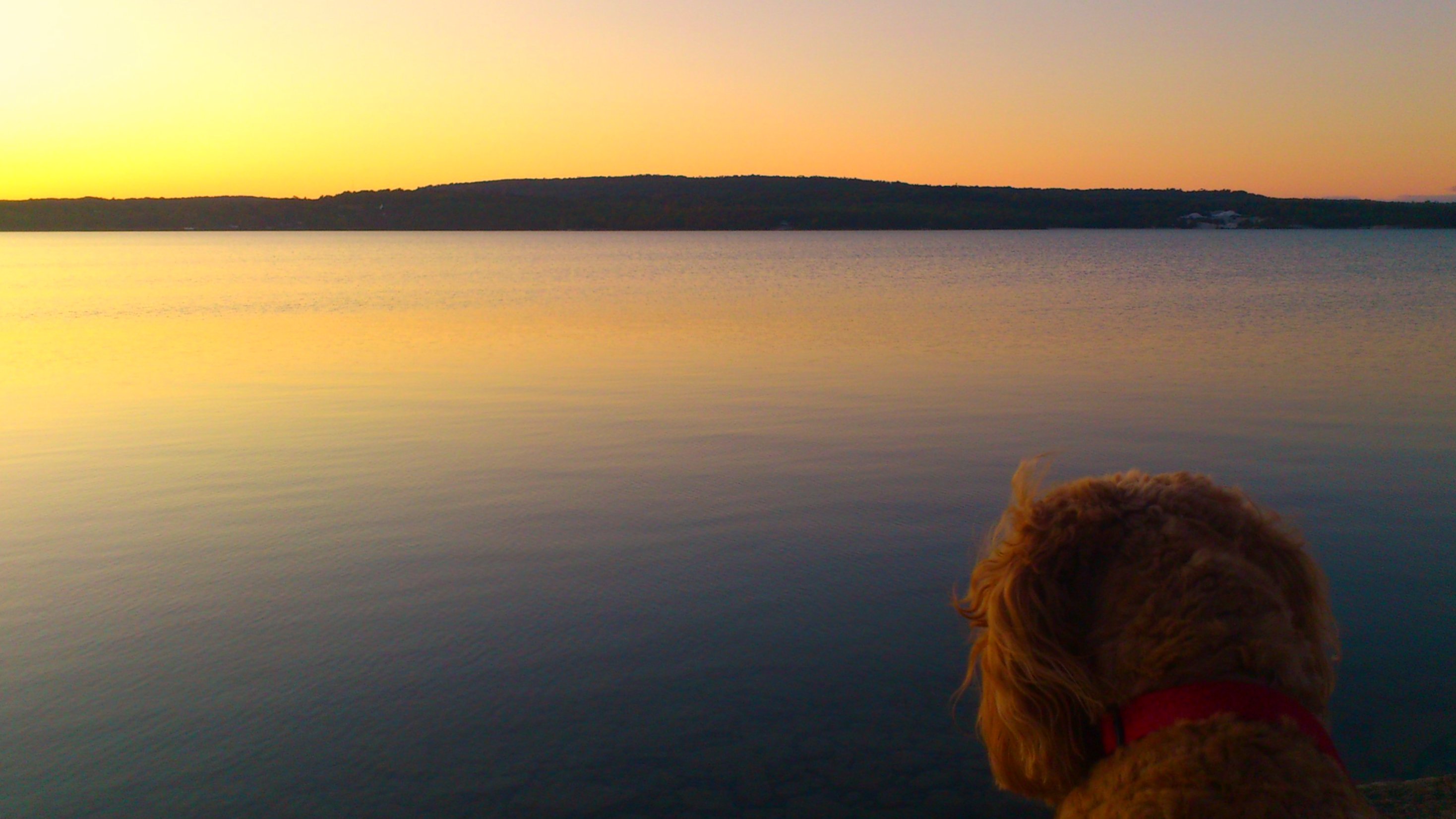
Jack wonders where the sun went
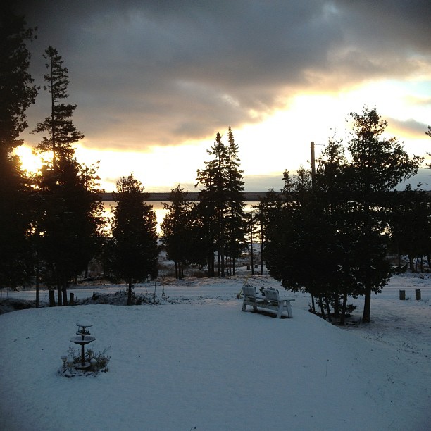
November 26, 2012
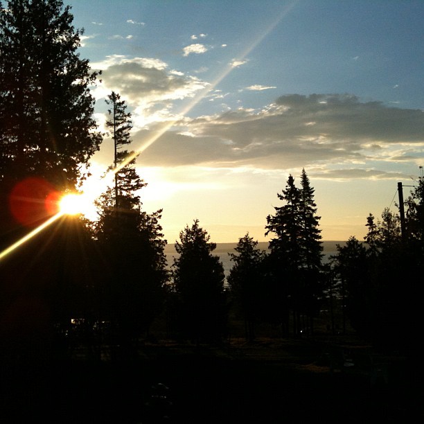
November 11, 2012
Sunrise through the trees.
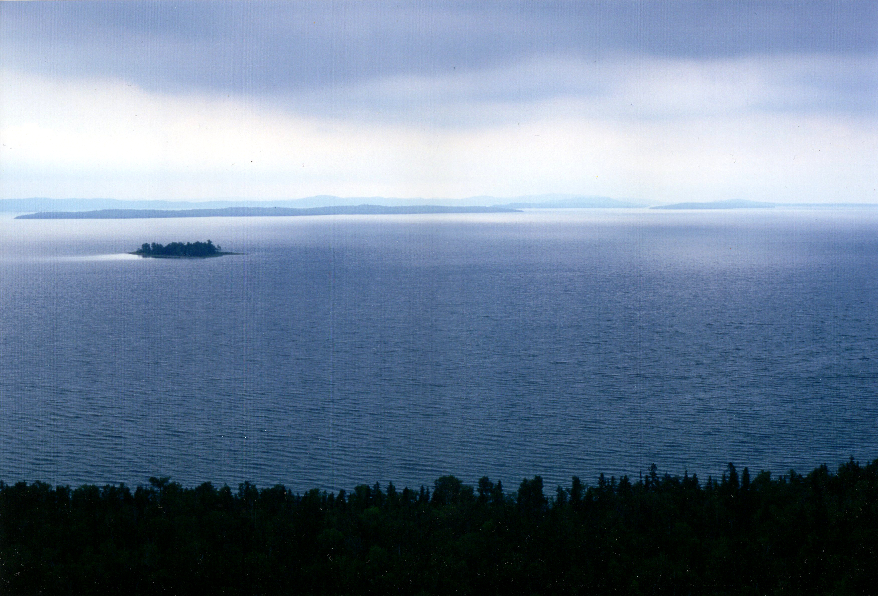
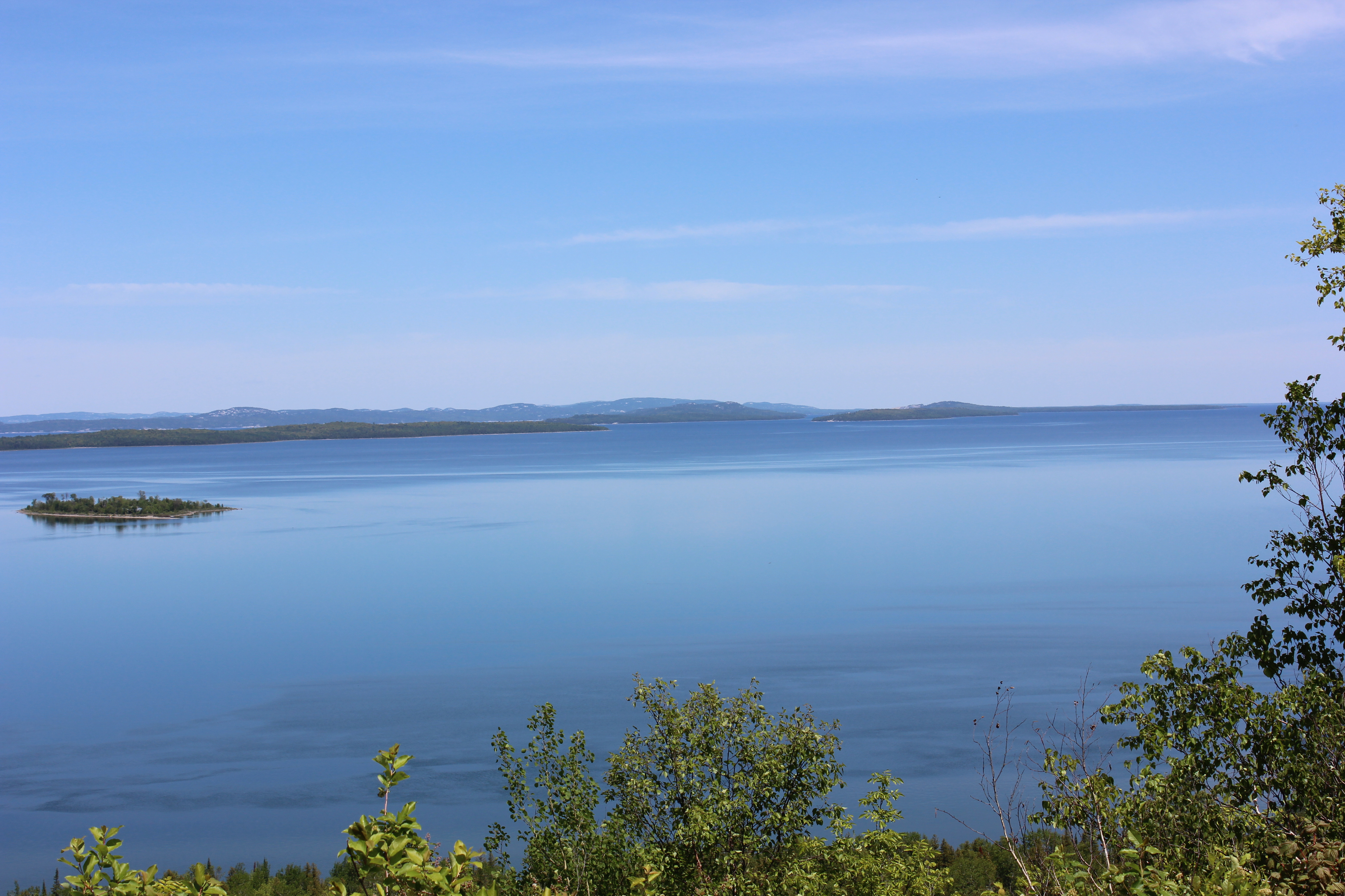
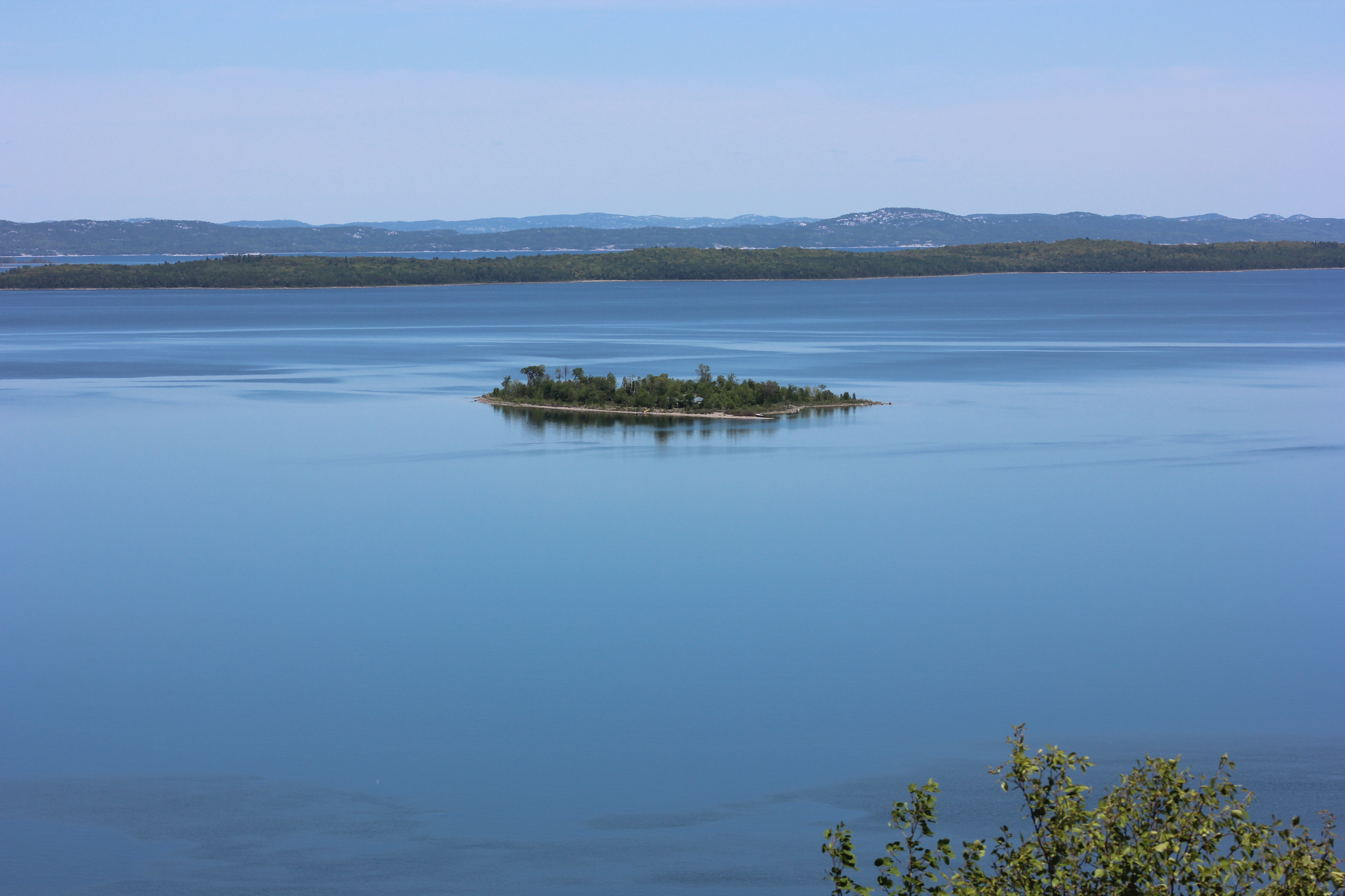
Manitoulin Island
View from Ten-mile Point, Manitoulin Island
View from Ten-mile Point, Manitoulin Island
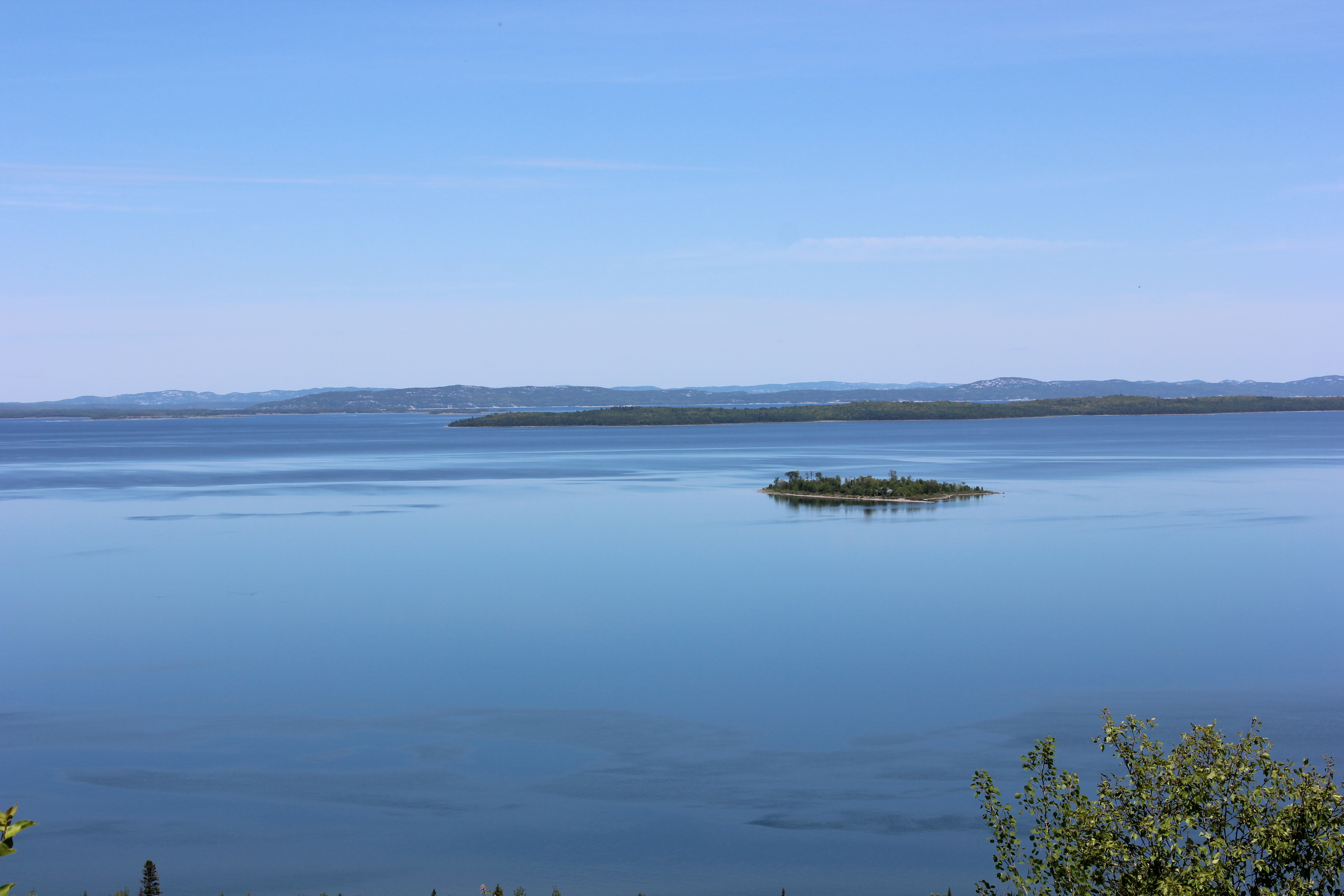
View from Ten-mile Point, Manitoulin Island
A Rabbit Island Rd, Wikwemikong, ON P0P 2J0 カナダの地図
別の場所を検索
近所の場所
Rabbit Island Rd, Wikwemikong, ON P0P 2J0 カナダ
カナダ 〒P0P オンタリオ ウィクウェミコン
Beach Rd, Wikwemikong, ON P0P 2J0 カナダBebamikawe Memorial Trail Head
カナダ オンタリオ ノースイースタン・マニトゥーラン・アンド・ザ・アイランズ
Cardwell St, Manitowaning, ON P0P 1N0 カナダ
カナダ 〒P0P オンタリオ マニトウォニング
カナダ オンタリオ ジェームス湾
カナダ オンタリオ アッシジナック
18 ON-6, Northeastern Manitoulin and the Islands, ON P0P カナダ
New England Rd, Manitowaning, ON P0P 1N0 カナダ
カナダ 〒P0P 1K0 オンタリオ リトル・カレント
Morphets Side Rd, Little Current, ON P0P 1K0 カナダMorphets Side Road
Bidwell Rd, Manitowaning, ON P0P 1N0 カナダ
Oakcliff Dr N, Mindemoya, ON P0P 1S0 カナダ
2nd Concession Rd, Gore Bay, ON P0P 1H0 カナダ
Lakeshore Rd, Wikwemikong, ON P0P 2J0 カナダ
カナダ 〒P0P オンタリオ テカマー
ON-, Little Current, ON P0P 1K0 カナダ
カナダ オンタリオ マニトゥーリン地区
カナダ オンタリオ テカマー
最近の検索
- アメリカ合衆国 アラスカ州 レッド・ドッグ・マイン日の出日の入り時間
- Am bhf, Borken, ドイツアム・バーンホーフ日の出日の入り時間
- 4th St E, Sonoma, CA, USA日の出日の入り時間
- Oakland Ave, Williamsport, PA アメリカ合衆国日の出日の入り時間
- Via Roma, Pieranica CR, イタリアローマ通り日の出日の入り時間
- クロアチア 〒 ドゥブロブニク GradClock Tower of Dubrovnik日の出日の入り時間
- アルゼンチン チュブ州 トレリュー日の出日の入り時間
- Hartfords Bluff Cir, Mt Pleasant, SC アメリカ合衆国日の出日の入り時間
- 日本、熊本県熊本市北区日の出日の入り時間
- 中華人民共和国 福州市 平潭県 平潭島日の出日の入り時間