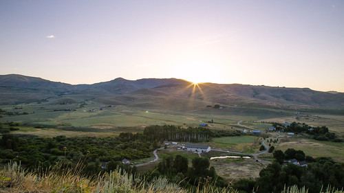
Sunrise Sunset Times of Homestead Road, Homestead Rd, Idaho, USA
Location: United States > Idaho > Camas County > Fairfield >
Timezone:
America/Boise
Current Time:
2025-06-14 12:06:41
Longitude:
-114.8765915
Latitude:
43.4174125
Sunrise Today:
05:58:10 AM
Sunset Today:
09:22:11 PM
Daylength Today:
15h 24m 1s
Sunrise Tomorrow:
05:58:14 AM
Sunset Tomorrow:
09:22:34 PM
Daylength Tomorrow:
15h 24m 20s
Year Show All Dates
| Date | Sunrise | Sunset | Daylength |
|---|---|---|---|
| 01/01/2025 | 08:12:10 AM | 05:15:14 PM | 9h 3m 4s |
| 01/02/2025 | 08:12:09 AM | 05:16:10 PM | 9h 4m 1s |
| 01/03/2025 | 08:12:06 AM | 05:17:07 PM | 9h 5m 1s |
| 01/04/2025 | 08:12:01 AM | 05:18:06 PM | 9h 6m 5s |
| 01/05/2025 | 08:11:53 AM | 05:19:07 PM | 9h 7m 14s |
| 01/06/2025 | 08:11:42 AM | 05:20:09 PM | 9h 8m 27s |
| 01/07/2025 | 08:11:29 AM | 05:21:13 PM | 9h 9m 44s |
| 01/08/2025 | 08:11:14 AM | 05:22:18 PM | 9h 11m 4s |
| 01/09/2025 | 08:10:56 AM | 05:23:24 PM | 9h 12m 28s |
| 01/10/2025 | 08:10:35 AM | 05:24:32 PM | 9h 13m 57s |
| 01/11/2025 | 08:10:13 AM | 05:25:41 PM | 9h 15m 28s |
| 01/12/2025 | 08:09:47 AM | 05:26:51 PM | 9h 17m 4s |
| 01/13/2025 | 08:09:20 AM | 05:28:02 PM | 9h 18m 42s |
| 01/14/2025 | 08:08:50 AM | 05:29:14 PM | 9h 20m 24s |
| 01/15/2025 | 08:08:18 AM | 05:30:27 PM | 9h 22m 9s |
| 01/16/2025 | 08:07:43 AM | 05:31:40 PM | 9h 23m 57s |
| 01/17/2025 | 08:07:07 AM | 05:32:55 PM | 9h 25m 48s |
| 01/18/2025 | 08:06:28 AM | 05:34:11 PM | 9h 27m 43s |
| 01/19/2025 | 08:05:47 AM | 05:35:27 PM | 9h 29m 40s |
| 01/20/2025 | 08:05:03 AM | 05:36:44 PM | 9h 31m 41s |
| 01/21/2025 | 08:04:18 AM | 05:38:01 PM | 9h 33m 43s |
| 01/22/2025 | 08:03:30 AM | 05:39:20 PM | 9h 35m 50s |
| 01/23/2025 | 08:02:40 AM | 05:40:38 PM | 9h 37m 58s |
| 01/24/2025 | 08:01:49 AM | 05:41:57 PM | 9h 40m 8s |
| 01/25/2025 | 08:00:55 AM | 05:43:17 PM | 9h 42m 22s |
| 01/26/2025 | 07:59:59 AM | 05:44:37 PM | 9h 44m 38s |
| 01/27/2025 | 07:59:01 AM | 05:45:57 PM | 9h 46m 56s |
| 01/28/2025 | 07:58:02 AM | 05:47:17 PM | 9h 49m 15s |
| 01/29/2025 | 07:57:00 AM | 05:48:38 PM | 9h 51m 38s |
| 01/30/2025 | 07:55:57 AM | 05:49:59 PM | 9h 54m 2s |
| 01/31/2025 | 07:54:52 AM | 05:51:20 PM | 9h 56m 28s |
| 02/01/2025 | 07:53:45 AM | 05:52:41 PM | 9h 58m 56s |
| 02/02/2025 | 07:52:36 AM | 05:54:03 PM | 10h 1m 27s |
| 02/03/2025 | 07:51:26 AM | 05:55:24 PM | 10h 3m 58s |
| 02/04/2025 | 07:50:14 AM | 05:56:45 PM | 10h 6m 31s |
| 02/05/2025 | 07:49:01 AM | 05:58:07 PM | 10h 9m 6s |
| 02/06/2025 | 07:47:46 AM | 05:59:28 PM | 10h 11m 42s |
| 02/07/2025 | 07:46:29 AM | 06:00:49 PM | 10h 14m 20s |
| 02/08/2025 | 07:45:11 AM | 06:02:11 PM | 10h 17m 0s |
| 02/09/2025 | 07:43:52 AM | 06:03:32 PM | 10h 19m 40s |
| 02/10/2025 | 07:42:31 AM | 06:04:52 PM | 10h 22m 21s |
| 02/11/2025 | 07:41:08 AM | 06:06:13 PM | 10h 25m 5s |
| 02/12/2025 | 07:39:45 AM | 06:07:34 PM | 10h 27m 49s |
| 02/13/2025 | 07:38:20 AM | 06:08:54 PM | 10h 30m 34s |
| 02/14/2025 | 07:36:54 AM | 06:10:14 PM | 10h 33m 20s |
| 02/15/2025 | 07:35:27 AM | 06:11:34 PM | 10h 36m 7s |
| 02/16/2025 | 07:33:58 AM | 06:12:54 PM | 10h 38m 56s |
| 02/17/2025 | 07:32:28 AM | 06:14:14 PM | 10h 41m 46s |
| 02/18/2025 | 07:30:58 AM | 06:15:33 PM | 10h 44m 35s |
| 02/19/2025 | 07:29:26 AM | 06:16:52 PM | 10h 47m 26s |
| 02/20/2025 | 07:27:53 AM | 06:18:11 PM | 10h 50m 18s |
| 02/21/2025 | 07:26:19 AM | 06:19:29 PM | 10h 53m 10s |
| 02/22/2025 | 07:24:45 AM | 06:20:47 PM | 10h 56m 2s |
| 02/23/2025 | 07:23:09 AM | 06:22:05 PM | 10h 58m 56s |
| 02/24/2025 | 07:21:32 AM | 06:23:23 PM | 11h 1m 51s |
| 02/25/2025 | 07:19:55 AM | 06:24:40 PM | 11h 4m 45s |
| 02/26/2025 | 07:18:17 AM | 06:25:57 PM | 11h 7m 40s |
| 02/27/2025 | 07:16:38 AM | 06:27:14 PM | 11h 10m 36s |
| 02/28/2025 | 07:14:58 AM | 06:28:30 PM | 11h 13m 32s |
| 03/01/2025 | 07:13:18 AM | 06:29:46 PM | 11h 16m 28s |
| 03/02/2025 | 07:11:37 AM | 06:31:02 PM | 11h 19m 25s |
| 03/03/2025 | 07:09:55 AM | 06:32:18 PM | 11h 22m 23s |
| 03/04/2025 | 07:08:13 AM | 06:33:33 PM | 11h 25m 20s |
| 03/05/2025 | 07:06:30 AM | 06:34:48 PM | 11h 28m 18s |
| 03/06/2025 | 07:04:46 AM | 06:36:03 PM | 11h 31m 17s |
| 03/07/2025 | 07:03:02 AM | 06:37:18 PM | 11h 34m 16s |
| 03/08/2025 | 07:01:18 AM | 06:38:32 PM | 11h 37m 14s |
| 03/09/2025 | 07:59:37 AM | 07:39:43 PM | 11h 40m 6s |
| 03/10/2025 | 07:57:52 AM | 07:40:57 PM | 11h 43m 5s |
| 03/11/2025 | 07:56:07 AM | 07:42:10 PM | 11h 46m 3s |
| 03/12/2025 | 07:54:21 AM | 07:43:23 PM | 11h 49m 2s |
| 03/13/2025 | 07:52:34 AM | 07:44:37 PM | 11h 52m 3s |
| 03/14/2025 | 07:50:48 AM | 07:45:49 PM | 11h 55m 1s |
| 03/15/2025 | 07:49:01 AM | 07:47:02 PM | 11h 58m 1s |
| 03/16/2025 | 07:47:14 AM | 07:48:15 PM | 12h 1m 1s |
| 03/17/2025 | 07:45:27 AM | 07:49:27 PM | 12h 4m 0s |
| 03/18/2025 | 07:43:40 AM | 07:50:39 PM | 12h 6m 59s |
| 03/19/2025 | 07:41:52 AM | 07:51:51 PM | 12h 9m 59s |
| 03/20/2025 | 07:40:05 AM | 07:53:03 PM | 12h 12m 58s |
| 03/21/2025 | 07:38:17 AM | 07:54:15 PM | 12h 15m 58s |
| 03/22/2025 | 07:36:29 AM | 07:55:27 PM | 12h 18m 58s |
| 03/23/2025 | 07:34:42 AM | 07:56:38 PM | 12h 21m 56s |
| 03/24/2025 | 07:32:54 AM | 07:57:50 PM | 12h 24m 56s |
| 03/25/2025 | 07:31:07 AM | 07:59:01 PM | 12h 27m 54s |
| 03/26/2025 | 07:29:19 AM | 08:00:12 PM | 12h 30m 53s |
| 03/27/2025 | 07:27:32 AM | 08:01:23 PM | 12h 33m 51s |
| 03/28/2025 | 07:25:45 AM | 08:02:34 PM | 12h 36m 49s |
| 03/29/2025 | 07:23:58 AM | 08:03:45 PM | 12h 39m 47s |
| 03/30/2025 | 07:22:11 AM | 08:04:56 PM | 12h 42m 45s |
| 03/31/2025 | 07:20:24 AM | 08:06:07 PM | 12h 45m 43s |
| 04/01/2025 | 07:18:38 AM | 08:07:18 PM | 12h 48m 40s |
| 04/02/2025 | 07:16:52 AM | 08:08:29 PM | 12h 51m 37s |
| 04/03/2025 | 07:15:07 AM | 08:09:40 PM | 12h 54m 33s |
| 04/04/2025 | 07:13:21 AM | 08:10:51 PM | 12h 57m 30s |
| 04/05/2025 | 07:11:37 AM | 08:12:01 PM | 13h 0m 24s |
| 04/06/2025 | 07:09:52 AM | 08:13:12 PM | 13h 3m 20s |
| 04/07/2025 | 07:08:08 AM | 08:14:23 PM | 13h 6m 15s |
| 04/08/2025 | 07:06:25 AM | 08:15:34 PM | 13h 9m 9s |
| 04/09/2025 | 07:04:42 AM | 08:16:45 PM | 13h 12m 3s |
| 04/10/2025 | 07:03:00 AM | 08:17:55 PM | 13h 14m 55s |
| 04/11/2025 | 07:01:18 AM | 08:19:06 PM | 13h 17m 48s |
| 04/12/2025 | 06:59:37 AM | 08:20:17 PM | 13h 20m 40s |
| 04/13/2025 | 06:57:56 AM | 08:21:28 PM | 13h 23m 32s |
| 04/14/2025 | 06:56:17 AM | 08:22:38 PM | 13h 26m 21s |
| 04/15/2025 | 06:54:38 AM | 08:23:49 PM | 13h 29m 11s |
| 04/16/2025 | 06:52:59 AM | 08:25:00 PM | 13h 32m 1s |
| 04/17/2025 | 06:51:22 AM | 08:26:11 PM | 13h 34m 49s |
| 04/18/2025 | 06:49:45 AM | 08:27:22 PM | 13h 37m 37s |
| 04/19/2025 | 06:48:09 AM | 08:28:32 PM | 13h 40m 23s |
| 04/20/2025 | 06:46:34 AM | 08:29:43 PM | 13h 43m 9s |
| 04/21/2025 | 06:45:00 AM | 08:30:54 PM | 13h 45m 54s |
| 04/22/2025 | 06:43:27 AM | 08:32:04 PM | 13h 48m 37s |
| 04/23/2025 | 06:41:55 AM | 08:33:15 PM | 13h 51m 20s |
| 04/24/2025 | 06:40:24 AM | 08:34:26 PM | 13h 54m 2s |
| 04/25/2025 | 06:38:54 AM | 08:35:36 PM | 13h 56m 42s |
| 04/26/2025 | 06:37:25 AM | 08:36:46 PM | 13h 59m 21s |
| 04/27/2025 | 06:35:58 AM | 08:37:57 PM | 14h 1m 59s |
| 04/28/2025 | 06:34:31 AM | 08:39:07 PM | 14h 4m 36s |
| 04/29/2025 | 06:33:06 AM | 08:40:17 PM | 14h 7m 11s |
| 04/30/2025 | 06:31:41 AM | 08:41:26 PM | 14h 9m 45s |
| 05/01/2025 | 06:30:19 AM | 08:42:36 PM | 14h 12m 17s |
| 05/02/2025 | 06:28:57 AM | 08:43:46 PM | 14h 14m 49s |
| 05/03/2025 | 06:27:37 AM | 08:44:55 PM | 14h 17m 18s |
| 05/04/2025 | 06:26:18 AM | 08:46:04 PM | 14h 19m 46s |
| 05/05/2025 | 06:25:00 AM | 08:47:12 PM | 14h 22m 12s |
| 05/06/2025 | 06:23:44 AM | 08:48:21 PM | 14h 24m 37s |
| 05/07/2025 | 06:22:30 AM | 08:49:29 PM | 14h 26m 59s |
| 05/08/2025 | 06:21:16 AM | 08:50:36 PM | 14h 29m 20s |
| 05/09/2025 | 06:20:05 AM | 08:51:44 PM | 14h 31m 39s |
| 05/10/2025 | 06:18:55 AM | 08:52:50 PM | 14h 33m 55s |
| 05/11/2025 | 06:17:47 AM | 08:53:57 PM | 14h 36m 10s |
| 05/12/2025 | 06:16:40 AM | 08:55:03 PM | 14h 38m 23s |
| 05/13/2025 | 06:15:35 AM | 08:56:08 PM | 14h 40m 33s |
| 05/14/2025 | 06:14:31 AM | 08:57:13 PM | 14h 42m 42s |
| 05/15/2025 | 06:13:30 AM | 08:58:17 PM | 14h 44m 47s |
| 05/16/2025 | 06:12:30 AM | 08:59:20 PM | 14h 46m 50s |
| 05/17/2025 | 06:11:32 AM | 09:00:23 PM | 14h 48m 51s |
| 05/18/2025 | 06:10:36 AM | 09:01:25 PM | 14h 50m 49s |
| 05/19/2025 | 06:09:41 AM | 09:02:27 PM | 14h 52m 46s |
| 05/20/2025 | 06:08:49 AM | 09:03:27 PM | 14h 54m 38s |
| 05/21/2025 | 06:07:58 AM | 09:04:27 PM | 14h 56m 29s |
| 05/22/2025 | 06:07:10 AM | 09:05:26 PM | 14h 58m 16s |
| 05/23/2025 | 06:06:23 AM | 09:06:23 PM | 15h 0m 0s |
| 05/24/2025 | 06:05:38 AM | 09:07:20 PM | 15h 1m 42s |
| 05/25/2025 | 06:04:56 AM | 09:08:16 PM | 15h 3m 20s |
| 05/26/2025 | 06:04:15 AM | 09:09:11 PM | 15h 4m 56s |
| 05/27/2025 | 06:03:36 AM | 09:10:04 PM | 15h 6m 28s |
| 05/28/2025 | 06:03:00 AM | 09:10:57 PM | 15h 7m 57s |
| 05/29/2025 | 06:02:26 AM | 09:11:48 PM | 15h 9m 22s |
| 05/30/2025 | 06:01:53 AM | 09:12:38 PM | 15h 10m 45s |
| 05/31/2025 | 06:01:23 AM | 09:13:26 PM | 15h 12m 3s |
| 06/01/2025 | 06:00:55 AM | 09:14:13 PM | 15h 13m 18s |
| 06/02/2025 | 06:00:29 AM | 09:14:59 PM | 15h 14m 30s |
| 06/03/2025 | 06:00:06 AM | 09:15:43 PM | 15h 15m 37s |
| 06/04/2025 | 05:59:44 AM | 09:16:26 PM | 15h 16m 42s |
| 06/05/2025 | 05:59:25 AM | 09:17:07 PM | 15h 17m 42s |
| 06/06/2025 | 05:59:08 AM | 09:17:47 PM | 15h 18m 39s |
| 06/07/2025 | 05:58:53 AM | 09:18:25 PM | 15h 19m 32s |
| 06/08/2025 | 05:58:40 AM | 09:19:01 PM | 15h 20m 21s |
| 06/09/2025 | 05:58:29 AM | 09:19:36 PM | 15h 21m 7s |
| 06/10/2025 | 05:58:21 AM | 09:20:09 PM | 15h 21m 48s |
| 06/11/2025 | 05:58:15 AM | 09:20:40 PM | 15h 22m 25s |
| 06/12/2025 | 05:58:11 AM | 09:21:09 PM | 15h 22m 58s |
| 06/13/2025 | 05:58:09 AM | 09:21:36 PM | 15h 23m 27s |
| 06/14/2025 | 05:58:09 AM | 09:22:01 PM | 15h 23m 52s |
| 06/15/2025 | 05:58:12 AM | 09:22:25 PM | 15h 24m 13s |
| 06/16/2025 | 05:58:17 AM | 09:22:46 PM | 15h 24m 29s |
| 06/17/2025 | 05:58:23 AM | 09:23:05 PM | 15h 24m 42s |
| 06/18/2025 | 05:58:32 AM | 09:23:23 PM | 15h 24m 51s |
| 06/19/2025 | 05:58:43 AM | 09:23:38 PM | 15h 24m 55s |
| 06/20/2025 | 05:58:56 AM | 09:23:51 PM | 15h 24m 55s |
| 06/21/2025 | 05:59:11 AM | 09:24:02 PM | 15h 24m 51s |
| 06/22/2025 | 05:59:28 AM | 09:24:11 PM | 15h 24m 43s |
| 06/23/2025 | 05:59:47 AM | 09:24:17 PM | 15h 24m 30s |
| 06/24/2025 | 06:00:08 AM | 09:24:22 PM | 15h 24m 14s |
| 06/25/2025 | 06:00:31 AM | 09:24:24 PM | 15h 23m 53s |
| 06/26/2025 | 06:00:56 AM | 09:24:24 PM | 15h 23m 28s |
| 06/27/2025 | 06:01:23 AM | 09:24:22 PM | 15h 22m 59s |
| 06/28/2025 | 06:01:51 AM | 09:24:18 PM | 15h 22m 27s |
| 06/29/2025 | 06:02:21 AM | 09:24:12 PM | 15h 21m 51s |
| 06/30/2025 | 06:02:53 AM | 09:24:03 PM | 15h 21m 10s |
| 07/01/2025 | 06:03:27 AM | 09:23:52 PM | 15h 20m 25s |
| 07/02/2025 | 06:04:02 AM | 09:23:38 PM | 15h 19m 36s |
| 07/03/2025 | 06:04:39 AM | 09:23:23 PM | 15h 18m 44s |
| 07/04/2025 | 06:05:17 AM | 09:23:05 PM | 15h 17m 48s |
| 07/05/2025 | 06:05:57 AM | 09:22:45 PM | 15h 16m 48s |
| 07/06/2025 | 06:06:39 AM | 09:22:23 PM | 15h 15m 44s |
| 07/07/2025 | 06:07:22 AM | 09:21:59 PM | 15h 14m 37s |
| 07/08/2025 | 06:08:06 AM | 09:21:32 PM | 15h 13m 26s |
| 07/09/2025 | 06:08:52 AM | 09:21:03 PM | 15h 12m 11s |
| 07/10/2025 | 06:09:39 AM | 09:20:32 PM | 15h 10m 53s |
| 07/11/2025 | 06:10:27 AM | 09:19:59 PM | 15h 9m 32s |
| 07/12/2025 | 06:11:16 AM | 09:19:24 PM | 15h 8m 8s |
| 07/13/2025 | 06:12:07 AM | 09:18:47 PM | 15h 6m 40s |
| 07/14/2025 | 06:12:58 AM | 09:18:07 PM | 15h 5m 9s |
| 07/15/2025 | 06:13:51 AM | 09:17:26 PM | 15h 3m 35s |
| 07/16/2025 | 06:14:45 AM | 09:16:42 PM | 15h 1m 57s |
| 07/17/2025 | 06:15:40 AM | 09:15:56 PM | 15h 0m 16s |
| 07/18/2025 | 06:16:35 AM | 09:15:09 PM | 14h 58m 34s |
| 07/19/2025 | 06:17:32 AM | 09:14:19 PM | 14h 56m 47s |
| 07/20/2025 | 06:18:29 AM | 09:13:27 PM | 14h 54m 58s |
| 07/21/2025 | 06:19:27 AM | 09:12:34 PM | 14h 53m 7s |
| 07/22/2025 | 06:20:26 AM | 09:11:38 PM | 14h 51m 12s |
| 07/23/2025 | 06:21:25 AM | 09:10:41 PM | 14h 49m 16s |
| 07/24/2025 | 06:22:25 AM | 09:09:42 PM | 14h 47m 17s |
| 07/25/2025 | 06:23:26 AM | 09:08:41 PM | 14h 45m 15s |
| 07/26/2025 | 06:24:28 AM | 09:07:38 PM | 14h 43m 10s |
| 07/27/2025 | 06:25:30 AM | 09:06:33 PM | 14h 41m 3s |
| 07/28/2025 | 06:26:32 AM | 09:05:27 PM | 14h 38m 55s |
| 07/29/2025 | 06:27:35 AM | 09:04:19 PM | 14h 36m 44s |
| 07/30/2025 | 06:28:38 AM | 09:03:10 PM | 14h 34m 32s |
| 07/31/2025 | 06:29:42 AM | 09:01:59 PM | 14h 32m 17s |
| 08/01/2025 | 06:30:46 AM | 09:00:46 PM | 14h 30m 0s |
| 08/02/2025 | 06:31:51 AM | 08:59:32 PM | 14h 27m 41s |
| 08/03/2025 | 06:32:55 AM | 08:58:16 PM | 14h 25m 21s |
| 08/04/2025 | 06:34:00 AM | 08:56:58 PM | 14h 22m 58s |
| 08/05/2025 | 06:35:06 AM | 08:55:40 PM | 14h 20m 34s |
| 08/06/2025 | 06:36:11 AM | 08:54:19 PM | 14h 18m 8s |
| 08/07/2025 | 06:37:17 AM | 08:52:58 PM | 14h 15m 41s |
| 08/08/2025 | 06:38:23 AM | 08:51:35 PM | 14h 13m 12s |
| 08/09/2025 | 06:39:29 AM | 08:50:11 PM | 14h 10m 42s |
| 08/10/2025 | 06:40:35 AM | 08:48:45 PM | 14h 8m 10s |
| 08/11/2025 | 06:41:41 AM | 08:47:19 PM | 14h 5m 38s |
| 08/12/2025 | 06:42:48 AM | 08:45:51 PM | 14h 3m 3s |
| 08/13/2025 | 06:43:54 AM | 08:44:22 PM | 14h 0m 28s |
| 08/14/2025 | 06:45:01 AM | 08:42:51 PM | 13h 57m 50s |
| 08/15/2025 | 06:46:07 AM | 08:41:20 PM | 13h 55m 13s |
| 08/16/2025 | 06:47:14 AM | 08:39:48 PM | 13h 52m 34s |
| 08/17/2025 | 06:48:21 AM | 08:38:14 PM | 13h 49m 53s |
| 08/18/2025 | 06:49:27 AM | 08:36:40 PM | 13h 47m 13s |
| 08/19/2025 | 06:50:34 AM | 08:35:04 PM | 13h 44m 30s |
| 08/20/2025 | 06:51:41 AM | 08:33:28 PM | 13h 41m 47s |
| 08/21/2025 | 06:52:47 AM | 08:31:51 PM | 13h 39m 4s |
| 08/22/2025 | 06:53:54 AM | 08:30:13 PM | 13h 36m 19s |
| 08/23/2025 | 06:55:00 AM | 08:28:34 PM | 13h 33m 34s |
| 08/24/2025 | 06:56:07 AM | 08:26:54 PM | 13h 30m 47s |
| 08/25/2025 | 06:57:14 AM | 08:25:13 PM | 13h 27m 59s |
| 08/26/2025 | 06:58:20 AM | 08:23:32 PM | 13h 25m 12s |
| 08/27/2025 | 06:59:27 AM | 08:21:50 PM | 13h 22m 23s |
| 08/28/2025 | 07:00:33 AM | 08:20:08 PM | 13h 19m 35s |
| 08/29/2025 | 07:01:40 AM | 08:18:24 PM | 13h 16m 44s |
| 08/30/2025 | 07:02:46 AM | 08:16:41 PM | 13h 13m 55s |
| 08/31/2025 | 07:03:52 AM | 08:14:56 PM | 13h 11m 4s |
| 09/01/2025 | 07:04:59 AM | 08:13:11 PM | 13h 8m 12s |
| 09/02/2025 | 07:06:05 AM | 08:11:26 PM | 13h 5m 21s |
| 09/03/2025 | 07:07:11 AM | 08:09:40 PM | 13h 2m 29s |
| 09/04/2025 | 07:08:17 AM | 08:07:53 PM | 12h 59m 36s |
| 09/05/2025 | 07:09:24 AM | 08:06:06 PM | 12h 56m 42s |
| 09/06/2025 | 07:10:30 AM | 08:04:19 PM | 12h 53m 49s |
| 09/07/2025 | 07:11:36 AM | 08:02:31 PM | 12h 50m 55s |
| 09/08/2025 | 07:12:42 AM | 08:00:43 PM | 12h 48m 1s |
| 09/09/2025 | 07:13:49 AM | 07:58:55 PM | 12h 45m 6s |
| 09/10/2025 | 07:14:55 AM | 07:57:07 PM | 12h 42m 12s |
| 09/11/2025 | 07:16:01 AM | 07:55:18 PM | 12h 39m 17s |
| 09/12/2025 | 07:17:08 AM | 07:53:29 PM | 12h 36m 21s |
| 09/13/2025 | 07:18:14 AM | 07:51:40 PM | 12h 33m 26s |
| 09/14/2025 | 07:19:20 AM | 07:49:50 PM | 12h 30m 30s |
| 09/15/2025 | 07:20:27 AM | 07:48:01 PM | 12h 27m 34s |
| 09/16/2025 | 07:21:34 AM | 07:46:11 PM | 12h 24m 37s |
| 09/17/2025 | 07:22:40 AM | 07:44:22 PM | 12h 21m 42s |
| 09/18/2025 | 07:23:47 AM | 07:42:32 PM | 12h 18m 45s |
| 09/19/2025 | 07:24:54 AM | 07:40:43 PM | 12h 15m 49s |
| 09/20/2025 | 07:26:01 AM | 07:38:53 PM | 12h 12m 52s |
| 09/21/2025 | 07:27:08 AM | 07:37:03 PM | 12h 9m 55s |
| 09/22/2025 | 07:28:16 AM | 07:35:14 PM | 12h 6m 58s |
| 09/23/2025 | 07:29:23 AM | 07:33:25 PM | 12h 4m 2s |
| 09/24/2025 | 07:30:31 AM | 07:31:36 PM | 12h 1m 5s |
| 09/25/2025 | 07:31:39 AM | 07:29:47 PM | 11h 58m 8s |
| 09/26/2025 | 07:32:47 AM | 07:27:58 PM | 11h 55m 11s |
| 09/27/2025 | 07:33:55 AM | 07:26:09 PM | 11h 52m 14s |
| 09/28/2025 | 07:35:03 AM | 07:24:21 PM | 11h 49m 18s |
| 09/29/2025 | 07:36:12 AM | 07:22:33 PM | 11h 46m 21s |
| 09/30/2025 | 07:37:21 AM | 07:20:45 PM | 11h 43m 24s |
| 10/01/2025 | 07:38:30 AM | 07:18:58 PM | 11h 40m 28s |
| 10/02/2025 | 07:39:39 AM | 07:17:11 PM | 11h 37m 32s |
| 10/03/2025 | 07:40:48 AM | 07:15:25 PM | 11h 34m 37s |
| 10/04/2025 | 07:41:58 AM | 07:13:39 PM | 11h 31m 41s |
| 10/05/2025 | 07:43:08 AM | 07:11:53 PM | 11h 28m 45s |
| 10/06/2025 | 07:44:19 AM | 07:10:08 PM | 11h 25m 49s |
| 10/07/2025 | 07:45:29 AM | 07:08:24 PM | 11h 22m 55s |
| 10/08/2025 | 07:46:40 AM | 07:06:40 PM | 11h 20m 0s |
| 10/09/2025 | 07:47:52 AM | 07:04:57 PM | 11h 17m 5s |
| 10/10/2025 | 07:49:03 AM | 07:03:15 PM | 11h 14m 12s |
| 10/11/2025 | 07:50:15 AM | 07:01:33 PM | 11h 11m 18s |
| 10/12/2025 | 07:51:27 AM | 06:59:52 PM | 11h 8m 25s |
| 10/13/2025 | 07:52:40 AM | 06:58:11 PM | 11h 5m 31s |
| 10/14/2025 | 07:53:52 AM | 06:56:32 PM | 11h 2m 40s |
| 10/15/2025 | 07:55:06 AM | 06:54:53 PM | 10h 59m 47s |
| 10/16/2025 | 07:56:19 AM | 06:53:15 PM | 10h 56m 56s |
| 10/17/2025 | 07:57:33 AM | 06:51:38 PM | 10h 54m 5s |
| 10/18/2025 | 07:58:47 AM | 06:50:02 PM | 10h 51m 15s |
| 10/19/2025 | 08:00:01 AM | 06:48:27 PM | 10h 48m 26s |
| 10/20/2025 | 08:01:16 AM | 06:46:53 PM | 10h 45m 37s |
| 10/21/2025 | 08:02:31 AM | 06:45:20 PM | 10h 42m 49s |
| 10/22/2025 | 08:03:46 AM | 06:43:48 PM | 10h 40m 2s |
| 10/23/2025 | 08:05:01 AM | 06:42:17 PM | 10h 37m 16s |
| 10/24/2025 | 08:06:17 AM | 06:40:47 PM | 10h 34m 30s |
| 10/25/2025 | 08:07:33 AM | 06:39:18 PM | 10h 31m 45s |
| 10/26/2025 | 08:08:50 AM | 06:37:51 PM | 10h 29m 1s |
| 10/27/2025 | 08:10:06 AM | 06:36:25 PM | 10h 26m 19s |
| 10/28/2025 | 08:11:23 AM | 06:35:00 PM | 10h 23m 37s |
| 10/29/2025 | 08:12:40 AM | 06:33:37 PM | 10h 20m 57s |
| 10/30/2025 | 08:13:57 AM | 06:32:15 PM | 10h 18m 18s |
| 10/31/2025 | 08:15:14 AM | 06:30:54 PM | 10h 15m 40s |
| 11/01/2025 | 08:16:32 AM | 06:29:35 PM | 10h 13m 3s |
| 11/02/2025 | 07:17:53 AM | 05:28:14 PM | 10h 10m 21s |
| 11/03/2025 | 07:19:11 AM | 05:26:58 PM | 10h 7m 47s |
| 11/04/2025 | 07:20:28 AM | 05:25:43 PM | 10h 5m 15s |
| 11/05/2025 | 07:21:46 AM | 05:24:31 PM | 10h 2m 45s |
| 11/06/2025 | 07:23:04 AM | 05:23:19 PM | 10h 0m 15s |
| 11/07/2025 | 07:24:22 AM | 05:22:10 PM | 9h 57m 48s |
| 11/08/2025 | 07:25:40 AM | 05:21:02 PM | 9h 55m 22s |
| 11/09/2025 | 07:26:58 AM | 05:19:56 PM | 9h 52m 58s |
| 11/10/2025 | 07:28:15 AM | 05:18:52 PM | 9h 50m 37s |
| 11/11/2025 | 07:29:33 AM | 05:17:49 PM | 9h 48m 16s |
| 11/12/2025 | 07:30:50 AM | 05:16:49 PM | 9h 45m 59s |
| 11/13/2025 | 07:32:07 AM | 05:15:50 PM | 9h 43m 43s |
| 11/14/2025 | 07:33:24 AM | 05:14:53 PM | 9h 41m 29s |
| 11/15/2025 | 07:34:41 AM | 05:13:59 PM | 9h 39m 18s |
| 11/16/2025 | 07:35:57 AM | 05:13:06 PM | 9h 37m 9s |
| 11/17/2025 | 07:37:13 AM | 05:12:16 PM | 9h 35m 3s |
| 11/18/2025 | 07:38:28 AM | 05:11:27 PM | 9h 32m 59s |
| 11/19/2025 | 07:39:43 AM | 05:10:41 PM | 9h 30m 58s |
| 11/20/2025 | 07:40:57 AM | 05:09:57 PM | 9h 29m 0s |
| 11/21/2025 | 07:42:11 AM | 05:09:15 PM | 9h 27m 4s |
| 11/22/2025 | 07:43:24 AM | 05:08:35 PM | 9h 25m 11s |
| 11/23/2025 | 07:44:36 AM | 05:07:58 PM | 9h 23m 22s |
| 11/24/2025 | 07:45:47 AM | 05:07:23 PM | 9h 21m 36s |
| 11/25/2025 | 07:46:58 AM | 05:06:50 PM | 9h 19m 52s |
| 11/26/2025 | 07:48:08 AM | 05:06:19 PM | 9h 18m 11s |
| 11/27/2025 | 07:49:17 AM | 05:05:51 PM | 9h 16m 34s |
| 11/28/2025 | 07:50:24 AM | 05:05:26 PM | 9h 15m 2s |
| 11/29/2025 | 07:51:31 AM | 05:05:02 PM | 9h 13m 31s |
| 11/30/2025 | 07:52:37 AM | 05:04:42 PM | 9h 12m 5s |
| 12/01/2025 | 07:53:41 AM | 05:04:23 PM | 9h 10m 42s |
| 12/02/2025 | 07:54:44 AM | 05:04:07 PM | 9h 9m 23s |
| 12/03/2025 | 07:55:46 AM | 05:03:54 PM | 9h 8m 8s |
| 12/04/2025 | 07:56:47 AM | 05:03:43 PM | 9h 6m 56s |
| 12/05/2025 | 07:57:46 AM | 05:03:35 PM | 9h 5m 49s |
| 12/06/2025 | 07:58:43 AM | 05:03:29 PM | 9h 4m 46s |
| 12/07/2025 | 07:59:39 AM | 05:03:25 PM | 9h 3m 46s |
| 12/08/2025 | 08:00:33 AM | 05:03:24 PM | 9h 2m 51s |
| 12/09/2025 | 08:01:26 AM | 05:03:26 PM | 9h 2m 0s |
| 12/10/2025 | 08:02:17 AM | 05:03:30 PM | 9h 1m 13s |
| 12/11/2025 | 08:03:06 AM | 05:03:37 PM | 9h 0m 31s |
| 12/12/2025 | 08:03:54 AM | 05:03:46 PM | 8h 59m 52s |
| 12/13/2025 | 08:04:39 AM | 05:03:58 PM | 8h 59m 19s |
| 12/14/2025 | 08:05:23 AM | 05:04:12 PM | 8h 58m 49s |
| 12/15/2025 | 08:06:04 AM | 05:04:29 PM | 8h 58m 25s |
| 12/16/2025 | 08:06:44 AM | 05:04:48 PM | 8h 58m 4s |
| 12/17/2025 | 08:07:21 AM | 05:05:09 PM | 8h 57m 48s |
| 12/18/2025 | 08:07:57 AM | 05:05:33 PM | 8h 57m 36s |
| 12/19/2025 | 08:08:30 AM | 05:06:00 PM | 8h 57m 30s |
| 12/20/2025 | 08:09:01 AM | 05:06:28 PM | 8h 57m 27s |
| 12/21/2025 | 08:09:29 AM | 05:06:59 PM | 8h 57m 30s |
| 12/22/2025 | 08:09:56 AM | 05:07:32 PM | 8h 57m 36s |
| 12/23/2025 | 08:10:20 AM | 05:08:08 PM | 8h 57m 48s |
| 12/24/2025 | 08:10:42 AM | 05:08:46 PM | 8h 58m 4s |
| 12/25/2025 | 08:11:01 AM | 05:09:25 PM | 8h 58m 24s |
| 12/26/2025 | 08:11:18 AM | 05:10:07 PM | 8h 58m 49s |
| 12/27/2025 | 08:11:33 AM | 05:10:51 PM | 8h 59m 18s |
| 12/28/2025 | 08:11:45 AM | 05:11:37 PM | 8h 59m 52s |
| 12/29/2025 | 08:11:55 AM | 05:12:25 PM | 9h 0m 30s |
| 12/30/2025 | 08:12:02 AM | 05:13:15 PM | 9h 1m 13s |
| 12/31/2025 | 08:12:07 AM | 05:14:07 PM | 9h 2m 0s |
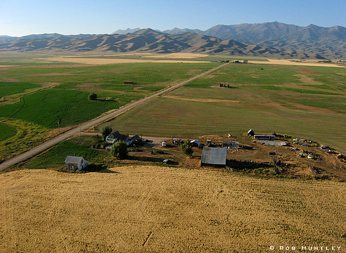
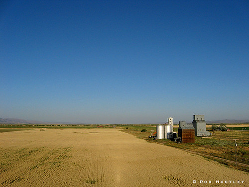
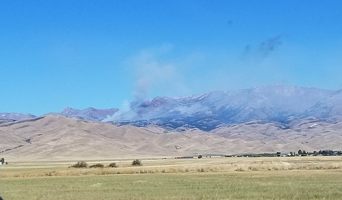
Sunrise & Sunset Photos
Homestead Road, Homestead Rd, Idaho, USA Map
Search another place
Near Places
Silver Brush Road, Silver Brush Rd, Idaho, USA
Soldier, ID, USA
Base Line Rd, Fairfield, ID, USA
Camas County, ID, USA
Fairfield, ID, USA
Indian Head Rock, ID, USA
E Paradise Dr, Mountain Home, ID, USA
Paradise Hot Springs, ID, USA
N Phil Pl, Mountain Home, ID, USA
12 N Pine-Featherville Rd, Mountain Home, ID, USA
Pine, ID, USA
N Pine-Featherville Rd, Mountain Home, ID, USA
Rancho Cielo Road, Rancho Cielo Rd, Idaho, USA
Bliss, ID, USA
Kentucky St, Bliss, ID, USA
Magic Resort, ID, USA
Gooding, ID, USA
Croy Creek Rd, Hailey, ID, USA
Gooding County, ID, USA
2nd Ave N, Hailey, ID, USA
Recent Searches
- Sunrise Sunset Times of Red Dog Mine, AK, USA
- Sunrise Sunset Times of Am Bahnhof, Am bhf, Borken, Germany
- Sunrise Sunset Times of 4th St E, Sonoma, CA, USA
- Sunrise Sunset Times of Oakland Ave, Williamsport, PA, USA
- Sunrise Sunset Times of Via Roma, Pieranica CR, Italy
- Sunrise Sunset Times of Clock Tower of Dubrovnik, Grad, Dubrovnik, Croatia
- Sunrise Sunset Times of Trelew, Chubut Province, Argentina
- Sunrise Sunset Times of Hartfords Bluff Cir, Mt Pleasant, SC, USA
- Sunrise Sunset Times of Kita Ward, Kumamoto, Japan
- Sunrise Sunset Times of Pingtan Island, Pingtan County, Fuzhou, China


