Sunrise Sunset Times of Fruitland, WA, USA
Location: United States > Washington > Stevens County >
Timezone:
America/Los_Angeles
Current Time:
2025-06-20 02:12:20
Longitude:
-118.1988742
Latitude:
48.0709969
Sunrise Today:
04:52:47 AM
Sunset Today:
08:56:20 PM
Daylength Today:
16h 3m 33s
Sunrise Tomorrow:
04:53:01 AM
Sunset Tomorrow:
08:56:32 PM
Daylength Tomorrow:
16h 3m 31s
Year Show All Dates
| Date | Sunrise | Sunset | Daylength |
|---|---|---|---|
| 01/01/2025 | 07:42:41 AM | 04:11:21 PM | 8h 28m 40s |
| 01/02/2025 | 07:42:34 AM | 04:12:23 PM | 8h 29m 49s |
| 01/03/2025 | 07:42:24 AM | 04:13:27 PM | 8h 31m 3s |
| 01/04/2025 | 07:42:11 AM | 04:14:33 PM | 8h 32m 22s |
| 01/05/2025 | 07:41:55 AM | 04:15:42 PM | 8h 33m 47s |
| 01/06/2025 | 07:41:37 AM | 04:16:52 PM | 8h 35m 15s |
| 01/07/2025 | 07:41:16 AM | 04:18:04 PM | 8h 36m 48s |
| 01/08/2025 | 07:40:51 AM | 04:19:17 PM | 8h 38m 26s |
| 01/09/2025 | 07:40:24 AM | 04:20:33 PM | 8h 40m 9s |
| 01/10/2025 | 07:39:54 AM | 04:21:50 PM | 8h 41m 56s |
| 01/11/2025 | 07:39:22 AM | 04:23:08 PM | 8h 43m 46s |
| 01/12/2025 | 07:38:47 AM | 04:24:28 PM | 8h 45m 41s |
| 01/13/2025 | 07:38:09 AM | 04:25:50 PM | 8h 47m 41s |
| 01/14/2025 | 07:37:28 AM | 04:27:13 PM | 8h 49m 45s |
| 01/15/2025 | 07:36:45 AM | 04:28:37 PM | 8h 51m 52s |
| 01/16/2025 | 07:35:59 AM | 04:30:02 PM | 8h 54m 3s |
| 01/17/2025 | 07:35:10 AM | 04:31:28 PM | 8h 56m 18s |
| 01/18/2025 | 07:34:19 AM | 04:32:56 PM | 8h 58m 37s |
| 01/19/2025 | 07:33:26 AM | 04:34:24 PM | 9h 0m 58s |
| 01/20/2025 | 07:32:30 AM | 04:35:53 PM | 9h 3m 23s |
| 01/21/2025 | 07:31:32 AM | 04:37:24 PM | 9h 5m 52s |
| 01/22/2025 | 07:30:31 AM | 04:38:55 PM | 9h 8m 24s |
| 01/23/2025 | 07:29:29 AM | 04:40:26 PM | 9h 10m 57s |
| 01/24/2025 | 07:28:23 AM | 04:41:59 PM | 9h 13m 36s |
| 01/25/2025 | 07:27:16 AM | 04:43:31 PM | 9h 16m 15s |
| 01/26/2025 | 07:26:07 AM | 04:45:05 PM | 9h 18m 58s |
| 01/27/2025 | 07:24:55 AM | 04:46:39 PM | 9h 21m 44s |
| 01/28/2025 | 07:23:42 AM | 04:48:13 PM | 9h 24m 31s |
| 01/29/2025 | 07:22:26 AM | 04:49:48 PM | 9h 27m 22s |
| 01/30/2025 | 07:21:08 AM | 04:51:23 PM | 9h 30m 15s |
| 01/31/2025 | 07:19:49 AM | 04:52:59 PM | 9h 33m 10s |
| 02/01/2025 | 07:18:27 AM | 04:54:34 PM | 9h 36m 7s |
| 02/02/2025 | 07:17:04 AM | 04:56:10 PM | 9h 39m 6s |
| 02/03/2025 | 07:15:39 AM | 04:57:46 PM | 9h 42m 7s |
| 02/04/2025 | 07:14:12 AM | 04:59:22 PM | 9h 45m 10s |
| 02/05/2025 | 07:12:44 AM | 05:00:59 PM | 9h 48m 15s |
| 02/06/2025 | 07:11:14 AM | 05:02:35 PM | 9h 51m 21s |
| 02/07/2025 | 07:09:42 AM | 05:04:11 PM | 9h 54m 29s |
| 02/08/2025 | 07:08:09 AM | 05:05:48 PM | 9h 57m 39s |
| 02/09/2025 | 07:06:34 AM | 05:07:24 PM | 10h 0m 50s |
| 02/10/2025 | 07:04:58 AM | 05:09:00 PM | 10h 4m 2s |
| 02/11/2025 | 07:03:20 AM | 05:10:36 PM | 10h 7m 16s |
| 02/12/2025 | 07:01:41 AM | 05:12:12 PM | 10h 10m 31s |
| 02/13/2025 | 07:00:01 AM | 05:13:48 PM | 10h 13m 47s |
| 02/14/2025 | 06:58:19 AM | 05:15:24 PM | 10h 17m 5s |
| 02/15/2025 | 06:56:36 AM | 05:16:59 PM | 10h 20m 23s |
| 02/16/2025 | 06:54:52 AM | 05:18:35 PM | 10h 23m 43s |
| 02/17/2025 | 06:53:07 AM | 05:20:10 PM | 10h 27m 3s |
| 02/18/2025 | 06:51:20 AM | 05:21:45 PM | 10h 30m 25s |
| 02/19/2025 | 06:49:33 AM | 05:23:19 PM | 10h 33m 46s |
| 02/20/2025 | 06:47:44 AM | 05:24:54 PM | 10h 37m 10s |
| 02/21/2025 | 06:45:55 AM | 05:26:28 PM | 10h 40m 33s |
| 02/22/2025 | 06:44:04 AM | 05:28:02 PM | 10h 43m 58s |
| 02/23/2025 | 06:42:13 AM | 05:29:35 PM | 10h 47m 22s |
| 02/24/2025 | 06:40:20 AM | 05:31:09 PM | 10h 50m 49s |
| 02/25/2025 | 06:38:27 AM | 05:32:42 PM | 10h 54m 15s |
| 02/26/2025 | 06:36:33 AM | 05:34:15 PM | 10h 57m 42s |
| 02/27/2025 | 06:34:38 AM | 05:35:47 PM | 11h 1m 9s |
| 02/28/2025 | 06:32:42 AM | 05:37:19 PM | 11h 4m 37s |
| 03/01/2025 | 06:30:46 AM | 05:38:51 PM | 11h 8m 5s |
| 03/02/2025 | 06:28:49 AM | 05:40:23 PM | 11h 11m 34s |
| 03/03/2025 | 06:26:52 AM | 05:41:54 PM | 11h 15m 2s |
| 03/04/2025 | 06:24:53 AM | 05:43:26 PM | 11h 18m 33s |
| 03/05/2025 | 06:22:55 AM | 05:44:56 PM | 11h 22m 1s |
| 03/06/2025 | 06:20:55 AM | 05:46:27 PM | 11h 25m 32s |
| 03/07/2025 | 06:18:56 AM | 05:47:57 PM | 11h 29m 1s |
| 03/08/2025 | 06:16:55 AM | 05:49:28 PM | 11h 32m 33s |
| 03/09/2025 | 07:15:00 AM | 06:50:54 PM | 11h 35m 54s |
| 03/10/2025 | 07:12:58 AM | 06:52:23 PM | 11h 39m 25s |
| 03/11/2025 | 07:10:57 AM | 06:53:53 PM | 11h 42m 56s |
| 03/12/2025 | 07:08:55 AM | 06:55:22 PM | 11h 46m 27s |
| 03/13/2025 | 07:06:53 AM | 06:56:51 PM | 11h 49m 58s |
| 03/14/2025 | 07:04:51 AM | 06:58:20 PM | 11h 53m 29s |
| 03/15/2025 | 07:02:48 AM | 06:59:48 PM | 11h 57m 0s |
| 03/16/2025 | 07:00:45 AM | 07:01:17 PM | 12h 0m 32s |
| 03/17/2025 | 06:58:42 AM | 07:02:45 PM | 12h 4m 3s |
| 03/18/2025 | 06:56:39 AM | 07:04:13 PM | 12h 7m 34s |
| 03/19/2025 | 06:54:35 AM | 07:05:41 PM | 12h 11m 6s |
| 03/20/2025 | 06:52:32 AM | 07:07:09 PM | 12h 14m 37s |
| 03/21/2025 | 06:50:29 AM | 07:08:36 PM | 12h 18m 7s |
| 03/22/2025 | 06:48:25 AM | 07:10:04 PM | 12h 21m 39s |
| 03/23/2025 | 06:46:22 AM | 07:11:31 PM | 12h 25m 9s |
| 03/24/2025 | 06:44:18 AM | 07:12:58 PM | 12h 28m 40s |
| 03/25/2025 | 06:42:15 AM | 07:14:26 PM | 12h 32m 11s |
| 03/26/2025 | 06:40:11 AM | 07:15:53 PM | 12h 35m 42s |
| 03/27/2025 | 06:38:08 AM | 07:17:20 PM | 12h 39m 12s |
| 03/28/2025 | 06:36:05 AM | 07:18:47 PM | 12h 42m 42s |
| 03/29/2025 | 06:34:02 AM | 07:20:13 PM | 12h 46m 11s |
| 03/30/2025 | 06:32:00 AM | 07:21:40 PM | 12h 49m 40s |
| 03/31/2025 | 06:29:58 AM | 07:23:07 PM | 12h 53m 9s |
| 04/01/2025 | 06:27:56 AM | 07:24:34 PM | 12h 56m 38s |
| 04/02/2025 | 06:25:54 AM | 07:26:00 PM | 13h 0m 6s |
| 04/03/2025 | 06:23:52 AM | 07:27:27 PM | 13h 3m 35s |
| 04/04/2025 | 06:21:51 AM | 07:28:54 PM | 13h 7m 3s |
| 04/05/2025 | 06:19:51 AM | 07:30:20 PM | 13h 10m 29s |
| 04/06/2025 | 06:17:51 AM | 07:31:47 PM | 13h 13m 56s |
| 04/07/2025 | 06:15:51 AM | 07:33:13 PM | 13h 17m 22s |
| 04/08/2025 | 06:13:52 AM | 07:34:40 PM | 13h 20m 48s |
| 04/09/2025 | 06:11:53 AM | 07:36:06 PM | 13h 24m 13s |
| 04/10/2025 | 06:09:55 AM | 07:37:33 PM | 13h 27m 38s |
| 04/11/2025 | 06:07:58 AM | 07:38:59 PM | 13h 31m 1s |
| 04/12/2025 | 06:06:01 AM | 07:40:26 PM | 13h 34m 25s |
| 04/13/2025 | 06:04:05 AM | 07:41:52 PM | 13h 37m 47s |
| 04/14/2025 | 06:02:09 AM | 07:43:19 PM | 13h 41m 10s |
| 04/15/2025 | 06:00:15 AM | 07:44:45 PM | 13h 44m 30s |
| 04/16/2025 | 05:58:21 AM | 07:46:12 PM | 13h 47m 51s |
| 04/17/2025 | 05:56:28 AM | 07:47:38 PM | 13h 51m 10s |
| 04/18/2025 | 05:54:36 AM | 07:49:04 PM | 13h 54m 28s |
| 04/19/2025 | 05:52:44 AM | 07:50:31 PM | 13h 57m 47s |
| 04/20/2025 | 05:50:54 AM | 07:51:57 PM | 14h 1m 3s |
| 04/21/2025 | 05:49:04 AM | 07:53:23 PM | 14h 4m 19s |
| 04/22/2025 | 05:47:16 AM | 07:54:49 PM | 14h 7m 33s |
| 04/23/2025 | 05:45:29 AM | 07:56:15 PM | 14h 10m 46s |
| 04/24/2025 | 05:43:42 AM | 07:57:41 PM | 14h 13m 59s |
| 04/25/2025 | 05:41:57 AM | 07:59:07 PM | 14h 17m 10s |
| 04/26/2025 | 05:40:13 AM | 08:00:32 PM | 14h 20m 19s |
| 04/27/2025 | 05:38:30 AM | 08:01:58 PM | 14h 23m 28s |
| 04/28/2025 | 05:36:48 AM | 08:03:23 PM | 14h 26m 35s |
| 04/29/2025 | 05:35:08 AM | 08:04:48 PM | 14h 29m 40s |
| 04/30/2025 | 05:33:29 AM | 08:06:13 PM | 14h 32m 44s |
| 05/01/2025 | 05:31:51 AM | 08:07:37 PM | 14h 35m 46s |
| 05/02/2025 | 05:30:15 AM | 08:09:02 PM | 14h 38m 47s |
| 05/03/2025 | 05:28:40 AM | 08:10:25 PM | 14h 41m 45s |
| 05/04/2025 | 05:27:07 AM | 08:11:49 PM | 14h 44m 42s |
| 05/05/2025 | 05:25:35 AM | 08:13:12 PM | 14h 47m 37s |
| 05/06/2025 | 05:24:04 AM | 08:14:35 PM | 14h 50m 31s |
| 05/07/2025 | 05:22:35 AM | 08:15:57 PM | 14h 53m 22s |
| 05/08/2025 | 05:21:08 AM | 08:17:19 PM | 14h 56m 11s |
| 05/09/2025 | 05:19:43 AM | 08:18:40 PM | 14h 58m 57s |
| 05/10/2025 | 05:18:19 AM | 08:20:01 PM | 15h 1m 42s |
| 05/11/2025 | 05:16:57 AM | 08:21:21 PM | 15h 4m 24s |
| 05/12/2025 | 05:15:37 AM | 08:22:41 PM | 15h 7m 4s |
| 05/13/2025 | 05:14:18 AM | 08:23:59 PM | 15h 9m 41s |
| 05/14/2025 | 05:13:02 AM | 08:25:17 PM | 15h 12m 15s |
| 05/15/2025 | 05:11:47 AM | 08:26:34 PM | 15h 14m 47s |
| 05/16/2025 | 05:10:35 AM | 08:27:51 PM | 15h 17m 16s |
| 05/17/2025 | 05:09:24 AM | 08:29:06 PM | 15h 19m 42s |
| 05/18/2025 | 05:08:15 AM | 08:30:21 PM | 15h 22m 6s |
| 05/19/2025 | 05:07:09 AM | 08:31:34 PM | 15h 24m 25s |
| 05/20/2025 | 05:06:05 AM | 08:32:47 PM | 15h 26m 42s |
| 05/21/2025 | 05:05:02 AM | 08:33:58 PM | 15h 28m 56s |
| 05/22/2025 | 05:04:02 AM | 08:35:08 PM | 15h 31m 6s |
| 05/23/2025 | 05:03:04 AM | 08:36:17 PM | 15h 33m 13s |
| 05/24/2025 | 05:02:09 AM | 08:37:25 PM | 15h 35m 16s |
| 05/25/2025 | 05:01:16 AM | 08:38:31 PM | 15h 37m 15s |
| 05/26/2025 | 05:00:25 AM | 08:39:36 PM | 15h 39m 11s |
| 05/27/2025 | 04:59:36 AM | 08:40:40 PM | 15h 41m 4s |
| 05/28/2025 | 04:58:50 AM | 08:41:42 PM | 15h 42m 52s |
| 05/29/2025 | 04:58:07 AM | 08:42:42 PM | 15h 44m 35s |
| 05/30/2025 | 04:57:25 AM | 08:43:41 PM | 15h 46m 16s |
| 05/31/2025 | 04:56:47 AM | 08:44:38 PM | 15h 47m 51s |
| 06/01/2025 | 04:56:10 AM | 08:45:34 PM | 15h 49m 24s |
| 06/02/2025 | 04:55:37 AM | 08:46:27 PM | 15h 50m 50s |
| 06/03/2025 | 04:55:06 AM | 08:47:19 PM | 15h 52m 13s |
| 06/04/2025 | 04:54:37 AM | 08:48:09 PM | 15h 53m 32s |
| 06/05/2025 | 04:54:11 AM | 08:48:57 PM | 15h 54m 46s |
| 06/06/2025 | 04:53:48 AM | 08:49:43 PM | 15h 55m 55s |
| 06/07/2025 | 04:53:27 AM | 08:50:27 PM | 15h 57m 0s |
| 06/08/2025 | 04:53:09 AM | 08:51:09 PM | 15h 58m 0s |
| 06/09/2025 | 04:52:53 AM | 08:51:48 PM | 15h 58m 55s |
| 06/10/2025 | 04:52:40 AM | 08:52:25 PM | 15h 59m 45s |
| 06/11/2025 | 04:52:30 AM | 08:53:00 PM | 16h 0m 30s |
| 06/12/2025 | 04:52:22 AM | 08:53:33 PM | 16h 1m 11s |
| 06/13/2025 | 04:52:17 AM | 08:54:04 PM | 16h 1m 47s |
| 06/14/2025 | 04:52:15 AM | 08:54:32 PM | 16h 2m 17s |
| 06/15/2025 | 04:52:15 AM | 08:54:57 PM | 16h 2m 42s |
| 06/16/2025 | 04:52:18 AM | 08:55:21 PM | 16h 3m 3s |
| 06/17/2025 | 04:52:23 AM | 08:55:41 PM | 16h 3m 18s |
| 06/18/2025 | 04:52:31 AM | 08:55:59 PM | 16h 3m 28s |
| 06/19/2025 | 04:52:42 AM | 08:56:15 PM | 16h 3m 33s |
| 06/20/2025 | 04:52:55 AM | 08:56:28 PM | 16h 3m 33s |
| 06/21/2025 | 04:53:11 AM | 08:56:38 PM | 16h 3m 27s |
| 06/22/2025 | 04:53:29 AM | 08:56:46 PM | 16h 3m 17s |
| 06/23/2025 | 04:53:49 AM | 08:56:51 PM | 16h 3m 2s |
| 06/24/2025 | 04:54:12 AM | 08:56:54 PM | 16h 2m 42s |
| 06/25/2025 | 04:54:38 AM | 08:56:54 PM | 16h 2m 16s |
| 06/26/2025 | 04:55:05 AM | 08:56:51 PM | 16h 1m 46s |
| 06/27/2025 | 04:55:36 AM | 08:56:45 PM | 16h 1m 9s |
| 06/28/2025 | 04:56:08 AM | 08:56:37 PM | 16h 0m 29s |
| 06/29/2025 | 04:56:42 AM | 08:56:26 PM | 15h 59m 44s |
| 06/30/2025 | 04:57:19 AM | 08:56:13 PM | 15h 58m 54s |
| 07/01/2025 | 04:57:58 AM | 08:55:56 PM | 15h 57m 58s |
| 07/02/2025 | 04:58:39 AM | 08:55:38 PM | 15h 56m 59s |
| 07/03/2025 | 04:59:22 AM | 08:55:16 PM | 15h 55m 54s |
| 07/04/2025 | 05:00:07 AM | 08:54:52 PM | 15h 54m 45s |
| 07/05/2025 | 05:00:53 AM | 08:54:25 PM | 15h 53m 32s |
| 07/06/2025 | 05:01:42 AM | 08:53:55 PM | 15h 52m 13s |
| 07/07/2025 | 05:02:33 AM | 08:53:23 PM | 15h 50m 50s |
| 07/08/2025 | 05:03:25 AM | 08:52:49 PM | 15h 49m 24s |
| 07/09/2025 | 05:04:19 AM | 08:52:12 PM | 15h 47m 53s |
| 07/10/2025 | 05:05:15 AM | 08:51:32 PM | 15h 46m 17s |
| 07/11/2025 | 05:06:12 AM | 08:50:50 PM | 15h 44m 38s |
| 07/12/2025 | 05:07:11 AM | 08:50:05 PM | 15h 42m 54s |
| 07/13/2025 | 05:08:11 AM | 08:49:18 PM | 15h 41m 7s |
| 07/14/2025 | 05:09:13 AM | 08:48:28 PM | 15h 39m 15s |
| 07/15/2025 | 05:10:16 AM | 08:47:36 PM | 15h 37m 20s |
| 07/16/2025 | 05:11:20 AM | 08:46:42 PM | 15h 35m 22s |
| 07/17/2025 | 05:12:26 AM | 08:45:45 PM | 15h 33m 19s |
| 07/18/2025 | 05:13:32 AM | 08:44:46 PM | 15h 31m 14s |
| 07/19/2025 | 05:14:40 AM | 08:43:45 PM | 15h 29m 5s |
| 07/20/2025 | 05:15:49 AM | 08:42:42 PM | 15h 26m 53s |
| 07/21/2025 | 05:16:59 AM | 08:41:36 PM | 15h 24m 37s |
| 07/22/2025 | 05:18:10 AM | 08:40:29 PM | 15h 22m 19s |
| 07/23/2025 | 05:19:22 AM | 08:39:19 PM | 15h 19m 57s |
| 07/24/2025 | 05:20:35 AM | 08:38:07 PM | 15h 17m 32s |
| 07/25/2025 | 05:21:48 AM | 08:36:53 PM | 15h 15m 5s |
| 07/26/2025 | 05:23:03 AM | 08:35:38 PM | 15h 12m 35s |
| 07/27/2025 | 05:24:18 AM | 08:34:20 PM | 15h 10m 2s |
| 07/28/2025 | 05:25:33 AM | 08:33:00 PM | 15h 7m 27s |
| 07/29/2025 | 05:26:50 AM | 08:31:39 PM | 15h 4m 49s |
| 07/30/2025 | 05:28:07 AM | 08:30:16 PM | 15h 2m 9s |
| 07/31/2025 | 05:29:24 AM | 08:28:51 PM | 14h 59m 27s |
| 08/01/2025 | 05:30:42 AM | 08:27:24 PM | 14h 56m 42s |
| 08/02/2025 | 05:32:01 AM | 08:25:56 PM | 14h 53m 55s |
| 08/03/2025 | 05:33:20 AM | 08:24:26 PM | 14h 51m 6s |
| 08/04/2025 | 05:34:39 AM | 08:22:54 PM | 14h 48m 15s |
| 08/05/2025 | 05:35:58 AM | 08:21:21 PM | 14h 45m 23s |
| 08/06/2025 | 05:37:18 AM | 08:19:46 PM | 14h 42m 28s |
| 08/07/2025 | 05:38:39 AM | 08:18:10 PM | 14h 39m 31s |
| 08/08/2025 | 05:39:59 AM | 08:16:32 PM | 14h 36m 33s |
| 08/09/2025 | 05:41:20 AM | 08:14:53 PM | 14h 33m 33s |
| 08/10/2025 | 05:42:41 AM | 08:13:13 PM | 14h 30m 32s |
| 08/11/2025 | 05:44:02 AM | 08:11:31 PM | 14h 27m 29s |
| 08/12/2025 | 05:45:23 AM | 08:09:49 PM | 14h 24m 26s |
| 08/13/2025 | 05:46:45 AM | 08:08:04 PM | 14h 21m 19s |
| 08/14/2025 | 05:48:06 AM | 08:06:19 PM | 14h 18m 13s |
| 08/15/2025 | 05:49:28 AM | 08:04:33 PM | 14h 15m 5s |
| 08/16/2025 | 05:50:50 AM | 08:02:45 PM | 14h 11m 55s |
| 08/17/2025 | 05:52:12 AM | 08:00:56 PM | 14h 8m 44s |
| 08/18/2025 | 05:53:34 AM | 07:59:07 PM | 14h 5m 33s |
| 08/19/2025 | 05:54:56 AM | 07:57:16 PM | 14h 2m 20s |
| 08/20/2025 | 05:56:17 AM | 07:55:24 PM | 13h 59m 7s |
| 08/21/2025 | 05:57:39 AM | 07:53:32 PM | 13h 55m 53s |
| 08/22/2025 | 05:59:01 AM | 07:51:38 PM | 13h 52m 37s |
| 08/23/2025 | 06:00:23 AM | 07:49:44 PM | 13h 49m 21s |
| 08/24/2025 | 06:01:45 AM | 07:47:49 PM | 13h 46m 4s |
| 08/25/2025 | 06:03:07 AM | 07:45:53 PM | 13h 42m 46s |
| 08/26/2025 | 06:04:29 AM | 07:43:56 PM | 13h 39m 27s |
| 08/27/2025 | 06:05:51 AM | 07:41:58 PM | 13h 36m 7s |
| 08/28/2025 | 06:07:13 AM | 07:40:00 PM | 13h 32m 47s |
| 08/29/2025 | 06:08:35 AM | 07:38:01 PM | 13h 29m 26s |
| 08/30/2025 | 06:09:57 AM | 07:36:02 PM | 13h 26m 5s |
| 08/31/2025 | 06:11:19 AM | 07:34:02 PM | 13h 22m 43s |
| 09/01/2025 | 06:12:41 AM | 07:32:02 PM | 13h 19m 21s |
| 09/02/2025 | 06:14:03 AM | 07:30:00 PM | 13h 15m 57s |
| 09/03/2025 | 06:15:25 AM | 07:27:59 PM | 13h 12m 34s |
| 09/04/2025 | 06:16:46 AM | 07:25:57 PM | 13h 9m 11s |
| 09/05/2025 | 06:18:08 AM | 07:23:54 PM | 13h 5m 46s |
| 09/06/2025 | 06:19:30 AM | 07:21:51 PM | 13h 2m 21s |
| 09/07/2025 | 06:20:52 AM | 07:19:48 PM | 12h 58m 56s |
| 09/08/2025 | 06:22:14 AM | 07:17:45 PM | 12h 55m 31s |
| 09/09/2025 | 06:23:35 AM | 07:15:41 PM | 12h 52m 6s |
| 09/10/2025 | 06:24:57 AM | 07:13:37 PM | 12h 48m 40s |
| 09/11/2025 | 06:26:19 AM | 07:11:32 PM | 12h 45m 13s |
| 09/12/2025 | 06:27:41 AM | 07:09:28 PM | 12h 41m 47s |
| 09/13/2025 | 06:29:03 AM | 07:07:23 PM | 12h 38m 20s |
| 09/14/2025 | 06:30:25 AM | 07:05:18 PM | 12h 34m 53s |
| 09/15/2025 | 06:31:47 AM | 07:03:13 PM | 12h 31m 26s |
| 09/16/2025 | 06:33:10 AM | 07:01:08 PM | 12h 27m 58s |
| 09/17/2025 | 06:34:32 AM | 06:59:03 PM | 12h 24m 31s |
| 09/18/2025 | 06:35:54 AM | 06:56:57 PM | 12h 21m 3s |
| 09/19/2025 | 06:37:17 AM | 06:54:52 PM | 12h 17m 35s |
| 09/20/2025 | 06:38:40 AM | 06:52:47 PM | 12h 14m 7s |
| 09/21/2025 | 06:40:02 AM | 06:50:42 PM | 12h 10m 40s |
| 09/22/2025 | 06:41:25 AM | 06:48:37 PM | 12h 7m 12s |
| 09/23/2025 | 06:42:48 AM | 06:46:32 PM | 12h 3m 44s |
| 09/24/2025 | 06:44:12 AM | 06:44:27 PM | 12h 0m 15s |
| 09/25/2025 | 06:45:35 AM | 06:42:23 PM | 11h 56m 48s |
| 09/26/2025 | 06:46:59 AM | 06:40:18 PM | 11h 53m 19s |
| 09/27/2025 | 06:48:23 AM | 06:38:14 PM | 11h 49m 51s |
| 09/28/2025 | 06:49:47 AM | 06:36:10 PM | 11h 46m 23s |
| 09/29/2025 | 06:51:11 AM | 06:34:07 PM | 11h 42m 56s |
| 09/30/2025 | 06:52:35 AM | 06:32:03 PM | 11h 39m 28s |
| 10/01/2025 | 06:54:00 AM | 06:30:00 PM | 11h 36m 0s |
| 10/02/2025 | 06:55:25 AM | 06:27:58 PM | 11h 32m 33s |
| 10/03/2025 | 06:56:50 AM | 06:25:56 PM | 11h 29m 6s |
| 10/04/2025 | 06:58:16 AM | 06:23:54 PM | 11h 25m 38s |
| 10/05/2025 | 06:59:41 AM | 06:21:53 PM | 11h 22m 12s |
| 10/06/2025 | 07:01:07 AM | 06:19:53 PM | 11h 18m 46s |
| 10/07/2025 | 07:02:34 AM | 06:17:53 PM | 11h 15m 19s |
| 10/08/2025 | 07:04:00 AM | 06:15:53 PM | 11h 11m 53s |
| 10/09/2025 | 07:05:27 AM | 06:13:55 PM | 11h 8m 28s |
| 10/10/2025 | 07:06:54 AM | 06:11:56 PM | 11h 5m 2s |
| 10/11/2025 | 07:08:22 AM | 06:09:59 PM | 11h 1m 37s |
| 10/12/2025 | 07:09:50 AM | 06:08:02 PM | 10h 58m 12s |
| 10/13/2025 | 07:11:18 AM | 06:06:06 PM | 10h 54m 48s |
| 10/14/2025 | 07:12:46 AM | 06:04:11 PM | 10h 51m 25s |
| 10/15/2025 | 07:14:15 AM | 06:02:17 PM | 10h 48m 2s |
| 10/16/2025 | 07:15:44 AM | 06:00:24 PM | 10h 44m 40s |
| 10/17/2025 | 07:17:13 AM | 05:58:31 PM | 10h 41m 18s |
| 10/18/2025 | 07:18:43 AM | 05:56:40 PM | 10h 37m 57s |
| 10/19/2025 | 07:20:12 AM | 05:54:49 PM | 10h 34m 37s |
| 10/20/2025 | 07:21:42 AM | 05:53:00 PM | 10h 31m 18s |
| 10/21/2025 | 07:23:13 AM | 05:51:11 PM | 10h 27m 58s |
| 10/22/2025 | 07:24:44 AM | 05:49:24 PM | 10h 24m 40s |
| 10/23/2025 | 07:26:14 AM | 05:47:38 PM | 10h 21m 24s |
| 10/24/2025 | 07:27:46 AM | 05:45:53 PM | 10h 18m 7s |
| 10/25/2025 | 07:29:17 AM | 05:44:09 PM | 10h 14m 52s |
| 10/26/2025 | 07:30:49 AM | 05:42:26 PM | 10h 11m 37s |
| 10/27/2025 | 07:32:20 AM | 05:40:45 PM | 10h 8m 25s |
| 10/28/2025 | 07:33:52 AM | 05:39:05 PM | 10h 5m 13s |
| 10/29/2025 | 07:35:24 AM | 05:37:27 PM | 10h 2m 3s |
| 10/30/2025 | 07:36:57 AM | 05:35:50 PM | 9h 58m 53s |
| 10/31/2025 | 07:38:29 AM | 05:34:14 PM | 9h 55m 45s |
| 11/01/2025 | 07:40:01 AM | 05:32:40 PM | 9h 52m 39s |
| 11/02/2025 | 06:41:38 AM | 04:31:04 PM | 9h 49m 26s |
| 11/03/2025 | 06:43:10 AM | 04:29:33 PM | 9h 46m 23s |
| 11/04/2025 | 06:44:43 AM | 04:28:04 PM | 9h 43m 21s |
| 11/05/2025 | 06:46:15 AM | 04:26:36 PM | 9h 40m 21s |
| 11/06/2025 | 06:47:48 AM | 04:25:11 PM | 9h 37m 23s |
| 11/07/2025 | 06:49:20 AM | 04:23:47 PM | 9h 34m 27s |
| 11/08/2025 | 06:50:52 AM | 04:22:25 PM | 9h 31m 33s |
| 11/09/2025 | 06:52:24 AM | 04:21:05 PM | 9h 28m 41s |
| 11/10/2025 | 06:53:56 AM | 04:19:47 PM | 9h 25m 51s |
| 11/11/2025 | 06:55:27 AM | 04:18:31 PM | 9h 23m 4s |
| 11/12/2025 | 06:56:58 AM | 04:17:16 PM | 9h 20m 18s |
| 11/13/2025 | 06:58:29 AM | 04:16:04 PM | 9h 17m 35s |
| 11/14/2025 | 06:59:59 AM | 04:14:55 PM | 9h 14m 56s |
| 11/15/2025 | 07:01:29 AM | 04:13:47 PM | 9h 12m 18s |
| 11/16/2025 | 07:02:58 AM | 04:12:41 PM | 9h 9m 43s |
| 11/17/2025 | 07:04:26 AM | 04:11:38 PM | 9h 7m 12s |
| 11/18/2025 | 07:05:54 AM | 04:10:37 PM | 9h 4m 43s |
| 11/19/2025 | 07:07:21 AM | 04:09:39 PM | 9h 2m 18s |
| 11/20/2025 | 07:08:48 AM | 04:08:42 PM | 8h 59m 54s |
| 11/21/2025 | 07:10:13 AM | 04:07:49 PM | 8h 57m 36s |
| 11/22/2025 | 07:11:38 AM | 04:06:57 PM | 8h 55m 19s |
| 11/23/2025 | 07:13:01 AM | 04:06:09 PM | 8h 53m 8s |
| 11/24/2025 | 07:14:24 AM | 04:05:23 PM | 8h 50m 59s |
| 11/25/2025 | 07:15:45 AM | 04:04:39 PM | 8h 48m 54s |
| 11/26/2025 | 07:17:05 AM | 04:03:58 PM | 8h 46m 53s |
| 11/27/2025 | 07:18:24 AM | 04:03:20 PM | 8h 44m 56s |
| 11/28/2025 | 07:19:42 AM | 04:02:45 PM | 8h 43m 3s |
| 11/29/2025 | 07:20:58 AM | 04:02:12 PM | 8h 41m 14s |
| 11/30/2025 | 07:22:13 AM | 04:01:42 PM | 8h 39m 29s |
| 12/01/2025 | 07:23:26 AM | 04:01:15 PM | 8h 37m 49s |
| 12/02/2025 | 07:24:38 AM | 04:00:51 PM | 8h 36m 13s |
| 12/03/2025 | 07:25:48 AM | 04:00:30 PM | 8h 34m 42s |
| 12/04/2025 | 07:26:56 AM | 04:00:11 PM | 8h 33m 15s |
| 12/05/2025 | 07:28:02 AM | 03:59:56 PM | 8h 31m 54s |
| 12/06/2025 | 07:29:06 AM | 03:59:43 PM | 8h 30m 37s |
| 12/07/2025 | 07:30:09 AM | 03:59:33 PM | 8h 29m 24s |
| 12/08/2025 | 07:31:09 AM | 03:59:26 PM | 8h 28m 17s |
| 12/09/2025 | 07:32:07 AM | 03:59:23 PM | 8h 27m 16s |
| 12/10/2025 | 07:33:03 AM | 03:59:22 PM | 8h 26m 19s |
| 12/11/2025 | 07:33:57 AM | 03:59:24 PM | 8h 25m 27s |
| 12/12/2025 | 07:34:48 AM | 03:59:29 PM | 8h 24m 41s |
| 12/13/2025 | 07:35:37 AM | 03:59:37 PM | 8h 24m 0s |
| 12/14/2025 | 07:36:24 AM | 03:59:49 PM | 8h 23m 25s |
| 12/15/2025 | 07:37:08 AM | 04:00:03 PM | 8h 22m 55s |
| 12/16/2025 | 07:37:50 AM | 04:00:20 PM | 8h 22m 30s |
| 12/17/2025 | 07:38:29 AM | 04:00:40 PM | 8h 22m 11s |
| 12/18/2025 | 07:39:05 AM | 04:01:02 PM | 8h 21m 57s |
| 12/19/2025 | 07:39:39 AM | 04:01:28 PM | 8h 21m 49s |
| 12/20/2025 | 07:40:10 AM | 04:01:57 PM | 8h 21m 47s |
| 12/21/2025 | 07:40:38 AM | 04:02:28 PM | 8h 21m 50s |
| 12/22/2025 | 07:41:04 AM | 04:03:02 PM | 8h 21m 58s |
| 12/23/2025 | 07:41:27 AM | 04:03:39 PM | 8h 22m 12s |
| 12/24/2025 | 07:41:47 AM | 04:04:18 PM | 8h 22m 31s |
| 12/25/2025 | 07:42:04 AM | 04:05:01 PM | 8h 22m 57s |
| 12/26/2025 | 07:42:18 AM | 04:05:45 PM | 8h 23m 27s |
| 12/27/2025 | 07:42:29 AM | 04:06:33 PM | 8h 24m 4s |
| 12/28/2025 | 07:42:38 AM | 04:07:23 PM | 8h 24m 45s |
| 12/29/2025 | 07:42:43 AM | 04:08:15 PM | 8h 25m 32s |
| 12/30/2025 | 07:42:46 AM | 04:09:10 PM | 8h 26m 24s |
| 12/31/2025 | 07:42:45 AM | 04:10:07 PM | 8h 27m 22s |
Sunrise & Sunset Photos

Running to catch the sunset.

The Final Sunset
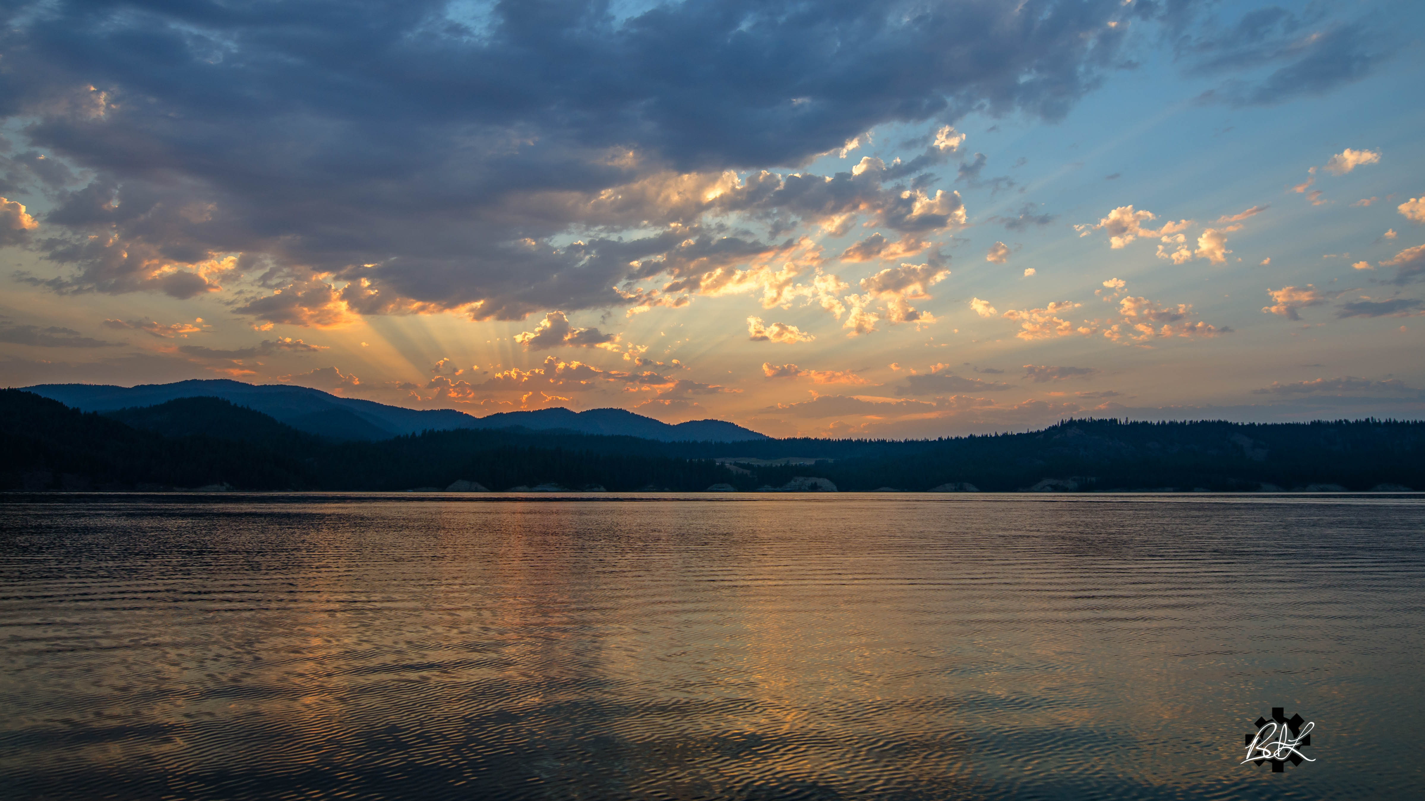
Sunset at Ninemile

25 Mile Creek State Park

25 Mile Creek State Park

Lakeside Harmonies

Downtown Hunters Washington 1

Shown With Optional Chrome Trim Package

Ready for Christmas

Discombobulator Panorama

2014. Mountain pine beetle damage around Franklin D. Roosevelt Lake, Washington.

Wilmont Creek

Wrinkled Rock

Hunters baseball team (c. 1928)

Downtown Hunters Washington 3

Downtown Hunters Washington 2

Barn on Larson Lane

2016-04-20 15;35;04

2016-04-20 15;37;35

2016-04-20 15;34;12

Lake Roosevelt III
Fruitland, WA, USA Map
Search another place
Near Places
Hunters, WA, USA
Enterprise Rd, Fruitland, WA, USA
Miller Mountain Rd, Fruitland, WA, USA
15 Stray Dog Canyon Rd, Inchelium, WA, USA
Inchelium, WA, USA
Deer Meadows, WA, USA
Miles Rd, Rice, WA, USA
Round Lake, Washington, USA
Miles Rd, Rice, WA, USA
Lincoln, WA, USA
Tate Rd, Rice, WA, USA
Rice, WA, USA
Rainy Ridge Road, Rainy Ridge Rd, Inchelium, WA, USA
Haag Cove Campground, Haag Rd, Kettle Falls, WA, USA
Ferry County, WA, USA
Graves Mountain, Washington, USA
Sherman Pass, Washington, USA
Jacknife Cutoff Road, Jacknife Cutoff Rd, Kettle Falls, WA, USA
Copper Butte, Washington, USA
Republic, WA, USA
Recent Searches
- Sunrise Sunset Times of Red Dog Mine, AK, USA
- Sunrise Sunset Times of Am Bahnhof, Am bhf, Borken, Germany
- Sunrise Sunset Times of 4th St E, Sonoma, CA, USA
- Sunrise Sunset Times of Oakland Ave, Williamsport, PA, USA
- Sunrise Sunset Times of Via Roma, Pieranica CR, Italy
- Sunrise Sunset Times of Clock Tower of Dubrovnik, Grad, Dubrovnik, Croatia
- Sunrise Sunset Times of Trelew, Chubut Province, Argentina
- Sunrise Sunset Times of Hartfords Bluff Cir, Mt Pleasant, SC, USA
- Sunrise Sunset Times of Kita Ward, Kumamoto, Japan
- Sunrise Sunset Times of Pingtan Island, Pingtan County, Fuzhou, China