Horas de salida y puesta de sol de Village Creek Road, Village Creek Rd, South Carolina, EE. UU.
Location: Estados Unidos > Carolina del Sur > Condado de Oconee > Mountain Rest >
Zona horaria:
America/New_York
Hora local:
2025-06-19 16:20:01
Longitud:
-83.1198471
Latitud:
34.886552
Salida de sol de hoy:
06:19:07 AM
Puesta de sol de hoy:
08:49:19 PM
La duración del día hoy:
14h 30m 12s
Salida de sol de mañana:
06:19:21 AM
Puesta de sol de mañana:
08:49:32 PM
La duración del día mañana:
14h 30m 11s
Mostrar todas las fechas
| Fecha | Salida de sol | Puesta de sol | Duración del día |
|---|---|---|---|
| 01/01/2025 | 07:40:17 AM | 05:32:54 PM | 9h 52m 37s |
| 02/01/2025 | 07:40:25 AM | 05:33:42 PM | 9h 53m 17s |
| 03/01/2025 | 07:40:31 AM | 05:34:30 PM | 9h 53m 59s |
| 04/01/2025 | 07:40:35 AM | 05:35:19 PM | 9h 54m 44s |
| 05/01/2025 | 07:40:37 AM | 05:36:10 PM | 9h 55m 33s |
| 06/01/2025 | 07:40:38 AM | 05:37:01 PM | 9h 56m 23s |
| 07/01/2025 | 07:40:36 AM | 05:37:54 PM | 9h 57m 18s |
| 08/01/2025 | 07:40:33 AM | 05:38:47 PM | 9h 58m 14s |
| 09/01/2025 | 07:40:27 AM | 05:39:41 PM | 9h 59m 14s |
| 10/01/2025 | 07:40:20 AM | 05:40:36 PM | 10h 0m 16s |
| 11/01/2025 | 07:40:11 AM | 05:41:31 PM | 10h 1m 20s |
| 12/01/2025 | 07:40:00 AM | 05:42:28 PM | 10h 2m 28s |
| 13/01/2025 | 07:39:47 AM | 05:43:24 PM | 10h 3m 37s |
| 14/01/2025 | 07:39:32 AM | 05:44:22 PM | 10h 4m 50s |
| 15/01/2025 | 07:39:15 AM | 05:45:20 PM | 10h 6m 5s |
| 16/01/2025 | 07:38:56 AM | 05:46:18 PM | 10h 7m 22s |
| 17/01/2025 | 07:38:36 AM | 05:47:17 PM | 10h 8m 41s |
| 18/01/2025 | 07:38:13 AM | 05:48:16 PM | 10h 10m 3s |
| 19/01/2025 | 07:37:49 AM | 05:49:15 PM | 10h 11m 26s |
| 20/01/2025 | 07:37:23 AM | 05:50:15 PM | 10h 12m 52s |
| 21/01/2025 | 07:36:55 AM | 05:51:15 PM | 10h 14m 20s |
| 22/01/2025 | 07:36:26 AM | 05:52:16 PM | 10h 15m 50s |
| 23/01/2025 | 07:35:54 AM | 05:53:16 PM | 10h 17m 22s |
| 24/01/2025 | 07:35:21 AM | 05:54:17 PM | 10h 18m 56s |
| 25/01/2025 | 07:34:46 AM | 05:55:18 PM | 10h 20m 32s |
| 26/01/2025 | 07:34:10 AM | 05:56:19 PM | 10h 22m 9s |
| 27/01/2025 | 07:33:32 AM | 05:57:20 PM | 10h 23m 48s |
| 28/01/2025 | 07:32:52 AM | 05:58:21 PM | 10h 25m 29s |
| 29/01/2025 | 07:32:11 AM | 05:59:21 PM | 10h 27m 10s |
| 30/01/2025 | 07:31:28 AM | 06:00:22 PM | 10h 28m 54s |
| 31/01/2025 | 07:30:43 AM | 06:01:23 PM | 10h 30m 40s |
| 01/02/2025 | 07:29:57 AM | 06:02:24 PM | 10h 32m 27s |
| 02/02/2025 | 07:29:09 AM | 06:03:25 PM | 10h 34m 16s |
| 03/02/2025 | 07:28:20 AM | 06:04:25 PM | 10h 36m 5s |
| 04/02/2025 | 07:27:30 AM | 06:05:25 PM | 10h 37m 55s |
| 05/02/2025 | 07:26:38 AM | 06:06:25 PM | 10h 39m 47s |
| 06/02/2025 | 07:25:44 AM | 06:07:25 PM | 10h 41m 41s |
| 07/02/2025 | 07:24:50 AM | 06:08:25 PM | 10h 43m 35s |
| 08/02/2025 | 07:23:53 AM | 06:09:25 PM | 10h 45m 32s |
| 09/02/2025 | 07:22:56 AM | 06:10:24 PM | 10h 47m 28s |
| 10/02/2025 | 07:21:57 AM | 06:11:23 PM | 10h 49m 26s |
| 11/02/2025 | 07:20:58 AM | 06:12:21 PM | 10h 51m 23s |
| 12/02/2025 | 07:19:56 AM | 06:13:20 PM | 10h 53m 24s |
| 13/02/2025 | 07:18:54 AM | 06:14:18 PM | 10h 55m 24s |
| 14/02/2025 | 07:17:51 AM | 06:15:16 PM | 10h 57m 25s |
| 15/02/2025 | 07:16:46 AM | 06:16:13 PM | 10h 59m 27s |
| 16/02/2025 | 07:15:41 AM | 06:17:10 PM | 11h 1m 29s |
| 17/02/2025 | 07:14:34 AM | 06:18:07 PM | 11h 3m 33s |
| 18/02/2025 | 07:13:26 AM | 06:19:03 PM | 11h 5m 37s |
| 19/02/2025 | 07:12:17 AM | 06:20:00 PM | 11h 7m 43s |
| 20/02/2025 | 07:11:08 AM | 06:20:55 PM | 11h 9m 47s |
| 21/02/2025 | 07:09:57 AM | 06:21:51 PM | 11h 11m 54s |
| 22/02/2025 | 07:08:46 AM | 06:22:46 PM | 11h 14m 0s |
| 23/02/2025 | 07:07:33 AM | 06:23:41 PM | 11h 16m 8s |
| 24/02/2025 | 07:06:20 AM | 06:24:35 PM | 11h 18m 15s |
| 25/02/2025 | 07:05:06 AM | 06:25:29 PM | 11h 20m 23s |
| 26/02/2025 | 07:03:51 AM | 06:26:23 PM | 11h 22m 32s |
| 27/02/2025 | 07:02:36 AM | 06:27:16 PM | 11h 24m 40s |
| 28/02/2025 | 07:01:20 AM | 06:28:09 PM | 11h 26m 49s |
| 01/03/2025 | 07:00:03 AM | 06:29:02 PM | 11h 28m 59s |
| 02/03/2025 | 06:58:45 AM | 06:29:55 PM | 11h 31m 10s |
| 03/03/2025 | 06:57:27 AM | 06:30:47 PM | 11h 33m 20s |
| 04/03/2025 | 06:56:08 AM | 06:31:39 PM | 11h 35m 31s |
| 05/03/2025 | 06:54:49 AM | 06:32:30 PM | 11h 37m 41s |
| 06/03/2025 | 06:53:29 AM | 06:33:22 PM | 11h 39m 53s |
| 07/03/2025 | 06:52:09 AM | 06:34:13 PM | 11h 42m 4s |
| 08/03/2025 | 06:50:48 AM | 06:35:03 PM | 11h 44m 15s |
| 09/03/2025 | 07:49:31 AM | 07:35:52 PM | 11h 46m 21s |
| 10/03/2025 | 07:48:09 AM | 07:36:42 PM | 11h 48m 33s |
| 11/03/2025 | 07:46:47 AM | 07:37:32 PM | 11h 50m 45s |
| 12/03/2025 | 07:45:25 AM | 07:38:22 PM | 11h 52m 57s |
| 13/03/2025 | 07:44:02 AM | 07:39:11 PM | 11h 55m 9s |
| 14/03/2025 | 07:42:39 AM | 07:40:00 PM | 11h 57m 21s |
| 15/03/2025 | 07:41:16 AM | 07:40:50 PM | 11h 59m 34s |
| 16/03/2025 | 07:39:53 AM | 07:41:39 PM | 12h 1m 46s |
| 17/03/2025 | 07:38:29 AM | 07:42:27 PM | 12h 3m 58s |
| 18/03/2025 | 07:37:06 AM | 07:43:16 PM | 12h 6m 10s |
| 19/03/2025 | 07:35:42 AM | 07:44:04 PM | 12h 8m 22s |
| 20/03/2025 | 07:34:18 AM | 07:44:53 PM | 12h 10m 35s |
| 21/03/2025 | 07:32:54 AM | 07:45:41 PM | 12h 12m 47s |
| 22/03/2025 | 07:31:30 AM | 07:46:29 PM | 12h 14m 59s |
| 23/03/2025 | 07:30:06 AM | 07:47:17 PM | 12h 17m 11s |
| 24/03/2025 | 07:28:42 AM | 07:48:05 PM | 12h 19m 23s |
| 25/03/2025 | 07:27:18 AM | 07:48:53 PM | 12h 21m 35s |
| 26/03/2025 | 07:25:54 AM | 07:49:40 PM | 12h 23m 46s |
| 27/03/2025 | 07:24:30 AM | 07:50:28 PM | 12h 25m 58s |
| 28/03/2025 | 07:23:07 AM | 07:51:15 PM | 12h 28m 8s |
| 29/03/2025 | 07:21:43 AM | 07:52:03 PM | 12h 30m 20s |
| 30/03/2025 | 07:20:20 AM | 07:52:50 PM | 12h 32m 30s |
| 31/03/2025 | 07:18:57 AM | 07:53:38 PM | 12h 34m 41s |
| 01/04/2025 | 07:17:34 AM | 07:54:25 PM | 12h 36m 51s |
| 02/04/2025 | 07:16:11 AM | 07:55:13 PM | 12h 39m 2s |
| 03/04/2025 | 07:14:49 AM | 07:56:00 PM | 12h 41m 11s |
| 04/04/2025 | 07:13:27 AM | 07:56:48 PM | 12h 43m 21s |
| 05/04/2025 | 07:12:05 AM | 07:57:35 PM | 12h 45m 30s |
| 06/04/2025 | 07:10:44 AM | 07:58:23 PM | 12h 47m 39s |
| 07/04/2025 | 07:09:23 AM | 07:59:10 PM | 12h 49m 47s |
| 08/04/2025 | 07:08:03 AM | 07:59:58 PM | 12h 51m 55s |
| 09/04/2025 | 07:06:43 AM | 08:00:45 PM | 12h 54m 2s |
| 10/04/2025 | 07:05:24 AM | 08:01:33 PM | 12h 56m 9s |
| 11/04/2025 | 07:04:05 AM | 08:02:21 PM | 12h 58m 16s |
| 12/04/2025 | 07:02:47 AM | 08:03:09 PM | 13h 0m 22s |
| 13/04/2025 | 07:01:29 AM | 08:03:57 PM | 13h 2m 28s |
| 14/04/2025 | 07:00:12 AM | 08:04:44 PM | 13h 4m 32s |
| 15/04/2025 | 06:58:56 AM | 08:05:32 PM | 13h 6m 36s |
| 16/04/2025 | 06:57:40 AM | 08:06:20 PM | 13h 8m 40s |
| 17/04/2025 | 06:56:25 AM | 08:07:09 PM | 13h 10m 44s |
| 18/04/2025 | 06:55:11 AM | 08:07:57 PM | 13h 12m 46s |
| 19/04/2025 | 06:53:58 AM | 08:08:45 PM | 13h 14m 47s |
| 20/04/2025 | 06:52:45 AM | 08:09:33 PM | 13h 16m 48s |
| 21/04/2025 | 06:51:33 AM | 08:10:22 PM | 13h 18m 49s |
| 22/04/2025 | 06:50:22 AM | 08:11:10 PM | 13h 20m 48s |
| 23/04/2025 | 06:49:12 AM | 08:11:59 PM | 13h 22m 47s |
| 24/04/2025 | 06:48:03 AM | 08:12:47 PM | 13h 24m 44s |
| 25/04/2025 | 06:46:55 AM | 08:13:36 PM | 13h 26m 41s |
| 26/04/2025 | 06:45:47 AM | 08:14:24 PM | 13h 28m 37s |
| 27/04/2025 | 06:44:41 AM | 08:15:13 PM | 13h 30m 32s |
| 28/04/2025 | 06:43:36 AM | 08:16:01 PM | 13h 32m 25s |
| 29/04/2025 | 06:42:32 AM | 08:16:50 PM | 13h 34m 18s |
| 30/04/2025 | 06:41:28 AM | 08:17:39 PM | 13h 36m 11s |
| 01/05/2025 | 06:40:26 AM | 08:18:27 PM | 13h 38m 1s |
| 02/05/2025 | 06:39:25 AM | 08:19:16 PM | 13h 39m 51s |
| 03/05/2025 | 06:38:26 AM | 08:20:04 PM | 13h 41m 38s |
| 04/05/2025 | 06:37:27 AM | 08:20:53 PM | 13h 43m 26s |
| 05/05/2025 | 06:36:30 AM | 08:21:41 PM | 13h 45m 11s |
| 06/05/2025 | 06:35:34 AM | 08:22:29 PM | 13h 46m 55s |
| 07/05/2025 | 06:34:39 AM | 08:23:17 PM | 13h 48m 38s |
| 08/05/2025 | 06:33:45 AM | 08:24:05 PM | 13h 50m 20s |
| 09/05/2025 | 06:32:53 AM | 08:24:53 PM | 13h 52m 0s |
| 10/05/2025 | 06:32:02 AM | 08:25:41 PM | 13h 53m 39s |
| 11/05/2025 | 06:31:12 AM | 08:26:28 PM | 13h 55m 16s |
| 12/05/2025 | 06:30:24 AM | 08:27:16 PM | 13h 56m 52s |
| 13/05/2025 | 06:29:37 AM | 08:28:03 PM | 13h 58m 26s |
| 14/05/2025 | 06:28:51 AM | 08:28:49 PM | 13h 59m 58s |
| 15/05/2025 | 06:28:07 AM | 08:29:36 PM | 14h 1m 29s |
| 16/05/2025 | 06:27:25 AM | 08:30:22 PM | 14h 2m 57s |
| 17/05/2025 | 06:26:44 AM | 08:31:07 PM | 14h 4m 23s |
| 18/05/2025 | 06:26:04 AM | 08:31:53 PM | 14h 5m 49s |
| 19/05/2025 | 06:25:26 AM | 08:32:37 PM | 14h 7m 11s |
| 20/05/2025 | 06:24:50 AM | 08:33:22 PM | 14h 8m 32s |
| 21/05/2025 | 06:24:15 AM | 08:34:06 PM | 14h 9m 51s |
| 22/05/2025 | 06:23:41 AM | 08:34:49 PM | 14h 11m 8s |
| 23/05/2025 | 06:23:09 AM | 08:35:32 PM | 14h 12m 23s |
| 24/05/2025 | 06:22:39 AM | 08:36:14 PM | 14h 13m 35s |
| 25/05/2025 | 06:22:10 AM | 08:36:56 PM | 14h 14m 46s |
| 26/05/2025 | 06:21:43 AM | 08:37:37 PM | 14h 15m 54s |
| 27/05/2025 | 06:21:18 AM | 08:38:17 PM | 14h 16m 59s |
| 28/05/2025 | 06:20:54 AM | 08:38:57 PM | 14h 18m 3s |
| 29/05/2025 | 06:20:32 AM | 08:39:35 PM | 14h 19m 3s |
| 30/05/2025 | 06:20:11 AM | 08:40:13 PM | 14h 20m 2s |
| 31/05/2025 | 06:19:52 AM | 08:40:51 PM | 14h 20m 59s |
| 01/06/2025 | 06:19:35 AM | 08:41:27 PM | 14h 21m 52s |
| 02/06/2025 | 06:19:19 AM | 08:42:02 PM | 14h 22m 43s |
| 03/06/2025 | 06:19:05 AM | 08:42:37 PM | 14h 23m 32s |
| 04/06/2025 | 06:18:53 AM | 08:43:10 PM | 14h 24m 17s |
| 05/06/2025 | 06:18:42 AM | 08:43:43 PM | 14h 25m 1s |
| 06/06/2025 | 06:18:33 AM | 08:44:14 PM | 14h 25m 41s |
| 07/06/2025 | 06:18:26 AM | 08:44:45 PM | 14h 26m 19s |
| 08/06/2025 | 06:18:20 AM | 08:45:14 PM | 14h 26m 54s |
| 09/06/2025 | 06:18:16 AM | 08:45:42 PM | 14h 27m 26s |
| 10/06/2025 | 06:18:13 AM | 08:46:09 PM | 14h 27m 56s |
| 11/06/2025 | 06:18:12 AM | 08:46:34 PM | 14h 28m 22s |
| 12/06/2025 | 06:18:13 AM | 08:46:59 PM | 14h 28m 46s |
| 13/06/2025 | 06:18:15 AM | 08:47:22 PM | 14h 29m 7s |
| 14/06/2025 | 06:18:19 AM | 08:47:44 PM | 14h 29m 25s |
| 15/06/2025 | 06:18:24 AM | 08:48:04 PM | 14h 29m 40s |
| 16/06/2025 | 06:18:31 AM | 08:48:24 PM | 14h 29m 53s |
| 17/06/2025 | 06:18:40 AM | 08:48:41 PM | 14h 30m 1s |
| 18/06/2025 | 06:18:49 AM | 08:48:58 PM | 14h 30m 9s |
| 19/06/2025 | 06:19:01 AM | 08:49:12 PM | 14h 30m 11s |
| 20/06/2025 | 06:19:14 AM | 08:49:26 PM | 14h 30m 12s |
| 21/06/2025 | 06:19:28 AM | 08:49:38 PM | 14h 30m 10s |
| 22/06/2025 | 06:19:43 AM | 08:49:48 PM | 14h 30m 5s |
| 23/06/2025 | 06:20:00 AM | 08:49:57 PM | 14h 29m 57s |
| 24/06/2025 | 06:20:19 AM | 08:50:04 PM | 14h 29m 45s |
| 25/06/2025 | 06:20:38 AM | 08:50:10 PM | 14h 29m 32s |
| 26/06/2025 | 06:20:59 AM | 08:50:14 PM | 14h 29m 15s |
| 27/06/2025 | 06:21:21 AM | 08:50:16 PM | 14h 28m 55s |
| 28/06/2025 | 06:21:45 AM | 08:50:17 PM | 14h 28m 32s |
| 29/06/2025 | 06:22:09 AM | 08:50:16 PM | 14h 28m 7s |
| 30/06/2025 | 06:22:35 AM | 08:50:14 PM | 14h 27m 39s |
| 01/07/2025 | 06:23:02 AM | 08:50:10 PM | 14h 27m 8s |
| 02/07/2025 | 06:23:30 AM | 08:50:04 PM | 14h 26m 34s |
| 03/07/2025 | 06:23:59 AM | 08:49:56 PM | 14h 25m 57s |
| 04/07/2025 | 06:24:29 AM | 08:49:47 PM | 14h 25m 18s |
| 05/07/2025 | 06:25:00 AM | 08:49:36 PM | 14h 24m 36s |
| 06/07/2025 | 06:25:32 AM | 08:49:24 PM | 14h 23m 52s |
| 07/07/2025 | 06:26:05 AM | 08:49:09 PM | 14h 23m 4s |
| 08/07/2025 | 06:26:38 AM | 08:48:54 PM | 14h 22m 16s |
| 09/07/2025 | 06:27:13 AM | 08:48:36 PM | 14h 21m 23s |
| 10/07/2025 | 06:27:48 AM | 08:48:17 PM | 14h 20m 29s |
| 11/07/2025 | 06:28:25 AM | 08:47:56 PM | 14h 19m 31s |
| 12/07/2025 | 06:29:02 AM | 08:47:33 PM | 14h 18m 31s |
| 13/07/2025 | 06:29:39 AM | 08:47:09 PM | 14h 17m 30s |
| 14/07/2025 | 06:30:17 AM | 08:46:43 PM | 14h 16m 26s |
| 15/07/2025 | 06:30:56 AM | 08:46:15 PM | 14h 15m 19s |
| 16/07/2025 | 06:31:36 AM | 08:45:46 PM | 14h 14m 10s |
| 17/07/2025 | 06:32:16 AM | 08:45:15 PM | 14h 12m 59s |
| 18/07/2025 | 06:32:57 AM | 08:44:43 PM | 14h 11m 46s |
| 19/07/2025 | 06:33:38 AM | 08:44:08 PM | 14h 10m 30s |
| 20/07/2025 | 06:34:19 AM | 08:43:33 PM | 14h 9m 14s |
| 21/07/2025 | 06:35:01 AM | 08:42:55 PM | 14h 7m 54s |
| 22/07/2025 | 06:35:44 AM | 08:42:17 PM | 14h 6m 33s |
| 23/07/2025 | 06:36:26 AM | 08:41:36 PM | 14h 5m 10s |
| 24/07/2025 | 06:37:10 AM | 08:40:54 PM | 14h 3m 44s |
| 25/07/2025 | 06:37:53 AM | 08:40:11 PM | 14h 2m 18s |
| 26/07/2025 | 06:38:37 AM | 08:39:26 PM | 14h 0m 49s |
| 27/07/2025 | 06:39:21 AM | 08:38:40 PM | 13h 59m 19s |
| 28/07/2025 | 06:40:05 AM | 08:37:52 PM | 13h 57m 47s |
| 29/07/2025 | 06:40:49 AM | 08:37:03 PM | 13h 56m 14s |
| 30/07/2025 | 06:41:34 AM | 08:36:12 PM | 13h 54m 38s |
| 31/07/2025 | 06:42:19 AM | 08:35:20 PM | 13h 53m 1s |
| 01/08/2025 | 06:43:04 AM | 08:34:27 PM | 13h 51m 23s |
| 02/08/2025 | 06:43:49 AM | 08:33:32 PM | 13h 49m 43s |
| 03/08/2025 | 06:44:34 AM | 08:32:36 PM | 13h 48m 2s |
| 04/08/2025 | 06:45:19 AM | 08:31:39 PM | 13h 46m 20s |
| 05/08/2025 | 06:46:04 AM | 08:30:40 PM | 13h 44m 36s |
| 06/08/2025 | 06:46:49 AM | 08:29:41 PM | 13h 42m 52s |
| 07/08/2025 | 06:47:35 AM | 08:28:40 PM | 13h 41m 5s |
| 08/08/2025 | 06:48:20 AM | 08:27:38 PM | 13h 39m 18s |
| 09/08/2025 | 06:49:05 AM | 08:26:34 PM | 13h 37m 29s |
| 10/08/2025 | 06:49:51 AM | 08:25:30 PM | 13h 35m 39s |
| 11/08/2025 | 06:50:36 AM | 08:24:24 PM | 13h 33m 48s |
| 12/08/2025 | 06:51:21 AM | 08:23:18 PM | 13h 31m 57s |
| 13/08/2025 | 06:52:06 AM | 08:22:10 PM | 13h 30m 4s |
| 14/08/2025 | 06:52:51 AM | 08:21:02 PM | 13h 28m 11s |
| 15/08/2025 | 06:53:36 AM | 08:19:52 PM | 13h 26m 16s |
| 16/08/2025 | 06:54:21 AM | 08:18:42 PM | 13h 24m 21s |
| 17/08/2025 | 06:55:06 AM | 08:17:30 PM | 13h 22m 24s |
| 18/08/2025 | 06:55:51 AM | 08:16:18 PM | 13h 20m 27s |
| 19/08/2025 | 06:56:36 AM | 08:15:04 PM | 13h 18m 28s |
| 20/08/2025 | 06:57:20 AM | 08:13:50 PM | 13h 16m 30s |
| 21/08/2025 | 06:58:05 AM | 08:12:35 PM | 13h 14m 30s |
| 22/08/2025 | 06:58:49 AM | 08:11:20 PM | 13h 12m 31s |
| 23/08/2025 | 06:59:34 AM | 08:10:03 PM | 13h 10m 29s |
| 24/08/2025 | 07:00:18 AM | 08:08:46 PM | 13h 8m 28s |
| 25/08/2025 | 07:01:02 AM | 08:07:28 PM | 13h 6m 26s |
| 26/08/2025 | 07:01:46 AM | 08:06:09 PM | 13h 4m 23s |
| 27/08/2025 | 07:02:30 AM | 08:04:50 PM | 13h 2m 20s |
| 28/08/2025 | 07:03:14 AM | 08:03:30 PM | 13h 0m 16s |
| 29/08/2025 | 07:03:57 AM | 08:02:10 PM | 12h 58m 13s |
| 30/08/2025 | 07:04:41 AM | 08:00:49 PM | 12h 56m 8s |
| 31/08/2025 | 07:05:25 AM | 07:59:27 PM | 12h 54m 2s |
| 01/09/2025 | 07:06:08 AM | 07:58:05 PM | 12h 51m 57s |
| 02/09/2025 | 07:06:52 AM | 07:56:42 PM | 12h 49m 50s |
| 03/09/2025 | 07:07:35 AM | 07:55:19 PM | 12h 47m 44s |
| 04/09/2025 | 07:08:18 AM | 07:53:56 PM | 12h 45m 38s |
| 05/09/2025 | 07:09:02 AM | 07:52:32 PM | 12h 43m 30s |
| 06/09/2025 | 07:09:45 AM | 07:51:08 PM | 12h 41m 23s |
| 07/09/2025 | 07:10:28 AM | 07:49:43 PM | 12h 39m 15s |
| 08/09/2025 | 07:11:11 AM | 07:48:18 PM | 12h 37m 7s |
| 09/09/2025 | 07:11:55 AM | 07:46:53 PM | 12h 34m 58s |
| 10/09/2025 | 07:12:38 AM | 07:45:28 PM | 12h 32m 50s |
| 11/09/2025 | 07:13:21 AM | 07:44:02 PM | 12h 30m 41s |
| 12/09/2025 | 07:14:04 AM | 07:42:36 PM | 12h 28m 32s |
| 13/09/2025 | 07:14:47 AM | 07:41:10 PM | 12h 26m 23s |
| 14/09/2025 | 07:15:31 AM | 07:39:44 PM | 12h 24m 13s |
| 15/09/2025 | 07:16:14 AM | 07:38:18 PM | 12h 22m 4s |
| 16/09/2025 | 07:16:57 AM | 07:36:52 PM | 12h 19m 55s |
| 17/09/2025 | 07:17:41 AM | 07:35:25 PM | 12h 17m 44s |
| 18/09/2025 | 07:18:24 AM | 07:33:59 PM | 12h 15m 35s |
| 19/09/2025 | 07:19:08 AM | 07:32:33 PM | 12h 13m 25s |
| 20/09/2025 | 07:19:52 AM | 07:31:06 PM | 12h 11m 14s |
| 21/09/2025 | 07:20:36 AM | 07:29:40 PM | 12h 9m 4s |
| 22/09/2025 | 07:21:20 AM | 07:28:14 PM | 12h 6m 54s |
| 23/09/2025 | 07:22:04 AM | 07:26:48 PM | 12h 4m 44s |
| 24/09/2025 | 07:22:48 AM | 07:25:22 PM | 12h 2m 34s |
| 25/09/2025 | 07:23:33 AM | 07:23:56 PM | 12h 0m 23s |
| 26/09/2025 | 07:24:17 AM | 07:22:31 PM | 11h 58m 14s |
| 27/09/2025 | 07:25:02 AM | 07:21:05 PM | 11h 56m 3s |
| 28/09/2025 | 07:25:47 AM | 07:19:40 PM | 11h 53m 53s |
| 29/09/2025 | 07:26:33 AM | 07:18:15 PM | 11h 51m 42s |
| 30/09/2025 | 07:27:18 AM | 07:16:51 PM | 11h 49m 33s |
| 01/10/2025 | 07:28:04 AM | 07:15:27 PM | 11h 47m 23s |
| 02/10/2025 | 07:28:50 AM | 07:14:03 PM | 11h 45m 13s |
| 03/10/2025 | 07:29:36 AM | 07:12:40 PM | 11h 43m 4s |
| 04/10/2025 | 07:30:23 AM | 07:11:17 PM | 11h 40m 54s |
| 05/10/2025 | 07:31:10 AM | 07:09:55 PM | 11h 38m 45s |
| 06/10/2025 | 07:31:57 AM | 07:08:33 PM | 11h 36m 36s |
| 07/10/2025 | 07:32:44 AM | 07:07:12 PM | 11h 34m 28s |
| 08/10/2025 | 07:33:32 AM | 07:05:51 PM | 11h 32m 19s |
| 09/10/2025 | 07:34:20 AM | 07:04:31 PM | 11h 30m 11s |
| 10/10/2025 | 07:35:09 AM | 07:03:11 PM | 11h 28m 2s |
| 11/10/2025 | 07:35:57 AM | 07:01:52 PM | 11h 25m 55s |
| 12/10/2025 | 07:36:46 AM | 07:00:34 PM | 11h 23m 48s |
| 13/10/2025 | 07:37:36 AM | 06:59:16 PM | 11h 21m 40s |
| 14/10/2025 | 07:38:26 AM | 06:58:00 PM | 11h 19m 34s |
| 15/10/2025 | 07:39:16 AM | 06:56:44 PM | 11h 17m 28s |
| 16/10/2025 | 07:40:06 AM | 06:55:29 PM | 11h 15m 23s |
| 17/10/2025 | 07:40:57 AM | 06:54:14 PM | 11h 13m 17s |
| 18/10/2025 | 07:41:48 AM | 06:53:01 PM | 11h 11m 13s |
| 19/10/2025 | 07:42:40 AM | 06:51:48 PM | 11h 9m 8s |
| 20/10/2025 | 07:43:32 AM | 06:50:37 PM | 11h 7m 5s |
| 21/10/2025 | 07:44:24 AM | 06:49:26 PM | 11h 5m 2s |
| 22/10/2025 | 07:45:17 AM | 06:48:16 PM | 11h 2m 59s |
| 23/10/2025 | 07:46:10 AM | 06:47:08 PM | 11h 0m 58s |
| 24/10/2025 | 07:47:03 AM | 06:46:00 PM | 10h 58m 57s |
| 25/10/2025 | 07:47:57 AM | 06:44:53 PM | 10h 56m 56s |
| 26/10/2025 | 07:48:51 AM | 06:43:48 PM | 10h 54m 57s |
| 27/10/2025 | 07:49:46 AM | 06:42:44 PM | 10h 52m 58s |
| 28/10/2025 | 07:50:40 AM | 06:41:41 PM | 10h 51m 1s |
| 29/10/2025 | 07:51:35 AM | 06:40:39 PM | 10h 49m 4s |
| 30/10/2025 | 07:52:31 AM | 06:39:38 PM | 10h 47m 7s |
| 31/10/2025 | 07:53:27 AM | 06:38:39 PM | 10h 45m 12s |
| 01/11/2025 | 07:54:23 AM | 06:37:41 PM | 10h 43m 18s |
| 02/11/2025 | 06:55:21 AM | 05:36:42 PM | 10h 41m 21s |
| 03/11/2025 | 06:56:18 AM | 05:35:47 PM | 10h 39m 29s |
| 04/11/2025 | 06:57:15 AM | 05:34:53 PM | 10h 37m 38s |
| 05/11/2025 | 06:58:12 AM | 05:34:01 PM | 10h 35m 49s |
| 06/11/2025 | 06:59:09 AM | 05:33:10 PM | 10h 34m 1s |
| 07/11/2025 | 07:00:07 AM | 05:32:20 PM | 10h 32m 13s |
| 08/11/2025 | 07:01:04 AM | 05:31:33 PM | 10h 30m 29s |
| 09/11/2025 | 07:02:02 AM | 05:30:46 PM | 10h 28m 44s |
| 10/11/2025 | 07:03:00 AM | 05:30:01 PM | 10h 27m 1s |
| 11/11/2025 | 07:03:58 AM | 05:29:18 PM | 10h 25m 20s |
| 12/11/2025 | 07:04:56 AM | 05:28:37 PM | 10h 23m 41s |
| 13/11/2025 | 07:05:54 AM | 05:27:57 PM | 10h 22m 3s |
| 14/11/2025 | 07:06:52 AM | 05:27:18 PM | 10h 20m 26s |
| 15/11/2025 | 07:07:50 AM | 05:26:42 PM | 10h 18m 52s |
| 16/11/2025 | 07:08:48 AM | 05:26:07 PM | 10h 17m 19s |
| 17/11/2025 | 07:09:46 AM | 05:25:34 PM | 10h 15m 48s |
| 18/11/2025 | 07:10:44 AM | 05:25:03 PM | 10h 14m 19s |
| 19/11/2025 | 07:11:42 AM | 05:24:33 PM | 10h 12m 51s |
| 20/11/2025 | 07:12:40 AM | 05:24:06 PM | 10h 11m 26s |
| 21/11/2025 | 07:13:37 AM | 05:23:40 PM | 10h 10m 3s |
| 22/11/2025 | 07:14:34 AM | 05:23:16 PM | 10h 8m 42s |
| 23/11/2025 | 07:15:30 AM | 05:22:54 PM | 10h 7m 24s |
| 24/11/2025 | 07:16:27 AM | 05:22:34 PM | 10h 6m 7s |
| 25/11/2025 | 07:17:23 AM | 05:22:15 PM | 10h 4m 52s |
| 26/11/2025 | 07:18:18 AM | 05:21:59 PM | 10h 3m 41s |
| 27/11/2025 | 07:19:13 AM | 05:21:44 PM | 10h 2m 31s |
| 28/11/2025 | 07:20:08 AM | 05:21:32 PM | 10h 1m 24s |
| 29/11/2025 | 07:21:01 AM | 05:21:21 PM | 10h 0m 20s |
| 30/11/2025 | 07:21:55 AM | 05:21:12 PM | 9h 59m 17s |
| 01/12/2025 | 07:22:47 AM | 05:21:06 PM | 9h 58m 19s |
| 02/12/2025 | 07:23:39 AM | 05:21:01 PM | 9h 57m 22s |
| 03/12/2025 | 07:24:30 AM | 05:20:58 PM | 9h 56m 28s |
| 04/12/2025 | 07:25:20 AM | 05:20:57 PM | 9h 55m 37s |
| 05/12/2025 | 07:26:10 AM | 05:20:58 PM | 9h 54m 48s |
| 06/12/2025 | 07:26:58 AM | 05:21:01 PM | 9h 54m 3s |
| 07/12/2025 | 07:27:46 AM | 05:21:06 PM | 9h 53m 20s |
| 08/12/2025 | 07:28:32 AM | 05:21:13 PM | 9h 52m 41s |
| 09/12/2025 | 07:29:18 AM | 05:21:22 PM | 9h 52m 4s |
| 10/12/2025 | 07:30:02 AM | 05:21:32 PM | 9h 51m 30s |
| 11/12/2025 | 07:30:45 AM | 05:21:45 PM | 9h 51m 0s |
| 12/12/2025 | 07:31:27 AM | 05:22:00 PM | 9h 50m 33s |
| 13/12/2025 | 07:32:08 AM | 05:22:16 PM | 9h 50m 8s |
| 14/12/2025 | 07:32:48 AM | 05:22:34 PM | 9h 49m 46s |
| 15/12/2025 | 07:33:26 AM | 05:22:54 PM | 9h 49m 28s |
| 16/12/2025 | 07:34:03 AM | 05:23:16 PM | 9h 49m 13s |
| 17/12/2025 | 07:34:38 AM | 05:23:39 PM | 9h 49m 1s |
| 18/12/2025 | 07:35:12 AM | 05:24:05 PM | 9h 48m 53s |
| 19/12/2025 | 07:35:44 AM | 05:24:32 PM | 9h 48m 48s |
| 20/12/2025 | 07:36:15 AM | 05:25:00 PM | 9h 48m 45s |
| 21/12/2025 | 07:36:44 AM | 05:25:31 PM | 9h 48m 47s |
| 22/12/2025 | 07:37:12 AM | 05:26:03 PM | 9h 48m 51s |
| 23/12/2025 | 07:37:38 AM | 05:26:36 PM | 9h 48m 58s |
| 24/12/2025 | 07:38:03 AM | 05:27:11 PM | 9h 49m 8s |
| 25/12/2025 | 07:38:25 AM | 05:27:48 PM | 9h 49m 23s |
| 26/12/2025 | 07:38:46 AM | 05:28:26 PM | 9h 49m 40s |
| 27/12/2025 | 07:39:06 AM | 05:29:05 PM | 9h 49m 59s |
| 28/12/2025 | 07:39:23 AM | 05:29:46 PM | 9h 50m 23s |
| 29/12/2025 | 07:39:39 AM | 05:30:29 PM | 9h 50m 50s |
| 30/12/2025 | 07:39:53 AM | 05:31:12 PM | 9h 51m 19s |
| 31/12/2025 | 07:40:05 AM | 05:31:57 PM | 9h 51m 52s |
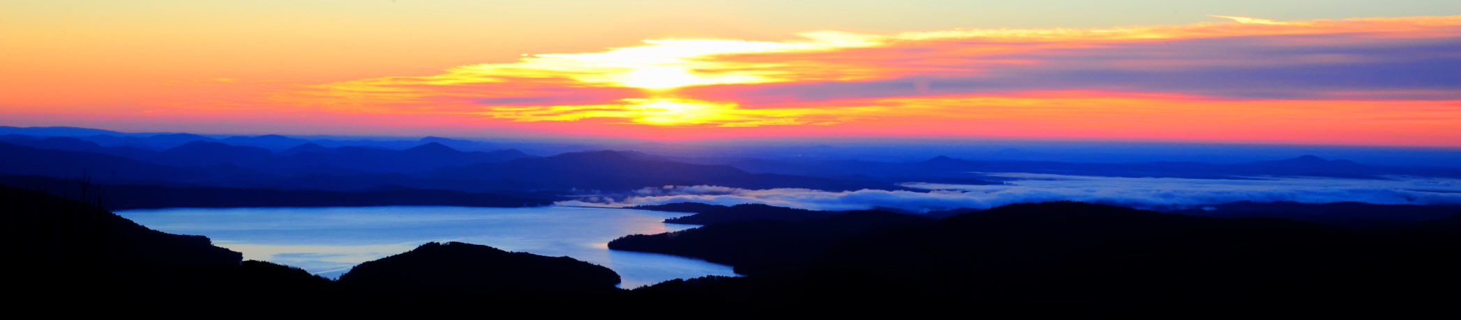
Fotos

Gentle Light

Travel into the night

docked for the night

Sweet Dreams

Miss Sunshine

Tamassee Knob
Sunrise on the way to W4G/NG-025 - Glade Mtn

Sunrise on the way to W4G/NG-025 - Glade Mtn

Sunrise on the way to W4G/NG-025 - Glade Mtn

West Fork of the Chattooga River

Chattooga River Potholes Highlands NC - The Artist's Hand

Issaqueena Falls

Secret Falls

Chattooga River at Burrells Ford

Lake Jocassee

Mountain View

Lake Jocassee

Behind the falls

Chattooga river, north view from burrells ford

Chattooga river, south view from burrells ford

View from Boone's Creek Baptist Church

DSC_6132-2.jpg

DSC_6131-2.jpg

DSC_6129-2.jpg
Mapa de Village Creek Road, Village Creek Rd, South Carolina, EE. UU.
Buscar otro lugar
Lugares cercanos
Lenore B Ln, Mountain Rest, SC, EE. UU.
Old Turnpike Rd, Mountain Rest, SC, EE. UU.
Bauknight Rd, Mountain Rest, SC, EE. UU.
Lakeside Dr, Mountain Rest, SC, EE. UU.
Lakeside Dr, Mountain Rest, SC, EE. UU.
Nature Ln, Mountain Rest, SC, EE. UU.
Chattooga Lake Rd, Mountain Rest, SC, EE. UU.
Mountain Rest, SC, EE. UU.
Lake Becky Rd, Mountain Rest, SC, EE. UU.
South Carolina, SC-, South Carolina, EE. UU.
Winding River Rd, Mountain Rest, SC, EE. UU.
W Village Creek Rd, Mountain Rest, SC, EE. UU.
Land Bridge Rd, Mountain Rest, SC, EE. UU.
Whites Way, Mountain Rest, SC, EE. UU.
Cherry Hill Recreation Area, SC-, Walhalla, SC, EE. UU.
Crystal Lake Rd, Mountain Rest, SC, EE. UU.
Lake Cheohee Rd, Tamassee, SC, EE. UU.
The Bear Blvd, Tamassee, SC, EE. UU.
Cassidy Bridge Rd, Mountain Rest, SC, EE. UU.
Issaqueena Falls, South Carolina, EE. UU.
Búsquedas recientes
- Horas de salida y puesta de sol de Red Dog Mine, AK, USA
- Horas de salida y puesta de sol de Am Bahnhof, Am bhf, Borken, Germany
- Horas de salida y puesta de sol de 4th St E, Sonoma, CA, EE. UU.
- Horas de salida y puesta de sol de Oakland Ave, Williamsport, PA, EE. UU.
- Horas de salida y puesta de sol de Via Roma, Pieranica CR, Italia
- Horas de salida y puesta de sol de Torre del reloj, Grad, Dubrovnik (Ragusa), Croacia
- Horas de salida y puesta de sol de Trelew, Chubut, Argentina
- Horas de salida y puesta de sol de Hartfords Bluff Cir, Mt Pleasant, SC, EE. UU.
- Horas de salida y puesta de sol de Kita Ward, Kumamoto, Japón
- Horas de salida y puesta de sol de Pingtan Island, Pingtan County, Fuzhou, China