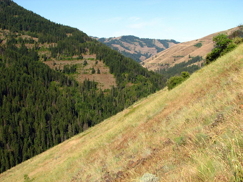
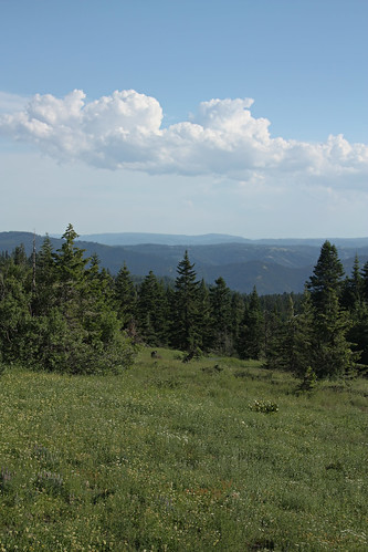
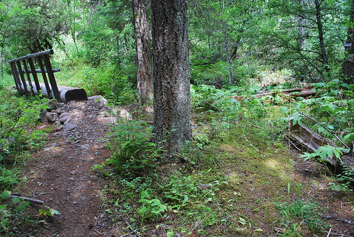
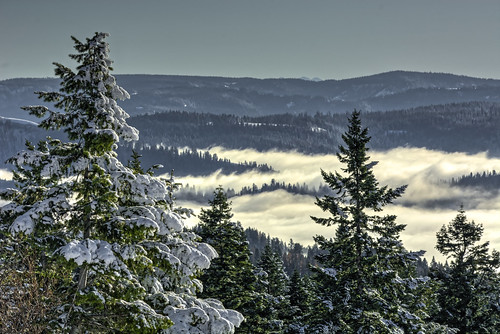
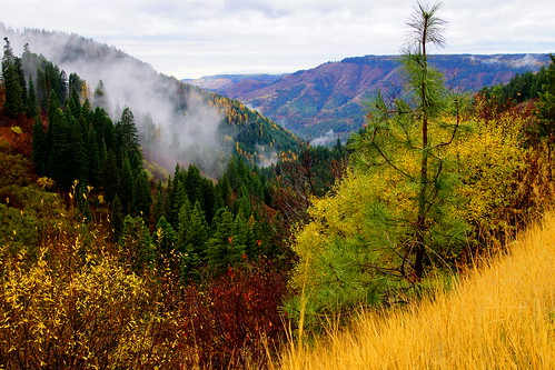
Horas de salida y puesta de sol de Umatilla Forks Campground, Oregón, EE. UU.
Location: Estados Unidos > Oregón > Condado de Umatilla > Weston >
Zona horaria:
America/Los_Angeles
Hora local:
2025-06-24 02:21:59
Longitud:
-118.188595
Latitud:
45.7261228
Salida de sol de hoy:
05:04:08 AM
Puesta de sol de hoy:
08:46:37 PM
La duración del día hoy:
15h 42m 29s
Salida de sol de mañana:
05:04:31 AM
Puesta de sol de mañana:
08:46:40 PM
La duración del día mañana:
15h 42m 9s
Mostrar todas las fechas
| Fecha | Salida de sol | Puesta de sol | Duración del día |
|---|---|---|---|
| 01/01/2025 | 07:33:32 AM | 04:20:25 PM | 8h 46m 53s |
| 02/01/2025 | 07:33:28 AM | 04:21:23 PM | 8h 47m 55s |
| 03/01/2025 | 07:33:22 AM | 04:22:24 PM | 8h 49m 2s |
| 04/01/2025 | 07:33:13 AM | 04:23:27 PM | 8h 50m 14s |
| 05/01/2025 | 07:33:01 AM | 04:24:31 PM | 8h 51m 30s |
| 06/01/2025 | 07:32:47 AM | 04:25:37 PM | 8h 52m 50s |
| 07/01/2025 | 07:32:30 AM | 04:26:44 PM | 8h 54m 14s |
| 08/01/2025 | 07:32:10 AM | 04:27:53 PM | 8h 55m 43s |
| 09/01/2025 | 07:31:48 AM | 04:29:04 PM | 8h 57m 16s |
| 10/01/2025 | 07:31:23 AM | 04:30:16 PM | 8h 58m 53s |
| 11/01/2025 | 07:30:56 AM | 04:31:29 PM | 9h 0m 33s |
| 12/01/2025 | 07:30:26 AM | 04:32:44 PM | 9h 2m 18s |
| 13/01/2025 | 07:29:54 AM | 04:34:00 PM | 9h 4m 6s |
| 14/01/2025 | 07:29:19 AM | 04:35:17 PM | 9h 5m 58s |
| 15/01/2025 | 07:28:41 AM | 04:36:35 PM | 9h 7m 54s |
| 16/01/2025 | 07:28:02 AM | 04:37:54 PM | 9h 9m 52s |
| 17/01/2025 | 07:27:19 AM | 04:39:14 PM | 9h 11m 55s |
| 18/01/2025 | 07:26:35 AM | 04:40:35 PM | 9h 14m 0s |
| 19/01/2025 | 07:25:48 AM | 04:41:57 PM | 9h 16m 9s |
| 20/01/2025 | 07:24:59 AM | 04:43:20 PM | 9h 18m 21s |
| 21/01/2025 | 07:24:07 AM | 04:44:44 PM | 9h 20m 37s |
| 22/01/2025 | 07:23:13 AM | 04:46:08 PM | 9h 22m 55s |
| 23/01/2025 | 07:22:17 AM | 04:47:32 PM | 9h 25m 15s |
| 24/01/2025 | 07:21:19 AM | 04:48:58 PM | 9h 27m 39s |
| 25/01/2025 | 07:20:19 AM | 04:50:23 PM | 9h 30m 4s |
| 26/01/2025 | 07:19:17 AM | 04:51:50 PM | 9h 32m 33s |
| 27/01/2025 | 07:18:13 AM | 04:53:16 PM | 9h 35m 3s |
| 28/01/2025 | 07:17:07 AM | 04:54:43 PM | 9h 37m 36s |
| 29/01/2025 | 07:15:58 AM | 04:56:11 PM | 9h 40m 13s |
| 30/01/2025 | 07:14:48 AM | 04:57:38 PM | 9h 42m 50s |
| 31/01/2025 | 07:13:36 AM | 04:59:06 PM | 9h 45m 30s |
| 01/02/2025 | 07:12:23 AM | 05:00:34 PM | 9h 48m 11s |
| 02/02/2025 | 07:11:07 AM | 05:02:02 PM | 9h 50m 55s |
| 03/02/2025 | 07:09:50 AM | 05:03:31 PM | 9h 53m 41s |
| 04/02/2025 | 07:08:31 AM | 05:04:59 PM | 9h 56m 28s |
| 05/02/2025 | 07:07:10 AM | 05:06:27 PM | 9h 59m 17s |
| 06/02/2025 | 07:05:48 AM | 05:07:56 PM | 10h 2m 8s |
| 07/02/2025 | 07:04:24 AM | 05:09:24 PM | 10h 5m 0s |
| 08/02/2025 | 07:02:59 AM | 05:10:52 PM | 10h 7m 53s |
| 09/02/2025 | 07:01:32 AM | 05:12:21 PM | 10h 10m 49s |
| 10/02/2025 | 07:00:04 AM | 05:13:49 PM | 10h 13m 45s |
| 11/02/2025 | 06:58:35 AM | 05:15:17 PM | 10h 16m 42s |
| 12/02/2025 | 06:57:04 AM | 05:16:45 PM | 10h 19m 41s |
| 13/02/2025 | 06:55:32 AM | 05:18:12 PM | 10h 22m 40s |
| 14/02/2025 | 06:53:58 AM | 05:19:40 PM | 10h 25m 42s |
| 15/02/2025 | 06:52:23 AM | 05:21:07 PM | 10h 28m 44s |
| 16/02/2025 | 06:50:47 AM | 05:22:34 PM | 10h 31m 47s |
| 17/02/2025 | 06:49:10 AM | 05:24:01 PM | 10h 34m 51s |
| 18/02/2025 | 06:47:32 AM | 05:25:28 PM | 10h 37m 56s |
| 19/02/2025 | 06:45:53 AM | 05:26:54 PM | 10h 41m 1s |
| 20/02/2025 | 06:44:13 AM | 05:28:20 PM | 10h 44m 7s |
| 21/02/2025 | 06:42:31 AM | 05:29:46 PM | 10h 47m 15s |
| 22/02/2025 | 06:40:49 AM | 05:31:12 PM | 10h 50m 23s |
| 23/02/2025 | 06:39:06 AM | 05:32:37 PM | 10h 53m 31s |
| 24/02/2025 | 06:37:22 AM | 05:34:02 PM | 10h 56m 40s |
| 25/02/2025 | 06:35:37 AM | 05:35:27 PM | 10h 59m 50s |
| 26/02/2025 | 06:33:51 AM | 05:36:51 PM | 11h 3m 0s |
| 27/02/2025 | 06:32:05 AM | 05:38:16 PM | 11h 6m 11s |
| 28/02/2025 | 06:30:17 AM | 05:39:40 PM | 11h 9m 23s |
| 01/03/2025 | 06:28:29 AM | 05:41:03 PM | 11h 12m 34s |
| 02/03/2025 | 06:26:41 AM | 05:42:27 PM | 11h 15m 46s |
| 03/03/2025 | 06:24:52 AM | 05:43:50 PM | 11h 18m 58s |
| 04/03/2025 | 06:23:02 AM | 05:45:12 PM | 11h 22m 10s |
| 05/03/2025 | 06:21:11 AM | 05:46:35 PM | 11h 25m 24s |
| 06/03/2025 | 06:19:20 AM | 05:47:57 PM | 11h 28m 37s |
| 07/03/2025 | 06:17:29 AM | 05:49:19 PM | 11h 31m 50s |
| 08/03/2025 | 06:15:37 AM | 05:50:41 PM | 11h 35m 4s |
| 09/03/2025 | 07:13:49 AM | 06:51:59 PM | 11h 38m 10s |
| 10/03/2025 | 07:11:56 AM | 06:53:21 PM | 11h 41m 25s |
| 11/03/2025 | 07:10:03 AM | 06:54:42 PM | 11h 44m 39s |
| 12/03/2025 | 07:08:10 AM | 06:56:03 PM | 11h 47m 53s |
| 13/03/2025 | 07:06:16 AM | 06:57:23 PM | 11h 51m 7s |
| 14/03/2025 | 07:04:22 AM | 06:58:44 PM | 11h 54m 22s |
| 15/03/2025 | 07:02:27 AM | 07:00:04 PM | 11h 57m 37s |
| 16/03/2025 | 07:00:33 AM | 07:01:24 PM | 12h 0m 51s |
| 17/03/2025 | 06:58:38 AM | 07:02:44 PM | 12h 4m 6s |
| 18/03/2025 | 06:56:43 AM | 07:04:04 PM | 12h 7m 21s |
| 19/03/2025 | 06:54:48 AM | 07:05:23 PM | 12h 10m 35s |
| 20/03/2025 | 06:52:53 AM | 07:06:43 PM | 12h 13m 50s |
| 21/03/2025 | 06:50:58 AM | 07:08:02 PM | 12h 17m 4s |
| 22/03/2025 | 06:49:03 AM | 07:09:21 PM | 12h 20m 18s |
| 23/03/2025 | 06:47:08 AM | 07:10:40 PM | 12h 23m 32s |
| 24/03/2025 | 06:45:12 AM | 07:11:59 PM | 12h 26m 47s |
| 25/03/2025 | 06:43:17 AM | 07:13:18 PM | 12h 30m 1s |
| 26/03/2025 | 06:41:22 AM | 07:14:37 PM | 12h 33m 15s |
| 27/03/2025 | 06:39:28 AM | 07:15:55 PM | 12h 36m 27s |
| 28/03/2025 | 06:37:33 AM | 07:17:14 PM | 12h 39m 41s |
| 29/03/2025 | 06:35:38 AM | 07:18:33 PM | 12h 42m 55s |
| 30/03/2025 | 06:33:44 AM | 07:19:51 PM | 12h 46m 7s |
| 31/03/2025 | 06:31:50 AM | 07:21:09 PM | 12h 49m 19s |
| 01/04/2025 | 06:29:56 AM | 07:22:28 PM | 12h 52m 32s |
| 02/04/2025 | 06:28:03 AM | 07:23:46 PM | 12h 55m 43s |
| 03/04/2025 | 06:26:10 AM | 07:25:04 PM | 12h 58m 54s |
| 04/04/2025 | 06:24:17 AM | 07:26:23 PM | 13h 2m 6s |
| 05/04/2025 | 06:22:25 AM | 07:27:41 PM | 13h 5m 16s |
| 06/04/2025 | 06:20:33 AM | 07:28:59 PM | 13h 8m 26s |
| 07/04/2025 | 06:18:42 AM | 07:30:18 PM | 13h 11m 36s |
| 08/04/2025 | 06:16:51 AM | 07:31:36 PM | 13h 14m 45s |
| 09/04/2025 | 06:15:01 AM | 07:32:54 PM | 13h 17m 53s |
| 10/04/2025 | 06:13:11 AM | 07:34:12 PM | 13h 21m 1s |
| 11/04/2025 | 06:11:22 AM | 07:35:31 PM | 13h 24m 9s |
| 12/04/2025 | 06:09:33 AM | 07:36:49 PM | 13h 27m 16s |
| 13/04/2025 | 06:07:45 AM | 07:38:07 PM | 13h 30m 22s |
| 14/04/2025 | 06:05:58 AM | 07:39:25 PM | 13h 33m 27s |
| 15/04/2025 | 06:04:12 AM | 07:40:43 PM | 13h 36m 31s |
| 16/04/2025 | 06:02:26 AM | 07:42:02 PM | 13h 39m 36s |
| 17/04/2025 | 06:00:41 AM | 07:43:20 PM | 13h 42m 39s |
| 18/04/2025 | 05:58:57 AM | 07:44:38 PM | 13h 45m 41s |
| 19/04/2025 | 05:57:14 AM | 07:45:56 PM | 13h 48m 42s |
| 20/04/2025 | 05:55:32 AM | 07:47:14 PM | 13h 51m 42s |
| 21/04/2025 | 05:53:51 AM | 07:48:32 PM | 13h 54m 41s |
| 22/04/2025 | 05:52:10 AM | 07:49:50 PM | 13h 57m 40s |
| 23/04/2025 | 05:50:31 AM | 07:51:08 PM | 14h 0m 37s |
| 24/04/2025 | 05:48:53 AM | 07:52:25 PM | 14h 3m 32s |
| 25/04/2025 | 05:47:16 AM | 07:53:43 PM | 14h 6m 27s |
| 26/04/2025 | 05:45:40 AM | 07:55:01 PM | 14h 9m 21s |
| 27/04/2025 | 05:44:05 AM | 07:56:18 PM | 14h 12m 13s |
| 28/04/2025 | 05:42:31 AM | 07:57:35 PM | 14h 15m 4s |
| 29/04/2025 | 05:40:59 AM | 07:58:52 PM | 14h 17m 53s |
| 30/04/2025 | 05:39:28 AM | 08:00:09 PM | 14h 20m 41s |
| 01/05/2025 | 05:37:58 AM | 08:01:26 PM | 14h 23m 28s |
| 02/05/2025 | 05:36:30 AM | 08:02:42 PM | 14h 26m 12s |
| 03/05/2025 | 05:35:02 AM | 08:03:58 PM | 14h 28m 56s |
| 04/05/2025 | 05:33:37 AM | 08:05:14 PM | 14h 31m 37s |
| 05/05/2025 | 05:32:13 AM | 08:06:29 PM | 14h 34m 16s |
| 06/05/2025 | 05:30:50 AM | 08:07:44 PM | 14h 36m 54s |
| 07/05/2025 | 05:29:29 AM | 08:08:59 PM | 14h 39m 30s |
| 08/05/2025 | 05:28:09 AM | 08:10:13 PM | 14h 42m 4s |
| 09/05/2025 | 05:26:51 AM | 08:11:27 PM | 14h 44m 36s |
| 10/05/2025 | 05:25:35 AM | 08:12:40 PM | 14h 47m 5s |
| 11/05/2025 | 05:24:20 AM | 08:13:53 PM | 14h 49m 33s |
| 12/05/2025 | 05:23:07 AM | 08:15:05 PM | 14h 51m 58s |
| 13/05/2025 | 05:21:56 AM | 08:16:17 PM | 14h 54m 21s |
| 14/05/2025 | 05:20:46 AM | 08:17:28 PM | 14h 56m 42s |
| 15/05/2025 | 05:19:39 AM | 08:18:38 PM | 14h 58m 59s |
| 16/05/2025 | 05:18:33 AM | 08:19:48 PM | 15h 1m 15s |
| 17/05/2025 | 05:17:29 AM | 08:20:56 PM | 15h 3m 27s |
| 18/05/2025 | 05:16:27 AM | 08:22:04 PM | 15h 5m 37s |
| 19/05/2025 | 05:15:27 AM | 08:23:11 PM | 15h 7m 44s |
| 20/05/2025 | 05:14:29 AM | 08:24:17 PM | 15h 9m 48s |
| 21/05/2025 | 05:13:33 AM | 08:25:22 PM | 15h 11m 49s |
| 22/05/2025 | 05:12:39 AM | 08:26:26 PM | 15h 13m 47s |
| 23/05/2025 | 05:11:48 AM | 08:27:29 PM | 15h 15m 41s |
| 24/05/2025 | 05:10:58 AM | 08:28:31 PM | 15h 17m 33s |
| 25/05/2025 | 05:10:11 AM | 08:29:32 PM | 15h 19m 21s |
| 26/05/2025 | 05:09:25 AM | 08:30:31 PM | 15h 21m 6s |
| 27/05/2025 | 05:08:42 AM | 08:31:29 PM | 15h 22m 47s |
| 28/05/2025 | 05:08:01 AM | 08:32:26 PM | 15h 24m 25s |
| 29/05/2025 | 05:07:23 AM | 08:33:21 PM | 15h 25m 58s |
| 30/05/2025 | 05:06:46 AM | 08:34:15 PM | 15h 27m 29s |
| 31/05/2025 | 05:06:12 AM | 08:35:08 PM | 15h 28m 56s |
| 01/06/2025 | 05:05:41 AM | 08:35:59 PM | 15h 30m 18s |
| 02/06/2025 | 05:05:11 AM | 08:36:48 PM | 15h 31m 37s |
| 03/06/2025 | 05:04:44 AM | 08:37:36 PM | 15h 32m 52s |
| 04/06/2025 | 05:04:19 AM | 08:38:22 PM | 15h 34m 3s |
| 05/06/2025 | 05:03:57 AM | 08:39:06 PM | 15h 35m 9s |
| 06/06/2025 | 05:03:37 AM | 08:39:48 PM | 15h 36m 11s |
| 07/06/2025 | 05:03:19 AM | 08:40:29 PM | 15h 37m 10s |
| 08/06/2025 | 05:03:04 AM | 08:41:08 PM | 15h 38m 4s |
| 09/06/2025 | 05:02:52 AM | 08:41:45 PM | 15h 38m 53s |
| 10/06/2025 | 05:02:41 AM | 08:42:19 PM | 15h 39m 38s |
| 11/06/2025 | 05:02:33 AM | 08:42:52 PM | 15h 40m 19s |
| 12/06/2025 | 05:02:28 AM | 08:43:23 PM | 15h 40m 55s |
| 13/06/2025 | 05:02:24 AM | 08:43:52 PM | 15h 41m 28s |
| 14/06/2025 | 05:02:24 AM | 08:44:18 PM | 15h 41m 54s |
| 15/06/2025 | 05:02:25 AM | 08:44:42 PM | 15h 42m 17s |
| 16/06/2025 | 05:02:29 AM | 08:45:05 PM | 15h 42m 36s |
| 17/06/2025 | 05:02:35 AM | 08:45:25 PM | 15h 42m 50s |
| 18/06/2025 | 05:02:44 AM | 08:45:42 PM | 15h 42m 58s |
| 19/06/2025 | 05:02:55 AM | 08:45:57 PM | 15h 43m 2s |
| 20/06/2025 | 05:03:08 AM | 08:46:11 PM | 15h 43m 3s |
| 21/06/2025 | 05:03:23 AM | 08:46:21 PM | 15h 42m 58s |
| 22/06/2025 | 05:03:41 AM | 08:46:30 PM | 15h 42m 49s |
| 23/06/2025 | 05:04:00 AM | 08:46:35 PM | 15h 42m 35s |
| 24/06/2025 | 05:04:22 AM | 08:46:39 PM | 15h 42m 17s |
| 25/06/2025 | 05:04:46 AM | 08:46:40 PM | 15h 41m 54s |
| 26/06/2025 | 05:05:13 AM | 08:46:39 PM | 15h 41m 26s |
| 27/06/2025 | 05:05:41 AM | 08:46:35 PM | 15h 40m 54s |
| 28/06/2025 | 05:06:11 AM | 08:46:29 PM | 15h 40m 18s |
| 29/06/2025 | 05:06:43 AM | 08:46:20 PM | 15h 39m 37s |
| 30/06/2025 | 05:07:17 AM | 08:46:09 PM | 15h 38m 52s |
| 01/07/2025 | 05:07:54 AM | 08:45:56 PM | 15h 38m 2s |
| 02/07/2025 | 05:08:31 AM | 08:45:40 PM | 15h 37m 9s |
| 03/07/2025 | 05:09:11 AM | 08:45:22 PM | 15h 36m 11s |
| 04/07/2025 | 05:09:53 AM | 08:45:01 PM | 15h 35m 8s |
| 05/07/2025 | 05:10:36 AM | 08:44:38 PM | 15h 34m 2s |
| 06/07/2025 | 05:11:21 AM | 08:44:12 PM | 15h 32m 51s |
| 07/07/2025 | 05:12:07 AM | 08:43:44 PM | 15h 31m 37s |
| 08/07/2025 | 05:12:55 AM | 08:43:14 PM | 15h 30m 19s |
| 09/07/2025 | 05:13:45 AM | 08:42:41 PM | 15h 28m 56s |
| 10/07/2025 | 05:14:36 AM | 08:42:06 PM | 15h 27m 30s |
| 11/07/2025 | 05:15:28 AM | 08:41:29 PM | 15h 26m 1s |
| 12/07/2025 | 05:16:22 AM | 08:40:49 PM | 15h 24m 27s |
| 13/07/2025 | 05:17:17 AM | 08:40:07 PM | 15h 22m 50s |
| 14/07/2025 | 05:18:13 AM | 08:39:23 PM | 15h 21m 10s |
| 15/07/2025 | 05:19:11 AM | 08:38:36 PM | 15h 19m 25s |
| 16/07/2025 | 05:20:09 AM | 08:37:48 PM | 15h 17m 39s |
| 17/07/2025 | 05:21:09 AM | 08:36:57 PM | 15h 15m 48s |
| 18/07/2025 | 05:22:10 AM | 08:36:04 PM | 15h 13m 54s |
| 19/07/2025 | 05:23:12 AM | 08:35:09 PM | 15h 11m 57s |
| 20/07/2025 | 05:24:14 AM | 08:34:12 PM | 15h 9m 58s |
| 21/07/2025 | 05:25:18 AM | 08:33:13 PM | 15h 7m 55s |
| 22/07/2025 | 05:26:23 AM | 08:32:11 PM | 15h 5m 48s |
| 23/07/2025 | 05:27:28 AM | 08:31:08 PM | 15h 3m 40s |
| 24/07/2025 | 05:28:34 AM | 08:30:03 PM | 15h 1m 29s |
| 25/07/2025 | 05:29:41 AM | 08:28:56 PM | 14h 59m 15s |
| 26/07/2025 | 05:30:48 AM | 08:27:47 PM | 14h 56m 59s |
| 27/07/2025 | 05:31:56 AM | 08:26:37 PM | 14h 54m 41s |
| 28/07/2025 | 05:33:05 AM | 08:25:24 PM | 14h 52m 19s |
| 29/07/2025 | 05:34:14 AM | 08:24:10 PM | 14h 49m 56s |
| 30/07/2025 | 05:35:24 AM | 08:22:54 PM | 14h 47m 30s |
| 31/07/2025 | 05:36:34 AM | 08:21:36 PM | 14h 45m 2s |
| 01/08/2025 | 05:37:44 AM | 08:20:17 PM | 14h 42m 33s |
| 02/08/2025 | 05:38:55 AM | 08:18:56 PM | 14h 40m 1s |
| 03/08/2025 | 05:40:07 AM | 08:17:33 PM | 14h 37m 26s |
| 04/08/2025 | 05:41:18 AM | 08:16:09 PM | 14h 34m 51s |
| 05/08/2025 | 05:42:30 AM | 08:14:44 PM | 14h 32m 14s |
| 06/08/2025 | 05:43:43 AM | 08:13:17 PM | 14h 29m 34s |
| 07/08/2025 | 05:44:55 AM | 08:11:48 PM | 14h 26m 53s |
| 08/08/2025 | 05:46:08 AM | 08:10:19 PM | 14h 24m 11s |
| 09/08/2025 | 05:47:21 AM | 08:08:47 PM | 14h 21m 26s |
| 10/08/2025 | 05:48:34 AM | 08:07:15 PM | 14h 18m 41s |
| 11/08/2025 | 05:49:47 AM | 08:05:41 PM | 14h 15m 54s |
| 12/08/2025 | 05:51:01 AM | 08:04:06 PM | 14h 13m 5s |
| 13/08/2025 | 05:52:14 AM | 08:02:30 PM | 14h 10m 16s |
| 14/08/2025 | 05:53:28 AM | 08:00:53 PM | 14h 7m 25s |
| 15/08/2025 | 05:54:42 AM | 07:59:14 PM | 14h 4m 32s |
| 16/08/2025 | 05:55:55 AM | 07:57:35 PM | 14h 1m 40s |
| 17/08/2025 | 05:57:09 AM | 07:55:54 PM | 13h 58m 45s |
| 18/08/2025 | 05:58:23 AM | 07:54:12 PM | 13h 55m 49s |
| 19/08/2025 | 05:59:37 AM | 07:52:30 PM | 13h 52m 53s |
| 20/08/2025 | 06:00:51 AM | 07:50:46 PM | 13h 49m 55s |
| 21/08/2025 | 06:02:05 AM | 07:49:02 PM | 13h 46m 57s |
| 22/08/2025 | 06:03:19 AM | 07:47:16 PM | 13h 43m 57s |
| 23/08/2025 | 06:04:32 AM | 07:45:30 PM | 13h 40m 58s |
| 24/08/2025 | 06:05:46 AM | 07:43:43 PM | 13h 37m 57s |
| 25/08/2025 | 06:07:00 AM | 07:41:55 PM | 13h 34m 55s |
| 26/08/2025 | 06:08:14 AM | 07:40:06 PM | 13h 31m 52s |
| 27/08/2025 | 06:09:28 AM | 07:38:17 PM | 13h 28m 49s |
| 28/08/2025 | 06:10:42 AM | 07:36:27 PM | 13h 25m 45s |
| 29/08/2025 | 06:11:55 AM | 07:34:37 PM | 13h 22m 42s |
| 30/08/2025 | 06:13:09 AM | 07:32:45 PM | 13h 19m 36s |
| 31/08/2025 | 06:14:23 AM | 07:30:53 PM | 13h 16m 30s |
| 01/09/2025 | 06:15:36 AM | 07:29:01 PM | 13h 13m 25s |
| 02/09/2025 | 06:16:50 AM | 07:27:08 PM | 13h 10m 18s |
| 03/09/2025 | 06:18:04 AM | 07:25:15 PM | 13h 7m 11s |
| 04/09/2025 | 06:19:17 AM | 07:23:21 PM | 13h 4m 4s |
| 05/09/2025 | 06:20:31 AM | 07:21:27 PM | 13h 0m 56s |
| 06/09/2025 | 06:21:45 AM | 07:19:32 PM | 12h 57m 47s |
| 07/09/2025 | 06:22:58 AM | 07:17:37 PM | 12h 54m 39s |
| 08/09/2025 | 06:24:12 AM | 07:15:42 PM | 12h 51m 30s |
| 09/09/2025 | 06:25:26 AM | 07:13:46 PM | 12h 48m 20s |
| 10/09/2025 | 06:26:39 AM | 07:11:50 PM | 12h 45m 11s |
| 11/09/2025 | 06:27:53 AM | 07:09:54 PM | 12h 42m 1s |
| 12/09/2025 | 06:29:07 AM | 07:07:57 PM | 12h 38m 50s |
| 13/09/2025 | 06:30:21 AM | 07:06:01 PM | 12h 35m 40s |
| 14/09/2025 | 06:31:34 AM | 07:04:04 PM | 12h 32m 30s |
| 15/09/2025 | 06:32:48 AM | 07:02:07 PM | 12h 29m 19s |
| 16/09/2025 | 06:34:02 AM | 07:00:10 PM | 12h 26m 8s |
| 17/09/2025 | 06:35:17 AM | 06:58:13 PM | 12h 22m 56s |
| 18/09/2025 | 06:36:31 AM | 06:56:16 PM | 12h 19m 45s |
| 19/09/2025 | 06:37:45 AM | 06:54:19 PM | 12h 16m 34s |
| 20/09/2025 | 06:39:00 AM | 06:52:22 PM | 12h 13m 22s |
| 21/09/2025 | 06:40:14 AM | 06:50:25 PM | 12h 10m 11s |
| 22/09/2025 | 06:41:29 AM | 06:48:28 PM | 12h 6m 59s |
| 23/09/2025 | 06:42:44 AM | 06:46:32 PM | 12h 3m 48s |
| 24/09/2025 | 06:43:59 AM | 06:44:35 PM | 12h 0m 36s |
| 25/09/2025 | 06:45:14 AM | 06:42:39 PM | 11h 57m 25s |
| 26/09/2025 | 06:46:30 AM | 06:40:42 PM | 11h 54m 12s |
| 27/09/2025 | 06:47:45 AM | 06:38:47 PM | 11h 51m 2s |
| 28/09/2025 | 06:49:01 AM | 06:36:51 PM | 11h 47m 50s |
| 29/09/2025 | 06:50:17 AM | 06:34:55 PM | 11h 44m 38s |
| 30/09/2025 | 06:51:33 AM | 06:33:00 PM | 11h 41m 27s |
| 01/10/2025 | 06:52:50 AM | 06:31:06 PM | 11h 38m 16s |
| 02/10/2025 | 06:54:07 AM | 06:29:12 PM | 11h 35m 5s |
| 03/10/2025 | 06:55:24 AM | 06:27:18 PM | 11h 31m 54s |
| 04/10/2025 | 06:56:41 AM | 06:25:24 PM | 11h 28m 43s |
| 05/10/2025 | 06:57:58 AM | 06:23:31 PM | 11h 25m 33s |
| 06/10/2025 | 06:59:16 AM | 06:21:39 PM | 11h 22m 23s |
| 07/10/2025 | 07:00:34 AM | 06:19:47 PM | 11h 19m 13s |
| 08/10/2025 | 07:01:53 AM | 06:17:56 PM | 11h 16m 3s |
| 09/10/2025 | 07:03:11 AM | 06:16:06 PM | 11h 12m 55s |
| 10/10/2025 | 07:04:30 AM | 06:14:16 PM | 11h 9m 46s |
| 11/10/2025 | 07:05:50 AM | 06:12:26 PM | 11h 6m 36s |
| 12/10/2025 | 07:07:09 AM | 06:10:38 PM | 11h 3m 29s |
| 13/10/2025 | 07:08:29 AM | 06:08:50 PM | 11h 0m 21s |
| 14/10/2025 | 07:09:49 AM | 06:07:03 PM | 10h 57m 14s |
| 15/10/2025 | 07:11:10 AM | 06:05:17 PM | 10h 54m 7s |
| 16/10/2025 | 07:12:30 AM | 06:03:32 PM | 10h 51m 2s |
| 17/10/2025 | 07:13:52 AM | 06:01:48 PM | 10h 47m 56s |
| 18/10/2025 | 07:15:13 AM | 06:00:04 PM | 10h 44m 51s |
| 19/10/2025 | 07:16:35 AM | 05:58:22 PM | 10h 41m 47s |
| 20/10/2025 | 07:17:57 AM | 05:56:40 PM | 10h 38m 43s |
| 21/10/2025 | 07:19:19 AM | 05:55:00 PM | 10h 35m 41s |
| 22/10/2025 | 07:20:41 AM | 05:53:21 PM | 10h 32m 40s |
| 23/10/2025 | 07:22:04 AM | 05:51:43 PM | 10h 29m 39s |
| 24/10/2025 | 07:23:27 AM | 05:50:06 PM | 10h 26m 39s |
| 25/10/2025 | 07:24:51 AM | 05:48:30 PM | 10h 23m 39s |
| 26/10/2025 | 07:26:14 AM | 05:46:56 PM | 10h 20m 42s |
| 27/10/2025 | 07:27:38 AM | 05:45:23 PM | 10h 17m 45s |
| 28/10/2025 | 07:29:02 AM | 05:43:51 PM | 10h 14m 49s |
| 29/10/2025 | 07:30:26 AM | 05:42:20 PM | 10h 11m 54s |
| 30/10/2025 | 07:31:50 AM | 05:40:51 PM | 10h 9m 1s |
| 31/10/2025 | 07:33:15 AM | 05:39:23 PM | 10h 6m 8s |
| 01/11/2025 | 07:34:39 AM | 05:37:57 PM | 10h 3m 18s |
| 02/11/2025 | 06:36:07 AM | 04:36:29 PM | 10h 0m 22s |
| 03/11/2025 | 06:37:32 AM | 04:35:06 PM | 9h 57m 34s |
| 04/11/2025 | 06:38:57 AM | 04:33:45 PM | 9h 54m 48s |
| 05/11/2025 | 06:40:22 AM | 04:32:25 PM | 9h 52m 3s |
| 06/11/2025 | 06:41:46 AM | 04:31:07 PM | 9h 49m 21s |
| 07/11/2025 | 06:43:11 AM | 04:29:51 PM | 9h 46m 40s |
| 08/11/2025 | 06:44:35 AM | 04:28:37 PM | 9h 44m 2s |
| 09/11/2025 | 06:46:00 AM | 04:27:24 PM | 9h 41m 24s |
| 10/11/2025 | 06:47:24 AM | 04:26:13 PM | 9h 38m 49s |
| 11/11/2025 | 06:48:48 AM | 04:25:05 PM | 9h 36m 17s |
| 12/11/2025 | 06:50:12 AM | 04:23:58 PM | 9h 33m 46s |
| 13/11/2025 | 06:51:35 AM | 04:22:53 PM | 9h 31m 18s |
| 14/11/2025 | 06:52:58 AM | 04:21:50 PM | 9h 28m 52s |
| 15/11/2025 | 06:54:21 AM | 04:20:49 PM | 9h 26m 28s |
| 16/11/2025 | 06:55:43 AM | 04:19:51 PM | 9h 24m 8s |
| 17/11/2025 | 06:57:05 AM | 04:18:54 PM | 9h 21m 49s |
| 18/11/2025 | 06:58:26 AM | 04:18:00 PM | 9h 19m 34s |
| 19/11/2025 | 06:59:47 AM | 04:17:08 PM | 9h 17m 21s |
| 20/11/2025 | 07:01:07 AM | 04:16:19 PM | 9h 15m 12s |
| 21/11/2025 | 07:02:26 AM | 04:15:31 PM | 9h 13m 5s |
| 22/11/2025 | 07:03:44 AM | 04:14:46 PM | 9h 11m 2s |
| 23/11/2025 | 07:05:02 AM | 04:14:04 PM | 9h 9m 2s |
| 24/11/2025 | 07:06:18 AM | 04:13:23 PM | 9h 7m 5s |
| 25/11/2025 | 07:07:34 AM | 04:12:46 PM | 9h 5m 12s |
| 26/11/2025 | 07:08:48 AM | 04:12:10 PM | 9h 3m 22s |
| 27/11/2025 | 07:10:02 AM | 04:11:38 PM | 9h 1m 36s |
| 28/11/2025 | 07:11:14 AM | 04:11:08 PM | 8h 59m 54s |
| 29/11/2025 | 07:12:25 AM | 04:10:40 PM | 8h 58m 15s |
| 30/11/2025 | 07:13:35 AM | 04:10:15 PM | 8h 56m 40s |
| 01/12/2025 | 07:14:44 AM | 04:09:53 PM | 8h 55m 9s |
| 02/12/2025 | 07:15:51 AM | 04:09:33 PM | 8h 53m 42s |
| 03/12/2025 | 07:16:56 AM | 04:09:16 PM | 8h 52m 20s |
| 04/12/2025 | 07:18:00 AM | 04:09:02 PM | 8h 51m 2s |
| 05/12/2025 | 07:19:02 AM | 04:08:50 PM | 8h 49m 48s |
| 06/12/2025 | 07:20:03 AM | 04:08:41 PM | 8h 48m 38s |
| 07/12/2025 | 07:21:02 AM | 04:08:35 PM | 8h 47m 33s |
| 08/12/2025 | 07:21:59 AM | 04:08:31 PM | 8h 46m 32s |
| 09/12/2025 | 07:22:54 AM | 04:08:31 PM | 8h 45m 37s |
| 10/12/2025 | 07:23:47 AM | 04:08:33 PM | 8h 44m 46s |
| 11/12/2025 | 07:24:39 AM | 04:08:37 PM | 8h 43m 58s |
| 12/12/2025 | 07:25:28 AM | 04:08:45 PM | 8h 43m 17s |
| 13/12/2025 | 07:26:15 AM | 04:08:55 PM | 8h 42m 40s |
| 14/12/2025 | 07:27:00 AM | 04:09:08 PM | 8h 42m 8s |
| 15/12/2025 | 07:27:43 AM | 04:09:23 PM | 8h 41m 40s |
| 16/12/2025 | 07:28:23 AM | 04:09:41 PM | 8h 41m 18s |
| 17/12/2025 | 07:29:01 AM | 04:10:02 PM | 8h 41m 1s |
| 18/12/2025 | 07:29:37 AM | 04:10:26 PM | 8h 40m 49s |
| 19/12/2025 | 07:30:10 AM | 04:10:52 PM | 8h 40m 42s |
| 20/12/2025 | 07:30:41 AM | 04:11:20 PM | 8h 40m 39s |
| 21/12/2025 | 07:31:10 AM | 04:11:52 PM | 8h 40m 42s |
| 22/12/2025 | 07:31:36 AM | 04:12:25 PM | 8h 40m 49s |
| 23/12/2025 | 07:31:59 AM | 04:13:01 PM | 8h 41m 2s |
| 24/12/2025 | 07:32:20 AM | 04:13:40 PM | 8h 41m 20s |
| 25/12/2025 | 07:32:38 AM | 04:14:21 PM | 8h 41m 43s |
| 26/12/2025 | 07:32:54 AM | 04:15:04 PM | 8h 42m 10s |
| 27/12/2025 | 07:33:07 AM | 04:15:50 PM | 8h 42m 43s |
| 28/12/2025 | 07:33:17 AM | 04:16:38 PM | 8h 43m 21s |
| 29/12/2025 | 07:33:25 AM | 04:17:28 PM | 8h 44m 3s |
| 30/12/2025 | 07:33:30 AM | 04:18:20 PM | 8h 44m 50s |
| 31/12/2025 | 07:33:33 AM | 04:19:14 PM | 8h 45m 41s |
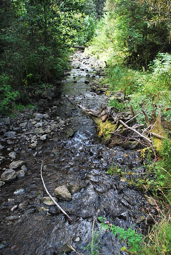
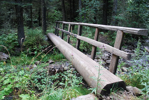
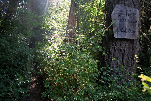
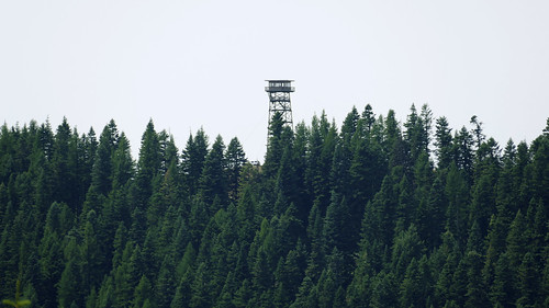
Fotos
Mapa de Umatilla Forks Campground, Oregón, EE. UU.
Buscar otro lugar
Lugares cercanos
Wildwood Loop, Weston, OR, EE. UU.
OR-, Weston, OR, EE. UU.
S Hill St, Weston, OR, EE. UU.
Weston, Oregón, EE. UU.
S Mill St, Milton-Freewater, OR, EE. UU.
Milton-Freewater, Oregón, EE. UU.
Blue Jay Loop, Walla Walla, WA, EE. UU.
E Currant St, Athena, OR, EE. UU.
Powerline Rd, Walla Walla, WA, EE. UU.
Meacham, OR, EE. UU.
Mill Creek Rd, Walla Walla, WA, EE. UU.
Scenic Loop Road, Scenic Loop Rd, Walla Walla, WA, EE. UU.
Scenic Loop Rd, Walla Walla, WA, EE. UU.
Merlot Dr, Walla Walla, WA, EE. UU.
Magnolia Dr, Walla Walla, WA, EE. UU.
Whiteley Rd, Walla Walla, WA, EE. UU.
W Langon Rd, Walla Walla, WA, EE. UU.
Greenbriar Drive, Walla Walla, WA, EE. UU.
McCorkle Ln, Walla Walla, WA, EE. UU.
90 Angelo Pl, Walla Walla, WA, EE. UU.
Búsquedas recientes
- Horas de salida y puesta de sol de Red Dog Mine, AK, USA
- Horas de salida y puesta de sol de Am Bahnhof, Am bhf, Borken, Germany
- Horas de salida y puesta de sol de 4th St E, Sonoma, CA, EE. UU.
- Horas de salida y puesta de sol de Oakland Ave, Williamsport, PA, EE. UU.
- Horas de salida y puesta de sol de Via Roma, Pieranica CR, Italia
- Horas de salida y puesta de sol de Torre del reloj, Grad, Dubrovnik (Ragusa), Croacia
- Horas de salida y puesta de sol de Trelew, Chubut, Argentina
- Horas de salida y puesta de sol de Hartfords Bluff Cir, Mt Pleasant, SC, EE. UU.
- Horas de salida y puesta de sol de Kita Ward, Kumamoto, Japón
- Horas de salida y puesta de sol de Pingtan Island, Pingtan County, Fuzhou, China


