Horas de salida y puesta de sol de The Glebe Ln, Charles City, VA, EE. UU.
Location: Estados Unidos > Virginia > Condado de Charles City > Charles City >
Zona horaria:
America/New_York
Hora local:
2025-06-14 14:52:55
Longitud:
-77.0561346
Latitud:
37.3458739
Salida de sol de hoy:
05:47:03 AM
Puesta de sol de hoy:
08:30:42 PM
La duración del día hoy:
14h 43m 39s
Salida de sol de mañana:
05:47:08 AM
Puesta de sol de mañana:
08:31:03 PM
La duración del día mañana:
14h 43m 55s
Mostrar todas las fechas
| Fecha | Salida de sol | Puesta de sol | Duración del día |
|---|---|---|---|
| 01/01/2025 | 07:22:31 AM | 05:02:09 PM | 9h 39m 38s |
| 02/01/2025 | 07:22:37 AM | 05:02:58 PM | 9h 40m 21s |
| 03/01/2025 | 07:22:41 AM | 05:03:49 PM | 9h 41m 8s |
| 04/01/2025 | 07:22:43 AM | 05:04:40 PM | 9h 41m 57s |
| 05/01/2025 | 07:22:43 AM | 05:05:33 PM | 9h 42m 50s |
| 06/01/2025 | 07:22:40 AM | 05:06:28 PM | 9h 43m 48s |
| 07/01/2025 | 07:22:36 AM | 05:07:23 PM | 9h 44m 47s |
| 08/01/2025 | 07:22:29 AM | 05:08:19 PM | 9h 45m 50s |
| 09/01/2025 | 07:22:21 AM | 05:09:16 PM | 9h 46m 55s |
| 10/01/2025 | 07:22:11 AM | 05:10:14 PM | 9h 48m 3s |
| 11/01/2025 | 07:21:58 AM | 05:11:13 PM | 9h 49m 15s |
| 12/01/2025 | 07:21:43 AM | 05:12:12 PM | 9h 50m 29s |
| 13/01/2025 | 07:21:27 AM | 05:13:13 PM | 9h 51m 46s |
| 14/01/2025 | 07:21:08 AM | 05:14:14 PM | 9h 53m 6s |
| 15/01/2025 | 07:20:48 AM | 05:15:16 PM | 9h 54m 28s |
| 16/01/2025 | 07:20:25 AM | 05:16:18 PM | 9h 55m 53s |
| 17/01/2025 | 07:20:00 AM | 05:17:21 PM | 9h 57m 21s |
| 18/01/2025 | 07:19:34 AM | 05:18:24 PM | 9h 58m 50s |
| 19/01/2025 | 07:19:06 AM | 05:19:28 PM | 10h 0m 22s |
| 20/01/2025 | 07:18:35 AM | 05:20:32 PM | 10h 1m 57s |
| 21/01/2025 | 07:18:03 AM | 05:21:37 PM | 10h 3m 34s |
| 22/01/2025 | 07:17:29 AM | 05:22:41 PM | 10h 5m 12s |
| 23/01/2025 | 07:16:53 AM | 05:23:47 PM | 10h 6m 54s |
| 24/01/2025 | 07:16:15 AM | 05:24:52 PM | 10h 8m 37s |
| 25/01/2025 | 07:15:36 AM | 05:25:58 PM | 10h 10m 22s |
| 26/01/2025 | 07:14:54 AM | 05:27:03 PM | 10h 12m 9s |
| 27/01/2025 | 07:14:11 AM | 05:28:09 PM | 10h 13m 58s |
| 28/01/2025 | 07:13:26 AM | 05:29:15 PM | 10h 15m 49s |
| 29/01/2025 | 07:12:40 AM | 05:30:21 PM | 10h 17m 41s |
| 30/01/2025 | 07:11:52 AM | 05:31:27 PM | 10h 19m 35s |
| 31/01/2025 | 07:11:02 AM | 05:32:33 PM | 10h 21m 31s |
| 01/02/2025 | 07:10:10 AM | 05:33:39 PM | 10h 23m 29s |
| 02/02/2025 | 07:09:18 AM | 05:34:45 PM | 10h 25m 27s |
| 03/02/2025 | 07:08:23 AM | 05:35:51 PM | 10h 27m 28s |
| 04/02/2025 | 07:07:27 AM | 05:36:57 PM | 10h 29m 30s |
| 05/02/2025 | 07:06:30 AM | 05:38:03 PM | 10h 31m 33s |
| 06/02/2025 | 07:05:31 AM | 05:39:08 PM | 10h 33m 37s |
| 07/02/2025 | 07:04:30 AM | 05:40:14 PM | 10h 35m 44s |
| 08/02/2025 | 07:03:29 AM | 05:41:19 PM | 10h 37m 50s |
| 09/02/2025 | 07:02:26 AM | 05:42:24 PM | 10h 39m 58s |
| 10/02/2025 | 07:01:21 AM | 05:43:28 PM | 10h 42m 7s |
| 11/02/2025 | 07:00:16 AM | 05:44:33 PM | 10h 44m 17s |
| 12/02/2025 | 06:59:09 AM | 05:45:37 PM | 10h 46m 28s |
| 13/02/2025 | 06:58:01 AM | 05:46:41 PM | 10h 48m 40s |
| 14/02/2025 | 06:56:51 AM | 05:47:45 PM | 10h 50m 54s |
| 15/02/2025 | 06:55:41 AM | 05:48:48 PM | 10h 53m 7s |
| 16/02/2025 | 06:54:29 AM | 05:49:51 PM | 10h 55m 22s |
| 17/02/2025 | 06:53:17 AM | 05:50:54 PM | 10h 57m 37s |
| 18/02/2025 | 06:52:03 AM | 05:51:56 PM | 10h 59m 53s |
| 19/02/2025 | 06:50:48 AM | 05:52:58 PM | 11h 2m 10s |
| 20/02/2025 | 06:49:33 AM | 05:54:00 PM | 11h 4m 27s |
| 21/02/2025 | 06:48:16 AM | 05:55:02 PM | 11h 6m 46s |
| 22/02/2025 | 06:46:58 AM | 05:56:03 PM | 11h 9m 5s |
| 23/02/2025 | 06:45:40 AM | 05:57:04 PM | 11h 11m 24s |
| 24/02/2025 | 06:44:21 AM | 05:58:04 PM | 11h 13m 43s |
| 25/02/2025 | 06:43:01 AM | 05:59:05 PM | 11h 16m 4s |
| 26/02/2025 | 06:41:40 AM | 06:00:04 PM | 11h 18m 24s |
| 27/02/2025 | 06:40:18 AM | 06:01:04 PM | 11h 20m 46s |
| 28/02/2025 | 06:38:56 AM | 06:02:03 PM | 11h 23m 7s |
| 01/03/2025 | 06:37:33 AM | 06:03:02 PM | 11h 25m 29s |
| 02/03/2025 | 06:36:09 AM | 06:04:01 PM | 11h 27m 52s |
| 03/03/2025 | 06:34:45 AM | 06:04:59 PM | 11h 30m 14s |
| 04/03/2025 | 06:33:20 AM | 06:05:57 PM | 11h 32m 37s |
| 05/03/2025 | 06:31:54 AM | 06:06:55 PM | 11h 35m 1s |
| 06/03/2025 | 06:30:28 AM | 06:07:53 PM | 11h 37m 25s |
| 07/03/2025 | 06:29:02 AM | 06:08:50 PM | 11h 39m 48s |
| 08/03/2025 | 06:27:35 AM | 06:09:47 PM | 11h 42m 12s |
| 09/03/2025 | 07:26:11 AM | 07:10:41 PM | 11h 44m 30s |
| 10/03/2025 | 07:24:43 AM | 07:11:38 PM | 11h 46m 55s |
| 11/03/2025 | 07:23:15 AM | 07:12:34 PM | 11h 49m 19s |
| 12/03/2025 | 07:21:47 AM | 07:13:30 PM | 11h 51m 43s |
| 13/03/2025 | 07:20:18 AM | 07:14:26 PM | 11h 54m 8s |
| 14/03/2025 | 07:18:49 AM | 07:15:21 PM | 11h 56m 32s |
| 15/03/2025 | 07:17:19 AM | 07:16:17 PM | 11h 58m 58s |
| 16/03/2025 | 07:15:50 AM | 07:17:12 PM | 12h 1m 22s |
| 17/03/2025 | 07:14:20 AM | 07:18:07 PM | 12h 3m 47s |
| 18/03/2025 | 07:12:50 AM | 07:19:02 PM | 12h 6m 12s |
| 19/03/2025 | 07:11:20 AM | 07:19:56 PM | 12h 8m 36s |
| 20/03/2025 | 07:09:50 AM | 07:20:51 PM | 12h 11m 1s |
| 21/03/2025 | 07:08:20 AM | 07:21:45 PM | 12h 13m 25s |
| 22/03/2025 | 07:06:49 AM | 07:22:40 PM | 12h 15m 51s |
| 23/03/2025 | 07:05:19 AM | 07:23:34 PM | 12h 18m 15s |
| 24/03/2025 | 07:03:49 AM | 07:24:28 PM | 12h 20m 39s |
| 25/03/2025 | 07:02:19 AM | 07:25:22 PM | 12h 23m 3s |
| 26/03/2025 | 07:00:48 AM | 07:26:16 PM | 12h 25m 28s |
| 27/03/2025 | 06:59:18 AM | 07:27:10 PM | 12h 27m 52s |
| 28/03/2025 | 06:57:49 AM | 07:28:03 PM | 12h 30m 14s |
| 29/03/2025 | 06:56:19 AM | 07:28:57 PM | 12h 32m 38s |
| 30/03/2025 | 06:54:49 AM | 07:29:51 PM | 12h 35m 2s |
| 31/03/2025 | 06:53:20 AM | 07:30:44 PM | 12h 37m 24s |
| 01/04/2025 | 06:51:51 AM | 07:31:38 PM | 12h 39m 47s |
| 02/04/2025 | 06:50:22 AM | 07:32:32 PM | 12h 42m 10s |
| 03/04/2025 | 06:48:54 AM | 07:33:25 PM | 12h 44m 31s |
| 04/04/2025 | 06:47:26 AM | 07:34:19 PM | 12h 46m 53s |
| 05/04/2025 | 06:45:58 AM | 07:35:13 PM | 12h 49m 15s |
| 06/04/2025 | 06:44:31 AM | 07:36:06 PM | 12h 51m 35s |
| 07/04/2025 | 06:43:04 AM | 07:37:00 PM | 12h 53m 56s |
| 08/04/2025 | 06:41:37 AM | 07:37:54 PM | 12h 56m 17s |
| 09/04/2025 | 06:40:11 AM | 07:38:47 PM | 12h 58m 36s |
| 10/04/2025 | 06:38:46 AM | 07:39:41 PM | 13h 0m 55s |
| 11/04/2025 | 06:37:21 AM | 07:40:35 PM | 13h 3m 14s |
| 12/04/2025 | 06:35:57 AM | 07:41:29 PM | 13h 5m 32s |
| 13/04/2025 | 06:34:33 AM | 07:42:22 PM | 13h 7m 49s |
| 14/04/2025 | 06:33:10 AM | 07:43:16 PM | 13h 10m 6s |
| 15/04/2025 | 06:31:48 AM | 07:44:10 PM | 13h 12m 22s |
| 16/04/2025 | 06:30:26 AM | 07:45:04 PM | 13h 14m 38s |
| 17/04/2025 | 06:29:05 AM | 07:45:58 PM | 13h 16m 53s |
| 18/04/2025 | 06:27:45 AM | 07:46:52 PM | 13h 19m 7s |
| 19/04/2025 | 06:26:26 AM | 07:47:47 PM | 13h 21m 21s |
| 20/04/2025 | 06:25:07 AM | 07:48:41 PM | 13h 23m 34s |
| 21/04/2025 | 06:23:50 AM | 07:49:35 PM | 13h 25m 45s |
| 22/04/2025 | 06:22:33 AM | 07:50:29 PM | 13h 27m 56s |
| 23/04/2025 | 06:21:17 AM | 07:51:23 PM | 13h 30m 6s |
| 24/04/2025 | 06:20:02 AM | 07:52:18 PM | 13h 32m 16s |
| 25/04/2025 | 06:18:48 AM | 07:53:12 PM | 13h 34m 24s |
| 26/04/2025 | 06:17:35 AM | 07:54:06 PM | 13h 36m 31s |
| 27/04/2025 | 06:16:23 AM | 07:55:00 PM | 13h 38m 37s |
| 28/04/2025 | 06:15:12 AM | 07:55:55 PM | 13h 40m 43s |
| 29/04/2025 | 06:14:02 AM | 07:56:49 PM | 13h 42m 47s |
| 30/04/2025 | 06:12:54 AM | 07:57:43 PM | 13h 44m 49s |
| 01/05/2025 | 06:11:46 AM | 07:58:37 PM | 13h 46m 51s |
| 02/05/2025 | 06:10:40 AM | 07:59:31 PM | 13h 48m 51s |
| 03/05/2025 | 06:09:35 AM | 08:00:25 PM | 13h 50m 50s |
| 04/05/2025 | 06:08:31 AM | 08:01:19 PM | 13h 52m 48s |
| 05/05/2025 | 06:07:28 AM | 08:02:12 PM | 13h 54m 44s |
| 06/05/2025 | 06:06:27 AM | 08:03:06 PM | 13h 56m 39s |
| 07/05/2025 | 06:05:27 AM | 08:03:59 PM | 13h 58m 32s |
| 08/05/2025 | 06:04:28 AM | 08:04:52 PM | 14h 0m 24s |
| 09/05/2025 | 06:03:31 AM | 08:05:45 PM | 14h 2m 14s |
| 10/05/2025 | 06:02:35 AM | 08:06:37 PM | 14h 4m 2s |
| 11/05/2025 | 06:01:40 AM | 08:07:30 PM | 14h 5m 50s |
| 12/05/2025 | 06:00:47 AM | 08:08:22 PM | 14h 7m 35s |
| 13/05/2025 | 05:59:55 AM | 08:09:13 PM | 14h 9m 18s |
| 14/05/2025 | 05:59:05 AM | 08:10:05 PM | 14h 11m 0s |
| 15/05/2025 | 05:58:17 AM | 08:10:56 PM | 14h 12m 39s |
| 16/05/2025 | 05:57:30 AM | 08:11:46 PM | 14h 14m 16s |
| 17/05/2025 | 05:56:44 AM | 08:12:36 PM | 14h 15m 52s |
| 18/05/2025 | 05:56:00 AM | 08:13:26 PM | 14h 17m 26s |
| 19/05/2025 | 05:55:18 AM | 08:14:15 PM | 14h 18m 57s |
| 20/05/2025 | 05:54:37 AM | 08:15:04 PM | 14h 20m 27s |
| 21/05/2025 | 05:53:58 AM | 08:15:52 PM | 14h 21m 54s |
| 22/05/2025 | 05:53:21 AM | 08:16:39 PM | 14h 23m 18s |
| 23/05/2025 | 05:52:45 AM | 08:17:26 PM | 14h 24m 41s |
| 24/05/2025 | 05:52:11 AM | 08:18:12 PM | 14h 26m 1s |
| 25/05/2025 | 05:51:38 AM | 08:18:57 PM | 14h 27m 19s |
| 26/05/2025 | 05:51:08 AM | 08:19:41 PM | 14h 28m 33s |
| 27/05/2025 | 05:50:39 AM | 08:20:25 PM | 14h 29m 46s |
| 28/05/2025 | 05:50:12 AM | 08:21:08 PM | 14h 30m 56s |
| 29/05/2025 | 05:49:46 AM | 08:21:50 PM | 14h 32m 4s |
| 30/05/2025 | 05:49:23 AM | 08:22:31 PM | 14h 33m 8s |
| 31/05/2025 | 05:49:01 AM | 08:23:11 PM | 14h 34m 10s |
| 01/06/2025 | 05:48:41 AM | 08:23:50 PM | 14h 35m 9s |
| 02/06/2025 | 05:48:22 AM | 08:24:28 PM | 14h 36m 6s |
| 03/06/2025 | 05:48:06 AM | 08:25:05 PM | 14h 36m 59s |
| 04/06/2025 | 05:47:51 AM | 08:25:41 PM | 14h 37m 50s |
| 05/06/2025 | 05:47:38 AM | 08:26:16 PM | 14h 38m 38s |
| 06/06/2025 | 05:47:27 AM | 08:26:50 PM | 14h 39m 23s |
| 07/06/2025 | 05:47:17 AM | 08:27:22 PM | 14h 40m 5s |
| 08/06/2025 | 05:47:10 AM | 08:27:53 PM | 14h 40m 43s |
| 09/06/2025 | 05:47:04 AM | 08:28:23 PM | 14h 41m 19s |
| 10/06/2025 | 05:47:00 AM | 08:28:51 PM | 14h 41m 51s |
| 11/06/2025 | 05:46:57 AM | 08:29:19 PM | 14h 42m 22s |
| 12/06/2025 | 05:46:57 AM | 08:29:44 PM | 14h 42m 47s |
| 13/06/2025 | 05:46:58 AM | 08:30:09 PM | 14h 43m 11s |
| 14/06/2025 | 05:47:01 AM | 08:30:31 PM | 14h 43m 30s |
| 15/06/2025 | 05:47:05 AM | 08:30:53 PM | 14h 43m 48s |
| 16/06/2025 | 05:47:11 AM | 08:31:12 PM | 14h 44m 1s |
| 17/06/2025 | 05:47:19 AM | 08:31:31 PM | 14h 44m 12s |
| 18/06/2025 | 05:47:29 AM | 08:31:47 PM | 14h 44m 18s |
| 19/06/2025 | 05:47:40 AM | 08:32:02 PM | 14h 44m 22s |
| 20/06/2025 | 05:47:52 AM | 08:32:16 PM | 14h 44m 24s |
| 21/06/2025 | 05:48:07 AM | 08:32:28 PM | 14h 44m 21s |
| 22/06/2025 | 05:48:23 AM | 08:32:38 PM | 14h 44m 15s |
| 23/06/2025 | 05:48:40 AM | 08:32:46 PM | 14h 44m 6s |
| 24/06/2025 | 05:48:59 AM | 08:32:53 PM | 14h 43m 54s |
| 25/06/2025 | 05:49:19 AM | 08:32:58 PM | 14h 43m 39s |
| 26/06/2025 | 05:49:41 AM | 08:33:01 PM | 14h 43m 20s |
| 27/06/2025 | 05:50:04 AM | 08:33:02 PM | 14h 42m 58s |
| 28/06/2025 | 05:50:29 AM | 08:33:02 PM | 14h 42m 33s |
| 29/06/2025 | 05:50:55 AM | 08:33:00 PM | 14h 42m 5s |
| 30/06/2025 | 05:51:22 AM | 08:32:56 PM | 14h 41m 34s |
| 01/07/2025 | 05:51:50 AM | 08:32:50 PM | 14h 41m 0s |
| 02/07/2025 | 05:52:20 AM | 08:32:43 PM | 14h 40m 23s |
| 03/07/2025 | 05:52:51 AM | 08:32:33 PM | 14h 39m 42s |
| 04/07/2025 | 05:53:23 AM | 08:32:22 PM | 14h 38m 59s |
| 05/07/2025 | 05:53:56 AM | 08:32:09 PM | 14h 38m 13s |
| 06/07/2025 | 05:54:30 AM | 08:31:54 PM | 14h 37m 24s |
| 07/07/2025 | 05:55:06 AM | 08:31:38 PM | 14h 36m 32s |
| 08/07/2025 | 05:55:42 AM | 08:31:19 PM | 14h 35m 37s |
| 09/07/2025 | 05:56:19 AM | 08:30:59 PM | 14h 34m 40s |
| 10/07/2025 | 05:56:58 AM | 08:30:37 PM | 14h 33m 39s |
| 11/07/2025 | 05:57:37 AM | 08:30:13 PM | 14h 32m 36s |
| 12/07/2025 | 05:58:17 AM | 08:29:47 PM | 14h 31m 30s |
| 13/07/2025 | 05:58:58 AM | 08:29:20 PM | 14h 30m 22s |
| 14/07/2025 | 05:59:39 AM | 08:28:50 PM | 14h 29m 11s |
| 15/07/2025 | 06:00:22 AM | 08:28:19 PM | 14h 27m 57s |
| 16/07/2025 | 06:01:05 AM | 08:27:47 PM | 14h 26m 42s |
| 17/07/2025 | 06:01:48 AM | 08:27:12 PM | 14h 25m 24s |
| 18/07/2025 | 06:02:33 AM | 08:26:36 PM | 14h 24m 3s |
| 19/07/2025 | 06:03:18 AM | 08:25:58 PM | 14h 22m 40s |
| 20/07/2025 | 06:04:03 AM | 08:25:18 PM | 14h 21m 15s |
| 21/07/2025 | 06:04:49 AM | 08:24:37 PM | 14h 19m 48s |
| 22/07/2025 | 06:05:36 AM | 08:23:54 PM | 14h 18m 18s |
| 23/07/2025 | 06:06:23 AM | 08:23:09 PM | 14h 16m 46s |
| 24/07/2025 | 06:07:10 AM | 08:22:23 PM | 14h 15m 13s |
| 25/07/2025 | 06:07:58 AM | 08:21:35 PM | 14h 13m 37s |
| 26/07/2025 | 06:08:46 AM | 08:20:46 PM | 14h 12m 0s |
| 27/07/2025 | 06:09:35 AM | 08:19:55 PM | 14h 10m 20s |
| 28/07/2025 | 06:10:24 AM | 08:19:03 PM | 14h 8m 39s |
| 29/07/2025 | 06:11:13 AM | 08:18:09 PM | 14h 6m 56s |
| 30/07/2025 | 06:12:02 AM | 08:17:13 PM | 14h 5m 11s |
| 31/07/2025 | 06:12:52 AM | 08:16:17 PM | 14h 3m 25s |
| 01/08/2025 | 06:13:42 AM | 08:15:18 PM | 14h 1m 36s |
| 02/08/2025 | 06:14:32 AM | 08:14:19 PM | 13h 59m 47s |
| 03/08/2025 | 06:15:22 AM | 08:13:18 PM | 13h 57m 56s |
| 04/08/2025 | 06:16:12 AM | 08:12:15 PM | 13h 56m 3s |
| 05/08/2025 | 06:17:02 AM | 08:11:12 PM | 13h 54m 10s |
| 06/08/2025 | 06:17:53 AM | 08:10:07 PM | 13h 52m 14s |
| 07/08/2025 | 06:18:43 AM | 08:09:01 PM | 13h 50m 18s |
| 08/08/2025 | 06:19:34 AM | 08:07:53 PM | 13h 48m 19s |
| 09/08/2025 | 06:20:25 AM | 08:06:45 PM | 13h 46m 20s |
| 10/08/2025 | 06:21:15 AM | 08:05:35 PM | 13h 44m 20s |
| 11/08/2025 | 06:22:06 AM | 08:04:24 PM | 13h 42m 18s |
| 12/08/2025 | 06:22:57 AM | 08:03:12 PM | 13h 40m 15s |
| 13/08/2025 | 06:23:48 AM | 08:01:59 PM | 13h 38m 11s |
| 14/08/2025 | 06:24:38 AM | 08:00:45 PM | 13h 36m 7s |
| 15/08/2025 | 06:25:29 AM | 07:59:29 PM | 13h 34m 0s |
| 16/08/2025 | 06:26:19 AM | 07:58:13 PM | 13h 31m 54s |
| 17/08/2025 | 06:27:10 AM | 07:56:56 PM | 13h 29m 46s |
| 18/08/2025 | 06:28:00 AM | 07:55:38 PM | 13h 27m 38s |
| 19/08/2025 | 06:28:51 AM | 07:54:19 PM | 13h 25m 28s |
| 20/08/2025 | 06:29:41 AM | 07:52:59 PM | 13h 23m 18s |
| 21/08/2025 | 06:30:32 AM | 07:51:38 PM | 13h 21m 6s |
| 22/08/2025 | 06:31:22 AM | 07:50:17 PM | 13h 18m 55s |
| 23/08/2025 | 06:32:12 AM | 07:48:55 PM | 13h 16m 43s |
| 24/08/2025 | 06:33:02 AM | 07:47:31 PM | 13h 14m 29s |
| 25/08/2025 | 06:33:52 AM | 07:46:08 PM | 13h 12m 16s |
| 26/08/2025 | 06:34:42 AM | 07:44:43 PM | 13h 10m 1s |
| 27/08/2025 | 06:35:32 AM | 07:43:18 PM | 13h 7m 46s |
| 28/08/2025 | 06:36:22 AM | 07:41:52 PM | 13h 5m 30s |
| 29/08/2025 | 06:37:11 AM | 07:40:26 PM | 13h 3m 15s |
| 30/08/2025 | 06:38:01 AM | 07:38:59 PM | 13h 0m 58s |
| 31/08/2025 | 06:38:51 AM | 07:37:31 PM | 12h 58m 40s |
| 01/09/2025 | 06:39:40 AM | 07:36:03 PM | 12h 56m 23s |
| 02/09/2025 | 06:40:30 AM | 07:34:35 PM | 12h 54m 5s |
| 03/09/2025 | 06:41:19 AM | 07:33:05 PM | 12h 51m 46s |
| 04/09/2025 | 06:42:08 AM | 07:31:36 PM | 12h 49m 28s |
| 05/09/2025 | 06:42:58 AM | 07:30:06 PM | 12h 47m 8s |
| 06/09/2025 | 06:43:47 AM | 07:28:36 PM | 12h 44m 49s |
| 07/09/2025 | 06:44:36 AM | 07:27:05 PM | 12h 42m 29s |
| 08/09/2025 | 06:45:25 AM | 07:25:34 PM | 12h 40m 9s |
| 09/09/2025 | 06:46:15 AM | 07:24:03 PM | 12h 37m 48s |
| 10/09/2025 | 06:47:04 AM | 07:22:32 PM | 12h 35m 28s |
| 11/09/2025 | 06:47:53 AM | 07:21:00 PM | 12h 33m 7s |
| 12/09/2025 | 06:48:43 AM | 07:19:28 PM | 12h 30m 45s |
| 13/09/2025 | 06:49:32 AM | 07:17:56 PM | 12h 28m 24s |
| 14/09/2025 | 06:50:21 AM | 07:16:24 PM | 12h 26m 3s |
| 15/09/2025 | 06:51:11 AM | 07:14:51 PM | 12h 23m 40s |
| 16/09/2025 | 06:52:00 AM | 07:13:19 PM | 12h 21m 19s |
| 17/09/2025 | 06:52:50 AM | 07:11:46 PM | 12h 18m 56s |
| 18/09/2025 | 06:53:40 AM | 07:10:14 PM | 12h 16m 34s |
| 19/09/2025 | 06:54:30 AM | 07:08:41 PM | 12h 14m 11s |
| 20/09/2025 | 06:55:19 AM | 07:07:09 PM | 12h 11m 50s |
| 21/09/2025 | 06:56:09 AM | 07:05:36 PM | 12h 9m 27s |
| 22/09/2025 | 06:57:00 AM | 07:04:04 PM | 12h 7m 4s |
| 23/09/2025 | 06:57:50 AM | 07:02:32 PM | 12h 4m 42s |
| 24/09/2025 | 06:58:40 AM | 07:01:00 PM | 12h 2m 20s |
| 25/09/2025 | 06:59:31 AM | 06:59:28 PM | 11h 59m 57s |
| 26/09/2025 | 07:00:22 AM | 06:57:56 PM | 11h 57m 34s |
| 27/09/2025 | 07:01:13 AM | 06:56:25 PM | 11h 55m 12s |
| 28/09/2025 | 07:02:04 AM | 06:54:54 PM | 11h 52m 50s |
| 29/09/2025 | 07:02:56 AM | 06:53:23 PM | 11h 50m 27s |
| 30/09/2025 | 07:03:47 AM | 06:51:52 PM | 11h 48m 5s |
| 01/10/2025 | 07:04:39 AM | 06:50:22 PM | 11h 45m 43s |
| 02/10/2025 | 07:05:31 AM | 06:48:52 PM | 11h 43m 21s |
| 03/10/2025 | 07:06:24 AM | 06:47:23 PM | 11h 40m 59s |
| 04/10/2025 | 07:07:17 AM | 06:45:54 PM | 11h 38m 37s |
| 05/10/2025 | 07:08:10 AM | 06:44:25 PM | 11h 36m 15s |
| 06/10/2025 | 07:09:03 AM | 06:42:57 PM | 11h 33m 54s |
| 07/10/2025 | 07:09:56 AM | 06:41:30 PM | 11h 31m 34s |
| 08/10/2025 | 07:10:50 AM | 06:40:03 PM | 11h 29m 13s |
| 09/10/2025 | 07:11:44 AM | 06:38:36 PM | 11h 26m 52s |
| 10/10/2025 | 07:12:39 AM | 06:37:11 PM | 11h 24m 32s |
| 11/10/2025 | 07:13:34 AM | 06:35:46 PM | 11h 22m 12s |
| 12/10/2025 | 07:14:29 AM | 06:34:22 PM | 11h 19m 53s |
| 13/10/2025 | 07:15:24 AM | 06:32:58 PM | 11h 17m 34s |
| 14/10/2025 | 07:16:20 AM | 06:31:35 PM | 11h 15m 15s |
| 15/10/2025 | 07:17:16 AM | 06:30:13 PM | 11h 12m 57s |
| 16/10/2025 | 07:18:13 AM | 06:28:52 PM | 11h 10m 39s |
| 17/10/2025 | 07:19:10 AM | 06:27:32 PM | 11h 8m 22s |
| 18/10/2025 | 07:20:07 AM | 06:26:12 PM | 11h 6m 5s |
| 19/10/2025 | 07:21:04 AM | 06:24:54 PM | 11h 3m 50s |
| 20/10/2025 | 07:22:02 AM | 06:23:36 PM | 11h 1m 34s |
| 21/10/2025 | 07:23:00 AM | 06:22:19 PM | 10h 59m 19s |
| 22/10/2025 | 07:23:59 AM | 06:21:04 PM | 10h 57m 5s |
| 23/10/2025 | 07:24:58 AM | 06:19:49 PM | 10h 54m 51s |
| 24/10/2025 | 07:25:57 AM | 06:18:36 PM | 10h 52m 39s |
| 25/10/2025 | 07:26:57 AM | 06:17:23 PM | 10h 50m 26s |
| 26/10/2025 | 07:27:57 AM | 06:16:12 PM | 10h 48m 15s |
| 27/10/2025 | 07:28:57 AM | 06:15:02 PM | 10h 46m 5s |
| 28/10/2025 | 07:29:57 AM | 06:13:53 PM | 10h 43m 56s |
| 29/10/2025 | 07:30:58 AM | 06:12:46 PM | 10h 41m 48s |
| 30/10/2025 | 07:31:59 AM | 06:11:40 PM | 10h 39m 41s |
| 31/10/2025 | 07:33:01 AM | 06:10:35 PM | 10h 37m 34s |
| 01/11/2025 | 07:34:02 AM | 06:09:31 PM | 10h 35m 29s |
| 02/11/2025 | 06:35:07 AM | 05:08:26 PM | 10h 33m 19s |
| 03/11/2025 | 06:36:09 AM | 05:07:26 PM | 10h 31m 17s |
| 04/11/2025 | 06:37:11 AM | 05:06:26 PM | 10h 29m 15s |
| 05/11/2025 | 06:38:13 AM | 05:05:28 PM | 10h 27m 15s |
| 06/11/2025 | 06:39:16 AM | 05:04:32 PM | 10h 25m 16s |
| 07/11/2025 | 06:40:19 AM | 05:03:37 PM | 10h 23m 18s |
| 08/11/2025 | 06:41:22 AM | 05:02:44 PM | 10h 21m 22s |
| 09/11/2025 | 06:42:25 AM | 05:01:53 PM | 10h 19m 28s |
| 10/11/2025 | 06:43:28 AM | 05:01:03 PM | 10h 17m 35s |
| 11/11/2025 | 06:44:31 AM | 05:00:14 PM | 10h 15m 43s |
| 12/11/2025 | 06:45:34 AM | 04:59:28 PM | 10h 13m 54s |
| 13/11/2025 | 06:46:37 AM | 04:58:43 PM | 10h 12m 6s |
| 14/11/2025 | 06:47:40 AM | 04:58:00 PM | 10h 10m 20s |
| 15/11/2025 | 06:48:43 AM | 04:57:19 PM | 10h 8m 36s |
| 16/11/2025 | 06:49:46 AM | 04:56:39 PM | 10h 6m 53s |
| 17/11/2025 | 06:50:48 AM | 04:56:01 PM | 10h 5m 13s |
| 18/11/2025 | 06:51:51 AM | 04:55:26 PM | 10h 3m 35s |
| 19/11/2025 | 06:52:53 AM | 04:54:52 PM | 10h 1m 59s |
| 20/11/2025 | 06:53:54 AM | 04:54:20 PM | 10h 0m 26s |
| 21/11/2025 | 06:54:56 AM | 04:53:50 PM | 9h 58m 54s |
| 22/11/2025 | 06:55:57 AM | 04:53:21 PM | 9h 57m 24s |
| 23/11/2025 | 06:56:58 AM | 04:52:55 PM | 9h 55m 57s |
| 24/11/2025 | 06:57:58 AM | 04:52:31 PM | 9h 54m 33s |
| 25/11/2025 | 06:58:58 AM | 04:52:09 PM | 9h 53m 11s |
| 26/11/2025 | 06:59:57 AM | 04:51:49 PM | 9h 51m 52s |
| 27/11/2025 | 07:00:56 AM | 04:51:31 PM | 9h 50m 35s |
| 28/11/2025 | 07:01:53 AM | 04:51:15 PM | 9h 49m 22s |
| 29/11/2025 | 07:02:51 AM | 04:51:01 PM | 9h 48m 10s |
| 30/11/2025 | 07:03:47 AM | 04:50:49 PM | 9h 47m 2s |
| 01/12/2025 | 07:04:43 AM | 04:50:39 PM | 9h 45m 56s |
| 02/12/2025 | 07:05:38 AM | 04:50:31 PM | 9h 44m 53s |
| 03/12/2025 | 07:06:32 AM | 04:50:25 PM | 9h 43m 53s |
| 04/12/2025 | 07:07:24 AM | 04:50:22 PM | 9h 42m 58s |
| 05/12/2025 | 07:08:16 AM | 04:50:20 PM | 9h 42m 4s |
| 06/12/2025 | 07:09:07 AM | 04:50:21 PM | 9h 41m 14s |
| 07/12/2025 | 07:09:57 AM | 04:50:24 PM | 9h 40m 27s |
| 08/12/2025 | 07:10:46 AM | 04:50:28 PM | 9h 39m 42s |
| 09/12/2025 | 07:11:33 AM | 04:50:35 PM | 9h 39m 2s |
| 10/12/2025 | 07:12:19 AM | 04:50:44 PM | 9h 38m 25s |
| 11/12/2025 | 07:13:04 AM | 04:50:55 PM | 9h 37m 51s |
| 12/12/2025 | 07:13:47 AM | 04:51:08 PM | 9h 37m 21s |
| 13/12/2025 | 07:14:29 AM | 04:51:23 PM | 9h 36m 54s |
| 14/12/2025 | 07:15:10 AM | 04:51:40 PM | 9h 36m 30s |
| 15/12/2025 | 07:15:49 AM | 04:51:59 PM | 9h 36m 10s |
| 16/12/2025 | 07:16:27 AM | 04:52:20 PM | 9h 35m 53s |
| 17/12/2025 | 07:17:03 AM | 04:52:43 PM | 9h 35m 40s |
| 18/12/2025 | 07:17:37 AM | 04:53:08 PM | 9h 35m 31s |
| 19/12/2025 | 07:18:10 AM | 04:53:34 PM | 9h 35m 24s |
| 20/12/2025 | 07:18:41 AM | 04:54:03 PM | 9h 35m 22s |
| 21/12/2025 | 07:19:10 AM | 04:54:33 PM | 9h 35m 23s |
| 22/12/2025 | 07:19:38 AM | 04:55:06 PM | 9h 35m 28s |
| 23/12/2025 | 07:20:03 AM | 04:55:39 PM | 9h 35m 36s |
| 24/12/2025 | 07:20:27 AM | 04:56:15 PM | 9h 35m 48s |
| 25/12/2025 | 07:20:49 AM | 04:56:52 PM | 9h 36m 3s |
| 26/12/2025 | 07:21:10 AM | 04:57:31 PM | 9h 36m 21s |
| 27/12/2025 | 07:21:28 AM | 04:58:12 PM | 9h 36m 44s |
| 28/12/2025 | 07:21:44 AM | 04:58:54 PM | 9h 37m 10s |
| 29/12/2025 | 07:21:58 AM | 04:59:37 PM | 9h 37m 39s |
| 30/12/2025 | 07:22:11 AM | 05:00:22 PM | 9h 38m 11s |
| 31/12/2025 | 07:22:21 AM | 05:01:09 PM | 9h 38m 48s |
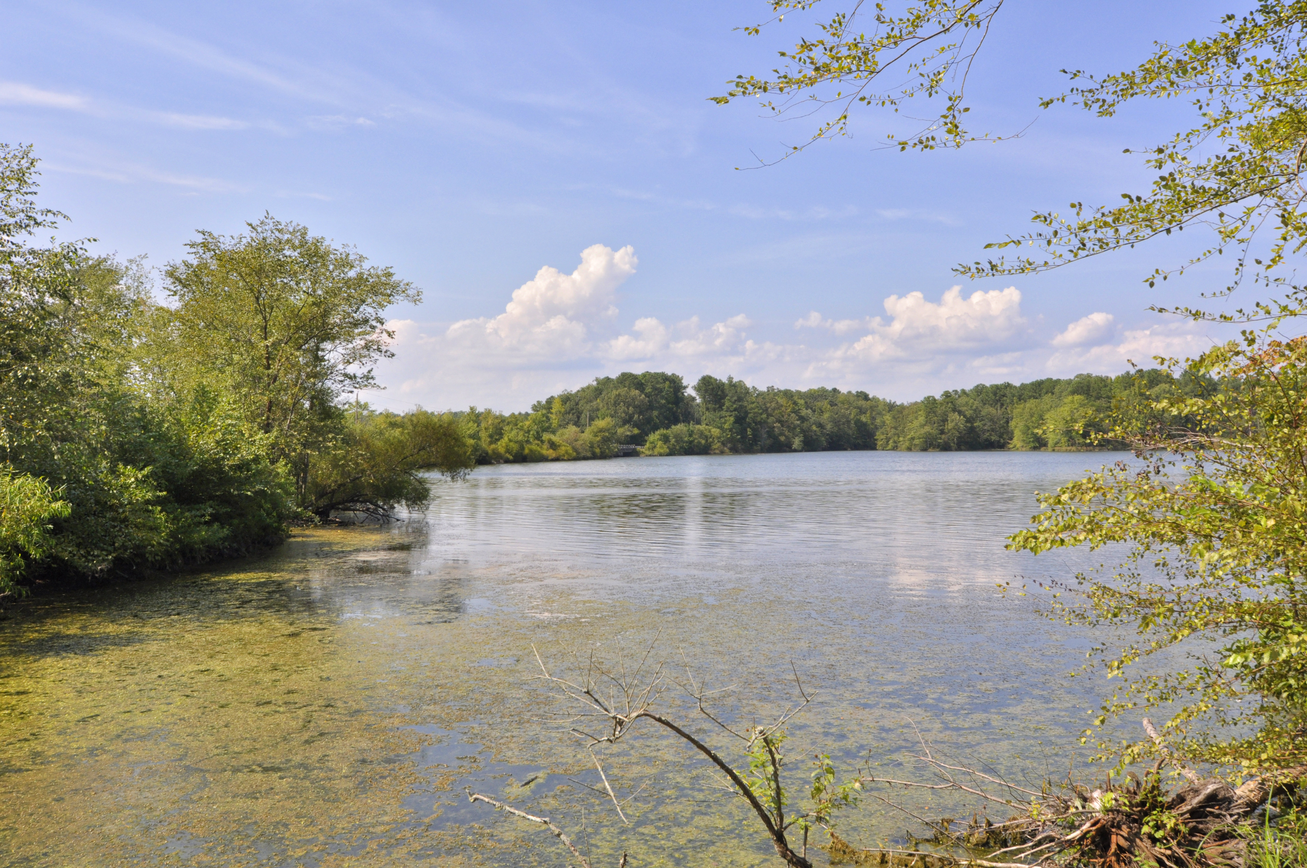
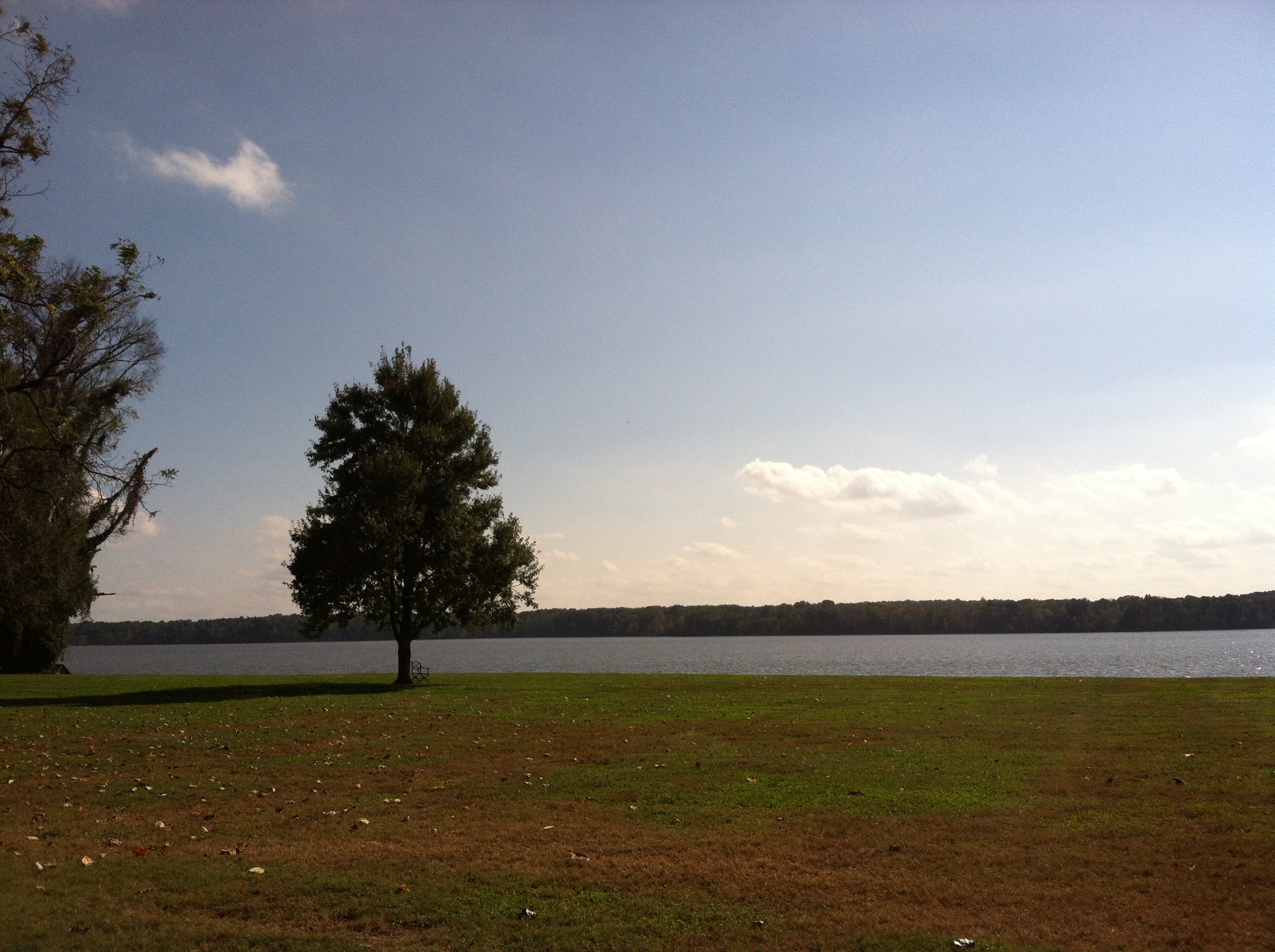
Fotos

SHIRLEY PLANTATION POND AMBER

Virginia: Near Harrison's Landing: Wilcox Landing

BLUE TAILS

Sunset on the James River at Westover

sunset after the storm

Ed Allen's Campground in Winter 11

Sunset in the country #sunset #sky #trees #rva

Chickahominy_Eagle

Glowing Fields of Grain

the view changes from where you are standing

side view

view of chimneys
water view
view of James River from Westover Plantation, Charles City County, VA

view of James River from Westover Plantation, Charles City County, VA
Mapa de The Glebe Ln, Charles City, VA, EE. UU.
Buscar otro lugar
Lugares cercanos
Charles City, Virginia, EE. UU.
The Glebe Ln, Charles City, VA, EE. UU.
Courthouse Rd, Providence Forge, VA, EE. UU.
Sherwood Forest, VA, EE. UU.
Sterling Heights Ln, Providence Forge, VA, EE. UU.
Sturgeon Point Rd, Providence Forge, VA, EE. UU.
2, VA, EE. UU.
Alpine Rd, Providence Forge, VA, EE. UU.
Providence Forge, VA, EE. UU.
Boulevard Rd, Providence Forge, VA, EE. UU.
Condado de Charles City, Virginia, EE. UU.
3, VA, EE. UU.
Willow Bank Rd, Charles City, VA, EE. UU.
John Tyler Memorial Hwy, Charles City, VA, EE. UU.
Wilcox Neck Road, Wilcox Neck Rd, Charles City, VA, EE. UU.
4, VA, EE. UU.
Wilcox Neck Rd, Charles City, VA, EE. UU.
Baileys Ridge Dr, Providence Forge, VA, EE. UU.
Mount Airy, VA, EE. UU.
Wilcox Neck Rd, Charles City, VA, EE. UU.
Búsquedas recientes
- Horas de salida y puesta de sol de Red Dog Mine, AK, USA
- Horas de salida y puesta de sol de Am Bahnhof, Am bhf, Borken, Germany
- Horas de salida y puesta de sol de 4th St E, Sonoma, CA, EE. UU.
- Horas de salida y puesta de sol de Oakland Ave, Williamsport, PA, EE. UU.
- Horas de salida y puesta de sol de Via Roma, Pieranica CR, Italia
- Horas de salida y puesta de sol de Torre del reloj, Grad, Dubrovnik (Ragusa), Croacia
- Horas de salida y puesta de sol de Trelew, Chubut, Argentina
- Horas de salida y puesta de sol de Hartfords Bluff Cir, Mt Pleasant, SC, EE. UU.
- Horas de salida y puesta de sol de Kita Ward, Kumamoto, Japón
- Horas de salida y puesta de sol de Pingtan Island, Pingtan County, Fuzhou, China