Horas de salida y puesta de sol de Strong Winds Peak, Clearwater County, AB T0M, Canadá
Location: Canadá > Alberta > Division No. 9 >
Zona horaria:
America/Edmonton
Hora local:
2025-06-18 00:13:33
Longitud:
-116.7713888
Latitud:
52.2661111
Salida de sol de hoy:
05:24:54 AM
Puesta de sol de hoy:
10:11:55 PM
La duración del día hoy:
16h 47m 1s
Salida de sol de mañana:
05:25:02 AM
Puesta de sol de mañana:
10:12:13 PM
La duración del día mañana:
16h 47m 11s
Mostrar todas las fechas
| Fecha | Salida de sol | Puesta de sol | Duración del día |
|---|---|---|---|
| 01/01/2025 | 08:56:07 AM | 04:46:27 PM | 7h 50m 20s |
| 02/01/2025 | 08:55:53 AM | 04:47:36 PM | 7h 51m 43s |
| 03/01/2025 | 08:55:35 AM | 04:48:48 PM | 7h 53m 13s |
| 04/01/2025 | 08:55:14 AM | 04:50:03 PM | 7h 54m 49s |
| 05/01/2025 | 08:54:50 AM | 04:51:20 PM | 7h 56m 30s |
| 06/01/2025 | 08:54:22 AM | 04:52:39 PM | 7h 58m 17s |
| 07/01/2025 | 08:53:51 AM | 04:54:01 PM | 8h 0m 10s |
| 08/01/2025 | 08:53:16 AM | 04:55:25 PM | 8h 2m 9s |
| 09/01/2025 | 08:52:39 AM | 04:56:51 PM | 8h 4m 12s |
| 10/01/2025 | 08:51:58 AM | 04:58:19 PM | 8h 6m 21s |
| 11/01/2025 | 08:51:14 AM | 04:59:49 PM | 8h 8m 35s |
| 12/01/2025 | 08:50:27 AM | 05:01:21 PM | 8h 10m 54s |
| 13/01/2025 | 08:49:37 AM | 05:02:55 PM | 8h 13m 18s |
| 14/01/2025 | 08:48:43 AM | 05:04:30 PM | 8h 15m 47s |
| 15/01/2025 | 08:47:47 AM | 05:06:07 PM | 8h 18m 20s |
| 16/01/2025 | 08:46:48 AM | 05:07:45 PM | 8h 20m 57s |
| 17/01/2025 | 08:45:47 AM | 05:09:25 PM | 8h 23m 38s |
| 18/01/2025 | 08:44:42 AM | 05:11:06 PM | 8h 26m 24s |
| 19/01/2025 | 08:43:35 AM | 05:12:49 PM | 8h 29m 14s |
| 20/01/2025 | 08:42:25 AM | 05:14:32 PM | 8h 32m 7s |
| 21/01/2025 | 08:41:12 AM | 05:16:17 PM | 8h 35m 5s |
| 22/01/2025 | 08:39:57 AM | 05:18:03 PM | 8h 38m 6s |
| 23/01/2025 | 08:38:39 AM | 05:19:49 PM | 8h 41m 10s |
| 24/01/2025 | 08:37:19 AM | 05:21:37 PM | 8h 44m 18s |
| 25/01/2025 | 08:35:56 AM | 05:23:25 PM | 8h 47m 29s |
| 26/01/2025 | 08:34:31 AM | 05:25:14 PM | 8h 50m 43s |
| 27/01/2025 | 08:33:04 AM | 05:27:04 PM | 8h 54m 0s |
| 28/01/2025 | 08:31:35 AM | 05:28:54 PM | 8h 57m 19s |
| 29/01/2025 | 08:30:03 AM | 05:30:45 PM | 9h 0m 42s |
| 30/01/2025 | 08:28:30 AM | 05:32:36 PM | 9h 4m 6s |
| 31/01/2025 | 08:26:54 AM | 05:34:27 PM | 9h 7m 33s |
| 01/02/2025 | 08:25:17 AM | 05:36:19 PM | 9h 11m 2s |
| 02/02/2025 | 08:23:37 AM | 05:38:12 PM | 9h 14m 35s |
| 03/02/2025 | 08:21:56 AM | 05:40:04 PM | 9h 18m 8s |
| 04/02/2025 | 08:20:12 AM | 05:41:57 PM | 9h 21m 45s |
| 05/02/2025 | 08:18:27 AM | 05:43:50 PM | 9h 25m 23s |
| 06/02/2025 | 08:16:41 AM | 05:45:43 PM | 9h 29m 2s |
| 07/02/2025 | 08:14:52 AM | 05:47:36 PM | 9h 32m 44s |
| 08/02/2025 | 08:13:02 AM | 05:49:29 PM | 9h 36m 27s |
| 09/02/2025 | 08:11:11 AM | 05:51:22 PM | 9h 40m 11s |
| 10/02/2025 | 08:09:18 AM | 05:53:15 PM | 9h 43m 57s |
| 11/02/2025 | 08:07:23 AM | 05:55:08 PM | 9h 47m 45s |
| 12/02/2025 | 08:05:27 AM | 05:57:01 PM | 9h 51m 34s |
| 13/02/2025 | 08:03:30 AM | 05:58:54 PM | 9h 55m 24s |
| 14/02/2025 | 08:01:31 AM | 06:00:47 PM | 9h 59m 16s |
| 15/02/2025 | 07:59:31 AM | 06:02:39 PM | 10h 3m 8s |
| 16/02/2025 | 07:57:30 AM | 06:04:32 PM | 10h 7m 2s |
| 17/02/2025 | 07:55:28 AM | 06:06:24 PM | 10h 10m 56s |
| 18/02/2025 | 07:53:24 AM | 06:08:16 PM | 10h 14m 52s |
| 19/02/2025 | 07:51:20 AM | 06:10:08 PM | 10h 18m 48s |
| 20/02/2025 | 07:49:14 AM | 06:11:59 PM | 10h 22m 45s |
| 21/02/2025 | 07:47:07 AM | 06:13:50 PM | 10h 26m 43s |
| 22/02/2025 | 07:45:00 AM | 06:15:41 PM | 10h 30m 41s |
| 23/02/2025 | 07:42:51 AM | 06:17:32 PM | 10h 34m 41s |
| 24/02/2025 | 07:40:42 AM | 06:19:23 PM | 10h 38m 41s |
| 25/02/2025 | 07:38:32 AM | 06:21:13 PM | 10h 42m 41s |
| 26/02/2025 | 07:36:21 AM | 06:23:03 PM | 10h 46m 42s |
| 27/02/2025 | 07:34:09 AM | 06:24:52 PM | 10h 50m 43s |
| 28/02/2025 | 07:31:56 AM | 06:26:42 PM | 10h 54m 46s |
| 01/03/2025 | 07:29:43 AM | 06:28:31 PM | 10h 58m 48s |
| 02/03/2025 | 07:27:29 AM | 06:30:20 PM | 11h 2m 51s |
| 03/03/2025 | 07:25:14 AM | 06:32:08 PM | 11h 6m 54s |
| 04/03/2025 | 07:22:59 AM | 06:33:56 PM | 11h 10m 57s |
| 05/03/2025 | 07:20:43 AM | 06:35:44 PM | 11h 15m 1s |
| 06/03/2025 | 07:18:27 AM | 06:37:32 PM | 11h 19m 5s |
| 07/03/2025 | 07:16:10 AM | 06:39:19 PM | 11h 23m 9s |
| 08/03/2025 | 07:13:53 AM | 06:41:06 PM | 11h 27m 13s |
| 09/03/2025 | 08:11:41 AM | 07:42:49 PM | 11h 31m 8s |
| 10/03/2025 | 08:09:23 AM | 07:44:35 PM | 11h 35m 12s |
| 11/03/2025 | 08:07:04 AM | 07:46:22 PM | 11h 39m 18s |
| 12/03/2025 | 08:04:45 AM | 07:48:08 PM | 11h 43m 23s |
| 13/03/2025 | 08:02:26 AM | 07:49:54 PM | 11h 47m 28s |
| 14/03/2025 | 08:00:07 AM | 07:51:40 PM | 11h 51m 33s |
| 15/03/2025 | 07:57:47 AM | 07:53:25 PM | 11h 55m 38s |
| 16/03/2025 | 07:55:27 AM | 07:55:11 PM | 11h 59m 44s |
| 17/03/2025 | 07:53:07 AM | 07:56:56 PM | 12h 3m 49s |
| 18/03/2025 | 07:50:47 AM | 07:58:41 PM | 12h 7m 54s |
| 19/03/2025 | 07:48:27 AM | 08:00:26 PM | 12h 11m 59s |
| 20/03/2025 | 07:46:06 AM | 08:02:11 PM | 12h 16m 5s |
| 21/03/2025 | 07:43:46 AM | 08:03:55 PM | 12h 20m 9s |
| 22/03/2025 | 07:41:26 AM | 08:05:40 PM | 12h 24m 14s |
| 23/03/2025 | 07:39:05 AM | 08:07:24 PM | 12h 28m 19s |
| 24/03/2025 | 07:36:45 AM | 08:09:08 PM | 12h 32m 23s |
| 25/03/2025 | 07:34:24 AM | 08:10:53 PM | 12h 36m 29s |
| 26/03/2025 | 07:32:04 AM | 08:12:37 PM | 12h 40m 33s |
| 27/03/2025 | 07:29:44 AM | 08:14:21 PM | 12h 44m 37s |
| 28/03/2025 | 07:27:24 AM | 08:16:05 PM | 12h 48m 41s |
| 29/03/2025 | 07:25:04 AM | 08:17:48 PM | 12h 52m 44s |
| 30/03/2025 | 07:22:44 AM | 08:19:32 PM | 12h 56m 48s |
| 31/03/2025 | 07:20:25 AM | 08:21:16 PM | 13h 0m 51s |
| 01/04/2025 | 07:18:06 AM | 08:23:00 PM | 13h 4m 54s |
| 02/04/2025 | 07:15:47 AM | 08:24:43 PM | 13h 8m 56s |
| 03/04/2025 | 07:13:29 AM | 08:26:27 PM | 13h 12m 58s |
| 04/04/2025 | 07:11:11 AM | 08:28:11 PM | 13h 17m 0s |
| 05/04/2025 | 07:08:53 AM | 08:29:54 PM | 13h 21m 1s |
| 06/04/2025 | 07:06:36 AM | 08:31:38 PM | 13h 25m 2s |
| 07/04/2025 | 07:04:19 AM | 08:33:22 PM | 13h 29m 3s |
| 08/04/2025 | 07:02:02 AM | 08:35:05 PM | 13h 33m 3s |
| 09/04/2025 | 06:59:47 AM | 08:36:49 PM | 13h 37m 2s |
| 10/04/2025 | 06:57:32 AM | 08:38:33 PM | 13h 41m 1s |
| 11/04/2025 | 06:55:17 AM | 08:40:16 PM | 13h 44m 59s |
| 12/04/2025 | 06:53:03 AM | 08:42:00 PM | 13h 48m 57s |
| 13/04/2025 | 06:50:50 AM | 08:43:44 PM | 13h 52m 54s |
| 14/04/2025 | 06:48:37 AM | 08:45:27 PM | 13h 56m 50s |
| 15/04/2025 | 06:46:25 AM | 08:47:11 PM | 14h 0m 46s |
| 16/04/2025 | 06:44:14 AM | 08:48:54 PM | 14h 4m 40s |
| 17/04/2025 | 06:42:04 AM | 08:50:38 PM | 14h 8m 34s |
| 18/04/2025 | 06:39:55 AM | 08:52:21 PM | 14h 12m 26s |
| 19/04/2025 | 06:37:46 AM | 08:54:05 PM | 14h 16m 19s |
| 20/04/2025 | 06:35:38 AM | 08:55:48 PM | 14h 20m 10s |
| 21/04/2025 | 06:33:32 AM | 08:57:32 PM | 14h 24m 0s |
| 22/04/2025 | 06:31:26 AM | 08:59:15 PM | 14h 27m 49s |
| 23/04/2025 | 06:29:22 AM | 09:00:58 PM | 14h 31m 36s |
| 24/04/2025 | 06:27:18 AM | 09:02:41 PM | 14h 35m 23s |
| 25/04/2025 | 06:25:16 AM | 09:04:24 PM | 14h 39m 8s |
| 26/04/2025 | 06:23:15 AM | 09:06:06 PM | 14h 42m 51s |
| 27/04/2025 | 06:21:15 AM | 09:07:49 PM | 14h 46m 34s |
| 28/04/2025 | 06:19:16 AM | 09:09:31 PM | 14h 50m 15s |
| 29/04/2025 | 06:17:19 AM | 09:11:13 PM | 14h 53m 54s |
| 30/04/2025 | 06:15:23 AM | 09:12:55 PM | 14h 57m 32s |
| 01/05/2025 | 06:13:28 AM | 09:14:36 PM | 15h 1m 8s |
| 02/05/2025 | 06:11:35 AM | 09:16:17 PM | 15h 4m 42s |
| 03/05/2025 | 06:09:43 AM | 09:17:58 PM | 15h 8m 15s |
| 04/05/2025 | 06:07:53 AM | 09:19:38 PM | 15h 11m 45s |
| 05/05/2025 | 06:06:04 AM | 09:21:18 PM | 15h 15m 14s |
| 06/05/2025 | 06:04:17 AM | 09:22:57 PM | 15h 18m 40s |
| 07/05/2025 | 06:02:32 AM | 09:24:36 PM | 15h 22m 4s |
| 08/05/2025 | 06:00:48 AM | 09:26:14 PM | 15h 25m 26s |
| 09/05/2025 | 05:59:07 AM | 09:27:51 PM | 15h 28m 44s |
| 10/05/2025 | 05:57:27 AM | 09:29:28 PM | 15h 32m 1s |
| 11/05/2025 | 05:55:49 AM | 09:31:04 PM | 15h 35m 15s |
| 12/05/2025 | 05:54:12 AM | 09:32:40 PM | 15h 38m 28s |
| 13/05/2025 | 05:52:38 AM | 09:34:14 PM | 15h 41m 36s |
| 14/05/2025 | 05:51:06 AM | 09:35:48 PM | 15h 44m 42s |
| 15/05/2025 | 05:49:36 AM | 09:37:20 PM | 15h 47m 44s |
| 16/05/2025 | 05:48:08 AM | 09:38:52 PM | 15h 50m 44s |
| 17/05/2025 | 05:46:43 AM | 09:40:22 PM | 15h 53m 39s |
| 18/05/2025 | 05:45:19 AM | 09:41:51 PM | 15h 56m 32s |
| 19/05/2025 | 05:43:58 AM | 09:43:20 PM | 15h 59m 22s |
| 20/05/2025 | 05:42:39 AM | 09:44:46 PM | 16h 2m 7s |
| 21/05/2025 | 05:41:23 AM | 09:46:12 PM | 16h 4m 49s |
| 22/05/2025 | 05:40:09 AM | 09:47:36 PM | 16h 7m 27s |
| 23/05/2025 | 05:38:58 AM | 09:48:58 PM | 16h 10m 0s |
| 24/05/2025 | 05:37:49 AM | 09:50:19 PM | 16h 12m 30s |
| 25/05/2025 | 05:36:43 AM | 09:51:39 PM | 16h 14m 56s |
| 26/05/2025 | 05:35:39 AM | 09:52:56 PM | 16h 17m 17s |
| 27/05/2025 | 05:34:38 AM | 09:54:12 PM | 16h 19m 34s |
| 28/05/2025 | 05:33:40 AM | 09:55:26 PM | 16h 21m 46s |
| 29/05/2025 | 05:32:45 AM | 09:56:38 PM | 16h 23m 53s |
| 30/05/2025 | 05:31:53 AM | 09:57:48 PM | 16h 25m 55s |
| 31/05/2025 | 05:31:03 AM | 09:58:56 PM | 16h 27m 53s |
| 01/06/2025 | 05:30:16 AM | 10:00:02 PM | 16h 29m 46s |
| 02/06/2025 | 05:29:33 AM | 10:01:05 PM | 16h 31m 32s |
| 03/06/2025 | 05:28:52 AM | 10:02:06 PM | 16h 33m 14s |
| 04/06/2025 | 05:28:15 AM | 10:03:05 PM | 16h 34m 50s |
| 05/06/2025 | 05:27:40 AM | 10:04:02 PM | 16h 36m 22s |
| 06/06/2025 | 05:27:09 AM | 10:04:56 PM | 16h 37m 47s |
| 07/06/2025 | 05:26:40 AM | 10:05:47 PM | 16h 39m 7s |
| 08/06/2025 | 05:26:15 AM | 10:06:36 PM | 16h 40m 21s |
| 09/06/2025 | 05:25:53 AM | 10:07:22 PM | 16h 41m 29s |
| 10/06/2025 | 05:25:34 AM | 10:08:05 PM | 16h 42m 31s |
| 11/06/2025 | 05:25:18 AM | 10:08:46 PM | 16h 43m 28s |
| 12/06/2025 | 05:25:06 AM | 10:09:23 PM | 16h 44m 17s |
| 13/06/2025 | 05:24:57 AM | 10:09:58 PM | 16h 45m 1s |
| 14/06/2025 | 05:24:51 AM | 10:10:30 PM | 16h 45m 39s |
| 15/06/2025 | 05:24:48 AM | 10:10:58 PM | 16h 46m 10s |
| 16/06/2025 | 05:24:48 AM | 10:11:24 PM | 16h 46m 36s |
| 17/06/2025 | 05:24:52 AM | 10:11:47 PM | 16h 46m 55s |
| 18/06/2025 | 05:24:58 AM | 10:12:06 PM | 16h 47m 8s |
| 19/06/2025 | 05:25:08 AM | 10:12:22 PM | 16h 47m 14s |
| 20/06/2025 | 05:25:21 AM | 10:12:36 PM | 16h 47m 15s |
| 21/06/2025 | 05:25:37 AM | 10:12:45 PM | 16h 47m 8s |
| 22/06/2025 | 05:25:56 AM | 10:12:52 PM | 16h 46m 56s |
| 23/06/2025 | 05:26:19 AM | 10:12:56 PM | 16h 46m 37s |
| 24/06/2025 | 05:26:44 AM | 10:12:56 PM | 16h 46m 12s |
| 25/06/2025 | 05:27:12 AM | 10:12:53 PM | 16h 45m 41s |
| 26/06/2025 | 05:27:43 AM | 10:12:47 PM | 16h 45m 4s |
| 27/06/2025 | 05:28:17 AM | 10:12:37 PM | 16h 44m 20s |
| 28/06/2025 | 05:28:54 AM | 10:12:24 PM | 16h 43m 30s |
| 29/06/2025 | 05:29:34 AM | 10:12:08 PM | 16h 42m 34s |
| 30/06/2025 | 05:30:16 AM | 10:11:49 PM | 16h 41m 33s |
| 01/07/2025 | 05:31:01 AM | 10:11:27 PM | 16h 40m 26s |
| 02/07/2025 | 05:31:49 AM | 10:11:01 PM | 16h 39m 12s |
| 03/07/2025 | 05:32:39 AM | 10:10:32 PM | 16h 37m 53s |
| 04/07/2025 | 05:33:32 AM | 10:10:00 PM | 16h 36m 28s |
| 05/07/2025 | 05:34:27 AM | 10:09:25 PM | 16h 34m 58s |
| 06/07/2025 | 05:35:24 AM | 10:08:47 PM | 16h 33m 23s |
| 07/07/2025 | 05:36:24 AM | 10:08:06 PM | 16h 31m 42s |
| 08/07/2025 | 05:37:26 AM | 10:07:22 PM | 16h 29m 56s |
| 09/07/2025 | 05:38:30 AM | 10:06:34 PM | 16h 28m 4s |
| 10/07/2025 | 05:39:36 AM | 10:05:44 PM | 16h 26m 8s |
| 11/07/2025 | 05:40:45 AM | 10:04:51 PM | 16h 24m 6s |
| 12/07/2025 | 05:41:55 AM | 10:03:55 PM | 16h 22m 0s |
| 13/07/2025 | 05:43:07 AM | 10:02:56 PM | 16h 19m 49s |
| 14/07/2025 | 05:44:20 AM | 10:01:55 PM | 16h 17m 35s |
| 15/07/2025 | 05:45:36 AM | 10:00:51 PM | 16h 15m 15s |
| 16/07/2025 | 05:46:53 AM | 09:59:44 PM | 16h 12m 51s |
| 17/07/2025 | 05:48:11 AM | 09:58:34 PM | 16h 10m 23s |
| 18/07/2025 | 05:49:31 AM | 09:57:22 PM | 16h 7m 51s |
| 19/07/2025 | 05:50:53 AM | 09:56:07 PM | 16h 5m 14s |
| 20/07/2025 | 05:52:16 AM | 09:54:50 PM | 16h 2m 34s |
| 21/07/2025 | 05:53:40 AM | 09:53:31 PM | 15h 59m 51s |
| 22/07/2025 | 05:55:05 AM | 09:52:09 PM | 15h 57m 4s |
| 23/07/2025 | 05:56:31 AM | 09:50:44 PM | 15h 54m 13s |
| 24/07/2025 | 05:57:59 AM | 09:49:18 PM | 15h 51m 19s |
| 25/07/2025 | 05:59:27 AM | 09:47:49 PM | 15h 48m 22s |
| 26/07/2025 | 06:00:57 AM | 09:46:18 PM | 15h 45m 21s |
| 27/07/2025 | 06:02:27 AM | 09:44:45 PM | 15h 42m 18s |
| 28/07/2025 | 06:03:58 AM | 09:43:11 PM | 15h 39m 13s |
| 29/07/2025 | 06:05:30 AM | 09:41:34 PM | 15h 36m 4s |
| 30/07/2025 | 06:07:03 AM | 09:39:55 PM | 15h 32m 52s |
| 31/07/2025 | 06:08:36 AM | 09:38:14 PM | 15h 29m 38s |
| 01/08/2025 | 06:10:10 AM | 09:36:31 PM | 15h 26m 21s |
| 02/08/2025 | 06:11:45 AM | 09:34:47 PM | 15h 23m 2s |
| 03/08/2025 | 06:13:20 AM | 09:33:01 PM | 15h 19m 41s |
| 04/08/2025 | 06:14:55 AM | 09:31:13 PM | 15h 16m 18s |
| 05/08/2025 | 06:16:32 AM | 09:29:23 PM | 15h 12m 51s |
| 06/08/2025 | 06:18:08 AM | 09:27:32 PM | 15h 9m 24s |
| 07/08/2025 | 06:19:45 AM | 09:25:40 PM | 15h 5m 55s |
| 08/08/2025 | 06:21:22 AM | 09:23:45 PM | 15h 2m 23s |
| 09/08/2025 | 06:22:59 AM | 09:21:50 PM | 14h 58m 51s |
| 10/08/2025 | 06:24:37 AM | 09:19:53 PM | 14h 55m 16s |
| 11/08/2025 | 06:26:15 AM | 09:17:55 PM | 14h 51m 40s |
| 12/08/2025 | 06:27:53 AM | 09:15:55 PM | 14h 48m 2s |
| 13/08/2025 | 06:29:31 AM | 09:13:54 PM | 14h 44m 23s |
| 14/08/2025 | 06:31:09 AM | 09:11:52 PM | 14h 40m 43s |
| 15/08/2025 | 06:32:48 AM | 09:09:49 PM | 14h 37m 1s |
| 16/08/2025 | 06:34:27 AM | 09:07:44 PM | 14h 33m 17s |
| 17/08/2025 | 06:36:05 AM | 09:05:39 PM | 14h 29m 34s |
| 18/08/2025 | 06:37:44 AM | 09:03:32 PM | 14h 25m 48s |
| 19/08/2025 | 06:39:23 AM | 09:01:25 PM | 14h 22m 2s |
| 20/08/2025 | 06:41:02 AM | 08:59:16 PM | 14h 18m 14s |
| 21/08/2025 | 06:42:41 AM | 08:57:07 PM | 14h 14m 26s |
| 22/08/2025 | 06:44:20 AM | 08:54:56 PM | 14h 10m 36s |
| 23/08/2025 | 06:45:59 AM | 08:52:45 PM | 14h 6m 46s |
| 24/08/2025 | 06:47:37 AM | 08:50:33 PM | 14h 2m 56s |
| 25/08/2025 | 06:49:16 AM | 08:48:20 PM | 13h 59m 4s |
| 26/08/2025 | 06:50:55 AM | 08:46:06 PM | 13h 55m 11s |
| 27/08/2025 | 06:52:34 AM | 08:43:52 PM | 13h 51m 18s |
| 28/08/2025 | 06:54:13 AM | 08:41:37 PM | 13h 47m 24s |
| 29/08/2025 | 06:55:52 AM | 08:39:21 PM | 13h 43m 29s |
| 30/08/2025 | 06:57:31 AM | 08:37:05 PM | 13h 39m 34s |
| 31/08/2025 | 06:59:09 AM | 08:34:48 PM | 13h 35m 39s |
| 01/09/2025 | 07:00:48 AM | 08:32:31 PM | 13h 31m 43s |
| 02/09/2025 | 07:02:27 AM | 08:30:13 PM | 13h 27m 46s |
| 03/09/2025 | 07:04:05 AM | 08:27:55 PM | 13h 23m 50s |
| 04/09/2025 | 07:05:44 AM | 08:25:36 PM | 13h 19m 52s |
| 05/09/2025 | 07:07:23 AM | 08:23:17 PM | 13h 15m 54s |
| 06/09/2025 | 07:09:01 AM | 08:20:57 PM | 13h 11m 56s |
| 07/09/2025 | 07:10:40 AM | 08:18:37 PM | 13h 7m 57s |
| 08/09/2025 | 07:12:19 AM | 08:16:17 PM | 13h 3m 58s |
| 09/09/2025 | 07:13:57 AM | 08:13:56 PM | 12h 59m 59s |
| 10/09/2025 | 07:15:36 AM | 08:11:35 PM | 12h 55m 59s |
| 11/09/2025 | 07:17:14 AM | 08:09:14 PM | 12h 52m 0s |
| 12/09/2025 | 07:18:53 AM | 08:06:53 PM | 12h 48m 0s |
| 13/09/2025 | 07:20:32 AM | 08:04:31 PM | 12h 43m 59s |
| 14/09/2025 | 07:22:11 AM | 08:02:09 PM | 12h 39m 58s |
| 15/09/2025 | 07:23:50 AM | 07:59:48 PM | 12h 35m 58s |
| 16/09/2025 | 07:25:29 AM | 07:57:26 PM | 12h 31m 57s |
| 17/09/2025 | 07:27:08 AM | 07:55:04 PM | 12h 27m 56s |
| 18/09/2025 | 07:28:47 AM | 07:52:42 PM | 12h 23m 55s |
| 19/09/2025 | 07:30:26 AM | 07:50:20 PM | 12h 19m 54s |
| 20/09/2025 | 07:32:05 AM | 07:47:58 PM | 12h 15m 53s |
| 21/09/2025 | 07:33:45 AM | 07:45:36 PM | 12h 11m 51s |
| 22/09/2025 | 07:35:25 AM | 07:43:14 PM | 12h 7m 49s |
| 23/09/2025 | 07:37:04 AM | 07:40:53 PM | 12h 3m 49s |
| 24/09/2025 | 07:38:44 AM | 07:38:31 PM | 11h 59m 47s |
| 25/09/2025 | 07:40:24 AM | 07:36:10 PM | 11h 55m 46s |
| 26/09/2025 | 07:42:05 AM | 07:33:49 PM | 11h 51m 44s |
| 27/09/2025 | 07:43:45 AM | 07:31:28 PM | 11h 47m 43s |
| 28/09/2025 | 07:45:26 AM | 07:29:07 PM | 11h 43m 41s |
| 29/09/2025 | 07:47:07 AM | 07:26:47 PM | 11h 39m 40s |
| 30/09/2025 | 07:48:48 AM | 07:24:27 PM | 11h 35m 39s |
| 01/10/2025 | 07:50:30 AM | 07:22:07 PM | 11h 31m 37s |
| 02/10/2025 | 07:52:11 AM | 07:19:48 PM | 11h 27m 37s |
| 03/10/2025 | 07:53:53 AM | 07:17:29 PM | 11h 23m 36s |
| 04/10/2025 | 07:55:36 AM | 07:15:11 PM | 11h 19m 35s |
| 05/10/2025 | 07:57:18 AM | 07:12:53 PM | 11h 15m 35s |
| 06/10/2025 | 07:59:01 AM | 07:10:36 PM | 11h 11m 35s |
| 07/10/2025 | 08:00:44 AM | 07:08:19 PM | 11h 7m 35s |
| 08/10/2025 | 08:02:27 AM | 07:06:03 PM | 11h 3m 36s |
| 09/10/2025 | 08:04:11 AM | 07:03:47 PM | 10h 59m 36s |
| 10/10/2025 | 08:05:55 AM | 07:01:32 PM | 10h 55m 37s |
| 11/10/2025 | 08:07:39 AM | 06:59:18 PM | 10h 51m 39s |
| 12/10/2025 | 08:09:24 AM | 06:57:04 PM | 10h 47m 40s |
| 13/10/2025 | 08:11:09 AM | 06:54:51 PM | 10h 43m 42s |
| 14/10/2025 | 08:12:54 AM | 06:52:39 PM | 10h 39m 45s |
| 15/10/2025 | 08:14:39 AM | 06:50:28 PM | 10h 35m 49s |
| 16/10/2025 | 08:16:25 AM | 06:48:18 PM | 10h 31m 53s |
| 17/10/2025 | 08:18:11 AM | 06:46:09 PM | 10h 27m 58s |
| 18/10/2025 | 08:19:58 AM | 06:44:00 PM | 10h 24m 2s |
| 19/10/2025 | 08:21:44 AM | 06:41:53 PM | 10h 20m 9s |
| 20/10/2025 | 08:23:31 AM | 06:39:46 PM | 10h 16m 15s |
| 21/10/2025 | 08:25:19 AM | 06:37:41 PM | 10h 12m 22s |
| 22/10/2025 | 08:27:06 AM | 06:35:37 PM | 10h 8m 31s |
| 23/10/2025 | 08:28:54 AM | 06:33:34 PM | 10h 4m 40s |
| 24/10/2025 | 08:30:42 AM | 06:31:32 PM | 10h 0m 50s |
| 25/10/2025 | 08:32:30 AM | 06:29:31 PM | 9h 57m 1s |
| 26/10/2025 | 08:34:18 AM | 06:27:32 PM | 9h 53m 14s |
| 27/10/2025 | 08:36:07 AM | 06:25:34 PM | 9h 49m 27s |
| 28/10/2025 | 08:37:56 AM | 06:23:37 PM | 9h 45m 41s |
| 29/10/2025 | 08:39:45 AM | 06:21:42 PM | 9h 41m 57s |
| 30/10/2025 | 08:41:33 AM | 06:19:48 PM | 9h 38m 15s |
| 31/10/2025 | 08:43:22 AM | 06:17:56 PM | 9h 34m 34s |
| 01/11/2025 | 08:45:11 AM | 06:16:05 PM | 9h 30m 54s |
| 02/11/2025 | 07:47:05 AM | 05:14:11 PM | 9h 27m 6s |
| 03/11/2025 | 07:48:54 AM | 05:12:24 PM | 9h 23m 30s |
| 04/11/2025 | 07:50:43 AM | 05:10:38 PM | 9h 19m 55s |
| 05/11/2025 | 07:52:32 AM | 05:08:55 PM | 9h 16m 23s |
| 06/11/2025 | 07:54:20 AM | 05:07:13 PM | 9h 12m 53s |
| 07/11/2025 | 07:56:09 AM | 05:05:32 PM | 9h 9m 23s |
| 08/11/2025 | 07:57:57 AM | 05:03:54 PM | 9h 5m 57s |
| 09/11/2025 | 07:59:45 AM | 05:02:18 PM | 9h 2m 33s |
| 10/11/2025 | 08:01:33 AM | 05:00:44 PM | 8h 59m 11s |
| 11/11/2025 | 08:03:20 AM | 04:59:12 PM | 8h 55m 52s |
| 12/11/2025 | 08:05:06 AM | 04:57:42 PM | 8h 52m 36s |
| 13/11/2025 | 08:06:52 AM | 04:56:15 PM | 8h 49m 23s |
| 14/11/2025 | 08:08:38 AM | 04:54:49 PM | 8h 46m 11s |
| 15/11/2025 | 08:10:23 AM | 04:53:26 PM | 8h 43m 3s |
| 16/11/2025 | 08:12:07 AM | 04:52:06 PM | 8h 39m 59s |
| 17/11/2025 | 08:13:50 AM | 04:50:48 PM | 8h 36m 58s |
| 18/11/2025 | 08:15:33 AM | 04:49:32 PM | 8h 33m 59s |
| 19/11/2025 | 08:17:14 AM | 04:48:19 PM | 8h 31m 5s |
| 20/11/2025 | 08:18:55 AM | 04:47:09 PM | 8h 28m 14s |
| 21/11/2025 | 08:20:34 AM | 04:46:01 PM | 8h 25m 27s |
| 22/11/2025 | 08:22:13 AM | 04:44:56 PM | 8h 22m 43s |
| 23/11/2025 | 08:23:50 AM | 04:43:54 PM | 8h 20m 4s |
| 24/11/2025 | 08:25:25 AM | 04:42:55 PM | 8h 17m 30s |
| 25/11/2025 | 08:26:59 AM | 04:41:58 PM | 8h 14m 59s |
| 26/11/2025 | 08:28:32 AM | 04:41:05 PM | 8h 12m 33s |
| 27/11/2025 | 08:30:03 AM | 04:40:14 PM | 8h 10m 11s |
| 28/11/2025 | 08:31:32 AM | 04:39:27 PM | 8h 7m 55s |
| 29/11/2025 | 08:33:00 AM | 04:38:43 PM | 8h 5m 43s |
| 30/11/2025 | 08:34:26 AM | 04:38:02 PM | 8h 3m 36s |
| 01/12/2025 | 08:35:50 AM | 04:37:24 PM | 8h 1m 34s |
| 02/12/2025 | 08:37:11 AM | 04:36:50 PM | 7h 59m 39s |
| 03/12/2025 | 08:38:31 AM | 04:36:19 PM | 7h 57m 48s |
| 04/12/2025 | 08:39:48 AM | 04:35:51 PM | 7h 56m 3s |
| 05/12/2025 | 08:41:03 AM | 04:35:27 PM | 7h 54m 24s |
| 06/12/2025 | 08:42:16 AM | 04:35:05 PM | 7h 52m 49s |
| 07/12/2025 | 08:43:26 AM | 04:34:48 PM | 7h 51m 22s |
| 08/12/2025 | 08:44:34 AM | 04:34:34 PM | 7h 50m 0s |
| 09/12/2025 | 08:45:39 AM | 04:34:23 PM | 7h 48m 44s |
| 10/12/2025 | 08:46:41 AM | 04:34:16 PM | 7h 47m 35s |
| 11/12/2025 | 08:47:41 AM | 04:34:13 PM | 7h 46m 32s |
| 12/12/2025 | 08:48:37 AM | 04:34:12 PM | 7h 45m 35s |
| 13/12/2025 | 08:49:31 AM | 04:34:16 PM | 7h 44m 45s |
| 14/12/2025 | 08:50:22 AM | 04:34:23 PM | 7h 44m 1s |
| 15/12/2025 | 08:51:09 AM | 04:34:34 PM | 7h 43m 25s |
| 16/12/2025 | 08:51:54 AM | 04:34:48 PM | 7h 42m 54s |
| 17/12/2025 | 08:52:35 AM | 04:35:05 PM | 7h 42m 30s |
| 18/12/2025 | 08:53:13 AM | 04:35:27 PM | 7h 42m 14s |
| 19/12/2025 | 08:53:48 AM | 04:35:51 PM | 7h 42m 3s |
| 20/12/2025 | 08:54:20 AM | 04:36:19 PM | 7h 41m 59s |
| 21/12/2025 | 08:54:48 AM | 04:36:51 PM | 7h 42m 3s |
| 22/12/2025 | 08:55:12 AM | 04:37:26 PM | 7h 42m 14s |
| 23/12/2025 | 08:55:34 AM | 04:38:04 PM | 7h 42m 30s |
| 24/12/2025 | 08:55:52 AM | 04:38:46 PM | 7h 42m 54s |
| 25/12/2025 | 08:56:06 AM | 04:39:30 PM | 7h 43m 24s |
| 26/12/2025 | 08:56:17 AM | 04:40:18 PM | 7h 44m 1s |
| 27/12/2025 | 08:56:25 AM | 04:41:10 PM | 7h 44m 45s |
| 28/12/2025 | 08:56:29 AM | 04:42:04 PM | 7h 45m 35s |
| 29/12/2025 | 08:56:29 AM | 04:43:01 PM | 7h 46m 32s |
| 30/12/2025 | 08:56:26 AM | 04:44:01 PM | 7h 47m 35s |
| 31/12/2025 | 08:56:20 AM | 04:45:05 PM | 7h 48m 45s |
Fotos
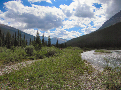
The View north from our lunch break spot.

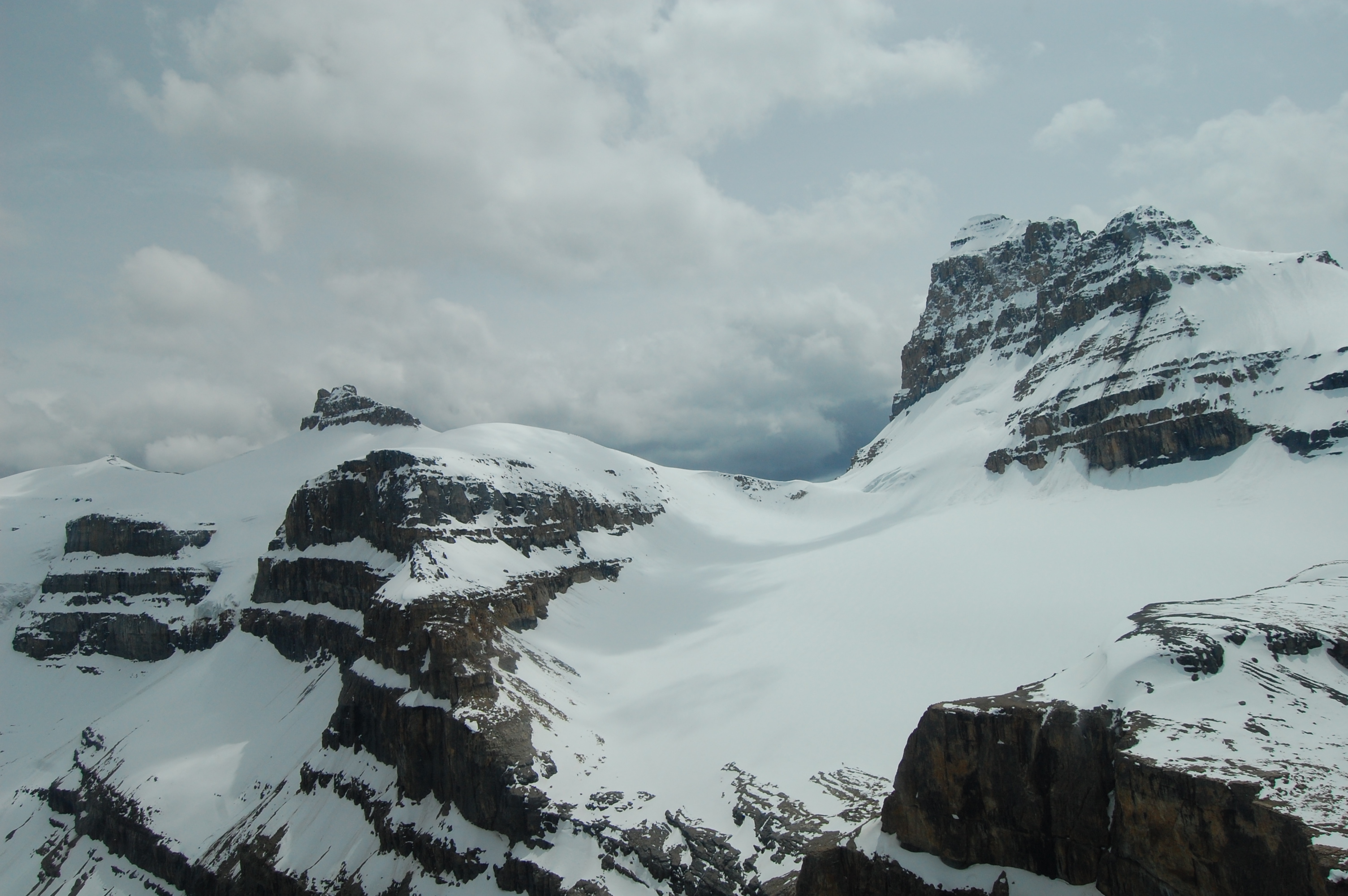
Whitegoat Wilderness, Alberta

Icefield Helicopter Tour

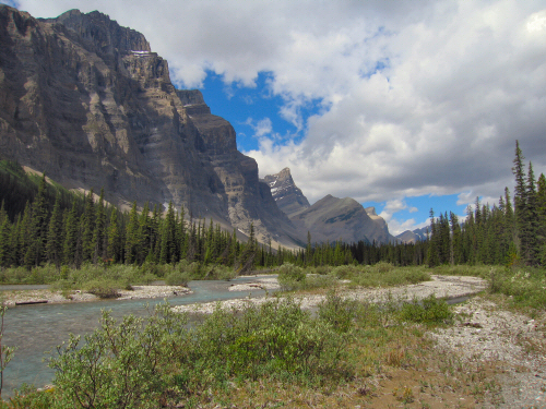
Cline River Alberta
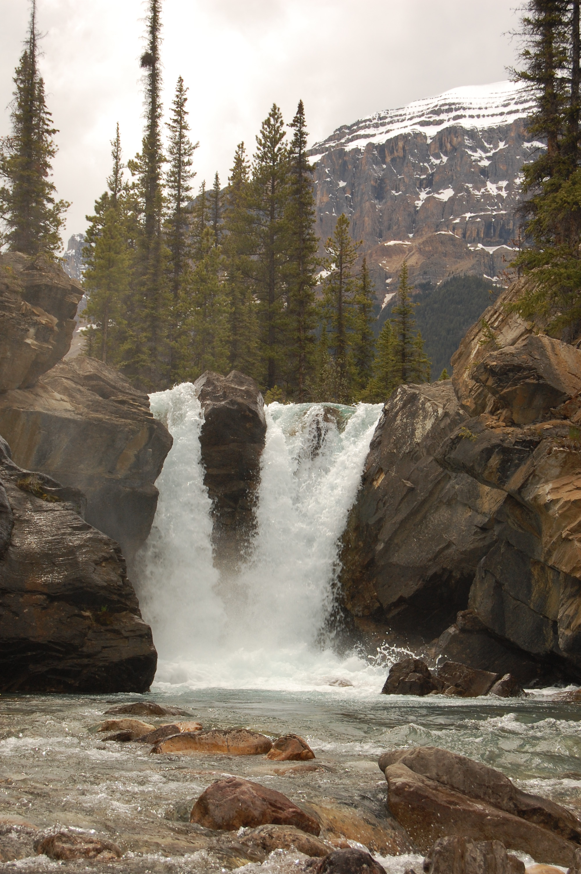
Falls with no name
Cline River Valley
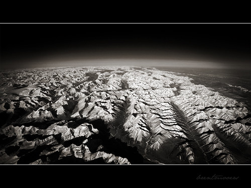
Curvature of the Earth
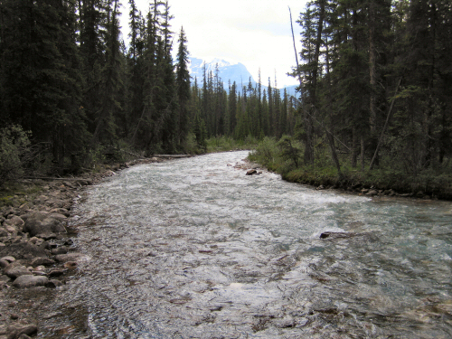
Cataract Creek near the crossing
Looking South down Cataract Creek.
Mapa de Strong Winds Peak, Clearwater County, AB T0M, Canadá
Buscar otro lugar
Lugares cercanos
Circle Game Peak, Clearwater County, AB T0M, Canadá
Quixote Peak, Clearwater County, AB T0M, Canadá
Ribbon Peak, Clearwater County, AB T0M, Canadá
Lonely Peak, Clearwater County, AB T0M, Canadá
Stan Rogers Peak, Clearwater County, AB T0M, Canadá
Cornice Peak, Clearwater County, AB T0M, Canadá
Carousel Peak, Clearwater County, AB T0M, Canadá
White Goat, Clearwater County, AB T0M, Canadá
Obstruction Mountain, Clearwater County, AB T0M, Canadá
Mount Stewart, Clearwater County, AB T0M, Canadá
Mount Coleman, Improvement District No. 9, AB T0L, Canadá
Cirrus Mountain, Improvement District No. 9, AB T0L, Canadá
Opabin Peak, Clearwater County, AB T0M, Canadá
HI Rampart Creek Wilderness Hostel, Parque Nacional Banff, AB-93, Banff, AB T1L 1B3, Canadá
Rampart Creek Campground, Icefields Pkwy, Improvement District No. 9, AB T0L, Canadá
Marble Mountain, Improvement District No. 12, AB T0E, Canadá
Capitoline Peak, Clearwater County, AB T0M, Canadá
Icefields Parkway, Icefields Pkwy, Improvement District No. 9, AB T0L, Canadá
Mount Aztec, Improvement District No. 12, AB T0E, Canadá
Mount Amery, Improvement District No. 9, AB T0L, Canadá
Búsquedas recientes
- Horas de salida y puesta de sol de Red Dog Mine, AK, USA
- Horas de salida y puesta de sol de Am Bahnhof, Am bhf, Borken, Germany
- Horas de salida y puesta de sol de 4th St E, Sonoma, CA, EE. UU.
- Horas de salida y puesta de sol de Oakland Ave, Williamsport, PA, EE. UU.
- Horas de salida y puesta de sol de Via Roma, Pieranica CR, Italia
- Horas de salida y puesta de sol de Torre del reloj, Grad, Dubrovnik (Ragusa), Croacia
- Horas de salida y puesta de sol de Trelew, Chubut, Argentina
- Horas de salida y puesta de sol de Hartfords Bluff Cir, Mt Pleasant, SC, EE. UU.
- Horas de salida y puesta de sol de Kita Ward, Kumamoto, Japón
- Horas de salida y puesta de sol de Pingtan Island, Pingtan County, Fuzhou, China