Horas de salida y puesta de sol de Ridgeview Ct, Morgan Hill, CA, EE. UU.
Location: Estados Unidos > California > Condado de Santa Clara > Morgan Hill >
Zona horaria:
America/Los_Angeles
Hora local:
2025-06-16 01:03:41
Longitud:
-121.5908229
Latitud:
37.1468741
Salida de sol de hoy:
05:45:53 AM
Puesta de sol de hoy:
08:28:38 PM
La duración del día hoy:
14h 42m 45s
Salida de sol de mañana:
05:46:00 AM
Puesta de sol de mañana:
08:28:57 PM
La duración del día mañana:
14h 42m 57s
Mostrar todas las fechas
| Fecha | Salida de sol | Puesta de sol | Duración del día |
|---|---|---|---|
| 01/01/2025 | 07:20:09 AM | 05:01:02 PM | 9h 40m 53s |
| 02/01/2025 | 07:20:14 AM | 05:01:51 PM | 9h 41m 37s |
| 03/01/2025 | 07:20:18 AM | 05:02:42 PM | 9h 42m 24s |
| 04/01/2025 | 07:20:19 AM | 05:03:34 PM | 9h 43m 15s |
| 05/01/2025 | 07:20:19 AM | 05:04:27 PM | 9h 44m 8s |
| 06/01/2025 | 07:20:16 AM | 05:05:21 PM | 9h 45m 5s |
| 07/01/2025 | 07:20:12 AM | 05:06:16 PM | 9h 46m 4s |
| 08/01/2025 | 07:20:05 AM | 05:07:12 PM | 9h 47m 7s |
| 09/01/2025 | 07:19:56 AM | 05:08:09 PM | 9h 48m 13s |
| 10/01/2025 | 07:19:45 AM | 05:09:07 PM | 9h 49m 22s |
| 11/01/2025 | 07:19:33 AM | 05:10:06 PM | 9h 50m 33s |
| 12/01/2025 | 07:19:18 AM | 05:11:06 PM | 9h 51m 48s |
| 13/01/2025 | 07:19:01 AM | 05:12:06 PM | 9h 53m 5s |
| 14/01/2025 | 07:18:42 AM | 05:13:07 PM | 9h 54m 25s |
| 15/01/2025 | 07:18:22 AM | 05:14:08 PM | 9h 55m 46s |
| 16/01/2025 | 07:17:59 AM | 05:15:10 PM | 9h 57m 11s |
| 17/01/2025 | 07:17:34 AM | 05:16:13 PM | 9h 58m 39s |
| 18/01/2025 | 07:17:07 AM | 05:17:16 PM | 10h 0m 9s |
| 19/01/2025 | 07:16:39 AM | 05:18:20 PM | 10h 1m 41s |
| 20/01/2025 | 07:16:08 AM | 05:19:24 PM | 10h 3m 16s |
| 21/01/2025 | 07:15:36 AM | 05:20:28 PM | 10h 4m 52s |
| 22/01/2025 | 07:15:02 AM | 05:21:32 PM | 10h 6m 30s |
| 23/01/2025 | 07:14:26 AM | 05:22:37 PM | 10h 8m 11s |
| 24/01/2025 | 07:13:48 AM | 05:23:42 PM | 10h 9m 54s |
| 25/01/2025 | 07:13:08 AM | 05:24:47 PM | 10h 11m 39s |
| 26/01/2025 | 07:12:27 AM | 05:25:53 PM | 10h 13m 26s |
| 27/01/2025 | 07:11:44 AM | 05:26:58 PM | 10h 15m 14s |
| 28/01/2025 | 07:10:59 AM | 05:28:04 PM | 10h 17m 5s |
| 29/01/2025 | 07:10:13 AM | 05:29:10 PM | 10h 18m 57s |
| 30/01/2025 | 07:09:25 AM | 05:30:15 PM | 10h 20m 50s |
| 31/01/2025 | 07:08:35 AM | 05:31:21 PM | 10h 22m 46s |
| 01/02/2025 | 07:07:44 AM | 05:32:26 PM | 10h 24m 42s |
| 02/02/2025 | 07:06:51 AM | 05:33:32 PM | 10h 26m 41s |
| 03/02/2025 | 07:05:56 AM | 05:34:37 PM | 10h 28m 41s |
| 04/02/2025 | 07:05:00 AM | 05:35:43 PM | 10h 30m 43s |
| 05/02/2025 | 07:04:03 AM | 05:36:48 PM | 10h 32m 45s |
| 06/02/2025 | 07:03:04 AM | 05:37:53 PM | 10h 34m 49s |
| 07/02/2025 | 07:02:04 AM | 05:38:58 PM | 10h 36m 54s |
| 08/02/2025 | 07:01:02 AM | 05:40:02 PM | 10h 39m 0s |
| 09/02/2025 | 06:59:59 AM | 05:41:07 PM | 10h 41m 8s |
| 10/02/2025 | 06:58:55 AM | 05:42:11 PM | 10h 43m 16s |
| 11/02/2025 | 06:57:50 AM | 05:43:15 PM | 10h 45m 25s |
| 12/02/2025 | 06:56:43 AM | 05:44:18 PM | 10h 47m 35s |
| 13/02/2025 | 06:55:35 AM | 05:45:22 PM | 10h 49m 47s |
| 14/02/2025 | 06:54:26 AM | 05:46:25 PM | 10h 51m 59s |
| 15/02/2025 | 06:53:16 AM | 05:47:28 PM | 10h 54m 12s |
| 16/02/2025 | 06:52:04 AM | 05:48:30 PM | 10h 56m 26s |
| 17/02/2025 | 06:50:52 AM | 05:49:32 PM | 10h 58m 40s |
| 18/02/2025 | 06:49:39 AM | 05:50:34 PM | 11h 0m 55s |
| 19/02/2025 | 06:48:24 AM | 05:51:36 PM | 11h 3m 12s |
| 20/02/2025 | 06:47:09 AM | 05:52:37 PM | 11h 5m 28s |
| 21/02/2025 | 06:45:52 AM | 05:53:38 PM | 11h 7m 46s |
| 22/02/2025 | 06:44:35 AM | 05:54:38 PM | 11h 10m 3s |
| 23/02/2025 | 06:43:17 AM | 05:55:39 PM | 11h 12m 22s |
| 24/02/2025 | 06:41:58 AM | 05:56:39 PM | 11h 14m 41s |
| 25/02/2025 | 06:40:38 AM | 05:57:38 PM | 11h 17m 0s |
| 26/02/2025 | 06:39:18 AM | 05:58:38 PM | 11h 19m 20s |
| 27/02/2025 | 06:37:56 AM | 05:59:37 PM | 11h 21m 41s |
| 28/02/2025 | 06:36:34 AM | 06:00:35 PM | 11h 24m 1s |
| 01/03/2025 | 06:35:12 AM | 06:01:34 PM | 11h 26m 22s |
| 02/03/2025 | 06:33:48 AM | 06:02:32 PM | 11h 28m 44s |
| 03/03/2025 | 06:32:24 AM | 06:03:30 PM | 11h 31m 6s |
| 04/03/2025 | 06:31:00 AM | 06:04:27 PM | 11h 33m 27s |
| 05/03/2025 | 06:29:35 AM | 06:05:24 PM | 11h 35m 49s |
| 06/03/2025 | 06:28:09 AM | 06:06:21 PM | 11h 38m 12s |
| 07/03/2025 | 06:26:43 AM | 06:07:18 PM | 11h 40m 35s |
| 08/03/2025 | 06:25:17 AM | 06:08:14 PM | 11h 42m 57s |
| 09/03/2025 | 07:23:53 AM | 07:09:08 PM | 11h 45m 15s |
| 10/03/2025 | 07:22:26 AM | 07:10:04 PM | 11h 47m 38s |
| 11/03/2025 | 07:20:58 AM | 07:10:59 PM | 11h 50m 1s |
| 12/03/2025 | 07:19:30 AM | 07:11:55 PM | 11h 52m 25s |
| 13/03/2025 | 07:18:02 AM | 07:12:50 PM | 11h 54m 48s |
| 14/03/2025 | 07:16:33 AM | 07:13:45 PM | 11h 57m 12s |
| 15/03/2025 | 07:15:04 AM | 07:14:40 PM | 11h 59m 36s |
| 16/03/2025 | 07:13:35 AM | 07:15:35 PM | 12h 2m 0s |
| 17/03/2025 | 07:12:06 AM | 07:16:29 PM | 12h 4m 23s |
| 18/03/2025 | 07:10:36 AM | 07:17:23 PM | 12h 6m 47s |
| 19/03/2025 | 07:09:07 AM | 07:18:17 PM | 12h 9m 10s |
| 20/03/2025 | 07:07:37 AM | 07:19:11 PM | 12h 11m 34s |
| 21/03/2025 | 07:06:07 AM | 07:20:05 PM | 12h 13m 58s |
| 22/03/2025 | 07:04:38 AM | 07:20:59 PM | 12h 16m 21s |
| 23/03/2025 | 07:03:08 AM | 07:21:53 PM | 12h 18m 45s |
| 24/03/2025 | 07:01:38 AM | 07:22:46 PM | 12h 21m 8s |
| 25/03/2025 | 07:00:08 AM | 07:23:40 PM | 12h 23m 32s |
| 26/03/2025 | 06:58:39 AM | 07:24:33 PM | 12h 25m 54s |
| 27/03/2025 | 06:57:09 AM | 07:25:26 PM | 12h 28m 17s |
| 28/03/2025 | 06:55:40 AM | 07:26:20 PM | 12h 30m 40s |
| 29/03/2025 | 06:54:11 AM | 07:27:13 PM | 12h 33m 2s |
| 30/03/2025 | 06:52:42 AM | 07:28:06 PM | 12h 35m 24s |
| 31/03/2025 | 06:51:13 AM | 07:28:59 PM | 12h 37m 46s |
| 01/04/2025 | 06:49:45 AM | 07:29:52 PM | 12h 40m 7s |
| 02/04/2025 | 06:48:17 AM | 07:30:45 PM | 12h 42m 28s |
| 03/04/2025 | 06:46:49 AM | 07:31:38 PM | 12h 44m 49s |
| 04/04/2025 | 06:45:21 AM | 07:32:32 PM | 12h 47m 11s |
| 05/04/2025 | 06:43:54 AM | 07:33:25 PM | 12h 49m 31s |
| 06/04/2025 | 06:42:27 AM | 07:34:18 PM | 12h 51m 51s |
| 07/04/2025 | 06:41:01 AM | 07:35:11 PM | 12h 54m 10s |
| 08/04/2025 | 06:39:35 AM | 07:36:04 PM | 12h 56m 29s |
| 09/04/2025 | 06:38:10 AM | 07:36:57 PM | 12h 58m 47s |
| 10/04/2025 | 06:36:45 AM | 07:37:51 PM | 13h 1m 6s |
| 11/04/2025 | 06:35:21 AM | 07:38:44 PM | 13h 3m 23s |
| 12/04/2025 | 06:33:57 AM | 07:39:37 PM | 13h 5m 40s |
| 13/04/2025 | 06:32:34 AM | 07:40:31 PM | 13h 7m 57s |
| 14/04/2025 | 06:31:12 AM | 07:41:24 PM | 13h 10m 12s |
| 15/04/2025 | 06:29:50 AM | 07:42:17 PM | 13h 12m 27s |
| 16/04/2025 | 06:28:30 AM | 07:43:11 PM | 13h 14m 41s |
| 17/04/2025 | 06:27:09 AM | 07:44:05 PM | 13h 16m 56s |
| 18/04/2025 | 06:25:50 AM | 07:44:58 PM | 13h 19m 8s |
| 19/04/2025 | 06:24:31 AM | 07:45:52 PM | 13h 21m 21s |
| 20/04/2025 | 06:23:13 AM | 07:46:45 PM | 13h 23m 32s |
| 21/04/2025 | 06:21:56 AM | 07:47:39 PM | 13h 25m 43s |
| 22/04/2025 | 06:20:40 AM | 07:48:33 PM | 13h 27m 53s |
| 23/04/2025 | 06:19:25 AM | 07:49:27 PM | 13h 30m 2s |
| 24/04/2025 | 06:18:11 AM | 07:50:20 PM | 13h 32m 9s |
| 25/04/2025 | 06:16:58 AM | 07:51:14 PM | 13h 34m 16s |
| 26/04/2025 | 06:15:45 AM | 07:52:08 PM | 13h 36m 23s |
| 27/04/2025 | 06:14:34 AM | 07:53:02 PM | 13h 38m 28s |
| 28/04/2025 | 06:13:24 AM | 07:53:55 PM | 13h 40m 31s |
| 29/04/2025 | 06:12:15 AM | 07:54:49 PM | 13h 42m 34s |
| 30/04/2025 | 06:11:07 AM | 07:55:43 PM | 13h 44m 36s |
| 01/05/2025 | 06:10:00 AM | 07:56:36 PM | 13h 46m 36s |
| 02/05/2025 | 06:08:55 AM | 07:57:30 PM | 13h 48m 35s |
| 03/05/2025 | 06:07:50 AM | 07:58:23 PM | 13h 50m 33s |
| 04/05/2025 | 06:06:47 AM | 07:59:17 PM | 13h 52m 30s |
| 05/05/2025 | 06:05:45 AM | 08:00:10 PM | 13h 54m 25s |
| 06/05/2025 | 06:04:45 AM | 08:01:03 PM | 13h 56m 18s |
| 07/05/2025 | 06:03:45 AM | 08:01:55 PM | 13h 58m 10s |
| 08/05/2025 | 06:02:47 AM | 08:02:48 PM | 14h 0m 1s |
| 09/05/2025 | 06:01:51 AM | 08:03:40 PM | 14h 1m 49s |
| 10/05/2025 | 06:00:56 AM | 08:04:33 PM | 14h 3m 37s |
| 11/05/2025 | 06:00:02 AM | 08:05:24 PM | 14h 5m 22s |
| 12/05/2025 | 05:59:09 AM | 08:06:16 PM | 14h 7m 7s |
| 13/05/2025 | 05:58:19 AM | 08:07:07 PM | 14h 8m 48s |
| 14/05/2025 | 05:57:29 AM | 08:07:58 PM | 14h 10m 29s |
| 15/05/2025 | 05:56:41 AM | 08:08:48 PM | 14h 12m 7s |
| 16/05/2025 | 05:55:55 AM | 08:09:38 PM | 14h 13m 43s |
| 17/05/2025 | 05:55:10 AM | 08:10:28 PM | 14h 15m 18s |
| 18/05/2025 | 05:54:27 AM | 08:11:17 PM | 14h 16m 50s |
| 19/05/2025 | 05:53:46 AM | 08:12:06 PM | 14h 18m 20s |
| 20/05/2025 | 05:53:06 AM | 08:12:54 PM | 14h 19m 48s |
| 21/05/2025 | 05:52:27 AM | 08:13:41 PM | 14h 21m 14s |
| 22/05/2025 | 05:51:51 AM | 08:14:28 PM | 14h 22m 37s |
| 23/05/2025 | 05:51:16 AM | 08:15:14 PM | 14h 23m 58s |
| 24/05/2025 | 05:50:42 AM | 08:16:00 PM | 14h 25m 18s |
| 25/05/2025 | 05:50:11 AM | 08:16:45 PM | 14h 26m 34s |
| 26/05/2025 | 05:49:41 AM | 08:17:29 PM | 14h 27m 48s |
| 27/05/2025 | 05:49:12 AM | 08:18:12 PM | 14h 29m 0s |
| 28/05/2025 | 05:48:46 AM | 08:18:54 PM | 14h 30m 8s |
| 29/05/2025 | 05:48:21 AM | 08:19:36 PM | 14h 31m 15s |
| 30/05/2025 | 05:47:58 AM | 08:20:16 PM | 14h 32m 18s |
| 31/05/2025 | 05:47:37 AM | 08:20:56 PM | 14h 33m 19s |
| 01/06/2025 | 05:47:18 AM | 08:21:35 PM | 14h 34m 17s |
| 02/06/2025 | 05:47:00 AM | 08:22:12 PM | 14h 35m 12s |
| 03/06/2025 | 05:46:44 AM | 08:22:49 PM | 14h 36m 5s |
| 04/06/2025 | 05:46:30 AM | 08:23:24 PM | 14h 36m 54s |
| 05/06/2025 | 05:46:18 AM | 08:23:59 PM | 14h 37m 41s |
| 06/06/2025 | 05:46:07 AM | 08:24:32 PM | 14h 38m 25s |
| 07/06/2025 | 05:45:58 AM | 08:25:04 PM | 14h 39m 6s |
| 08/06/2025 | 05:45:51 AM | 08:25:34 PM | 14h 39m 43s |
| 09/06/2025 | 05:45:46 AM | 08:26:04 PM | 14h 40m 18s |
| 10/06/2025 | 05:45:42 AM | 08:26:32 PM | 14h 40m 50s |
| 11/06/2025 | 05:45:40 AM | 08:26:58 PM | 14h 41m 18s |
| 12/06/2025 | 05:45:40 AM | 08:27:23 PM | 14h 41m 43s |
| 13/06/2025 | 05:45:42 AM | 08:27:47 PM | 14h 42m 5s |
| 14/06/2025 | 05:45:45 AM | 08:28:10 PM | 14h 42m 25s |
| 15/06/2025 | 05:45:50 AM | 08:28:31 PM | 14h 42m 41s |
| 16/06/2025 | 05:45:57 AM | 08:28:50 PM | 14h 42m 53s |
| 17/06/2025 | 05:46:05 AM | 08:29:08 PM | 14h 43m 3s |
| 18/06/2025 | 05:46:15 AM | 08:29:24 PM | 14h 43m 9s |
| 19/06/2025 | 05:46:27 AM | 08:29:39 PM | 14h 43m 12s |
| 20/06/2025 | 05:46:40 AM | 08:29:52 PM | 14h 43m 12s |
| 21/06/2025 | 05:46:54 AM | 08:30:03 PM | 14h 43m 9s |
| 22/06/2025 | 05:47:11 AM | 08:30:13 PM | 14h 43m 2s |
| 23/06/2025 | 05:47:28 AM | 08:30:21 PM | 14h 42m 53s |
| 24/06/2025 | 05:47:48 AM | 08:30:27 PM | 14h 42m 39s |
| 25/06/2025 | 05:48:08 AM | 08:30:32 PM | 14h 42m 24s |
| 26/06/2025 | 05:48:30 AM | 08:30:34 PM | 14h 42m 4s |
| 27/06/2025 | 05:48:54 AM | 08:30:36 PM | 14h 41m 42s |
| 28/06/2025 | 05:49:18 AM | 08:30:35 PM | 14h 41m 17s |
| 29/06/2025 | 05:49:45 AM | 08:30:32 PM | 14h 40m 47s |
| 30/06/2025 | 05:50:12 AM | 08:30:28 PM | 14h 40m 16s |
| 01/07/2025 | 05:50:41 AM | 08:30:22 PM | 14h 39m 41s |
| 02/07/2025 | 05:51:10 AM | 08:30:14 PM | 14h 39m 4s |
| 03/07/2025 | 05:51:41 AM | 08:30:05 PM | 14h 38m 24s |
| 04/07/2025 | 05:52:14 AM | 08:29:53 PM | 14h 37m 39s |
| 05/07/2025 | 05:52:47 AM | 08:29:40 PM | 14h 36m 53s |
| 06/07/2025 | 05:53:21 AM | 08:29:25 PM | 14h 36m 4s |
| 07/07/2025 | 05:53:57 AM | 08:29:08 PM | 14h 35m 11s |
| 08/07/2025 | 05:54:33 AM | 08:28:49 PM | 14h 34m 16s |
| 09/07/2025 | 05:55:10 AM | 08:28:29 PM | 14h 33m 19s |
| 10/07/2025 | 05:55:49 AM | 08:28:06 PM | 14h 32m 17s |
| 11/07/2025 | 05:56:28 AM | 08:27:42 PM | 14h 31m 14s |
| 12/07/2025 | 05:57:08 AM | 08:27:16 PM | 14h 30m 8s |
| 13/07/2025 | 05:57:48 AM | 08:26:49 PM | 14h 29m 1s |
| 14/07/2025 | 05:58:30 AM | 08:26:19 PM | 14h 27m 49s |
| 15/07/2025 | 05:59:12 AM | 08:25:48 PM | 14h 26m 36s |
| 16/07/2025 | 05:59:55 AM | 08:25:15 PM | 14h 25m 20s |
| 17/07/2025 | 06:00:39 AM | 08:24:40 PM | 14h 24m 1s |
| 18/07/2025 | 06:01:23 AM | 08:24:04 PM | 14h 22m 41s |
| 19/07/2025 | 06:02:08 AM | 08:23:26 PM | 14h 21m 18s |
| 20/07/2025 | 06:02:53 AM | 08:22:46 PM | 14h 19m 53s |
| 21/07/2025 | 06:03:39 AM | 08:22:05 PM | 14h 18m 26s |
| 22/07/2025 | 06:04:25 AM | 08:21:22 PM | 14h 16m 57s |
| 23/07/2025 | 06:05:12 AM | 08:20:37 PM | 14h 15m 25s |
| 24/07/2025 | 06:05:59 AM | 08:19:51 PM | 14h 13m 52s |
| 25/07/2025 | 06:06:47 AM | 08:19:03 PM | 14h 12m 16s |
| 26/07/2025 | 06:07:34 AM | 08:18:14 PM | 14h 10m 40s |
| 27/07/2025 | 06:08:23 AM | 08:17:23 PM | 14h 9m 0s |
| 28/07/2025 | 06:09:11 AM | 08:16:31 PM | 14h 7m 20s |
| 29/07/2025 | 06:10:00 AM | 08:15:37 PM | 14h 5m 37s |
| 30/07/2025 | 06:10:49 AM | 08:14:41 PM | 14h 3m 52s |
| 31/07/2025 | 06:11:38 AM | 08:13:45 PM | 14h 2m 7s |
| 01/08/2025 | 06:12:28 AM | 08:12:46 PM | 14h 0m 18s |
| 02/08/2025 | 06:13:17 AM | 08:11:47 PM | 13h 58m 30s |
| 03/08/2025 | 06:14:07 AM | 08:10:46 PM | 13h 56m 39s |
| 04/08/2025 | 06:14:57 AM | 08:09:44 PM | 13h 54m 47s |
| 05/08/2025 | 06:15:47 AM | 08:08:40 PM | 13h 52m 53s |
| 06/08/2025 | 06:16:37 AM | 08:07:35 PM | 13h 50m 58s |
| 07/08/2025 | 06:17:27 AM | 08:06:29 PM | 13h 49m 2s |
| 08/08/2025 | 06:18:17 AM | 08:05:22 PM | 13h 47m 5s |
| 09/08/2025 | 06:19:08 AM | 08:04:14 PM | 13h 45m 6s |
| 10/08/2025 | 06:19:58 AM | 08:03:04 PM | 13h 43m 6s |
| 11/08/2025 | 06:20:48 AM | 08:01:53 PM | 13h 41m 5s |
| 12/08/2025 | 06:21:38 AM | 08:00:42 PM | 13h 39m 4s |
| 13/08/2025 | 06:22:29 AM | 07:59:29 PM | 13h 37m 0s |
| 14/08/2025 | 06:23:19 AM | 07:58:15 PM | 13h 34m 56s |
| 15/08/2025 | 06:24:09 AM | 07:57:00 PM | 13h 32m 51s |
| 16/08/2025 | 06:24:59 AM | 07:55:44 PM | 13h 30m 45s |
| 17/08/2025 | 06:25:49 AM | 07:54:27 PM | 13h 28m 38s |
| 18/08/2025 | 06:26:39 AM | 07:53:09 PM | 13h 26m 30s |
| 19/08/2025 | 06:27:29 AM | 07:51:50 PM | 13h 24m 21s |
| 20/08/2025 | 06:28:19 AM | 07:50:31 PM | 13h 22m 12s |
| 21/08/2025 | 06:29:09 AM | 07:49:10 PM | 13h 20m 1s |
| 22/08/2025 | 06:29:58 AM | 07:47:49 PM | 13h 17m 51s |
| 23/08/2025 | 06:30:48 AM | 07:46:27 PM | 13h 15m 39s |
| 24/08/2025 | 06:31:38 AM | 07:45:04 PM | 13h 13m 26s |
| 25/08/2025 | 06:32:27 AM | 07:43:41 PM | 13h 11m 14s |
| 26/08/2025 | 06:33:17 AM | 07:42:16 PM | 13h 8m 59s |
| 27/08/2025 | 06:34:06 AM | 07:40:52 PM | 13h 6m 46s |
| 28/08/2025 | 06:34:55 AM | 07:39:26 PM | 13h 4m 31s |
| 29/08/2025 | 06:35:44 AM | 07:38:00 PM | 13h 2m 16s |
| 30/08/2025 | 06:36:34 AM | 07:36:33 PM | 12h 59m 59s |
| 31/08/2025 | 06:37:23 AM | 07:35:06 PM | 12h 57m 43s |
| 01/09/2025 | 06:38:12 AM | 07:33:39 PM | 12h 55m 27s |
| 02/09/2025 | 06:39:01 AM | 07:32:10 PM | 12h 53m 9s |
| 03/09/2025 | 06:39:49 AM | 07:30:42 PM | 12h 50m 53s |
| 04/09/2025 | 06:40:38 AM | 07:29:13 PM | 12h 48m 35s |
| 05/09/2025 | 06:41:27 AM | 07:27:43 PM | 12h 46m 16s |
| 06/09/2025 | 06:42:16 AM | 07:26:13 PM | 12h 43m 57s |
| 07/09/2025 | 06:43:05 AM | 07:24:43 PM | 12h 41m 38s |
| 08/09/2025 | 06:43:53 AM | 07:23:13 PM | 12h 39m 20s |
| 09/09/2025 | 06:44:42 AM | 07:21:42 PM | 12h 37m 0s |
| 10/09/2025 | 06:45:31 AM | 07:20:11 PM | 12h 34m 40s |
| 11/09/2025 | 06:46:20 AM | 07:18:40 PM | 12h 32m 20s |
| 12/09/2025 | 06:47:09 AM | 07:17:08 PM | 12h 29m 59s |
| 13/09/2025 | 06:47:57 AM | 07:15:36 PM | 12h 27m 39s |
| 14/09/2025 | 06:48:46 AM | 07:14:05 PM | 12h 25m 19s |
| 15/09/2025 | 06:49:35 AM | 07:12:33 PM | 12h 22m 58s |
| 16/09/2025 | 06:50:24 AM | 07:11:01 PM | 12h 20m 37s |
| 17/09/2025 | 06:51:13 AM | 07:09:29 PM | 12h 18m 16s |
| 18/09/2025 | 06:52:03 AM | 07:07:57 PM | 12h 15m 54s |
| 19/09/2025 | 06:52:52 AM | 07:06:25 PM | 12h 13m 33s |
| 20/09/2025 | 06:53:41 AM | 07:04:53 PM | 12h 11m 12s |
| 21/09/2025 | 06:54:31 AM | 07:03:21 PM | 12h 8m 50s |
| 22/09/2025 | 06:55:21 AM | 07:01:49 PM | 12h 6m 28s |
| 23/09/2025 | 06:56:11 AM | 07:00:18 PM | 12h 4m 7s |
| 24/09/2025 | 06:57:01 AM | 06:58:46 PM | 12h 1m 45s |
| 25/09/2025 | 06:57:51 AM | 06:57:15 PM | 11h 59m 24s |
| 26/09/2025 | 06:58:41 AM | 06:55:44 PM | 11h 57m 3s |
| 27/09/2025 | 06:59:32 AM | 06:54:13 PM | 11h 54m 41s |
| 28/09/2025 | 07:00:22 AM | 06:52:42 PM | 11h 52m 20s |
| 29/09/2025 | 07:01:13 AM | 06:51:12 PM | 11h 49m 59s |
| 30/09/2025 | 07:02:05 AM | 06:49:42 PM | 11h 47m 37s |
| 01/10/2025 | 07:02:56 AM | 06:48:12 PM | 11h 45m 16s |
| 02/10/2025 | 07:03:48 AM | 06:46:43 PM | 11h 42m 55s |
| 03/10/2025 | 07:04:40 AM | 06:45:14 PM | 11h 40m 34s |
| 04/10/2025 | 07:05:32 AM | 06:43:46 PM | 11h 38m 14s |
| 05/10/2025 | 07:06:25 AM | 06:42:18 PM | 11h 35m 53s |
| 06/10/2025 | 07:07:17 AM | 06:40:51 PM | 11h 33m 34s |
| 07/10/2025 | 07:08:11 AM | 06:39:24 PM | 11h 31m 13s |
| 08/10/2025 | 07:09:04 AM | 06:37:58 PM | 11h 28m 54s |
| 09/10/2025 | 07:09:58 AM | 06:36:32 PM | 11h 26m 34s |
| 10/10/2025 | 07:10:52 AM | 06:35:07 PM | 11h 24m 15s |
| 11/10/2025 | 07:11:46 AM | 06:33:43 PM | 11h 21m 57s |
| 12/10/2025 | 07:12:41 AM | 06:32:19 PM | 11h 19m 38s |
| 13/10/2025 | 07:13:36 AM | 06:30:56 PM | 11h 17m 20s |
| 14/10/2025 | 07:14:31 AM | 06:29:34 PM | 11h 15m 3s |
| 15/10/2025 | 07:15:27 AM | 06:28:13 PM | 11h 12m 46s |
| 16/10/2025 | 07:16:23 AM | 06:26:52 PM | 11h 10m 29s |
| 17/10/2025 | 07:17:20 AM | 06:25:33 PM | 11h 8m 13s |
| 18/10/2025 | 07:18:16 AM | 06:24:14 PM | 11h 5m 58s |
| 19/10/2025 | 07:19:13 AM | 06:22:56 PM | 11h 3m 43s |
| 20/10/2025 | 07:20:11 AM | 06:21:39 PM | 11h 1m 28s |
| 21/10/2025 | 07:21:09 AM | 06:20:23 PM | 10h 59m 14s |
| 22/10/2025 | 07:22:07 AM | 06:19:08 PM | 10h 57m 1s |
| 23/10/2025 | 07:23:05 AM | 06:17:55 PM | 10h 54m 50s |
| 24/10/2025 | 07:24:04 AM | 06:16:42 PM | 10h 52m 38s |
| 25/10/2025 | 07:25:03 AM | 06:15:30 PM | 10h 50m 27s |
| 26/10/2025 | 07:26:03 AM | 06:14:20 PM | 10h 48m 17s |
| 27/10/2025 | 07:27:03 AM | 06:13:11 PM | 10h 46m 8s |
| 28/10/2025 | 07:28:03 AM | 06:12:03 PM | 10h 44m 0s |
| 29/10/2025 | 07:29:03 AM | 06:10:56 PM | 10h 41m 53s |
| 30/10/2025 | 07:30:04 AM | 06:09:50 PM | 10h 39m 46s |
| 31/10/2025 | 07:31:05 AM | 06:08:46 PM | 10h 37m 41s |
| 01/11/2025 | 07:32:06 AM | 06:07:44 PM | 10h 35m 38s |
| 02/11/2025 | 06:33:10 AM | 05:06:40 PM | 10h 33m 30s |
| 03/11/2025 | 06:34:12 AM | 05:05:40 PM | 10h 31m 28s |
| 04/11/2025 | 06:35:14 AM | 05:04:41 PM | 10h 29m 27s |
| 05/11/2025 | 06:36:16 AM | 05:03:44 PM | 10h 27m 28s |
| 06/11/2025 | 06:37:18 AM | 05:02:49 PM | 10h 25m 31s |
| 07/11/2025 | 06:38:20 AM | 05:01:55 PM | 10h 23m 35s |
| 08/11/2025 | 06:39:23 AM | 05:01:02 PM | 10h 21m 39s |
| 09/11/2025 | 06:40:25 AM | 05:00:12 PM | 10h 19m 47s |
| 10/11/2025 | 06:41:28 AM | 04:59:23 PM | 10h 17m 55s |
| 11/11/2025 | 06:42:31 AM | 04:58:35 PM | 10h 16m 4s |
| 12/11/2025 | 06:43:33 AM | 04:57:49 PM | 10h 14m 16s |
| 13/11/2025 | 06:44:36 AM | 04:57:05 PM | 10h 12m 29s |
| 14/11/2025 | 06:45:38 AM | 04:56:23 PM | 10h 10m 45s |
| 15/11/2025 | 06:46:41 AM | 04:55:43 PM | 10h 9m 2s |
| 16/11/2025 | 06:47:43 AM | 04:55:04 PM | 10h 7m 21s |
| 17/11/2025 | 06:48:45 AM | 04:54:27 PM | 10h 5m 42s |
| 18/11/2025 | 06:49:47 AM | 04:53:52 PM | 10h 4m 5s |
| 19/11/2025 | 06:50:49 AM | 04:53:19 PM | 10h 2m 30s |
| 20/11/2025 | 06:51:50 AM | 04:52:48 PM | 10h 0m 58s |
| 21/11/2025 | 06:52:51 AM | 04:52:19 PM | 9h 59m 28s |
| 22/11/2025 | 06:53:52 AM | 04:51:51 PM | 9h 57m 59s |
| 23/11/2025 | 06:54:52 AM | 04:51:26 PM | 9h 56m 34s |
| 24/11/2025 | 06:55:52 AM | 04:51:03 PM | 9h 55m 11s |
| 25/11/2025 | 06:56:52 AM | 04:50:41 PM | 9h 53m 49s |
| 26/11/2025 | 06:57:50 AM | 04:50:22 PM | 9h 52m 32s |
| 27/11/2025 | 06:58:48 AM | 04:50:05 PM | 9h 51m 17s |
| 28/11/2025 | 06:59:46 AM | 04:49:50 PM | 9h 50m 4s |
| 29/11/2025 | 07:00:43 AM | 04:49:36 PM | 9h 48m 53s |
| 30/11/2025 | 07:01:39 AM | 04:49:25 PM | 9h 47m 46s |
| 01/12/2025 | 07:02:34 AM | 04:49:16 PM | 9h 46m 42s |
| 02/12/2025 | 07:03:28 AM | 04:49:09 PM | 9h 45m 41s |
| 03/12/2025 | 07:04:22 AM | 04:49:04 PM | 9h 44m 42s |
| 04/12/2025 | 07:05:14 AM | 04:49:01 PM | 9h 43m 47s |
| 05/12/2025 | 07:06:05 AM | 04:49:01 PM | 9h 42m 56s |
| 06/12/2025 | 07:06:56 AM | 04:49:02 PM | 9h 42m 6s |
| 07/12/2025 | 07:07:45 AM | 04:49:05 PM | 9h 41m 20s |
| 08/12/2025 | 07:08:33 AM | 04:49:11 PM | 9h 40m 38s |
| 09/12/2025 | 07:09:20 AM | 04:49:18 PM | 9h 39m 58s |
| 10/12/2025 | 07:10:06 AM | 04:49:28 PM | 9h 39m 22s |
| 11/12/2025 | 07:10:50 AM | 04:49:39 PM | 9h 38m 49s |
| 12/12/2025 | 07:11:33 AM | 04:49:53 PM | 9h 38m 20s |
| 13/12/2025 | 07:12:15 AM | 04:50:09 PM | 9h 37m 54s |
| 14/12/2025 | 07:12:55 AM | 04:50:26 PM | 9h 37m 31s |
| 15/12/2025 | 07:13:34 AM | 04:50:46 PM | 9h 37m 12s |
| 16/12/2025 | 07:14:11 AM | 04:51:07 PM | 9h 36m 56s |
| 17/12/2025 | 07:14:46 AM | 04:51:31 PM | 9h 36m 45s |
| 18/12/2025 | 07:15:20 AM | 04:51:56 PM | 9h 36m 36s |
| 19/12/2025 | 07:15:53 AM | 04:52:23 PM | 9h 36m 30s |
| 20/12/2025 | 07:16:23 AM | 04:52:52 PM | 9h 36m 29s |
| 21/12/2025 | 07:16:52 AM | 04:53:23 PM | 9h 36m 31s |
| 22/12/2025 | 07:17:19 AM | 04:53:56 PM | 9h 36m 37s |
| 23/12/2025 | 07:17:44 AM | 04:54:30 PM | 9h 36m 46s |
| 24/12/2025 | 07:18:08 AM | 04:55:06 PM | 9h 36m 58s |
| 25/12/2025 | 07:18:30 AM | 04:55:44 PM | 9h 37m 14s |
| 26/12/2025 | 07:18:49 AM | 04:56:23 PM | 9h 37m 34s |
| 27/12/2025 | 07:19:07 AM | 04:57:04 PM | 9h 37m 57s |
| 28/12/2025 | 07:19:23 AM | 04:57:46 PM | 9h 38m 23s |
| 29/12/2025 | 07:19:37 AM | 04:58:30 PM | 9h 38m 53s |
| 30/12/2025 | 07:19:49 AM | 04:59:15 PM | 9h 39m 26s |
| 31/12/2025 | 07:19:59 AM | 05:00:02 PM | 9h 40m 3s |
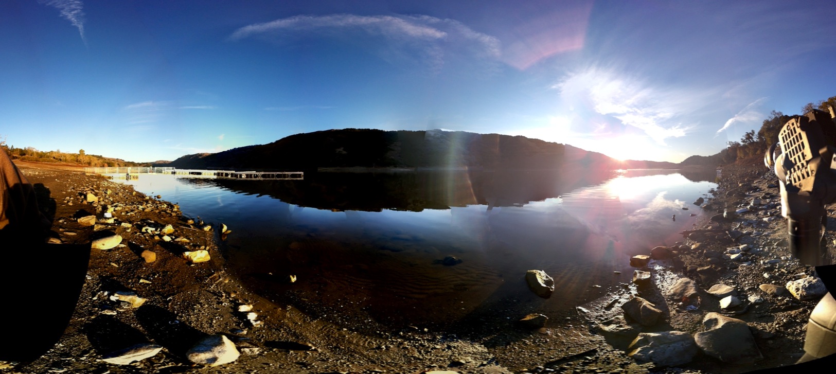
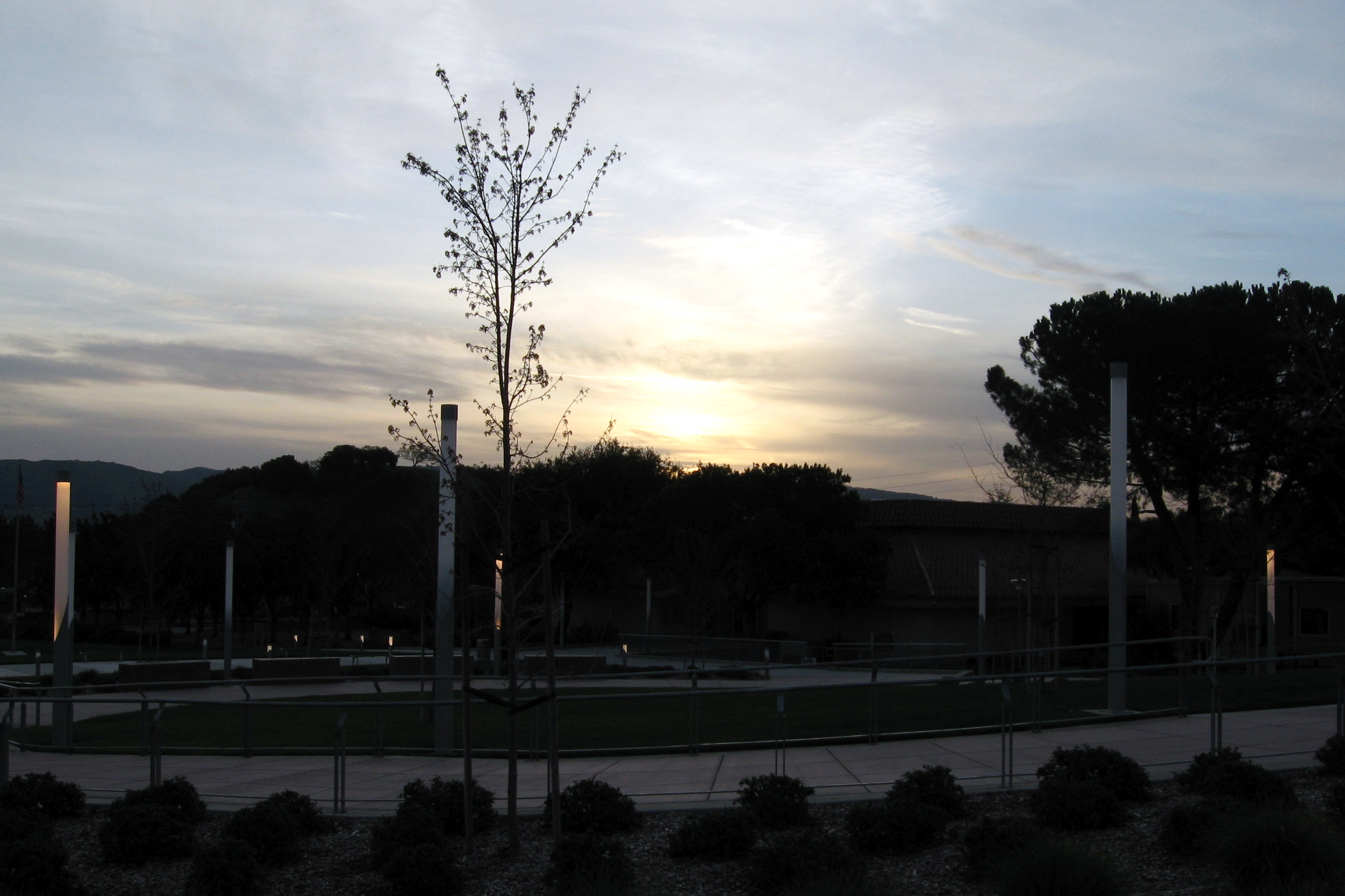
Fotos

Square hay bales

Armageddon ....

Tree at Sunset

Sunset through the lens of Iphone 4S

Two Trees

A Tree near Springs Trail

signal, Butterfield Boulevard at Sutter Boulevard, Morgan Hill, January 1, 2018

WWII Retro Pinup: Captain Felix

The Mistletoe Tree

A Valley of Views

No swimming

Henry Coe State Park

Week 49

Red Skies at Night

Sunset at Harvey Bear Park

~~GilroyCalif/January2012 #1~~

One of the Ogier Ponds along the Coyote Creek Regional Bicycle Trail

Flat Frog Tree

Oak Tree with Rocks

Winter Rows

Riding at Sunset

Oaks at Dawn

WEEK 13 Story: Golden Hour

Star Trails Henry Coe State Park

Faith Martinez First Birthday
Post meteor shower Sunrise

Sunrise in Morgan Hill

Gilroy Sunrise Fire Station

south of Coyote Creek golf course, off 101

Raleigh scattering...

Morning: sunrise.

Morgan Hill sunrise

Before the invasion

Camping at Coe State Park - Sunrise

Morgan Hill, CA

Five minutes to sunrise

Twenty minutes before sunrise

Morgan Hill, CA
A Saturday Sunrise

Half-hour past sunrise
Mapa de Ridgeview Ct, Morgan Hill, CA, EE. UU.
Buscar otro lugar
Lugares cercanos
Manzanita Dr, Morgan Hill, CA, EE. UU.
E Dunne Ave, Morgan Hill, CA, EE. UU.
Cimarron Dr, Morgan Hill, CA, EE. UU.
Center Ave, San Martin, CA, EE. UU.
Columbet Ave, San Martin, CA, EE. UU.
Anderson Dam Trail, Morgan Hill, CA, EE. UU.
Walnut Grove Dr, Morgan Hill, CA, EE. UU.
E San Martin Ave, San Martin, CA, EE. UU.
Markross Ct, Morgan Hill, CA, EE. UU.
Diana Ave, Morgan Hill, CA, EE. UU.
Calle Viento, Morgan Hill, CA, EE. UU.
Eagle View Drive, Eagle View Dr, Morgan Hill, CA, EE. UU.
Rising Sun Drive, Morgan Hill, CA, EE. UU.
Target, Cochrane Rd, Morgan Hill, CA, EE. UU.
San Martín, California, EE. UU.
San Martin Airport, San Martín, California, EE. UU.
Morgan Hill, California, EE. UU.
Main & Monterey, Morgan Hill, California, EE. UU.
80 W Central Ave, Morgan Hill, CA, EE. UU.
Wings-History Aircraft Museum, Murphy Ave, San Martin, CA, EE. UU.
Búsquedas recientes
- Horas de salida y puesta de sol de Red Dog Mine, AK, USA
- Horas de salida y puesta de sol de Am Bahnhof, Am bhf, Borken, Germany
- Horas de salida y puesta de sol de 4th St E, Sonoma, CA, EE. UU.
- Horas de salida y puesta de sol de Oakland Ave, Williamsport, PA, EE. UU.
- Horas de salida y puesta de sol de Via Roma, Pieranica CR, Italia
- Horas de salida y puesta de sol de Torre del reloj, Grad, Dubrovnik (Ragusa), Croacia
- Horas de salida y puesta de sol de Trelew, Chubut, Argentina
- Horas de salida y puesta de sol de Hartfords Bluff Cir, Mt Pleasant, SC, EE. UU.
- Horas de salida y puesta de sol de Kita Ward, Kumamoto, Japón
- Horas de salida y puesta de sol de Pingtan Island, Pingtan County, Fuzhou, China