Horas de salida y puesta de sol de Pine Camp Rd, Coeburn, VA, EE. UU.
Location: Estados Unidos > Virginia > Condado de Wise > 2 > Coeburn >
Zona horaria:
America/New_York
Hora local:
2025-07-11 20:12:37
Longitud:
-82.5171145
Latitud:
36.9025687
Salida de sol de hoy:
06:21:00 AM
Puesta de sol de hoy:
08:50:38 PM
La duración del día hoy:
14h 29m 38s
Salida de sol de mañana:
06:21:40 AM
Puesta de sol de mañana:
08:50:12 PM
La duración del día mañana:
14h 28m 32s
Mostrar todas las fechas
| Fecha | Salida de sol | Puesta de sol | Duración del día |
|---|---|---|---|
| 01/01/2025 | 07:43:10 AM | 05:25:12 PM | 9h 42m 2s |
| 02/01/2025 | 07:43:16 AM | 05:26:01 PM | 9h 42m 45s |
| 03/01/2025 | 07:43:20 AM | 05:26:51 PM | 9h 43m 31s |
| 04/01/2025 | 07:43:22 AM | 05:27:43 PM | 9h 44m 21s |
| 05/01/2025 | 07:43:23 AM | 05:28:35 PM | 9h 45m 12s |
| 06/01/2025 | 07:43:21 AM | 05:29:29 PM | 9h 46m 8s |
| 07/01/2025 | 07:43:17 AM | 05:30:24 PM | 9h 47m 7s |
| 08/01/2025 | 07:43:11 AM | 05:31:19 PM | 9h 48m 8s |
| 09/01/2025 | 07:43:03 AM | 05:32:16 PM | 9h 49m 13s |
| 10/01/2025 | 07:42:53 AM | 05:33:13 PM | 9h 50m 20s |
| 11/01/2025 | 07:42:41 AM | 05:34:12 PM | 9h 51m 31s |
| 12/01/2025 | 07:42:27 AM | 05:35:11 PM | 9h 52m 44s |
| 13/01/2025 | 07:42:11 AM | 05:36:10 PM | 9h 53m 59s |
| 14/01/2025 | 07:41:53 AM | 05:37:11 PM | 9h 55m 18s |
| 15/01/2025 | 07:41:33 AM | 05:38:12 PM | 9h 56m 39s |
| 16/01/2025 | 07:41:12 AM | 05:39:13 PM | 9h 58m 1s |
| 17/01/2025 | 07:40:48 AM | 05:40:15 PM | 9h 59m 27s |
| 18/01/2025 | 07:40:22 AM | 05:41:18 PM | 10h 0m 56s |
| 19/01/2025 | 07:39:54 AM | 05:42:21 PM | 10h 2m 27s |
| 20/01/2025 | 07:39:25 AM | 05:43:24 PM | 10h 3m 59s |
| 21/01/2025 | 07:38:53 AM | 05:44:28 PM | 10h 5m 35s |
| 22/01/2025 | 07:38:20 AM | 05:45:32 PM | 10h 7m 12s |
| 23/01/2025 | 07:37:45 AM | 05:46:36 PM | 10h 8m 51s |
| 24/01/2025 | 07:37:08 AM | 05:47:41 PM | 10h 10m 33s |
| 25/01/2025 | 07:36:29 AM | 05:48:45 PM | 10h 12m 16s |
| 26/01/2025 | 07:35:49 AM | 05:49:50 PM | 10h 14m 1s |
| 27/01/2025 | 07:35:07 AM | 05:50:55 PM | 10h 15m 48s |
| 28/01/2025 | 07:34:23 AM | 05:52:00 PM | 10h 17m 37s |
| 29/01/2025 | 07:33:37 AM | 05:53:05 PM | 10h 19m 28s |
| 30/01/2025 | 07:32:50 AM | 05:54:11 PM | 10h 21m 21s |
| 31/01/2025 | 07:32:01 AM | 05:55:16 PM | 10h 23m 15s |
| 01/02/2025 | 07:31:11 AM | 05:56:21 PM | 10h 25m 10s |
| 02/02/2025 | 07:30:19 AM | 05:57:26 PM | 10h 27m 7s |
| 03/02/2025 | 07:29:25 AM | 05:58:31 PM | 10h 29m 6s |
| 04/02/2025 | 07:28:30 AM | 05:59:35 PM | 10h 31m 5s |
| 05/02/2025 | 07:27:34 AM | 06:00:40 PM | 10h 33m 6s |
| 06/02/2025 | 07:26:36 AM | 06:01:44 PM | 10h 35m 8s |
| 07/02/2025 | 07:25:37 AM | 06:02:49 PM | 10h 37m 12s |
| 08/02/2025 | 07:24:36 AM | 06:03:53 PM | 10h 39m 17s |
| 09/02/2025 | 07:23:34 AM | 06:04:57 PM | 10h 41m 23s |
| 10/02/2025 | 07:22:31 AM | 06:06:00 PM | 10h 43m 29s |
| 11/02/2025 | 07:21:26 AM | 06:07:04 PM | 10h 45m 38s |
| 12/02/2025 | 07:20:20 AM | 06:08:07 PM | 10h 47m 47s |
| 13/02/2025 | 07:19:13 AM | 06:09:10 PM | 10h 49m 57s |
| 14/02/2025 | 07:18:05 AM | 06:10:12 PM | 10h 52m 7s |
| 15/02/2025 | 07:16:55 AM | 06:11:14 PM | 10h 54m 19s |
| 16/02/2025 | 07:15:45 AM | 06:12:16 PM | 10h 56m 31s |
| 17/02/2025 | 07:14:33 AM | 06:13:18 PM | 10h 58m 45s |
| 18/02/2025 | 07:13:21 AM | 06:14:19 PM | 11h 0m 58s |
| 19/02/2025 | 07:12:07 AM | 06:15:20 PM | 11h 3m 13s |
| 20/02/2025 | 07:10:53 AM | 06:16:21 PM | 11h 5m 28s |
| 21/02/2025 | 07:09:37 AM | 06:17:22 PM | 11h 7m 45s |
| 22/02/2025 | 07:08:21 AM | 06:18:22 PM | 11h 10m 1s |
| 23/02/2025 | 07:07:03 AM | 06:19:21 PM | 11h 12m 18s |
| 24/02/2025 | 07:05:45 AM | 06:20:21 PM | 11h 14m 36s |
| 25/02/2025 | 07:04:26 AM | 06:21:20 PM | 11h 16m 54s |
| 26/02/2025 | 07:03:07 AM | 06:22:19 PM | 11h 19m 12s |
| 27/02/2025 | 07:01:46 AM | 06:23:17 PM | 11h 21m 31s |
| 28/02/2025 | 07:00:25 AM | 06:24:15 PM | 11h 23m 50s |
| 01/03/2025 | 06:59:03 AM | 06:25:13 PM | 11h 26m 10s |
| 02/03/2025 | 06:57:40 AM | 06:26:10 PM | 11h 28m 30s |
| 03/03/2025 | 06:56:17 AM | 06:27:08 PM | 11h 30m 51s |
| 04/03/2025 | 06:54:53 AM | 06:28:05 PM | 11h 33m 12s |
| 05/03/2025 | 06:53:29 AM | 06:29:01 PM | 11h 35m 32s |
| 06/03/2025 | 06:52:04 AM | 06:29:58 PM | 11h 37m 54s |
| 07/03/2025 | 06:50:39 AM | 06:30:54 PM | 11h 40m 15s |
| 08/03/2025 | 06:49:13 AM | 06:31:49 PM | 11h 42m 36s |
| 09/03/2025 | 07:47:50 AM | 07:32:43 PM | 11h 44m 53s |
| 10/03/2025 | 07:46:24 AM | 07:33:38 PM | 11h 47m 14s |
| 11/03/2025 | 07:44:57 AM | 07:34:33 PM | 11h 49m 36s |
| 12/03/2025 | 07:43:29 AM | 07:35:28 PM | 11h 51m 59s |
| 13/03/2025 | 07:42:02 AM | 07:36:22 PM | 11h 54m 20s |
| 14/03/2025 | 07:40:34 AM | 07:37:17 PM | 11h 56m 43s |
| 15/03/2025 | 07:39:06 AM | 07:38:11 PM | 11h 59m 5s |
| 16/03/2025 | 07:37:37 AM | 07:39:05 PM | 12h 1m 28s |
| 17/03/2025 | 07:36:09 AM | 07:39:59 PM | 12h 3m 50s |
| 18/03/2025 | 07:34:40 AM | 07:40:53 PM | 12h 6m 13s |
| 19/03/2025 | 07:33:11 AM | 07:41:46 PM | 12h 8m 35s |
| 20/03/2025 | 07:31:42 AM | 07:42:40 PM | 12h 10m 58s |
| 21/03/2025 | 07:30:13 AM | 07:43:33 PM | 12h 13m 20s |
| 22/03/2025 | 07:28:44 AM | 07:44:26 PM | 12h 15m 42s |
| 23/03/2025 | 07:27:15 AM | 07:45:19 PM | 12h 18m 4s |
| 24/03/2025 | 07:25:45 AM | 07:46:12 PM | 12h 20m 27s |
| 25/03/2025 | 07:24:16 AM | 07:47:05 PM | 12h 22m 49s |
| 26/03/2025 | 07:22:47 AM | 07:47:58 PM | 12h 25m 11s |
| 27/03/2025 | 07:21:18 AM | 07:48:50 PM | 12h 27m 32s |
| 28/03/2025 | 07:19:50 AM | 07:49:43 PM | 12h 29m 53s |
| 29/03/2025 | 07:18:21 AM | 07:50:36 PM | 12h 32m 15s |
| 30/03/2025 | 07:16:53 AM | 07:51:28 PM | 12h 34m 35s |
| 31/03/2025 | 07:15:25 AM | 07:52:21 PM | 12h 36m 56s |
| 01/04/2025 | 07:13:57 AM | 07:53:13 PM | 12h 39m 16s |
| 02/04/2025 | 07:12:29 AM | 07:54:06 PM | 12h 41m 37s |
| 03/04/2025 | 07:11:02 AM | 07:54:58 PM | 12h 43m 56s |
| 04/04/2025 | 07:09:35 AM | 07:55:50 PM | 12h 46m 15s |
| 05/04/2025 | 07:08:08 AM | 07:56:43 PM | 12h 48m 35s |
| 06/04/2025 | 07:06:42 AM | 07:57:35 PM | 12h 50m 53s |
| 07/04/2025 | 07:05:16 AM | 07:58:28 PM | 12h 53m 12s |
| 08/04/2025 | 07:03:51 AM | 07:59:21 PM | 12h 55m 30s |
| 09/04/2025 | 07:02:26 AM | 08:00:13 PM | 12h 57m 47s |
| 10/04/2025 | 07:01:02 AM | 08:01:06 PM | 13h 0m 4s |
| 11/04/2025 | 06:59:38 AM | 08:01:58 PM | 13h 2m 20s |
| 12/04/2025 | 06:58:15 AM | 08:02:51 PM | 13h 4m 36s |
| 13/04/2025 | 06:56:53 AM | 08:03:44 PM | 13h 6m 51s |
| 14/04/2025 | 06:55:31 AM | 08:04:37 PM | 13h 9m 6s |
| 15/04/2025 | 06:54:10 AM | 08:05:30 PM | 13h 11m 20s |
| 16/04/2025 | 06:52:49 AM | 08:06:22 PM | 13h 13m 33s |
| 17/04/2025 | 06:51:29 AM | 08:07:15 PM | 13h 15m 46s |
| 18/04/2025 | 06:50:10 AM | 08:08:08 PM | 13h 17m 58s |
| 19/04/2025 | 06:48:52 AM | 08:09:01 PM | 13h 20m 9s |
| 20/04/2025 | 06:47:35 AM | 08:09:54 PM | 13h 22m 19s |
| 21/04/2025 | 06:46:18 AM | 08:10:48 PM | 13h 24m 30s |
| 22/04/2025 | 06:45:02 AM | 08:11:41 PM | 13h 26m 39s |
| 23/04/2025 | 06:43:47 AM | 08:12:34 PM | 13h 28m 47s |
| 24/04/2025 | 06:42:34 AM | 08:13:27 PM | 13h 30m 53s |
| 25/04/2025 | 06:41:21 AM | 08:14:20 PM | 13h 32m 59s |
| 26/04/2025 | 06:40:09 AM | 08:15:13 PM | 13h 35m 4s |
| 27/04/2025 | 06:38:58 AM | 08:16:07 PM | 13h 37m 9s |
| 28/04/2025 | 06:37:48 AM | 08:17:00 PM | 13h 39m 12s |
| 29/04/2025 | 06:36:39 AM | 08:17:53 PM | 13h 41m 14s |
| 30/04/2025 | 06:35:32 AM | 08:18:46 PM | 13h 43m 14s |
| 01/05/2025 | 06:34:25 AM | 08:19:39 PM | 13h 45m 14s |
| 02/05/2025 | 06:33:20 AM | 08:20:32 PM | 13h 47m 12s |
| 03/05/2025 | 06:32:16 AM | 08:21:25 PM | 13h 49m 9s |
| 04/05/2025 | 06:31:13 AM | 08:22:18 PM | 13h 51m 5s |
| 05/05/2025 | 06:30:11 AM | 08:23:10 PM | 13h 52m 59s |
| 06/05/2025 | 06:29:11 AM | 08:24:03 PM | 13h 54m 52s |
| 07/05/2025 | 06:28:12 AM | 08:24:55 PM | 13h 56m 43s |
| 08/05/2025 | 06:27:14 AM | 08:25:47 PM | 13h 58m 33s |
| 09/05/2025 | 06:26:18 AM | 08:26:39 PM | 14h 0m 21s |
| 10/05/2025 | 06:25:22 AM | 08:27:31 PM | 14h 2m 9s |
| 11/05/2025 | 06:24:29 AM | 08:28:22 PM | 14h 3m 53s |
| 12/05/2025 | 06:23:37 AM | 08:29:13 PM | 14h 5m 36s |
| 13/05/2025 | 06:22:46 AM | 08:30:04 PM | 14h 7m 18s |
| 14/05/2025 | 06:21:57 AM | 08:30:55 PM | 14h 8m 58s |
| 15/05/2025 | 06:21:09 AM | 08:31:45 PM | 14h 10m 36s |
| 16/05/2025 | 06:20:23 AM | 08:32:34 PM | 14h 12m 11s |
| 17/05/2025 | 06:19:38 AM | 08:33:24 PM | 14h 13m 46s |
| 18/05/2025 | 06:18:55 AM | 08:34:12 PM | 14h 15m 17s |
| 19/05/2025 | 06:18:13 AM | 08:35:01 PM | 14h 16m 48s |
| 20/05/2025 | 06:17:34 AM | 08:35:49 PM | 14h 18m 15s |
| 21/05/2025 | 06:16:55 AM | 08:36:36 PM | 14h 19m 41s |
| 22/05/2025 | 06:16:19 AM | 08:37:22 PM | 14h 21m 3s |
| 23/05/2025 | 06:15:44 AM | 08:38:08 PM | 14h 22m 24s |
| 24/05/2025 | 06:15:10 AM | 08:38:54 PM | 14h 23m 44s |
| 25/05/2025 | 06:14:39 AM | 08:39:38 PM | 14h 24m 59s |
| 26/05/2025 | 06:14:09 AM | 08:40:22 PM | 14h 26m 13s |
| 27/05/2025 | 06:13:40 AM | 08:41:05 PM | 14h 27m 25s |
| 28/05/2025 | 06:13:14 AM | 08:41:47 PM | 14h 28m 33s |
| 29/05/2025 | 06:12:49 AM | 08:42:29 PM | 14h 29m 40s |
| 30/05/2025 | 06:12:26 AM | 08:43:09 PM | 14h 30m 43s |
| 31/05/2025 | 06:12:05 AM | 08:43:49 PM | 14h 31m 44s |
| 01/06/2025 | 06:11:45 AM | 08:44:27 PM | 14h 32m 42s |
| 02/06/2025 | 06:11:27 AM | 08:45:05 PM | 14h 33m 38s |
| 03/06/2025 | 06:11:11 AM | 08:45:41 PM | 14h 34m 30s |
| 04/06/2025 | 06:10:57 AM | 08:46:17 PM | 14h 35m 20s |
| 05/06/2025 | 06:10:44 AM | 08:46:51 PM | 14h 36m 7s |
| 06/06/2025 | 06:10:34 AM | 08:47:24 PM | 14h 36m 50s |
| 07/06/2025 | 06:10:25 AM | 08:47:56 PM | 14h 37m 31s |
| 08/06/2025 | 06:10:17 AM | 08:48:27 PM | 14h 38m 10s |
| 09/06/2025 | 06:10:12 AM | 08:48:57 PM | 14h 38m 45s |
| 10/06/2025 | 06:10:08 AM | 08:49:25 PM | 14h 39m 17s |
| 11/06/2025 | 06:10:06 AM | 08:49:52 PM | 14h 39m 46s |
| 12/06/2025 | 06:10:06 AM | 08:50:17 PM | 14h 40m 11s |
| 13/06/2025 | 06:10:07 AM | 08:50:41 PM | 14h 40m 34s |
| 14/06/2025 | 06:10:10 AM | 08:51:04 PM | 14h 40m 54s |
| 15/06/2025 | 06:10:15 AM | 08:51:25 PM | 14h 41m 10s |
| 16/06/2025 | 06:10:21 AM | 08:51:44 PM | 14h 41m 23s |
| 17/06/2025 | 06:10:29 AM | 08:52:03 PM | 14h 41m 34s |
| 18/06/2025 | 06:10:38 AM | 08:52:19 PM | 14h 41m 41s |
| 19/06/2025 | 06:10:50 AM | 08:52:34 PM | 14h 41m 44s |
| 20/06/2025 | 06:11:02 AM | 08:52:48 PM | 14h 41m 46s |
| 21/06/2025 | 06:11:17 AM | 08:52:59 PM | 14h 41m 42s |
| 22/06/2025 | 06:11:33 AM | 08:53:09 PM | 14h 41m 36s |
| 23/06/2025 | 06:11:50 AM | 08:53:18 PM | 14h 41m 28s |
| 24/06/2025 | 06:12:09 AM | 08:53:25 PM | 14h 41m 16s |
| 25/06/2025 | 06:12:29 AM | 08:53:30 PM | 14h 41m 1s |
| 26/06/2025 | 06:12:50 AM | 08:53:33 PM | 14h 40m 43s |
| 27/06/2025 | 06:13:13 AM | 08:53:35 PM | 14h 40m 22s |
| 28/06/2025 | 06:13:38 AM | 08:53:35 PM | 14h 39m 57s |
| 29/06/2025 | 06:14:03 AM | 08:53:33 PM | 14h 39m 30s |
| 30/06/2025 | 06:14:30 AM | 08:53:29 PM | 14h 38m 59s |
| 01/07/2025 | 06:14:59 AM | 08:53:23 PM | 14h 38m 24s |
| 02/07/2025 | 06:15:28 AM | 08:53:16 PM | 14h 37m 48s |
| 03/07/2025 | 06:15:59 AM | 08:53:07 PM | 14h 37m 8s |
| 04/07/2025 | 06:16:30 AM | 08:52:56 PM | 14h 36m 26s |
| 05/07/2025 | 06:17:03 AM | 08:52:44 PM | 14h 35m 41s |
| 06/07/2025 | 06:17:37 AM | 08:52:29 PM | 14h 34m 52s |
| 07/07/2025 | 06:18:12 AM | 08:52:13 PM | 14h 34m 1s |
| 08/07/2025 | 06:18:48 AM | 08:51:55 PM | 14h 33m 7s |
| 09/07/2025 | 06:19:24 AM | 08:51:35 PM | 14h 32m 11s |
| 10/07/2025 | 06:20:02 AM | 08:51:14 PM | 14h 31m 12s |
| 11/07/2025 | 06:20:41 AM | 08:50:50 PM | 14h 30m 9s |
| 12/07/2025 | 06:21:20 AM | 08:50:25 PM | 14h 29m 5s |
| 13/07/2025 | 06:22:00 AM | 08:49:58 PM | 14h 27m 58s |
| 14/07/2025 | 06:22:41 AM | 08:49:29 PM | 14h 26m 48s |
| 15/07/2025 | 06:23:23 AM | 08:48:59 PM | 14h 25m 36s |
| 16/07/2025 | 06:24:06 AM | 08:48:27 PM | 14h 24m 21s |
| 17/07/2025 | 06:24:49 AM | 08:47:53 PM | 14h 23m 4s |
| 18/07/2025 | 06:25:32 AM | 08:47:17 PM | 14h 21m 45s |
| 19/07/2025 | 06:26:17 AM | 08:46:40 PM | 14h 20m 23s |
| 20/07/2025 | 06:27:01 AM | 08:46:01 PM | 14h 19m 0s |
| 21/07/2025 | 06:27:47 AM | 08:45:21 PM | 14h 17m 34s |
| 22/07/2025 | 06:28:32 AM | 08:44:39 PM | 14h 16m 7s |
| 23/07/2025 | 06:29:19 AM | 08:43:55 PM | 14h 14m 36s |
| 24/07/2025 | 06:30:05 AM | 08:43:09 PM | 14h 13m 4s |
| 25/07/2025 | 06:30:52 AM | 08:42:22 PM | 14h 11m 30s |
| 26/07/2025 | 06:31:40 AM | 08:41:34 PM | 14h 9m 54s |
| 27/07/2025 | 06:32:27 AM | 08:40:44 PM | 14h 8m 17s |
| 28/07/2025 | 06:33:15 AM | 08:39:52 PM | 14h 6m 37s |
| 29/07/2025 | 06:34:04 AM | 08:38:59 PM | 14h 4m 55s |
| 30/07/2025 | 06:34:52 AM | 08:38:05 PM | 14h 3m 13s |
| 31/07/2025 | 06:35:41 AM | 08:37:09 PM | 14h 1m 28s |
| 01/08/2025 | 06:36:30 AM | 08:36:11 PM | 13h 59m 41s |
| 02/08/2025 | 06:37:19 AM | 08:35:13 PM | 13h 57m 54s |
| 03/08/2025 | 06:38:08 AM | 08:34:13 PM | 13h 56m 5s |
| 04/08/2025 | 06:38:57 AM | 08:33:11 PM | 13h 54m 14s |
| 05/08/2025 | 06:39:47 AM | 08:32:08 PM | 13h 52m 21s |
| 06/08/2025 | 06:40:36 AM | 08:31:04 PM | 13h 50m 28s |
| 07/08/2025 | 06:41:26 AM | 08:29:59 PM | 13h 48m 33s |
| 08/08/2025 | 06:42:15 AM | 08:28:53 PM | 13h 46m 38s |
| 09/08/2025 | 06:43:05 AM | 08:27:45 PM | 13h 44m 40s |
| 10/08/2025 | 06:43:55 AM | 08:26:36 PM | 13h 42m 41s |
| 11/08/2025 | 06:44:45 AM | 08:25:26 PM | 13h 40m 41s |
| 12/08/2025 | 06:45:34 AM | 08:24:15 PM | 13h 38m 41s |
| 13/08/2025 | 06:46:24 AM | 08:23:03 PM | 13h 36m 39s |
| 14/08/2025 | 06:47:14 AM | 08:21:50 PM | 13h 34m 36s |
| 15/08/2025 | 06:48:03 AM | 08:20:36 PM | 13h 32m 33s |
| 16/08/2025 | 06:48:53 AM | 08:19:21 PM | 13h 30m 28s |
| 17/08/2025 | 06:49:42 AM | 08:18:05 PM | 13h 28m 23s |
| 18/08/2025 | 06:50:32 AM | 08:16:48 PM | 13h 26m 16s |
| 19/08/2025 | 06:51:21 AM | 08:15:30 PM | 13h 24m 9s |
| 20/08/2025 | 06:52:10 AM | 08:14:11 PM | 13h 22m 1s |
| 21/08/2025 | 06:53:00 AM | 08:12:51 PM | 13h 19m 51s |
| 22/08/2025 | 06:53:49 AM | 08:11:31 PM | 13h 17m 42s |
| 23/08/2025 | 06:54:38 AM | 08:10:10 PM | 13h 15m 32s |
| 24/08/2025 | 06:55:27 AM | 08:08:48 PM | 13h 13m 21s |
| 25/08/2025 | 06:56:16 AM | 08:07:25 PM | 13h 11m 9s |
| 26/08/2025 | 06:57:04 AM | 08:06:01 PM | 13h 8m 57s |
| 27/08/2025 | 06:57:53 AM | 08:04:37 PM | 13h 6m 44s |
| 28/08/2025 | 06:58:42 AM | 08:03:13 PM | 13h 4m 31s |
| 29/08/2025 | 06:59:31 AM | 08:01:47 PM | 13h 2m 16s |
| 30/08/2025 | 07:00:19 AM | 08:00:21 PM | 13h 0m 2s |
| 31/08/2025 | 07:01:07 AM | 07:58:55 PM | 12h 57m 48s |
| 01/09/2025 | 07:01:56 AM | 07:57:28 PM | 12h 55m 32s |
| 02/09/2025 | 07:02:44 AM | 07:56:00 PM | 12h 53m 16s |
| 03/09/2025 | 07:03:33 AM | 07:54:33 PM | 12h 51m 0s |
| 04/09/2025 | 07:04:21 AM | 07:53:04 PM | 12h 48m 43s |
| 05/09/2025 | 07:05:09 AM | 07:51:35 PM | 12h 46m 26s |
| 06/09/2025 | 07:05:57 AM | 07:50:06 PM | 12h 44m 9s |
| 07/09/2025 | 07:06:45 AM | 07:48:37 PM | 12h 41m 52s |
| 08/09/2025 | 07:07:34 AM | 07:47:07 PM | 12h 39m 33s |
| 09/09/2025 | 07:08:22 AM | 07:45:37 PM | 12h 37m 15s |
| 10/09/2025 | 07:09:10 AM | 07:44:07 PM | 12h 34m 57s |
| 11/09/2025 | 07:09:58 AM | 07:42:36 PM | 12h 32m 38s |
| 12/09/2025 | 07:10:46 AM | 07:41:05 PM | 12h 30m 19s |
| 13/09/2025 | 07:11:34 AM | 07:39:34 PM | 12h 28m 0s |
| 14/09/2025 | 07:12:23 AM | 07:38:03 PM | 12h 25m 40s |
| 15/09/2025 | 07:13:11 AM | 07:36:32 PM | 12h 23m 21s |
| 16/09/2025 | 07:13:59 AM | 07:35:01 PM | 12h 21m 2s |
| 17/09/2025 | 07:14:48 AM | 07:33:29 PM | 12h 18m 41s |
| 18/09/2025 | 07:15:36 AM | 07:31:58 PM | 12h 16m 22s |
| 19/09/2025 | 07:16:25 AM | 07:30:26 PM | 12h 14m 1s |
| 20/09/2025 | 07:17:14 AM | 07:28:55 PM | 12h 11m 41s |
| 21/09/2025 | 07:18:03 AM | 07:27:24 PM | 12h 9m 21s |
| 22/09/2025 | 07:18:52 AM | 07:25:53 PM | 12h 7m 1s |
| 23/09/2025 | 07:19:41 AM | 07:24:21 PM | 12h 4m 40s |
| 24/09/2025 | 07:20:30 AM | 07:22:51 PM | 12h 2m 21s |
| 25/09/2025 | 07:21:20 AM | 07:21:20 PM | 12h 0m 0s |
| 26/09/2025 | 07:22:10 AM | 07:19:49 PM | 11h 57m 39s |
| 27/09/2025 | 07:22:59 AM | 07:18:19 PM | 11h 55m 20s |
| 28/09/2025 | 07:23:50 AM | 07:16:49 PM | 11h 52m 59s |
| 29/09/2025 | 07:24:40 AM | 07:15:19 PM | 11h 50m 39s |
| 30/09/2025 | 07:25:30 AM | 07:13:50 PM | 11h 48m 20s |
| 01/10/2025 | 07:26:21 AM | 07:12:21 PM | 11h 46m 0s |
| 02/10/2025 | 07:27:12 AM | 07:10:52 PM | 11h 43m 40s |
| 03/10/2025 | 07:28:04 AM | 07:09:24 PM | 11h 41m 20s |
| 04/10/2025 | 07:28:55 AM | 07:07:56 PM | 11h 39m 1s |
| 05/10/2025 | 07:29:47 AM | 07:06:28 PM | 11h 36m 41s |
| 06/10/2025 | 07:30:39 AM | 07:05:02 PM | 11h 34m 23s |
| 07/10/2025 | 07:31:32 AM | 07:03:35 PM | 11h 32m 3s |
| 08/10/2025 | 07:32:24 AM | 07:02:09 PM | 11h 29m 45s |
| 09/10/2025 | 07:33:17 AM | 07:00:44 PM | 11h 27m 27s |
| 10/10/2025 | 07:34:11 AM | 06:59:20 PM | 11h 25m 9s |
| 11/10/2025 | 07:35:04 AM | 06:57:56 PM | 11h 22m 52s |
| 12/10/2025 | 07:35:58 AM | 06:56:33 PM | 11h 20m 35s |
| 13/10/2025 | 07:36:53 AM | 06:55:10 PM | 11h 18m 17s |
| 14/10/2025 | 07:37:47 AM | 06:53:49 PM | 11h 16m 2s |
| 15/10/2025 | 07:38:42 AM | 06:52:28 PM | 11h 13m 46s |
| 16/10/2025 | 07:39:38 AM | 06:51:08 PM | 11h 11m 30s |
| 17/10/2025 | 07:40:34 AM | 06:49:48 PM | 11h 9m 14s |
| 18/10/2025 | 07:41:30 AM | 06:48:30 PM | 11h 7m 0s |
| 19/10/2025 | 07:42:26 AM | 06:47:13 PM | 11h 4m 47s |
| 20/10/2025 | 07:43:23 AM | 06:45:56 PM | 11h 2m 33s |
| 21/10/2025 | 07:44:20 AM | 06:44:41 PM | 11h 0m 21s |
| 22/10/2025 | 07:45:17 AM | 06:43:26 PM | 10h 58m 9s |
| 23/10/2025 | 07:46:15 AM | 06:42:13 PM | 10h 55m 58s |
| 24/10/2025 | 07:47:13 AM | 06:41:00 PM | 10h 53m 47s |
| 25/10/2025 | 07:48:12 AM | 06:39:49 PM | 10h 51m 37s |
| 26/10/2025 | 07:49:11 AM | 06:38:39 PM | 10h 49m 28s |
| 27/10/2025 | 07:50:10 AM | 06:37:30 PM | 10h 47m 20s |
| 28/10/2025 | 07:51:09 AM | 06:36:22 PM | 10h 45m 13s |
| 29/10/2025 | 07:52:09 AM | 06:35:16 PM | 10h 43m 7s |
| 30/10/2025 | 07:53:09 AM | 06:34:11 PM | 10h 41m 2s |
| 31/10/2025 | 07:54:10 AM | 06:33:07 PM | 10h 38m 57s |
| 01/11/2025 | 07:55:10 AM | 06:32:04 PM | 10h 36m 54s |
| 02/11/2025 | 06:56:13 AM | 05:31:01 PM | 10h 34m 48s |
| 03/11/2025 | 06:57:15 AM | 05:30:01 PM | 10h 32m 46s |
| 04/11/2025 | 06:58:16 AM | 05:29:03 PM | 10h 30m 47s |
| 05/11/2025 | 06:59:17 AM | 05:28:06 PM | 10h 28m 49s |
| 06/11/2025 | 07:00:19 AM | 05:27:11 PM | 10h 26m 52s |
| 07/11/2025 | 07:01:21 AM | 05:26:17 PM | 10h 24m 56s |
| 08/11/2025 | 07:02:23 AM | 05:25:25 PM | 10h 23m 2s |
| 09/11/2025 | 07:03:25 AM | 05:24:34 PM | 10h 21m 9s |
| 10/11/2025 | 07:04:27 AM | 05:23:45 PM | 10h 19m 18s |
| 11/11/2025 | 07:05:29 AM | 05:22:58 PM | 10h 17m 29s |
| 12/11/2025 | 07:06:31 AM | 05:22:12 PM | 10h 15m 41s |
| 13/11/2025 | 07:07:33 AM | 05:21:28 PM | 10h 13m 55s |
| 14/11/2025 | 07:08:35 AM | 05:20:46 PM | 10h 12m 11s |
| 15/11/2025 | 07:09:37 AM | 05:20:06 PM | 10h 10m 29s |
| 16/11/2025 | 07:10:39 AM | 05:19:27 PM | 10h 8m 48s |
| 17/11/2025 | 07:11:41 AM | 05:18:50 PM | 10h 7m 9s |
| 18/11/2025 | 07:12:42 AM | 05:18:15 PM | 10h 5m 33s |
| 19/11/2025 | 07:13:44 AM | 05:17:42 PM | 10h 3m 58s |
| 20/11/2025 | 07:14:45 AM | 05:17:11 PM | 10h 2m 26s |
| 21/11/2025 | 07:15:45 AM | 05:16:42 PM | 10h 0m 57s |
| 22/11/2025 | 07:16:46 AM | 05:16:15 PM | 9h 59m 29s |
| 23/11/2025 | 07:17:46 AM | 05:15:49 PM | 9h 58m 3s |
| 24/11/2025 | 07:18:45 AM | 05:15:26 PM | 9h 56m 41s |
| 25/11/2025 | 07:19:44 AM | 05:15:04 PM | 9h 55m 20s |
| 26/11/2025 | 07:20:43 AM | 05:14:45 PM | 9h 54m 2s |
| 27/11/2025 | 07:21:41 AM | 05:14:28 PM | 9h 52m 47s |
| 28/11/2025 | 07:22:38 AM | 05:14:12 PM | 9h 51m 34s |
| 29/11/2025 | 07:23:34 AM | 05:13:59 PM | 9h 50m 25s |
| 30/11/2025 | 07:24:30 AM | 05:13:47 PM | 9h 49m 17s |
| 01/12/2025 | 07:25:25 AM | 05:13:38 PM | 9h 48m 13s |
| 02/12/2025 | 07:26:20 AM | 05:13:31 PM | 9h 47m 11s |
| 03/12/2025 | 07:27:13 AM | 05:13:26 PM | 9h 46m 13s |
| 04/12/2025 | 07:28:05 AM | 05:13:23 PM | 9h 45m 18s |
| 05/12/2025 | 07:28:57 AM | 05:13:22 PM | 9h 44m 25s |
| 06/12/2025 | 07:29:47 AM | 05:13:23 PM | 9h 43m 36s |
| 07/12/2025 | 07:30:37 AM | 05:13:26 PM | 9h 42m 49s |
| 08/12/2025 | 07:31:25 AM | 05:13:31 PM | 9h 42m 6s |
| 09/12/2025 | 07:32:12 AM | 05:13:38 PM | 9h 41m 26s |
| 10/12/2025 | 07:32:58 AM | 05:13:48 PM | 9h 40m 50s |
| 11/12/2025 | 07:33:42 AM | 05:13:59 PM | 9h 40m 17s |
| 12/12/2025 | 07:34:25 AM | 05:14:12 PM | 9h 39m 47s |
| 13/12/2025 | 07:35:07 AM | 05:14:28 PM | 9h 39m 21s |
| 14/12/2025 | 07:35:47 AM | 05:14:45 PM | 9h 38m 58s |
| 15/12/2025 | 07:36:26 AM | 05:15:04 PM | 9h 38m 38s |
| 16/12/2025 | 07:37:04 AM | 05:15:25 PM | 9h 38m 21s |
| 17/12/2025 | 07:37:40 AM | 05:15:48 PM | 9h 38m 8s |
| 18/12/2025 | 07:38:14 AM | 05:16:13 PM | 9h 37m 59s |
| 19/12/2025 | 07:38:47 AM | 05:16:40 PM | 9h 37m 53s |
| 20/12/2025 | 07:39:18 AM | 05:17:09 PM | 9h 37m 51s |
| 21/12/2025 | 07:39:47 AM | 05:17:39 PM | 9h 37m 52s |
| 22/12/2025 | 07:40:14 AM | 05:18:11 PM | 9h 37m 57s |
| 23/12/2025 | 07:40:40 AM | 05:18:45 PM | 9h 38m 5s |
| 24/12/2025 | 07:41:04 AM | 05:19:21 PM | 9h 38m 17s |
| 25/12/2025 | 07:41:26 AM | 05:19:58 PM | 9h 38m 32s |
| 26/12/2025 | 07:41:46 AM | 05:20:36 PM | 9h 38m 50s |
| 27/12/2025 | 07:42:05 AM | 05:21:17 PM | 9h 39m 12s |
| 28/12/2025 | 07:42:21 AM | 05:21:59 PM | 9h 39m 38s |
| 29/12/2025 | 07:42:36 AM | 05:22:42 PM | 9h 40m 6s |
| 30/12/2025 | 07:42:49 AM | 05:23:27 PM | 9h 40m 38s |
| 31/12/2025 | 07:42:59 AM | 05:24:13 PM | 9h 41m 14s |
Fotos
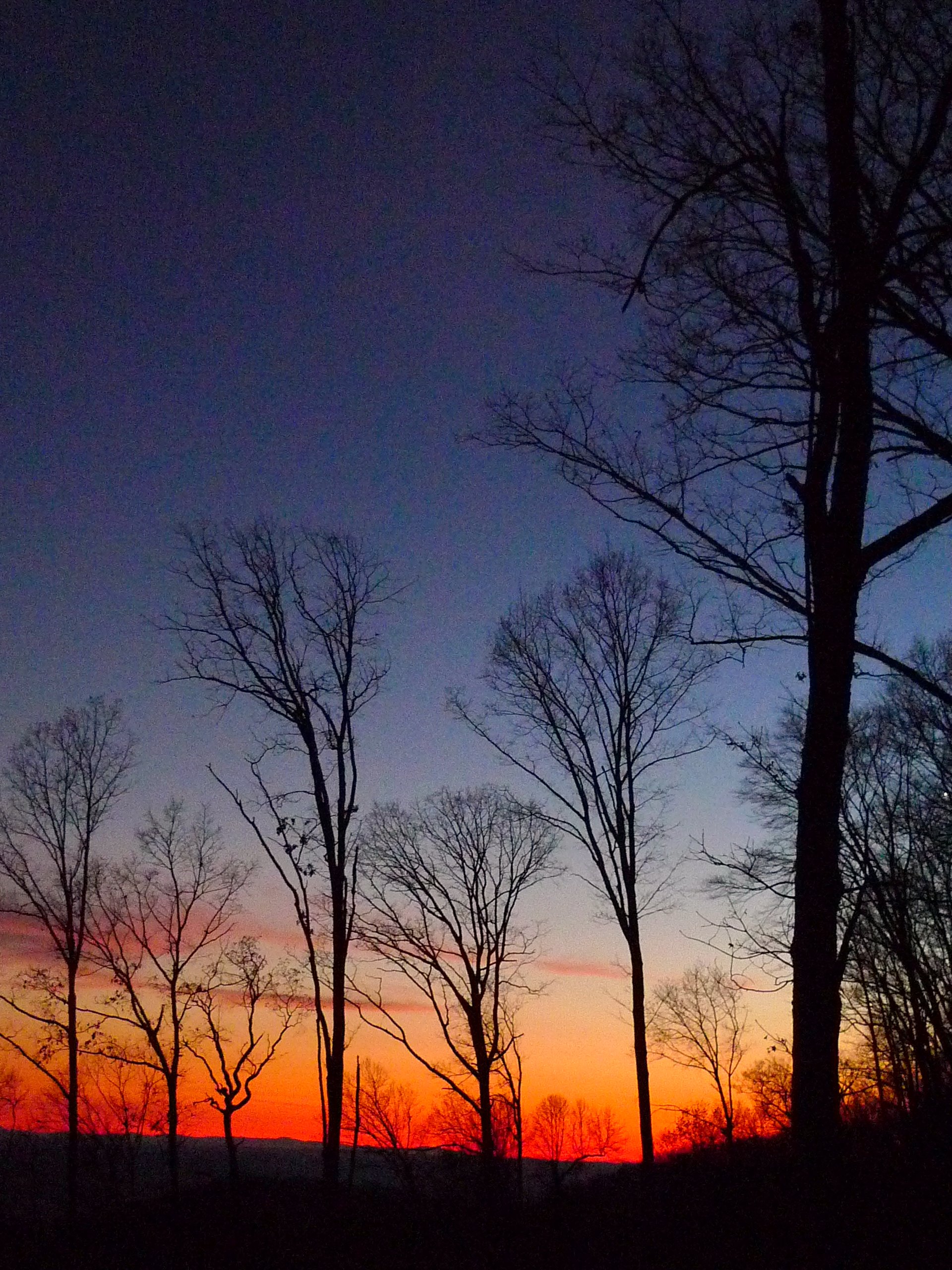
Sunset on Osborne Ridge

Sunset on Osborne Ridge

Red Skies At Night

WP_20141128_056.JPG

WP_20141128_055.JPG

WP_20141128_054.JPG

WP_20141128_053.JPG

WP_20141128_052.JPG

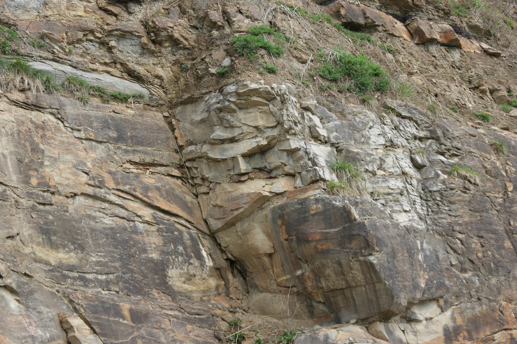
The Devil's Fork IV

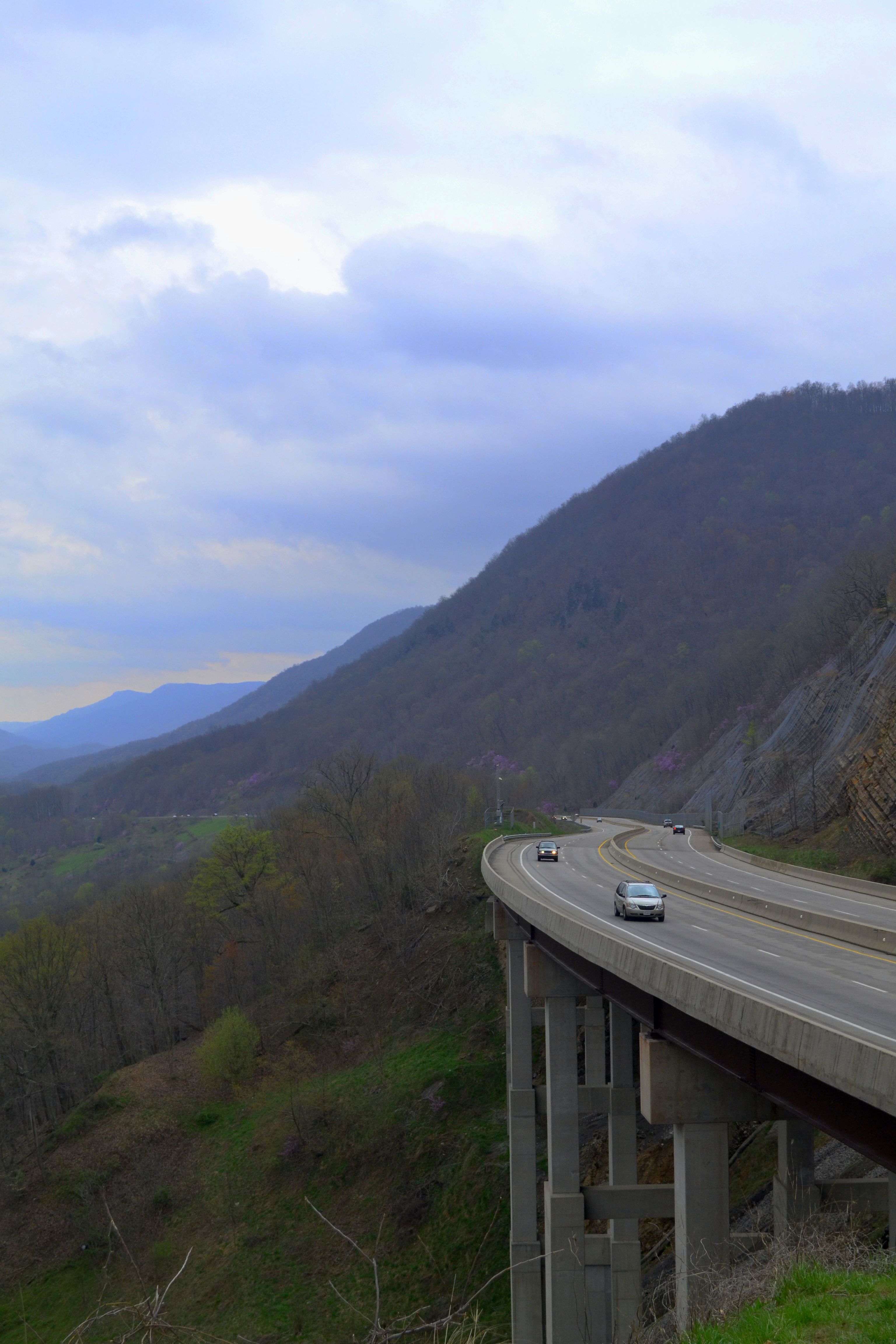
Spring in the Mountains

The Devil's Fork III

: : My Virginia : : Mew View

: : My Virginia : : Powell Valley

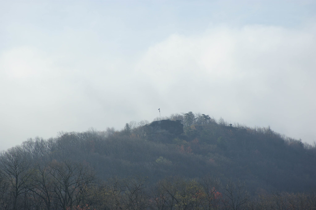
Blanketed in the Fog

Bear Rock Overlook

Storm Clouds over Powell Valley, Wise County, Virginia
Benge's Gap and James Walker Robinson Memorial Scenic Overlook

Big Stone Gap Overlook Panoramic

: : My Virginia : : Grazing in the Grass

Beneath a fog of country mountains.

View of Powell Valley near Norton, Virginia

Wise County, Virginia Views
Wise County, Virginia Views
Wise County, Virginia Views

Wise County, Virginia Views
Mapa de Pine Camp Rd, Coeburn, VA, EE. UU.
Buscar otro lugar
Lugares cercanos
Taffy Lane, Taffy Ln, Coeburn, VA, EE. UU.
Dungannon Rd, Coeburn, VA, EE. UU.
4, VA, EE. UU.
Valley View Church, Hunters Valley East Rd, Dungannon, VA, EE. UU.
Dungannon, Virginia, EE. UU.
Grays Ford, VA, EE. UU.
Coalpit Branch Drive, Coalpit Branch Dr, 5, VA, EE. UU.
River Bluff Rd, Dungannon, VA, EE. UU.
Hunters Valley East Rd, Dungannon, VA, EE. UU.
Luray Rd, Nickelsville, VA, EE. UU.
Falls Creek Road, Falls Creek Rd, Dungannon, VA, EE. UU.
Twin Springs High School, Titan Ln, Nickelsville, VA, EE. UU.
Titan Ln, Nickelsville, VA, EE. UU.
Long Hollow Road, Long Hollow Rd, 3, VA, EE. UU.
Fort Blackmore, VA, EE. UU.
Scarberry Hollow, Castlewood, VA, EE. UU.
Evans Road, Evans Rd, Coeburn, VA, EE. UU.
McClellan Town Ln, Gate City, VA, EE. UU.
Nickelsville, Virginia, EE. UU.
Co Rd, Warren Baker Dr, Castlewood, VA, EE. UU.
Búsquedas recientes
- Horas de salida y puesta de sol de Red Dog Mine, AK, USA
- Horas de salida y puesta de sol de Am Bahnhof, Am bhf, Borken, Germany
- Horas de salida y puesta de sol de 4th St E, Sonoma, CA, EE. UU.
- Horas de salida y puesta de sol de Oakland Ave, Williamsport, PA, EE. UU.
- Horas de salida y puesta de sol de Via Roma, Pieranica CR, Italia
- Horas de salida y puesta de sol de Torre del reloj, Grad, Dubrovnik (Ragusa), Croacia
- Horas de salida y puesta de sol de Trelew, Chubut, Argentina
- Horas de salida y puesta de sol de Hartfords Bluff Cir, Mt Pleasant, SC, EE. UU.
- Horas de salida y puesta de sol de Kita Ward, Kumamoto, Japón
- Horas de salida y puesta de sol de Pingtan Island, Pingtan County, Fuzhou, China