Horas de salida y puesta de sol de Old Clarksville Pike, Ashland City, TN, EE. UU.
Location: Estados Unidos > Tennessee > Condado de Cheatham > Ashland City >
Zona horaria:
America/Chicago
Hora local:
2025-06-16 23:40:07
Longitud:
-86.997438
Latitud:
36.333388
Salida de sol de hoy:
05:30:00 AM
Puesta de sol de hoy:
08:08:09 PM
La duración del día hoy:
14h 38m 9s
Salida de sol de mañana:
05:30:09 AM
Puesta de sol de mañana:
08:08:27 PM
La duración del día mañana:
14h 38m 18s
Mostrar todas las fechas
| Fecha | Salida de sol | Puesta de sol | Duración del día |
|---|---|---|---|
| 01/01/2025 | 06:59:34 AM | 04:44:41 PM | 9h 45m 7s |
| 02/01/2025 | 06:59:41 AM | 04:45:30 PM | 9h 45m 49s |
| 03/01/2025 | 06:59:45 AM | 04:46:20 PM | 9h 46m 35s |
| 04/01/2025 | 06:59:48 AM | 04:47:11 PM | 9h 47m 23s |
| 05/01/2025 | 06:59:49 AM | 04:48:03 PM | 9h 48m 14s |
| 06/01/2025 | 06:59:47 AM | 04:48:56 PM | 9h 49m 9s |
| 07/01/2025 | 06:59:44 AM | 04:49:50 PM | 9h 50m 6s |
| 08/01/2025 | 06:59:39 AM | 04:50:45 PM | 9h 51m 6s |
| 09/01/2025 | 06:59:31 AM | 04:51:41 PM | 9h 52m 10s |
| 10/01/2025 | 06:59:22 AM | 04:52:37 PM | 9h 53m 15s |
| 11/01/2025 | 06:59:11 AM | 04:53:35 PM | 9h 54m 24s |
| 12/01/2025 | 06:58:58 AM | 04:54:33 PM | 9h 55m 35s |
| 13/01/2025 | 06:58:42 AM | 04:55:32 PM | 9h 56m 50s |
| 14/01/2025 | 06:58:25 AM | 04:56:32 PM | 9h 58m 7s |
| 15/01/2025 | 06:58:06 AM | 04:57:32 PM | 9h 59m 26s |
| 16/01/2025 | 06:57:45 AM | 04:58:32 PM | 10h 0m 47s |
| 17/01/2025 | 06:57:22 AM | 04:59:34 PM | 10h 2m 12s |
| 18/01/2025 | 06:56:57 AM | 05:00:35 PM | 10h 3m 38s |
| 19/01/2025 | 06:56:30 AM | 05:01:37 PM | 10h 5m 7s |
| 20/01/2025 | 06:56:02 AM | 05:02:40 PM | 10h 6m 38s |
| 21/01/2025 | 06:55:31 AM | 05:03:42 PM | 10h 8m 11s |
| 22/01/2025 | 06:54:59 AM | 05:04:45 PM | 10h 9m 46s |
| 23/01/2025 | 06:54:25 AM | 05:05:48 PM | 10h 11m 23s |
| 24/01/2025 | 06:53:49 AM | 05:06:52 PM | 10h 13m 3s |
| 25/01/2025 | 06:53:11 AM | 05:07:55 PM | 10h 14m 44s |
| 26/01/2025 | 06:52:32 AM | 05:08:59 PM | 10h 16m 27s |
| 27/01/2025 | 06:51:51 AM | 05:10:03 PM | 10h 18m 12s |
| 28/01/2025 | 06:51:08 AM | 05:11:07 PM | 10h 19m 59s |
| 29/01/2025 | 06:50:23 AM | 05:12:11 PM | 10h 21m 48s |
| 30/01/2025 | 06:49:37 AM | 05:13:15 PM | 10h 23m 38s |
| 31/01/2025 | 06:48:50 AM | 05:14:18 PM | 10h 25m 28s |
| 01/02/2025 | 06:48:00 AM | 05:15:22 PM | 10h 27m 22s |
| 02/02/2025 | 06:47:10 AM | 05:16:26 PM | 10h 29m 16s |
| 03/02/2025 | 06:46:17 AM | 05:17:30 PM | 10h 31m 13s |
| 04/02/2025 | 06:45:24 AM | 05:18:33 PM | 10h 33m 9s |
| 05/02/2025 | 06:44:28 AM | 05:19:36 PM | 10h 35m 8s |
| 06/02/2025 | 06:43:32 AM | 05:20:40 PM | 10h 37m 8s |
| 07/02/2025 | 06:42:34 AM | 05:21:43 PM | 10h 39m 9s |
| 08/02/2025 | 06:41:34 AM | 05:22:45 PM | 10h 41m 11s |
| 09/02/2025 | 06:40:33 AM | 05:23:48 PM | 10h 43m 15s |
| 10/02/2025 | 06:39:31 AM | 05:24:50 PM | 10h 45m 19s |
| 11/02/2025 | 06:38:28 AM | 05:25:52 PM | 10h 47m 24s |
| 12/02/2025 | 06:37:23 AM | 05:26:54 PM | 10h 49m 31s |
| 13/02/2025 | 06:36:18 AM | 05:27:55 PM | 10h 51m 37s |
| 14/02/2025 | 06:35:11 AM | 05:28:56 PM | 10h 53m 45s |
| 15/02/2025 | 06:34:03 AM | 05:29:57 PM | 10h 55m 54s |
| 16/02/2025 | 06:32:54 AM | 05:30:58 PM | 10h 58m 4s |
| 17/02/2025 | 06:31:43 AM | 05:31:58 PM | 11h 0m 15s |
| 18/02/2025 | 06:30:32 AM | 05:32:58 PM | 11h 2m 26s |
| 19/02/2025 | 06:29:20 AM | 05:33:58 PM | 11h 4m 38s |
| 20/02/2025 | 06:28:07 AM | 05:34:57 PM | 11h 6m 50s |
| 21/02/2025 | 06:26:53 AM | 05:35:56 PM | 11h 9m 3s |
| 22/02/2025 | 06:25:38 AM | 05:36:54 PM | 11h 11m 16s |
| 23/02/2025 | 06:24:22 AM | 05:37:53 PM | 11h 13m 31s |
| 24/02/2025 | 06:23:05 AM | 05:38:51 PM | 11h 15m 46s |
| 25/02/2025 | 06:21:47 AM | 05:39:48 PM | 11h 18m 1s |
| 26/02/2025 | 06:20:29 AM | 05:40:46 PM | 11h 20m 17s |
| 27/02/2025 | 06:19:10 AM | 05:41:43 PM | 11h 22m 33s |
| 28/02/2025 | 06:17:50 AM | 05:42:39 PM | 11h 24m 49s |
| 01/03/2025 | 06:16:30 AM | 05:43:36 PM | 11h 27m 6s |
| 02/03/2025 | 06:15:08 AM | 05:44:32 PM | 11h 29m 24s |
| 03/03/2025 | 06:13:47 AM | 05:45:27 PM | 11h 31m 40s |
| 04/03/2025 | 06:12:24 AM | 05:46:23 PM | 11h 33m 59s |
| 05/03/2025 | 06:11:01 AM | 05:47:18 PM | 11h 36m 17s |
| 06/03/2025 | 06:09:38 AM | 05:48:13 PM | 11h 38m 35s |
| 07/03/2025 | 06:08:14 AM | 05:49:07 PM | 11h 40m 53s |
| 08/03/2025 | 06:06:50 AM | 05:50:02 PM | 11h 43m 12s |
| 09/03/2025 | 07:05:28 AM | 06:50:54 PM | 11h 45m 26s |
| 10/03/2025 | 07:04:03 AM | 06:51:47 PM | 11h 47m 44s |
| 11/03/2025 | 07:02:38 AM | 06:52:41 PM | 11h 50m 3s |
| 12/03/2025 | 07:01:12 AM | 06:53:34 PM | 11h 52m 22s |
| 13/03/2025 | 06:59:45 AM | 06:54:27 PM | 11h 54m 42s |
| 14/03/2025 | 06:58:19 AM | 06:55:20 PM | 11h 57m 1s |
| 15/03/2025 | 06:56:52 AM | 06:56:13 PM | 11h 59m 21s |
| 16/03/2025 | 06:55:25 AM | 06:57:06 PM | 12h 1m 41s |
| 17/03/2025 | 06:53:58 AM | 06:57:58 PM | 12h 4m 0s |
| 18/03/2025 | 06:52:31 AM | 06:58:50 PM | 12h 6m 19s |
| 19/03/2025 | 06:51:03 AM | 06:59:42 PM | 12h 8m 39s |
| 20/03/2025 | 06:49:36 AM | 07:00:34 PM | 12h 10m 58s |
| 21/03/2025 | 06:48:08 AM | 07:01:26 PM | 12h 13m 18s |
| 22/03/2025 | 06:46:40 AM | 07:02:18 PM | 12h 15m 38s |
| 23/03/2025 | 06:45:13 AM | 07:03:09 PM | 12h 17m 56s |
| 24/03/2025 | 06:43:45 AM | 07:04:01 PM | 12h 20m 16s |
| 25/03/2025 | 06:42:18 AM | 07:04:52 PM | 12h 22m 34s |
| 26/03/2025 | 06:40:50 AM | 07:05:44 PM | 12h 24m 54s |
| 27/03/2025 | 06:39:23 AM | 07:06:35 PM | 12h 27m 12s |
| 28/03/2025 | 06:37:55 AM | 07:07:26 PM | 12h 29m 31s |
| 29/03/2025 | 06:36:28 AM | 07:08:17 PM | 12h 31m 49s |
| 30/03/2025 | 06:35:01 AM | 07:09:08 PM | 12h 34m 7s |
| 31/03/2025 | 06:33:35 AM | 07:09:59 PM | 12h 36m 24s |
| 01/04/2025 | 06:32:08 AM | 07:10:50 PM | 12h 38m 42s |
| 02/04/2025 | 06:30:42 AM | 07:11:41 PM | 12h 40m 59s |
| 03/04/2025 | 06:29:16 AM | 07:12:32 PM | 12h 43m 16s |
| 04/04/2025 | 06:27:51 AM | 07:13:23 PM | 12h 45m 32s |
| 05/04/2025 | 06:26:26 AM | 07:14:14 PM | 12h 47m 48s |
| 06/04/2025 | 06:25:01 AM | 07:15:05 PM | 12h 50m 4s |
| 07/04/2025 | 06:23:37 AM | 07:15:57 PM | 12h 52m 20s |
| 08/04/2025 | 06:22:13 AM | 07:16:48 PM | 12h 54m 35s |
| 09/04/2025 | 06:20:49 AM | 07:17:39 PM | 12h 56m 50s |
| 10/04/2025 | 06:19:27 AM | 07:18:30 PM | 12h 59m 3s |
| 11/04/2025 | 06:18:04 AM | 07:19:21 PM | 13h 1m 17s |
| 12/04/2025 | 06:16:43 AM | 07:20:13 PM | 13h 3m 30s |
| 13/04/2025 | 06:15:22 AM | 07:21:04 PM | 13h 5m 42s |
| 14/04/2025 | 06:14:01 AM | 07:21:55 PM | 13h 7m 54s |
| 15/04/2025 | 06:12:41 AM | 07:22:47 PM | 13h 10m 6s |
| 16/04/2025 | 06:11:22 AM | 07:23:38 PM | 13h 12m 16s |
| 17/04/2025 | 06:10:04 AM | 07:24:30 PM | 13h 14m 26s |
| 18/04/2025 | 06:08:46 AM | 07:25:21 PM | 13h 16m 35s |
| 19/04/2025 | 06:07:29 AM | 07:26:13 PM | 13h 18m 44s |
| 20/04/2025 | 06:06:13 AM | 07:27:05 PM | 13h 20m 52s |
| 21/04/2025 | 06:04:58 AM | 07:27:57 PM | 13h 22m 59s |
| 22/04/2025 | 06:03:44 AM | 07:28:48 PM | 13h 25m 4s |
| 23/04/2025 | 06:02:31 AM | 07:29:40 PM | 13h 27m 9s |
| 24/04/2025 | 06:01:18 AM | 07:30:32 PM | 13h 29m 14s |
| 25/04/2025 | 06:00:07 AM | 07:31:24 PM | 13h 31m 17s |
| 26/04/2025 | 05:58:56 AM | 07:32:16 PM | 13h 33m 20s |
| 27/04/2025 | 05:57:47 AM | 07:33:08 PM | 13h 35m 21s |
| 28/04/2025 | 05:56:38 AM | 07:33:59 PM | 13h 37m 21s |
| 29/04/2025 | 05:55:31 AM | 07:34:51 PM | 13h 39m 20s |
| 30/04/2025 | 05:54:25 AM | 07:35:43 PM | 13h 41m 18s |
| 01/05/2025 | 05:53:19 AM | 07:36:35 PM | 13h 43m 16s |
| 02/05/2025 | 05:52:15 AM | 07:37:26 PM | 13h 45m 11s |
| 03/05/2025 | 05:51:13 AM | 07:38:18 PM | 13h 47m 5s |
| 04/05/2025 | 05:50:11 AM | 07:39:10 PM | 13h 48m 59s |
| 05/05/2025 | 05:49:11 AM | 07:40:01 PM | 13h 50m 50s |
| 06/05/2025 | 05:48:11 AM | 07:40:52 PM | 13h 52m 41s |
| 07/05/2025 | 05:47:14 AM | 07:41:43 PM | 13h 54m 29s |
| 08/05/2025 | 05:46:17 AM | 07:42:34 PM | 13h 56m 17s |
| 09/05/2025 | 05:45:22 AM | 07:43:25 PM | 13h 58m 3s |
| 10/05/2025 | 05:44:28 AM | 07:44:15 PM | 13h 59m 47s |
| 11/05/2025 | 05:43:36 AM | 07:45:06 PM | 14h 1m 30s |
| 12/05/2025 | 05:42:45 AM | 07:45:56 PM | 14h 3m 11s |
| 13/05/2025 | 05:41:55 AM | 07:46:45 PM | 14h 4m 50s |
| 14/05/2025 | 05:41:07 AM | 07:47:35 PM | 14h 6m 28s |
| 15/05/2025 | 05:40:21 AM | 07:48:24 PM | 14h 8m 3s |
| 16/05/2025 | 05:39:36 AM | 07:49:12 PM | 14h 9m 36s |
| 17/05/2025 | 05:38:52 AM | 07:50:00 PM | 14h 11m 8s |
| 18/05/2025 | 05:38:10 AM | 07:50:48 PM | 14h 12m 38s |
| 19/05/2025 | 05:37:30 AM | 07:51:36 PM | 14h 14m 6s |
| 20/05/2025 | 05:36:51 AM | 07:52:22 PM | 14h 15m 31s |
| 21/05/2025 | 05:36:14 AM | 07:53:08 PM | 14h 16m 54s |
| 22/05/2025 | 05:35:38 AM | 07:53:54 PM | 14h 18m 16s |
| 23/05/2025 | 05:35:04 AM | 07:54:39 PM | 14h 19m 35s |
| 24/05/2025 | 05:34:32 AM | 07:55:24 PM | 14h 20m 52s |
| 25/05/2025 | 05:34:01 AM | 07:56:07 PM | 14h 22m 6s |
| 26/05/2025 | 05:33:32 AM | 07:56:50 PM | 14h 23m 18s |
| 27/05/2025 | 05:33:04 AM | 07:57:32 PM | 14h 24m 28s |
| 28/05/2025 | 05:32:39 AM | 07:58:14 PM | 14h 25m 35s |
| 29/05/2025 | 05:32:15 AM | 07:58:54 PM | 14h 26m 39s |
| 30/05/2025 | 05:31:53 AM | 07:59:34 PM | 14h 27m 41s |
| 31/05/2025 | 05:31:32 AM | 08:00:13 PM | 14h 28m 41s |
| 01/06/2025 | 05:31:13 AM | 08:00:51 PM | 14h 29m 38s |
| 02/06/2025 | 05:30:56 AM | 08:01:28 PM | 14h 30m 32s |
| 03/06/2025 | 05:30:41 AM | 08:02:04 PM | 14h 31m 23s |
| 04/06/2025 | 05:30:27 AM | 08:02:38 PM | 14h 32m 11s |
| 05/06/2025 | 05:30:15 AM | 08:03:12 PM | 14h 32m 57s |
| 06/06/2025 | 05:30:05 AM | 08:03:45 PM | 14h 33m 40s |
| 07/06/2025 | 05:29:57 AM | 08:04:16 PM | 14h 34m 19s |
| 08/06/2025 | 05:29:50 AM | 08:04:46 PM | 14h 34m 56s |
| 09/06/2025 | 05:29:45 AM | 08:05:15 PM | 14h 35m 30s |
| 10/06/2025 | 05:29:41 AM | 08:05:43 PM | 14h 36m 2s |
| 11/06/2025 | 05:29:40 AM | 08:06:10 PM | 14h 36m 30s |
| 12/06/2025 | 05:29:40 AM | 08:06:35 PM | 14h 36m 55s |
| 13/06/2025 | 05:29:41 AM | 08:06:58 PM | 14h 37m 17s |
| 14/06/2025 | 05:29:45 AM | 08:07:21 PM | 14h 37m 36s |
| 15/06/2025 | 05:29:50 AM | 08:07:42 PM | 14h 37m 52s |
| 16/06/2025 | 05:29:56 AM | 08:08:01 PM | 14h 38m 5s |
| 17/06/2025 | 05:30:05 AM | 08:08:19 PM | 14h 38m 14s |
| 18/06/2025 | 05:30:14 AM | 08:08:35 PM | 14h 38m 21s |
| 19/06/2025 | 05:30:26 AM | 08:08:50 PM | 14h 38m 24s |
| 20/06/2025 | 05:30:38 AM | 08:09:04 PM | 14h 38m 26s |
| 21/06/2025 | 05:30:53 AM | 08:09:15 PM | 14h 38m 22s |
| 22/06/2025 | 05:31:09 AM | 08:09:25 PM | 14h 38m 16s |
| 23/06/2025 | 05:31:26 AM | 08:09:34 PM | 14h 38m 8s |
| 24/06/2025 | 05:31:45 AM | 08:09:41 PM | 14h 37m 56s |
| 25/06/2025 | 05:32:05 AM | 08:09:46 PM | 14h 37m 41s |
| 26/06/2025 | 05:32:26 AM | 08:09:49 PM | 14h 37m 23s |
| 27/06/2025 | 05:32:49 AM | 08:09:51 PM | 14h 37m 2s |
| 28/06/2025 | 05:33:13 AM | 08:09:51 PM | 14h 36m 38s |
| 29/06/2025 | 05:33:39 AM | 08:09:49 PM | 14h 36m 10s |
| 30/06/2025 | 05:34:05 AM | 08:09:46 PM | 14h 35m 41s |
| 01/07/2025 | 05:34:33 AM | 08:09:41 PM | 14h 35m 8s |
| 02/07/2025 | 05:35:02 AM | 08:09:34 PM | 14h 34m 32s |
| 03/07/2025 | 05:35:32 AM | 08:09:25 PM | 14h 33m 53s |
| 04/07/2025 | 05:36:04 AM | 08:09:15 PM | 14h 33m 11s |
| 05/07/2025 | 05:36:36 AM | 08:09:02 PM | 14h 32m 26s |
| 06/07/2025 | 05:37:09 AM | 08:08:49 PM | 14h 31m 40s |
| 07/07/2025 | 05:37:44 AM | 08:08:33 PM | 14h 30m 49s |
| 08/07/2025 | 05:38:19 AM | 08:08:15 PM | 14h 29m 56s |
| 09/07/2025 | 05:38:55 AM | 08:07:56 PM | 14h 29m 1s |
| 10/07/2025 | 05:39:32 AM | 08:07:35 PM | 14h 28m 3s |
| 11/07/2025 | 05:40:10 AM | 08:07:12 PM | 14h 27m 2s |
| 12/07/2025 | 05:40:49 AM | 08:06:48 PM | 14h 25m 59s |
| 13/07/2025 | 05:41:28 AM | 08:06:21 PM | 14h 24m 53s |
| 14/07/2025 | 05:42:09 AM | 08:05:53 PM | 14h 23m 44s |
| 15/07/2025 | 05:42:50 AM | 08:05:24 PM | 14h 22m 34s |
| 16/07/2025 | 05:43:31 AM | 08:04:52 PM | 14h 21m 21s |
| 17/07/2025 | 05:44:13 AM | 08:04:19 PM | 14h 20m 6s |
| 18/07/2025 | 05:44:56 AM | 08:03:44 PM | 14h 18m 48s |
| 19/07/2025 | 05:45:40 AM | 08:03:08 PM | 14h 17m 28s |
| 20/07/2025 | 05:46:24 AM | 08:02:30 PM | 14h 16m 6s |
| 21/07/2025 | 05:47:08 AM | 08:01:50 PM | 14h 14m 42s |
| 22/07/2025 | 05:47:53 AM | 08:01:09 PM | 14h 13m 16s |
| 23/07/2025 | 05:48:38 AM | 08:00:26 PM | 14h 11m 48s |
| 24/07/2025 | 05:49:24 AM | 07:59:42 PM | 14h 10m 18s |
| 25/07/2025 | 05:50:10 AM | 07:58:56 PM | 14h 8m 46s |
| 26/07/2025 | 05:50:56 AM | 07:58:08 PM | 14h 7m 12s |
| 27/07/2025 | 05:51:43 AM | 07:57:19 PM | 14h 5m 36s |
| 28/07/2025 | 05:52:30 AM | 07:56:28 PM | 14h 3m 58s |
| 29/07/2025 | 05:53:17 AM | 07:55:36 PM | 14h 2m 19s |
| 30/07/2025 | 05:54:04 AM | 07:54:43 PM | 14h 0m 39s |
| 31/07/2025 | 05:54:52 AM | 07:53:48 PM | 13h 58m 56s |
| 01/08/2025 | 05:55:39 AM | 07:52:52 PM | 13h 57m 13s |
| 02/08/2025 | 05:56:27 AM | 07:51:54 PM | 13h 55m 27s |
| 03/08/2025 | 05:57:15 AM | 07:50:55 PM | 13h 53m 40s |
| 04/08/2025 | 05:58:03 AM | 07:49:55 PM | 13h 51m 52s |
| 05/08/2025 | 05:58:52 AM | 07:48:53 PM | 13h 50m 1s |
| 06/08/2025 | 05:59:40 AM | 07:47:51 PM | 13h 48m 11s |
| 07/08/2025 | 06:00:28 AM | 07:46:46 PM | 13h 46m 18s |
| 08/08/2025 | 06:01:17 AM | 07:45:41 PM | 13h 44m 24s |
| 09/08/2025 | 06:02:05 AM | 07:44:35 PM | 13h 42m 30s |
| 10/08/2025 | 06:02:53 AM | 07:43:27 PM | 13h 40m 34s |
| 11/08/2025 | 06:03:42 AM | 07:42:19 PM | 13h 38m 37s |
| 12/08/2025 | 06:04:30 AM | 07:41:09 PM | 13h 36m 39s |
| 13/08/2025 | 06:05:19 AM | 07:39:58 PM | 13h 34m 39s |
| 14/08/2025 | 06:06:07 AM | 07:38:46 PM | 13h 32m 39s |
| 15/08/2025 | 06:06:55 AM | 07:37:33 PM | 13h 30m 38s |
| 16/08/2025 | 06:07:44 AM | 07:36:19 PM | 13h 28m 35s |
| 17/08/2025 | 06:08:32 AM | 07:35:04 PM | 13h 26m 32s |
| 18/08/2025 | 06:09:20 AM | 07:33:49 PM | 13h 24m 29s |
| 19/08/2025 | 06:10:08 AM | 07:32:32 PM | 13h 22m 24s |
| 20/08/2025 | 06:10:56 AM | 07:31:14 PM | 13h 20m 18s |
| 21/08/2025 | 06:11:44 AM | 07:29:56 PM | 13h 18m 12s |
| 22/08/2025 | 06:12:31 AM | 07:28:37 PM | 13h 16m 6s |
| 23/08/2025 | 06:13:19 AM | 07:27:17 PM | 13h 13m 58s |
| 24/08/2025 | 06:14:07 AM | 07:25:56 PM | 13h 11m 49s |
| 25/08/2025 | 06:14:54 AM | 07:24:35 PM | 13h 9m 41s |
| 26/08/2025 | 06:15:42 AM | 07:23:13 PM | 13h 7m 31s |
| 27/08/2025 | 06:16:29 AM | 07:21:50 PM | 13h 5m 21s |
| 28/08/2025 | 06:17:16 AM | 07:20:27 PM | 13h 3m 11s |
| 29/08/2025 | 06:18:04 AM | 07:19:03 PM | 13h 0m 59s |
| 30/08/2025 | 06:18:51 AM | 07:17:38 PM | 12h 58m 47s |
| 31/08/2025 | 06:19:38 AM | 07:16:13 PM | 12h 56m 35s |
| 01/09/2025 | 06:20:25 AM | 07:14:48 PM | 12h 54m 23s |
| 02/09/2025 | 06:21:12 AM | 07:13:22 PM | 12h 52m 10s |
| 03/09/2025 | 06:21:58 AM | 07:11:55 PM | 12h 49m 57s |
| 04/09/2025 | 06:22:45 AM | 07:10:28 PM | 12h 47m 43s |
| 05/09/2025 | 06:23:32 AM | 07:09:01 PM | 12h 45m 29s |
| 06/09/2025 | 06:24:19 AM | 07:07:33 PM | 12h 43m 14s |
| 07/09/2025 | 06:25:06 AM | 07:06:05 PM | 12h 40m 59s |
| 08/09/2025 | 06:25:52 AM | 07:04:36 PM | 12h 38m 44s |
| 09/09/2025 | 06:26:39 AM | 07:03:08 PM | 12h 36m 29s |
| 10/09/2025 | 06:27:26 AM | 07:01:39 PM | 12h 34m 13s |
| 11/09/2025 | 06:28:13 AM | 07:00:10 PM | 12h 31m 57s |
| 12/09/2025 | 06:28:59 AM | 06:58:40 PM | 12h 29m 41s |
| 13/09/2025 | 06:29:46 AM | 06:57:11 PM | 12h 27m 25s |
| 14/09/2025 | 06:30:33 AM | 06:55:41 PM | 12h 25m 8s |
| 15/09/2025 | 06:31:20 AM | 06:54:11 PM | 12h 22m 51s |
| 16/09/2025 | 06:32:07 AM | 06:52:41 PM | 12h 20m 34s |
| 17/09/2025 | 06:32:54 AM | 06:51:11 PM | 12h 18m 17s |
| 18/09/2025 | 06:33:41 AM | 06:49:42 PM | 12h 16m 1s |
| 19/09/2025 | 06:34:28 AM | 06:48:12 PM | 12h 13m 44s |
| 20/09/2025 | 06:35:16 AM | 06:46:42 PM | 12h 11m 26s |
| 21/09/2025 | 06:36:03 AM | 06:45:12 PM | 12h 9m 9s |
| 22/09/2025 | 06:36:51 AM | 06:43:42 PM | 12h 6m 51s |
| 23/09/2025 | 06:37:38 AM | 06:42:12 PM | 12h 4m 34s |
| 24/09/2025 | 06:38:26 AM | 06:40:43 PM | 12h 2m 17s |
| 25/09/2025 | 06:39:14 AM | 06:39:14 PM | 12h 0m 0s |
| 26/09/2025 | 06:40:03 AM | 06:37:44 PM | 11h 57m 41s |
| 27/09/2025 | 06:40:51 AM | 06:36:16 PM | 11h 55m 25s |
| 28/09/2025 | 06:41:40 AM | 06:34:47 PM | 11h 53m 7s |
| 29/09/2025 | 06:42:29 AM | 06:33:19 PM | 11h 50m 50s |
| 30/09/2025 | 06:43:18 AM | 06:31:51 PM | 11h 48m 33s |
| 01/10/2025 | 06:44:07 AM | 06:30:23 PM | 11h 46m 16s |
| 02/10/2025 | 06:44:57 AM | 06:28:56 PM | 11h 43m 59s |
| 03/10/2025 | 06:45:47 AM | 06:27:29 PM | 11h 41m 42s |
| 04/10/2025 | 06:46:37 AM | 06:26:03 PM | 11h 39m 26s |
| 05/10/2025 | 06:47:27 AM | 06:24:37 PM | 11h 37m 10s |
| 06/10/2025 | 06:48:18 AM | 06:23:11 PM | 11h 34m 53s |
| 07/10/2025 | 06:49:09 AM | 06:21:47 PM | 11h 32m 38s |
| 08/10/2025 | 06:50:00 AM | 06:20:22 PM | 11h 30m 22s |
| 09/10/2025 | 06:50:52 AM | 06:18:59 PM | 11h 28m 7s |
| 10/10/2025 | 06:51:44 AM | 06:17:36 PM | 11h 25m 52s |
| 11/10/2025 | 06:52:36 AM | 06:16:13 PM | 11h 23m 37s |
| 12/10/2025 | 06:53:29 AM | 06:14:51 PM | 11h 21m 22s |
| 13/10/2025 | 06:54:22 AM | 06:13:30 PM | 11h 19m 8s |
| 14/10/2025 | 06:55:15 AM | 06:12:10 PM | 11h 16m 55s |
| 15/10/2025 | 06:56:09 AM | 06:10:51 PM | 11h 14m 42s |
| 16/10/2025 | 06:57:03 AM | 06:09:32 PM | 11h 12m 29s |
| 17/10/2025 | 06:57:57 AM | 06:08:14 PM | 11h 10m 17s |
| 18/10/2025 | 06:58:52 AM | 06:06:57 PM | 11h 8m 5s |
| 19/10/2025 | 06:59:47 AM | 06:05:42 PM | 11h 5m 55s |
| 20/10/2025 | 07:00:42 AM | 06:04:26 PM | 11h 3m 44s |
| 21/10/2025 | 07:01:38 AM | 06:03:12 PM | 11h 1m 34s |
| 22/10/2025 | 07:02:34 AM | 06:01:59 PM | 10h 59m 25s |
| 23/10/2025 | 07:03:30 AM | 06:00:47 PM | 10h 57m 17s |
| 24/10/2025 | 07:04:27 AM | 05:59:36 PM | 10h 55m 9s |
| 25/10/2025 | 07:05:24 AM | 05:58:27 PM | 10h 53m 3s |
| 26/10/2025 | 07:06:22 AM | 05:57:18 PM | 10h 50m 56s |
| 27/10/2025 | 07:07:20 AM | 05:56:10 PM | 10h 48m 50s |
| 28/10/2025 | 07:08:18 AM | 05:55:04 PM | 10h 46m 46s |
| 29/10/2025 | 07:09:16 AM | 05:53:59 PM | 10h 44m 43s |
| 30/10/2025 | 07:10:15 AM | 05:52:55 PM | 10h 42m 40s |
| 31/10/2025 | 07:11:14 AM | 05:51:53 PM | 10h 40m 39s |
| 01/11/2025 | 07:12:13 AM | 05:50:52 PM | 10h 38m 39s |
| 02/11/2025 | 06:13:15 AM | 04:49:49 PM | 10h 36m 34s |
| 03/11/2025 | 06:14:15 AM | 04:48:51 PM | 10h 34m 36s |
| 04/11/2025 | 06:15:15 AM | 04:47:54 PM | 10h 32m 39s |
| 05/11/2025 | 06:16:15 AM | 04:46:59 PM | 10h 30m 44s |
| 06/11/2025 | 06:17:16 AM | 04:46:05 PM | 10h 28m 49s |
| 07/11/2025 | 06:18:16 AM | 04:45:12 PM | 10h 26m 56s |
| 08/11/2025 | 06:19:17 AM | 04:44:22 PM | 10h 25m 5s |
| 09/11/2025 | 06:20:18 AM | 04:43:32 PM | 10h 23m 14s |
| 10/11/2025 | 06:21:19 AM | 04:42:45 PM | 10h 21m 26s |
| 11/11/2025 | 06:22:20 AM | 04:41:59 PM | 10h 19m 39s |
| 12/11/2025 | 06:23:21 AM | 04:41:14 PM | 10h 17m 53s |
| 13/11/2025 | 06:24:22 AM | 04:40:32 PM | 10h 16m 10s |
| 14/11/2025 | 06:25:23 AM | 04:39:51 PM | 10h 14m 28s |
| 15/11/2025 | 06:26:23 AM | 04:39:11 PM | 10h 12m 48s |
| 16/11/2025 | 06:27:24 AM | 04:38:34 PM | 10h 11m 10s |
| 17/11/2025 | 06:28:25 AM | 04:37:58 PM | 10h 9m 33s |
| 18/11/2025 | 06:29:25 AM | 04:37:25 PM | 10h 8m 0s |
| 19/11/2025 | 06:30:25 AM | 04:36:53 PM | 10h 6m 28s |
| 20/11/2025 | 06:31:25 AM | 04:36:23 PM | 10h 4m 58s |
| 21/11/2025 | 06:32:25 AM | 04:35:54 PM | 10h 3m 29s |
| 22/11/2025 | 06:33:25 AM | 04:35:28 PM | 10h 2m 3s |
| 23/11/2025 | 06:34:24 AM | 04:35:04 PM | 10h 0m 40s |
| 24/11/2025 | 06:35:22 AM | 04:34:41 PM | 9h 59m 19s |
| 25/11/2025 | 06:36:20 AM | 04:34:21 PM | 9h 58m 1s |
| 26/11/2025 | 06:37:18 AM | 04:34:03 PM | 9h 56m 45s |
| 27/11/2025 | 06:38:15 AM | 04:33:46 PM | 9h 55m 31s |
| 28/11/2025 | 06:39:11 AM | 04:33:32 PM | 9h 54m 21s |
| 29/11/2025 | 06:40:07 AM | 04:33:19 PM | 9h 53m 12s |
| 30/11/2025 | 06:41:02 AM | 04:33:09 PM | 9h 52m 7s |
| 01/12/2025 | 06:41:56 AM | 04:33:00 PM | 9h 51m 4s |
| 02/12/2025 | 06:42:50 AM | 04:32:54 PM | 9h 50m 4s |
| 03/12/2025 | 06:43:42 AM | 04:32:50 PM | 9h 49m 8s |
| 04/12/2025 | 06:44:34 AM | 04:32:47 PM | 9h 48m 13s |
| 05/12/2025 | 06:45:25 AM | 04:32:47 PM | 9h 47m 22s |
| 06/12/2025 | 06:46:15 AM | 04:32:49 PM | 9h 46m 34s |
| 07/12/2025 | 06:47:04 AM | 04:32:52 PM | 9h 45m 48s |
| 08/12/2025 | 06:47:51 AM | 04:32:58 PM | 9h 45m 7s |
| 09/12/2025 | 06:48:38 AM | 04:33:06 PM | 9h 44m 28s |
| 10/12/2025 | 06:49:23 AM | 04:33:16 PM | 9h 43m 53s |
| 11/12/2025 | 06:50:07 AM | 04:33:28 PM | 9h 43m 21s |
| 12/12/2025 | 06:50:50 AM | 04:33:41 PM | 9h 42m 51s |
| 13/12/2025 | 06:51:31 AM | 04:33:57 PM | 9h 42m 26s |
| 14/12/2025 | 06:52:11 AM | 04:34:15 PM | 9h 42m 4s |
| 15/12/2025 | 06:52:50 AM | 04:34:34 PM | 9h 41m 44s |
| 16/12/2025 | 06:53:27 AM | 04:34:56 PM | 9h 41m 29s |
| 17/12/2025 | 06:54:03 AM | 04:35:19 PM | 9h 41m 16s |
| 18/12/2025 | 06:54:37 AM | 04:35:44 PM | 9h 41m 7s |
| 19/12/2025 | 06:55:09 AM | 04:36:11 PM | 9h 41m 2s |
| 20/12/2025 | 06:55:40 AM | 04:36:40 PM | 9h 41m 0s |
| 21/12/2025 | 06:56:09 AM | 04:37:10 PM | 9h 41m 1s |
| 22/12/2025 | 06:56:37 AM | 04:37:42 PM | 9h 41m 5s |
| 23/12/2025 | 06:57:03 AM | 04:38:16 PM | 9h 41m 13s |
| 24/12/2025 | 06:57:27 AM | 04:38:52 PM | 9h 41m 25s |
| 25/12/2025 | 06:57:49 AM | 04:39:29 PM | 9h 41m 40s |
| 26/12/2025 | 06:58:09 AM | 04:40:07 PM | 9h 41m 58s |
| 27/12/2025 | 06:58:28 AM | 04:40:48 PM | 9h 42m 20s |
| 28/12/2025 | 06:58:44 AM | 04:41:29 PM | 9h 42m 45s |
| 29/12/2025 | 06:58:59 AM | 04:42:12 PM | 9h 43m 13s |
| 30/12/2025 | 06:59:12 AM | 04:42:57 PM | 9h 43m 45s |
| 31/12/2025 | 06:59:23 AM | 04:43:43 PM | 9h 44m 20s |
Fotos

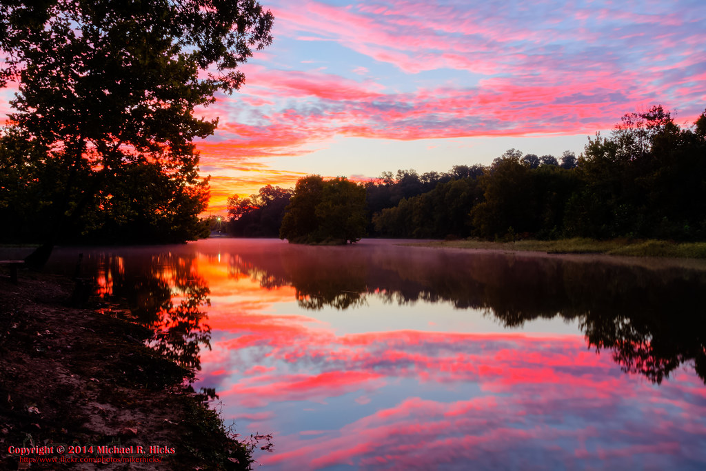
Fall Sunset at Beaman Park 2008

Beaman Park at Sunset

Cumberland River Bicentennial Trail Bridge near Sunset

Sycamore Hills barn in the fog

Fall Sunset 2012

Off the Beaten Path

Sunrise - 3rd annual George McCabe Memorial Hike

Sunset in Corn Country

Cool Sunset

Sycamore Hills

Rolling down the Road

Sunset over Lois
Sunrise - 3rd annual George McCabe Memorial Hike

Sunrise - 3rd annual George McCabe Memorial Hike

Sunrise - 3rd annual George McCabe Memorial Hike

Sunrise - 3rd annual George McCabe Memorial Hike

Sunrise - 3rd annual George McCabe Memorial Hike
Mapa de Old Clarksville Pike, Ashland City, TN, EE. UU.
Buscar otro lugar
Lugares cercanos
Old Clarksville Pike, Ashland City, TN, EE. UU.
Old Clarksville Pike, Joelton, TN, EE. UU.
Abernathy Rd, Ashland City, TN, EE. UU.
Oakwood Rd, Joelton, TN, EE. UU.
Bracey Cir, Joelton, TN, EE. UU.
Ed Harris Rd, Ashland City, TN, EE. UU.
Ed Harris Rd, Ashland City, TN, EE. UU.
Ashland City, Tennessee, EE. UU.
N Vine St, Ashland City, TN, EE. UU.
Little Marrowbone Rd, Ashland City, TN, EE. UU.
Grays Point Rd, Joelton, TN, EE. UU.
Shoals Landing, Ashland City, TN, EE. UU.
Floy Ln, Ashland City, TN, EE. UU.
Noah Reeves Rd, Ashland City, TN, EE. UU.
TN-12, Ashland City, TN, EE. UU.
Sunrise Cir, Ashland City, TN, EE. UU.
River Rd, Ashland City, TN, EE. UU.
Greenbrier Rd, Ashland City, TN, EE. UU.
William Hill, Nashville, TN, EE. UU.
Matlock Dr, Chapmansboro, TN, EE. UU.
Búsquedas recientes
- Horas de salida y puesta de sol de Red Dog Mine, AK, USA
- Horas de salida y puesta de sol de Am Bahnhof, Am bhf, Borken, Germany
- Horas de salida y puesta de sol de 4th St E, Sonoma, CA, EE. UU.
- Horas de salida y puesta de sol de Oakland Ave, Williamsport, PA, EE. UU.
- Horas de salida y puesta de sol de Via Roma, Pieranica CR, Italia
- Horas de salida y puesta de sol de Torre del reloj, Grad, Dubrovnik (Ragusa), Croacia
- Horas de salida y puesta de sol de Trelew, Chubut, Argentina
- Horas de salida y puesta de sol de Hartfords Bluff Cir, Mt Pleasant, SC, EE. UU.
- Horas de salida y puesta de sol de Kita Ward, Kumamoto, Japón
- Horas de salida y puesta de sol de Pingtan Island, Pingtan County, Fuzhou, China