Horas de salida y puesta de sol de Maniguh, Uttarakhand, India
Location: India > Uttarakhand > Distrito de Rudraprayag >
Zona horaria:
Asia/Calcutta
Hora local:
2025-07-04 04:00:25
Longitud:
79.0637994
Latitud:
30.3832149
Salida de sol de hoy:
05:16:41 AM
Puesta de sol de hoy:
07:19:47 PM
La duración del día hoy:
14h 3m 6s
Salida de sol de mañana:
05:17:08 AM
Puesta de sol de mañana:
07:19:41 PM
La duración del día mañana:
14h 2m 33s
Mostrar todas las fechas
| Fecha | Salida de sol | Puesta de sol | Duración del día |
|---|---|---|---|
| 01/01/2025 | 07:10:31 AM | 05:24:23 PM | 10h 13m 52s |
| 02/01/2025 | 07:10:43 AM | 05:25:06 PM | 10h 14m 23s |
| 03/01/2025 | 07:10:54 AM | 05:25:50 PM | 10h 14m 56s |
| 04/01/2025 | 07:11:04 AM | 05:26:35 PM | 10h 15m 31s |
| 05/01/2025 | 07:11:12 AM | 05:27:21 PM | 10h 16m 9s |
| 06/01/2025 | 07:11:18 AM | 05:28:07 PM | 10h 16m 49s |
| 07/01/2025 | 07:11:22 AM | 05:28:55 PM | 10h 17m 33s |
| 08/01/2025 | 07:11:25 AM | 05:29:42 PM | 10h 18m 17s |
| 09/01/2025 | 07:11:26 AM | 05:30:31 PM | 10h 19m 5s |
| 10/01/2025 | 07:11:26 AM | 05:31:20 PM | 10h 19m 54s |
| 11/01/2025 | 07:11:23 AM | 05:32:10 PM | 10h 20m 47s |
| 12/01/2025 | 07:11:19 AM | 05:33:00 PM | 10h 21m 41s |
| 13/01/2025 | 07:11:14 AM | 05:33:50 PM | 10h 22m 36s |
| 14/01/2025 | 07:11:06 AM | 05:34:41 PM | 10h 23m 35s |
| 15/01/2025 | 07:10:57 AM | 05:35:32 PM | 10h 24m 35s |
| 16/01/2025 | 07:10:47 AM | 05:36:24 PM | 10h 25m 37s |
| 17/01/2025 | 07:10:34 AM | 05:37:16 PM | 10h 26m 42s |
| 18/01/2025 | 07:10:20 AM | 05:38:08 PM | 10h 27m 48s |
| 19/01/2025 | 07:10:05 AM | 05:39:00 PM | 10h 28m 55s |
| 20/01/2025 | 07:09:47 AM | 05:39:53 PM | 10h 30m 6s |
| 21/01/2025 | 07:09:28 AM | 05:40:46 PM | 10h 31m 18s |
| 22/01/2025 | 07:09:08 AM | 05:41:38 PM | 10h 32m 30s |
| 23/01/2025 | 07:08:45 AM | 05:42:31 PM | 10h 33m 46s |
| 24/01/2025 | 07:08:21 AM | 05:43:24 PM | 10h 35m 3s |
| 25/01/2025 | 07:07:56 AM | 05:44:17 PM | 10h 36m 21s |
| 26/01/2025 | 07:07:29 AM | 05:45:10 PM | 10h 37m 41s |
| 27/01/2025 | 07:07:00 AM | 05:46:03 PM | 10h 39m 3s |
| 28/01/2025 | 07:06:30 AM | 05:46:55 PM | 10h 40m 25s |
| 29/01/2025 | 07:05:59 AM | 05:47:48 PM | 10h 41m 49s |
| 30/01/2025 | 07:05:26 AM | 05:48:40 PM | 10h 43m 14s |
| 31/01/2025 | 07:04:51 AM | 05:49:33 PM | 10h 44m 42s |
| 01/02/2025 | 07:04:15 AM | 05:50:25 PM | 10h 46m 10s |
| 02/02/2025 | 07:03:38 AM | 05:51:17 PM | 10h 47m 39s |
| 03/02/2025 | 07:02:59 AM | 05:52:08 PM | 10h 49m 9s |
| 04/02/2025 | 07:02:18 AM | 05:53:00 PM | 10h 50m 42s |
| 05/02/2025 | 07:01:37 AM | 05:53:51 PM | 10h 52m 14s |
| 06/02/2025 | 07:00:54 AM | 05:54:42 PM | 10h 53m 48s |
| 07/02/2025 | 07:00:10 AM | 05:55:32 PM | 10h 55m 22s |
| 08/02/2025 | 06:59:24 AM | 05:56:23 PM | 10h 56m 59s |
| 09/02/2025 | 06:58:37 AM | 05:57:13 PM | 10h 58m 36s |
| 10/02/2025 | 06:57:49 AM | 05:58:02 PM | 11h 0m 13s |
| 11/02/2025 | 06:57:00 AM | 05:58:52 PM | 11h 1m 52s |
| 12/02/2025 | 06:56:10 AM | 05:59:41 PM | 11h 3m 31s |
| 13/02/2025 | 06:55:18 AM | 06:00:29 PM | 11h 5m 11s |
| 14/02/2025 | 06:54:26 AM | 06:01:18 PM | 11h 6m 52s |
| 15/02/2025 | 06:53:32 AM | 06:02:05 PM | 11h 8m 33s |
| 16/02/2025 | 06:52:37 AM | 06:02:53 PM | 11h 10m 16s |
| 17/02/2025 | 06:51:41 AM | 06:03:40 PM | 11h 11m 59s |
| 18/02/2025 | 06:50:45 AM | 06:04:27 PM | 11h 13m 42s |
| 19/02/2025 | 06:49:47 AM | 06:05:13 PM | 11h 15m 26s |
| 20/02/2025 | 06:48:48 AM | 06:05:59 PM | 11h 17m 11s |
| 21/02/2025 | 06:47:49 AM | 06:06:45 PM | 11h 18m 56s |
| 22/02/2025 | 06:46:48 AM | 06:07:30 PM | 11h 20m 42s |
| 23/02/2025 | 06:45:47 AM | 06:08:15 PM | 11h 22m 28s |
| 24/02/2025 | 06:44:44 AM | 06:08:59 PM | 11h 24m 15s |
| 25/02/2025 | 06:43:41 AM | 06:09:44 PM | 11h 26m 3s |
| 26/02/2025 | 06:42:38 AM | 06:10:27 PM | 11h 27m 49s |
| 27/02/2025 | 06:41:33 AM | 06:11:11 PM | 11h 29m 38s |
| 28/02/2025 | 06:40:28 AM | 06:11:54 PM | 11h 31m 26s |
| 01/03/2025 | 06:39:22 AM | 06:12:36 PM | 11h 33m 14s |
| 02/03/2025 | 06:38:15 AM | 06:13:19 PM | 11h 35m 4s |
| 03/03/2025 | 06:37:08 AM | 06:14:01 PM | 11h 36m 53s |
| 04/03/2025 | 06:36:00 AM | 06:14:43 PM | 11h 38m 43s |
| 05/03/2025 | 06:34:52 AM | 06:15:24 PM | 11h 40m 32s |
| 06/03/2025 | 06:33:43 AM | 06:16:05 PM | 11h 42m 22s |
| 07/03/2025 | 06:32:34 AM | 06:16:46 PM | 11h 44m 12s |
| 08/03/2025 | 06:31:24 AM | 06:17:26 PM | 11h 46m 2s |
| 09/03/2025 | 06:30:14 AM | 06:18:06 PM | 11h 47m 52s |
| 10/03/2025 | 06:29:03 AM | 06:18:46 PM | 11h 49m 43s |
| 11/03/2025 | 06:27:52 AM | 06:19:26 PM | 11h 51m 34s |
| 12/03/2025 | 06:26:40 AM | 06:20:05 PM | 11h 53m 25s |
| 13/03/2025 | 06:25:29 AM | 06:20:45 PM | 11h 55m 16s |
| 14/03/2025 | 06:24:16 AM | 06:21:24 PM | 11h 57m 8s |
| 15/03/2025 | 06:23:04 AM | 06:22:02 PM | 11h 58m 58s |
| 16/03/2025 | 06:21:52 AM | 06:22:41 PM | 12h 0m 49s |
| 17/03/2025 | 06:20:39 AM | 06:23:19 PM | 12h 2m 40s |
| 18/03/2025 | 06:19:26 AM | 06:23:58 PM | 12h 4m 32s |
| 19/03/2025 | 06:18:12 AM | 06:24:36 PM | 12h 6m 24s |
| 20/03/2025 | 06:16:59 AM | 06:25:14 PM | 12h 8m 15s |
| 21/03/2025 | 06:15:46 AM | 06:25:51 PM | 12h 10m 5s |
| 22/03/2025 | 06:14:32 AM | 06:26:29 PM | 12h 11m 57s |
| 23/03/2025 | 06:13:19 AM | 06:27:06 PM | 12h 13m 47s |
| 24/03/2025 | 06:12:05 AM | 06:27:44 PM | 12h 15m 39s |
| 25/03/2025 | 06:10:52 AM | 06:28:21 PM | 12h 17m 29s |
| 26/03/2025 | 06:09:38 AM | 06:28:59 PM | 12h 19m 21s |
| 27/03/2025 | 06:08:25 AM | 06:29:36 PM | 12h 21m 11s |
| 28/03/2025 | 06:07:11 AM | 06:30:13 PM | 12h 23m 2s |
| 29/03/2025 | 06:05:58 AM | 06:30:50 PM | 12h 24m 52s |
| 30/03/2025 | 06:04:45 AM | 06:31:27 PM | 12h 26m 42s |
| 31/03/2025 | 06:03:32 AM | 06:32:04 PM | 12h 28m 32s |
| 01/04/2025 | 06:02:20 AM | 06:32:41 PM | 12h 30m 21s |
| 02/04/2025 | 06:01:07 AM | 06:33:18 PM | 12h 32m 11s |
| 03/04/2025 | 05:59:55 AM | 06:33:55 PM | 12h 34m 0s |
| 04/04/2025 | 05:58:43 AM | 06:34:32 PM | 12h 35m 49s |
| 05/04/2025 | 05:57:32 AM | 06:35:10 PM | 12h 37m 38s |
| 06/04/2025 | 05:56:20 AM | 06:35:47 PM | 12h 39m 27s |
| 07/04/2025 | 05:55:10 AM | 06:36:24 PM | 12h 41m 14s |
| 08/04/2025 | 05:53:59 AM | 06:37:01 PM | 12h 43m 2s |
| 09/04/2025 | 05:52:49 AM | 06:37:39 PM | 12h 44m 50s |
| 10/04/2025 | 05:51:40 AM | 06:38:16 PM | 12h 46m 36s |
| 11/04/2025 | 05:50:31 AM | 06:38:54 PM | 12h 48m 23s |
| 12/04/2025 | 05:49:22 AM | 06:39:31 PM | 12h 50m 9s |
| 13/04/2025 | 05:48:14 AM | 06:40:09 PM | 12h 51m 55s |
| 14/04/2025 | 05:47:07 AM | 06:40:47 PM | 12h 53m 40s |
| 15/04/2025 | 05:46:00 AM | 06:41:24 PM | 12h 55m 24s |
| 16/04/2025 | 05:44:53 AM | 06:42:02 PM | 12h 57m 9s |
| 17/04/2025 | 05:43:48 AM | 06:42:41 PM | 12h 58m 53s |
| 18/04/2025 | 05:42:43 AM | 06:43:19 PM | 13h 0m 36s |
| 19/04/2025 | 05:41:39 AM | 06:43:57 PM | 13h 2m 18s |
| 20/04/2025 | 05:40:35 AM | 06:44:35 PM | 13h 4m 0s |
| 21/04/2025 | 05:39:32 AM | 06:45:14 PM | 13h 5m 42s |
| 22/04/2025 | 05:38:30 AM | 06:45:53 PM | 13h 7m 23s |
| 23/04/2025 | 05:37:29 AM | 06:46:31 PM | 13h 9m 2s |
| 24/04/2025 | 05:36:29 AM | 06:47:10 PM | 13h 10m 41s |
| 25/04/2025 | 05:35:29 AM | 06:47:49 PM | 13h 12m 20s |
| 26/04/2025 | 05:34:31 AM | 06:48:28 PM | 13h 13m 57s |
| 27/04/2025 | 05:33:33 AM | 06:49:07 PM | 13h 15m 34s |
| 28/04/2025 | 05:32:36 AM | 06:49:47 PM | 13h 17m 11s |
| 29/04/2025 | 05:31:40 AM | 06:50:26 PM | 13h 18m 46s |
| 30/04/2025 | 05:30:46 AM | 06:51:05 PM | 13h 20m 19s |
| 01/05/2025 | 05:29:52 AM | 06:51:45 PM | 13h 21m 53s |
| 02/05/2025 | 05:28:59 AM | 06:52:25 PM | 13h 23m 26s |
| 03/05/2025 | 05:28:07 AM | 06:53:04 PM | 13h 24m 57s |
| 04/05/2025 | 05:27:16 AM | 06:53:44 PM | 13h 26m 28s |
| 05/05/2025 | 05:26:27 AM | 06:54:23 PM | 13h 27m 56s |
| 06/05/2025 | 05:25:38 AM | 06:55:03 PM | 13h 29m 25s |
| 07/05/2025 | 05:24:51 AM | 06:55:43 PM | 13h 30m 52s |
| 08/05/2025 | 05:24:05 AM | 06:56:22 PM | 13h 32m 17s |
| 09/05/2025 | 05:23:20 AM | 06:57:02 PM | 13h 33m 42s |
| 10/05/2025 | 05:22:36 AM | 06:57:41 PM | 13h 35m 5s |
| 11/05/2025 | 05:21:53 AM | 06:58:21 PM | 13h 36m 28s |
| 12/05/2025 | 05:21:12 AM | 06:59:00 PM | 13h 37m 48s |
| 13/05/2025 | 05:20:32 AM | 06:59:40 PM | 13h 39m 8s |
| 14/05/2025 | 05:19:53 AM | 07:00:19 PM | 13h 40m 26s |
| 15/05/2025 | 05:19:15 AM | 07:00:58 PM | 13h 41m 43s |
| 16/05/2025 | 05:18:39 AM | 07:01:36 PM | 13h 42m 57s |
| 17/05/2025 | 05:18:04 AM | 07:02:15 PM | 13h 44m 11s |
| 18/05/2025 | 05:17:30 AM | 07:02:53 PM | 13h 45m 23s |
| 19/05/2025 | 05:16:58 AM | 07:03:32 PM | 13h 46m 34s |
| 20/05/2025 | 05:16:27 AM | 07:04:09 PM | 13h 47m 42s |
| 21/05/2025 | 05:15:58 AM | 07:04:47 PM | 13h 48m 49s |
| 22/05/2025 | 05:15:29 AM | 07:05:24 PM | 13h 49m 55s |
| 23/05/2025 | 05:15:03 AM | 07:06:01 PM | 13h 50m 58s |
| 24/05/2025 | 05:14:37 AM | 07:06:38 PM | 13h 52m 1s |
| 25/05/2025 | 05:14:13 AM | 07:07:14 PM | 13h 53m 1s |
| 26/05/2025 | 05:13:51 AM | 07:07:49 PM | 13h 53m 58s |
| 27/05/2025 | 05:13:30 AM | 07:08:24 PM | 13h 54m 54s |
| 28/05/2025 | 05:13:10 AM | 07:08:59 PM | 13h 55m 49s |
| 29/05/2025 | 05:12:52 AM | 07:09:33 PM | 13h 56m 41s |
| 30/05/2025 | 05:12:35 AM | 07:10:07 PM | 13h 57m 32s |
| 31/05/2025 | 05:12:19 AM | 07:10:40 PM | 13h 58m 21s |
| 01/06/2025 | 05:12:06 AM | 07:11:12 PM | 13h 59m 6s |
| 02/06/2025 | 05:11:53 AM | 07:11:44 PM | 13h 59m 51s |
| 03/06/2025 | 05:11:42 AM | 07:12:15 PM | 14h 0m 33s |
| 04/06/2025 | 05:11:32 AM | 07:12:45 PM | 14h 1m 13s |
| 05/06/2025 | 05:11:24 AM | 07:13:14 PM | 14h 1m 50s |
| 06/06/2025 | 05:11:17 AM | 07:13:43 PM | 14h 2m 26s |
| 07/06/2025 | 05:11:12 AM | 07:14:11 PM | 14h 2m 59s |
| 08/06/2025 | 05:11:08 AM | 07:14:38 PM | 14h 3m 30s |
| 09/06/2025 | 05:11:05 AM | 07:15:04 PM | 14h 3m 59s |
| 10/06/2025 | 05:11:04 AM | 07:15:29 PM | 14h 4m 25s |
| 11/06/2025 | 05:11:04 AM | 07:15:53 PM | 14h 4m 49s |
| 12/06/2025 | 05:11:06 AM | 07:16:17 PM | 14h 5m 11s |
| 13/06/2025 | 05:11:09 AM | 07:16:39 PM | 14h 5m 30s |
| 14/06/2025 | 05:11:13 AM | 07:17:00 PM | 14h 5m 47s |
| 15/06/2025 | 05:11:19 AM | 07:17:20 PM | 14h 6m 1s |
| 16/06/2025 | 05:11:25 AM | 07:17:39 PM | 14h 6m 14s |
| 17/06/2025 | 05:11:33 AM | 07:17:57 PM | 14h 6m 24s |
| 18/06/2025 | 05:11:43 AM | 07:18:14 PM | 14h 6m 31s |
| 19/06/2025 | 05:11:53 AM | 07:18:29 PM | 14h 6m 36s |
| 20/06/2025 | 05:12:05 AM | 07:18:44 PM | 14h 6m 39s |
| 21/06/2025 | 05:12:18 AM | 07:18:57 PM | 14h 6m 39s |
| 22/06/2025 | 05:12:32 AM | 07:19:09 PM | 14h 6m 37s |
| 23/06/2025 | 05:12:48 AM | 07:19:19 PM | 14h 6m 31s |
| 24/06/2025 | 05:13:04 AM | 07:19:29 PM | 14h 6m 25s |
| 25/06/2025 | 05:13:22 AM | 07:19:37 PM | 14h 6m 15s |
| 26/06/2025 | 05:13:40 AM | 07:19:43 PM | 14h 6m 3s |
| 27/06/2025 | 05:14:00 AM | 07:19:49 PM | 14h 5m 49s |
| 28/06/2025 | 05:14:21 AM | 07:19:53 PM | 14h 5m 32s |
| 29/06/2025 | 05:14:42 AM | 07:19:55 PM | 14h 5m 13s |
| 30/06/2025 | 05:15:05 AM | 07:19:56 PM | 14h 4m 51s |
| 01/07/2025 | 05:15:28 AM | 07:19:56 PM | 14h 4m 28s |
| 02/07/2025 | 05:15:53 AM | 07:19:54 PM | 14h 4m 1s |
| 03/07/2025 | 05:16:18 AM | 07:19:51 PM | 14h 3m 33s |
| 04/07/2025 | 05:16:44 AM | 07:19:46 PM | 14h 3m 2s |
| 05/07/2025 | 05:17:11 AM | 07:19:40 PM | 14h 2m 29s |
| 06/07/2025 | 05:17:38 AM | 07:19:33 PM | 14h 1m 55s |
| 07/07/2025 | 05:18:06 AM | 07:19:24 PM | 14h 1m 18s |
| 08/07/2025 | 05:18:35 AM | 07:19:13 PM | 14h 0m 38s |
| 09/07/2025 | 05:19:05 AM | 07:19:02 PM | 13h 59m 57s |
| 10/07/2025 | 05:19:35 AM | 07:18:48 PM | 13h 59m 13s |
| 11/07/2025 | 05:20:06 AM | 07:18:33 PM | 13h 58m 27s |
| 12/07/2025 | 05:20:38 AM | 07:18:17 PM | 13h 57m 39s |
| 13/07/2025 | 05:21:09 AM | 07:17:59 PM | 13h 56m 50s |
| 14/07/2025 | 05:21:42 AM | 07:17:40 PM | 13h 55m 58s |
| 15/07/2025 | 05:22:15 AM | 07:17:19 PM | 13h 55m 4s |
| 16/07/2025 | 05:22:48 AM | 07:16:57 PM | 13h 54m 9s |
| 17/07/2025 | 05:23:22 AM | 07:16:33 PM | 13h 53m 11s |
| 18/07/2025 | 05:23:56 AM | 07:16:08 PM | 13h 52m 12s |
| 19/07/2025 | 05:24:31 AM | 07:15:41 PM | 13h 51m 10s |
| 20/07/2025 | 05:25:05 AM | 07:15:13 PM | 13h 50m 8s |
| 21/07/2025 | 05:25:41 AM | 07:14:44 PM | 13h 49m 3s |
| 22/07/2025 | 05:26:16 AM | 07:14:13 PM | 13h 47m 57s |
| 23/07/2025 | 05:26:52 AM | 07:13:41 PM | 13h 46m 49s |
| 24/07/2025 | 05:27:27 AM | 07:13:07 PM | 13h 45m 40s |
| 25/07/2025 | 05:28:04 AM | 07:12:32 PM | 13h 44m 28s |
| 26/07/2025 | 05:28:40 AM | 07:11:56 PM | 13h 43m 16s |
| 27/07/2025 | 05:29:16 AM | 07:11:18 PM | 13h 42m 2s |
| 28/07/2025 | 05:29:53 AM | 07:10:39 PM | 13h 40m 46s |
| 29/07/2025 | 05:30:29 AM | 07:09:59 PM | 13h 39m 30s |
| 30/07/2025 | 05:31:06 AM | 07:09:17 PM | 13h 38m 11s |
| 31/07/2025 | 05:31:42 AM | 07:08:34 PM | 13h 36m 52s |
| 01/08/2025 | 05:32:19 AM | 07:07:50 PM | 13h 35m 31s |
| 02/08/2025 | 05:32:56 AM | 07:07:05 PM | 13h 34m 9s |
| 03/08/2025 | 05:33:33 AM | 07:06:18 PM | 13h 32m 45s |
| 04/08/2025 | 05:34:09 AM | 07:05:30 PM | 13h 31m 21s |
| 05/08/2025 | 05:34:46 AM | 07:04:41 PM | 13h 29m 55s |
| 06/08/2025 | 05:35:23 AM | 07:03:51 PM | 13h 28m 28s |
| 07/08/2025 | 05:35:59 AM | 07:03:00 PM | 13h 27m 1s |
| 08/08/2025 | 05:36:36 AM | 07:02:08 PM | 13h 25m 32s |
| 09/08/2025 | 05:37:13 AM | 07:01:14 PM | 13h 24m 1s |
| 10/08/2025 | 05:37:49 AM | 07:00:20 PM | 13h 22m 31s |
| 11/08/2025 | 05:38:25 AM | 06:59:24 PM | 13h 20m 59s |
| 12/08/2025 | 05:39:01 AM | 06:58:28 PM | 13h 19m 27s |
| 13/08/2025 | 05:39:37 AM | 06:57:30 PM | 13h 17m 53s |
| 14/08/2025 | 05:40:13 AM | 06:56:31 PM | 13h 16m 18s |
| 15/08/2025 | 05:40:49 AM | 06:55:32 PM | 13h 14m 43s |
| 16/08/2025 | 05:41:25 AM | 06:54:31 PM | 13h 13m 6s |
| 17/08/2025 | 05:42:00 AM | 06:53:30 PM | 13h 11m 30s |
| 18/08/2025 | 05:42:36 AM | 06:52:28 PM | 13h 9m 52s |
| 19/08/2025 | 05:43:11 AM | 06:51:25 PM | 13h 8m 14s |
| 20/08/2025 | 05:43:46 AM | 06:50:21 PM | 13h 6m 35s |
| 21/08/2025 | 05:44:21 AM | 06:49:16 PM | 13h 4m 55s |
| 22/08/2025 | 05:44:56 AM | 06:48:11 PM | 13h 3m 15s |
| 23/08/2025 | 05:45:31 AM | 06:47:05 PM | 13h 1m 34s |
| 24/08/2025 | 05:46:05 AM | 06:45:58 PM | 12h 59m 53s |
| 25/08/2025 | 05:46:40 AM | 06:44:51 PM | 12h 58m 11s |
| 26/08/2025 | 05:47:14 AM | 06:43:42 PM | 12h 56m 28s |
| 27/08/2025 | 05:47:48 AM | 06:42:33 PM | 12h 54m 45s |
| 28/08/2025 | 05:48:22 AM | 06:41:24 PM | 12h 53m 2s |
| 29/08/2025 | 05:48:56 AM | 06:40:14 PM | 12h 51m 18s |
| 30/08/2025 | 05:49:30 AM | 06:39:03 PM | 12h 49m 33s |
| 31/08/2025 | 05:50:03 AM | 06:37:52 PM | 12h 47m 49s |
| 01/09/2025 | 05:50:37 AM | 06:36:41 PM | 12h 46m 4s |
| 02/09/2025 | 05:51:10 AM | 06:35:29 PM | 12h 44m 19s |
| 03/09/2025 | 05:51:44 AM | 06:34:16 PM | 12h 42m 32s |
| 04/09/2025 | 05:52:17 AM | 06:33:03 PM | 12h 40m 46s |
| 05/09/2025 | 05:52:50 AM | 06:31:50 PM | 12h 39m 0s |
| 06/09/2025 | 05:53:23 AM | 06:30:36 PM | 12h 37m 13s |
| 07/09/2025 | 05:53:56 AM | 06:29:22 PM | 12h 35m 26s |
| 08/09/2025 | 05:54:29 AM | 06:28:07 PM | 12h 33m 38s |
| 09/09/2025 | 05:55:02 AM | 06:26:53 PM | 12h 31m 51s |
| 10/09/2025 | 05:55:35 AM | 06:25:38 PM | 12h 30m 3s |
| 11/09/2025 | 05:56:08 AM | 06:24:23 PM | 12h 28m 15s |
| 12/09/2025 | 05:56:41 AM | 06:23:07 PM | 12h 26m 26s |
| 13/09/2025 | 05:57:14 AM | 06:21:52 PM | 12h 24m 38s |
| 14/09/2025 | 05:57:47 AM | 06:20:36 PM | 12h 22m 49s |
| 15/09/2025 | 05:58:20 AM | 06:19:20 PM | 12h 21m 0s |
| 16/09/2025 | 05:58:53 AM | 06:18:04 PM | 12h 19m 11s |
| 17/09/2025 | 05:59:26 AM | 06:16:48 PM | 12h 17m 22s |
| 18/09/2025 | 05:59:59 AM | 06:15:32 PM | 12h 15m 33s |
| 19/09/2025 | 06:00:33 AM | 06:14:16 PM | 12h 13m 43s |
| 20/09/2025 | 06:01:06 AM | 06:13:00 PM | 12h 11m 54s |
| 21/09/2025 | 06:01:39 AM | 06:11:44 PM | 12h 10m 5s |
| 22/09/2025 | 06:02:13 AM | 06:10:28 PM | 12h 8m 15s |
| 23/09/2025 | 06:02:47 AM | 06:09:13 PM | 12h 6m 26s |
| 24/09/2025 | 06:03:20 AM | 06:07:57 PM | 12h 4m 37s |
| 25/09/2025 | 06:03:54 AM | 06:06:41 PM | 12h 2m 47s |
| 26/09/2025 | 06:04:29 AM | 06:05:26 PM | 12h 0m 57s |
| 27/09/2025 | 06:05:03 AM | 06:04:11 PM | 11h 59m 8s |
| 28/09/2025 | 06:05:37 AM | 06:02:56 PM | 11h 57m 19s |
| 29/09/2025 | 06:06:12 AM | 06:01:41 PM | 11h 55m 29s |
| 30/09/2025 | 06:06:47 AM | 06:00:27 PM | 11h 53m 40s |
| 01/10/2025 | 06:07:22 AM | 05:59:13 PM | 11h 51m 51s |
| 02/10/2025 | 06:07:58 AM | 05:57:59 PM | 11h 50m 1s |
| 03/10/2025 | 06:08:34 AM | 05:56:46 PM | 11h 48m 12s |
| 04/10/2025 | 06:09:10 AM | 05:55:33 PM | 11h 46m 23s |
| 05/10/2025 | 06:09:46 AM | 05:54:21 PM | 11h 44m 35s |
| 06/10/2025 | 06:10:22 AM | 05:53:09 PM | 11h 42m 47s |
| 07/10/2025 | 06:10:59 AM | 05:51:57 PM | 11h 40m 58s |
| 08/10/2025 | 06:11:36 AM | 05:50:46 PM | 11h 39m 10s |
| 09/10/2025 | 06:12:14 AM | 05:49:36 PM | 11h 37m 22s |
| 10/10/2025 | 06:12:52 AM | 05:48:26 PM | 11h 35m 34s |
| 11/10/2025 | 06:13:30 AM | 05:47:17 PM | 11h 33m 47s |
| 12/10/2025 | 06:14:09 AM | 05:46:08 PM | 11h 31m 59s |
| 13/10/2025 | 06:14:48 AM | 05:45:00 PM | 11h 30m 12s |
| 14/10/2025 | 06:15:27 AM | 05:43:53 PM | 11h 28m 26s |
| 15/10/2025 | 06:16:06 AM | 05:42:47 PM | 11h 26m 41s |
| 16/10/2025 | 06:16:47 AM | 05:41:41 PM | 11h 24m 54s |
| 17/10/2025 | 06:17:27 AM | 05:40:36 PM | 11h 23m 9s |
| 18/10/2025 | 06:18:08 AM | 05:39:32 PM | 11h 21m 24s |
| 19/10/2025 | 06:18:49 AM | 05:38:29 PM | 11h 19m 40s |
| 20/10/2025 | 06:19:31 AM | 05:37:26 PM | 11h 17m 55s |
| 21/10/2025 | 06:20:13 AM | 05:36:25 PM | 11h 16m 12s |
| 22/10/2025 | 06:20:55 AM | 05:35:24 PM | 11h 14m 29s |
| 23/10/2025 | 06:21:38 AM | 05:34:24 PM | 11h 12m 46s |
| 24/10/2025 | 06:22:21 AM | 05:33:26 PM | 11h 11m 5s |
| 25/10/2025 | 06:23:05 AM | 05:32:28 PM | 11h 9m 23s |
| 26/10/2025 | 06:23:49 AM | 05:31:32 PM | 11h 7m 43s |
| 27/10/2025 | 06:24:33 AM | 05:30:36 PM | 11h 6m 3s |
| 28/10/2025 | 06:25:18 AM | 05:29:42 PM | 11h 4m 24s |
| 29/10/2025 | 06:26:03 AM | 05:28:48 PM | 11h 2m 45s |
| 30/10/2025 | 06:26:49 AM | 05:27:56 PM | 11h 1m 7s |
| 31/10/2025 | 06:27:35 AM | 05:27:05 PM | 10h 59m 30s |
| 01/11/2025 | 06:28:22 AM | 05:26:16 PM | 10h 57m 54s |
| 02/11/2025 | 06:29:08 AM | 05:25:27 PM | 10h 56m 19s |
| 03/11/2025 | 06:29:55 AM | 05:24:40 PM | 10h 54m 45s |
| 04/11/2025 | 06:30:43 AM | 05:23:54 PM | 10h 53m 11s |
| 05/11/2025 | 06:31:31 AM | 05:23:10 PM | 10h 51m 39s |
| 06/11/2025 | 06:32:19 AM | 05:22:26 PM | 10h 50m 7s |
| 07/11/2025 | 06:33:07 AM | 05:21:44 PM | 10h 48m 37s |
| 08/11/2025 | 06:33:56 AM | 05:21:04 PM | 10h 47m 8s |
| 09/11/2025 | 06:34:45 AM | 05:20:25 PM | 10h 45m 40s |
| 10/11/2025 | 06:35:34 AM | 05:19:47 PM | 10h 44m 13s |
| 11/11/2025 | 06:36:24 AM | 05:19:11 PM | 10h 42m 47s |
| 12/11/2025 | 06:37:13 AM | 05:18:37 PM | 10h 41m 24s |
| 13/11/2025 | 06:38:03 AM | 05:18:03 PM | 10h 40m 0s |
| 14/11/2025 | 06:38:53 AM | 05:17:32 PM | 10h 38m 39s |
| 15/11/2025 | 06:39:43 AM | 05:17:02 PM | 10h 37m 19s |
| 16/11/2025 | 06:40:33 AM | 05:16:33 PM | 10h 36m 0s |
| 17/11/2025 | 06:41:24 AM | 05:16:06 PM | 10h 34m 42s |
| 18/11/2025 | 06:42:14 AM | 05:15:41 PM | 10h 33m 27s |
| 19/11/2025 | 06:43:05 AM | 05:15:18 PM | 10h 32m 13s |
| 20/11/2025 | 06:43:55 AM | 05:14:56 PM | 10h 31m 1s |
| 21/11/2025 | 06:44:45 AM | 05:14:35 PM | 10h 29m 50s |
| 22/11/2025 | 06:45:36 AM | 05:14:16 PM | 10h 28m 40s |
| 23/11/2025 | 06:46:26 AM | 05:14:00 PM | 10h 27m 34s |
| 24/11/2025 | 06:47:16 AM | 05:13:44 PM | 10h 26m 28s |
| 25/11/2025 | 06:48:06 AM | 05:13:31 PM | 10h 25m 25s |
| 26/11/2025 | 06:48:55 AM | 05:13:19 PM | 10h 24m 24s |
| 27/11/2025 | 06:49:45 AM | 05:13:09 PM | 10h 23m 24s |
| 28/11/2025 | 06:50:34 AM | 05:13:00 PM | 10h 22m 26s |
| 29/11/2025 | 06:51:23 AM | 05:12:53 PM | 10h 21m 30s |
| 30/11/2025 | 06:52:11 AM | 05:12:48 PM | 10h 20m 37s |
| 01/12/2025 | 06:52:59 AM | 05:12:45 PM | 10h 19m 46s |
| 02/12/2025 | 06:53:46 AM | 05:12:44 PM | 10h 18m 58s |
| 03/12/2025 | 06:54:33 AM | 05:12:44 PM | 10h 18m 11s |
| 04/12/2025 | 06:55:20 AM | 05:12:46 PM | 10h 17m 26s |
| 05/12/2025 | 06:56:06 AM | 05:12:49 PM | 10h 16m 43s |
| 06/12/2025 | 06:56:51 AM | 05:12:55 PM | 10h 16m 4s |
| 07/12/2025 | 06:57:35 AM | 05:13:02 PM | 10h 15m 27s |
| 08/12/2025 | 06:58:19 AM | 05:13:11 PM | 10h 14m 52s |
| 09/12/2025 | 06:59:02 AM | 05:13:21 PM | 10h 14m 19s |
| 10/12/2025 | 06:59:45 AM | 05:13:33 PM | 10h 13m 48s |
| 11/12/2025 | 07:00:26 AM | 05:13:47 PM | 10h 13m 21s |
| 12/12/2025 | 07:01:06 AM | 05:14:02 PM | 10h 12m 56s |
| 13/12/2025 | 07:01:46 AM | 05:14:19 PM | 10h 12m 33s |
| 14/12/2025 | 07:02:24 AM | 05:14:38 PM | 10h 12m 14s |
| 15/12/2025 | 07:03:02 AM | 05:14:58 PM | 10h 11m 56s |
| 16/12/2025 | 07:03:38 AM | 05:15:20 PM | 10h 11m 42s |
| 17/12/2025 | 07:04:14 AM | 05:15:43 PM | 10h 11m 29s |
| 18/12/2025 | 07:04:48 AM | 05:16:08 PM | 10h 11m 20s |
| 19/12/2025 | 07:05:21 AM | 05:16:34 PM | 10h 11m 13s |
| 20/12/2025 | 07:05:53 AM | 05:17:02 PM | 10h 11m 9s |
| 21/12/2025 | 07:06:23 AM | 05:17:31 PM | 10h 11m 8s |
| 22/12/2025 | 07:06:53 AM | 05:18:01 PM | 10h 11m 8s |
| 23/12/2025 | 07:07:21 AM | 05:18:33 PM | 10h 11m 12s |
| 24/12/2025 | 07:07:47 AM | 05:19:06 PM | 10h 11m 19s |
| 25/12/2025 | 07:08:12 AM | 05:19:40 PM | 10h 11m 28s |
| 26/12/2025 | 07:08:36 AM | 05:20:16 PM | 10h 11m 40s |
| 27/12/2025 | 07:08:58 AM | 05:20:52 PM | 10h 11m 54s |
| 28/12/2025 | 07:09:19 AM | 05:21:30 PM | 10h 12m 11s |
| 29/12/2025 | 07:09:39 AM | 05:22:09 PM | 10h 12m 30s |
| 30/12/2025 | 07:09:56 AM | 05:22:49 PM | 10h 12m 53s |
| 31/12/2025 | 07:10:13 AM | 05:23:30 PM | 10h 13m 17s |
Fotos

Sari Village

Chopta Mountain View

View of the snow caped Kedar sector of Gharwal Himalayas from near Sayalsur
Nagrasu, Uttarakhand

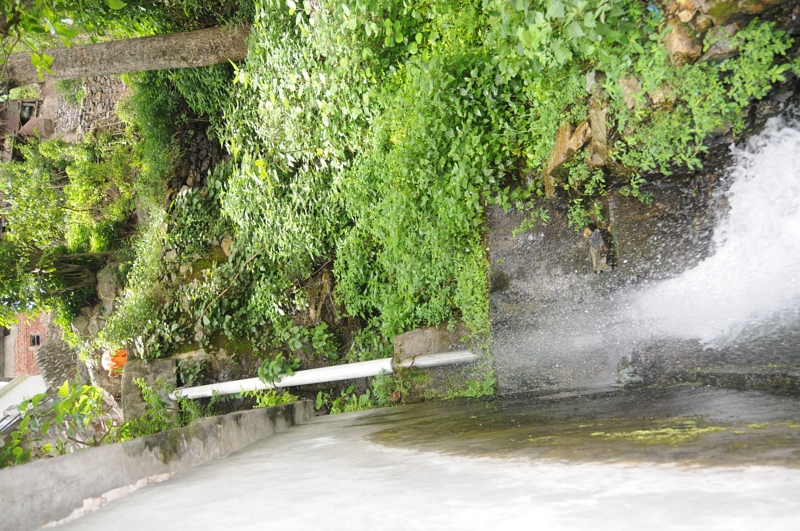
Rudraprayag, Uttarakhand

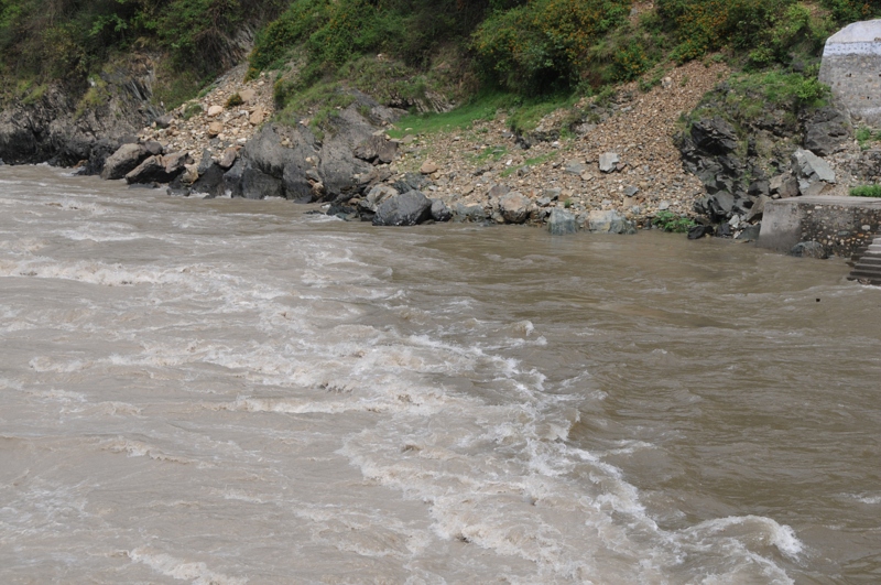
Rudraprayag, Uttarakhand
Rudraprayag, Uttarakhand

Rudraprayag, Uttarakhand

CSP_2994.JPG

CSP_3031.JPG

CSP_2995.JPG

CSP_2980.JPG

CSP_3003.JPG

CSP_3004.JPG

CSP_3000.JPG

CSP_3014.JPG

CSP_2991.JPG

CSP_2981.JPG

CSP_3018.JPG

CSP_2979.JPG

CSP_3010.JPG
Mapa de Maniguh, Uttarakhand, India
Buscar otro lugar
Lugares cercanos
Agastmuni, Uttarakhand, India
Chopta, Uttarakhand, India
India Post Chandra Puri, Chandra Puri, Rudraprayag, NH-, Kedarnath Road, Agastmuni, Agastmuni, Uttar
Chandrapuri, Uttarakhand, India
Durgadhar, Uttarakhand, India
Dashjula Kandai, Uttarakhand, India
Karndhar, Uttarakhand, India
Madola, Uttarakhand, India
Ratura, Uttarakhand, India
Shivanandi, Uttarakhand, India
Gholtir, Uttarakhand, India
Tilwara, Uttarakhand, India
Distrito de Rudraprayag, Uttarakhand, India
Nagrasu, Uttarakhand, India
Koteshwar Mahadev Mandir, कोटेश्वर मंदिर मार्ग, Uttarakhand, India
Chhinka, Uttarakhand, India
Makku Math, Uttarakhand, India
Rudraprayag, Uttarakhand, India
Tuneta, Uttarakhand, India
Ukhimath, Uttarakhand, India
Búsquedas recientes
- Horas de salida y puesta de sol de Red Dog Mine, AK, USA
- Horas de salida y puesta de sol de Am Bahnhof, Am bhf, Borken, Germany
- Horas de salida y puesta de sol de 4th St E, Sonoma, CA, EE. UU.
- Horas de salida y puesta de sol de Oakland Ave, Williamsport, PA, EE. UU.
- Horas de salida y puesta de sol de Via Roma, Pieranica CR, Italia
- Horas de salida y puesta de sol de Torre del reloj, Grad, Dubrovnik (Ragusa), Croacia
- Horas de salida y puesta de sol de Trelew, Chubut, Argentina
- Horas de salida y puesta de sol de Hartfords Bluff Cir, Mt Pleasant, SC, EE. UU.
- Horas de salida y puesta de sol de Kita Ward, Kumamoto, Japón
- Horas de salida y puesta de sol de Pingtan Island, Pingtan County, Fuzhou, China