Horas de salida y puesta de sol de Mahaw Dr, Imperial, MO, EE. UU.
Location: Estados Unidos > Misuri > Condado de Jefferson > Windsor Township > Imperial >
Zona horaria:
America/Chicago
Hora local:
2025-07-10 01:53:32
Longitud:
-90.4390932
Latitud:
38.4140523
Salida de sol de hoy:
05:47:10 AM
Puesta de sol de hoy:
08:27:21 PM
La duración del día hoy:
14h 40m 11s
Salida de sol de mañana:
05:47:50 AM
Puesta de sol de mañana:
08:26:56 PM
La duración del día mañana:
14h 39m 6s
Mostrar todas las fechas
| Fecha | Salida de sol | Puesta de sol | Duración del día |
|---|---|---|---|
| 01/01/2025 | 07:19:02 AM | 04:52:46 PM | 9h 33m 44s |
| 02/01/2025 | 07:19:07 AM | 04:53:37 PM | 9h 34m 30s |
| 03/01/2025 | 07:19:09 AM | 04:54:28 PM | 9h 35m 19s |
| 04/01/2025 | 07:19:10 AM | 04:55:22 PM | 9h 36m 12s |
| 05/01/2025 | 07:19:08 AM | 04:56:16 PM | 9h 37m 8s |
| 06/01/2025 | 07:19:04 AM | 04:57:11 PM | 9h 38m 7s |
| 07/01/2025 | 07:18:59 AM | 04:58:08 PM | 9h 39m 9s |
| 08/01/2025 | 07:18:51 AM | 04:59:05 PM | 9h 40m 14s |
| 09/01/2025 | 07:18:41 AM | 05:00:04 PM | 9h 41m 23s |
| 10/01/2025 | 07:18:28 AM | 05:01:03 PM | 9h 42m 35s |
| 11/01/2025 | 07:18:14 AM | 05:02:04 PM | 9h 43m 50s |
| 12/01/2025 | 07:17:58 AM | 05:03:05 PM | 9h 45m 7s |
| 13/01/2025 | 07:17:39 AM | 05:04:07 PM | 9h 46m 28s |
| 14/01/2025 | 07:17:19 AM | 05:05:10 PM | 9h 47m 51s |
| 15/01/2025 | 07:16:56 AM | 05:06:14 PM | 9h 49m 18s |
| 16/01/2025 | 07:16:32 AM | 05:07:18 PM | 9h 50m 46s |
| 17/01/2025 | 07:16:05 AM | 05:08:23 PM | 9h 52m 18s |
| 18/01/2025 | 07:15:37 AM | 05:09:28 PM | 9h 53m 51s |
| 19/01/2025 | 07:15:06 AM | 05:10:34 PM | 9h 55m 28s |
| 20/01/2025 | 07:14:34 AM | 05:11:40 PM | 9h 57m 6s |
| 21/01/2025 | 07:13:59 AM | 05:12:47 PM | 9h 58m 48s |
| 22/01/2025 | 07:13:23 AM | 05:13:54 PM | 10h 0m 31s |
| 23/01/2025 | 07:12:45 AM | 05:15:01 PM | 10h 2m 16s |
| 24/01/2025 | 07:12:05 AM | 05:16:08 PM | 10h 4m 3s |
| 25/01/2025 | 07:11:23 AM | 05:17:16 PM | 10h 5m 53s |
| 26/01/2025 | 07:10:39 AM | 05:18:24 PM | 10h 7m 45s |
| 27/01/2025 | 07:09:53 AM | 05:19:32 PM | 10h 9m 39s |
| 28/01/2025 | 07:09:06 AM | 05:20:41 PM | 10h 11m 35s |
| 29/01/2025 | 07:08:17 AM | 05:21:49 PM | 10h 13m 32s |
| 30/01/2025 | 07:07:27 AM | 05:22:58 PM | 10h 15m 31s |
| 31/01/2025 | 07:06:34 AM | 05:24:06 PM | 10h 17m 32s |
| 01/02/2025 | 07:05:40 AM | 05:25:15 PM | 10h 19m 35s |
| 02/02/2025 | 07:04:45 AM | 05:26:23 PM | 10h 21m 38s |
| 03/02/2025 | 07:03:48 AM | 05:27:31 PM | 10h 23m 43s |
| 04/02/2025 | 07:02:49 AM | 05:28:40 PM | 10h 25m 51s |
| 05/02/2025 | 07:01:49 AM | 05:29:48 PM | 10h 27m 59s |
| 06/02/2025 | 07:00:47 AM | 05:30:56 PM | 10h 30m 9s |
| 07/02/2025 | 06:59:44 AM | 05:32:04 PM | 10h 32m 20s |
| 08/02/2025 | 06:58:40 AM | 05:33:12 PM | 10h 34m 32s |
| 09/02/2025 | 06:57:34 AM | 05:34:19 PM | 10h 36m 45s |
| 10/02/2025 | 06:56:27 AM | 05:35:26 PM | 10h 38m 59s |
| 11/02/2025 | 06:55:19 AM | 05:36:33 PM | 10h 41m 14s |
| 12/02/2025 | 06:54:09 AM | 05:37:40 PM | 10h 43m 31s |
| 13/02/2025 | 06:52:58 AM | 05:38:47 PM | 10h 45m 49s |
| 14/02/2025 | 06:51:46 AM | 05:39:53 PM | 10h 48m 7s |
| 15/02/2025 | 06:50:33 AM | 05:40:59 PM | 10h 50m 26s |
| 16/02/2025 | 06:49:18 AM | 05:42:05 PM | 10h 52m 47s |
| 17/02/2025 | 06:48:03 AM | 05:43:10 PM | 10h 55m 7s |
| 18/02/2025 | 06:46:46 AM | 05:44:16 PM | 10h 57m 30s |
| 19/02/2025 | 06:45:29 AM | 05:45:20 PM | 10h 59m 51s |
| 20/02/2025 | 06:44:10 AM | 05:46:25 PM | 11h 2m 15s |
| 21/02/2025 | 06:42:51 AM | 05:47:29 PM | 11h 4m 38s |
| 22/02/2025 | 06:41:31 AM | 05:48:33 PM | 11h 7m 2s |
| 23/02/2025 | 06:40:09 AM | 05:49:37 PM | 11h 9m 28s |
| 24/02/2025 | 06:38:47 AM | 05:50:40 PM | 11h 11m 53s |
| 25/02/2025 | 06:37:24 AM | 05:51:43 PM | 11h 14m 19s |
| 26/02/2025 | 06:36:00 AM | 05:52:46 PM | 11h 16m 46s |
| 27/02/2025 | 06:34:36 AM | 05:53:48 PM | 11h 19m 12s |
| 28/02/2025 | 06:33:11 AM | 05:54:50 PM | 11h 21m 39s |
| 01/03/2025 | 06:31:45 AM | 05:55:52 PM | 11h 24m 7s |
| 02/03/2025 | 06:30:18 AM | 05:56:53 PM | 11h 26m 35s |
| 03/03/2025 | 06:28:51 AM | 05:57:55 PM | 11h 29m 4s |
| 04/03/2025 | 06:27:23 AM | 05:58:55 PM | 11h 31m 32s |
| 05/03/2025 | 06:25:55 AM | 05:59:56 PM | 11h 34m 1s |
| 06/03/2025 | 06:24:26 AM | 06:00:56 PM | 11h 36m 30s |
| 07/03/2025 | 06:22:57 AM | 06:01:56 PM | 11h 38m 59s |
| 08/03/2025 | 06:21:27 AM | 06:02:56 PM | 11h 41m 29s |
| 09/03/2025 | 07:20:00 AM | 07:03:53 PM | 11h 43m 53s |
| 10/03/2025 | 07:18:30 AM | 07:04:52 PM | 11h 46m 22s |
| 11/03/2025 | 07:16:59 AM | 07:05:51 PM | 11h 48m 52s |
| 12/03/2025 | 07:15:27 AM | 07:06:50 PM | 11h 51m 23s |
| 13/03/2025 | 07:13:56 AM | 07:07:49 PM | 11h 53m 53s |
| 14/03/2025 | 07:12:24 AM | 07:08:47 PM | 11h 56m 23s |
| 15/03/2025 | 07:10:52 AM | 07:09:45 PM | 11h 58m 53s |
| 16/03/2025 | 07:09:19 AM | 07:10:44 PM | 12h 1m 25s |
| 17/03/2025 | 07:07:46 AM | 07:11:41 PM | 12h 3m 55s |
| 18/03/2025 | 07:06:14 AM | 07:12:39 PM | 12h 6m 25s |
| 19/03/2025 | 07:04:41 AM | 07:13:37 PM | 12h 8m 56s |
| 20/03/2025 | 07:03:08 AM | 07:14:34 PM | 12h 11m 26s |
| 21/03/2025 | 07:01:35 AM | 07:15:31 PM | 12h 13m 56s |
| 22/03/2025 | 07:00:02 AM | 07:16:28 PM | 12h 16m 26s |
| 23/03/2025 | 06:58:29 AM | 07:17:25 PM | 12h 18m 56s |
| 24/03/2025 | 06:56:55 AM | 07:18:22 PM | 12h 21m 27s |
| 25/03/2025 | 06:55:22 AM | 07:19:19 PM | 12h 23m 57s |
| 26/03/2025 | 06:53:49 AM | 07:20:16 PM | 12h 26m 27s |
| 27/03/2025 | 06:52:17 AM | 07:21:12 PM | 12h 28m 55s |
| 28/03/2025 | 06:50:44 AM | 07:22:09 PM | 12h 31m 25s |
| 29/03/2025 | 06:49:11 AM | 07:23:06 PM | 12h 33m 55s |
| 30/03/2025 | 06:47:39 AM | 07:24:02 PM | 12h 36m 23s |
| 31/03/2025 | 06:46:07 AM | 07:24:59 PM | 12h 38m 52s |
| 01/04/2025 | 06:44:35 AM | 07:25:55 PM | 12h 41m 20s |
| 02/04/2025 | 06:43:04 AM | 07:26:51 PM | 12h 43m 47s |
| 03/04/2025 | 06:41:32 AM | 07:27:48 PM | 12h 46m 16s |
| 04/04/2025 | 06:40:01 AM | 07:28:44 PM | 12h 48m 43s |
| 05/04/2025 | 06:38:31 AM | 07:29:41 PM | 12h 51m 10s |
| 06/04/2025 | 06:37:01 AM | 07:30:37 PM | 12h 53m 36s |
| 07/04/2025 | 06:35:31 AM | 07:31:34 PM | 12h 56m 3s |
| 08/04/2025 | 06:34:02 AM | 07:32:30 PM | 12h 58m 28s |
| 09/04/2025 | 06:32:33 AM | 07:33:27 PM | 13h 0m 54s |
| 10/04/2025 | 06:31:05 AM | 07:34:23 PM | 13h 3m 18s |
| 11/04/2025 | 06:29:38 AM | 07:35:20 PM | 13h 5m 42s |
| 12/04/2025 | 06:28:11 AM | 07:36:16 PM | 13h 8m 5s |
| 13/04/2025 | 06:26:44 AM | 07:37:13 PM | 13h 10m 29s |
| 14/04/2025 | 06:25:19 AM | 07:38:09 PM | 13h 12m 50s |
| 15/04/2025 | 06:23:54 AM | 07:39:06 PM | 13h 15m 12s |
| 16/04/2025 | 06:22:29 AM | 07:40:03 PM | 13h 17m 34s |
| 17/04/2025 | 06:21:06 AM | 07:41:00 PM | 13h 19m 54s |
| 18/04/2025 | 06:19:43 AM | 07:41:56 PM | 13h 22m 13s |
| 19/04/2025 | 06:18:21 AM | 07:42:53 PM | 13h 24m 32s |
| 20/04/2025 | 06:17:00 AM | 07:43:50 PM | 13h 26m 50s |
| 21/04/2025 | 06:15:40 AM | 07:44:47 PM | 13h 29m 7s |
| 22/04/2025 | 06:14:20 AM | 07:45:44 PM | 13h 31m 24s |
| 23/04/2025 | 06:13:02 AM | 07:46:41 PM | 13h 33m 39s |
| 24/04/2025 | 06:11:44 AM | 07:47:38 PM | 13h 35m 54s |
| 25/04/2025 | 06:10:28 AM | 07:48:34 PM | 13h 38m 6s |
| 26/04/2025 | 06:09:12 AM | 07:49:31 PM | 13h 40m 19s |
| 27/04/2025 | 06:07:58 AM | 07:50:28 PM | 13h 42m 30s |
| 28/04/2025 | 06:06:45 AM | 07:51:25 PM | 13h 44m 40s |
| 29/04/2025 | 06:05:32 AM | 07:52:22 PM | 13h 46m 50s |
| 30/04/2025 | 06:04:21 AM | 07:53:18 PM | 13h 48m 57s |
| 01/05/2025 | 06:03:11 AM | 07:54:15 PM | 13h 51m 4s |
| 02/05/2025 | 06:02:02 AM | 07:55:11 PM | 13h 53m 9s |
| 03/05/2025 | 06:00:55 AM | 07:56:08 PM | 13h 55m 13s |
| 04/05/2025 | 05:59:49 AM | 07:57:04 PM | 13h 57m 15s |
| 05/05/2025 | 05:58:44 AM | 07:58:00 PM | 13h 59m 16s |
| 06/05/2025 | 05:57:40 AM | 07:58:56 PM | 14h 1m 16s |
| 07/05/2025 | 05:56:38 AM | 07:59:51 PM | 14h 3m 13s |
| 08/05/2025 | 05:55:37 AM | 08:00:47 PM | 14h 5m 10s |
| 09/05/2025 | 05:54:37 AM | 08:01:42 PM | 14h 7m 5s |
| 10/05/2025 | 05:53:39 AM | 08:02:37 PM | 14h 8m 58s |
| 11/05/2025 | 05:52:42 AM | 08:03:31 PM | 14h 10m 49s |
| 12/05/2025 | 05:51:47 AM | 08:04:25 PM | 14h 12m 38s |
| 13/05/2025 | 05:50:54 AM | 08:05:19 PM | 14h 14m 25s |
| 14/05/2025 | 05:50:01 AM | 08:06:13 PM | 14h 16m 12s |
| 15/05/2025 | 05:49:11 AM | 08:07:06 PM | 14h 17m 55s |
| 16/05/2025 | 05:48:22 AM | 08:07:58 PM | 14h 19m 36s |
| 17/05/2025 | 05:47:34 AM | 08:08:50 PM | 14h 21m 16s |
| 18/05/2025 | 05:46:48 AM | 08:09:42 PM | 14h 22m 54s |
| 19/05/2025 | 05:46:04 AM | 08:10:33 PM | 14h 24m 29s |
| 20/05/2025 | 05:45:22 AM | 08:11:23 PM | 14h 26m 1s |
| 21/05/2025 | 05:44:41 AM | 08:12:13 PM | 14h 27m 32s |
| 22/05/2025 | 05:44:02 AM | 08:13:02 PM | 14h 29m 0s |
| 23/05/2025 | 05:43:24 AM | 08:13:51 PM | 14h 30m 27s |
| 24/05/2025 | 05:42:49 AM | 08:14:38 PM | 14h 31m 49s |
| 25/05/2025 | 05:42:15 AM | 08:15:25 PM | 14h 33m 10s |
| 26/05/2025 | 05:41:43 AM | 08:16:11 PM | 14h 34m 28s |
| 27/05/2025 | 05:41:12 AM | 08:16:57 PM | 14h 35m 45s |
| 28/05/2025 | 05:40:44 AM | 08:17:41 PM | 14h 36m 57s |
| 29/05/2025 | 05:40:17 AM | 08:18:24 PM | 14h 38m 7s |
| 30/05/2025 | 05:39:52 AM | 08:19:07 PM | 14h 39m 15s |
| 31/05/2025 | 05:39:29 AM | 08:19:48 PM | 14h 40m 19s |
| 01/06/2025 | 05:39:08 AM | 08:20:28 PM | 14h 41m 20s |
| 02/06/2025 | 05:38:48 AM | 08:21:08 PM | 14h 42m 20s |
| 03/06/2025 | 05:38:31 AM | 08:21:46 PM | 14h 43m 15s |
| 04/06/2025 | 05:38:15 AM | 08:22:23 PM | 14h 44m 8s |
| 05/06/2025 | 05:38:01 AM | 08:22:59 PM | 14h 44m 58s |
| 06/06/2025 | 05:37:49 AM | 08:23:33 PM | 14h 45m 44s |
| 07/06/2025 | 05:37:39 AM | 08:24:06 PM | 14h 46m 27s |
| 08/06/2025 | 05:37:31 AM | 08:24:38 PM | 14h 47m 7s |
| 09/06/2025 | 05:37:24 AM | 08:25:09 PM | 14h 47m 45s |
| 10/06/2025 | 05:37:19 AM | 08:25:38 PM | 14h 48m 19s |
| 11/06/2025 | 05:37:16 AM | 08:26:05 PM | 14h 48m 49s |
| 12/06/2025 | 05:37:15 AM | 08:26:31 PM | 14h 49m 16s |
| 13/06/2025 | 05:37:16 AM | 08:26:56 PM | 14h 49m 40s |
| 14/06/2025 | 05:37:19 AM | 08:27:19 PM | 14h 50m 0s |
| 15/06/2025 | 05:37:23 AM | 08:27:41 PM | 14h 50m 18s |
| 16/06/2025 | 05:37:29 AM | 08:28:01 PM | 14h 50m 32s |
| 17/06/2025 | 05:37:37 AM | 08:28:19 PM | 14h 50m 42s |
| 18/06/2025 | 05:37:46 AM | 08:28:36 PM | 14h 50m 50s |
| 19/06/2025 | 05:37:57 AM | 08:28:51 PM | 14h 50m 54s |
| 20/06/2025 | 05:38:10 AM | 08:29:04 PM | 14h 50m 54s |
| 21/06/2025 | 05:38:25 AM | 08:29:16 PM | 14h 50m 51s |
| 22/06/2025 | 05:38:41 AM | 08:29:26 PM | 14h 50m 45s |
| 23/06/2025 | 05:38:58 AM | 08:29:34 PM | 14h 50m 36s |
| 24/06/2025 | 05:39:18 AM | 08:29:40 PM | 14h 50m 22s |
| 25/06/2025 | 05:39:38 AM | 08:29:44 PM | 14h 50m 6s |
| 26/06/2025 | 05:40:01 AM | 08:29:47 PM | 14h 49m 46s |
| 27/06/2025 | 05:40:24 AM | 08:29:48 PM | 14h 49m 24s |
| 28/06/2025 | 05:40:50 AM | 08:29:47 PM | 14h 48m 57s |
| 29/06/2025 | 05:41:16 AM | 08:29:44 PM | 14h 48m 28s |
| 30/06/2025 | 05:41:44 AM | 08:29:39 PM | 14h 47m 55s |
| 01/07/2025 | 05:42:14 AM | 08:29:32 PM | 14h 47m 18s |
| 02/07/2025 | 05:42:44 AM | 08:29:24 PM | 14h 46m 40s |
| 03/07/2025 | 05:43:16 AM | 08:29:13 PM | 14h 45m 57s |
| 04/07/2025 | 05:43:49 AM | 08:29:01 PM | 14h 45m 12s |
| 05/07/2025 | 05:44:24 AM | 08:28:47 PM | 14h 44m 23s |
| 06/07/2025 | 05:44:59 AM | 08:28:31 PM | 14h 43m 32s |
| 07/07/2025 | 05:45:36 AM | 08:28:13 PM | 14h 42m 37s |
| 08/07/2025 | 05:46:13 AM | 08:27:53 PM | 14h 41m 40s |
| 09/07/2025 | 05:46:52 AM | 08:27:31 PM | 14h 40m 39s |
| 10/07/2025 | 05:47:32 AM | 08:27:08 PM | 14h 39m 36s |
| 11/07/2025 | 05:48:12 AM | 08:26:42 PM | 14h 38m 30s |
| 12/07/2025 | 05:48:54 AM | 08:26:15 PM | 14h 37m 21s |
| 13/07/2025 | 05:49:36 AM | 08:25:46 PM | 14h 36m 10s |
| 14/07/2025 | 05:50:19 AM | 08:25:15 PM | 14h 34m 56s |
| 15/07/2025 | 05:51:03 AM | 08:24:42 PM | 14h 33m 39s |
| 16/07/2025 | 05:51:48 AM | 08:24:08 PM | 14h 32m 20s |
| 17/07/2025 | 05:52:34 AM | 08:23:31 PM | 14h 30m 57s |
| 18/07/2025 | 05:53:20 AM | 08:22:53 PM | 14h 29m 33s |
| 19/07/2025 | 05:54:06 AM | 08:22:13 PM | 14h 28m 7s |
| 20/07/2025 | 05:54:54 AM | 08:21:32 PM | 14h 26m 38s |
| 21/07/2025 | 05:55:42 AM | 08:20:48 PM | 14h 25m 6s |
| 22/07/2025 | 05:56:30 AM | 08:20:03 PM | 14h 23m 33s |
| 23/07/2025 | 05:57:19 AM | 08:19:17 PM | 14h 21m 58s |
| 24/07/2025 | 05:58:09 AM | 08:18:28 PM | 14h 20m 19s |
| 25/07/2025 | 05:58:59 AM | 08:17:38 PM | 14h 18m 39s |
| 26/07/2025 | 05:59:49 AM | 08:16:47 PM | 14h 16m 58s |
| 27/07/2025 | 06:00:40 AM | 08:15:54 PM | 14h 15m 14s |
| 28/07/2025 | 06:01:31 AM | 08:14:59 PM | 14h 13m 28s |
| 29/07/2025 | 06:02:22 AM | 08:14:03 PM | 14h 11m 41s |
| 30/07/2025 | 06:03:14 AM | 08:13:05 PM | 14h 9m 51s |
| 31/07/2025 | 06:04:06 AM | 08:12:06 PM | 14h 8m 0s |
| 01/08/2025 | 06:04:58 AM | 08:11:05 PM | 14h 6m 7s |
| 02/08/2025 | 06:05:50 AM | 08:10:03 PM | 14h 4m 13s |
| 03/08/2025 | 06:06:42 AM | 08:09:00 PM | 14h 2m 18s |
| 04/08/2025 | 06:07:35 AM | 08:07:55 PM | 14h 0m 20s |
| 05/08/2025 | 06:08:28 AM | 08:06:49 PM | 13h 58m 21s |
| 06/08/2025 | 06:09:21 AM | 08:05:41 PM | 13h 56m 20s |
| 07/08/2025 | 06:10:14 AM | 08:04:33 PM | 13h 54m 19s |
| 08/08/2025 | 06:11:07 AM | 08:03:23 PM | 13h 52m 16s |
| 09/08/2025 | 06:12:00 AM | 08:02:12 PM | 13h 50m 12s |
| 10/08/2025 | 06:12:53 AM | 08:00:59 PM | 13h 48m 6s |
| 11/08/2025 | 06:13:46 AM | 07:59:46 PM | 13h 46m 0s |
| 12/08/2025 | 06:14:40 AM | 07:58:31 PM | 13h 43m 51s |
| 13/08/2025 | 06:15:33 AM | 07:57:15 PM | 13h 41m 42s |
| 14/08/2025 | 06:16:26 AM | 07:55:59 PM | 13h 39m 33s |
| 15/08/2025 | 06:17:19 AM | 07:54:41 PM | 13h 37m 22s |
| 16/08/2025 | 06:18:12 AM | 07:53:22 PM | 13h 35m 10s |
| 17/08/2025 | 06:19:06 AM | 07:52:02 PM | 13h 32m 56s |
| 18/08/2025 | 06:19:59 AM | 07:50:41 PM | 13h 30m 42s |
| 19/08/2025 | 06:20:52 AM | 07:49:20 PM | 13h 28m 28s |
| 20/08/2025 | 06:21:45 AM | 07:47:57 PM | 13h 26m 12s |
| 21/08/2025 | 06:22:38 AM | 07:46:34 PM | 13h 23m 56s |
| 22/08/2025 | 06:23:31 AM | 07:45:09 PM | 13h 21m 38s |
| 23/08/2025 | 06:24:23 AM | 07:43:44 PM | 13h 19m 21s |
| 24/08/2025 | 06:25:16 AM | 07:42:19 PM | 13h 17m 3s |
| 25/08/2025 | 06:26:09 AM | 07:40:52 PM | 13h 14m 43s |
| 26/08/2025 | 06:27:01 AM | 07:39:25 PM | 13h 12m 24s |
| 27/08/2025 | 06:27:54 AM | 07:37:57 PM | 13h 10m 3s |
| 28/08/2025 | 06:28:46 AM | 07:36:28 PM | 13h 7m 42s |
| 29/08/2025 | 06:29:39 AM | 07:34:59 PM | 13h 5m 20s |
| 30/08/2025 | 06:30:31 AM | 07:33:29 PM | 13h 2m 58s |
| 31/08/2025 | 06:31:24 AM | 07:31:59 PM | 13h 0m 35s |
| 01/09/2025 | 06:32:16 AM | 07:30:28 PM | 12h 58m 12s |
| 02/09/2025 | 06:33:08 AM | 07:28:57 PM | 12h 55m 49s |
| 03/09/2025 | 06:34:00 AM | 07:27:25 PM | 12h 53m 25s |
| 04/09/2025 | 06:34:52 AM | 07:25:53 PM | 12h 51m 1s |
| 05/09/2025 | 06:35:44 AM | 07:24:20 PM | 12h 48m 36s |
| 06/09/2025 | 06:36:36 AM | 07:22:47 PM | 12h 46m 11s |
| 07/09/2025 | 06:37:28 AM | 07:21:14 PM | 12h 43m 46s |
| 08/09/2025 | 06:38:20 AM | 07:19:40 PM | 12h 41m 20s |
| 09/09/2025 | 06:39:13 AM | 07:18:06 PM | 12h 38m 53s |
| 10/09/2025 | 06:40:05 AM | 07:16:32 PM | 12h 36m 27s |
| 11/09/2025 | 06:40:57 AM | 07:14:57 PM | 12h 34m 0s |
| 12/09/2025 | 06:41:49 AM | 07:13:22 PM | 12h 31m 33s |
| 13/09/2025 | 06:42:41 AM | 07:11:47 PM | 12h 29m 6s |
| 14/09/2025 | 06:43:33 AM | 07:10:12 PM | 12h 26m 39s |
| 15/09/2025 | 06:44:25 AM | 07:08:37 PM | 12h 24m 12s |
| 16/09/2025 | 06:45:18 AM | 07:07:02 PM | 12h 21m 44s |
| 17/09/2025 | 06:46:10 AM | 07:05:27 PM | 12h 19m 17s |
| 18/09/2025 | 06:47:03 AM | 07:03:51 PM | 12h 16m 48s |
| 19/09/2025 | 06:47:55 AM | 07:02:16 PM | 12h 14m 21s |
| 20/09/2025 | 06:48:48 AM | 07:00:41 PM | 12h 11m 53s |
| 21/09/2025 | 06:49:41 AM | 06:59:06 PM | 12h 9m 25s |
| 22/09/2025 | 06:50:34 AM | 06:57:31 PM | 12h 6m 57s |
| 23/09/2025 | 06:51:27 AM | 06:55:56 PM | 12h 4m 29s |
| 24/09/2025 | 06:52:20 AM | 06:54:21 PM | 12h 2m 1s |
| 25/09/2025 | 06:53:14 AM | 06:52:46 PM | 11h 59m 32s |
| 26/09/2025 | 06:54:07 AM | 06:51:12 PM | 11h 57m 5s |
| 27/09/2025 | 06:55:01 AM | 06:49:37 PM | 11h 54m 36s |
| 28/09/2025 | 06:55:55 AM | 06:48:03 PM | 11h 52m 8s |
| 29/09/2025 | 06:56:49 AM | 06:46:30 PM | 11h 49m 41s |
| 30/09/2025 | 06:57:44 AM | 06:44:56 PM | 11h 47m 12s |
| 01/10/2025 | 06:58:39 AM | 06:43:23 PM | 11h 44m 44s |
| 02/10/2025 | 06:59:34 AM | 06:41:51 PM | 11h 42m 17s |
| 03/10/2025 | 07:00:29 AM | 06:40:19 PM | 11h 39m 50s |
| 04/10/2025 | 07:01:24 AM | 06:38:47 PM | 11h 37m 23s |
| 05/10/2025 | 07:02:20 AM | 06:37:16 PM | 11h 34m 56s |
| 06/10/2025 | 07:03:16 AM | 06:35:45 PM | 11h 32m 29s |
| 07/10/2025 | 07:04:13 AM | 06:34:15 PM | 11h 30m 2s |
| 08/10/2025 | 07:05:09 AM | 06:32:45 PM | 11h 27m 36s |
| 09/10/2025 | 07:06:06 AM | 06:31:16 PM | 11h 25m 10s |
| 10/10/2025 | 07:07:03 AM | 06:29:48 PM | 11h 22m 45s |
| 11/10/2025 | 07:08:01 AM | 06:28:20 PM | 11h 20m 19s |
| 12/10/2025 | 07:08:59 AM | 06:26:53 PM | 11h 17m 54s |
| 13/10/2025 | 07:09:57 AM | 06:25:27 PM | 11h 15m 30s |
| 14/10/2025 | 07:10:56 AM | 06:24:01 PM | 11h 13m 5s |
| 15/10/2025 | 07:11:55 AM | 06:22:36 PM | 11h 10m 41s |
| 16/10/2025 | 07:12:54 AM | 06:21:12 PM | 11h 8m 18s |
| 17/10/2025 | 07:13:54 AM | 06:19:49 PM | 11h 5m 55s |
| 18/10/2025 | 07:14:54 AM | 06:18:27 PM | 11h 3m 33s |
| 19/10/2025 | 07:15:54 AM | 06:17:06 PM | 11h 1m 12s |
| 20/10/2025 | 07:16:54 AM | 06:15:46 PM | 10h 58m 52s |
| 21/10/2025 | 07:17:55 AM | 06:14:27 PM | 10h 56m 32s |
| 22/10/2025 | 07:18:57 AM | 06:13:08 PM | 10h 54m 11s |
| 23/10/2025 | 07:19:58 AM | 06:11:51 PM | 10h 51m 53s |
| 24/10/2025 | 07:21:00 AM | 06:10:35 PM | 10h 49m 35s |
| 25/10/2025 | 07:22:03 AM | 06:09:20 PM | 10h 47m 17s |
| 26/10/2025 | 07:23:05 AM | 06:08:07 PM | 10h 45m 2s |
| 27/10/2025 | 07:24:08 AM | 06:06:54 PM | 10h 42m 46s |
| 28/10/2025 | 07:25:11 AM | 06:05:43 PM | 10h 40m 32s |
| 29/10/2025 | 07:26:15 AM | 06:04:33 PM | 10h 38m 18s |
| 30/10/2025 | 07:27:18 AM | 06:03:24 PM | 10h 36m 6s |
| 31/10/2025 | 07:28:22 AM | 06:02:17 PM | 10h 33m 55s |
| 01/11/2025 | 07:29:26 AM | 06:01:10 PM | 10h 31m 44s |
| 02/11/2025 | 06:30:34 AM | 05:00:03 PM | 10h 29m 29s |
| 03/11/2025 | 06:31:38 AM | 04:59:00 PM | 10h 27m 22s |
| 04/11/2025 | 06:32:43 AM | 04:57:58 PM | 10h 25m 15s |
| 05/11/2025 | 06:33:48 AM | 04:56:58 PM | 10h 23m 10s |
| 06/11/2025 | 06:34:53 AM | 04:56:00 PM | 10h 21m 7s |
| 07/11/2025 | 06:35:58 AM | 04:55:02 PM | 10h 19m 4s |
| 08/11/2025 | 06:37:04 AM | 04:54:07 PM | 10h 17m 3s |
| 09/11/2025 | 06:38:09 AM | 04:53:13 PM | 10h 15m 4s |
| 10/11/2025 | 06:39:14 AM | 04:52:21 PM | 10h 13m 7s |
| 11/11/2025 | 06:40:20 AM | 04:51:31 PM | 10h 11m 11s |
| 12/11/2025 | 06:41:25 AM | 04:50:42 PM | 10h 9m 17s |
| 13/11/2025 | 06:42:30 AM | 04:49:55 PM | 10h 7m 25s |
| 14/11/2025 | 06:43:36 AM | 04:49:10 PM | 10h 5m 34s |
| 15/11/2025 | 06:44:41 AM | 04:48:26 PM | 10h 3m 45s |
| 16/11/2025 | 06:45:46 AM | 04:47:45 PM | 10h 1m 59s |
| 17/11/2025 | 06:46:50 AM | 04:47:05 PM | 10h 0m 15s |
| 18/11/2025 | 06:47:55 AM | 04:46:27 PM | 9h 58m 32s |
| 19/11/2025 | 06:48:59 AM | 04:45:52 PM | 9h 56m 53s |
| 20/11/2025 | 06:50:03 AM | 04:45:18 PM | 9h 55m 15s |
| 21/11/2025 | 06:51:06 AM | 04:44:46 PM | 9h 53m 40s |
| 22/11/2025 | 06:52:09 AM | 04:44:16 PM | 9h 52m 7s |
| 23/11/2025 | 06:53:12 AM | 04:43:48 PM | 9h 50m 36s |
| 24/11/2025 | 06:54:14 AM | 04:43:22 PM | 9h 49m 8s |
| 25/11/2025 | 06:55:15 AM | 04:42:59 PM | 9h 47m 44s |
| 26/11/2025 | 06:56:16 AM | 04:42:37 PM | 9h 46m 21s |
| 27/11/2025 | 06:57:16 AM | 04:42:17 PM | 9h 45m 1s |
| 28/11/2025 | 06:58:15 AM | 04:42:00 PM | 9h 43m 45s |
| 29/11/2025 | 06:59:14 AM | 04:41:44 PM | 9h 42m 30s |
| 30/11/2025 | 07:00:12 AM | 04:41:31 PM | 9h 41m 19s |
| 01/12/2025 | 07:01:09 AM | 04:41:20 PM | 9h 40m 11s |
| 02/12/2025 | 07:02:05 AM | 04:41:11 PM | 9h 39m 6s |
| 03/12/2025 | 07:03:00 AM | 04:41:04 PM | 9h 38m 4s |
| 04/12/2025 | 07:03:54 AM | 04:41:00 PM | 9h 37m 6s |
| 05/12/2025 | 07:04:47 AM | 04:40:57 PM | 9h 36m 10s |
| 06/12/2025 | 07:05:39 AM | 04:40:57 PM | 9h 35m 18s |
| 07/12/2025 | 07:06:30 AM | 04:40:59 PM | 9h 34m 29s |
| 08/12/2025 | 07:07:19 AM | 04:41:03 PM | 9h 33m 44s |
| 09/12/2025 | 07:08:08 AM | 04:41:09 PM | 9h 33m 1s |
| 10/12/2025 | 07:08:54 AM | 04:41:17 PM | 9h 32m 23s |
| 11/12/2025 | 07:09:40 AM | 04:41:27 PM | 9h 31m 47s |
| 12/12/2025 | 07:10:24 AM | 04:41:40 PM | 9h 31m 16s |
| 13/12/2025 | 07:11:06 AM | 04:41:54 PM | 9h 30m 48s |
| 14/12/2025 | 07:11:47 AM | 04:42:11 PM | 9h 30m 24s |
| 15/12/2025 | 07:12:27 AM | 04:42:30 PM | 9h 30m 3s |
| 16/12/2025 | 07:13:05 AM | 04:42:51 PM | 9h 29m 46s |
| 17/12/2025 | 07:13:41 AM | 04:43:13 PM | 9h 29m 32s |
| 18/12/2025 | 07:14:15 AM | 04:43:38 PM | 9h 29m 23s |
| 19/12/2025 | 07:14:48 AM | 04:44:05 PM | 9h 29m 17s |
| 20/12/2025 | 07:15:19 AM | 04:44:33 PM | 9h 29m 14s |
| 21/12/2025 | 07:15:48 AM | 04:45:04 PM | 9h 29m 16s |
| 22/12/2025 | 07:16:15 AM | 04:45:36 PM | 9h 29m 21s |
| 23/12/2025 | 07:16:41 AM | 04:46:11 PM | 9h 29m 30s |
| 24/12/2025 | 07:17:04 AM | 04:46:47 PM | 9h 29m 43s |
| 25/12/2025 | 07:17:26 AM | 04:47:24 PM | 9h 29m 58s |
| 26/12/2025 | 07:17:45 AM | 04:48:04 PM | 9h 30m 19s |
| 27/12/2025 | 07:18:03 AM | 04:48:45 PM | 9h 30m 42s |
| 28/12/2025 | 07:18:19 AM | 04:49:28 PM | 9h 31m 9s |
| 29/12/2025 | 07:18:32 AM | 04:50:12 PM | 9h 31m 40s |
| 30/12/2025 | 07:18:44 AM | 04:50:58 PM | 9h 32m 14s |
| 31/12/2025 | 07:18:53 AM | 04:51:45 PM | 9h 32m 52s |
Fotos

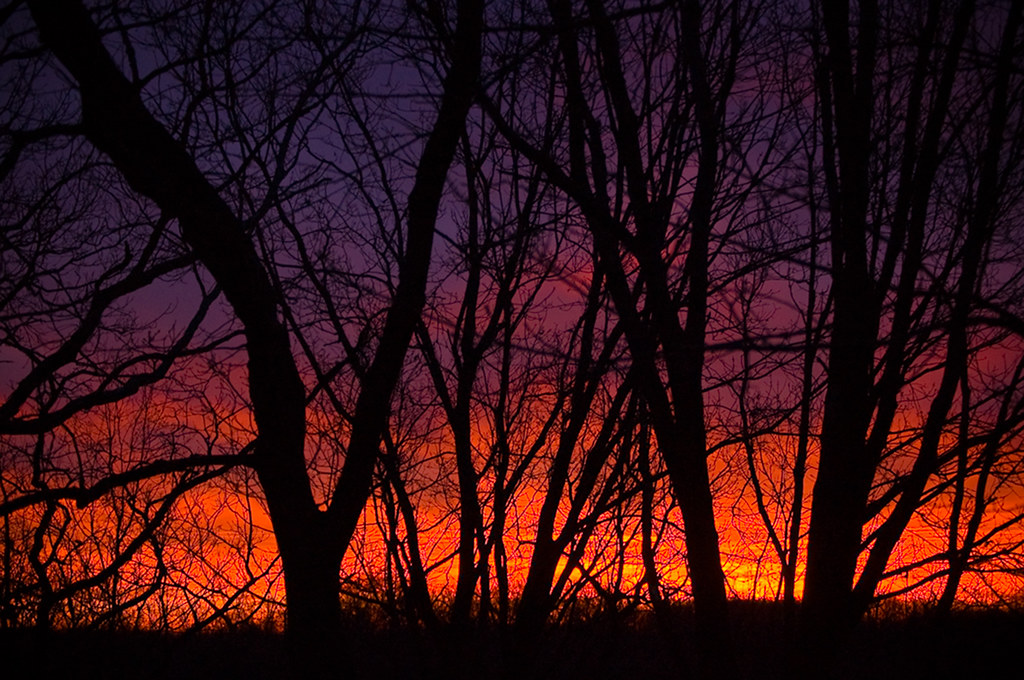
Mississippi Sunrise

Sunrise on the Mississippi

Emmenegger Nature Park_20190227_121924

I-270_P1210144
Golden Autumn
I-270_P1210145
Bird Neon Sign Art at Laumeier Sculpture Park_P1000063

I-44 Bridge over Meramec River_20190222_155851

Twisted Tree Steakhouse - Sunset Hills, MO_20160805_120144

DSC_8785-Pano

DSC_3391-2

Sunrise on the Mississippi

Sunset 44

Saline Valley

Stockstrom Residence, 1949 -- entry court

Broken Objects In Mirror Are Closer Than They Appear_P1230395

Broken Coke Bottle - Tilt-shift miniature fake_P1230453c

Meramec River Sunset

Watching Night Come

Borders Bookstore Closing - Sunset Hills, MO_DSC02519

Gravois Rd. (Highway 30) in Sunset Hills, MO - Tilt-shift Miniature Fake_P1230509c3

Mississippi Overlook

Sunrise At BNSF Railroad Truss Bridge Over Meramec River in Valley Park, MO_PA128203c

Work Day

Valley Park early morning 3

Sunrise at Arnold, MO_P7280895

Porch panorama

Arnold Water Tower in the Morning_IMG_3868

Steak 'n Shake - The World's Best Medicine - Valley Park, MO_IMG_0516
Still Waters

Colorful Sunrise over the Meramec River from I-55 in Arnold, MO_IMG_5181

backyard sunrise...since the sun sets behind my neighbors house you will most likely never see a "front yard sunset" image here on Flickr

Sunrise Destination

Sunrise over Arnold

Lone Oak
Sunrise in Paradise Valley

Sunrise, heading into St. Louis county

Anybody else catch the kick-ass sunrise today? ☀️
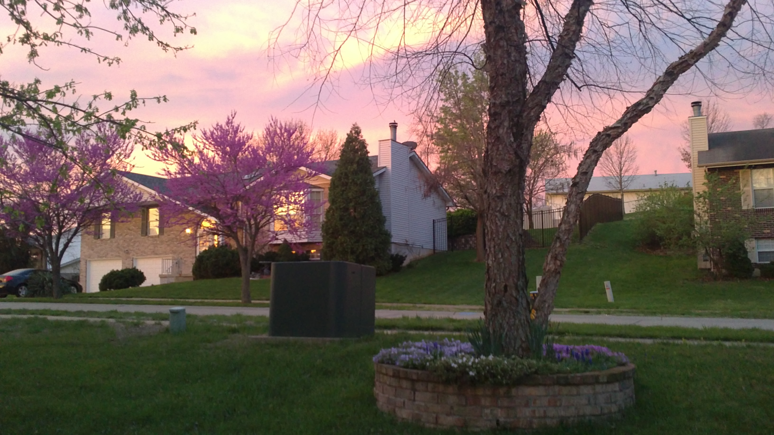
Spring sunrise
Mapa de Mahaw Dr, Imperial, MO, EE. UU.
Buscar otro lugar
Lugares cercanos
Oaker, Arnold, MO, EE. UU.
Ridgeview, Arnold, MO, EE. UU.
Doris, Arnold, MO, EE. UU.
Paula Dr, Arnold, MO, EE. UU.
Miller Rd, Arnold, MO, EE. UU.
Kneef Road, Kneef Rd, Imperial Township, MO, EE. UU.
Imperial Township, MO, EE. UU.
Persimmon Ridge, Arnold, MO, EE. UU.
Vogel Rd, Arnold, MO, EE. UU.
Windsor Township, MO, EE. UU.
Quiet Forest Dr, Imperial, MO, EE. UU.
Missouri State Rd, Arnold, MO, EE. UU.
Quiet Forest Dr, Imperial, MO, EE. UU.
E Romaine Creek Rd, Imperial, MO, EE. UU.
Meadow Dr, Arnold, MO, EE. UU.
Northview Dr, Arnold, MO, EE. UU.
Old Romaine Creek Road, Old Romaine Creek Rd, Rock Township, MO, EE. UU.
Sunrise Dr, Imperial, MO, EE. UU.
Old Missouri 21, Imperial, MO, EE. UU.
Missouri State Road, Missouri State Rd, Arnold, MO, EE. UU.
Búsquedas recientes
- Horas de salida y puesta de sol de Red Dog Mine, AK, USA
- Horas de salida y puesta de sol de Am Bahnhof, Am bhf, Borken, Germany
- Horas de salida y puesta de sol de 4th St E, Sonoma, CA, EE. UU.
- Horas de salida y puesta de sol de Oakland Ave, Williamsport, PA, EE. UU.
- Horas de salida y puesta de sol de Via Roma, Pieranica CR, Italia
- Horas de salida y puesta de sol de Torre del reloj, Grad, Dubrovnik (Ragusa), Croacia
- Horas de salida y puesta de sol de Trelew, Chubut, Argentina
- Horas de salida y puesta de sol de Hartfords Bluff Cir, Mt Pleasant, SC, EE. UU.
- Horas de salida y puesta de sol de Kita Ward, Kumamoto, Japón
- Horas de salida y puesta de sol de Pingtan Island, Pingtan County, Fuzhou, China