Horas de salida y puesta de sol de Langford St, Moultrie, GA, EE. UU.
Location: Estados Unidos > Georgia > Condado de Colquitt > Moultrie >
Zona horaria:
America/New_York
Hora local:
2025-06-13 01:05:45
Longitud:
-83.6238357
Latitud:
31.0672372
Salida de sol de hoy:
06:30:14 AM
Puesta de sol de hoy:
08:39:13 PM
La duración del día hoy:
14h 8m 59s
Salida de sol de mañana:
06:30:18 AM
Puesta de sol de mañana:
08:39:34 PM
La duración del día mañana:
14h 9m 16s
Mostrar todas las fechas
| Fecha | Salida de sol | Puesta de sol | Duración del día |
|---|---|---|---|
| 01/01/2025 | 07:33:02 AM | 05:44:12 PM | 10h 11m 10s |
| 02/01/2025 | 07:33:12 AM | 05:44:56 PM | 10h 11m 44s |
| 03/01/2025 | 07:33:21 AM | 05:45:42 PM | 10h 12m 21s |
| 04/01/2025 | 07:33:29 AM | 05:46:28 PM | 10h 12m 59s |
| 05/01/2025 | 07:33:35 AM | 05:47:15 PM | 10h 13m 40s |
| 06/01/2025 | 07:33:39 AM | 05:48:03 PM | 10h 14m 24s |
| 07/01/2025 | 07:33:41 AM | 05:48:51 PM | 10h 15m 10s |
| 08/01/2025 | 07:33:41 AM | 05:49:40 PM | 10h 15m 59s |
| 09/01/2025 | 07:33:40 AM | 05:50:30 PM | 10h 16m 50s |
| 10/01/2025 | 07:33:38 AM | 05:51:20 PM | 10h 17m 42s |
| 11/01/2025 | 07:33:33 AM | 05:52:11 PM | 10h 18m 38s |
| 12/01/2025 | 07:33:27 AM | 05:53:02 PM | 10h 19m 35s |
| 13/01/2025 | 07:33:19 AM | 05:53:54 PM | 10h 20m 35s |
| 14/01/2025 | 07:33:09 AM | 05:54:46 PM | 10h 21m 37s |
| 15/01/2025 | 07:32:58 AM | 05:55:39 PM | 10h 22m 41s |
| 16/01/2025 | 07:32:44 AM | 05:56:32 PM | 10h 23m 48s |
| 17/01/2025 | 07:32:30 AM | 05:57:25 PM | 10h 24m 55s |
| 18/01/2025 | 07:32:13 AM | 05:58:18 PM | 10h 26m 5s |
| 19/01/2025 | 07:31:55 AM | 05:59:12 PM | 10h 27m 17s |
| 20/01/2025 | 07:31:35 AM | 06:00:05 PM | 10h 28m 30s |
| 21/01/2025 | 07:31:14 AM | 06:00:59 PM | 10h 29m 45s |
| 22/01/2025 | 07:30:50 AM | 06:01:53 PM | 10h 31m 3s |
| 23/01/2025 | 07:30:26 AM | 06:02:47 PM | 10h 32m 21s |
| 24/01/2025 | 07:29:59 AM | 06:03:41 PM | 10h 33m 42s |
| 25/01/2025 | 07:29:31 AM | 06:04:35 PM | 10h 35m 4s |
| 26/01/2025 | 07:29:02 AM | 06:05:29 PM | 10h 36m 27s |
| 27/01/2025 | 07:28:31 AM | 06:06:23 PM | 10h 37m 52s |
| 28/01/2025 | 07:27:58 AM | 06:07:17 PM | 10h 39m 19s |
| 29/01/2025 | 07:27:24 AM | 06:08:10 PM | 10h 40m 46s |
| 30/01/2025 | 07:26:48 AM | 06:09:04 PM | 10h 42m 16s |
| 31/01/2025 | 07:26:11 AM | 06:09:57 PM | 10h 43m 46s |
| 01/02/2025 | 07:25:32 AM | 06:10:50 PM | 10h 45m 18s |
| 02/02/2025 | 07:24:52 AM | 06:11:43 PM | 10h 46m 51s |
| 03/02/2025 | 07:24:11 AM | 06:12:36 PM | 10h 48m 25s |
| 04/02/2025 | 07:23:28 AM | 06:13:29 PM | 10h 50m 1s |
| 05/02/2025 | 07:22:44 AM | 06:14:21 PM | 10h 51m 37s |
| 06/02/2025 | 07:21:59 AM | 06:15:13 PM | 10h 53m 14s |
| 07/02/2025 | 07:21:12 AM | 06:16:05 PM | 10h 54m 53s |
| 08/02/2025 | 07:20:24 AM | 06:16:56 PM | 10h 56m 32s |
| 09/02/2025 | 07:19:35 AM | 06:17:47 PM | 10h 58m 12s |
| 10/02/2025 | 07:18:44 AM | 06:18:38 PM | 10h 59m 54s |
| 11/02/2025 | 07:17:53 AM | 06:19:28 PM | 11h 1m 35s |
| 12/02/2025 | 07:17:00 AM | 06:20:18 PM | 11h 3m 18s |
| 13/02/2025 | 07:16:06 AM | 06:21:08 PM | 11h 5m 2s |
| 14/02/2025 | 07:15:11 AM | 06:21:57 PM | 11h 6m 46s |
| 15/02/2025 | 07:14:15 AM | 06:22:46 PM | 11h 8m 31s |
| 16/02/2025 | 07:13:18 AM | 06:23:35 PM | 11h 10m 17s |
| 17/02/2025 | 07:12:20 AM | 06:24:23 PM | 11h 12m 3s |
| 18/02/2025 | 07:11:20 AM | 06:25:11 PM | 11h 13m 51s |
| 19/02/2025 | 07:10:20 AM | 06:25:59 PM | 11h 15m 39s |
| 20/02/2025 | 07:09:19 AM | 06:26:46 PM | 11h 17m 27s |
| 21/02/2025 | 07:08:17 AM | 06:27:32 PM | 11h 19m 15s |
| 22/02/2025 | 07:07:15 AM | 06:28:19 PM | 11h 21m 4s |
| 23/02/2025 | 07:06:11 AM | 06:29:05 PM | 11h 22m 54s |
| 24/02/2025 | 07:05:07 AM | 06:29:50 PM | 11h 24m 43s |
| 25/02/2025 | 07:04:01 AM | 06:30:36 PM | 11h 26m 35s |
| 26/02/2025 | 07:02:56 AM | 06:31:21 PM | 11h 28m 25s |
| 27/02/2025 | 07:01:49 AM | 06:32:05 PM | 11h 30m 16s |
| 28/02/2025 | 07:00:42 AM | 06:32:50 PM | 11h 32m 8s |
| 01/03/2025 | 06:59:34 AM | 06:33:33 PM | 11h 33m 59s |
| 02/03/2025 | 06:58:25 AM | 06:34:17 PM | 11h 35m 52s |
| 03/03/2025 | 06:57:16 AM | 06:35:00 PM | 11h 37m 44s |
| 04/03/2025 | 06:56:06 AM | 06:35:43 PM | 11h 39m 37s |
| 05/03/2025 | 06:54:56 AM | 06:36:26 PM | 11h 41m 30s |
| 06/03/2025 | 06:53:45 AM | 06:37:08 PM | 11h 43m 23s |
| 07/03/2025 | 06:52:33 AM | 06:37:50 PM | 11h 45m 17s |
| 08/03/2025 | 06:51:22 AM | 06:38:32 PM | 11h 47m 10s |
| 09/03/2025 | 07:50:12 AM | 07:39:12 PM | 11h 49m 0s |
| 10/03/2025 | 07:49:00 AM | 07:39:53 PM | 11h 50m 53s |
| 11/03/2025 | 07:47:47 AM | 07:40:34 PM | 11h 52m 47s |
| 12/03/2025 | 07:46:34 AM | 07:41:15 PM | 11h 54m 41s |
| 13/03/2025 | 07:45:20 AM | 07:41:55 PM | 11h 56m 35s |
| 14/03/2025 | 07:44:06 AM | 07:42:36 PM | 11h 58m 30s |
| 15/03/2025 | 07:42:52 AM | 07:43:16 PM | 12h 0m 24s |
| 16/03/2025 | 07:41:38 AM | 07:43:56 PM | 12h 2m 18s |
| 17/03/2025 | 07:40:23 AM | 07:44:35 PM | 12h 4m 12s |
| 18/03/2025 | 07:39:08 AM | 07:45:15 PM | 12h 6m 7s |
| 19/03/2025 | 07:37:54 AM | 07:45:55 PM | 12h 8m 1s |
| 20/03/2025 | 07:36:39 AM | 07:46:34 PM | 12h 9m 55s |
| 21/03/2025 | 07:35:24 AM | 07:47:13 PM | 12h 11m 49s |
| 22/03/2025 | 07:34:09 AM | 07:47:52 PM | 12h 13m 43s |
| 23/03/2025 | 07:32:54 AM | 07:48:31 PM | 12h 15m 37s |
| 24/03/2025 | 07:31:39 AM | 07:49:10 PM | 12h 17m 31s |
| 25/03/2025 | 07:30:23 AM | 07:49:49 PM | 12h 19m 26s |
| 26/03/2025 | 07:29:09 AM | 07:50:28 PM | 12h 21m 19s |
| 27/03/2025 | 07:27:54 AM | 07:51:06 PM | 12h 23m 12s |
| 28/03/2025 | 07:26:39 AM | 07:51:45 PM | 12h 25m 6s |
| 29/03/2025 | 07:25:24 AM | 07:52:23 PM | 12h 26m 59s |
| 30/03/2025 | 07:24:10 AM | 07:53:02 PM | 12h 28m 52s |
| 31/03/2025 | 07:22:56 AM | 07:53:41 PM | 12h 30m 45s |
| 01/04/2025 | 07:21:42 AM | 07:54:19 PM | 12h 32m 37s |
| 02/04/2025 | 07:20:28 AM | 07:54:58 PM | 12h 34m 30s |
| 03/04/2025 | 07:19:15 AM | 07:55:36 PM | 12h 36m 21s |
| 04/04/2025 | 07:18:01 AM | 07:56:15 PM | 12h 38m 14s |
| 05/04/2025 | 07:16:49 AM | 07:56:54 PM | 12h 40m 5s |
| 06/04/2025 | 07:15:36 AM | 07:57:32 PM | 12h 41m 56s |
| 07/04/2025 | 07:14:24 AM | 07:58:11 PM | 12h 43m 47s |
| 08/04/2025 | 07:13:13 AM | 07:58:50 PM | 12h 45m 37s |
| 09/04/2025 | 07:12:02 AM | 07:59:29 PM | 12h 47m 27s |
| 10/04/2025 | 07:10:51 AM | 08:00:08 PM | 12h 49m 17s |
| 11/04/2025 | 07:09:41 AM | 08:00:47 PM | 12h 51m 6s |
| 12/04/2025 | 07:08:31 AM | 08:01:26 PM | 12h 52m 55s |
| 13/04/2025 | 07:07:22 AM | 08:02:05 PM | 12h 54m 43s |
| 14/04/2025 | 07:06:14 AM | 08:02:45 PM | 12h 56m 31s |
| 15/04/2025 | 07:05:06 AM | 08:03:24 PM | 12h 58m 18s |
| 16/04/2025 | 07:03:59 AM | 08:04:04 PM | 13h 0m 5s |
| 17/04/2025 | 07:02:53 AM | 08:04:43 PM | 13h 1m 50s |
| 18/04/2025 | 07:01:47 AM | 08:05:23 PM | 13h 3m 36s |
| 19/04/2025 | 07:00:42 AM | 08:06:03 PM | 13h 5m 21s |
| 20/04/2025 | 06:59:37 AM | 08:06:43 PM | 13h 7m 6s |
| 21/04/2025 | 06:58:34 AM | 08:07:23 PM | 13h 8m 49s |
| 22/04/2025 | 06:57:31 AM | 08:08:03 PM | 13h 10m 32s |
| 23/04/2025 | 06:56:29 AM | 08:08:43 PM | 13h 12m 14s |
| 24/04/2025 | 06:55:28 AM | 08:09:23 PM | 13h 13m 55s |
| 25/04/2025 | 06:54:28 AM | 08:10:04 PM | 13h 15m 36s |
| 26/04/2025 | 06:53:29 AM | 08:10:44 PM | 13h 17m 15s |
| 27/04/2025 | 06:52:31 AM | 08:11:25 PM | 13h 18m 54s |
| 28/04/2025 | 06:51:33 AM | 08:12:06 PM | 13h 20m 33s |
| 29/04/2025 | 06:50:37 AM | 08:12:46 PM | 13h 22m 9s |
| 30/04/2025 | 06:49:42 AM | 08:13:27 PM | 13h 23m 45s |
| 01/05/2025 | 06:48:47 AM | 08:14:08 PM | 13h 25m 21s |
| 02/05/2025 | 06:47:54 AM | 08:14:49 PM | 13h 26m 55s |
| 03/05/2025 | 06:47:02 AM | 08:15:30 PM | 13h 28m 28s |
| 04/05/2025 | 06:46:11 AM | 08:16:11 PM | 13h 30m 0s |
| 05/05/2025 | 06:45:21 AM | 08:16:52 PM | 13h 31m 31s |
| 06/05/2025 | 06:44:32 AM | 08:17:32 PM | 13h 33m 0s |
| 07/05/2025 | 06:43:45 AM | 08:18:13 PM | 13h 34m 28s |
| 08/05/2025 | 06:42:58 AM | 08:18:54 PM | 13h 35m 56s |
| 09/05/2025 | 06:42:13 AM | 08:19:35 PM | 13h 37m 22s |
| 10/05/2025 | 06:41:29 AM | 08:20:16 PM | 13h 38m 47s |
| 11/05/2025 | 06:40:46 AM | 08:20:56 PM | 13h 40m 10s |
| 12/05/2025 | 06:40:05 AM | 08:21:37 PM | 13h 41m 32s |
| 13/05/2025 | 06:39:25 AM | 08:22:17 PM | 13h 42m 52s |
| 14/05/2025 | 06:38:46 AM | 08:22:57 PM | 13h 44m 11s |
| 15/05/2025 | 06:38:08 AM | 08:23:37 PM | 13h 45m 29s |
| 16/05/2025 | 06:37:32 AM | 08:24:17 PM | 13h 46m 45s |
| 17/05/2025 | 06:36:57 AM | 08:24:56 PM | 13h 47m 59s |
| 18/05/2025 | 06:36:24 AM | 08:25:35 PM | 13h 49m 11s |
| 19/05/2025 | 06:35:51 AM | 08:26:14 PM | 13h 50m 23s |
| 20/05/2025 | 06:35:21 AM | 08:26:53 PM | 13h 51m 32s |
| 21/05/2025 | 06:34:51 AM | 08:27:31 PM | 13h 52m 40s |
| 22/05/2025 | 06:34:23 AM | 08:28:09 PM | 13h 53m 46s |
| 23/05/2025 | 06:33:57 AM | 08:28:46 PM | 13h 54m 49s |
| 24/05/2025 | 06:33:32 AM | 08:29:23 PM | 13h 55m 51s |
| 25/05/2025 | 06:33:08 AM | 08:30:00 PM | 13h 56m 52s |
| 26/05/2025 | 06:32:46 AM | 08:30:36 PM | 13h 57m 50s |
| 27/05/2025 | 06:32:25 AM | 08:31:11 PM | 13h 58m 46s |
| 28/05/2025 | 06:32:06 AM | 08:31:46 PM | 13h 59m 40s |
| 29/05/2025 | 06:31:48 AM | 08:32:21 PM | 14h 0m 33s |
| 30/05/2025 | 06:31:32 AM | 08:32:54 PM | 14h 1m 22s |
| 31/05/2025 | 06:31:17 AM | 08:33:28 PM | 14h 2m 11s |
| 01/06/2025 | 06:31:04 AM | 08:34:00 PM | 14h 2m 56s |
| 02/06/2025 | 06:30:52 AM | 08:34:32 PM | 14h 3m 40s |
| 03/06/2025 | 06:30:42 AM | 08:35:03 PM | 14h 4m 21s |
| 04/06/2025 | 06:30:33 AM | 08:35:33 PM | 14h 5m 0s |
| 05/06/2025 | 06:30:25 AM | 08:36:02 PM | 14h 5m 37s |
| 06/06/2025 | 06:30:19 AM | 08:36:31 PM | 14h 6m 12s |
| 07/06/2025 | 06:30:14 AM | 08:36:58 PM | 14h 6m 44s |
| 08/06/2025 | 06:30:11 AM | 08:37:25 PM | 14h 7m 14s |
| 09/06/2025 | 06:30:09 AM | 08:37:51 PM | 14h 7m 42s |
| 10/06/2025 | 06:30:09 AM | 08:38:15 PM | 14h 8m 6s |
| 11/06/2025 | 06:30:10 AM | 08:38:39 PM | 14h 8m 29s |
| 12/06/2025 | 06:30:12 AM | 08:39:02 PM | 14h 8m 50s |
| 13/06/2025 | 06:30:16 AM | 08:39:23 PM | 14h 9m 7s |
| 14/06/2025 | 06:30:21 AM | 08:39:44 PM | 14h 9m 23s |
| 15/06/2025 | 06:30:28 AM | 08:40:03 PM | 14h 9m 35s |
| 16/06/2025 | 06:30:35 AM | 08:40:21 PM | 14h 9m 46s |
| 17/06/2025 | 06:30:44 AM | 08:40:38 PM | 14h 9m 54s |
| 18/06/2025 | 06:30:55 AM | 08:40:54 PM | 14h 9m 59s |
| 19/06/2025 | 06:31:06 AM | 08:41:09 PM | 14h 10m 3s |
| 20/06/2025 | 06:31:19 AM | 08:41:22 PM | 14h 10m 3s |
| 21/06/2025 | 06:31:33 AM | 08:41:34 PM | 14h 10m 1s |
| 22/06/2025 | 06:31:48 AM | 08:41:45 PM | 14h 9m 57s |
| 23/06/2025 | 06:32:05 AM | 08:41:54 PM | 14h 9m 49s |
| 24/06/2025 | 06:32:22 AM | 08:42:02 PM | 14h 9m 40s |
| 25/06/2025 | 06:32:41 AM | 08:42:09 PM | 14h 9m 28s |
| 26/06/2025 | 06:33:01 AM | 08:42:14 PM | 14h 9m 13s |
| 27/06/2025 | 06:33:21 AM | 08:42:18 PM | 14h 8m 57s |
| 28/06/2025 | 06:33:43 AM | 08:42:21 PM | 14h 8m 38s |
| 29/06/2025 | 06:34:06 AM | 08:42:22 PM | 14h 8m 16s |
| 30/06/2025 | 06:34:29 AM | 08:42:21 PM | 14h 7m 52s |
| 01/07/2025 | 06:34:54 AM | 08:42:19 PM | 14h 7m 25s |
| 02/07/2025 | 06:35:19 AM | 08:42:16 PM | 14h 6m 57s |
| 03/07/2025 | 06:35:46 AM | 08:42:11 PM | 14h 6m 25s |
| 04/07/2025 | 06:36:13 AM | 08:42:05 PM | 14h 5m 52s |
| 05/07/2025 | 06:36:41 AM | 08:41:57 PM | 14h 5m 16s |
| 06/07/2025 | 06:37:10 AM | 08:41:48 PM | 14h 4m 38s |
| 07/07/2025 | 06:37:39 AM | 08:41:37 PM | 14h 3m 58s |
| 08/07/2025 | 06:38:09 AM | 08:41:25 PM | 14h 3m 16s |
| 09/07/2025 | 06:38:40 AM | 08:41:11 PM | 14h 2m 31s |
| 10/07/2025 | 06:39:11 AM | 08:40:56 PM | 14h 1m 45s |
| 11/07/2025 | 06:39:43 AM | 08:40:39 PM | 14h 0m 56s |
| 12/07/2025 | 06:40:16 AM | 08:40:21 PM | 14h 0m 5s |
| 13/07/2025 | 06:40:49 AM | 08:40:01 PM | 13h 59m 12s |
| 14/07/2025 | 06:41:23 AM | 08:39:39 PM | 13h 58m 16s |
| 15/07/2025 | 06:41:57 AM | 08:39:17 PM | 13h 57m 20s |
| 16/07/2025 | 06:42:31 AM | 08:38:52 PM | 13h 56m 21s |
| 17/07/2025 | 06:43:06 AM | 08:38:27 PM | 13h 55m 21s |
| 18/07/2025 | 06:43:42 AM | 08:37:59 PM | 13h 54m 17s |
| 19/07/2025 | 06:44:17 AM | 08:37:31 PM | 13h 53m 14s |
| 20/07/2025 | 06:44:53 AM | 08:37:00 PM | 13h 52m 7s |
| 21/07/2025 | 06:45:30 AM | 08:36:29 PM | 13h 50m 59s |
| 22/07/2025 | 06:46:06 AM | 08:35:56 PM | 13h 49m 50s |
| 23/07/2025 | 06:46:43 AM | 08:35:21 PM | 13h 48m 38s |
| 24/07/2025 | 06:47:20 AM | 08:34:46 PM | 13h 47m 26s |
| 25/07/2025 | 06:47:57 AM | 08:34:08 PM | 13h 46m 11s |
| 26/07/2025 | 06:48:35 AM | 08:33:30 PM | 13h 44m 55s |
| 27/07/2025 | 06:49:12 AM | 08:32:50 PM | 13h 43m 38s |
| 28/07/2025 | 06:49:50 AM | 08:32:09 PM | 13h 42m 19s |
| 29/07/2025 | 06:50:28 AM | 08:31:26 PM | 13h 40m 58s |
| 30/07/2025 | 06:51:06 AM | 08:30:42 PM | 13h 39m 36s |
| 31/07/2025 | 06:51:43 AM | 08:29:57 PM | 13h 38m 14s |
| 01/08/2025 | 06:52:21 AM | 08:29:11 PM | 13h 36m 50s |
| 02/08/2025 | 06:52:59 AM | 08:28:23 PM | 13h 35m 24s |
| 03/08/2025 | 06:53:37 AM | 08:27:34 PM | 13h 33m 57s |
| 04/08/2025 | 06:54:15 AM | 08:26:44 PM | 13h 32m 29s |
| 05/08/2025 | 06:54:53 AM | 08:25:53 PM | 13h 31m 0s |
| 06/08/2025 | 06:55:31 AM | 08:25:01 PM | 13h 29m 30s |
| 07/08/2025 | 06:56:09 AM | 08:24:07 PM | 13h 27m 58s |
| 08/08/2025 | 06:56:47 AM | 08:23:13 PM | 13h 26m 26s |
| 09/08/2025 | 06:57:24 AM | 08:22:17 PM | 13h 24m 53s |
| 10/08/2025 | 06:58:02 AM | 08:21:20 PM | 13h 23m 18s |
| 11/08/2025 | 06:58:39 AM | 08:20:23 PM | 13h 21m 44s |
| 12/08/2025 | 06:59:17 AM | 08:19:24 PM | 13h 20m 7s |
| 13/08/2025 | 06:59:54 AM | 08:18:24 PM | 13h 18m 30s |
| 14/08/2025 | 07:00:31 AM | 08:17:24 PM | 13h 16m 53s |
| 15/08/2025 | 07:01:08 AM | 08:16:22 PM | 13h 15m 14s |
| 16/08/2025 | 07:01:45 AM | 08:15:19 PM | 13h 13m 34s |
| 17/08/2025 | 07:02:22 AM | 08:14:16 PM | 13h 11m 54s |
| 18/08/2025 | 07:02:59 AM | 08:13:12 PM | 13h 10m 13s |
| 19/08/2025 | 07:03:35 AM | 08:12:07 PM | 13h 8m 32s |
| 20/08/2025 | 07:04:12 AM | 08:11:01 PM | 13h 6m 49s |
| 21/08/2025 | 07:04:48 AM | 08:09:54 PM | 13h 5m 6s |
| 22/08/2025 | 07:05:24 AM | 08:08:47 PM | 13h 3m 23s |
| 23/08/2025 | 07:06:00 AM | 08:07:38 PM | 13h 1m 38s |
| 24/08/2025 | 07:06:36 AM | 08:06:30 PM | 12h 59m 54s |
| 25/08/2025 | 07:07:12 AM | 08:05:20 PM | 12h 58m 8s |
| 26/08/2025 | 07:07:47 AM | 08:04:10 PM | 12h 56m 23s |
| 27/08/2025 | 07:08:23 AM | 08:02:59 PM | 12h 54m 36s |
| 28/08/2025 | 07:08:58 AM | 08:01:48 PM | 12h 52m 50s |
| 29/08/2025 | 07:09:33 AM | 08:00:36 PM | 12h 51m 3s |
| 30/08/2025 | 07:10:08 AM | 07:59:23 PM | 12h 49m 15s |
| 31/08/2025 | 07:10:43 AM | 07:58:10 PM | 12h 47m 27s |
| 01/09/2025 | 07:11:18 AM | 07:56:57 PM | 12h 45m 39s |
| 02/09/2025 | 07:11:53 AM | 07:55:43 PM | 12h 43m 50s |
| 03/09/2025 | 07:12:28 AM | 07:54:28 PM | 12h 42m 0s |
| 04/09/2025 | 07:13:02 AM | 07:53:14 PM | 12h 40m 12s |
| 05/09/2025 | 07:13:37 AM | 07:51:58 PM | 12h 38m 21s |
| 06/09/2025 | 07:14:12 AM | 07:50:43 PM | 12h 36m 31s |
| 07/09/2025 | 07:14:46 AM | 07:49:27 PM | 12h 34m 41s |
| 08/09/2025 | 07:15:21 AM | 07:48:11 PM | 12h 32m 50s |
| 09/09/2025 | 07:15:55 AM | 07:46:55 PM | 12h 31m 0s |
| 10/09/2025 | 07:16:29 AM | 07:45:38 PM | 12h 29m 9s |
| 11/09/2025 | 07:17:04 AM | 07:44:21 PM | 12h 27m 17s |
| 12/09/2025 | 07:17:38 AM | 07:43:04 PM | 12h 25m 26s |
| 13/09/2025 | 07:18:13 AM | 07:41:47 PM | 12h 23m 34s |
| 14/09/2025 | 07:18:47 AM | 07:40:30 PM | 12h 21m 43s |
| 15/09/2025 | 07:19:22 AM | 07:39:12 PM | 12h 19m 50s |
| 16/09/2025 | 07:19:56 AM | 07:37:55 PM | 12h 17m 59s |
| 17/09/2025 | 07:20:31 AM | 07:36:37 PM | 12h 16m 6s |
| 18/09/2025 | 07:21:06 AM | 07:35:20 PM | 12h 14m 14s |
| 19/09/2025 | 07:21:41 AM | 07:34:02 PM | 12h 12m 21s |
| 20/09/2025 | 07:22:15 AM | 07:32:45 PM | 12h 10m 30s |
| 21/09/2025 | 07:22:51 AM | 07:31:27 PM | 12h 8m 36s |
| 22/09/2025 | 07:23:26 AM | 07:30:10 PM | 12h 6m 44s |
| 23/09/2025 | 07:24:01 AM | 07:28:53 PM | 12h 4m 52s |
| 24/09/2025 | 07:24:36 AM | 07:27:36 PM | 12h 3m 0s |
| 25/09/2025 | 07:25:12 AM | 07:26:19 PM | 12h 1m 7s |
| 26/09/2025 | 07:25:48 AM | 07:25:02 PM | 11h 59m 14s |
| 27/09/2025 | 07:26:24 AM | 07:23:45 PM | 11h 57m 21s |
| 28/09/2025 | 07:27:00 AM | 07:22:29 PM | 11h 55m 29s |
| 29/09/2025 | 07:27:37 AM | 07:21:13 PM | 11h 53m 36s |
| 30/09/2025 | 07:28:13 AM | 07:19:58 PM | 11h 51m 45s |
| 01/10/2025 | 07:28:50 AM | 07:18:43 PM | 11h 49m 53s |
| 02/10/2025 | 07:29:27 AM | 07:17:28 PM | 11h 48m 1s |
| 03/10/2025 | 07:30:05 AM | 07:16:13 PM | 11h 46m 8s |
| 04/10/2025 | 07:30:43 AM | 07:14:59 PM | 11h 44m 16s |
| 05/10/2025 | 07:31:21 AM | 07:13:46 PM | 11h 42m 25s |
| 06/10/2025 | 07:31:59 AM | 07:12:33 PM | 11h 40m 34s |
| 07/10/2025 | 07:32:38 AM | 07:11:20 PM | 11h 38m 42s |
| 08/10/2025 | 07:33:17 AM | 07:10:08 PM | 11h 36m 51s |
| 09/10/2025 | 07:33:56 AM | 07:08:57 PM | 11h 35m 1s |
| 10/10/2025 | 07:34:36 AM | 07:07:46 PM | 11h 33m 10s |
| 11/10/2025 | 07:35:16 AM | 07:06:36 PM | 11h 31m 20s |
| 12/10/2025 | 07:35:56 AM | 07:05:26 PM | 11h 29m 30s |
| 13/10/2025 | 07:36:37 AM | 07:04:18 PM | 11h 27m 41s |
| 14/10/2025 | 07:37:18 AM | 07:03:09 PM | 11h 25m 51s |
| 15/10/2025 | 07:37:59 AM | 07:02:02 PM | 11h 24m 3s |
| 16/10/2025 | 07:38:41 AM | 07:00:56 PM | 11h 22m 15s |
| 17/10/2025 | 07:39:23 AM | 06:59:50 PM | 11h 20m 27s |
| 18/10/2025 | 07:40:06 AM | 06:58:45 PM | 11h 18m 39s |
| 19/10/2025 | 07:40:49 AM | 06:57:41 PM | 11h 16m 52s |
| 20/10/2025 | 07:41:32 AM | 06:56:38 PM | 11h 15m 6s |
| 21/10/2025 | 07:42:16 AM | 06:55:36 PM | 11h 13m 20s |
| 22/10/2025 | 07:43:00 AM | 06:54:35 PM | 11h 11m 35s |
| 23/10/2025 | 07:43:45 AM | 06:53:34 PM | 11h 9m 49s |
| 24/10/2025 | 07:44:30 AM | 06:52:35 PM | 11h 8m 5s |
| 25/10/2025 | 07:45:15 AM | 06:51:37 PM | 11h 6m 22s |
| 26/10/2025 | 07:46:01 AM | 06:50:40 PM | 11h 4m 39s |
| 27/10/2025 | 07:46:47 AM | 06:49:44 PM | 11h 2m 57s |
| 28/10/2025 | 07:47:34 AM | 06:48:49 PM | 11h 1m 15s |
| 29/10/2025 | 07:48:21 AM | 06:47:55 PM | 10h 59m 34s |
| 30/10/2025 | 07:49:08 AM | 06:47:03 PM | 10h 57m 55s |
| 31/10/2025 | 07:49:56 AM | 06:46:12 PM | 10h 56m 16s |
| 01/11/2025 | 07:50:44 AM | 06:45:22 PM | 10h 54m 38s |
| 02/11/2025 | 06:51:34 AM | 05:44:31 PM | 10h 52m 57s |
| 03/11/2025 | 06:52:23 AM | 05:43:44 PM | 10h 51m 21s |
| 04/11/2025 | 06:53:12 AM | 05:42:58 PM | 10h 49m 46s |
| 05/11/2025 | 06:54:02 AM | 05:42:13 PM | 10h 48m 11s |
| 06/11/2025 | 06:54:51 AM | 05:41:30 PM | 10h 46m 39s |
| 07/11/2025 | 06:55:41 AM | 05:40:48 PM | 10h 45m 7s |
| 08/11/2025 | 06:56:32 AM | 05:40:07 PM | 10h 43m 35s |
| 09/11/2025 | 06:57:22 AM | 05:39:28 PM | 10h 42m 6s |
| 10/11/2025 | 06:58:13 AM | 05:38:51 PM | 10h 40m 38s |
| 11/11/2025 | 06:59:03 AM | 05:38:15 PM | 10h 39m 12s |
| 12/11/2025 | 06:59:54 AM | 05:37:40 PM | 10h 37m 46s |
| 13/11/2025 | 07:00:46 AM | 05:37:07 PM | 10h 36m 21s |
| 14/11/2025 | 07:01:37 AM | 05:36:36 PM | 10h 34m 59s |
| 15/11/2025 | 07:02:28 AM | 05:36:06 PM | 10h 33m 38s |
| 16/11/2025 | 07:03:20 AM | 05:35:38 PM | 10h 32m 18s |
| 17/11/2025 | 07:04:11 AM | 05:35:11 PM | 10h 31m 0s |
| 18/11/2025 | 07:05:03 AM | 05:34:46 PM | 10h 29m 43s |
| 19/11/2025 | 07:05:54 AM | 05:34:23 PM | 10h 28m 29s |
| 20/11/2025 | 07:06:46 AM | 05:34:02 PM | 10h 27m 16s |
| 21/11/2025 | 07:07:37 AM | 05:33:42 PM | 10h 26m 5s |
| 22/11/2025 | 07:08:28 AM | 05:33:24 PM | 10h 24m 56s |
| 23/11/2025 | 07:09:19 AM | 05:33:07 PM | 10h 23m 48s |
| 24/11/2025 | 07:10:10 AM | 05:32:52 PM | 10h 22m 42s |
| 25/11/2025 | 07:11:00 AM | 05:32:40 PM | 10h 21m 40s |
| 26/11/2025 | 07:11:51 AM | 05:32:28 PM | 10h 20m 37s |
| 27/11/2025 | 07:12:41 AM | 05:32:19 PM | 10h 19m 38s |
| 28/11/2025 | 07:13:30 AM | 05:32:11 PM | 10h 18m 41s |
| 29/11/2025 | 07:14:19 AM | 05:32:05 PM | 10h 17m 46s |
| 30/11/2025 | 07:15:08 AM | 05:32:01 PM | 10h 16m 53s |
| 01/12/2025 | 07:15:56 AM | 05:31:58 PM | 10h 16m 2s |
| 02/12/2025 | 07:16:44 AM | 05:31:58 PM | 10h 15m 14s |
| 03/12/2025 | 07:17:31 AM | 05:31:59 PM | 10h 14m 28s |
| 04/12/2025 | 07:18:18 AM | 05:32:02 PM | 10h 13m 44s |
| 05/12/2025 | 07:19:04 AM | 05:32:06 PM | 10h 13m 2s |
| 06/12/2025 | 07:19:49 AM | 05:32:13 PM | 10h 12m 24s |
| 07/12/2025 | 07:20:33 AM | 05:32:21 PM | 10h 11m 48s |
| 08/12/2025 | 07:21:17 AM | 05:32:30 PM | 10h 11m 13s |
| 09/12/2025 | 07:22:00 AM | 05:32:42 PM | 10h 10m 42s |
| 10/12/2025 | 07:22:42 AM | 05:32:55 PM | 10h 10m 13s |
| 11/12/2025 | 07:23:23 AM | 05:33:10 PM | 10h 9m 47s |
| 12/12/2025 | 07:24:03 AM | 05:33:26 PM | 10h 9m 23s |
| 13/12/2025 | 07:24:42 AM | 05:33:44 PM | 10h 9m 2s |
| 14/12/2025 | 07:25:19 AM | 05:34:04 PM | 10h 8m 45s |
| 15/12/2025 | 07:25:56 AM | 05:34:26 PM | 10h 8m 30s |
| 16/12/2025 | 07:26:32 AM | 05:34:48 PM | 10h 8m 16s |
| 17/12/2025 | 07:27:06 AM | 05:35:13 PM | 10h 8m 7s |
| 18/12/2025 | 07:27:40 AM | 05:35:39 PM | 10h 7m 59s |
| 19/12/2025 | 07:28:12 AM | 05:36:06 PM | 10h 7m 54s |
| 20/12/2025 | 07:28:42 AM | 05:36:35 PM | 10h 7m 53s |
| 21/12/2025 | 07:29:12 AM | 05:37:05 PM | 10h 7m 53s |
| 22/12/2025 | 07:29:40 AM | 05:37:37 PM | 10h 7m 57s |
| 23/12/2025 | 07:30:06 AM | 05:38:10 PM | 10h 8m 4s |
| 24/12/2025 | 07:30:32 AM | 05:38:44 PM | 10h 8m 12s |
| 25/12/2025 | 07:30:55 AM | 05:39:20 PM | 10h 8m 25s |
| 26/12/2025 | 07:31:18 AM | 05:39:57 PM | 10h 8m 39s |
| 27/12/2025 | 07:31:38 AM | 05:40:35 PM | 10h 8m 57s |
| 28/12/2025 | 07:31:58 AM | 05:41:14 PM | 10h 9m 16s |
| 29/12/2025 | 07:32:15 AM | 05:41:54 PM | 10h 9m 39s |
| 30/12/2025 | 07:32:31 AM | 05:42:35 PM | 10h 10m 4s |
| 31/12/2025 | 07:32:46 AM | 05:43:18 PM | 10h 10m 32s |
Fotos

Sunrise at the pond
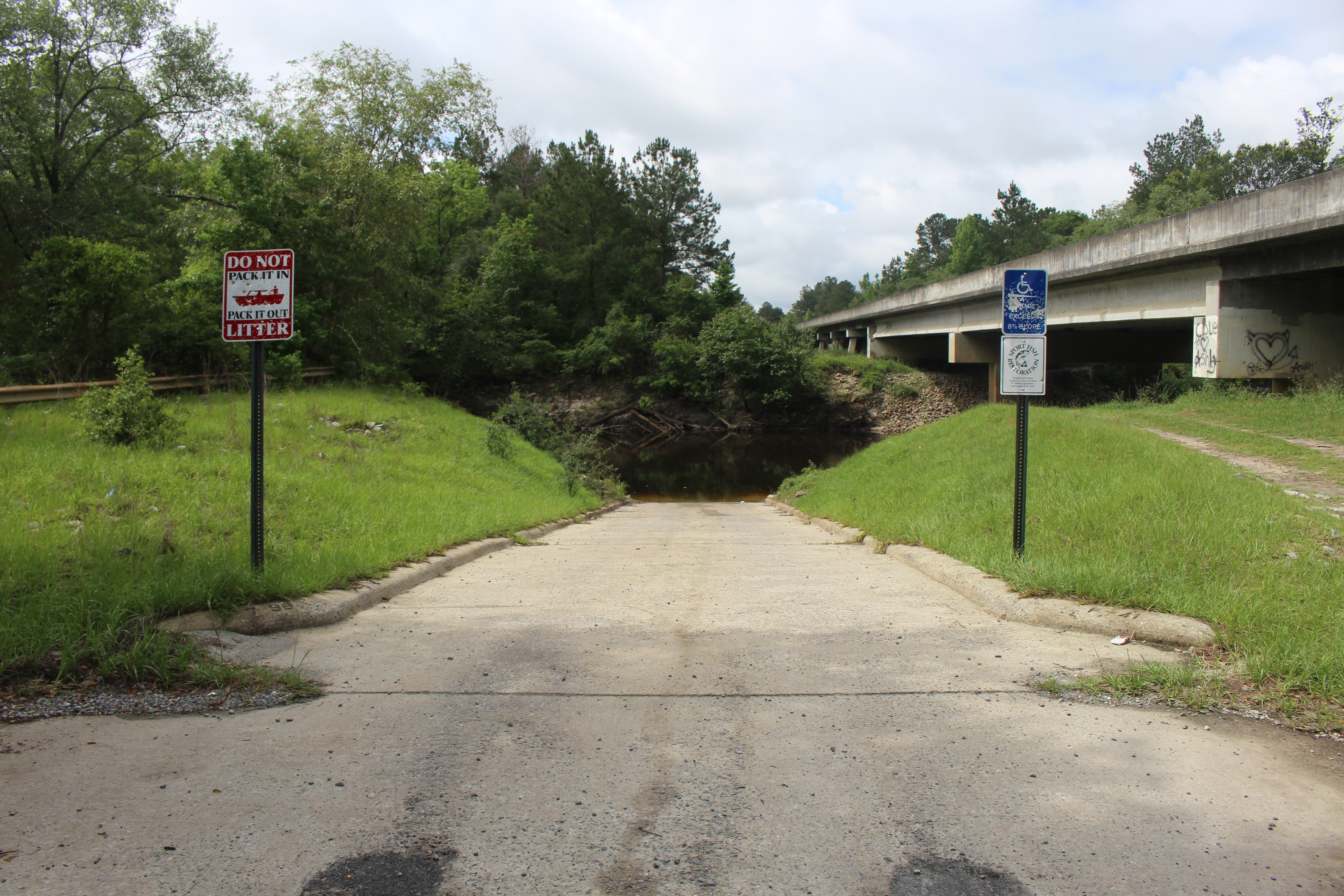
Little River Boat ramp at SR76 Bridge
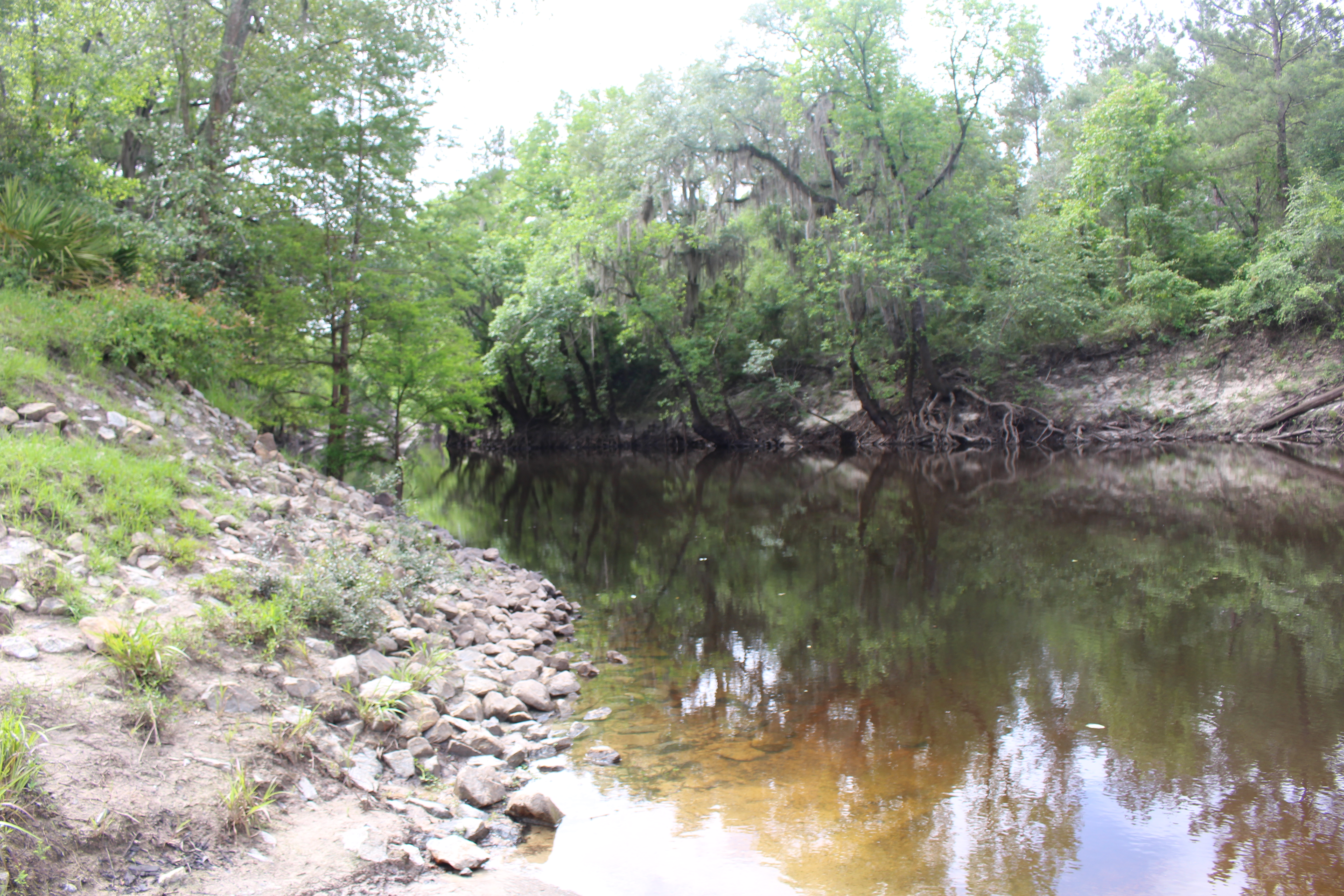
Little River flowing south from SR76 boat ramp
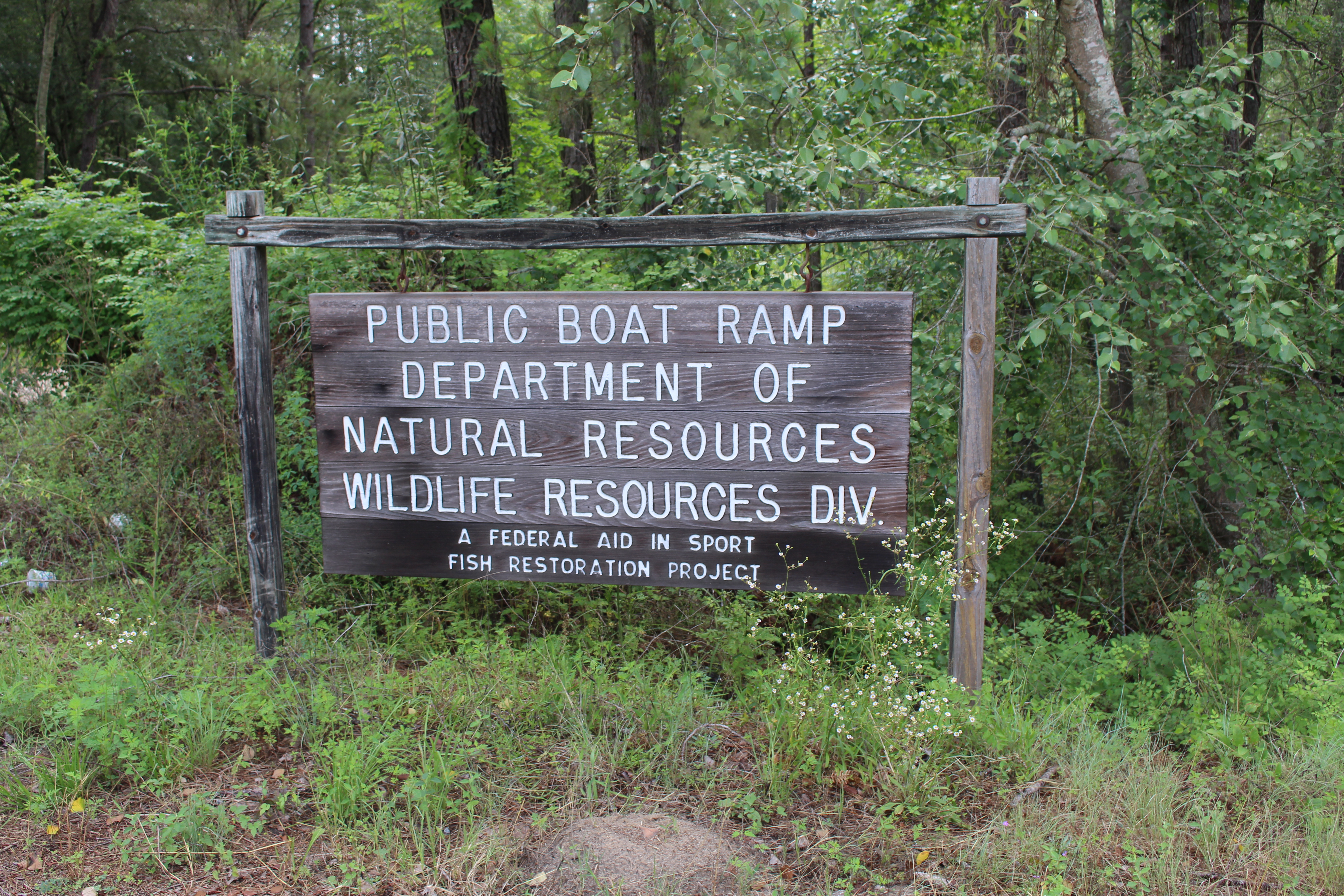
SR76 boat ramp sign

SR76 Bridge over Little River 1
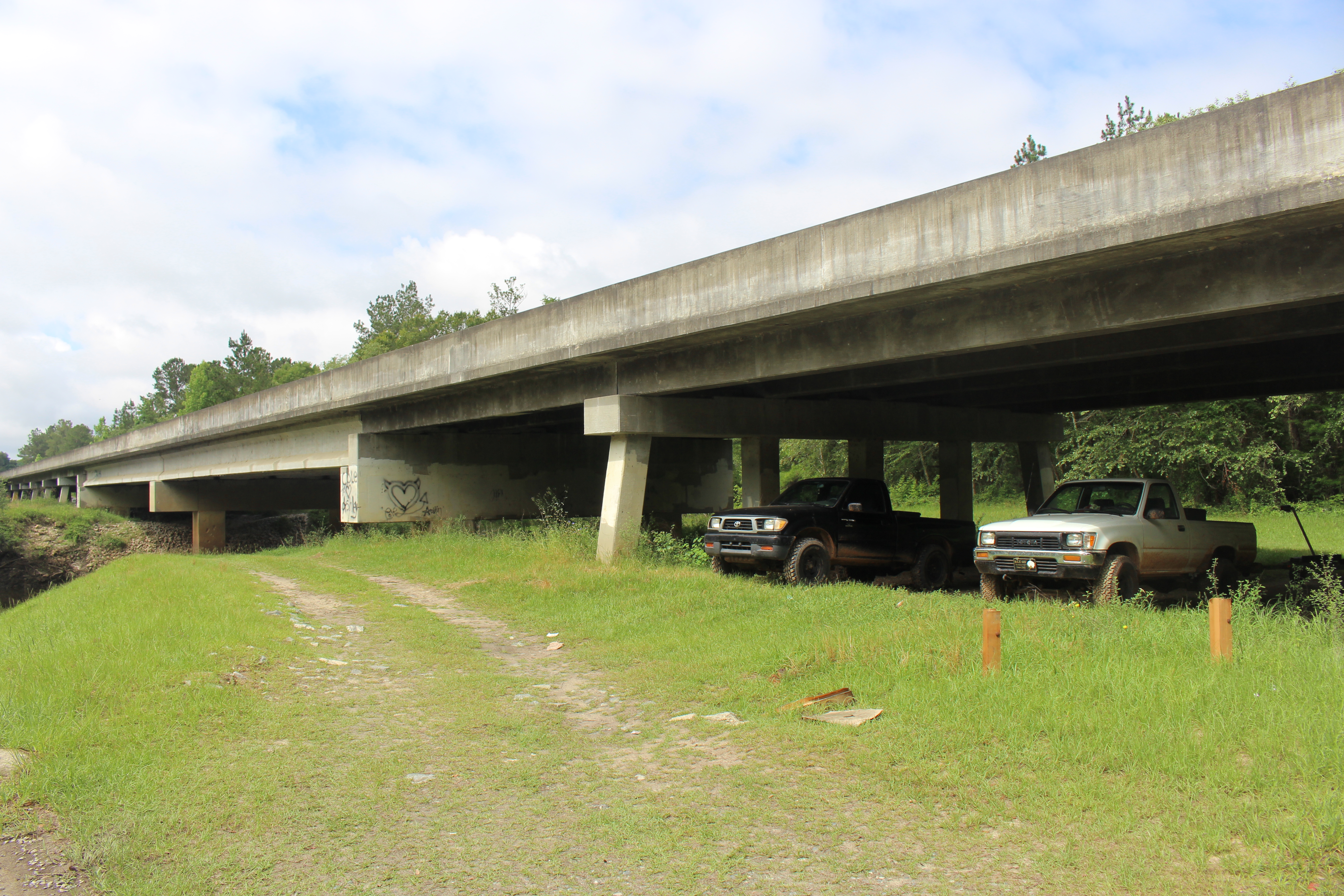
SR76 Bridge over Little River 2
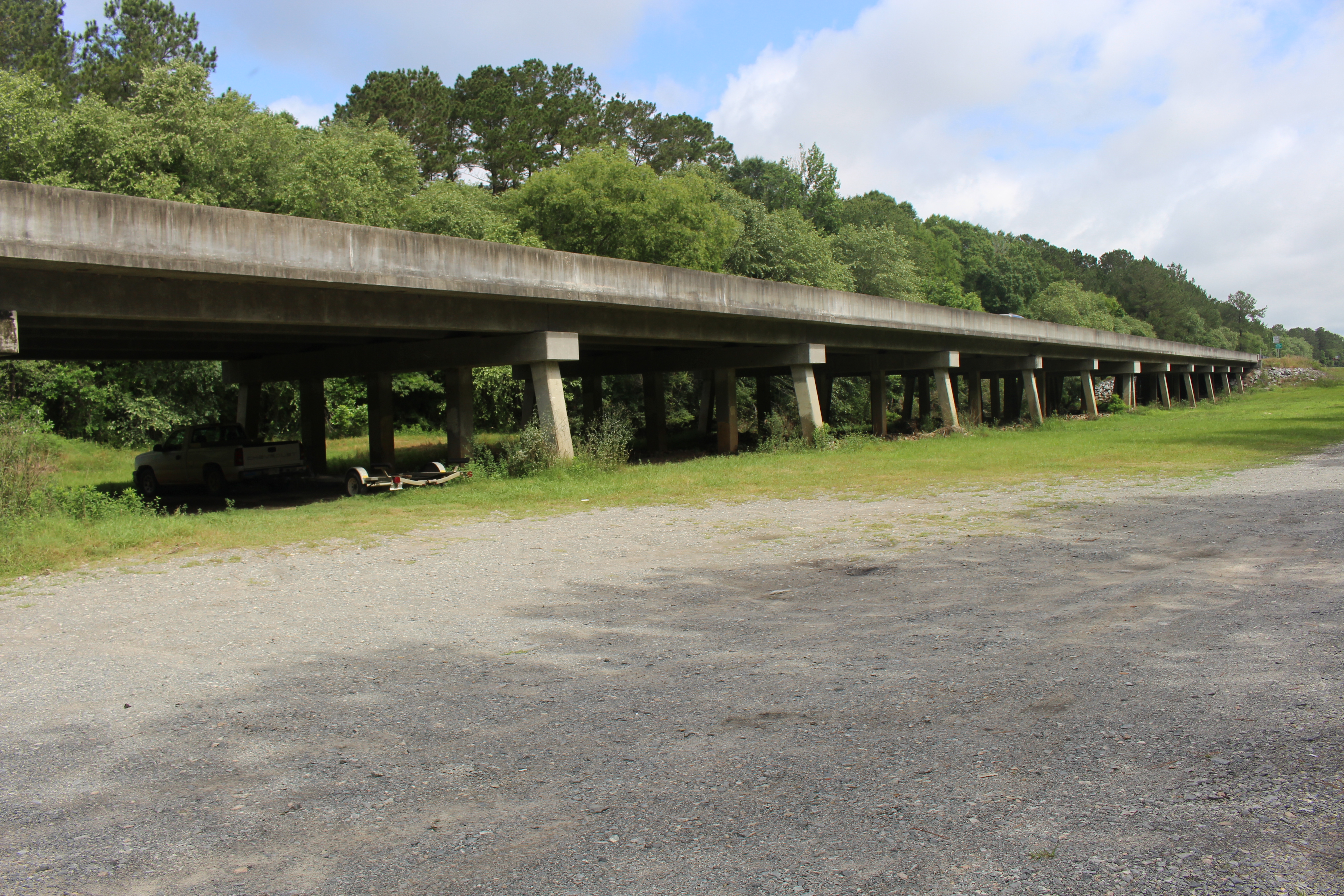
SR76 Bridge over Little River 3

317/366 AND Day 3623: Dancing at Calico in Moultrie
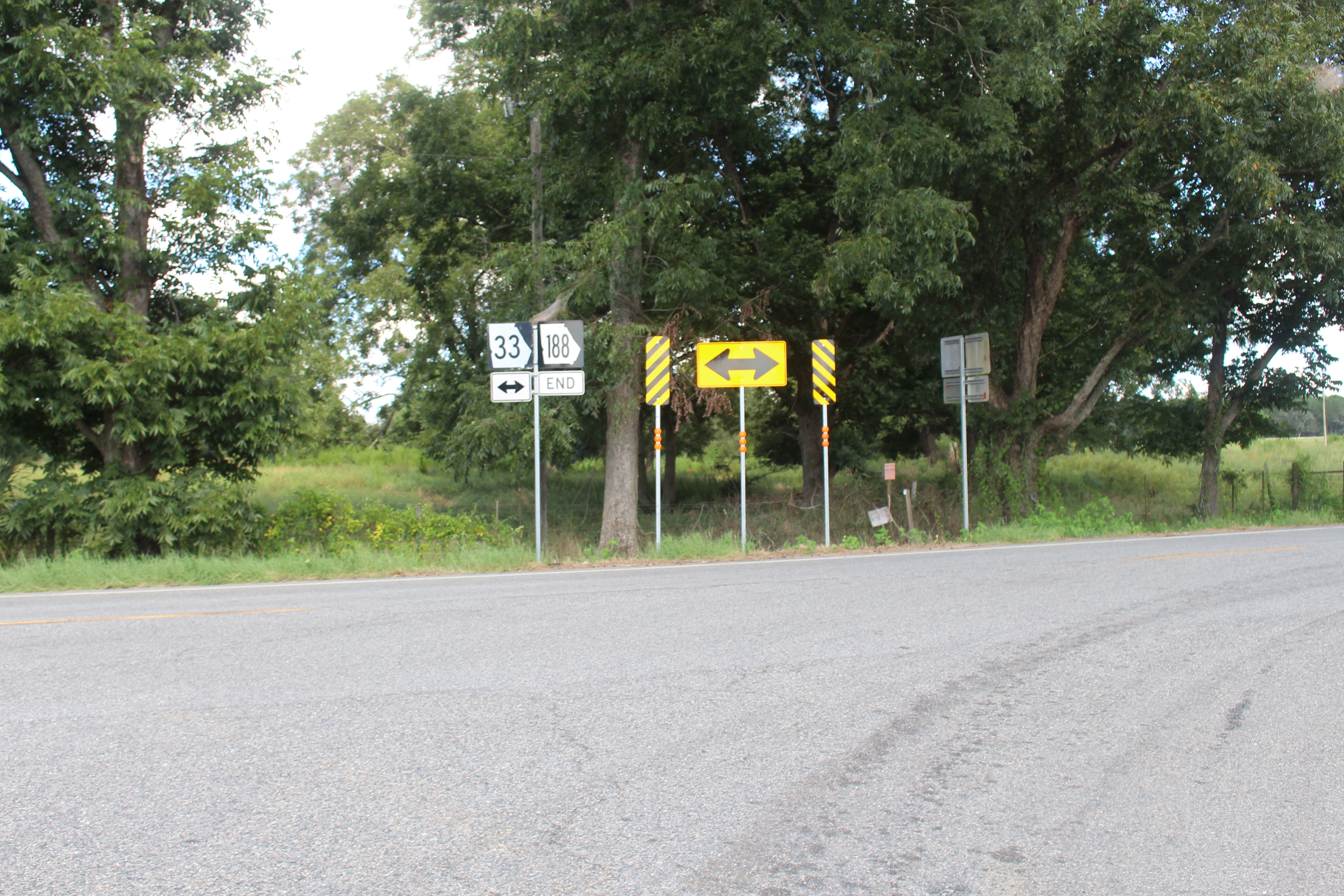
GA188 end Thomas County

GA122 133 intersection, Brooks County
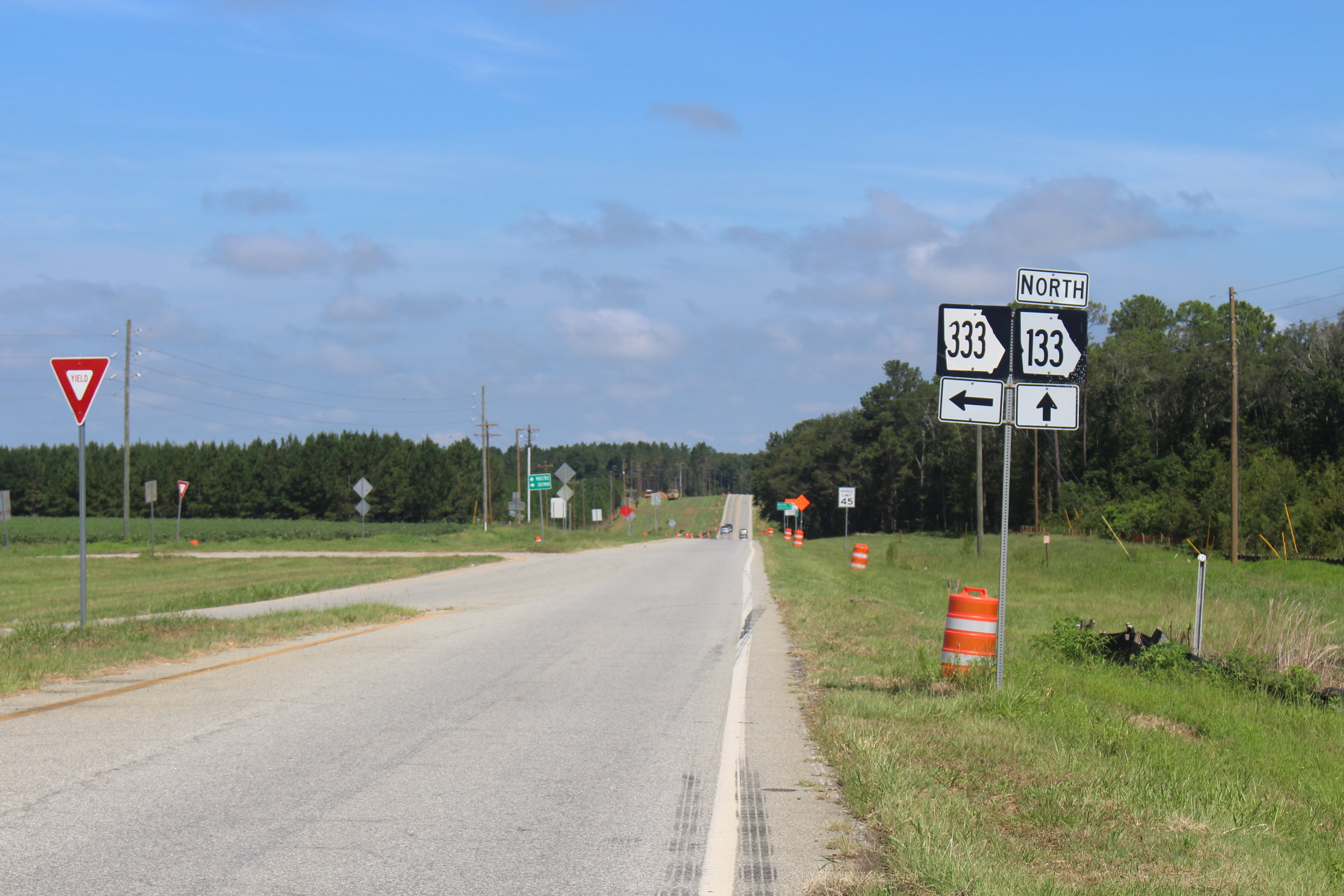
GA133NB, Brooks County
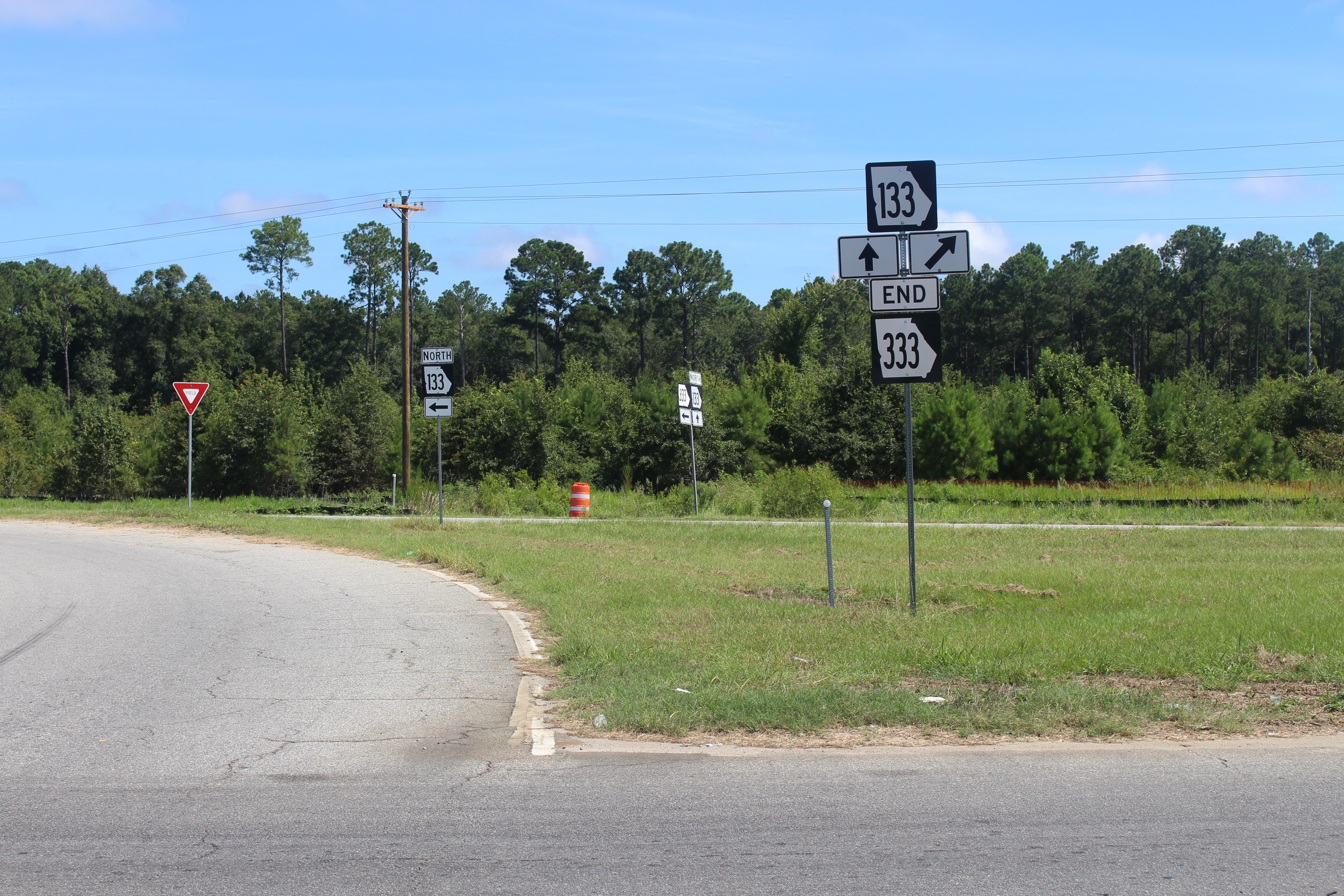
GA333NB end, Brooks County

Olde Greenfield Church and Historic Cemetery Marker Colquitt Co GA

In Memory of Rev T C Gregory Marker Colquitt Co GA
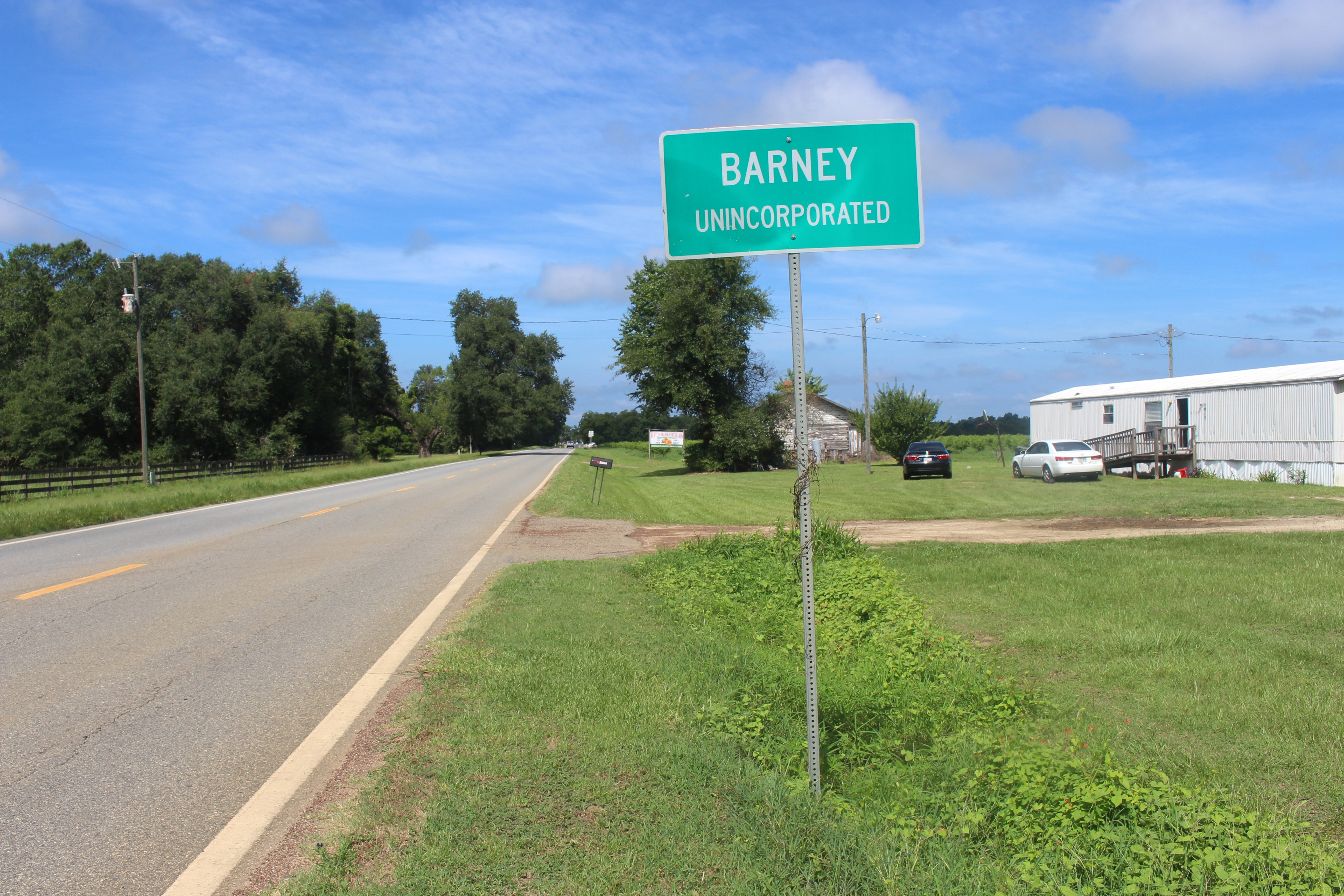
Barney limit GA122WB

Abandoned 1A Barney GA

Abandoned 1B Barney GA
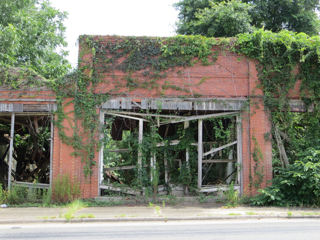
Abandoned 1C Barney GA
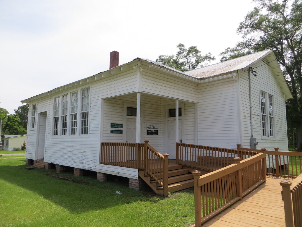
Barney Colored Elementary School Barney GA

Barney Colored Elementary School Marker Barney GA
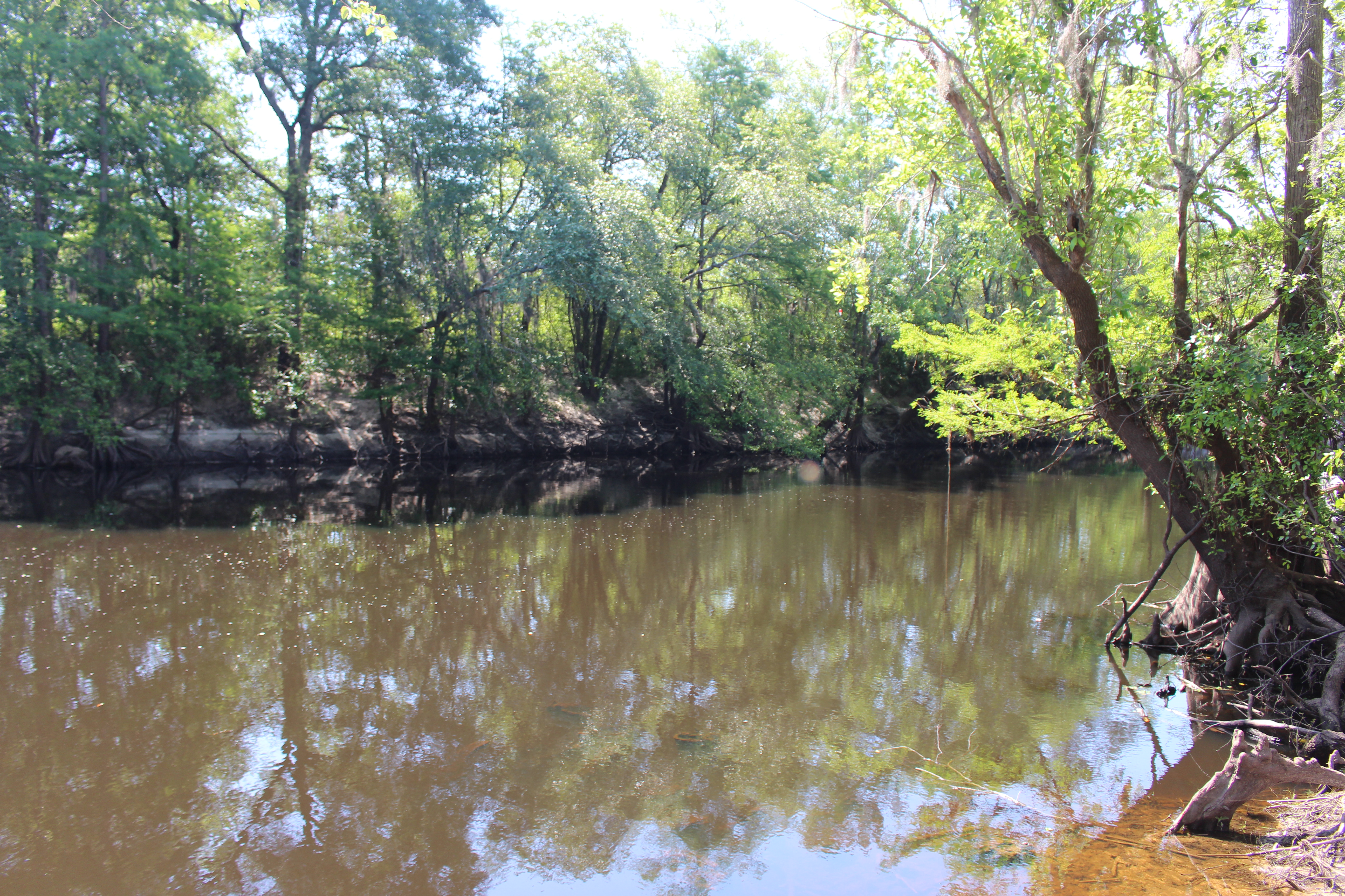
Little River at SR37 Bridge

SR37 Bridge over Little River 1
Mapa de Langford St, Moultrie, GA, EE. UU.
Buscar otro lugar
Lugares cercanos
Moultrie Rd, Barney, GA, EE. UU.
Co Rd, Pavo, GA, EE. UU.
Walden Rd, Pavo, GA, EE. UU.
Walden Rd, Pavo, GA, EE. UU.
Barney, GA, EE. UU.
Reed Bingham State Park, Reed Bingham Rd, Adel, GA, EE. UU.
Reed Bingham Road, Reed Bingham Rd, Adel, GA, EE. UU.
Bull Creek Rd, Moultrie, GA, EE. UU.
Dorminey Rd, Moultrie, GA, EE. UU.
Antioch Greggs Rd, Adel, GA, EE. UU.
Pavo, Georgia, EE. UU.
S Roberts St, Pavo, GA, EE. UU.
Gene McQueen Rd, Moultrie, GA, EE. UU.
1st St, Morven, GA, EE. UU.
Condado de Cook, Georgia, EE. UU.
Morven, Georgia, EE. UU.
5th St SE, Moultrie, GA, EE. UU.
Salem Rd, Pavo, GA, EE. UU.
Murphy, GA, EE. UU.
Moultrie, Georgia, EE. UU.
Búsquedas recientes
- Horas de salida y puesta de sol de Red Dog Mine, AK, USA
- Horas de salida y puesta de sol de Am Bahnhof, Am bhf, Borken, Germany
- Horas de salida y puesta de sol de 4th St E, Sonoma, CA, EE. UU.
- Horas de salida y puesta de sol de Oakland Ave, Williamsport, PA, EE. UU.
- Horas de salida y puesta de sol de Via Roma, Pieranica CR, Italia
- Horas de salida y puesta de sol de Torre del reloj, Grad, Dubrovnik (Ragusa), Croacia
- Horas de salida y puesta de sol de Trelew, Chubut, Argentina
- Horas de salida y puesta de sol de Hartfords Bluff Cir, Mt Pleasant, SC, EE. UU.
- Horas de salida y puesta de sol de Kita Ward, Kumamoto, Japón
- Horas de salida y puesta de sol de Pingtan Island, Pingtan County, Fuzhou, China