| Zona horaria: | hora estándar de China |
|---|---|
| Hora local: | jueves, 12 de noviembre de 2026 0:53 |
| Longitud: | 109.2169807 |
| Latitud: | 23.7532648 |
| Amanecer hoy: | 6:56:46 |
| Atardecer hoy: | 18:00:24 |
| Horas de luz hoy: | 11h 3m 38s |
| Amanecer mañana: | 6:57:25 |
| Atardecer mañana: | 18:00:01 |
| Horas de luz mañana: | 11h 2m 35s |
: Mostrar todas las fechas
| Fecha | Salida de sol | Puesta de sol | Duración del día |
|---|---|---|---|
| 1 de ene. de 2026 | 7:26:24 | 18:07:51 | 10h 41m 26s |
| 1 de feb. de 2026 | 7:25:47 | 18:29:39 | 11h 3m 52s |
| 1 de mar. de 2026 | 7:08:00 | 18:46:30 | 11h 38m 30s |
| 1 de abr. de 2026 | 6:37:57 | 18:59:17 | 12h 21m 19s |
| 1 de may. de 2026 | 6:11:25 | 19:11:47 | 13h 0m 21s |
| 1 de jun. de 2026 | 5:57:33 | 19:26:51 | 13h 29m 17s |
| 1 de jul. de 2026 | 6:00:19 | 19:35:22 | 13h 35m 3s |
| 1 de ago. de 2026 | 6:13:14 | 19:28:15 | 13h 15m 1s |
| 1 de sep. de 2026 | 6:25:49 | 19:04:29 | 12h 38m 40s |
| 1 de oct. de 2026 | 6:35:31 | 18:33:35 | 11h 58m 4s |
| 1 de nov. de 2026 | 6:49:20 | 18:06:39 | 11h 17m 19s |
| 12 de nov. de 2026 | 6:56:06 | 18:00:48 | 11h 4m 42s |
| 13 de nov. de 2026 | 6:56:46 | 18:00:24 | 11h 3m 38s |
| 1 de dic. de 2026 | 7:09:12 | 17:57:00 | 10h 47m 48s |
Fotos de amanecer y atardecer

Laibin - Red Water River by cnmark

Tug, Ocean Cartier, holding BBG Laibin, bulk carrier by D70
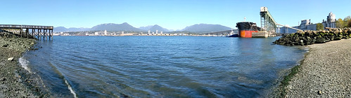
Vancouver harbour from New Brighton park from GPS Below Sea Level Altitude - 15.44 m by D70

Approaching Hong Kong over sea by Inklaar