Horas de salida y puesta de sol de Hoh Mainline, Forks, WA, EE. UU.
Location: Estados Unidos > Washington > Forks >
Zona horaria:
America/Los_Angeles
Hora local:
2025-07-08 00:08:34
Longitud:
-124.1339443
Latitud:
47.7178656
Salida de sol de hoy:
05:28:08 AM
Puesta de sol de hoy:
09:15:24 PM
La duración del día hoy:
15h 47m 16s
Salida de sol de mañana:
05:29:00 AM
Puesta de sol de mañana:
09:14:49 PM
La duración del día mañana:
15h 45m 49s
Mostrar todas las fechas
| Fecha | Salida de sol | Puesta de sol | Duración del día |
|---|---|---|---|
| 01/01/2025 | 08:04:59 AM | 04:36:32 PM | 8h 31m 33s |
| 02/01/2025 | 08:04:53 AM | 04:37:34 PM | 8h 32m 41s |
| 03/01/2025 | 08:04:43 AM | 04:38:38 PM | 8h 33m 55s |
| 04/01/2025 | 08:04:31 AM | 04:39:43 PM | 8h 35m 12s |
| 05/01/2025 | 08:04:16 AM | 04:40:51 PM | 8h 36m 35s |
| 06/01/2025 | 08:03:58 AM | 04:42:00 PM | 8h 38m 2s |
| 07/01/2025 | 08:03:37 AM | 04:43:12 PM | 8h 39m 35s |
| 08/01/2025 | 08:03:14 AM | 04:44:25 PM | 8h 41m 11s |
| 09/01/2025 | 08:02:47 AM | 04:45:39 PM | 8h 42m 52s |
| 10/01/2025 | 08:02:18 AM | 04:46:55 PM | 8h 44m 37s |
| 11/01/2025 | 08:01:47 AM | 04:48:13 PM | 8h 46m 26s |
| 12/01/2025 | 08:01:12 AM | 04:49:32 PM | 8h 48m 20s |
| 13/01/2025 | 08:00:35 AM | 04:50:53 PM | 8h 50m 18s |
| 14/01/2025 | 07:59:55 AM | 04:52:15 PM | 8h 52m 20s |
| 15/01/2025 | 07:59:13 AM | 04:53:38 PM | 8h 54m 25s |
| 16/01/2025 | 07:58:28 AM | 04:55:02 PM | 8h 56m 34s |
| 17/01/2025 | 07:57:40 AM | 04:56:28 PM | 8h 58m 48s |
| 18/01/2025 | 07:56:50 AM | 04:57:54 PM | 9h 1m 4s |
| 19/01/2025 | 07:55:58 AM | 04:59:22 PM | 9h 3m 24s |
| 20/01/2025 | 07:55:03 AM | 05:00:50 PM | 9h 5m 47s |
| 21/01/2025 | 07:54:06 AM | 05:02:19 PM | 9h 8m 13s |
| 22/01/2025 | 07:53:06 AM | 05:03:49 PM | 9h 10m 43s |
| 23/01/2025 | 07:52:05 AM | 05:05:19 PM | 9h 13m 14s |
| 24/01/2025 | 07:51:01 AM | 05:06:51 PM | 9h 15m 50s |
| 25/01/2025 | 07:49:54 AM | 05:08:22 PM | 9h 18m 28s |
| 26/01/2025 | 07:48:46 AM | 05:09:55 PM | 9h 21m 9s |
| 27/01/2025 | 07:47:36 AM | 05:11:28 PM | 9h 23m 52s |
| 28/01/2025 | 07:46:23 AM | 05:13:01 PM | 9h 26m 38s |
| 29/01/2025 | 07:45:09 AM | 05:14:34 PM | 9h 29m 25s |
| 30/01/2025 | 07:43:52 AM | 05:16:08 PM | 9h 32m 16s |
| 31/01/2025 | 07:42:34 AM | 05:17:43 PM | 9h 35m 9s |
| 01/02/2025 | 07:41:14 AM | 05:19:17 PM | 9h 38m 3s |
| 02/02/2025 | 07:39:52 AM | 05:20:52 PM | 9h 41m 0s |
| 03/02/2025 | 07:38:28 AM | 05:22:27 PM | 9h 43m 59s |
| 04/02/2025 | 07:37:02 AM | 05:24:02 PM | 9h 47m 0s |
| 05/02/2025 | 07:35:35 AM | 05:25:37 PM | 9h 50m 2s |
| 06/02/2025 | 07:34:06 AM | 05:27:12 PM | 9h 53m 6s |
| 07/02/2025 | 07:32:36 AM | 05:28:47 PM | 9h 56m 11s |
| 08/02/2025 | 07:31:04 AM | 05:30:22 PM | 9h 59m 18s |
| 09/02/2025 | 07:29:30 AM | 05:31:57 PM | 10h 2m 27s |
| 10/02/2025 | 07:27:55 AM | 05:33:32 PM | 10h 5m 37s |
| 11/02/2025 | 07:26:19 AM | 05:35:06 PM | 10h 8m 47s |
| 12/02/2025 | 07:24:41 AM | 05:36:41 PM | 10h 12m 0s |
| 13/02/2025 | 07:23:02 AM | 05:38:16 PM | 10h 15m 14s |
| 14/02/2025 | 07:21:21 AM | 05:39:50 PM | 10h 18m 29s |
| 15/02/2025 | 07:19:40 AM | 05:41:24 PM | 10h 21m 44s |
| 16/02/2025 | 07:17:57 AM | 05:42:58 PM | 10h 25m 1s |
| 17/02/2025 | 07:16:13 AM | 05:44:32 PM | 10h 28m 19s |
| 18/02/2025 | 07:14:28 AM | 05:46:06 PM | 10h 31m 38s |
| 19/02/2025 | 07:12:41 AM | 05:47:39 PM | 10h 34m 58s |
| 20/02/2025 | 07:10:54 AM | 05:49:12 PM | 10h 38m 18s |
| 21/02/2025 | 07:09:06 AM | 05:50:45 PM | 10h 41m 39s |
| 22/02/2025 | 07:07:17 AM | 05:52:18 PM | 10h 45m 1s |
| 23/02/2025 | 07:05:26 AM | 05:53:50 PM | 10h 48m 24s |
| 24/02/2025 | 07:03:35 AM | 05:55:22 PM | 10h 51m 47s |
| 25/02/2025 | 07:01:43 AM | 05:56:54 PM | 10h 55m 11s |
| 26/02/2025 | 06:59:51 AM | 05:58:25 PM | 10h 58m 34s |
| 27/02/2025 | 06:57:57 AM | 05:59:57 PM | 11h 2m 0s |
| 28/02/2025 | 06:56:03 AM | 06:01:28 PM | 11h 5m 25s |
| 01/03/2025 | 06:54:08 AM | 06:02:58 PM | 11h 8m 50s |
| 02/03/2025 | 06:52:12 AM | 06:04:29 PM | 11h 12m 17s |
| 03/03/2025 | 06:50:16 AM | 06:05:59 PM | 11h 15m 43s |
| 04/03/2025 | 06:48:19 AM | 06:07:29 PM | 11h 19m 10s |
| 05/03/2025 | 06:46:21 AM | 06:08:58 PM | 11h 22m 37s |
| 06/03/2025 | 06:44:23 AM | 06:10:27 PM | 11h 26m 4s |
| 07/03/2025 | 06:42:25 AM | 06:11:57 PM | 11h 29m 32s |
| 08/03/2025 | 06:40:26 AM | 06:13:25 PM | 11h 32m 59s |
| 09/03/2025 | 07:38:31 AM | 07:14:50 PM | 11h 36m 19s |
| 10/03/2025 | 07:36:32 AM | 07:16:19 PM | 11h 39m 47s |
| 11/03/2025 | 07:34:31 AM | 07:17:47 PM | 11h 43m 16s |
| 12/03/2025 | 07:32:31 AM | 07:19:15 PM | 11h 46m 44s |
| 13/03/2025 | 07:30:30 AM | 07:20:42 PM | 11h 50m 12s |
| 14/03/2025 | 07:28:29 AM | 07:22:10 PM | 11h 53m 41s |
| 15/03/2025 | 07:26:28 AM | 07:23:37 PM | 11h 57m 9s |
| 16/03/2025 | 07:24:26 AM | 07:25:04 PM | 12h 0m 38s |
| 17/03/2025 | 07:22:24 AM | 07:26:31 PM | 12h 4m 7s |
| 18/03/2025 | 07:20:22 AM | 07:27:58 PM | 12h 7m 36s |
| 19/03/2025 | 07:18:20 AM | 07:29:24 PM | 12h 11m 4s |
| 20/03/2025 | 07:16:18 AM | 07:30:51 PM | 12h 14m 33s |
| 21/03/2025 | 07:14:16 AM | 07:32:17 PM | 12h 18m 1s |
| 22/03/2025 | 07:12:14 AM | 07:33:43 PM | 12h 21m 29s |
| 23/03/2025 | 07:10:12 AM | 07:35:09 PM | 12h 24m 57s |
| 24/03/2025 | 07:08:09 AM | 07:36:35 PM | 12h 28m 26s |
| 25/03/2025 | 07:06:07 AM | 07:38:01 PM | 12h 31m 54s |
| 26/03/2025 | 07:04:05 AM | 07:39:27 PM | 12h 35m 22s |
| 27/03/2025 | 07:02:04 AM | 07:40:53 PM | 12h 38m 49s |
| 28/03/2025 | 07:00:02 AM | 07:42:18 PM | 12h 42m 16s |
| 29/03/2025 | 06:58:00 AM | 07:43:44 PM | 12h 45m 44s |
| 30/03/2025 | 06:55:59 AM | 07:45:09 PM | 12h 49m 10s |
| 31/03/2025 | 06:53:58 AM | 07:46:35 PM | 12h 52m 37s |
| 01/04/2025 | 06:51:57 AM | 07:48:00 PM | 12h 56m 3s |
| 02/04/2025 | 06:49:57 AM | 07:49:25 PM | 12h 59m 28s |
| 03/04/2025 | 06:47:57 AM | 07:50:51 PM | 13h 2m 54s |
| 04/04/2025 | 06:45:57 AM | 07:52:16 PM | 13h 6m 19s |
| 05/04/2025 | 06:43:58 AM | 07:53:41 PM | 13h 9m 43s |
| 06/04/2025 | 06:41:59 AM | 07:55:07 PM | 13h 13m 8s |
| 07/04/2025 | 06:40:01 AM | 07:56:32 PM | 13h 16m 31s |
| 08/04/2025 | 06:38:03 AM | 07:57:57 PM | 13h 19m 54s |
| 09/04/2025 | 06:36:05 AM | 07:59:22 PM | 13h 23m 17s |
| 10/04/2025 | 06:34:09 AM | 08:00:48 PM | 13h 26m 39s |
| 11/04/2025 | 06:32:13 AM | 08:02:13 PM | 13h 30m 0s |
| 12/04/2025 | 06:30:17 AM | 08:03:38 PM | 13h 33m 21s |
| 13/04/2025 | 06:28:22 AM | 08:05:03 PM | 13h 36m 41s |
| 14/04/2025 | 06:26:28 AM | 08:06:28 PM | 13h 40m 0s |
| 15/04/2025 | 06:24:35 AM | 08:07:54 PM | 13h 43m 19s |
| 16/04/2025 | 06:22:42 AM | 08:09:19 PM | 13h 46m 37s |
| 17/04/2025 | 06:20:51 AM | 08:10:44 PM | 13h 49m 53s |
| 18/04/2025 | 06:19:00 AM | 08:12:09 PM | 13h 53m 9s |
| 19/04/2025 | 06:17:10 AM | 08:13:34 PM | 13h 56m 24s |
| 20/04/2025 | 06:15:21 AM | 08:14:59 PM | 13h 59m 38s |
| 21/04/2025 | 06:13:32 AM | 08:16:24 PM | 14h 2m 52s |
| 22/04/2025 | 06:11:45 AM | 08:17:48 PM | 14h 6m 3s |
| 23/04/2025 | 06:09:59 AM | 08:19:13 PM | 14h 9m 14s |
| 24/04/2025 | 06:08:14 AM | 08:20:38 PM | 14h 12m 24s |
| 25/04/2025 | 06:06:30 AM | 08:22:02 PM | 14h 15m 32s |
| 26/04/2025 | 06:04:47 AM | 08:23:27 PM | 14h 18m 40s |
| 27/04/2025 | 06:03:06 AM | 08:24:51 PM | 14h 21m 45s |
| 28/04/2025 | 06:01:25 AM | 08:26:15 PM | 14h 24m 50s |
| 29/04/2025 | 05:59:46 AM | 08:27:38 PM | 14h 27m 52s |
| 30/04/2025 | 05:58:09 AM | 08:29:02 PM | 14h 30m 53s |
| 01/05/2025 | 05:56:32 AM | 08:30:25 PM | 14h 33m 53s |
| 02/05/2025 | 05:54:57 AM | 08:31:48 PM | 14h 36m 51s |
| 03/05/2025 | 05:53:23 AM | 08:33:11 PM | 14h 39m 48s |
| 04/05/2025 | 05:51:51 AM | 08:34:33 PM | 14h 42m 42s |
| 05/05/2025 | 05:50:20 AM | 08:35:55 PM | 14h 45m 35s |
| 06/05/2025 | 05:48:51 AM | 08:37:17 PM | 14h 48m 26s |
| 07/05/2025 | 05:47:24 AM | 08:38:38 PM | 14h 51m 14s |
| 08/05/2025 | 05:45:58 AM | 08:39:58 PM | 14h 54m 0s |
| 09/05/2025 | 05:44:33 AM | 08:41:18 PM | 14h 56m 45s |
| 10/05/2025 | 05:43:11 AM | 08:42:38 PM | 14h 59m 27s |
| 11/05/2025 | 05:41:50 AM | 08:43:57 PM | 15h 2m 7s |
| 12/05/2025 | 05:40:31 AM | 08:45:15 PM | 15h 4m 44s |
| 13/05/2025 | 05:39:14 AM | 08:46:33 PM | 15h 7m 19s |
| 14/05/2025 | 05:37:58 AM | 08:47:49 PM | 15h 9m 51s |
| 15/05/2025 | 05:36:45 AM | 08:49:06 PM | 15h 12m 21s |
| 16/05/2025 | 05:35:34 AM | 08:50:21 PM | 15h 14m 47s |
| 17/05/2025 | 05:34:24 AM | 08:51:35 PM | 15h 17m 11s |
| 18/05/2025 | 05:33:17 AM | 08:52:49 PM | 15h 19m 32s |
| 19/05/2025 | 05:32:11 AM | 08:54:01 PM | 15h 21m 50s |
| 20/05/2025 | 05:31:08 AM | 08:55:12 PM | 15h 24m 4s |
| 21/05/2025 | 05:30:07 AM | 08:56:23 PM | 15h 26m 16s |
| 22/05/2025 | 05:29:08 AM | 08:57:32 PM | 15h 28m 24s |
| 23/05/2025 | 05:28:11 AM | 08:58:40 PM | 15h 30m 29s |
| 24/05/2025 | 05:27:16 AM | 08:59:47 PM | 15h 32m 31s |
| 25/05/2025 | 05:26:24 AM | 09:00:52 PM | 15h 34m 28s |
| 26/05/2025 | 05:25:34 AM | 09:01:56 PM | 15h 36m 22s |
| 27/05/2025 | 05:24:46 AM | 09:02:59 PM | 15h 38m 13s |
| 28/05/2025 | 05:24:01 AM | 09:04:00 PM | 15h 39m 59s |
| 29/05/2025 | 05:23:18 AM | 09:05:00 PM | 15h 41m 42s |
| 30/05/2025 | 05:22:38 AM | 09:05:58 PM | 15h 43m 20s |
| 31/05/2025 | 05:22:00 AM | 09:06:54 PM | 15h 44m 54s |
| 01/06/2025 | 05:21:25 AM | 09:07:49 PM | 15h 46m 24s |
| 02/06/2025 | 05:20:52 AM | 09:08:42 PM | 15h 47m 50s |
| 03/06/2025 | 05:20:21 AM | 09:09:33 PM | 15h 49m 12s |
| 04/06/2025 | 05:19:53 AM | 09:10:22 PM | 15h 50m 29s |
| 05/06/2025 | 05:19:28 AM | 09:11:09 PM | 15h 51m 41s |
| 06/06/2025 | 05:19:05 AM | 09:11:55 PM | 15h 52m 50s |
| 07/06/2025 | 05:18:45 AM | 09:12:38 PM | 15h 53m 53s |
| 08/06/2025 | 05:18:27 AM | 09:13:19 PM | 15h 54m 52s |
| 09/06/2025 | 05:18:12 AM | 09:13:58 PM | 15h 55m 46s |
| 10/06/2025 | 05:18:00 AM | 09:14:35 PM | 15h 56m 35s |
| 11/06/2025 | 05:17:50 AM | 09:15:10 PM | 15h 57m 20s |
| 12/06/2025 | 05:17:43 AM | 09:15:42 PM | 15h 57m 59s |
| 13/06/2025 | 05:17:38 AM | 09:16:12 PM | 15h 58m 34s |
| 14/06/2025 | 05:17:36 AM | 09:16:40 PM | 15h 59m 4s |
| 15/06/2025 | 05:17:36 AM | 09:17:05 PM | 15h 59m 29s |
| 16/06/2025 | 05:17:39 AM | 09:17:28 PM | 15h 59m 49s |
| 17/06/2025 | 05:17:45 AM | 09:17:49 PM | 16h 0m 4s |
| 18/06/2025 | 05:17:53 AM | 09:18:07 PM | 16h 0m 14s |
| 19/06/2025 | 05:18:04 AM | 09:18:22 PM | 16h 0m 18s |
| 20/06/2025 | 05:18:17 AM | 09:18:35 PM | 16h 0m 18s |
| 21/06/2025 | 05:18:33 AM | 09:18:46 PM | 16h 0m 13s |
| 22/06/2025 | 05:18:51 AM | 09:18:54 PM | 16h 0m 3s |
| 23/06/2025 | 05:19:11 AM | 09:18:59 PM | 15h 59m 48s |
| 24/06/2025 | 05:19:34 AM | 09:19:01 PM | 15h 59m 27s |
| 25/06/2025 | 05:19:59 AM | 09:19:01 PM | 15h 59m 2s |
| 26/06/2025 | 05:20:27 AM | 09:18:59 PM | 15h 58m 32s |
| 27/06/2025 | 05:20:56 AM | 09:18:54 PM | 15h 57m 58s |
| 28/06/2025 | 05:21:28 AM | 09:18:46 PM | 15h 57m 18s |
| 29/06/2025 | 05:22:03 AM | 09:18:35 PM | 15h 56m 32s |
| 30/06/2025 | 05:22:39 AM | 09:18:22 PM | 15h 55m 43s |
| 01/07/2025 | 05:23:17 AM | 09:18:06 PM | 15h 54m 49s |
| 02/07/2025 | 05:23:58 AM | 09:17:48 PM | 15h 53m 50s |
| 03/07/2025 | 05:24:40 AM | 09:17:27 PM | 15h 52m 47s |
| 04/07/2025 | 05:25:25 AM | 09:17:03 PM | 15h 51m 38s |
| 05/07/2025 | 05:26:11 AM | 09:16:37 PM | 15h 50m 26s |
| 06/07/2025 | 05:26:59 AM | 09:16:08 PM | 15h 49m 9s |
| 07/07/2025 | 05:27:49 AM | 09:15:36 PM | 15h 47m 47s |
| 08/07/2025 | 05:28:41 AM | 09:15:02 PM | 15h 46m 21s |
| 09/07/2025 | 05:29:34 AM | 09:14:26 PM | 15h 44m 52s |
| 10/07/2025 | 05:30:29 AM | 09:13:47 PM | 15h 43m 18s |
| 11/07/2025 | 05:31:25 AM | 09:13:05 PM | 15h 41m 40s |
| 12/07/2025 | 05:32:23 AM | 09:12:21 PM | 15h 39m 58s |
| 13/07/2025 | 05:33:23 AM | 09:11:35 PM | 15h 38m 12s |
| 14/07/2025 | 05:34:24 AM | 09:10:46 PM | 15h 36m 22s |
| 15/07/2025 | 05:35:26 AM | 09:09:55 PM | 15h 34m 29s |
| 16/07/2025 | 05:36:29 AM | 09:09:02 PM | 15h 32m 33s |
| 17/07/2025 | 05:37:34 AM | 09:08:06 PM | 15h 30m 32s |
| 18/07/2025 | 05:38:40 AM | 09:07:08 PM | 15h 28m 28s |
| 19/07/2025 | 05:39:47 AM | 09:06:08 PM | 15h 26m 21s |
| 20/07/2025 | 05:40:55 AM | 09:05:05 PM | 15h 24m 10s |
| 21/07/2025 | 05:42:04 AM | 09:04:01 PM | 15h 21m 57s |
| 22/07/2025 | 05:43:14 AM | 09:02:54 PM | 15h 19m 40s |
| 23/07/2025 | 05:44:24 AM | 09:01:45 PM | 15h 17m 21s |
| 24/07/2025 | 05:45:36 AM | 09:00:35 PM | 15h 14m 59s |
| 25/07/2025 | 05:46:49 AM | 08:59:22 PM | 15h 12m 33s |
| 26/07/2025 | 05:48:02 AM | 08:58:07 PM | 15h 10m 5s |
| 27/07/2025 | 05:49:16 AM | 08:56:51 PM | 15h 7m 35s |
| 28/07/2025 | 05:50:30 AM | 08:55:32 PM | 15h 5m 2s |
| 29/07/2025 | 05:51:46 AM | 08:54:12 PM | 15h 2m 26s |
| 30/07/2025 | 05:53:01 AM | 08:52:50 PM | 14h 59m 49s |
| 31/07/2025 | 05:54:18 AM | 08:51:26 PM | 14h 57m 8s |
| 01/08/2025 | 05:55:35 AM | 08:50:00 PM | 14h 54m 25s |
| 02/08/2025 | 05:56:52 AM | 08:48:33 PM | 14h 51m 41s |
| 03/08/2025 | 05:58:10 AM | 08:47:04 PM | 14h 48m 54s |
| 04/08/2025 | 05:59:28 AM | 08:45:34 PM | 14h 46m 6s |
| 05/08/2025 | 06:00:46 AM | 08:44:02 PM | 14h 43m 16s |
| 06/08/2025 | 06:02:05 AM | 08:42:28 PM | 14h 40m 23s |
| 07/08/2025 | 06:03:24 AM | 08:40:53 PM | 14h 37m 29s |
| 08/08/2025 | 06:04:43 AM | 08:39:17 PM | 14h 34m 34s |
| 09/08/2025 | 06:06:03 AM | 08:37:39 PM | 14h 31m 36s |
| 10/08/2025 | 06:07:22 AM | 08:36:00 PM | 14h 28m 38s |
| 11/08/2025 | 06:08:42 AM | 08:34:20 PM | 14h 25m 38s |
| 12/08/2025 | 06:10:02 AM | 08:32:38 PM | 14h 22m 36s |
| 13/08/2025 | 06:11:23 AM | 08:30:55 PM | 14h 19m 32s |
| 14/08/2025 | 06:12:43 AM | 08:29:11 PM | 14h 16m 28s |
| 15/08/2025 | 06:14:03 AM | 08:27:26 PM | 14h 13m 23s |
| 16/08/2025 | 06:15:24 AM | 08:25:39 PM | 14h 10m 15s |
| 17/08/2025 | 06:16:44 AM | 08:23:52 PM | 14h 7m 8s |
| 18/08/2025 | 06:18:05 AM | 08:22:04 PM | 14h 3m 59s |
| 19/08/2025 | 06:19:26 AM | 08:20:14 PM | 14h 0m 48s |
| 20/08/2025 | 06:20:46 AM | 08:18:24 PM | 13h 57m 38s |
| 21/08/2025 | 06:22:07 AM | 08:16:32 PM | 13h 54m 25s |
| 22/08/2025 | 06:23:28 AM | 08:14:40 PM | 13h 51m 12s |
| 23/08/2025 | 06:24:49 AM | 08:12:47 PM | 13h 47m 58s |
| 24/08/2025 | 06:26:09 AM | 08:10:53 PM | 13h 44m 44s |
| 25/08/2025 | 06:27:30 AM | 08:08:58 PM | 13h 41m 28s |
| 26/08/2025 | 06:28:51 AM | 08:07:03 PM | 13h 38m 12s |
| 27/08/2025 | 06:30:11 AM | 08:05:07 PM | 13h 34m 56s |
| 28/08/2025 | 06:31:32 AM | 08:03:10 PM | 13h 31m 38s |
| 29/08/2025 | 06:32:53 AM | 08:01:12 PM | 13h 28m 19s |
| 30/08/2025 | 06:34:13 AM | 07:59:14 PM | 13h 25m 1s |
| 31/08/2025 | 06:35:34 AM | 07:57:15 PM | 13h 21m 41s |
| 01/09/2025 | 06:36:54 AM | 07:55:16 PM | 13h 18m 22s |
| 02/09/2025 | 06:38:15 AM | 07:53:16 PM | 13h 15m 1s |
| 03/09/2025 | 06:39:36 AM | 07:51:16 PM | 13h 11m 40s |
| 04/09/2025 | 06:40:56 AM | 07:49:15 PM | 13h 8m 19s |
| 05/09/2025 | 06:42:17 AM | 07:47:14 PM | 13h 4m 57s |
| 06/09/2025 | 06:43:37 AM | 07:45:12 PM | 13h 1m 35s |
| 07/09/2025 | 06:44:58 AM | 07:43:10 PM | 12h 58m 12s |
| 08/09/2025 | 06:46:18 AM | 07:41:08 PM | 12h 54m 50s |
| 09/09/2025 | 06:47:39 AM | 07:39:06 PM | 12h 51m 27s |
| 10/09/2025 | 06:48:59 AM | 07:37:03 PM | 12h 48m 4s |
| 11/09/2025 | 06:50:20 AM | 07:35:00 PM | 12h 44m 40s |
| 12/09/2025 | 06:51:41 AM | 07:32:56 PM | 12h 41m 15s |
| 13/09/2025 | 06:53:01 AM | 07:30:53 PM | 12h 37m 52s |
| 14/09/2025 | 06:54:22 AM | 07:28:49 PM | 12h 34m 27s |
| 15/09/2025 | 06:55:43 AM | 07:26:45 PM | 12h 31m 2s |
| 16/09/2025 | 06:57:04 AM | 07:24:42 PM | 12h 27m 38s |
| 17/09/2025 | 06:58:25 AM | 07:22:38 PM | 12h 24m 13s |
| 18/09/2025 | 06:59:46 AM | 07:20:34 PM | 12h 20m 48s |
| 19/09/2025 | 07:01:08 AM | 07:18:30 PM | 12h 17m 22s |
| 20/09/2025 | 07:02:29 AM | 07:16:26 PM | 12h 13m 57s |
| 21/09/2025 | 07:03:50 AM | 07:14:22 PM | 12h 10m 32s |
| 22/09/2025 | 07:05:12 AM | 07:12:18 PM | 12h 7m 6s |
| 23/09/2025 | 07:06:34 AM | 07:10:15 PM | 12h 3m 41s |
| 24/09/2025 | 07:07:56 AM | 07:08:11 PM | 12h 0m 15s |
| 25/09/2025 | 07:09:18 AM | 07:06:08 PM | 11h 56m 50s |
| 26/09/2025 | 07:10:40 AM | 07:04:05 PM | 11h 53m 25s |
| 27/09/2025 | 07:12:03 AM | 07:02:02 PM | 11h 49m 59s |
| 28/09/2025 | 07:13:26 AM | 06:59:59 PM | 11h 46m 33s |
| 29/09/2025 | 07:14:49 AM | 06:57:57 PM | 11h 43m 8s |
| 30/09/2025 | 07:16:12 AM | 06:55:55 PM | 11h 39m 43s |
| 01/10/2025 | 07:17:35 AM | 06:53:53 PM | 11h 36m 18s |
| 02/10/2025 | 07:18:59 AM | 06:51:52 PM | 11h 32m 53s |
| 03/10/2025 | 07:20:23 AM | 06:49:52 PM | 11h 29m 29s |
| 04/10/2025 | 07:21:47 AM | 06:47:51 PM | 11h 26m 4s |
| 05/10/2025 | 07:23:12 AM | 06:45:51 PM | 11h 22m 39s |
| 06/10/2025 | 07:24:36 AM | 06:43:52 PM | 11h 19m 16s |
| 07/10/2025 | 07:26:01 AM | 06:41:53 PM | 11h 15m 52s |
| 08/10/2025 | 07:27:27 AM | 06:39:55 PM | 11h 12m 28s |
| 09/10/2025 | 07:28:52 AM | 06:37:58 PM | 11h 9m 6s |
| 10/10/2025 | 07:30:18 AM | 06:36:01 PM | 11h 5m 43s |
| 11/10/2025 | 07:31:44 AM | 06:34:05 PM | 11h 2m 21s |
| 12/10/2025 | 07:33:11 AM | 06:32:10 PM | 10h 58m 59s |
| 13/10/2025 | 07:34:38 AM | 06:30:15 PM | 10h 55m 37s |
| 14/10/2025 | 07:36:05 AM | 06:28:21 PM | 10h 52m 16s |
| 15/10/2025 | 07:37:32 AM | 06:26:28 PM | 10h 48m 56s |
| 16/10/2025 | 07:39:00 AM | 06:24:36 PM | 10h 45m 36s |
| 17/10/2025 | 07:40:28 AM | 06:22:45 PM | 10h 42m 17s |
| 18/10/2025 | 07:41:56 AM | 06:20:55 PM | 10h 38m 59s |
| 19/10/2025 | 07:43:25 AM | 06:19:05 PM | 10h 35m 40s |
| 20/10/2025 | 07:44:53 AM | 06:17:17 PM | 10h 32m 24s |
| 21/10/2025 | 07:46:23 AM | 06:15:30 PM | 10h 29m 7s |
| 22/10/2025 | 07:47:52 AM | 06:13:44 PM | 10h 25m 52s |
| 23/10/2025 | 07:49:22 AM | 06:11:59 PM | 10h 22m 37s |
| 24/10/2025 | 07:50:51 AM | 06:10:15 PM | 10h 19m 24s |
| 25/10/2025 | 07:52:22 AM | 06:08:33 PM | 10h 16m 11s |
| 26/10/2025 | 07:53:52 AM | 06:06:52 PM | 10h 13m 0s |
| 27/10/2025 | 07:55:22 AM | 06:05:12 PM | 10h 9m 50s |
| 28/10/2025 | 07:56:53 AM | 06:03:33 PM | 10h 6m 40s |
| 29/10/2025 | 07:58:24 AM | 06:01:56 PM | 10h 3m 32s |
| 30/10/2025 | 07:59:55 AM | 06:00:20 PM | 10h 0m 25s |
| 31/10/2025 | 08:01:26 AM | 05:58:46 PM | 9h 57m 20s |
| 01/11/2025 | 08:02:57 AM | 05:57:13 PM | 9h 54m 16s |
| 02/11/2025 | 07:04:32 AM | 04:55:38 PM | 9h 51m 6s |
| 03/11/2025 | 07:06:04 AM | 04:54:09 PM | 9h 48m 5s |
| 04/11/2025 | 07:07:35 AM | 04:52:41 PM | 9h 45m 6s |
| 05/11/2025 | 07:09:06 AM | 04:51:15 PM | 9h 42m 9s |
| 06/11/2025 | 07:10:37 AM | 04:49:50 PM | 9h 39m 13s |
| 07/11/2025 | 07:12:08 AM | 04:48:28 PM | 9h 36m 20s |
| 08/11/2025 | 07:13:39 AM | 04:47:07 PM | 9h 33m 28s |
| 09/11/2025 | 07:15:10 AM | 04:45:48 PM | 9h 30m 38s |
| 10/11/2025 | 07:16:40 AM | 04:44:31 PM | 9h 27m 51s |
| 11/11/2025 | 07:18:11 AM | 04:43:16 PM | 9h 25m 5s |
| 12/11/2025 | 07:19:41 AM | 04:42:03 PM | 9h 22m 22s |
| 13/11/2025 | 07:21:10 AM | 04:40:52 PM | 9h 19m 42s |
| 14/11/2025 | 07:22:39 AM | 04:39:43 PM | 9h 17m 4s |
| 15/11/2025 | 07:24:08 AM | 04:38:37 PM | 9h 14m 29s |
| 16/11/2025 | 07:25:36 AM | 04:37:32 PM | 9h 11m 56s |
| 17/11/2025 | 07:27:03 AM | 04:36:30 PM | 9h 9m 27s |
| 18/11/2025 | 07:28:30 AM | 04:35:31 PM | 9h 7m 1s |
| 19/11/2025 | 07:29:56 AM | 04:34:33 PM | 9h 4m 37s |
| 20/11/2025 | 07:31:21 AM | 04:33:38 PM | 9h 2m 17s |
| 21/11/2025 | 07:32:46 AM | 04:32:45 PM | 8h 59m 59s |
| 22/11/2025 | 07:34:09 AM | 04:31:55 PM | 8h 57m 46s |
| 23/11/2025 | 07:35:32 AM | 04:31:07 PM | 8h 55m 35s |
| 24/11/2025 | 07:36:54 AM | 04:30:22 PM | 8h 53m 28s |
| 25/11/2025 | 07:38:14 AM | 04:29:40 PM | 8h 51m 26s |
| 26/11/2025 | 07:39:33 AM | 04:29:00 PM | 8h 49m 27s |
| 27/11/2025 | 07:40:52 AM | 04:28:23 PM | 8h 47m 31s |
| 28/11/2025 | 07:42:08 AM | 04:27:48 PM | 8h 45m 40s |
| 29/11/2025 | 07:43:24 AM | 04:27:16 PM | 8h 43m 52s |
| 30/11/2025 | 07:44:38 AM | 04:26:47 PM | 8h 42m 9s |
| 01/12/2025 | 07:45:50 AM | 04:26:21 PM | 8h 40m 31s |
| 02/12/2025 | 07:47:01 AM | 04:25:57 PM | 8h 38m 56s |
| 03/12/2025 | 07:48:10 AM | 04:25:37 PM | 8h 37m 27s |
| 04/12/2025 | 07:49:17 AM | 04:25:19 PM | 8h 36m 2s |
| 05/12/2025 | 07:50:23 AM | 04:25:04 PM | 8h 34m 41s |
| 06/12/2025 | 07:51:27 AM | 04:24:52 PM | 8h 33m 25s |
| 07/12/2025 | 07:52:28 AM | 04:24:43 PM | 8h 32m 15s |
| 08/12/2025 | 07:53:28 AM | 04:24:37 PM | 8h 31m 9s |
| 09/12/2025 | 07:54:26 AM | 04:24:34 PM | 8h 30m 8s |
| 10/12/2025 | 07:55:21 AM | 04:24:34 PM | 8h 29m 13s |
| 11/12/2025 | 07:56:15 AM | 04:24:36 PM | 8h 28m 21s |
| 12/12/2025 | 07:57:06 AM | 04:24:42 PM | 8h 27m 36s |
| 13/12/2025 | 07:57:54 AM | 04:24:50 PM | 8h 26m 56s |
| 14/12/2025 | 07:58:41 AM | 04:25:02 PM | 8h 26m 21s |
| 15/12/2025 | 07:59:25 AM | 04:25:16 PM | 8h 25m 51s |
| 16/12/2025 | 08:00:06 AM | 04:25:33 PM | 8h 25m 27s |
| 17/12/2025 | 08:00:45 AM | 04:25:53 PM | 8h 25m 8s |
| 18/12/2025 | 08:01:21 AM | 04:26:16 PM | 8h 24m 55s |
| 19/12/2025 | 08:01:55 AM | 04:26:42 PM | 8h 24m 47s |
| 20/12/2025 | 08:02:26 AM | 04:27:11 PM | 8h 24m 45s |
| 21/12/2025 | 08:02:54 AM | 04:27:42 PM | 8h 24m 48s |
| 22/12/2025 | 08:03:20 AM | 04:28:16 PM | 8h 24m 56s |
| 23/12/2025 | 08:03:43 AM | 04:28:53 PM | 8h 25m 10s |
| 24/12/2025 | 08:04:03 AM | 04:29:32 PM | 8h 25m 29s |
| 25/12/2025 | 08:04:20 AM | 04:30:14 PM | 8h 25m 54s |
| 26/12/2025 | 08:04:34 AM | 04:30:59 PM | 8h 26m 25s |
| 27/12/2025 | 08:04:46 AM | 04:31:46 PM | 8h 27m 0s |
| 28/12/2025 | 08:04:54 AM | 04:32:36 PM | 8h 27m 42s |
| 29/12/2025 | 08:05:00 AM | 04:33:28 PM | 8h 28m 28s |
| 30/12/2025 | 08:05:03 AM | 04:34:22 PM | 8h 29m 19s |
| 31/12/2025 | 08:05:03 AM | 04:35:19 PM | 8h 30m 16s |
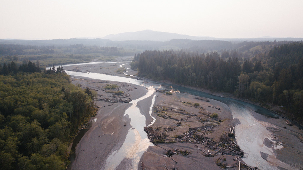
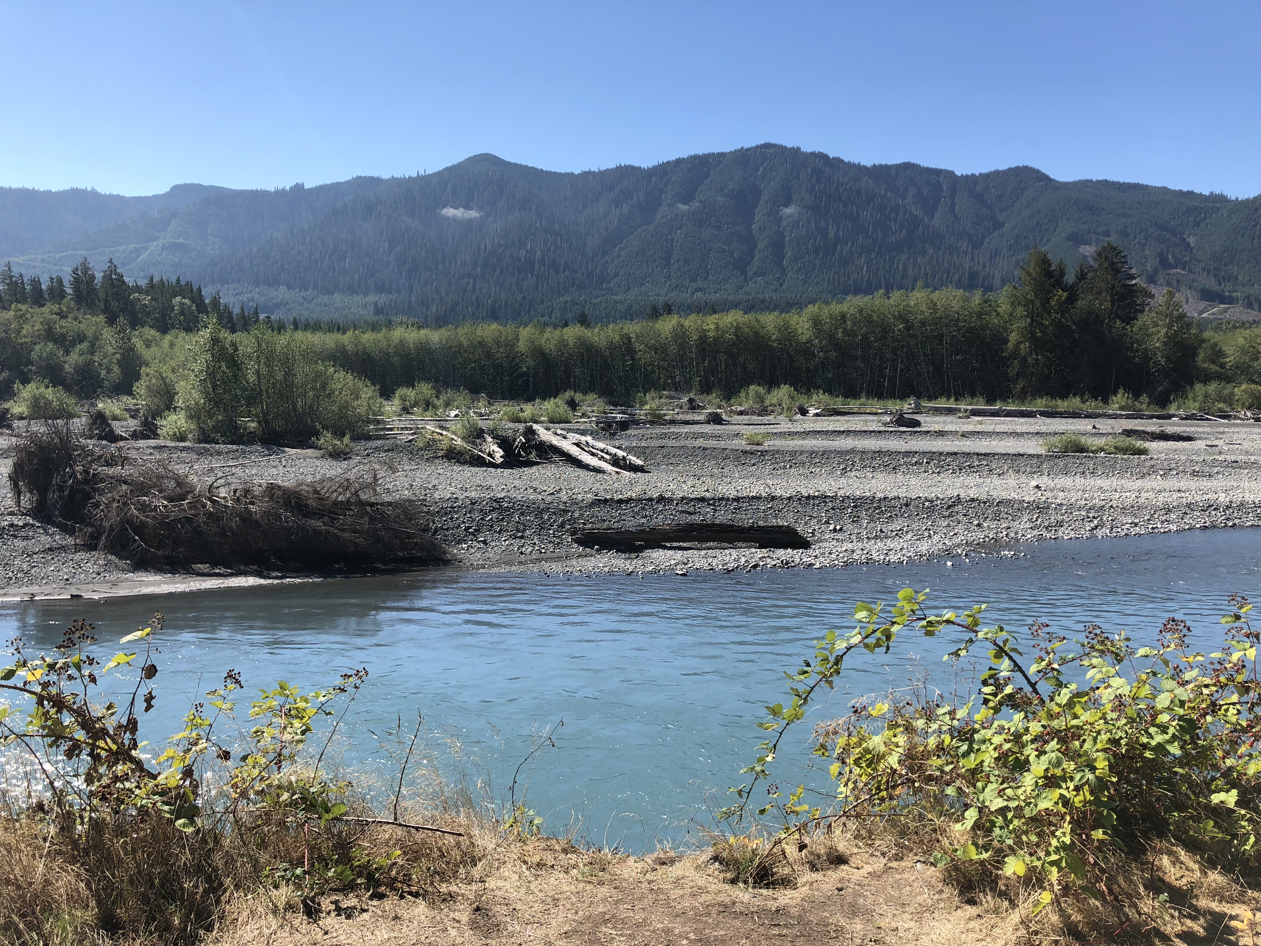
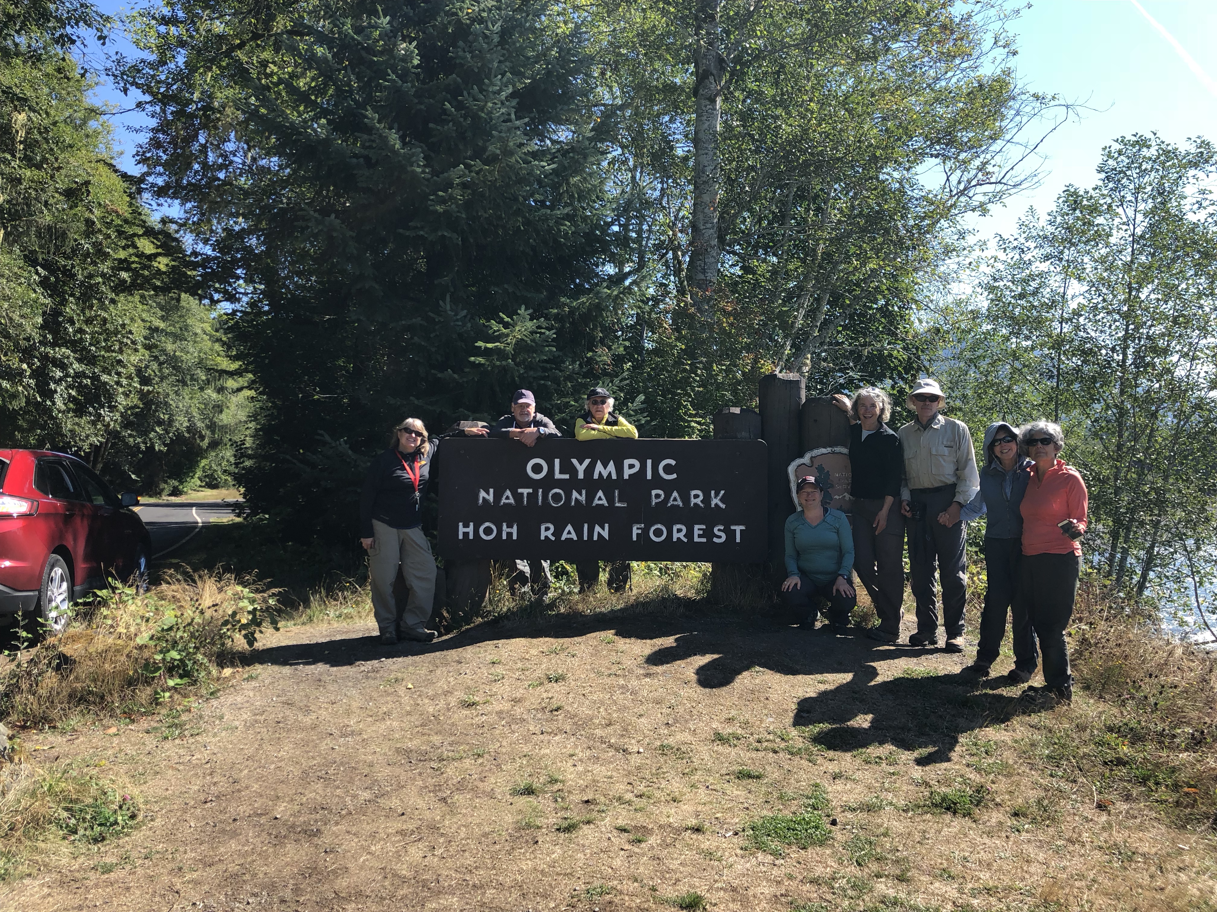
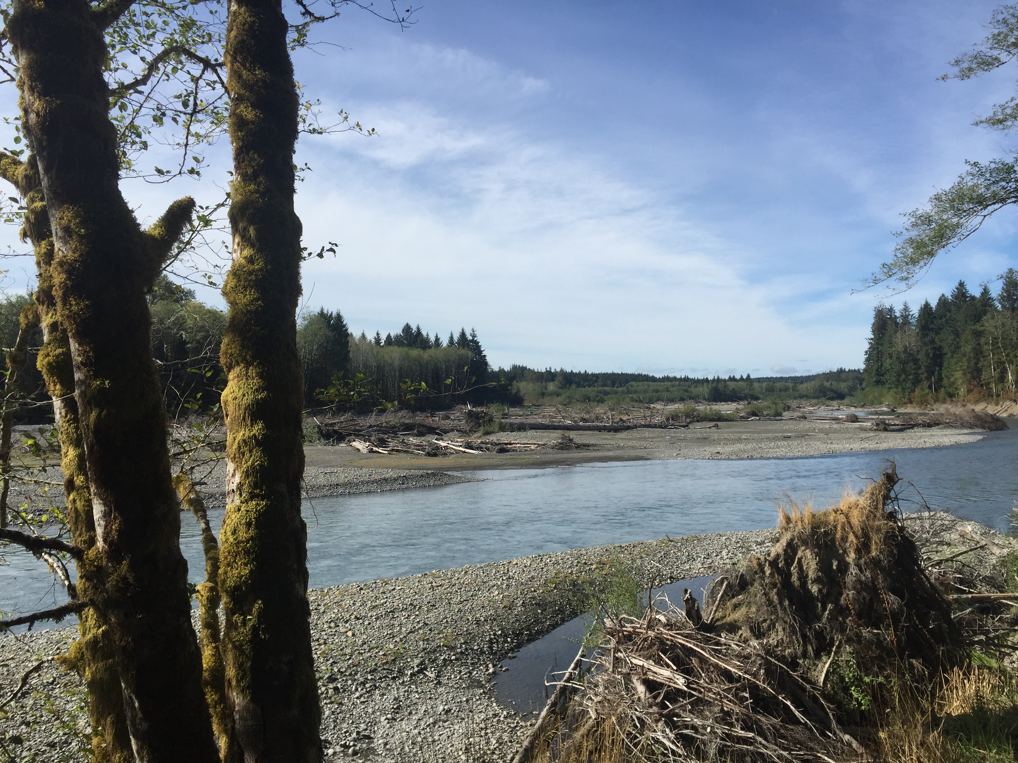
Fotos
We woke up here

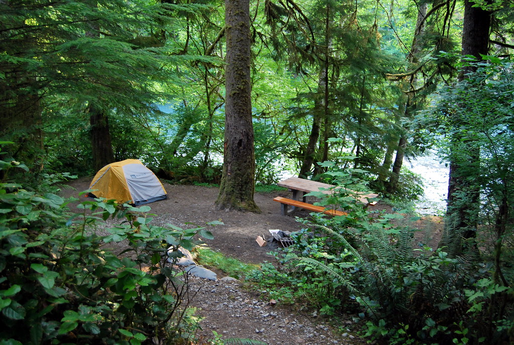
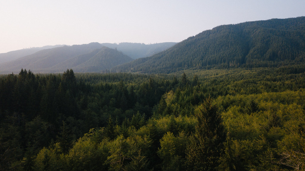
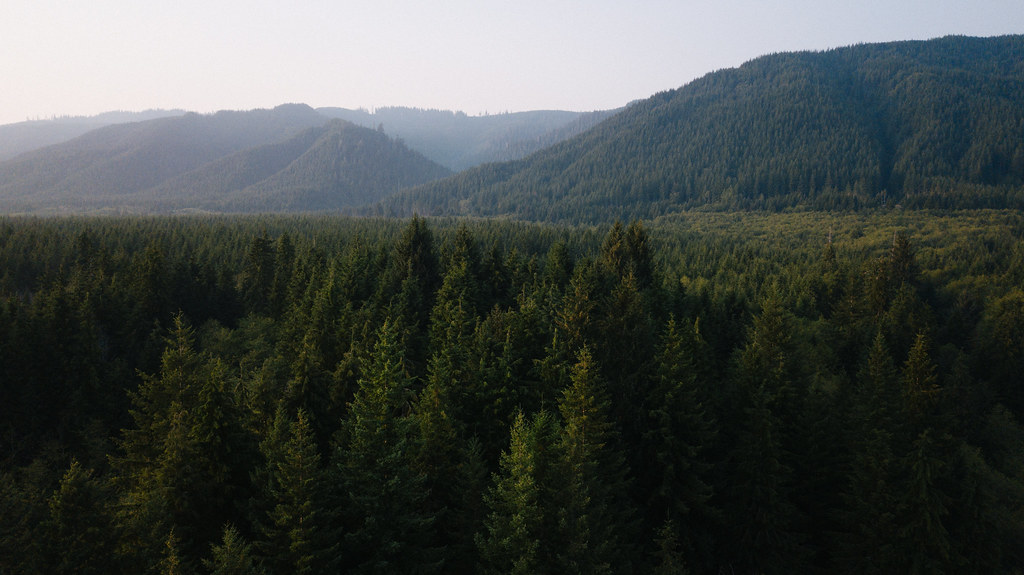
Hoh Rain Forest

Hoh Rain Forest

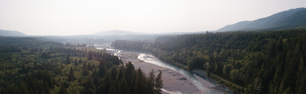
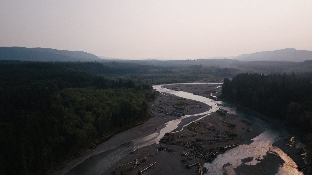
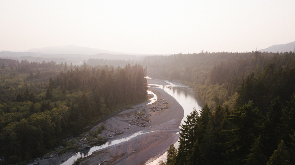
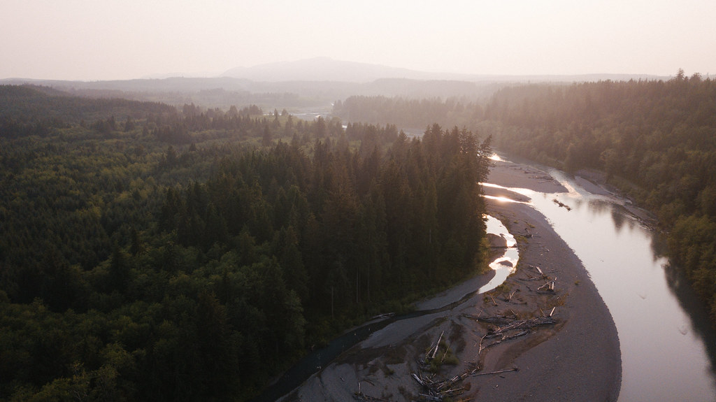
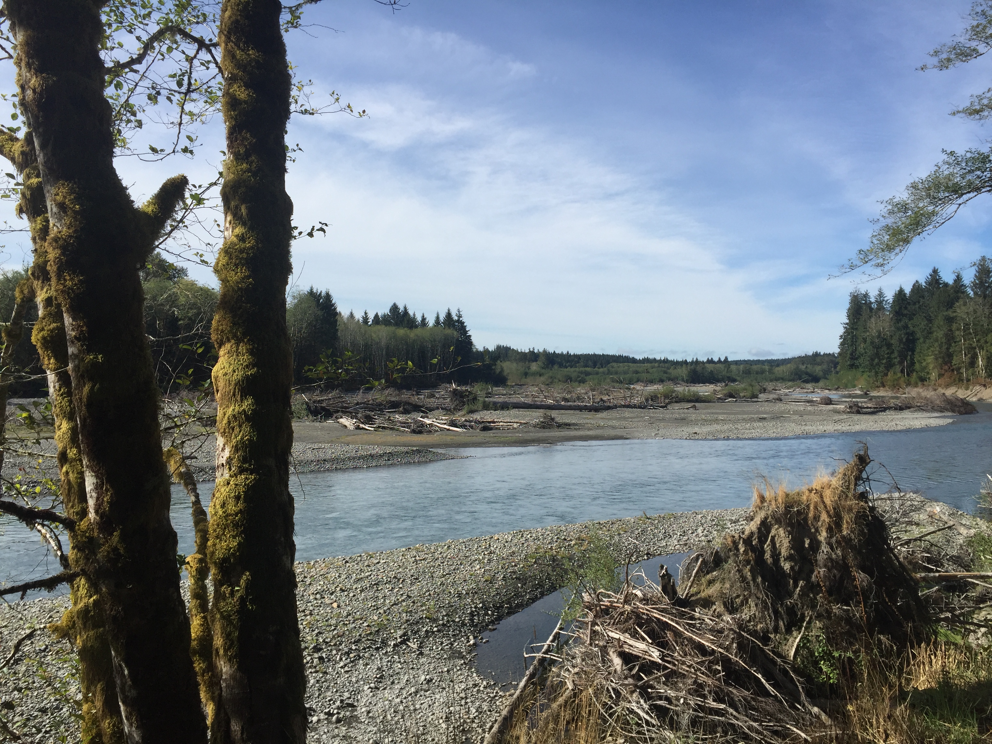
Hoh River morning panorama

The Cloud Forest
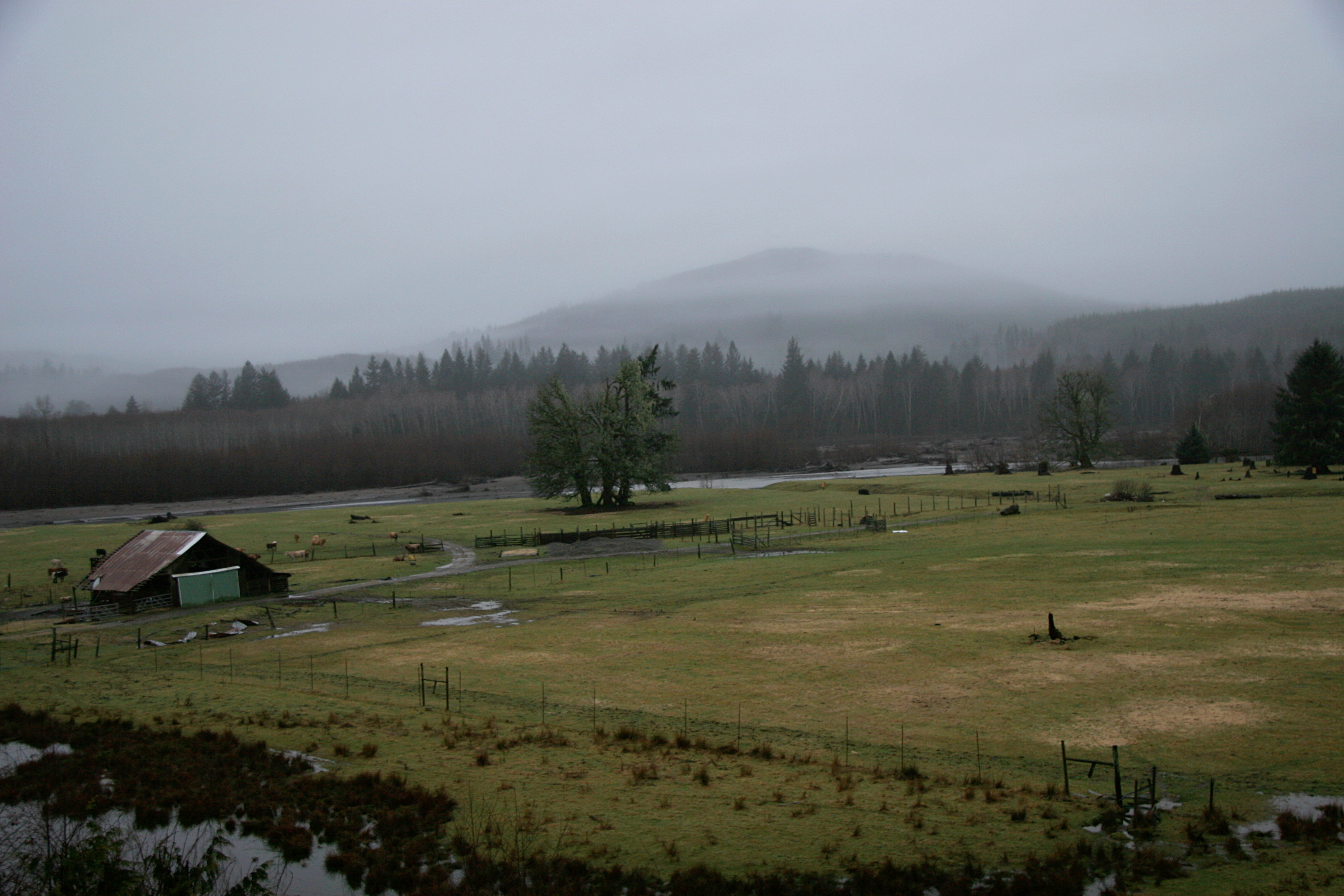
View from the back of the Ho Hum Ranch
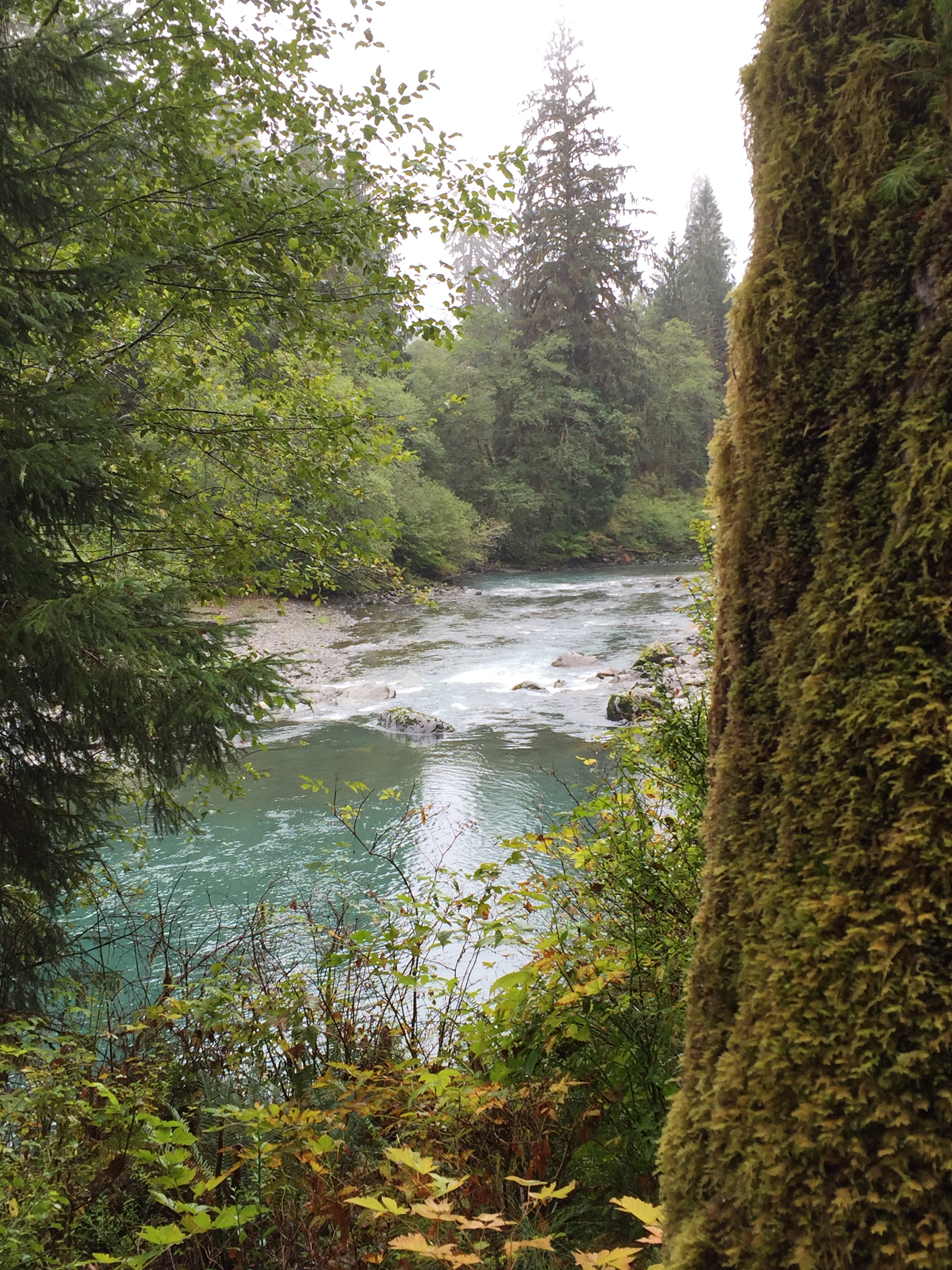
View of the Queets River
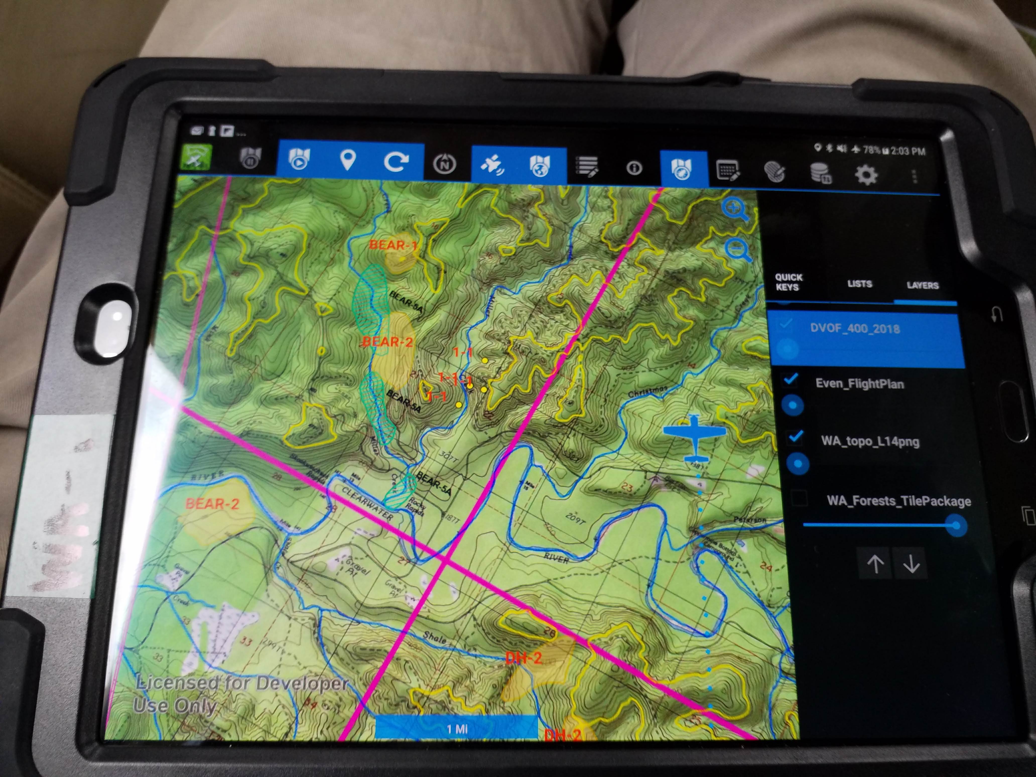
2018. Recording bear (BEAR-1 and BEAR-2) and Douglas-fir beetle (1-1) tree mortality using the new Digital Mobile Sketch Map (DMSM) system. Olympic Peninsula, Washington.

Hoh River Panorama
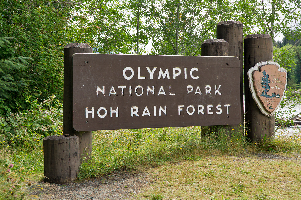
Olympic National Park | Hoh Rain Forest

Upper Hoh Road Cabin
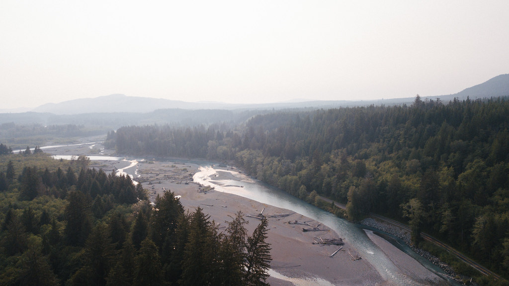
DJI_0026-1
DJI_0028-Pano-1

DJI_0021-1-2
DJI_0041-1-2

DJI_0044-Pano-1
DJI_0041-1
DJI_0035-1
DJI_0054-1
DJI_0057-1
DJI_0032-1
OLYM (14)
OLYM (15)
Washington Trip
Washington Trip
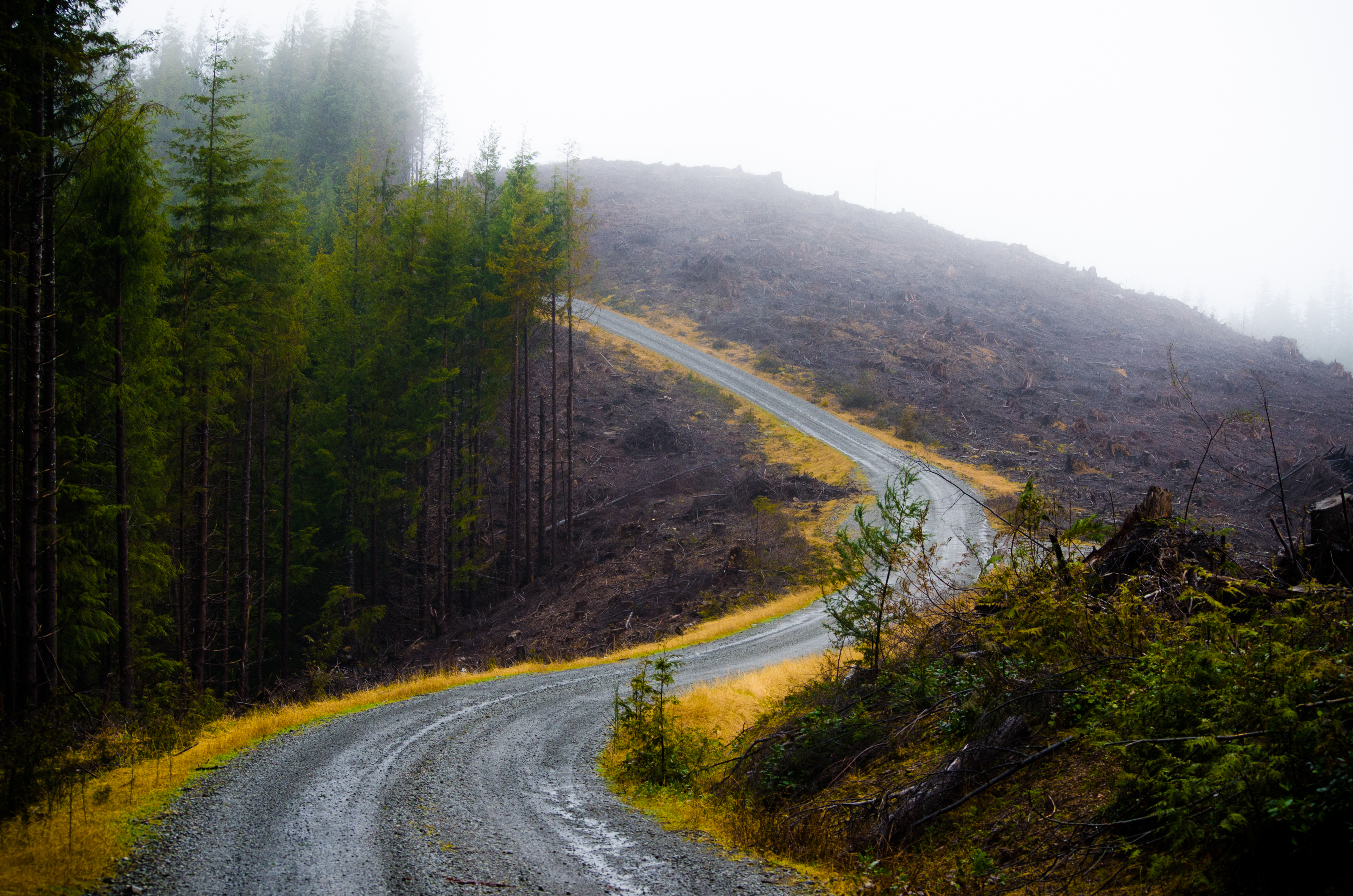
Logging Road

2016.08.19-21 - Olympic Peninsula Tour #3

2016.08.19-21 - Olympic Peninsula Tour #3
Mapa de Hoh Mainline, Forks, WA, EE. UU.
Buscar otro lugar
Lugares cercanos
Forks, Washington, EE. UU.
Clearwater Rd, Forks, WA, EE. UU.
Kalaloch Lodge at Olympic National Park, US-, Forks, WA, EE. UU.
Amanda Park, Washington, EE. UU.
US-, Amanda Park, WA, EE. UU.
Lago Quinault, Washington, EE. UU.
Quinault, Washington, EE. UU.
Península Olímpica, Washington, EE. UU.
S Shore Rd, Quinault, WA, EE. UU.
Moclips, Washington, EE. UU.
Moclips, Washington, EE. UU.
WA-, Moclips, WA, EE. UU.
WA-, Moclips, WA, EE. UU.
WA-, Moclips, WA, EE. UU.
WA-, Moclips, WA, EE. UU.
WA-, Moclips, WA, EE. UU.
WA-, Moclips, WA, EE. UU.
Ocean Crest Resort, WA-, Moclips, WA, EE. UU.
44 Pacific Ln, Ocean Shores, WA, EE. UU.
25 4th St N, Pacific Beach, WA, EE. UU.
Búsquedas recientes
- Horas de salida y puesta de sol de Red Dog Mine, AK, USA
- Horas de salida y puesta de sol de Am Bahnhof, Am bhf, Borken, Germany
- Horas de salida y puesta de sol de 4th St E, Sonoma, CA, EE. UU.
- Horas de salida y puesta de sol de Oakland Ave, Williamsport, PA, EE. UU.
- Horas de salida y puesta de sol de Via Roma, Pieranica CR, Italia
- Horas de salida y puesta de sol de Torre del reloj, Grad, Dubrovnik (Ragusa), Croacia
- Horas de salida y puesta de sol de Trelew, Chubut, Argentina
- Horas de salida y puesta de sol de Hartfords Bluff Cir, Mt Pleasant, SC, EE. UU.
- Horas de salida y puesta de sol de Kita Ward, Kumamoto, Japón
- Horas de salida y puesta de sol de Pingtan Island, Pingtan County, Fuzhou, China