Horas de salida y puesta de sol de Harmony, White Bird, ID, EE. UU.
Location: Estados Unidos > Idaho > White Bird >
Zona horaria:
America/Los_Angeles
Hora local:
2025-07-07 04:34:41
Longitud:
-116.217632
Latitud:
45.710946
Salida de sol de hoy:
05:03:48 AM
Puesta de sol de hoy:
08:36:05 PM
La duración del día hoy:
15h 32m 17s
Salida de sol de mañana:
05:04:35 AM
Puesta de sol de mañana:
08:35:37 PM
La duración del día mañana:
15h 31m 2s
Mostrar todas las fechas
| Fecha | Salida de sol | Puesta de sol | Duración del día |
|---|---|---|---|
| 01/01/2025 | 07:25:36 AM | 04:12:35 PM | 8h 46m 59s |
| 02/01/2025 | 07:25:32 AM | 04:13:33 PM | 8h 48m 1s |
| 03/01/2025 | 07:25:26 AM | 04:14:34 PM | 8h 49m 8s |
| 04/01/2025 | 07:25:17 AM | 04:15:36 PM | 8h 50m 19s |
| 05/01/2025 | 07:25:05 AM | 04:16:41 PM | 8h 51m 36s |
| 06/01/2025 | 07:24:51 AM | 04:17:46 PM | 8h 52m 55s |
| 07/01/2025 | 07:24:34 AM | 04:18:54 PM | 8h 54m 20s |
| 08/01/2025 | 07:24:14 AM | 04:20:03 PM | 8h 55m 49s |
| 09/01/2025 | 07:23:52 AM | 04:21:14 PM | 8h 57m 22s |
| 10/01/2025 | 07:23:27 AM | 04:22:25 PM | 8h 58m 58s |
| 11/01/2025 | 07:23:00 AM | 04:23:39 PM | 9h 0m 39s |
| 12/01/2025 | 07:22:30 AM | 04:24:53 PM | 9h 2m 23s |
| 13/01/2025 | 07:21:58 AM | 04:26:09 PM | 9h 4m 11s |
| 14/01/2025 | 07:21:23 AM | 04:27:26 PM | 9h 6m 3s |
| 15/01/2025 | 07:20:46 AM | 04:28:44 PM | 9h 7m 58s |
| 16/01/2025 | 07:20:06 AM | 04:30:04 PM | 9h 9m 58s |
| 17/01/2025 | 07:19:24 AM | 04:31:24 PM | 9h 12m 0s |
| 18/01/2025 | 07:18:39 AM | 04:32:45 PM | 9h 14m 6s |
| 19/01/2025 | 07:17:52 AM | 04:34:07 PM | 9h 16m 15s |
| 20/01/2025 | 07:17:03 AM | 04:35:29 PM | 9h 18m 26s |
| 21/01/2025 | 07:16:12 AM | 04:36:53 PM | 9h 20m 41s |
| 22/01/2025 | 07:15:18 AM | 04:38:17 PM | 9h 22m 59s |
| 23/01/2025 | 07:14:22 AM | 04:39:42 PM | 9h 25m 20s |
| 24/01/2025 | 07:13:24 AM | 04:41:07 PM | 9h 27m 43s |
| 25/01/2025 | 07:12:24 AM | 04:42:33 PM | 9h 30m 9s |
| 26/01/2025 | 07:11:22 AM | 04:43:59 PM | 9h 32m 37s |
| 27/01/2025 | 07:10:18 AM | 04:45:25 PM | 9h 35m 7s |
| 28/01/2025 | 07:09:11 AM | 04:46:52 PM | 9h 37m 41s |
| 29/01/2025 | 07:08:03 AM | 04:48:20 PM | 9h 40m 17s |
| 30/01/2025 | 07:06:53 AM | 04:49:47 PM | 9h 42m 54s |
| 31/01/2025 | 07:05:41 AM | 04:51:15 PM | 9h 45m 34s |
| 01/02/2025 | 07:04:28 AM | 04:52:43 PM | 9h 48m 15s |
| 02/02/2025 | 07:03:12 AM | 04:54:11 PM | 9h 50m 59s |
| 03/02/2025 | 07:01:55 AM | 04:55:39 PM | 9h 53m 44s |
| 04/02/2025 | 07:00:36 AM | 04:57:07 PM | 9h 56m 31s |
| 05/02/2025 | 06:59:16 AM | 04:58:36 PM | 9h 59m 20s |
| 06/02/2025 | 06:57:54 AM | 05:00:04 PM | 10h 2m 10s |
| 07/02/2025 | 06:56:30 AM | 05:01:32 PM | 10h 5m 2s |
| 08/02/2025 | 06:55:05 AM | 05:03:01 PM | 10h 7m 56s |
| 09/02/2025 | 06:53:38 AM | 05:04:29 PM | 10h 10m 51s |
| 10/02/2025 | 06:52:10 AM | 05:05:57 PM | 10h 13m 47s |
| 11/02/2025 | 06:50:40 AM | 05:07:25 PM | 10h 16m 45s |
| 12/02/2025 | 06:49:10 AM | 05:08:53 PM | 10h 19m 43s |
| 13/02/2025 | 06:47:37 AM | 05:10:20 PM | 10h 22m 43s |
| 14/02/2025 | 06:46:04 AM | 05:11:48 PM | 10h 25m 44s |
| 15/02/2025 | 06:44:29 AM | 05:13:15 PM | 10h 28m 46s |
| 16/02/2025 | 06:42:53 AM | 05:14:42 PM | 10h 31m 49s |
| 17/02/2025 | 06:41:16 AM | 05:16:09 PM | 10h 34m 53s |
| 18/02/2025 | 06:39:38 AM | 05:17:36 PM | 10h 37m 58s |
| 19/02/2025 | 06:37:59 AM | 05:19:02 PM | 10h 41m 3s |
| 20/02/2025 | 06:36:19 AM | 05:20:28 PM | 10h 44m 9s |
| 21/02/2025 | 06:34:38 AM | 05:21:54 PM | 10h 47m 16s |
| 22/02/2025 | 06:32:55 AM | 05:23:19 PM | 10h 50m 24s |
| 23/02/2025 | 06:31:12 AM | 05:24:45 PM | 10h 53m 33s |
| 24/02/2025 | 06:29:28 AM | 05:26:10 PM | 10h 56m 42s |
| 25/02/2025 | 06:27:43 AM | 05:27:34 PM | 10h 59m 51s |
| 26/02/2025 | 06:25:58 AM | 05:28:59 PM | 11h 3m 1s |
| 27/02/2025 | 06:24:11 AM | 05:30:23 PM | 11h 6m 12s |
| 28/02/2025 | 06:22:24 AM | 05:31:47 PM | 11h 9m 23s |
| 01/03/2025 | 06:20:36 AM | 05:33:11 PM | 11h 12m 35s |
| 02/03/2025 | 06:18:48 AM | 05:34:34 PM | 11h 15m 46s |
| 03/03/2025 | 06:16:58 AM | 05:35:57 PM | 11h 18m 59s |
| 04/03/2025 | 06:15:09 AM | 05:37:20 PM | 11h 22m 11s |
| 05/03/2025 | 06:13:18 AM | 05:38:42 PM | 11h 25m 24s |
| 06/03/2025 | 06:11:27 AM | 05:40:04 PM | 11h 28m 37s |
| 07/03/2025 | 06:09:36 AM | 05:41:26 PM | 11h 31m 50s |
| 08/03/2025 | 06:07:44 AM | 05:42:48 PM | 11h 35m 4s |
| 09/03/2025 | 07:05:56 AM | 06:44:06 PM | 11h 38m 10s |
| 10/03/2025 | 07:04:03 AM | 06:45:28 PM | 11h 41m 25s |
| 11/03/2025 | 07:02:10 AM | 06:46:49 PM | 11h 44m 39s |
| 12/03/2025 | 07:00:17 AM | 06:48:09 PM | 11h 47m 52s |
| 13/03/2025 | 06:58:23 AM | 06:49:30 PM | 11h 51m 7s |
| 14/03/2025 | 06:56:29 AM | 06:50:50 PM | 11h 54m 21s |
| 15/03/2025 | 06:54:35 AM | 06:52:11 PM | 11h 57m 36s |
| 16/03/2025 | 06:52:40 AM | 06:53:31 PM | 12h 0m 51s |
| 17/03/2025 | 06:50:46 AM | 06:54:50 PM | 12h 4m 4s |
| 18/03/2025 | 06:48:51 AM | 06:56:10 PM | 12h 7m 19s |
| 19/03/2025 | 06:46:56 AM | 06:57:30 PM | 12h 10m 34s |
| 20/03/2025 | 06:45:01 AM | 06:58:49 PM | 12h 13m 48s |
| 21/03/2025 | 06:43:06 AM | 07:00:08 PM | 12h 17m 2s |
| 22/03/2025 | 06:41:11 AM | 07:01:27 PM | 12h 20m 16s |
| 23/03/2025 | 06:39:16 AM | 07:02:46 PM | 12h 23m 30s |
| 24/03/2025 | 06:37:20 AM | 07:04:05 PM | 12h 26m 45s |
| 25/03/2025 | 06:35:25 AM | 07:05:24 PM | 12h 29m 59s |
| 26/03/2025 | 06:33:31 AM | 07:06:43 PM | 12h 33m 12s |
| 27/03/2025 | 06:31:36 AM | 07:08:01 PM | 12h 36m 25s |
| 28/03/2025 | 06:29:41 AM | 07:09:20 PM | 12h 39m 39s |
| 29/03/2025 | 06:27:47 AM | 07:10:38 PM | 12h 42m 51s |
| 30/03/2025 | 06:25:52 AM | 07:11:57 PM | 12h 46m 5s |
| 31/03/2025 | 06:23:58 AM | 07:13:15 PM | 12h 49m 17s |
| 01/04/2025 | 06:22:05 AM | 07:14:34 PM | 12h 52m 29s |
| 02/04/2025 | 06:20:11 AM | 07:15:52 PM | 12h 55m 41s |
| 03/04/2025 | 06:18:18 AM | 07:17:10 PM | 12h 58m 52s |
| 04/04/2025 | 06:16:26 AM | 07:18:28 PM | 13h 2m 2s |
| 05/04/2025 | 06:14:33 AM | 07:19:47 PM | 13h 5m 14s |
| 06/04/2025 | 06:12:42 AM | 07:21:05 PM | 13h 8m 23s |
| 07/04/2025 | 06:10:50 AM | 07:22:23 PM | 13h 11m 33s |
| 08/04/2025 | 06:09:00 AM | 07:23:41 PM | 13h 14m 41s |
| 09/04/2025 | 06:07:09 AM | 07:24:59 PM | 13h 17m 50s |
| 10/04/2025 | 06:05:20 AM | 07:26:18 PM | 13h 20m 58s |
| 11/04/2025 | 06:03:30 AM | 07:27:36 PM | 13h 24m 6s |
| 12/04/2025 | 06:01:42 AM | 07:28:54 PM | 13h 27m 12s |
| 13/04/2025 | 05:59:54 AM | 07:30:12 PM | 13h 30m 18s |
| 14/04/2025 | 05:58:07 AM | 07:31:30 PM | 13h 33m 23s |
| 15/04/2025 | 05:56:21 AM | 07:32:48 PM | 13h 36m 27s |
| 16/04/2025 | 05:54:35 AM | 07:34:07 PM | 13h 39m 32s |
| 17/04/2025 | 05:52:50 AM | 07:35:25 PM | 13h 42m 35s |
| 18/04/2025 | 05:51:06 AM | 07:36:43 PM | 13h 45m 37s |
| 19/04/2025 | 05:49:23 AM | 07:38:01 PM | 13h 48m 38s |
| 20/04/2025 | 05:47:41 AM | 07:39:19 PM | 13h 51m 38s |
| 21/04/2025 | 05:46:00 AM | 07:40:37 PM | 13h 54m 37s |
| 22/04/2025 | 05:44:20 AM | 07:41:55 PM | 13h 57m 35s |
| 23/04/2025 | 05:42:41 AM | 07:43:12 PM | 14h 0m 31s |
| 24/04/2025 | 05:41:02 AM | 07:44:30 PM | 14h 3m 28s |
| 25/04/2025 | 05:39:25 AM | 07:45:48 PM | 14h 6m 23s |
| 26/04/2025 | 05:37:49 AM | 07:47:05 PM | 14h 9m 16s |
| 27/04/2025 | 05:36:15 AM | 07:48:22 PM | 14h 12m 7s |
| 28/04/2025 | 05:34:41 AM | 07:49:40 PM | 14h 14m 59s |
| 29/04/2025 | 05:33:09 AM | 07:50:57 PM | 14h 17m 48s |
| 30/04/2025 | 05:31:38 AM | 07:52:13 PM | 14h 20m 35s |
| 01/05/2025 | 05:30:08 AM | 07:53:30 PM | 14h 23m 22s |
| 02/05/2025 | 05:28:39 AM | 07:54:46 PM | 14h 26m 7s |
| 03/05/2025 | 05:27:12 AM | 07:56:02 PM | 14h 28m 50s |
| 04/05/2025 | 05:25:47 AM | 07:57:18 PM | 14h 31m 31s |
| 05/05/2025 | 05:24:22 AM | 07:58:33 PM | 14h 34m 11s |
| 06/05/2025 | 05:23:00 AM | 07:59:48 PM | 14h 36m 48s |
| 07/05/2025 | 05:21:39 AM | 08:01:03 PM | 14h 39m 24s |
| 08/05/2025 | 05:20:19 AM | 08:02:17 PM | 14h 41m 58s |
| 09/05/2025 | 05:19:01 AM | 08:03:31 PM | 14h 44m 30s |
| 10/05/2025 | 05:17:45 AM | 08:04:44 PM | 14h 46m 59s |
| 11/05/2025 | 05:16:30 AM | 08:05:57 PM | 14h 49m 27s |
| 12/05/2025 | 05:15:17 AM | 08:07:09 PM | 14h 51m 52s |
| 13/05/2025 | 05:14:06 AM | 08:08:21 PM | 14h 54m 15s |
| 14/05/2025 | 05:12:56 AM | 08:09:32 PM | 14h 56m 36s |
| 15/05/2025 | 05:11:49 AM | 08:10:42 PM | 14h 58m 53s |
| 16/05/2025 | 05:10:43 AM | 08:11:51 PM | 15h 1m 8s |
| 17/05/2025 | 05:09:39 AM | 08:13:00 PM | 15h 3m 21s |
| 18/05/2025 | 05:08:37 AM | 08:14:08 PM | 15h 5m 31s |
| 19/05/2025 | 05:07:38 AM | 08:15:15 PM | 15h 7m 37s |
| 20/05/2025 | 05:06:40 AM | 08:16:21 PM | 15h 9m 41s |
| 21/05/2025 | 05:05:44 AM | 08:17:26 PM | 15h 11m 42s |
| 22/05/2025 | 05:04:50 AM | 08:18:30 PM | 15h 13m 40s |
| 23/05/2025 | 05:03:58 AM | 08:19:32 PM | 15h 15m 34s |
| 24/05/2025 | 05:03:09 AM | 08:20:34 PM | 15h 17m 25s |
| 25/05/2025 | 05:02:21 AM | 08:21:35 PM | 15h 19m 14s |
| 26/05/2025 | 05:01:36 AM | 08:22:34 PM | 15h 20m 58s |
| 27/05/2025 | 05:00:53 AM | 08:23:32 PM | 15h 22m 39s |
| 28/05/2025 | 05:00:12 AM | 08:24:29 PM | 15h 24m 17s |
| 29/05/2025 | 04:59:33 AM | 08:25:25 PM | 15h 25m 52s |
| 30/05/2025 | 04:58:57 AM | 08:26:19 PM | 15h 27m 22s |
| 31/05/2025 | 04:58:23 AM | 08:27:11 PM | 15h 28m 48s |
| 01/06/2025 | 04:57:51 AM | 08:28:02 PM | 15h 30m 11s |
| 02/06/2025 | 04:57:22 AM | 08:28:51 PM | 15h 31m 29s |
| 03/06/2025 | 04:56:55 AM | 08:29:39 PM | 15h 32m 44s |
| 04/06/2025 | 04:56:30 AM | 08:30:25 PM | 15h 33m 55s |
| 05/06/2025 | 04:56:08 AM | 08:31:09 PM | 15h 35m 1s |
| 06/06/2025 | 04:55:48 AM | 08:31:52 PM | 15h 36m 4s |
| 07/06/2025 | 04:55:30 AM | 08:32:32 PM | 15h 37m 2s |
| 08/06/2025 | 04:55:15 AM | 08:33:11 PM | 15h 37m 56s |
| 09/06/2025 | 04:55:02 AM | 08:33:48 PM | 15h 38m 46s |
| 10/06/2025 | 04:54:52 AM | 08:34:23 PM | 15h 39m 31s |
| 11/06/2025 | 04:54:44 AM | 08:34:55 PM | 15h 40m 11s |
| 12/06/2025 | 04:54:38 AM | 08:35:26 PM | 15h 40m 48s |
| 13/06/2025 | 04:54:35 AM | 08:35:55 PM | 15h 41m 20s |
| 14/06/2025 | 04:54:34 AM | 08:36:21 PM | 15h 41m 47s |
| 15/06/2025 | 04:54:36 AM | 08:36:46 PM | 15h 42m 10s |
| 16/06/2025 | 04:54:40 AM | 08:37:08 PM | 15h 42m 28s |
| 17/06/2025 | 04:54:46 AM | 08:37:28 PM | 15h 42m 42s |
| 18/06/2025 | 04:54:54 AM | 08:37:45 PM | 15h 42m 51s |
| 19/06/2025 | 04:55:05 AM | 08:38:01 PM | 15h 42m 56s |
| 20/06/2025 | 04:55:18 AM | 08:38:14 PM | 15h 42m 56s |
| 21/06/2025 | 04:55:34 AM | 08:38:24 PM | 15h 42m 50s |
| 22/06/2025 | 04:55:51 AM | 08:38:33 PM | 15h 42m 42s |
| 23/06/2025 | 04:56:11 AM | 08:38:39 PM | 15h 42m 28s |
| 24/06/2025 | 04:56:33 AM | 08:38:42 PM | 15h 42m 9s |
| 25/06/2025 | 04:56:57 AM | 08:38:43 PM | 15h 41m 46s |
| 26/06/2025 | 04:57:23 AM | 08:38:42 PM | 15h 41m 19s |
| 27/06/2025 | 04:57:51 AM | 08:38:38 PM | 15h 40m 47s |
| 28/06/2025 | 04:58:22 AM | 08:38:32 PM | 15h 40m 10s |
| 29/06/2025 | 04:58:54 AM | 08:38:24 PM | 15h 39m 30s |
| 30/06/2025 | 04:59:28 AM | 08:38:13 PM | 15h 38m 45s |
| 01/07/2025 | 05:00:04 AM | 08:37:59 PM | 15h 37m 55s |
| 02/07/2025 | 05:00:42 AM | 08:37:43 PM | 15h 37m 1s |
| 03/07/2025 | 05:01:22 AM | 08:37:25 PM | 15h 36m 3s |
| 04/07/2025 | 05:02:03 AM | 08:37:04 PM | 15h 35m 1s |
| 05/07/2025 | 05:02:46 AM | 08:36:41 PM | 15h 33m 55s |
| 06/07/2025 | 05:03:31 AM | 08:36:16 PM | 15h 32m 45s |
| 07/07/2025 | 05:04:17 AM | 08:35:48 PM | 15h 31m 31s |
| 08/07/2025 | 05:05:05 AM | 08:35:17 PM | 15h 30m 12s |
| 09/07/2025 | 05:05:55 AM | 08:34:45 PM | 15h 28m 50s |
| 10/07/2025 | 05:06:46 AM | 08:34:10 PM | 15h 27m 24s |
| 11/07/2025 | 05:07:38 AM | 08:33:32 PM | 15h 25m 54s |
| 12/07/2025 | 05:08:32 AM | 08:32:53 PM | 15h 24m 21s |
| 13/07/2025 | 05:09:27 AM | 08:32:11 PM | 15h 22m 44s |
| 14/07/2025 | 05:10:23 AM | 08:31:27 PM | 15h 21m 4s |
| 15/07/2025 | 05:11:21 AM | 08:30:40 PM | 15h 19m 19s |
| 16/07/2025 | 05:12:19 AM | 08:29:52 PM | 15h 17m 33s |
| 17/07/2025 | 05:13:19 AM | 08:29:01 PM | 15h 15m 42s |
| 18/07/2025 | 05:14:20 AM | 08:28:08 PM | 15h 13m 48s |
| 19/07/2025 | 05:15:21 AM | 08:27:13 PM | 15h 11m 52s |
| 20/07/2025 | 05:16:24 AM | 08:26:16 PM | 15h 9m 52s |
| 21/07/2025 | 05:17:28 AM | 08:25:17 PM | 15h 7m 49s |
| 22/07/2025 | 05:18:32 AM | 08:24:16 PM | 15h 5m 44s |
| 23/07/2025 | 05:19:37 AM | 08:23:13 PM | 15h 3m 36s |
| 24/07/2025 | 05:20:43 AM | 08:22:08 PM | 15h 1m 25s |
| 25/07/2025 | 05:21:50 AM | 08:21:01 PM | 14h 59m 11s |
| 26/07/2025 | 05:22:57 AM | 08:19:52 PM | 14h 56m 55s |
| 27/07/2025 | 05:24:06 AM | 08:18:41 PM | 14h 54m 35s |
| 28/07/2025 | 05:25:14 AM | 08:17:29 PM | 14h 52m 15s |
| 29/07/2025 | 05:26:23 AM | 08:16:15 PM | 14h 49m 52s |
| 30/07/2025 | 05:27:33 AM | 08:14:59 PM | 14h 47m 26s |
| 31/07/2025 | 05:28:43 AM | 08:13:41 PM | 14h 44m 58s |
| 01/08/2025 | 05:29:54 AM | 08:12:22 PM | 14h 42m 28s |
| 02/08/2025 | 05:31:05 AM | 08:11:01 PM | 14h 39m 56s |
| 03/08/2025 | 05:32:16 AM | 08:09:38 PM | 14h 37m 22s |
| 04/08/2025 | 05:33:27 AM | 08:08:14 PM | 14h 34m 47s |
| 05/08/2025 | 05:34:39 AM | 08:06:49 PM | 14h 32m 10s |
| 06/08/2025 | 05:35:52 AM | 08:05:22 PM | 14h 29m 30s |
| 07/08/2025 | 05:37:04 AM | 08:03:54 PM | 14h 26m 50s |
| 08/08/2025 | 05:38:17 AM | 08:02:24 PM | 14h 24m 7s |
| 09/08/2025 | 05:39:30 AM | 08:00:53 PM | 14h 21m 23s |
| 10/08/2025 | 05:40:43 AM | 07:59:20 PM | 14h 18m 37s |
| 11/08/2025 | 05:41:56 AM | 07:57:47 PM | 14h 15m 51s |
| 12/08/2025 | 05:43:09 AM | 07:56:12 PM | 14h 13m 3s |
| 13/08/2025 | 05:44:23 AM | 07:54:35 PM | 14h 10m 12s |
| 14/08/2025 | 05:45:36 AM | 07:52:58 PM | 14h 7m 22s |
| 15/08/2025 | 05:46:50 AM | 07:51:20 PM | 14h 4m 30s |
| 16/08/2025 | 05:48:04 AM | 07:49:40 PM | 14h 1m 36s |
| 17/08/2025 | 05:49:18 AM | 07:48:00 PM | 13h 58m 42s |
| 18/08/2025 | 05:50:31 AM | 07:46:18 PM | 13h 55m 47s |
| 19/08/2025 | 05:51:45 AM | 07:44:35 PM | 13h 52m 50s |
| 20/08/2025 | 05:52:59 AM | 07:42:52 PM | 13h 49m 53s |
| 21/08/2025 | 05:54:13 AM | 07:41:07 PM | 13h 46m 54s |
| 22/08/2025 | 05:55:27 AM | 07:39:22 PM | 13h 43m 55s |
| 23/08/2025 | 05:56:41 AM | 07:37:36 PM | 13h 40m 55s |
| 24/08/2025 | 05:57:54 AM | 07:35:49 PM | 13h 37m 55s |
| 25/08/2025 | 05:59:08 AM | 07:34:01 PM | 13h 34m 53s |
| 26/08/2025 | 06:00:22 AM | 07:32:13 PM | 13h 31m 51s |
| 27/08/2025 | 06:01:36 AM | 07:30:23 PM | 13h 28m 47s |
| 28/08/2025 | 06:02:49 AM | 07:28:33 PM | 13h 25m 44s |
| 29/08/2025 | 06:04:03 AM | 07:26:43 PM | 13h 22m 40s |
| 30/08/2025 | 06:05:17 AM | 07:24:52 PM | 13h 19m 35s |
| 31/08/2025 | 06:06:30 AM | 07:23:00 PM | 13h 16m 30s |
| 01/09/2025 | 06:07:44 AM | 07:21:08 PM | 13h 13m 24s |
| 02/09/2025 | 06:08:58 AM | 07:19:15 PM | 13h 10m 17s |
| 03/09/2025 | 06:10:11 AM | 07:17:21 PM | 13h 7m 10s |
| 04/09/2025 | 06:11:25 AM | 07:15:28 PM | 13h 4m 3s |
| 05/09/2025 | 06:12:38 AM | 07:13:33 PM | 13h 0m 55s |
| 06/09/2025 | 06:13:52 AM | 07:11:39 PM | 12h 57m 47s |
| 07/09/2025 | 06:15:06 AM | 07:09:44 PM | 12h 54m 38s |
| 08/09/2025 | 06:16:19 AM | 07:07:48 PM | 12h 51m 29s |
| 09/09/2025 | 06:17:33 AM | 07:05:53 PM | 12h 48m 20s |
| 10/09/2025 | 06:18:46 AM | 07:03:57 PM | 12h 45m 11s |
| 11/09/2025 | 06:20:00 AM | 07:02:01 PM | 12h 42m 1s |
| 12/09/2025 | 06:21:14 AM | 07:00:04 PM | 12h 38m 50s |
| 13/09/2025 | 06:22:28 AM | 06:58:08 PM | 12h 35m 40s |
| 14/09/2025 | 06:23:41 AM | 06:56:11 PM | 12h 32m 30s |
| 15/09/2025 | 06:24:55 AM | 06:54:14 PM | 12h 29m 19s |
| 16/09/2025 | 06:26:09 AM | 06:52:18 PM | 12h 26m 9s |
| 17/09/2025 | 06:27:23 AM | 06:50:21 PM | 12h 22m 58s |
| 18/09/2025 | 06:28:38 AM | 06:48:24 PM | 12h 19m 46s |
| 19/09/2025 | 06:29:52 AM | 06:46:27 PM | 12h 16m 35s |
| 20/09/2025 | 06:31:06 AM | 06:44:30 PM | 12h 13m 24s |
| 21/09/2025 | 06:32:21 AM | 06:42:33 PM | 12h 10m 12s |
| 22/09/2025 | 06:33:36 AM | 06:40:36 PM | 12h 7m 0s |
| 23/09/2025 | 06:34:50 AM | 06:38:39 PM | 12h 3m 49s |
| 24/09/2025 | 06:36:05 AM | 06:36:43 PM | 12h 0m 38s |
| 25/09/2025 | 06:37:21 AM | 06:34:46 PM | 11h 57m 25s |
| 26/09/2025 | 06:38:36 AM | 06:32:50 PM | 11h 54m 14s |
| 27/09/2025 | 06:39:52 AM | 06:30:54 PM | 11h 51m 2s |
| 28/09/2025 | 06:41:07 AM | 06:28:59 PM | 11h 47m 52s |
| 29/09/2025 | 06:42:23 AM | 06:27:03 PM | 11h 44m 40s |
| 30/09/2025 | 06:43:40 AM | 06:25:08 PM | 11h 41m 28s |
| 01/10/2025 | 06:44:56 AM | 06:23:14 PM | 11h 38m 18s |
| 02/10/2025 | 06:46:13 AM | 06:21:20 PM | 11h 35m 7s |
| 03/10/2025 | 06:47:30 AM | 06:19:26 PM | 11h 31m 56s |
| 04/10/2025 | 06:48:47 AM | 06:17:32 PM | 11h 28m 45s |
| 05/10/2025 | 06:50:04 AM | 06:15:40 PM | 11h 25m 36s |
| 06/10/2025 | 06:51:22 AM | 06:13:47 PM | 11h 22m 25s |
| 07/10/2025 | 06:52:40 AM | 06:11:56 PM | 11h 19m 16s |
| 08/10/2025 | 06:53:58 AM | 06:10:04 PM | 11h 16m 6s |
| 09/10/2025 | 06:55:17 AM | 06:08:14 PM | 11h 12m 57s |
| 10/10/2025 | 06:56:36 AM | 06:06:24 PM | 11h 9m 48s |
| 11/10/2025 | 06:57:55 AM | 06:04:35 PM | 11h 6m 40s |
| 12/10/2025 | 06:59:15 AM | 06:02:46 PM | 11h 3m 31s |
| 13/10/2025 | 07:00:35 AM | 06:00:59 PM | 11h 0m 24s |
| 14/10/2025 | 07:01:55 AM | 05:59:12 PM | 10h 57m 17s |
| 15/10/2025 | 07:03:15 AM | 05:57:26 PM | 10h 54m 11s |
| 16/10/2025 | 07:04:36 AM | 05:55:41 PM | 10h 51m 5s |
| 17/10/2025 | 07:05:57 AM | 05:53:56 PM | 10h 47m 59s |
| 18/10/2025 | 07:07:18 AM | 05:52:13 PM | 10h 44m 55s |
| 19/10/2025 | 07:08:40 AM | 05:50:31 PM | 10h 41m 51s |
| 20/10/2025 | 07:10:02 AM | 05:48:49 PM | 10h 38m 47s |
| 21/10/2025 | 07:11:24 AM | 05:47:09 PM | 10h 35m 45s |
| 22/10/2025 | 07:12:46 AM | 05:45:30 PM | 10h 32m 44s |
| 23/10/2025 | 07:14:09 AM | 05:43:52 PM | 10h 29m 43s |
| 24/10/2025 | 07:15:32 AM | 05:42:15 PM | 10h 26m 43s |
| 25/10/2025 | 07:16:55 AM | 05:40:39 PM | 10h 23m 44s |
| 26/10/2025 | 07:18:19 AM | 05:39:05 PM | 10h 20m 46s |
| 27/10/2025 | 07:19:43 AM | 05:37:32 PM | 10h 17m 49s |
| 28/10/2025 | 07:21:07 AM | 05:36:00 PM | 10h 14m 53s |
| 29/10/2025 | 07:22:31 AM | 05:34:29 PM | 10h 11m 58s |
| 30/10/2025 | 07:23:55 AM | 05:33:00 PM | 10h 9m 5s |
| 31/10/2025 | 07:25:19 AM | 05:31:33 PM | 10h 6m 14s |
| 01/11/2025 | 07:26:44 AM | 05:30:07 PM | 10h 3m 23s |
| 02/11/2025 | 06:28:12 AM | 04:28:39 PM | 10h 0m 27s |
| 03/11/2025 | 06:29:37 AM | 04:27:16 PM | 9h 57m 39s |
| 04/11/2025 | 06:31:01 AM | 04:25:55 PM | 9h 54m 54s |
| 05/11/2025 | 06:32:26 AM | 04:24:35 PM | 9h 52m 9s |
| 06/11/2025 | 06:33:51 AM | 04:23:17 PM | 9h 49m 26s |
| 07/11/2025 | 06:35:15 AM | 04:22:01 PM | 9h 46m 46s |
| 08/11/2025 | 06:36:40 AM | 04:20:46 PM | 9h 44m 6s |
| 09/11/2025 | 06:38:04 AM | 04:19:34 PM | 9h 41m 30s |
| 10/11/2025 | 06:39:28 AM | 04:18:23 PM | 9h 38m 55s |
| 11/11/2025 | 06:40:52 AM | 04:17:14 PM | 9h 36m 22s |
| 12/11/2025 | 06:42:16 AM | 04:16:08 PM | 9h 33m 52s |
| 13/11/2025 | 06:43:39 AM | 04:15:03 PM | 9h 31m 24s |
| 14/11/2025 | 06:45:02 AM | 04:14:00 PM | 9h 28m 58s |
| 15/11/2025 | 06:46:25 AM | 04:12:59 PM | 9h 26m 34s |
| 16/11/2025 | 06:47:47 AM | 04:12:01 PM | 9h 24m 14s |
| 17/11/2025 | 06:49:09 AM | 04:11:04 PM | 9h 21m 55s |
| 18/11/2025 | 06:50:30 AM | 04:10:10 PM | 9h 19m 40s |
| 19/11/2025 | 06:51:50 AM | 04:09:18 PM | 9h 17m 28s |
| 20/11/2025 | 06:53:10 AM | 04:08:29 PM | 9h 15m 19s |
| 21/11/2025 | 06:54:29 AM | 04:07:41 PM | 9h 13m 12s |
| 22/11/2025 | 06:55:48 AM | 04:06:56 PM | 9h 11m 8s |
| 23/11/2025 | 06:57:05 AM | 04:06:14 PM | 9h 9m 9s |
| 24/11/2025 | 06:58:22 AM | 04:05:34 PM | 9h 7m 12s |
| 25/11/2025 | 06:59:37 AM | 04:04:56 PM | 9h 5m 19s |
| 26/11/2025 | 07:00:52 AM | 04:04:21 PM | 9h 3m 29s |
| 27/11/2025 | 07:02:05 AM | 04:03:48 PM | 9h 1m 43s |
| 28/11/2025 | 07:03:18 AM | 04:03:18 PM | 9h 0m 0s |
| 29/11/2025 | 07:04:29 AM | 04:02:50 PM | 8h 58m 21s |
| 30/11/2025 | 07:05:39 AM | 04:02:25 PM | 8h 56m 46s |
| 01/12/2025 | 07:06:47 AM | 04:02:03 PM | 8h 55m 16s |
| 02/12/2025 | 07:07:54 AM | 04:01:43 PM | 8h 53m 49s |
| 03/12/2025 | 07:09:00 AM | 04:01:26 PM | 8h 52m 26s |
| 04/12/2025 | 07:10:03 AM | 04:01:12 PM | 8h 51m 9s |
| 05/12/2025 | 07:11:06 AM | 04:01:00 PM | 8h 49m 54s |
| 06/12/2025 | 07:12:06 AM | 04:00:51 PM | 8h 48m 45s |
| 07/12/2025 | 07:13:05 AM | 04:00:45 PM | 8h 47m 40s |
| 08/12/2025 | 07:14:02 AM | 04:00:42 PM | 8h 46m 40s |
| 09/12/2025 | 07:14:58 AM | 04:00:41 PM | 8h 45m 43s |
| 10/12/2025 | 07:15:51 AM | 04:00:43 PM | 8h 44m 52s |
| 11/12/2025 | 07:16:42 AM | 04:00:48 PM | 8h 44m 6s |
| 12/12/2025 | 07:17:31 AM | 04:00:55 PM | 8h 43m 24s |
| 13/12/2025 | 07:18:18 AM | 04:01:05 PM | 8h 42m 47s |
| 14/12/2025 | 07:19:03 AM | 04:01:18 PM | 8h 42m 15s |
| 15/12/2025 | 07:19:46 AM | 04:01:33 PM | 8h 41m 47s |
| 16/12/2025 | 07:20:26 AM | 04:01:52 PM | 8h 41m 26s |
| 17/12/2025 | 07:21:05 AM | 04:02:13 PM | 8h 41m 8s |
| 18/12/2025 | 07:21:40 AM | 04:02:36 PM | 8h 40m 56s |
| 19/12/2025 | 07:22:14 AM | 04:03:02 PM | 8h 40m 48s |
| 20/12/2025 | 07:22:45 AM | 04:03:31 PM | 8h 40m 46s |
| 21/12/2025 | 07:23:13 AM | 04:04:02 PM | 8h 40m 49s |
| 22/12/2025 | 07:23:39 AM | 04:04:36 PM | 8h 40m 57s |
| 23/12/2025 | 07:24:03 AM | 04:05:12 PM | 8h 41m 9s |
| 24/12/2025 | 07:24:24 AM | 04:05:50 PM | 8h 41m 26s |
| 25/12/2025 | 07:24:42 AM | 04:06:31 PM | 8h 41m 49s |
| 26/12/2025 | 07:24:58 AM | 04:07:15 PM | 8h 42m 17s |
| 27/12/2025 | 07:25:11 AM | 04:08:00 PM | 8h 42m 49s |
| 28/12/2025 | 07:25:21 AM | 04:08:48 PM | 8h 43m 27s |
| 29/12/2025 | 07:25:29 AM | 04:09:38 PM | 8h 44m 9s |
| 30/12/2025 | 07:25:34 AM | 04:10:30 PM | 8h 44m 56s |
| 31/12/2025 | 07:25:36 AM | 04:11:24 PM | 8h 45m 48s |
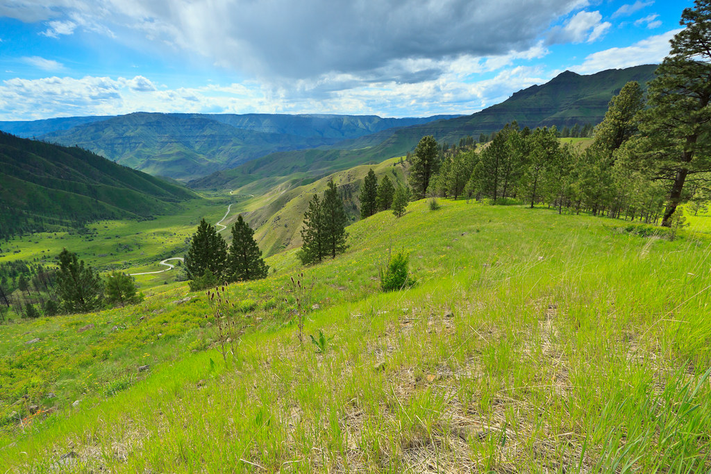
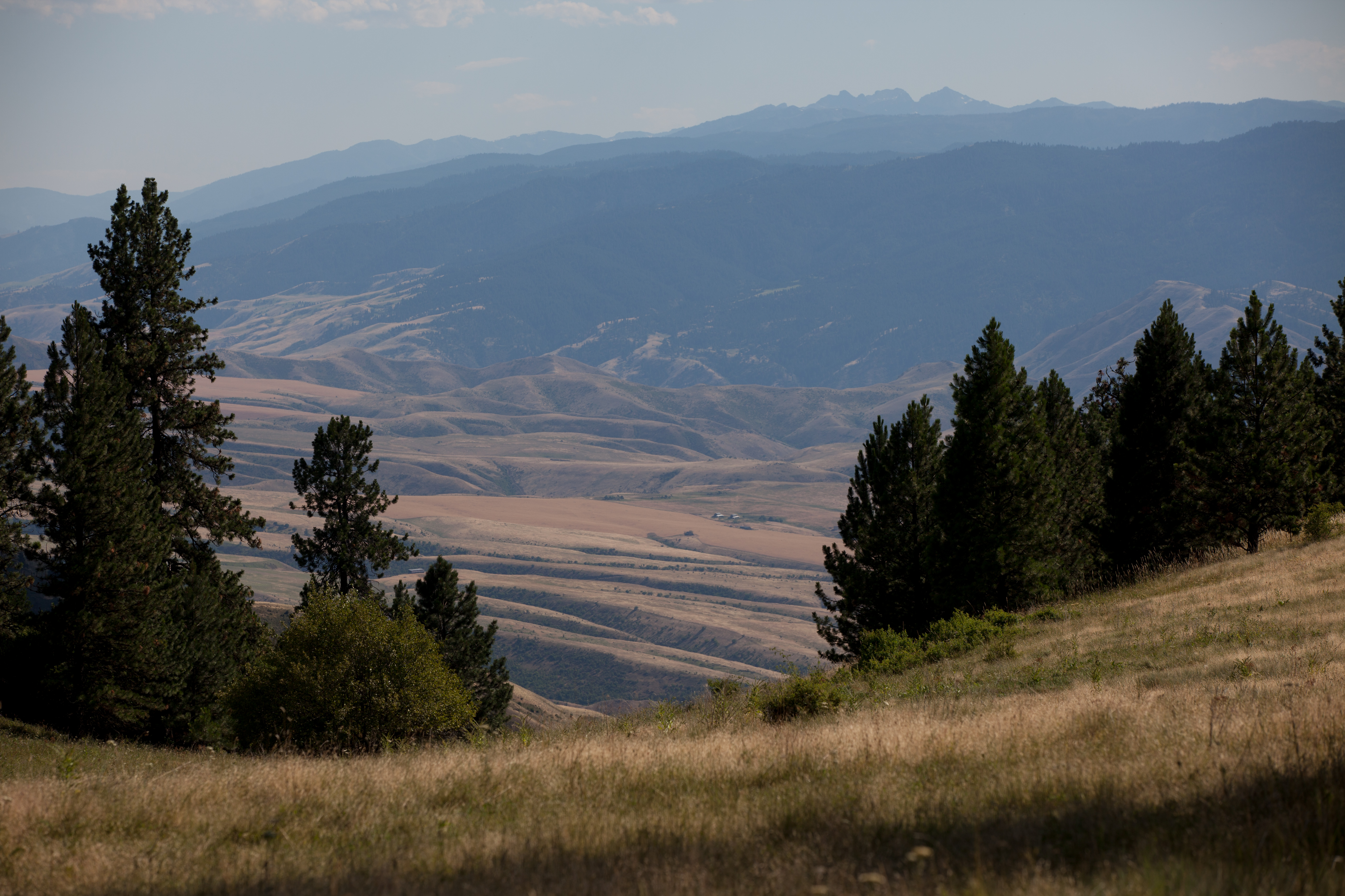
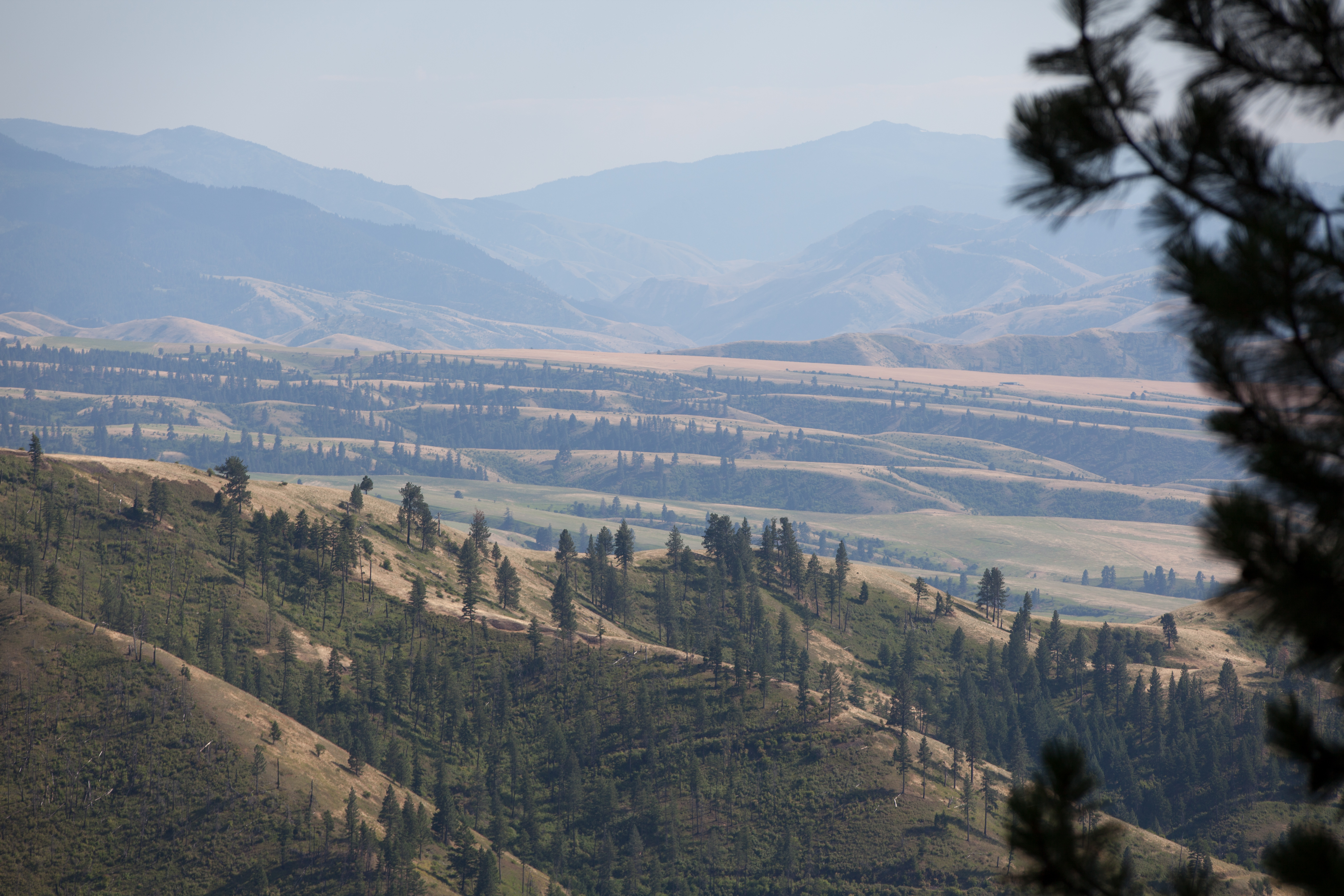
Fotos

Sunrise at Cindy & Jay's

Beyond earlier limits

Old hwy 95 - White Bird Hill road

White Bird Canyon battlefield
Pittsburg Saddle

White Bird Canyon battlefield

Upper meadow
Rafting Lower Salmon 20120722-104.jpg

Rafting Lower Salmon 20120722-133.jpg

Rafting Lower Salmon 20120722-146.jpg

One Switchback of many on White Bird Hill - a steep grade on Hwy 95 Central Idaho just above the time line 120817-094126 C4Tc
Rafting Lower Salmon 20120722-105.jpg

Rafting Lower Salmon 20120722-090.jpg
Mapa de Harmony, White Bird, ID, EE. UU.
Buscar otro lugar
Lugares cercanos
Woodys Way, White Bird, ID, EE. UU.
White Bird, Idaho, EE. UU.
Hammer Creek Road, Hammer Creek Rd, Idaho, EE. UU.
White Bird Hill, Idaho, EE. UU.
Buckhorn Rd, White Bird, ID, EE. UU.
Old White Bird Hill Rd, Grangeville, ID, EE. UU.
Doumecq Rd, White Bird, ID, EE. UU.
Blue Grouse Road, Blue Grouse Rd, Idaho, EE. UU.
77 Canyon View Rd, White Bird, ID, EE. UU.
Bear Ridge Rd, Cottonwood, ID, EE. UU.
Twin Pines Ln, Grangeville, ID, EE. UU.
Lucile, ID, EE. UU.
Canfield, ID, EE. UU.
Seven U Ranch Rd, Lucile, ID, EE. UU.
20 Fish Hatchery Rd, Grangeville, ID, EE. UU.
Grangeville, Idaho, EE. UU.
21 Poor Farm Rd, Grangeville, ID, EE. UU.
NF-, Grangeville, ID, EE. UU.
NF-, Grangeville, ID, EE. UU.
96 Black Tail View, Grangeville, ID, EE. UU.
Búsquedas recientes
- Horas de salida y puesta de sol de Red Dog Mine, AK, USA
- Horas de salida y puesta de sol de Am Bahnhof, Am bhf, Borken, Germany
- Horas de salida y puesta de sol de 4th St E, Sonoma, CA, EE. UU.
- Horas de salida y puesta de sol de Oakland Ave, Williamsport, PA, EE. UU.
- Horas de salida y puesta de sol de Via Roma, Pieranica CR, Italia
- Horas de salida y puesta de sol de Torre del reloj, Grad, Dubrovnik (Ragusa), Croacia
- Horas de salida y puesta de sol de Trelew, Chubut, Argentina
- Horas de salida y puesta de sol de Hartfords Bluff Cir, Mt Pleasant, SC, EE. UU.
- Horas de salida y puesta de sol de Kita Ward, Kumamoto, Japón
- Horas de salida y puesta de sol de Pingtan Island, Pingtan County, Fuzhou, China