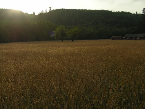
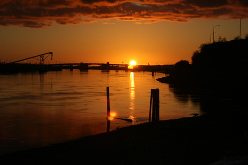
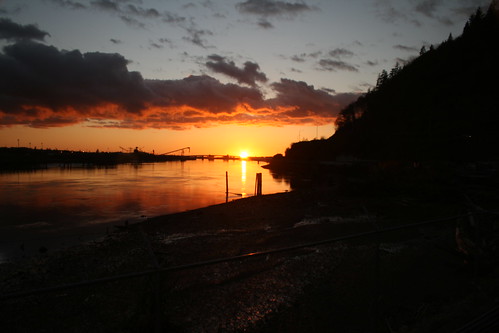
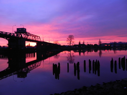
Horas de salida y puesta de sol de Condado de Grays Harbor, Washington, EE. UU.
Location: Estados Unidos > Washington >
Zona horaria:
America/Los_Angeles
Hora local:
2025-06-05 20:55:26
Longitud:
-123.7012468
Latitud:
46.9953526
Salida de sol de hoy:
05:20:41 AM
Puesta de sol de hoy:
09:06:37 PM
La duración del día hoy:
15h 45m 56s
Salida de sol de mañana:
05:20:20 AM
Puesta de sol de mañana:
09:07:20 PM
La duración del día mañana:
15h 47m 0s
Mostrar todas las fechas
| Fecha | Salida de sol | Puesta de sol | Duración del día |
|---|---|---|---|
| 01/01/2025 | 08:00:24 AM | 04:37:40 PM | 8h 37m 16s |
| 02/01/2025 | 08:00:18 AM | 04:38:41 PM | 8h 38m 23s |
| 03/01/2025 | 08:00:10 AM | 04:39:43 PM | 8h 39m 33s |
| 04/01/2025 | 07:59:59 AM | 04:40:48 PM | 8h 40m 49s |
| 05/01/2025 | 07:59:45 AM | 04:41:54 PM | 8h 42m 9s |
| 06/01/2025 | 07:59:28 AM | 04:43:02 PM | 8h 43m 34s |
| 07/01/2025 | 07:59:09 AM | 04:44:12 PM | 8h 45m 3s |
| 08/01/2025 | 07:58:47 AM | 04:45:23 PM | 8h 46m 36s |
| 09/01/2025 | 07:58:22 AM | 04:46:37 PM | 8h 48m 15s |
| 10/01/2025 | 07:57:55 AM | 04:47:51 PM | 8h 49m 56s |
| 11/01/2025 | 07:57:25 AM | 04:49:07 PM | 8h 51m 42s |
| 12/01/2025 | 07:56:52 AM | 04:50:25 PM | 8h 53m 33s |
| 13/01/2025 | 07:56:16 AM | 04:51:44 PM | 8h 55m 28s |
| 14/01/2025 | 07:55:38 AM | 04:53:04 PM | 8h 57m 26s |
| 15/01/2025 | 07:54:58 AM | 04:54:25 PM | 8h 59m 27s |
| 16/01/2025 | 07:54:15 AM | 04:55:47 PM | 9h 1m 32s |
| 17/01/2025 | 07:53:29 AM | 04:57:11 PM | 9h 3m 42s |
| 18/01/2025 | 07:52:41 AM | 04:58:35 PM | 9h 5m 54s |
| 19/01/2025 | 07:51:51 AM | 05:00:01 PM | 9h 8m 10s |
| 20/01/2025 | 07:50:58 AM | 05:01:27 PM | 9h 10m 29s |
| 21/01/2025 | 07:50:03 AM | 05:02:54 PM | 9h 12m 51s |
| 22/01/2025 | 07:49:06 AM | 05:04:22 PM | 9h 15m 16s |
| 23/01/2025 | 07:48:06 AM | 05:05:50 PM | 9h 17m 44s |
| 24/01/2025 | 07:47:05 AM | 05:07:19 PM | 9h 20m 14s |
| 25/01/2025 | 07:46:01 AM | 05:08:49 PM | 9h 22m 48s |
| 26/01/2025 | 07:44:55 AM | 05:10:19 PM | 9h 25m 24s |
| 27/01/2025 | 07:43:46 AM | 05:11:49 PM | 9h 28m 3s |
| 28/01/2025 | 07:42:36 AM | 05:13:20 PM | 9h 30m 44s |
| 29/01/2025 | 07:41:24 AM | 05:14:51 PM | 9h 33m 27s |
| 30/01/2025 | 07:40:10 AM | 05:16:23 PM | 9h 36m 13s |
| 31/01/2025 | 07:38:54 AM | 05:17:55 PM | 9h 39m 1s |
| 01/02/2025 | 07:37:36 AM | 05:19:27 PM | 9h 41m 51s |
| 02/02/2025 | 07:36:17 AM | 05:20:59 PM | 9h 44m 42s |
| 03/02/2025 | 07:34:55 AM | 05:22:31 PM | 9h 47m 36s |
| 04/02/2025 | 07:33:32 AM | 05:24:04 PM | 9h 50m 32s |
| 05/02/2025 | 07:32:07 AM | 05:25:36 PM | 9h 53m 29s |
| 06/02/2025 | 07:30:41 AM | 05:27:09 PM | 9h 56m 28s |
| 07/02/2025 | 07:29:13 AM | 05:28:42 PM | 9h 59m 29s |
| 08/02/2025 | 07:27:44 AM | 05:30:14 PM | 10h 2m 30s |
| 09/02/2025 | 07:26:13 AM | 05:31:47 PM | 10h 5m 34s |
| 10/02/2025 | 07:24:40 AM | 05:33:19 PM | 10h 8m 39s |
| 11/02/2025 | 07:23:06 AM | 05:34:51 PM | 10h 11m 45s |
| 12/02/2025 | 07:21:31 AM | 05:36:23 PM | 10h 14m 52s |
| 13/02/2025 | 07:19:54 AM | 05:37:55 PM | 10h 18m 1s |
| 14/02/2025 | 07:18:17 AM | 05:39:27 PM | 10h 21m 10s |
| 15/02/2025 | 07:16:38 AM | 05:40:59 PM | 10h 24m 21s |
| 16/02/2025 | 07:14:57 AM | 05:42:30 PM | 10h 27m 33s |
| 17/02/2025 | 07:13:16 AM | 05:44:01 PM | 10h 30m 45s |
| 18/02/2025 | 07:11:33 AM | 05:45:32 PM | 10h 33m 59s |
| 19/02/2025 | 07:09:50 AM | 05:47:03 PM | 10h 37m 13s |
| 20/02/2025 | 07:08:05 AM | 05:48:34 PM | 10h 40m 29s |
| 21/02/2025 | 07:06:19 AM | 05:50:04 PM | 10h 43m 45s |
| 22/02/2025 | 07:04:33 AM | 05:51:34 PM | 10h 47m 1s |
| 23/02/2025 | 07:02:45 AM | 05:53:04 PM | 10h 50m 19s |
| 24/02/2025 | 07:00:56 AM | 05:54:33 PM | 10h 53m 37s |
| 25/02/2025 | 06:59:07 AM | 05:56:02 PM | 10h 56m 55s |
| 26/02/2025 | 06:57:17 AM | 05:57:31 PM | 11h 0m 14s |
| 27/02/2025 | 06:55:26 AM | 05:59:00 PM | 11h 3m 34s |
| 28/02/2025 | 06:53:34 AM | 06:00:28 PM | 11h 6m 54s |
| 01/03/2025 | 06:51:42 AM | 06:01:56 PM | 11h 10m 14s |
| 02/03/2025 | 06:49:49 AM | 06:03:24 PM | 11h 13m 35s |
| 03/03/2025 | 06:47:55 AM | 06:04:52 PM | 11h 16m 57s |
| 04/03/2025 | 06:46:01 AM | 06:06:19 PM | 11h 20m 18s |
| 05/03/2025 | 06:44:06 AM | 06:07:46 PM | 11h 23m 40s |
| 06/03/2025 | 06:42:11 AM | 06:09:12 PM | 11h 27m 1s |
| 07/03/2025 | 06:40:15 AM | 06:10:39 PM | 11h 30m 24s |
| 08/03/2025 | 06:38:18 AM | 06:12:05 PM | 11h 33m 47s |
| 09/03/2025 | 07:36:26 AM | 07:13:27 PM | 11h 37m 1s |
| 10/03/2025 | 07:34:29 AM | 07:14:53 PM | 11h 40m 24s |
| 11/03/2025 | 07:32:32 AM | 07:16:19 PM | 11h 43m 47s |
| 12/03/2025 | 07:30:34 AM | 07:17:44 PM | 11h 47m 10s |
| 13/03/2025 | 07:28:35 AM | 07:19:09 PM | 11h 50m 34s |
| 14/03/2025 | 07:26:37 AM | 07:20:34 PM | 11h 53m 57s |
| 15/03/2025 | 07:24:38 AM | 07:21:59 PM | 11h 57m 21s |
| 16/03/2025 | 07:22:39 AM | 07:23:23 PM | 12h 0m 44s |
| 17/03/2025 | 07:20:40 AM | 07:24:47 PM | 12h 4m 7s |
| 18/03/2025 | 07:18:41 AM | 07:26:12 PM | 12h 7m 31s |
| 19/03/2025 | 07:16:41 AM | 07:27:36 PM | 12h 10m 55s |
| 20/03/2025 | 07:14:42 AM | 07:28:59 PM | 12h 14m 17s |
| 21/03/2025 | 07:12:42 AM | 07:30:23 PM | 12h 17m 41s |
| 22/03/2025 | 07:10:43 AM | 07:31:47 PM | 12h 21m 4s |
| 23/03/2025 | 07:08:43 AM | 07:33:10 PM | 12h 24m 27s |
| 24/03/2025 | 07:06:44 AM | 07:34:33 PM | 12h 27m 49s |
| 25/03/2025 | 07:04:44 AM | 07:35:57 PM | 12h 31m 13s |
| 26/03/2025 | 07:02:45 AM | 07:37:20 PM | 12h 34m 35s |
| 27/03/2025 | 07:00:46 AM | 07:38:43 PM | 12h 37m 57s |
| 28/03/2025 | 06:58:46 AM | 07:40:06 PM | 12h 41m 20s |
| 29/03/2025 | 06:56:48 AM | 07:41:29 PM | 12h 44m 41s |
| 30/03/2025 | 06:54:49 AM | 07:42:52 PM | 12h 48m 3s |
| 31/03/2025 | 06:52:50 AM | 07:44:15 PM | 12h 51m 25s |
| 01/04/2025 | 06:50:52 AM | 07:45:37 PM | 12h 54m 45s |
| 02/04/2025 | 06:48:54 AM | 07:47:00 PM | 12h 58m 6s |
| 03/04/2025 | 06:46:57 AM | 07:48:23 PM | 13h 1m 26s |
| 04/04/2025 | 06:45:00 AM | 07:49:46 PM | 13h 4m 46s |
| 05/04/2025 | 06:43:03 AM | 07:51:08 PM | 13h 8m 5s |
| 06/04/2025 | 06:41:07 AM | 07:52:31 PM | 13h 11m 24s |
| 07/04/2025 | 06:39:11 AM | 07:53:54 PM | 13h 14m 43s |
| 08/04/2025 | 06:37:16 AM | 07:55:16 PM | 13h 18m 0s |
| 09/04/2025 | 06:35:21 AM | 07:56:39 PM | 13h 21m 18s |
| 10/04/2025 | 06:33:27 AM | 07:58:02 PM | 13h 24m 35s |
| 11/04/2025 | 06:31:34 AM | 07:59:24 PM | 13h 27m 50s |
| 12/04/2025 | 06:29:41 AM | 08:00:47 PM | 13h 31m 6s |
| 13/04/2025 | 06:27:49 AM | 08:02:09 PM | 13h 34m 20s |
| 14/04/2025 | 06:25:57 AM | 08:03:32 PM | 13h 37m 35s |
| 15/04/2025 | 06:24:06 AM | 08:04:54 PM | 13h 40m 48s |
| 16/04/2025 | 06:22:16 AM | 08:06:17 PM | 13h 44m 1s |
| 17/04/2025 | 06:20:27 AM | 08:07:40 PM | 13h 47m 13s |
| 18/04/2025 | 06:18:39 AM | 08:09:02 PM | 13h 50m 23s |
| 19/04/2025 | 06:16:51 AM | 08:10:24 PM | 13h 53m 33s |
| 20/04/2025 | 06:15:05 AM | 08:11:47 PM | 13h 56m 42s |
| 21/04/2025 | 06:13:19 AM | 08:13:09 PM | 13h 59m 50s |
| 22/04/2025 | 06:11:35 AM | 08:14:31 PM | 14h 2m 56s |
| 23/04/2025 | 06:09:51 AM | 08:15:53 PM | 14h 6m 2s |
| 24/04/2025 | 06:08:09 AM | 08:17:16 PM | 14h 9m 7s |
| 25/04/2025 | 06:06:27 AM | 08:18:37 PM | 14h 12m 10s |
| 26/04/2025 | 06:04:47 AM | 08:19:59 PM | 14h 15m 12s |
| 27/04/2025 | 06:03:08 AM | 08:21:21 PM | 14h 18m 13s |
| 28/04/2025 | 06:01:30 AM | 08:22:42 PM | 14h 21m 12s |
| 29/04/2025 | 05:59:54 AM | 08:24:04 PM | 14h 24m 10s |
| 30/04/2025 | 05:58:18 AM | 08:25:25 PM | 14h 27m 7s |
| 01/05/2025 | 05:56:44 AM | 08:26:45 PM | 14h 30m 1s |
| 02/05/2025 | 05:55:12 AM | 08:28:06 PM | 14h 32m 54s |
| 03/05/2025 | 05:53:40 AM | 08:29:26 PM | 14h 35m 46s |
| 04/05/2025 | 05:52:11 AM | 08:30:46 PM | 14h 38m 35s |
| 05/05/2025 | 05:50:42 AM | 08:32:05 PM | 14h 41m 23s |
| 06/05/2025 | 05:49:16 AM | 08:33:24 PM | 14h 44m 8s |
| 07/05/2025 | 05:47:51 AM | 08:34:43 PM | 14h 46m 52s |
| 08/05/2025 | 05:46:27 AM | 08:36:01 PM | 14h 49m 34s |
| 09/05/2025 | 05:45:05 AM | 08:37:19 PM | 14h 52m 14s |
| 10/05/2025 | 05:43:45 AM | 08:38:36 PM | 14h 54m 51s |
| 11/05/2025 | 05:42:26 AM | 08:39:53 PM | 14h 57m 27s |
| 12/05/2025 | 05:41:10 AM | 08:41:09 PM | 14h 59m 59s |
| 13/05/2025 | 05:39:55 AM | 08:42:24 PM | 15h 2m 29s |
| 14/05/2025 | 05:38:41 AM | 08:43:39 PM | 15h 4m 58s |
| 15/05/2025 | 05:37:30 AM | 08:44:53 PM | 15h 7m 23s |
| 16/05/2025 | 05:36:21 AM | 08:46:06 PM | 15h 9m 45s |
| 17/05/2025 | 05:35:13 AM | 08:47:18 PM | 15h 12m 5s |
| 18/05/2025 | 05:34:08 AM | 08:48:29 PM | 15h 14m 21s |
| 19/05/2025 | 05:33:05 AM | 08:49:40 PM | 15h 16m 35s |
| 20/05/2025 | 05:32:03 AM | 08:50:49 PM | 15h 18m 46s |
| 21/05/2025 | 05:31:04 AM | 08:51:57 PM | 15h 20m 53s |
| 22/05/2025 | 05:30:07 AM | 08:53:05 PM | 15h 22m 58s |
| 23/05/2025 | 05:29:12 AM | 08:54:11 PM | 15h 24m 59s |
| 24/05/2025 | 05:28:20 AM | 08:55:16 PM | 15h 26m 56s |
| 25/05/2025 | 05:27:29 AM | 08:56:19 PM | 15h 28m 50s |
| 26/05/2025 | 05:26:41 AM | 08:57:21 PM | 15h 30m 40s |
| 27/05/2025 | 05:25:55 AM | 08:58:22 PM | 15h 32m 27s |
| 28/05/2025 | 05:25:12 AM | 08:59:22 PM | 15h 34m 10s |
| 29/05/2025 | 05:24:30 AM | 09:00:20 PM | 15h 35m 50s |
| 30/05/2025 | 05:23:51 AM | 09:01:16 PM | 15h 37m 25s |
| 31/05/2025 | 05:23:15 AM | 09:02:11 PM | 15h 38m 56s |
| 01/06/2025 | 05:22:41 AM | 09:03:05 PM | 15h 40m 24s |
| 02/06/2025 | 05:22:09 AM | 09:03:56 PM | 15h 41m 47s |
| 03/06/2025 | 05:21:40 AM | 09:04:46 PM | 15h 43m 6s |
| 04/06/2025 | 05:21:13 AM | 09:05:34 PM | 15h 44m 21s |
| 05/06/2025 | 05:20:49 AM | 09:06:20 PM | 15h 45m 31s |
| 06/06/2025 | 05:20:28 AM | 09:07:04 PM | 15h 46m 36s |
| 07/06/2025 | 05:20:08 AM | 09:07:47 PM | 15h 47m 39s |
| 08/06/2025 | 05:19:52 AM | 09:08:27 PM | 15h 48m 35s |
| 09/06/2025 | 05:19:37 AM | 09:09:05 PM | 15h 49m 28s |
| 10/06/2025 | 05:19:26 AM | 09:09:41 PM | 15h 50m 15s |
| 11/06/2025 | 05:19:17 AM | 09:10:15 PM | 15h 50m 58s |
| 12/06/2025 | 05:19:10 AM | 09:10:47 PM | 15h 51m 37s |
| 13/06/2025 | 05:19:06 AM | 09:11:17 PM | 15h 52m 11s |
| 14/06/2025 | 05:19:04 AM | 09:11:44 PM | 15h 52m 40s |
| 15/06/2025 | 05:19:05 AM | 09:12:09 PM | 15h 53m 4s |
| 16/06/2025 | 05:19:09 AM | 09:12:31 PM | 15h 53m 22s |
| 17/06/2025 | 05:19:15 AM | 09:12:52 PM | 15h 53m 37s |
| 18/06/2025 | 05:19:23 AM | 09:13:10 PM | 15h 53m 47s |
| 19/06/2025 | 05:19:34 AM | 09:13:25 PM | 15h 53m 51s |
| 20/06/2025 | 05:19:47 AM | 09:13:38 PM | 15h 53m 51s |
| 21/06/2025 | 05:20:02 AM | 09:13:48 PM | 15h 53m 46s |
| 22/06/2025 | 05:20:20 AM | 09:13:56 PM | 15h 53m 36s |
| 23/06/2025 | 05:20:40 AM | 09:14:02 PM | 15h 53m 22s |
| 24/06/2025 | 05:21:03 AM | 09:14:05 PM | 15h 53m 2s |
| 25/06/2025 | 05:21:28 AM | 09:14:05 PM | 15h 52m 37s |
| 26/06/2025 | 05:21:55 AM | 09:14:03 PM | 15h 52m 8s |
| 27/06/2025 | 05:22:24 AM | 09:13:58 PM | 15h 51m 34s |
| 28/06/2025 | 05:22:55 AM | 09:13:51 PM | 15h 50m 56s |
| 29/06/2025 | 05:23:29 AM | 09:13:41 PM | 15h 50m 12s |
| 30/06/2025 | 05:24:04 AM | 09:13:29 PM | 15h 49m 25s |
| 01/07/2025 | 05:24:42 AM | 09:13:14 PM | 15h 48m 32s |
| 02/07/2025 | 05:25:21 AM | 09:12:57 PM | 15h 47m 36s |
| 03/07/2025 | 05:26:03 AM | 09:12:36 PM | 15h 46m 33s |
| 04/07/2025 | 05:26:46 AM | 09:12:14 PM | 15h 45m 28s |
| 05/07/2025 | 05:27:31 AM | 09:11:49 PM | 15h 44m 18s |
| 06/07/2025 | 05:28:18 AM | 09:11:21 PM | 15h 43m 3s |
| 07/07/2025 | 05:29:07 AM | 09:10:51 PM | 15h 41m 44s |
| 08/07/2025 | 05:29:57 AM | 09:10:18 PM | 15h 40m 21s |
| 09/07/2025 | 05:30:49 AM | 09:09:43 PM | 15h 38m 54s |
| 10/07/2025 | 05:31:42 AM | 09:09:06 PM | 15h 37m 24s |
| 11/07/2025 | 05:32:37 AM | 09:08:26 PM | 15h 35m 49s |
| 12/07/2025 | 05:33:34 AM | 09:07:43 PM | 15h 34m 9s |
| 13/07/2025 | 05:34:31 AM | 09:06:59 PM | 15h 32m 28s |
| 14/07/2025 | 05:35:31 AM | 09:06:12 PM | 15h 30m 41s |
| 15/07/2025 | 05:36:31 AM | 09:05:22 PM | 15h 28m 51s |
| 16/07/2025 | 05:37:33 AM | 09:04:31 PM | 15h 26m 58s |
| 17/07/2025 | 05:38:35 AM | 09:03:37 PM | 15h 25m 2s |
| 18/07/2025 | 05:39:39 AM | 09:02:41 PM | 15h 23m 2s |
| 19/07/2025 | 05:40:44 AM | 09:01:42 PM | 15h 20m 58s |
| 20/07/2025 | 05:41:50 AM | 09:00:42 PM | 15h 18m 52s |
| 21/07/2025 | 05:42:57 AM | 08:59:39 PM | 15h 16m 42s |
| 22/07/2025 | 05:44:05 AM | 08:58:35 PM | 15h 14m 30s |
| 23/07/2025 | 05:45:14 AM | 08:57:28 PM | 15h 12m 14s |
| 24/07/2025 | 05:46:24 AM | 08:56:20 PM | 15h 9m 56s |
| 25/07/2025 | 05:47:34 AM | 08:55:09 PM | 15h 7m 35s |
| 26/07/2025 | 05:48:45 AM | 08:53:56 PM | 15h 5m 11s |
| 27/07/2025 | 05:49:57 AM | 08:52:42 PM | 15h 2m 45s |
| 28/07/2025 | 05:51:09 AM | 08:51:26 PM | 15h 0m 17s |
| 29/07/2025 | 05:52:22 AM | 08:50:08 PM | 14h 57m 46s |
| 30/07/2025 | 05:53:36 AM | 08:48:48 PM | 14h 55m 12s |
| 31/07/2025 | 05:54:50 AM | 08:47:26 PM | 14h 52m 36s |
| 01/08/2025 | 05:56:04 AM | 08:46:03 PM | 14h 49m 59s |
| 02/08/2025 | 05:57:19 AM | 08:44:38 PM | 14h 47m 19s |
| 03/08/2025 | 05:58:34 AM | 08:43:12 PM | 14h 44m 38s |
| 04/08/2025 | 05:59:50 AM | 08:41:44 PM | 14h 41m 54s |
| 05/08/2025 | 06:01:06 AM | 08:40:14 PM | 14h 39m 8s |
| 06/08/2025 | 06:02:22 AM | 08:38:43 PM | 14h 36m 21s |
| 07/08/2025 | 06:03:39 AM | 08:37:11 PM | 14h 33m 32s |
| 08/08/2025 | 06:04:56 AM | 08:35:37 PM | 14h 30m 41s |
| 09/08/2025 | 06:06:13 AM | 08:34:01 PM | 14h 27m 48s |
| 10/08/2025 | 06:07:30 AM | 08:32:25 PM | 14h 24m 55s |
| 11/08/2025 | 06:08:48 AM | 08:30:47 PM | 14h 21m 59s |
| 12/08/2025 | 06:10:05 AM | 08:29:08 PM | 14h 19m 3s |
| 13/08/2025 | 06:11:23 AM | 08:27:27 PM | 14h 16m 4s |
| 14/08/2025 | 06:12:41 AM | 08:25:46 PM | 14h 13m 5s |
| 15/08/2025 | 06:13:59 AM | 08:24:03 PM | 14h 10m 4s |
| 16/08/2025 | 06:15:17 AM | 08:22:19 PM | 14h 7m 2s |
| 17/08/2025 | 06:16:35 AM | 08:20:34 PM | 14h 3m 59s |
| 18/08/2025 | 06:17:53 AM | 08:18:48 PM | 14h 0m 55s |
| 19/08/2025 | 06:19:11 AM | 08:17:01 PM | 13h 57m 50s |
| 20/08/2025 | 06:20:29 AM | 08:15:13 PM | 13h 54m 44s |
| 21/08/2025 | 06:21:47 AM | 08:13:25 PM | 13h 51m 38s |
| 22/08/2025 | 06:23:05 AM | 08:11:35 PM | 13h 48m 30s |
| 23/08/2025 | 06:24:23 AM | 08:09:44 PM | 13h 45m 21s |
| 24/08/2025 | 06:25:42 AM | 08:07:53 PM | 13h 42m 11s |
| 25/08/2025 | 06:27:00 AM | 08:06:01 PM | 13h 39m 1s |
| 26/08/2025 | 06:28:18 AM | 08:04:08 PM | 13h 35m 50s |
| 27/08/2025 | 06:29:36 AM | 08:02:14 PM | 13h 32m 38s |
| 28/08/2025 | 06:30:54 AM | 08:00:20 PM | 13h 29m 26s |
| 29/08/2025 | 06:32:12 AM | 07:58:25 PM | 13h 26m 13s |
| 30/08/2025 | 06:33:30 AM | 07:56:29 PM | 13h 22m 59s |
| 31/08/2025 | 06:34:48 AM | 07:54:33 PM | 13h 19m 45s |
| 01/09/2025 | 06:36:06 AM | 07:52:37 PM | 13h 16m 31s |
| 02/09/2025 | 06:37:24 AM | 07:50:39 PM | 13h 13m 15s |
| 03/09/2025 | 06:38:42 AM | 07:48:42 PM | 13h 10m 0s |
| 04/09/2025 | 06:40:00 AM | 07:46:43 PM | 13h 6m 43s |
| 05/09/2025 | 06:41:18 AM | 07:44:45 PM | 13h 3m 27s |
| 06/09/2025 | 06:42:36 AM | 07:42:46 PM | 13h 0m 10s |
| 07/09/2025 | 06:43:54 AM | 07:40:46 PM | 12h 56m 52s |
| 08/09/2025 | 06:45:12 AM | 07:38:47 PM | 12h 53m 35s |
| 09/09/2025 | 06:46:30 AM | 07:36:47 PM | 12h 50m 17s |
| 10/09/2025 | 06:47:48 AM | 07:34:46 PM | 12h 46m 58s |
| 11/09/2025 | 06:49:06 AM | 07:32:46 PM | 12h 43m 40s |
| 12/09/2025 | 06:50:24 AM | 07:30:45 PM | 12h 40m 21s |
| 13/09/2025 | 06:51:43 AM | 07:28:44 PM | 12h 37m 1s |
| 14/09/2025 | 06:53:01 AM | 07:26:43 PM | 12h 33m 42s |
| 15/09/2025 | 06:54:19 AM | 07:24:42 PM | 12h 30m 23s |
| 16/09/2025 | 06:55:37 AM | 07:22:41 PM | 12h 27m 4s |
| 17/09/2025 | 06:56:56 AM | 07:20:39 PM | 12h 23m 43s |
| 18/09/2025 | 06:58:14 AM | 07:18:38 PM | 12h 20m 24s |
| 19/09/2025 | 06:59:33 AM | 07:16:37 PM | 12h 17m 4s |
| 20/09/2025 | 07:00:52 AM | 07:14:35 PM | 12h 13m 43s |
| 21/09/2025 | 07:02:11 AM | 07:12:34 PM | 12h 10m 23s |
| 22/09/2025 | 07:03:30 AM | 07:10:33 PM | 12h 7m 3s |
| 23/09/2025 | 07:04:49 AM | 07:08:32 PM | 12h 3m 43s |
| 24/09/2025 | 07:06:09 AM | 07:06:31 PM | 12h 0m 22s |
| 25/09/2025 | 07:07:28 AM | 07:04:30 PM | 11h 57m 2s |
| 26/09/2025 | 07:08:48 AM | 07:02:29 PM | 11h 53m 41s |
| 27/09/2025 | 07:10:08 AM | 07:00:29 PM | 11h 50m 21s |
| 28/09/2025 | 07:11:28 AM | 06:58:29 PM | 11h 47m 1s |
| 29/09/2025 | 07:12:49 AM | 06:56:29 PM | 11h 43m 40s |
| 30/09/2025 | 07:14:09 AM | 06:54:30 PM | 11h 40m 21s |
| 01/10/2025 | 07:15:30 AM | 06:52:31 PM | 11h 37m 1s |
| 02/10/2025 | 07:16:51 AM | 06:50:32 PM | 11h 33m 41s |
| 03/10/2025 | 07:18:13 AM | 06:48:34 PM | 11h 30m 21s |
| 04/10/2025 | 07:19:34 AM | 06:46:36 PM | 11h 27m 2s |
| 05/10/2025 | 07:20:56 AM | 06:44:39 PM | 11h 23m 43s |
| 06/10/2025 | 07:22:18 AM | 06:42:43 PM | 11h 20m 25s |
| 07/10/2025 | 07:23:41 AM | 06:40:46 PM | 11h 17m 5s |
| 08/10/2025 | 07:25:03 AM | 06:38:51 PM | 11h 13m 48s |
| 09/10/2025 | 07:26:26 AM | 06:36:56 PM | 11h 10m 30s |
| 10/10/2025 | 07:27:50 AM | 06:35:02 PM | 11h 7m 12s |
| 11/10/2025 | 07:29:13 AM | 06:33:08 PM | 11h 3m 55s |
| 12/10/2025 | 07:30:37 AM | 06:31:15 PM | 11h 0m 38s |
| 13/10/2025 | 07:32:02 AM | 06:29:23 PM | 10h 57m 21s |
| 14/10/2025 | 07:33:26 AM | 06:27:32 PM | 10h 54m 6s |
| 15/10/2025 | 07:34:51 AM | 06:25:42 PM | 10h 50m 51s |
| 16/10/2025 | 07:36:16 AM | 06:23:52 PM | 10h 47m 36s |
| 17/10/2025 | 07:37:41 AM | 06:22:04 PM | 10h 44m 23s |
| 18/10/2025 | 07:39:07 AM | 06:20:16 PM | 10h 41m 9s |
| 19/10/2025 | 07:40:33 AM | 06:18:29 PM | 10h 37m 56s |
| 20/10/2025 | 07:41:59 AM | 06:16:43 PM | 10h 34m 44s |
| 21/10/2025 | 07:43:26 AM | 06:14:59 PM | 10h 31m 33s |
| 22/10/2025 | 07:44:53 AM | 06:13:15 PM | 10h 28m 22s |
| 23/10/2025 | 07:46:20 AM | 06:11:33 PM | 10h 25m 13s |
| 24/10/2025 | 07:47:47 AM | 06:09:52 PM | 10h 22m 5s |
| 25/10/2025 | 07:49:15 AM | 06:08:12 PM | 10h 18m 57s |
| 26/10/2025 | 07:50:43 AM | 06:06:33 PM | 10h 15m 50s |
| 27/10/2025 | 07:52:11 AM | 06:04:56 PM | 10h 12m 45s |
| 28/10/2025 | 07:53:39 AM | 06:03:20 PM | 10h 9m 41s |
| 29/10/2025 | 07:55:07 AM | 06:01:45 PM | 10h 6m 38s |
| 30/10/2025 | 07:56:36 AM | 06:00:12 PM | 10h 3m 36s |
| 31/10/2025 | 07:58:04 AM | 05:58:40 PM | 10h 0m 36s |
| 01/11/2025 | 07:59:33 AM | 05:57:10 PM | 9h 57m 37s |
| 02/11/2025 | 07:01:06 AM | 04:55:37 PM | 9h 54m 31s |
| 03/11/2025 | 07:02:34 AM | 04:54:10 PM | 9h 51m 36s |
| 04/11/2025 | 07:04:03 AM | 04:52:45 PM | 9h 48m 42s |
| 05/11/2025 | 07:05:32 AM | 04:51:21 PM | 9h 45m 49s |
| 06/11/2025 | 07:07:01 AM | 04:49:59 PM | 9h 42m 58s |
| 07/11/2025 | 07:08:29 AM | 04:48:39 PM | 9h 40m 10s |
| 08/11/2025 | 07:09:58 AM | 04:47:20 PM | 9h 37m 22s |
| 09/11/2025 | 07:11:26 AM | 04:46:04 PM | 9h 34m 38s |
| 10/11/2025 | 07:12:54 AM | 04:44:49 PM | 9h 31m 55s |
| 11/11/2025 | 07:14:22 AM | 04:43:37 PM | 9h 29m 15s |
| 12/11/2025 | 07:15:50 AM | 04:42:26 PM | 9h 26m 36s |
| 13/11/2025 | 07:17:17 AM | 04:41:17 PM | 9h 24m 0s |
| 14/11/2025 | 07:18:44 AM | 04:40:11 PM | 9h 21m 27s |
| 15/11/2025 | 07:20:10 AM | 04:39:07 PM | 9h 18m 57s |
| 16/11/2025 | 07:21:36 AM | 04:38:04 PM | 9h 16m 28s |
| 17/11/2025 | 07:23:01 AM | 04:37:04 PM | 9h 14m 3s |
| 18/11/2025 | 07:24:26 AM | 04:36:07 PM | 9h 11m 41s |
| 19/11/2025 | 07:25:50 AM | 04:35:11 PM | 9h 9m 21s |
| 20/11/2025 | 07:27:13 AM | 04:34:18 PM | 9h 7m 5s |
| 21/11/2025 | 07:28:36 AM | 04:33:28 PM | 9h 4m 52s |
| 22/11/2025 | 07:29:58 AM | 04:32:39 PM | 9h 2m 41s |
| 23/11/2025 | 07:31:18 AM | 04:31:54 PM | 9h 0m 36s |
| 24/11/2025 | 07:32:38 AM | 04:31:10 PM | 8h 58m 32s |
| 25/11/2025 | 07:33:57 AM | 04:30:30 PM | 8h 56m 33s |
| 26/11/2025 | 07:35:14 AM | 04:29:51 PM | 8h 54m 37s |
| 27/11/2025 | 07:36:30 AM | 04:29:16 PM | 8h 52m 46s |
| 28/11/2025 | 07:37:46 AM | 04:28:43 PM | 8h 50m 57s |
| 29/11/2025 | 07:38:59 AM | 04:28:13 PM | 8h 49m 14s |
| 30/11/2025 | 07:40:12 AM | 04:27:45 PM | 8h 47m 33s |
| 01/12/2025 | 07:41:23 AM | 04:27:21 PM | 8h 45m 58s |
| 02/12/2025 | 07:42:32 AM | 04:26:59 PM | 8h 44m 27s |
| 03/12/2025 | 07:43:40 AM | 04:26:39 PM | 8h 42m 59s |
| 04/12/2025 | 07:44:46 AM | 04:26:23 PM | 8h 41m 37s |
| 05/12/2025 | 07:45:50 AM | 04:26:09 PM | 8h 40m 19s |
| 06/12/2025 | 07:46:53 AM | 04:25:58 PM | 8h 39m 5s |
| 07/12/2025 | 07:47:53 AM | 04:25:50 PM | 8h 37m 57s |
| 08/12/2025 | 07:48:52 AM | 04:25:45 PM | 8h 36m 53s |
| 09/12/2025 | 07:49:49 AM | 04:25:43 PM | 8h 35m 54s |
| 10/12/2025 | 07:50:43 AM | 04:25:44 PM | 8h 35m 1s |
| 11/12/2025 | 07:51:36 AM | 04:25:47 PM | 8h 34m 11s |
| 12/12/2025 | 07:52:26 AM | 04:25:53 PM | 8h 33m 27s |
| 13/12/2025 | 07:53:14 AM | 04:26:02 PM | 8h 32m 48s |
| 14/12/2025 | 07:54:00 AM | 04:26:14 PM | 8h 32m 14s |
| 15/12/2025 | 07:54:44 AM | 04:26:29 PM | 8h 31m 45s |
| 16/12/2025 | 07:55:25 AM | 04:26:47 PM | 8h 31m 22s |
| 17/12/2025 | 07:56:03 AM | 04:27:07 PM | 8h 31m 4s |
| 18/12/2025 | 07:56:39 AM | 04:27:30 PM | 8h 30m 51s |
| 19/12/2025 | 07:57:13 AM | 04:27:56 PM | 8h 30m 43s |
| 20/12/2025 | 07:57:44 AM | 04:28:25 PM | 8h 30m 41s |
| 21/12/2025 | 07:58:12 AM | 04:28:56 PM | 8h 30m 44s |
| 22/12/2025 | 07:58:38 AM | 04:29:30 PM | 8h 30m 52s |
| 23/12/2025 | 07:59:01 AM | 04:30:07 PM | 8h 31m 6s |
| 24/12/2025 | 07:59:21 AM | 04:30:46 PM | 8h 31m 25s |
| 25/12/2025 | 07:59:39 AM | 04:31:28 PM | 8h 31m 49s |
| 26/12/2025 | 07:59:54 AM | 04:32:12 PM | 8h 32m 18s |
| 27/12/2025 | 08:00:06 AM | 04:32:58 PM | 8h 32m 52s |
| 28/12/2025 | 08:00:15 AM | 04:33:47 PM | 8h 33m 32s |
| 29/12/2025 | 08:00:22 AM | 04:34:39 PM | 8h 34m 17s |
| 30/12/2025 | 08:00:25 AM | 04:35:32 PM | 8h 35m 7s |
| 31/12/2025 | 08:00:26 AM | 04:36:28 PM | 8h 36m 2s |
Fotos
Mapa de Condado de Grays Harbor, Washington, EE. UU.
Buscar otro lugar
lugares en Condado de Grays Harbor, Washington, EE. UU.
Aberdeen, Washington, EE. UU.
Hoquiam, Washington, EE. UU.
Ocean Shores, Washington, EE. UU.
Elma, Washington, EE. UU.
Montesano, Washington, EE. UU.
McCleary, Washington, EE. UU.
Grayland, Washington, EE. UU.
Moclips, Washington, EE. UU.
Westport, Washington, EE. UU.
Malone-Porter, WA, EE. UU.
Cosmopolis, Washington, EE. UU.
Amanda Park, Washington, EE. UU.
Oakville, Washington, EE. UU.
Brady, Washington, EE. UU.
Ocean City, Washington, EE. UU.
Oyehut, Washington, EE. UU.
Copalis Crossing, WA, EE. UU.
Chehalis Village, Washington, EE. UU.
Quinault, Washington, EE. UU.
Seabrook, WA, EE. UU.
Cohassett Beach, Washington, EE. UU.
Copalis Beach, Washington, EE. UU.
Cosmopolis, WA, EE. UU.
Central Park, Washington, EE. UU.
Satsop, Washington, EE. UU.
Lugares cercanos
Central Park, Washington, EE. UU.
Silkey Rd, Aberdeen, WA, EE. UU.
Lois Ln Ct, Aberdeen, WA, EE. UU.
Whitkan Ln, Aberdeen, WA, EE. UU.
Harrison Rd, Aberdeen, WA, EE. UU.
Lillooet Loop, Aberdeen, WA, EE. UU.
Clarke Rd, Aberdeen, WA, EE. UU.
Central Park Dr, Aberdeen, WA, EE. UU.
Aberdeen Lake Rd, Aberdeen, WA, EE. UU.
Wynoochee Valley Rd, Montesano, WA, EE. UU.
26 Fern Ln N, Montesano, WA, EE. UU.
Wynooche Wishkah Rd, Montesano, WA, EE. UU.
Pioneer Ave W, Montesano, WA, EE. UU.
S 5th St, Montesano, WA, EE. UU.
S 4th St, Montesano, WA, EE. UU.
Montesano, Washington, EE. UU.
W Broadway Ave, Montesano, WA, EE. UU.
N Main St, Montesano, WA, EE. UU.
N Main St, Montesano, WA, EE. UU.
Beacon Ave, Montesano, WA, EE. UU.
Búsquedas recientes
- Horas de salida y puesta de sol de Red Dog Mine, AK, USA
- Horas de salida y puesta de sol de Am Bahnhof, Am bhf, Borken, Germany
- Horas de salida y puesta de sol de 4th St E, Sonoma, CA, EE. UU.
- Horas de salida y puesta de sol de Oakland Ave, Williamsport, PA, EE. UU.
- Horas de salida y puesta de sol de Via Roma, Pieranica CR, Italia
- Horas de salida y puesta de sol de Torre del reloj, Grad, Dubrovnik (Ragusa), Croacia
- Horas de salida y puesta de sol de Trelew, Chubut, Argentina
- Horas de salida y puesta de sol de Hartfords Bluff Cir, Mt Pleasant, SC, EE. UU.
- Horas de salida y puesta de sol de Kita Ward, Kumamoto, Japón
- Horas de salida y puesta de sol de Pingtan Island, Pingtan County, Fuzhou, China

