Horas de salida y puesta de sol de Ferryland, NL, Canadá
Location: Canadá > Terranova y Labrador > Division No. 1 > Division No. 1 >
Zona horaria:
America/St_Johns
Hora local:
2025-06-30 09:52:57
Longitud:
-52.8826702
Latitud:
47.0339483
Salida de sol de hoy:
05:10:08 AM
Puesta de sol de hoy:
09:00:33 PM
La duración del día hoy:
15h 50m 25s
Salida de sol de mañana:
05:10:44 AM
Puesta de sol de mañana:
09:00:20 PM
La duración del día mañana:
15h 49m 36s
Mostrar todas las fechas
| Fecha | Salida de sol | Puesta de sol | Duración del día |
|---|---|---|---|
| 01/01/2025 | 07:47:17 AM | 04:23:52 PM | 8h 36m 35s |
| 02/01/2025 | 07:47:13 AM | 04:24:52 PM | 8h 37m 39s |
| 03/01/2025 | 07:47:06 AM | 04:25:54 PM | 8h 38m 48s |
| 04/01/2025 | 07:46:56 AM | 04:26:57 PM | 8h 40m 1s |
| 05/01/2025 | 07:46:43 AM | 04:28:03 PM | 8h 41m 20s |
| 06/01/2025 | 07:46:27 AM | 04:29:10 PM | 8h 42m 43s |
| 07/01/2025 | 07:46:09 AM | 04:30:20 PM | 8h 44m 11s |
| 08/01/2025 | 07:45:48 AM | 04:31:31 PM | 8h 45m 43s |
| 09/01/2025 | 07:45:24 AM | 04:32:43 PM | 8h 47m 19s |
| 10/01/2025 | 07:44:58 AM | 04:33:57 PM | 8h 48m 59s |
| 11/01/2025 | 07:44:28 AM | 04:35:13 PM | 8h 50m 45s |
| 12/01/2025 | 07:43:57 AM | 04:36:30 PM | 8h 52m 33s |
| 13/01/2025 | 07:43:22 AM | 04:37:49 PM | 8h 54m 27s |
| 14/01/2025 | 07:42:45 AM | 04:39:08 PM | 8h 56m 23s |
| 15/01/2025 | 07:42:05 AM | 04:40:29 PM | 8h 58m 24s |
| 16/01/2025 | 07:41:23 AM | 04:41:51 PM | 9h 0m 28s |
| 17/01/2025 | 07:40:38 AM | 04:43:14 PM | 9h 2m 36s |
| 18/01/2025 | 07:39:51 AM | 04:44:39 PM | 9h 4m 48s |
| 19/01/2025 | 07:39:02 AM | 04:46:04 PM | 9h 7m 2s |
| 20/01/2025 | 07:38:10 AM | 04:47:30 PM | 9h 9m 20s |
| 21/01/2025 | 07:37:16 AM | 04:48:57 PM | 9h 11m 41s |
| 22/01/2025 | 07:36:19 AM | 04:50:24 PM | 9h 14m 5s |
| 23/01/2025 | 07:35:20 AM | 04:51:52 PM | 9h 16m 32s |
| 24/01/2025 | 07:34:19 AM | 04:53:21 PM | 9h 19m 2s |
| 25/01/2025 | 07:33:16 AM | 04:54:51 PM | 9h 21m 35s |
| 26/01/2025 | 07:32:10 AM | 04:56:21 PM | 9h 24m 11s |
| 27/01/2025 | 07:31:03 AM | 04:57:51 PM | 9h 26m 48s |
| 28/01/2025 | 07:29:54 AM | 04:59:22 PM | 9h 29m 28s |
| 29/01/2025 | 07:28:42 AM | 05:00:53 PM | 9h 32m 11s |
| 30/01/2025 | 07:27:29 AM | 05:02:25 PM | 9h 34m 56s |
| 31/01/2025 | 07:26:13 AM | 05:03:57 PM | 9h 37m 44s |
| 01/02/2025 | 07:24:56 AM | 05:05:29 PM | 9h 40m 33s |
| 02/02/2025 | 07:23:37 AM | 05:07:01 PM | 9h 43m 24s |
| 03/02/2025 | 07:22:16 AM | 05:08:34 PM | 9h 46m 18s |
| 04/02/2025 | 07:20:54 AM | 05:10:06 PM | 9h 49m 12s |
| 05/02/2025 | 07:19:29 AM | 05:11:39 PM | 9h 52m 10s |
| 06/02/2025 | 07:18:03 AM | 05:13:12 PM | 9h 55m 9s |
| 07/02/2025 | 07:16:36 AM | 05:14:44 PM | 9h 58m 8s |
| 08/02/2025 | 07:15:07 AM | 05:16:17 PM | 10h 1m 10s |
| 09/02/2025 | 07:13:36 AM | 05:17:50 PM | 10h 4m 14s |
| 10/02/2025 | 07:12:04 AM | 05:19:22 PM | 10h 7m 18s |
| 11/02/2025 | 07:10:31 AM | 05:20:55 PM | 10h 10m 24s |
| 12/02/2025 | 07:08:56 AM | 05:22:27 PM | 10h 13m 31s |
| 13/02/2025 | 07:07:20 AM | 05:23:59 PM | 10h 16m 39s |
| 14/02/2025 | 07:05:42 AM | 05:25:31 PM | 10h 19m 49s |
| 15/02/2025 | 07:04:03 AM | 05:27:03 PM | 10h 23m 0s |
| 16/02/2025 | 07:02:24 AM | 05:28:35 PM | 10h 26m 11s |
| 17/02/2025 | 07:00:42 AM | 05:30:06 PM | 10h 29m 24s |
| 18/02/2025 | 06:59:00 AM | 05:31:37 PM | 10h 32m 37s |
| 19/02/2025 | 06:57:17 AM | 05:33:08 PM | 10h 35m 51s |
| 20/02/2025 | 06:55:32 AM | 05:34:39 PM | 10h 39m 7s |
| 21/02/2025 | 06:53:47 AM | 05:36:10 PM | 10h 42m 23s |
| 22/02/2025 | 06:52:00 AM | 05:37:40 PM | 10h 45m 40s |
| 23/02/2025 | 06:50:13 AM | 05:39:10 PM | 10h 48m 57s |
| 24/02/2025 | 06:48:25 AM | 05:40:39 PM | 10h 52m 14s |
| 25/02/2025 | 06:46:36 AM | 05:42:09 PM | 10h 55m 33s |
| 26/02/2025 | 06:44:46 AM | 05:43:38 PM | 10h 58m 52s |
| 27/02/2025 | 06:42:55 AM | 05:45:07 PM | 11h 2m 12s |
| 28/02/2025 | 06:41:03 AM | 05:46:35 PM | 11h 5m 32s |
| 01/03/2025 | 06:39:11 AM | 05:48:04 PM | 11h 8m 53s |
| 02/03/2025 | 06:37:18 AM | 05:49:32 PM | 11h 12m 14s |
| 03/03/2025 | 06:35:25 AM | 05:51:00 PM | 11h 15m 35s |
| 04/03/2025 | 06:33:30 AM | 05:52:27 PM | 11h 18m 57s |
| 05/03/2025 | 06:31:36 AM | 05:53:54 PM | 11h 22m 18s |
| 06/03/2025 | 06:29:40 AM | 05:55:21 PM | 11h 25m 41s |
| 07/03/2025 | 06:27:44 AM | 05:56:48 PM | 11h 29m 4s |
| 08/03/2025 | 06:25:48 AM | 05:58:14 PM | 11h 32m 26s |
| 09/03/2025 | 07:23:56 AM | 06:59:37 PM | 11h 35m 41s |
| 10/03/2025 | 07:21:59 AM | 07:01:03 PM | 11h 39m 4s |
| 11/03/2025 | 07:20:01 AM | 07:02:29 PM | 11h 42m 28s |
| 12/03/2025 | 07:18:03 AM | 07:03:54 PM | 11h 45m 51s |
| 13/03/2025 | 07:16:05 AM | 07:05:19 PM | 11h 49m 14s |
| 14/03/2025 | 07:14:07 AM | 07:06:44 PM | 11h 52m 37s |
| 15/03/2025 | 07:12:08 AM | 07:08:09 PM | 11h 56m 1s |
| 16/03/2025 | 07:10:09 AM | 07:09:34 PM | 11h 59m 25s |
| 17/03/2025 | 07:08:10 AM | 07:10:59 PM | 12h 2m 49s |
| 18/03/2025 | 07:06:10 AM | 07:12:23 PM | 12h 6m 13s |
| 19/03/2025 | 07:04:11 AM | 07:13:47 PM | 12h 9m 36s |
| 20/03/2025 | 07:02:11 AM | 07:15:11 PM | 12h 13m 0s |
| 21/03/2025 | 07:00:11 AM | 07:16:35 PM | 12h 16m 24s |
| 22/03/2025 | 06:58:12 AM | 07:17:59 PM | 12h 19m 47s |
| 23/03/2025 | 06:56:12 AM | 07:19:22 PM | 12h 23m 10s |
| 24/03/2025 | 06:54:12 AM | 07:20:46 PM | 12h 26m 34s |
| 25/03/2025 | 06:52:13 AM | 07:22:09 PM | 12h 29m 56s |
| 26/03/2025 | 06:50:13 AM | 07:23:33 PM | 12h 33m 20s |
| 27/03/2025 | 06:48:14 AM | 07:24:56 PM | 12h 36m 42s |
| 28/03/2025 | 06:46:14 AM | 07:26:19 PM | 12h 40m 5s |
| 29/03/2025 | 06:44:15 AM | 07:27:42 PM | 12h 43m 27s |
| 30/03/2025 | 06:42:16 AM | 07:29:05 PM | 12h 46m 49s |
| 31/03/2025 | 06:40:18 AM | 07:30:28 PM | 12h 50m 10s |
| 01/04/2025 | 06:38:19 AM | 07:31:51 PM | 12h 53m 32s |
| 02/04/2025 | 06:36:21 AM | 07:33:14 PM | 12h 56m 53s |
| 03/04/2025 | 06:34:23 AM | 07:34:37 PM | 13h 0m 14s |
| 04/04/2025 | 06:32:26 AM | 07:36:00 PM | 13h 3m 34s |
| 05/04/2025 | 06:30:29 AM | 07:37:23 PM | 13h 6m 54s |
| 06/04/2025 | 06:28:32 AM | 07:38:45 PM | 13h 10m 13s |
| 07/04/2025 | 06:26:36 AM | 07:40:08 PM | 13h 13m 32s |
| 08/04/2025 | 06:24:41 AM | 07:41:31 PM | 13h 16m 50s |
| 09/04/2025 | 06:22:46 AM | 07:42:54 PM | 13h 20m 8s |
| 10/04/2025 | 06:20:51 AM | 07:44:17 PM | 13h 23m 26s |
| 11/04/2025 | 06:18:57 AM | 07:45:39 PM | 13h 26m 42s |
| 12/04/2025 | 06:17:04 AM | 07:47:02 PM | 13h 29m 58s |
| 13/04/2025 | 06:15:11 AM | 07:48:25 PM | 13h 33m 14s |
| 14/04/2025 | 06:13:20 AM | 07:49:47 PM | 13h 36m 27s |
| 15/04/2025 | 06:11:28 AM | 07:51:10 PM | 13h 39m 42s |
| 16/04/2025 | 06:09:38 AM | 07:52:33 PM | 13h 42m 55s |
| 17/04/2025 | 06:07:48 AM | 07:53:56 PM | 13h 46m 8s |
| 18/04/2025 | 06:06:00 AM | 07:55:18 PM | 13h 49m 18s |
| 19/04/2025 | 06:04:12 AM | 07:56:41 PM | 13h 52m 29s |
| 20/04/2025 | 06:02:25 AM | 07:58:03 PM | 13h 55m 38s |
| 21/04/2025 | 06:00:39 AM | 07:59:26 PM | 13h 58m 47s |
| 22/04/2025 | 05:58:53 AM | 08:00:48 PM | 14h 1m 55s |
| 23/04/2025 | 05:57:09 AM | 08:02:10 PM | 14h 5m 1s |
| 24/04/2025 | 05:55:26 AM | 08:03:33 PM | 14h 8m 7s |
| 25/04/2025 | 05:53:44 AM | 08:04:55 PM | 14h 11m 11s |
| 26/04/2025 | 05:52:04 AM | 08:06:17 PM | 14h 14m 13s |
| 27/04/2025 | 05:50:24 AM | 08:07:39 PM | 14h 17m 15s |
| 28/04/2025 | 05:48:46 AM | 08:09:00 PM | 14h 20m 14s |
| 29/04/2025 | 05:47:08 AM | 08:10:22 PM | 14h 23m 14s |
| 30/04/2025 | 05:45:32 AM | 08:11:43 PM | 14h 26m 11s |
| 01/05/2025 | 05:43:58 AM | 08:13:04 PM | 14h 29m 6s |
| 02/05/2025 | 05:42:24 AM | 08:14:25 PM | 14h 32m 1s |
| 03/05/2025 | 05:40:53 AM | 08:15:45 PM | 14h 34m 52s |
| 04/05/2025 | 05:39:22 AM | 08:17:05 PM | 14h 37m 43s |
| 05/05/2025 | 05:37:53 AM | 08:18:25 PM | 14h 40m 32s |
| 06/05/2025 | 05:36:26 AM | 08:19:44 PM | 14h 43m 18s |
| 07/05/2025 | 05:35:00 AM | 08:21:03 PM | 14h 46m 3s |
| 08/05/2025 | 05:33:35 AM | 08:22:22 PM | 14h 48m 47s |
| 09/05/2025 | 05:32:13 AM | 08:23:40 PM | 14h 51m 27s |
| 10/05/2025 | 05:30:52 AM | 08:24:57 PM | 14h 54m 5s |
| 11/05/2025 | 05:29:32 AM | 08:26:14 PM | 14h 56m 42s |
| 12/05/2025 | 05:28:15 AM | 08:27:31 PM | 14h 59m 16s |
| 13/05/2025 | 05:26:59 AM | 08:28:46 PM | 15h 1m 47s |
| 14/05/2025 | 05:25:45 AM | 08:30:01 PM | 15h 4m 16s |
| 15/05/2025 | 05:24:33 AM | 08:31:16 PM | 15h 6m 43s |
| 16/05/2025 | 05:23:23 AM | 08:32:29 PM | 15h 9m 6s |
| 17/05/2025 | 05:22:15 AM | 08:33:42 PM | 15h 11m 27s |
| 18/05/2025 | 05:21:08 AM | 08:34:54 PM | 15h 13m 46s |
| 19/05/2025 | 05:20:04 AM | 08:36:04 PM | 15h 16m 0s |
| 20/05/2025 | 05:19:02 AM | 08:37:14 PM | 15h 18m 12s |
| 21/05/2025 | 05:18:02 AM | 08:38:23 PM | 15h 20m 21s |
| 22/05/2025 | 05:17:04 AM | 08:39:31 PM | 15h 22m 27s |
| 23/05/2025 | 05:16:08 AM | 08:40:38 PM | 15h 24m 30s |
| 24/05/2025 | 05:15:14 AM | 08:41:43 PM | 15h 26m 29s |
| 25/05/2025 | 05:14:23 AM | 08:42:47 PM | 15h 28m 24s |
| 26/05/2025 | 05:13:34 AM | 08:43:50 PM | 15h 30m 16s |
| 27/05/2025 | 05:12:47 AM | 08:44:52 PM | 15h 32m 5s |
| 28/05/2025 | 05:12:02 AM | 08:45:52 PM | 15h 33m 50s |
| 29/05/2025 | 05:11:20 AM | 08:46:51 PM | 15h 35m 31s |
| 30/05/2025 | 05:10:40 AM | 08:47:48 PM | 15h 37m 8s |
| 31/05/2025 | 05:10:03 AM | 08:48:43 PM | 15h 38m 40s |
| 01/06/2025 | 05:09:28 AM | 08:49:37 PM | 15h 40m 9s |
| 02/06/2025 | 05:08:55 AM | 08:50:30 PM | 15h 41m 35s |
| 03/06/2025 | 05:08:25 AM | 08:51:20 PM | 15h 42m 55s |
| 04/06/2025 | 05:07:57 AM | 08:52:09 PM | 15h 44m 12s |
| 05/06/2025 | 05:07:32 AM | 08:52:56 PM | 15h 45m 24s |
| 06/06/2025 | 05:07:09 AM | 08:53:41 PM | 15h 46m 32s |
| 07/06/2025 | 05:06:49 AM | 08:54:24 PM | 15h 47m 35s |
| 08/06/2025 | 05:06:31 AM | 08:55:05 PM | 15h 48m 34s |
| 09/06/2025 | 05:06:16 AM | 08:55:44 PM | 15h 49m 28s |
| 10/06/2025 | 05:06:04 AM | 08:56:21 PM | 15h 50m 17s |
| 11/06/2025 | 05:05:53 AM | 08:56:56 PM | 15h 51m 3s |
| 12/06/2025 | 05:05:46 AM | 08:57:29 PM | 15h 51m 43s |
| 13/06/2025 | 05:05:41 AM | 08:57:59 PM | 15h 52m 18s |
| 14/06/2025 | 05:05:38 AM | 08:58:27 PM | 15h 52m 49s |
| 15/06/2025 | 05:05:38 AM | 08:58:53 PM | 15h 53m 15s |
| 16/06/2025 | 05:05:40 AM | 08:59:17 PM | 15h 53m 37s |
| 17/06/2025 | 05:05:45 AM | 08:59:38 PM | 15h 53m 53s |
| 18/06/2025 | 05:05:53 AM | 08:59:57 PM | 15h 54m 4s |
| 19/06/2025 | 05:06:03 AM | 09:00:13 PM | 15h 54m 10s |
| 20/06/2025 | 05:06:15 AM | 09:00:27 PM | 15h 54m 12s |
| 21/06/2025 | 05:06:29 AM | 09:00:38 PM | 15h 54m 9s |
| 22/06/2025 | 05:06:46 AM | 09:00:47 PM | 15h 54m 1s |
| 23/06/2025 | 05:07:06 AM | 09:00:54 PM | 15h 53m 48s |
| 24/06/2025 | 05:07:27 AM | 09:00:58 PM | 15h 53m 31s |
| 25/06/2025 | 05:07:51 AM | 09:00:59 PM | 15h 53m 8s |
| 26/06/2025 | 05:08:17 AM | 09:00:58 PM | 15h 52m 41s |
| 27/06/2025 | 05:08:46 AM | 09:00:54 PM | 15h 52m 8s |
| 28/06/2025 | 05:09:16 AM | 09:00:48 PM | 15h 51m 32s |
| 29/06/2025 | 05:09:49 AM | 09:00:39 PM | 15h 50m 50s |
| 30/06/2025 | 05:10:24 AM | 09:00:28 PM | 15h 50m 4s |
| 01/07/2025 | 05:11:01 AM | 09:00:14 PM | 15h 49m 13s |
| 02/07/2025 | 05:11:40 AM | 08:59:57 PM | 15h 48m 17s |
| 03/07/2025 | 05:12:20 AM | 08:59:38 PM | 15h 47m 18s |
| 04/07/2025 | 05:13:03 AM | 08:59:16 PM | 15h 46m 13s |
| 05/07/2025 | 05:13:47 AM | 08:58:52 PM | 15h 45m 5s |
| 06/07/2025 | 05:14:34 AM | 08:58:25 PM | 15h 43m 51s |
| 07/07/2025 | 05:15:22 AM | 08:57:56 PM | 15h 42m 34s |
| 08/07/2025 | 05:16:11 AM | 08:57:24 PM | 15h 41m 13s |
| 09/07/2025 | 05:17:03 AM | 08:56:50 PM | 15h 39m 47s |
| 10/07/2025 | 05:17:56 AM | 08:56:13 PM | 15h 38m 17s |
| 11/07/2025 | 05:18:50 AM | 08:55:34 PM | 15h 36m 44s |
| 12/07/2025 | 05:19:46 AM | 08:54:53 PM | 15h 35m 7s |
| 13/07/2025 | 05:20:43 AM | 08:54:09 PM | 15h 33m 26s |
| 14/07/2025 | 05:21:42 AM | 08:53:23 PM | 15h 31m 41s |
| 15/07/2025 | 05:22:42 AM | 08:52:34 PM | 15h 29m 52s |
| 16/07/2025 | 05:23:43 AM | 08:51:43 PM | 15h 28m 0s |
| 17/07/2025 | 05:24:46 AM | 08:50:50 PM | 15h 26m 4s |
| 18/07/2025 | 05:25:50 AM | 08:49:55 PM | 15h 24m 5s |
| 19/07/2025 | 05:26:54 AM | 08:48:57 PM | 15h 22m 3s |
| 20/07/2025 | 05:28:00 AM | 08:47:57 PM | 15h 19m 57s |
| 21/07/2025 | 05:29:07 AM | 08:46:56 PM | 15h 17m 49s |
| 22/07/2025 | 05:30:14 AM | 08:45:52 PM | 15h 15m 38s |
| 23/07/2025 | 05:31:23 AM | 08:44:46 PM | 15h 13m 23s |
| 24/07/2025 | 05:32:32 AM | 08:43:38 PM | 15h 11m 6s |
| 25/07/2025 | 05:33:42 AM | 08:42:28 PM | 15h 8m 46s |
| 26/07/2025 | 05:34:53 AM | 08:41:16 PM | 15h 6m 23s |
| 27/07/2025 | 05:36:05 AM | 08:40:02 PM | 15h 3m 57s |
| 28/07/2025 | 05:37:17 AM | 08:38:46 PM | 15h 1m 29s |
| 29/07/2025 | 05:38:30 AM | 08:37:29 PM | 14h 58m 59s |
| 30/07/2025 | 05:39:43 AM | 08:36:10 PM | 14h 56m 27s |
| 31/07/2025 | 05:40:57 AM | 08:34:49 PM | 14h 53m 52s |
| 01/08/2025 | 05:42:12 AM | 08:33:26 PM | 14h 51m 14s |
| 02/08/2025 | 05:43:27 AM | 08:32:02 PM | 14h 48m 35s |
| 03/08/2025 | 05:44:42 AM | 08:30:36 PM | 14h 45m 54s |
| 04/08/2025 | 05:45:58 AM | 08:29:08 PM | 14h 43m 10s |
| 05/08/2025 | 05:47:14 AM | 08:27:39 PM | 14h 40m 25s |
| 06/08/2025 | 05:48:30 AM | 08:26:08 PM | 14h 37m 38s |
| 07/08/2025 | 05:49:47 AM | 08:24:36 PM | 14h 34m 49s |
| 08/08/2025 | 05:51:04 AM | 08:23:03 PM | 14h 31m 59s |
| 09/08/2025 | 05:52:21 AM | 08:21:28 PM | 14h 29m 7s |
| 10/08/2025 | 05:53:38 AM | 08:19:51 PM | 14h 26m 13s |
| 11/08/2025 | 05:54:56 AM | 08:18:14 PM | 14h 23m 18s |
| 12/08/2025 | 05:56:13 AM | 08:16:35 PM | 14h 20m 22s |
| 13/08/2025 | 05:57:31 AM | 08:14:55 PM | 14h 17m 24s |
| 14/08/2025 | 05:58:49 AM | 08:13:14 PM | 14h 14m 25s |
| 15/08/2025 | 06:00:07 AM | 08:11:31 PM | 14h 11m 24s |
| 16/08/2025 | 06:01:25 AM | 08:09:48 PM | 14h 8m 23s |
| 17/08/2025 | 06:02:43 AM | 08:08:03 PM | 14h 5m 20s |
| 18/08/2025 | 06:04:01 AM | 08:06:17 PM | 14h 2m 16s |
| 19/08/2025 | 06:05:20 AM | 08:04:31 PM | 13h 59m 11s |
| 20/08/2025 | 06:06:38 AM | 08:02:43 PM | 13h 56m 5s |
| 21/08/2025 | 06:07:56 AM | 08:00:55 PM | 13h 52m 59s |
| 22/08/2025 | 06:09:14 AM | 07:59:05 PM | 13h 49m 51s |
| 23/08/2025 | 06:10:33 AM | 07:57:15 PM | 13h 46m 42s |
| 24/08/2025 | 06:11:51 AM | 07:55:24 PM | 13h 43m 33s |
| 25/08/2025 | 06:13:09 AM | 07:53:32 PM | 13h 40m 23s |
| 26/08/2025 | 06:14:28 AM | 07:51:39 PM | 13h 37m 11s |
| 27/08/2025 | 06:15:46 AM | 07:49:45 PM | 13h 33m 59s |
| 28/08/2025 | 06:17:04 AM | 07:47:51 PM | 13h 30m 47s |
| 29/08/2025 | 06:18:22 AM | 07:45:56 PM | 13h 27m 34s |
| 30/08/2025 | 06:19:41 AM | 07:44:01 PM | 13h 24m 20s |
| 31/08/2025 | 06:20:59 AM | 07:42:05 PM | 13h 21m 6s |
| 01/09/2025 | 06:22:17 AM | 07:40:08 PM | 13h 17m 51s |
| 02/09/2025 | 06:23:35 AM | 07:38:11 PM | 13h 14m 36s |
| 03/09/2025 | 06:24:53 AM | 07:36:13 PM | 13h 11m 20s |
| 04/09/2025 | 06:26:11 AM | 07:34:15 PM | 13h 8m 4s |
| 05/09/2025 | 06:27:29 AM | 07:32:16 PM | 13h 4m 47s |
| 06/09/2025 | 06:28:47 AM | 07:30:17 PM | 13h 1m 30s |
| 07/09/2025 | 06:30:06 AM | 07:28:18 PM | 12h 58m 12s |
| 08/09/2025 | 06:31:24 AM | 07:26:18 PM | 12h 54m 54s |
| 09/09/2025 | 06:32:42 AM | 07:24:18 PM | 12h 51m 36s |
| 10/09/2025 | 06:34:00 AM | 07:22:18 PM | 12h 48m 18s |
| 11/09/2025 | 06:35:18 AM | 07:20:17 PM | 12h 44m 59s |
| 12/09/2025 | 06:36:36 AM | 07:18:17 PM | 12h 41m 41s |
| 13/09/2025 | 06:37:55 AM | 07:16:16 PM | 12h 38m 21s |
| 14/09/2025 | 06:39:13 AM | 07:14:14 PM | 12h 35m 1s |
| 15/09/2025 | 06:40:31 AM | 07:12:13 PM | 12h 31m 42s |
| 16/09/2025 | 06:41:50 AM | 07:10:12 PM | 12h 28m 22s |
| 17/09/2025 | 06:43:08 AM | 07:08:10 PM | 12h 25m 2s |
| 18/09/2025 | 06:44:27 AM | 07:06:09 PM | 12h 21m 42s |
| 19/09/2025 | 06:45:46 AM | 07:04:07 PM | 12h 18m 21s |
| 20/09/2025 | 06:47:05 AM | 07:02:06 PM | 12h 15m 1s |
| 21/09/2025 | 06:48:24 AM | 07:00:04 PM | 12h 11m 40s |
| 22/09/2025 | 06:49:43 AM | 06:58:03 PM | 12h 8m 20s |
| 23/09/2025 | 06:51:02 AM | 06:56:02 PM | 12h 5m 0s |
| 24/09/2025 | 06:52:22 AM | 06:54:01 PM | 12h 1m 39s |
| 25/09/2025 | 06:53:41 AM | 06:52:00 PM | 11h 58m 19s |
| 26/09/2025 | 06:55:01 AM | 06:49:59 PM | 11h 54m 58s |
| 27/09/2025 | 06:56:21 AM | 06:47:58 PM | 11h 51m 37s |
| 28/09/2025 | 06:57:42 AM | 06:45:58 PM | 11h 48m 16s |
| 29/09/2025 | 06:59:02 AM | 06:43:58 PM | 11h 44m 56s |
| 30/09/2025 | 07:00:23 AM | 06:41:58 PM | 11h 41m 35s |
| 01/10/2025 | 07:01:44 AM | 06:39:59 PM | 11h 38m 15s |
| 02/10/2025 | 07:03:05 AM | 06:38:00 PM | 11h 34m 55s |
| 03/10/2025 | 07:04:26 AM | 06:36:02 PM | 11h 31m 36s |
| 04/10/2025 | 07:05:48 AM | 06:34:04 PM | 11h 28m 16s |
| 05/10/2025 | 07:07:10 AM | 06:32:06 PM | 11h 24m 56s |
| 06/10/2025 | 07:08:32 AM | 06:30:09 PM | 11h 21m 37s |
| 07/10/2025 | 07:09:54 AM | 06:28:13 PM | 11h 18m 19s |
| 08/10/2025 | 07:11:17 AM | 06:26:17 PM | 11h 15m 0s |
| 09/10/2025 | 07:12:40 AM | 06:24:21 PM | 11h 11m 41s |
| 10/10/2025 | 07:14:04 AM | 06:22:27 PM | 11h 8m 23s |
| 11/10/2025 | 07:15:27 AM | 06:20:33 PM | 11h 5m 6s |
| 12/10/2025 | 07:16:51 AM | 06:18:40 PM | 11h 1m 49s |
| 13/10/2025 | 07:18:15 AM | 06:16:47 PM | 10h 58m 32s |
| 14/10/2025 | 07:19:40 AM | 06:14:55 PM | 10h 55m 15s |
| 15/10/2025 | 07:21:05 AM | 06:13:05 PM | 10h 52m 0s |
| 16/10/2025 | 07:22:30 AM | 06:11:15 PM | 10h 48m 45s |
| 17/10/2025 | 07:23:55 AM | 06:09:25 PM | 10h 45m 30s |
| 18/10/2025 | 07:25:21 AM | 06:07:37 PM | 10h 42m 16s |
| 19/10/2025 | 07:26:47 AM | 06:05:50 PM | 10h 39m 3s |
| 20/10/2025 | 07:28:13 AM | 06:04:04 PM | 10h 35m 51s |
| 21/10/2025 | 07:29:40 AM | 06:02:19 PM | 10h 32m 39s |
| 22/10/2025 | 07:31:07 AM | 06:00:35 PM | 10h 29m 28s |
| 23/10/2025 | 07:32:34 AM | 05:58:52 PM | 10h 26m 18s |
| 24/10/2025 | 07:34:01 AM | 05:57:10 PM | 10h 23m 9s |
| 25/10/2025 | 07:35:29 AM | 05:55:29 PM | 10h 20m 0s |
| 26/10/2025 | 07:36:57 AM | 05:53:50 PM | 10h 16m 53s |
| 27/10/2025 | 07:38:25 AM | 05:52:12 PM | 10h 13m 47s |
| 28/10/2025 | 07:39:53 AM | 05:50:35 PM | 10h 10m 42s |
| 29/10/2025 | 07:41:22 AM | 05:49:00 PM | 10h 7m 38s |
| 30/10/2025 | 07:42:50 AM | 05:47:26 PM | 10h 4m 36s |
| 31/10/2025 | 07:44:19 AM | 05:45:53 PM | 10h 1m 34s |
| 01/11/2025 | 07:45:48 AM | 05:44:22 PM | 9h 58m 34s |
| 02/11/2025 | 06:47:20 AM | 04:42:49 PM | 9h 55m 29s |
| 03/11/2025 | 06:48:49 AM | 04:41:21 PM | 9h 52m 32s |
| 04/11/2025 | 06:50:18 AM | 04:39:55 PM | 9h 49m 37s |
| 05/11/2025 | 06:51:47 AM | 04:38:31 PM | 9h 46m 44s |
| 06/11/2025 | 06:53:16 AM | 04:37:08 PM | 9h 43m 52s |
| 07/11/2025 | 06:54:45 AM | 04:35:47 PM | 9h 41m 2s |
| 08/11/2025 | 06:56:14 AM | 04:34:28 PM | 9h 38m 14s |
| 09/11/2025 | 06:57:42 AM | 04:33:10 PM | 9h 35m 28s |
| 10/11/2025 | 06:59:11 AM | 04:31:55 PM | 9h 32m 44s |
| 11/11/2025 | 07:00:39 AM | 04:30:41 PM | 9h 30m 2s |
| 12/11/2025 | 07:02:06 AM | 04:29:30 PM | 9h 27m 24s |
| 13/11/2025 | 07:03:34 AM | 04:28:20 PM | 9h 24m 46s |
| 14/11/2025 | 07:05:01 AM | 04:27:13 PM | 9h 22m 12s |
| 15/11/2025 | 07:06:28 AM | 04:26:08 PM | 9h 19m 40s |
| 16/11/2025 | 07:07:54 AM | 04:25:04 PM | 9h 17m 10s |
| 17/11/2025 | 07:09:20 AM | 04:24:03 PM | 9h 14m 43s |
| 18/11/2025 | 07:10:45 AM | 04:23:05 PM | 9h 12m 20s |
| 19/11/2025 | 07:12:09 AM | 04:22:08 PM | 9h 9m 59s |
| 20/11/2025 | 07:13:33 AM | 04:21:14 PM | 9h 7m 41s |
| 21/11/2025 | 07:14:56 AM | 04:20:23 PM | 9h 5m 27s |
| 22/11/2025 | 07:16:18 AM | 04:19:33 PM | 9h 3m 15s |
| 23/11/2025 | 07:17:39 AM | 04:18:47 PM | 9h 1m 8s |
| 24/11/2025 | 07:18:59 AM | 04:18:02 PM | 8h 59m 3s |
| 25/11/2025 | 07:20:18 AM | 04:17:20 PM | 8h 57m 2s |
| 26/11/2025 | 07:21:36 AM | 04:16:41 PM | 8h 55m 5s |
| 27/11/2025 | 07:22:53 AM | 04:16:05 PM | 8h 53m 12s |
| 28/11/2025 | 07:24:09 AM | 04:15:31 PM | 8h 51m 22s |
| 29/11/2025 | 07:25:23 AM | 04:14:59 PM | 8h 49m 36s |
| 30/11/2025 | 07:26:36 AM | 04:14:31 PM | 8h 47m 55s |
| 01/12/2025 | 07:27:48 AM | 04:14:05 PM | 8h 46m 17s |
| 02/12/2025 | 07:28:58 AM | 04:13:42 PM | 8h 44m 44s |
| 03/12/2025 | 07:30:06 AM | 04:13:21 PM | 8h 43m 15s |
| 04/12/2025 | 07:31:13 AM | 04:13:04 PM | 8h 41m 51s |
| 05/12/2025 | 07:32:18 AM | 04:12:49 PM | 8h 40m 31s |
| 06/12/2025 | 07:33:21 AM | 04:12:37 PM | 8h 39m 16s |
| 07/12/2025 | 07:34:23 AM | 04:12:28 PM | 8h 38m 5s |
| 08/12/2025 | 07:35:22 AM | 04:12:21 PM | 8h 36m 59s |
| 09/12/2025 | 07:36:20 AM | 04:12:18 PM | 8h 35m 58s |
| 10/12/2025 | 07:37:15 AM | 04:12:17 PM | 8h 35m 2s |
| 11/12/2025 | 07:38:09 AM | 04:12:20 PM | 8h 34m 11s |
| 12/12/2025 | 07:39:00 AM | 04:12:25 PM | 8h 33m 25s |
| 13/12/2025 | 07:39:49 AM | 04:12:33 PM | 8h 32m 44s |
| 14/12/2025 | 07:40:36 AM | 04:12:44 PM | 8h 32m 8s |
| 15/12/2025 | 07:41:20 AM | 04:12:57 PM | 8h 31m 37s |
| 16/12/2025 | 07:42:02 AM | 04:13:14 PM | 8h 31m 12s |
| 17/12/2025 | 07:42:42 AM | 04:13:33 PM | 8h 30m 51s |
| 18/12/2025 | 07:43:19 AM | 04:13:55 PM | 8h 30m 36s |
| 19/12/2025 | 07:43:53 AM | 04:14:20 PM | 8h 30m 27s |
| 20/12/2025 | 07:44:25 AM | 04:14:48 PM | 8h 30m 23s |
| 21/12/2025 | 07:44:55 AM | 04:15:18 PM | 8h 30m 23s |
| 22/12/2025 | 07:45:21 AM | 04:15:51 PM | 8h 30m 30s |
| 23/12/2025 | 07:45:45 AM | 04:16:27 PM | 8h 30m 42s |
| 24/12/2025 | 07:46:07 AM | 04:17:05 PM | 8h 30m 58s |
| 25/12/2025 | 07:46:25 AM | 04:17:45 PM | 8h 31m 20s |
| 26/12/2025 | 07:46:41 AM | 04:18:29 PM | 8h 31m 48s |
| 27/12/2025 | 07:46:54 AM | 04:19:14 PM | 8h 32m 20s |
| 28/12/2025 | 07:47:05 AM | 04:20:02 PM | 8h 32m 57s |
| 29/12/2025 | 07:47:12 AM | 04:20:53 PM | 8h 33m 41s |
| 30/12/2025 | 07:47:17 AM | 04:21:46 PM | 8h 34m 29s |
| 31/12/2025 | 07:47:19 AM | 04:22:41 PM | 8h 35m 22s |
Fotos

An Ancient Fence

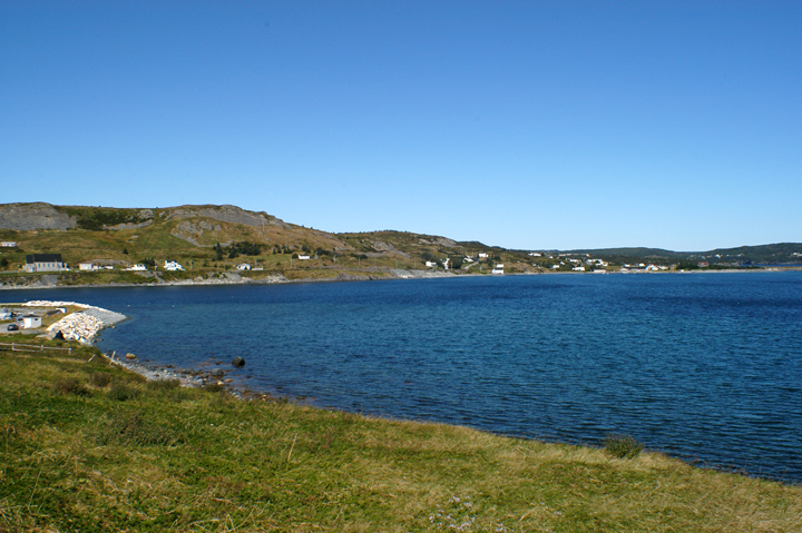
Sunset over Ferryland
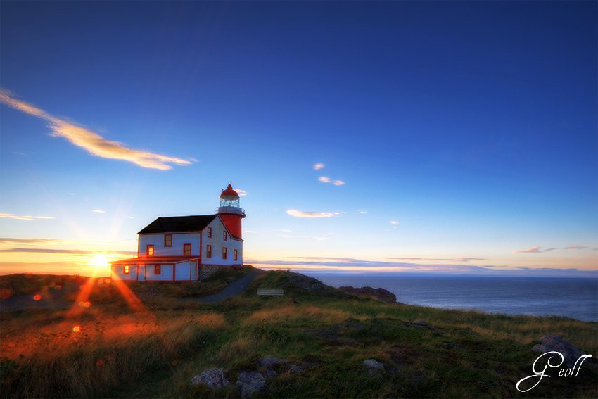
Lighthouse

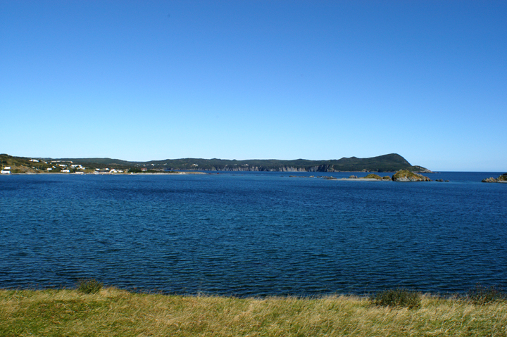
La Manche View

Rural Newfoundland
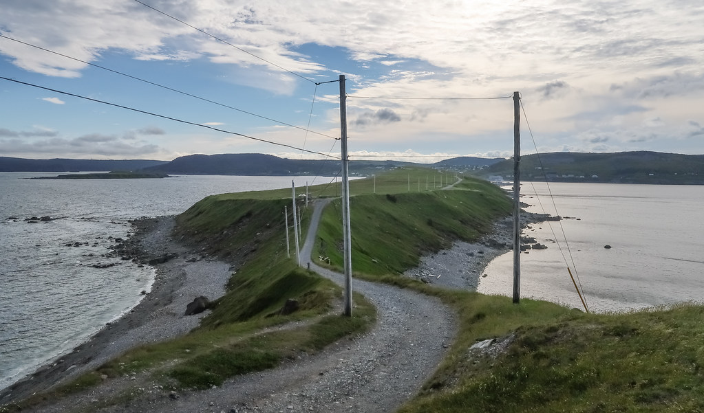
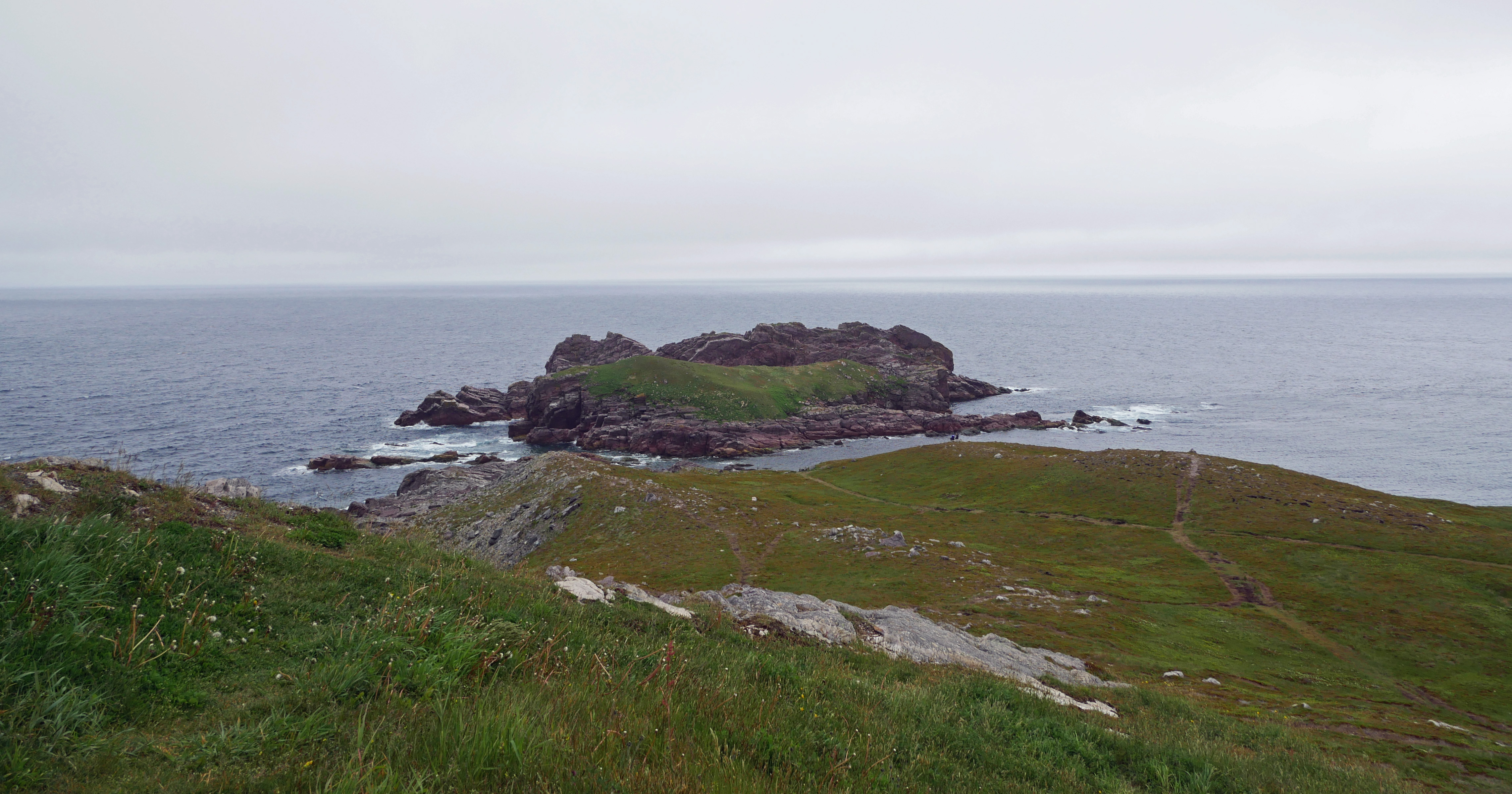
Picture of the isthmus "The Downs" as viewed from the cape "Ferryland Head."

Standing Tall
DSC_41741z Ferryland outer harbour island chain
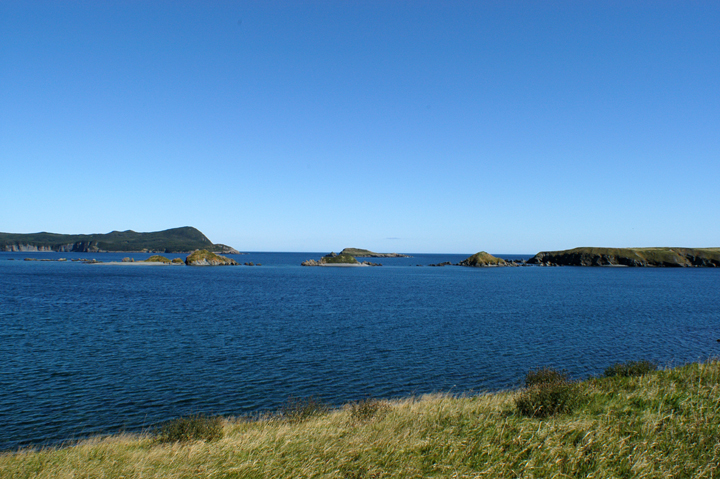
DSC_41740z Ferryland seascape SE panorama islands
DSC_41742z Ferryland shoreline harbour panorama one
View from Ferryland Lighthouse
Mapa de Ferryland, NL, Canadá
Buscar otro lugar
Lugares cercanos
Fermeuse, NL, Canadá
NL-10, Fermeuse, NL A0A 2G0, Canadá
Division No. 1, Subd. U, NL, Canadá
Mobile, NL A0A, Canadá
NL-10, Mobile, NL A0A 3A0, Canadá
Witless Bay, NL, Canadá
Bay Bulls, NL A0A, Canadá
Division No. 1, Subd. D, NL, Canadá
Division No. 1, Subd. V, NL A0A, Canadá
TCH, St. John's, NL, Canadá
Holyrood, Terranova y Labrador, Canadá
Goulds, St. John's, NL, Canadá
Cochrane Pond, St. John's, NL, Canadá
22 Keith Dr, Goulds, NL A1S 1B1, Canadá
Goulds, NL A1S 1R9, Canadá
Division No. 1, Subd. W, NL, Canadá
Glendenning Golf Course, Gabriel Rd, St. John's, NL A1H 1A5, Canadá
Cheeseman Drive, St. John's, NL A1H 0G8, Canadá
Gabriel Road, Gabriel Rd, St. John's, NL A1H, Canadá
Salmonier Line, Brigus Junction, NL A0B 1G0, Canadá
Búsquedas recientes
- Horas de salida y puesta de sol de Red Dog Mine, AK, USA
- Horas de salida y puesta de sol de Am Bahnhof, Am bhf, Borken, Germany
- Horas de salida y puesta de sol de 4th St E, Sonoma, CA, EE. UU.
- Horas de salida y puesta de sol de Oakland Ave, Williamsport, PA, EE. UU.
- Horas de salida y puesta de sol de Via Roma, Pieranica CR, Italia
- Horas de salida y puesta de sol de Torre del reloj, Grad, Dubrovnik (Ragusa), Croacia
- Horas de salida y puesta de sol de Trelew, Chubut, Argentina
- Horas de salida y puesta de sol de Hartfords Bluff Cir, Mt Pleasant, SC, EE. UU.
- Horas de salida y puesta de sol de Kita Ward, Kumamoto, Japón
- Horas de salida y puesta de sol de Pingtan Island, Pingtan County, Fuzhou, China