Horas de salida y puesta de sol de Dewberry Ln, Mt Airy, GA, EE. UU.
Location: Estados Unidos > Georgia > Condado de Habersham > Mount Airy >
Zona horaria:
America/New_York
Hora local:
2025-06-24 18:41:53
Longitud:
-83.488761
Latitud:
34.597981
Salida de sol de hoy:
06:22:45 AM
Puesta de sol de hoy:
08:50:48 PM
La duración del día hoy:
14h 28m 3s
Salida de sol de mañana:
06:23:05 AM
Puesta de sol de mañana:
08:50:53 PM
La duración del día mañana:
14h 27m 48s
Mostrar todas las fechas
| Fecha | Salida de sol | Puesta de sol | Duración del día |
|---|---|---|---|
| 01/01/2025 | 07:41:02 AM | 05:35:07 PM | 9h 54m 5s |
| 02/01/2025 | 07:41:10 AM | 05:35:54 PM | 9h 54m 44s |
| 03/01/2025 | 07:41:16 AM | 05:36:42 PM | 9h 55m 26s |
| 04/01/2025 | 07:41:21 AM | 05:37:31 PM | 9h 56m 10s |
| 05/01/2025 | 07:41:23 AM | 05:38:22 PM | 9h 56m 59s |
| 06/01/2025 | 07:41:24 AM | 05:39:13 PM | 9h 57m 49s |
| 07/01/2025 | 07:41:22 AM | 05:40:05 PM | 9h 58m 43s |
| 08/01/2025 | 07:41:19 AM | 05:40:58 PM | 9h 59m 39s |
| 09/01/2025 | 07:41:14 AM | 05:41:51 PM | 10h 0m 37s |
| 10/01/2025 | 07:41:07 AM | 05:42:46 PM | 10h 1m 39s |
| 11/01/2025 | 07:40:58 AM | 05:43:41 PM | 10h 2m 43s |
| 12/01/2025 | 07:40:48 AM | 05:44:37 PM | 10h 3m 49s |
| 13/01/2025 | 07:40:35 AM | 05:45:33 PM | 10h 4m 58s |
| 14/01/2025 | 07:40:20 AM | 05:46:30 PM | 10h 6m 10s |
| 15/01/2025 | 07:40:04 AM | 05:47:28 PM | 10h 7m 24s |
| 16/01/2025 | 07:39:46 AM | 05:48:25 PM | 10h 8m 39s |
| 17/01/2025 | 07:39:26 AM | 05:49:24 PM | 10h 9m 58s |
| 18/01/2025 | 07:39:04 AM | 05:50:22 PM | 10h 11m 18s |
| 19/01/2025 | 07:38:40 AM | 05:51:22 PM | 10h 12m 42s |
| 20/01/2025 | 07:38:14 AM | 05:52:21 PM | 10h 14m 7s |
| 21/01/2025 | 07:37:47 AM | 05:53:20 PM | 10h 15m 33s |
| 22/01/2025 | 07:37:18 AM | 05:54:20 PM | 10h 17m 2s |
| 23/01/2025 | 07:36:47 AM | 05:55:20 PM | 10h 18m 33s |
| 24/01/2025 | 07:36:15 AM | 05:56:20 PM | 10h 20m 5s |
| 25/01/2025 | 07:35:40 AM | 05:57:21 PM | 10h 21m 41s |
| 26/01/2025 | 07:35:05 AM | 05:58:21 PM | 10h 23m 16s |
| 27/01/2025 | 07:34:27 AM | 05:59:21 PM | 10h 24m 54s |
| 28/01/2025 | 07:33:48 AM | 06:00:22 PM | 10h 26m 34s |
| 29/01/2025 | 07:33:07 AM | 06:01:22 PM | 10h 28m 15s |
| 30/01/2025 | 07:32:24 AM | 06:02:22 PM | 10h 29m 58s |
| 31/01/2025 | 07:31:40 AM | 06:03:23 PM | 10h 31m 43s |
| 01/02/2025 | 07:30:55 AM | 06:04:23 PM | 10h 33m 28s |
| 02/02/2025 | 07:30:08 AM | 06:05:23 PM | 10h 35m 15s |
| 03/02/2025 | 07:29:19 AM | 06:06:23 PM | 10h 37m 4s |
| 04/02/2025 | 07:28:30 AM | 06:07:22 PM | 10h 38m 52s |
| 05/02/2025 | 07:27:38 AM | 06:08:22 PM | 10h 40m 44s |
| 06/02/2025 | 07:26:45 AM | 06:09:21 PM | 10h 42m 36s |
| 07/02/2025 | 07:25:51 AM | 06:10:20 PM | 10h 44m 29s |
| 08/02/2025 | 07:24:56 AM | 06:11:19 PM | 10h 46m 23s |
| 09/02/2025 | 07:23:59 AM | 06:12:18 PM | 10h 48m 19s |
| 10/02/2025 | 07:23:01 AM | 06:13:16 PM | 10h 50m 15s |
| 11/02/2025 | 07:22:02 AM | 06:14:14 PM | 10h 52m 12s |
| 12/02/2025 | 07:21:02 AM | 06:15:12 PM | 10h 54m 10s |
| 13/02/2025 | 07:20:00 AM | 06:16:09 PM | 10h 56m 9s |
| 14/02/2025 | 07:18:57 AM | 06:17:06 PM | 10h 58m 9s |
| 15/02/2025 | 07:17:53 AM | 06:18:03 PM | 11h 0m 10s |
| 16/02/2025 | 07:16:48 AM | 06:18:59 PM | 11h 2m 11s |
| 17/02/2025 | 07:15:42 AM | 06:19:56 PM | 11h 4m 14s |
| 18/02/2025 | 07:14:35 AM | 06:20:51 PM | 11h 6m 16s |
| 19/02/2025 | 07:13:27 AM | 06:21:47 PM | 11h 8m 20s |
| 20/02/2025 | 07:12:18 AM | 06:22:42 PM | 11h 10m 24s |
| 21/02/2025 | 07:11:08 AM | 06:23:37 PM | 11h 12m 29s |
| 22/02/2025 | 07:09:58 AM | 06:24:31 PM | 11h 14m 33s |
| 23/02/2025 | 07:08:46 AM | 06:25:25 PM | 11h 16m 39s |
| 24/02/2025 | 07:07:33 AM | 06:26:19 PM | 11h 18m 46s |
| 25/02/2025 | 07:06:20 AM | 06:27:12 PM | 11h 20m 52s |
| 26/02/2025 | 07:05:06 AM | 06:28:05 PM | 11h 22m 59s |
| 27/02/2025 | 07:03:51 AM | 06:28:58 PM | 11h 25m 7s |
| 28/02/2025 | 07:02:36 AM | 06:29:51 PM | 11h 27m 15s |
| 01/03/2025 | 07:01:20 AM | 06:30:43 PM | 11h 29m 23s |
| 02/03/2025 | 07:00:03 AM | 06:31:34 PM | 11h 31m 31s |
| 03/03/2025 | 06:58:45 AM | 06:32:26 PM | 11h 33m 41s |
| 04/03/2025 | 06:57:27 AM | 06:33:17 PM | 11h 35m 50s |
| 05/03/2025 | 06:56:09 AM | 06:34:08 PM | 11h 37m 59s |
| 06/03/2025 | 06:54:50 AM | 06:34:58 PM | 11h 40m 8s |
| 07/03/2025 | 06:53:30 AM | 06:35:49 PM | 11h 42m 19s |
| 08/03/2025 | 06:52:10 AM | 06:36:39 PM | 11h 44m 29s |
| 09/03/2025 | 07:50:53 AM | 07:37:26 PM | 11h 46m 33s |
| 10/03/2025 | 07:49:32 AM | 07:38:16 PM | 11h 48m 44s |
| 11/03/2025 | 07:48:11 AM | 07:39:05 PM | 11h 50m 54s |
| 12/03/2025 | 07:46:49 AM | 07:39:54 PM | 11h 53m 5s |
| 13/03/2025 | 07:45:27 AM | 07:40:43 PM | 11h 55m 16s |
| 14/03/2025 | 07:44:05 AM | 07:41:32 PM | 11h 57m 27s |
| 15/03/2025 | 07:42:43 AM | 07:42:20 PM | 11h 59m 37s |
| 16/03/2025 | 07:41:20 AM | 07:43:08 PM | 12h 1m 48s |
| 17/03/2025 | 07:39:57 AM | 07:43:56 PM | 12h 3m 59s |
| 18/03/2025 | 07:38:34 AM | 07:44:44 PM | 12h 6m 10s |
| 19/03/2025 | 07:37:11 AM | 07:45:32 PM | 12h 8m 21s |
| 20/03/2025 | 07:35:48 AM | 07:46:20 PM | 12h 10m 32s |
| 21/03/2025 | 07:34:25 AM | 07:47:07 PM | 12h 12m 42s |
| 22/03/2025 | 07:33:01 AM | 07:47:55 PM | 12h 14m 54s |
| 23/03/2025 | 07:31:38 AM | 07:48:42 PM | 12h 17m 4s |
| 24/03/2025 | 07:30:15 AM | 07:49:29 PM | 12h 19m 14s |
| 25/03/2025 | 07:28:52 AM | 07:50:16 PM | 12h 21m 24s |
| 26/03/2025 | 07:27:28 AM | 07:51:03 PM | 12h 23m 35s |
| 27/03/2025 | 07:26:05 AM | 07:51:50 PM | 12h 25m 45s |
| 28/03/2025 | 07:24:42 AM | 07:52:37 PM | 12h 27m 55s |
| 29/03/2025 | 07:23:19 AM | 07:53:24 PM | 12h 30m 5s |
| 30/03/2025 | 07:21:57 AM | 07:54:10 PM | 12h 32m 13s |
| 31/03/2025 | 07:20:34 AM | 07:54:57 PM | 12h 34m 23s |
| 01/04/2025 | 07:19:12 AM | 07:55:44 PM | 12h 36m 32s |
| 02/04/2025 | 07:17:50 AM | 07:56:31 PM | 12h 38m 41s |
| 03/04/2025 | 07:16:29 AM | 07:57:17 PM | 12h 40m 48s |
| 04/04/2025 | 07:15:07 AM | 07:58:04 PM | 12h 42m 57s |
| 05/04/2025 | 07:13:47 AM | 07:58:51 PM | 12h 45m 4s |
| 06/04/2025 | 07:12:26 AM | 07:59:38 PM | 12h 47m 12s |
| 07/04/2025 | 07:11:06 AM | 08:00:25 PM | 12h 49m 19s |
| 08/04/2025 | 07:09:46 AM | 08:01:12 PM | 12h 51m 26s |
| 09/04/2025 | 07:08:27 AM | 08:01:58 PM | 12h 53m 31s |
| 10/04/2025 | 07:07:09 AM | 08:02:45 PM | 12h 55m 36s |
| 11/04/2025 | 07:05:51 AM | 08:03:33 PM | 12h 57m 42s |
| 12/04/2025 | 07:04:33 AM | 08:04:20 PM | 12h 59m 47s |
| 13/04/2025 | 07:03:16 AM | 08:05:07 PM | 13h 1m 51s |
| 14/04/2025 | 07:02:00 AM | 08:05:54 PM | 13h 3m 54s |
| 15/04/2025 | 07:00:44 AM | 08:06:41 PM | 13h 5m 57s |
| 16/04/2025 | 06:59:29 AM | 08:07:29 PM | 13h 8m 0s |
| 17/04/2025 | 06:58:15 AM | 08:08:16 PM | 13h 10m 1s |
| 18/04/2025 | 06:57:01 AM | 08:09:04 PM | 13h 12m 3s |
| 19/04/2025 | 06:55:48 AM | 08:09:51 PM | 13h 14m 3s |
| 20/04/2025 | 06:54:36 AM | 08:10:39 PM | 13h 16m 3s |
| 21/04/2025 | 06:53:25 AM | 08:11:27 PM | 13h 18m 2s |
| 22/04/2025 | 06:52:15 AM | 08:12:14 PM | 13h 19m 59s |
| 23/04/2025 | 06:51:06 AM | 08:13:02 PM | 13h 21m 56s |
| 24/04/2025 | 06:49:57 AM | 08:13:50 PM | 13h 23m 53s |
| 25/04/2025 | 06:48:49 AM | 08:14:38 PM | 13h 25m 49s |
| 26/04/2025 | 06:47:43 AM | 08:15:26 PM | 13h 27m 43s |
| 27/04/2025 | 06:46:37 AM | 08:16:14 PM | 13h 29m 37s |
| 28/04/2025 | 06:45:32 AM | 08:17:02 PM | 13h 31m 30s |
| 29/04/2025 | 06:44:29 AM | 08:17:50 PM | 13h 33m 21s |
| 30/04/2025 | 06:43:26 AM | 08:18:38 PM | 13h 35m 12s |
| 01/05/2025 | 06:42:25 AM | 08:19:26 PM | 13h 37m 1s |
| 02/05/2025 | 06:41:25 AM | 08:20:14 PM | 13h 38m 49s |
| 03/05/2025 | 06:40:25 AM | 08:21:02 PM | 13h 40m 37s |
| 04/05/2025 | 06:39:27 AM | 08:21:49 PM | 13h 42m 22s |
| 05/05/2025 | 06:38:31 AM | 08:22:37 PM | 13h 44m 6s |
| 06/05/2025 | 06:37:35 AM | 08:23:25 PM | 13h 45m 50s |
| 07/05/2025 | 06:36:41 AM | 08:24:12 PM | 13h 47m 31s |
| 08/05/2025 | 06:35:48 AM | 08:25:00 PM | 13h 49m 12s |
| 09/05/2025 | 06:34:56 AM | 08:25:47 PM | 13h 50m 51s |
| 10/05/2025 | 06:34:05 AM | 08:26:34 PM | 13h 52m 29s |
| 11/05/2025 | 06:33:16 AM | 08:27:21 PM | 13h 54m 5s |
| 12/05/2025 | 06:32:29 AM | 08:28:08 PM | 13h 55m 39s |
| 13/05/2025 | 06:31:42 AM | 08:28:54 PM | 13h 57m 12s |
| 14/05/2025 | 06:30:57 AM | 08:29:40 PM | 13h 58m 43s |
| 15/05/2025 | 06:30:14 AM | 08:30:26 PM | 14h 0m 12s |
| 16/05/2025 | 06:29:32 AM | 08:31:12 PM | 14h 1m 40s |
| 17/05/2025 | 06:28:51 AM | 08:31:57 PM | 14h 3m 6s |
| 18/05/2025 | 06:28:12 AM | 08:32:42 PM | 14h 4m 30s |
| 19/05/2025 | 06:27:35 AM | 08:33:26 PM | 14h 5m 51s |
| 20/05/2025 | 06:26:59 AM | 08:34:10 PM | 14h 7m 11s |
| 21/05/2025 | 06:26:24 AM | 08:34:53 PM | 14h 8m 29s |
| 22/05/2025 | 06:25:51 AM | 08:35:36 PM | 14h 9m 45s |
| 23/05/2025 | 06:25:20 AM | 08:36:19 PM | 14h 10m 59s |
| 24/05/2025 | 06:24:50 AM | 08:37:01 PM | 14h 12m 11s |
| 25/05/2025 | 06:24:21 AM | 08:37:42 PM | 14h 13m 21s |
| 26/05/2025 | 06:23:55 AM | 08:38:22 PM | 14h 14m 27s |
| 27/05/2025 | 06:23:30 AM | 08:39:02 PM | 14h 15m 32s |
| 28/05/2025 | 06:23:06 AM | 08:39:42 PM | 14h 16m 36s |
| 29/05/2025 | 06:22:44 AM | 08:40:20 PM | 14h 17m 36s |
| 30/05/2025 | 06:22:24 AM | 08:40:58 PM | 14h 18m 34s |
| 31/05/2025 | 06:22:05 AM | 08:41:35 PM | 14h 19m 30s |
| 01/06/2025 | 06:21:48 AM | 08:42:11 PM | 14h 20m 23s |
| 02/06/2025 | 06:21:33 AM | 08:42:46 PM | 14h 21m 13s |
| 03/06/2025 | 06:21:19 AM | 08:43:20 PM | 14h 22m 1s |
| 04/06/2025 | 06:21:07 AM | 08:43:53 PM | 14h 22m 46s |
| 05/06/2025 | 06:20:57 AM | 08:44:25 PM | 14h 23m 28s |
| 06/06/2025 | 06:20:48 AM | 08:44:56 PM | 14h 24m 8s |
| 07/06/2025 | 06:20:41 AM | 08:45:27 PM | 14h 24m 46s |
| 08/06/2025 | 06:20:35 AM | 08:45:56 PM | 14h 25m 21s |
| 09/06/2025 | 06:20:31 AM | 08:46:24 PM | 14h 25m 53s |
| 10/06/2025 | 06:20:29 AM | 08:46:50 PM | 14h 26m 21s |
| 11/06/2025 | 06:20:28 AM | 08:47:16 PM | 14h 26m 48s |
| 12/06/2025 | 06:20:29 AM | 08:47:40 PM | 14h 27m 11s |
| 13/06/2025 | 06:20:31 AM | 08:48:03 PM | 14h 27m 32s |
| 14/06/2025 | 06:20:35 AM | 08:48:25 PM | 14h 27m 50s |
| 15/06/2025 | 06:20:41 AM | 08:48:45 PM | 14h 28m 4s |
| 16/06/2025 | 06:20:48 AM | 08:49:04 PM | 14h 28m 16s |
| 17/06/2025 | 06:20:56 AM | 08:49:22 PM | 14h 28m 26s |
| 18/06/2025 | 06:21:06 AM | 08:49:38 PM | 14h 28m 32s |
| 19/06/2025 | 06:21:17 AM | 08:49:53 PM | 14h 28m 36s |
| 20/06/2025 | 06:21:30 AM | 08:50:06 PM | 14h 28m 36s |
| 21/06/2025 | 06:21:44 AM | 08:50:18 PM | 14h 28m 34s |
| 22/06/2025 | 06:22:00 AM | 08:50:29 PM | 14h 28m 29s |
| 23/06/2025 | 06:22:17 AM | 08:50:37 PM | 14h 28m 20s |
| 24/06/2025 | 06:22:35 AM | 08:50:45 PM | 14h 28m 10s |
| 25/06/2025 | 06:22:55 AM | 08:50:51 PM | 14h 27m 56s |
| 26/06/2025 | 06:23:15 AM | 08:50:55 PM | 14h 27m 40s |
| 27/06/2025 | 06:23:37 AM | 08:50:57 PM | 14h 27m 20s |
| 28/06/2025 | 06:24:01 AM | 08:50:58 PM | 14h 26m 57s |
| 29/06/2025 | 06:24:25 AM | 08:50:57 PM | 14h 26m 32s |
| 30/06/2025 | 06:24:51 AM | 08:50:55 PM | 14h 26m 4s |
| 01/07/2025 | 06:25:17 AM | 08:50:51 PM | 14h 25m 34s |
| 02/07/2025 | 06:25:45 AM | 08:50:46 PM | 14h 25m 1s |
| 03/07/2025 | 06:26:14 AM | 08:50:38 PM | 14h 24m 24s |
| 04/07/2025 | 06:26:44 AM | 08:50:29 PM | 14h 23m 45s |
| 05/07/2025 | 06:27:14 AM | 08:50:19 PM | 14h 23m 5s |
| 06/07/2025 | 06:27:46 AM | 08:50:07 PM | 14h 22m 21s |
| 07/07/2025 | 06:28:19 AM | 08:49:53 PM | 14h 21m 34s |
| 08/07/2025 | 06:28:52 AM | 08:49:37 PM | 14h 20m 45s |
| 09/07/2025 | 06:29:26 AM | 08:49:20 PM | 14h 19m 54s |
| 10/07/2025 | 06:30:02 AM | 08:49:01 PM | 14h 18m 59s |
| 11/07/2025 | 06:30:37 AM | 08:48:40 PM | 14h 18m 3s |
| 12/07/2025 | 06:31:14 AM | 08:48:18 PM | 14h 17m 4s |
| 13/07/2025 | 06:31:51 AM | 08:47:54 PM | 14h 16m 3s |
| 14/07/2025 | 06:32:29 AM | 08:47:28 PM | 14h 14m 59s |
| 15/07/2025 | 06:33:08 AM | 08:47:01 PM | 14h 13m 53s |
| 16/07/2025 | 06:33:47 AM | 08:46:32 PM | 14h 12m 45s |
| 17/07/2025 | 06:34:27 AM | 08:46:02 PM | 14h 11m 35s |
| 18/07/2025 | 06:35:07 AM | 08:45:30 PM | 14h 10m 23s |
| 19/07/2025 | 06:35:47 AM | 08:44:56 PM | 14h 9m 9s |
| 20/07/2025 | 06:36:28 AM | 08:44:21 PM | 14h 7m 53s |
| 21/07/2025 | 06:37:10 AM | 08:43:44 PM | 14h 6m 34s |
| 22/07/2025 | 06:37:52 AM | 08:43:05 PM | 14h 5m 13s |
| 23/07/2025 | 06:38:34 AM | 08:42:25 PM | 14h 3m 51s |
| 24/07/2025 | 06:39:17 AM | 08:41:44 PM | 14h 2m 27s |
| 25/07/2025 | 06:40:00 AM | 08:41:01 PM | 14h 1m 1s |
| 26/07/2025 | 06:40:43 AM | 08:40:17 PM | 13h 59m 34s |
| 27/07/2025 | 06:41:27 AM | 08:39:31 PM | 13h 58m 4s |
| 28/07/2025 | 06:42:10 AM | 08:38:44 PM | 13h 56m 34s |
| 29/07/2025 | 06:42:54 AM | 08:37:55 PM | 13h 55m 1s |
| 30/07/2025 | 06:43:38 AM | 08:37:05 PM | 13h 53m 27s |
| 31/07/2025 | 06:44:22 AM | 08:36:14 PM | 13h 51m 52s |
| 01/08/2025 | 06:45:07 AM | 08:35:21 PM | 13h 50m 14s |
| 02/08/2025 | 06:45:51 AM | 08:34:27 PM | 13h 48m 36s |
| 03/08/2025 | 06:46:36 AM | 08:33:31 PM | 13h 46m 55s |
| 04/08/2025 | 06:47:20 AM | 08:32:35 PM | 13h 45m 15s |
| 05/08/2025 | 06:48:05 AM | 08:31:37 PM | 13h 43m 32s |
| 06/08/2025 | 06:48:50 AM | 08:30:37 PM | 13h 41m 47s |
| 07/08/2025 | 06:49:34 AM | 08:29:37 PM | 13h 40m 3s |
| 08/08/2025 | 06:50:19 AM | 08:28:36 PM | 13h 38m 17s |
| 09/08/2025 | 06:51:04 AM | 08:27:33 PM | 13h 36m 29s |
| 10/08/2025 | 06:51:48 AM | 08:26:29 PM | 13h 34m 41s |
| 11/08/2025 | 06:52:33 AM | 08:25:24 PM | 13h 32m 51s |
| 12/08/2025 | 06:53:18 AM | 08:24:18 PM | 13h 31m 0s |
| 13/08/2025 | 06:54:02 AM | 08:23:11 PM | 13h 29m 9s |
| 14/08/2025 | 06:54:47 AM | 08:22:03 PM | 13h 27m 16s |
| 15/08/2025 | 06:55:31 AM | 08:20:54 PM | 13h 25m 23s |
| 16/08/2025 | 06:56:15 AM | 08:19:45 PM | 13h 23m 30s |
| 17/08/2025 | 06:57:00 AM | 08:18:34 PM | 13h 21m 34s |
| 18/08/2025 | 06:57:44 AM | 08:17:22 PM | 13h 19m 38s |
| 19/08/2025 | 06:58:28 AM | 08:16:09 PM | 13h 17m 41s |
| 20/08/2025 | 06:59:12 AM | 08:14:56 PM | 13h 15m 44s |
| 21/08/2025 | 06:59:56 AM | 08:13:42 PM | 13h 13m 46s |
| 22/08/2025 | 07:00:39 AM | 08:12:26 PM | 13h 11m 47s |
| 23/08/2025 | 07:01:23 AM | 08:11:11 PM | 13h 9m 48s |
| 24/08/2025 | 07:02:07 AM | 08:09:54 PM | 13h 7m 47s |
| 25/08/2025 | 07:02:50 AM | 08:08:37 PM | 13h 5m 47s |
| 26/08/2025 | 07:03:33 AM | 08:07:19 PM | 13h 3m 46s |
| 27/08/2025 | 07:04:17 AM | 08:06:00 PM | 13h 1m 43s |
| 28/08/2025 | 07:05:00 AM | 08:04:41 PM | 12h 59m 41s |
| 29/08/2025 | 07:05:43 AM | 08:03:21 PM | 12h 57m 38s |
| 30/08/2025 | 07:06:26 AM | 08:02:01 PM | 12h 55m 35s |
| 31/08/2025 | 07:07:09 AM | 08:00:40 PM | 12h 53m 31s |
| 01/09/2025 | 07:07:52 AM | 07:59:18 PM | 12h 51m 26s |
| 02/09/2025 | 07:08:34 AM | 07:57:57 PM | 12h 49m 23s |
| 03/09/2025 | 07:09:17 AM | 07:56:34 PM | 12h 47m 17s |
| 04/09/2025 | 07:10:00 AM | 07:55:11 PM | 12h 45m 11s |
| 05/09/2025 | 07:10:42 AM | 07:53:48 PM | 12h 43m 6s |
| 06/09/2025 | 07:11:25 AM | 07:52:25 PM | 12h 41m 0s |
| 07/09/2025 | 07:12:08 AM | 07:51:01 PM | 12h 38m 53s |
| 08/09/2025 | 07:12:50 AM | 07:49:37 PM | 12h 36m 47s |
| 09/09/2025 | 07:13:33 AM | 07:48:12 PM | 12h 34m 39s |
| 10/09/2025 | 07:14:15 AM | 07:46:48 PM | 12h 32m 33s |
| 11/09/2025 | 07:14:58 AM | 07:45:23 PM | 12h 30m 25s |
| 12/09/2025 | 07:15:40 AM | 07:43:58 PM | 12h 28m 18s |
| 13/09/2025 | 07:16:23 AM | 07:42:32 PM | 12h 26m 9s |
| 14/09/2025 | 07:17:05 AM | 07:41:07 PM | 12h 24m 2s |
| 15/09/2025 | 07:17:48 AM | 07:39:41 PM | 12h 21m 53s |
| 16/09/2025 | 07:18:31 AM | 07:38:16 PM | 12h 19m 45s |
| 17/09/2025 | 07:19:13 AM | 07:36:50 PM | 12h 17m 37s |
| 18/09/2025 | 07:19:56 AM | 07:35:24 PM | 12h 15m 28s |
| 19/09/2025 | 07:20:39 AM | 07:33:59 PM | 12h 13m 20s |
| 20/09/2025 | 07:21:22 AM | 07:32:33 PM | 12h 11m 11s |
| 21/09/2025 | 07:22:05 AM | 07:31:07 PM | 12h 9m 2s |
| 22/09/2025 | 07:22:49 AM | 07:29:42 PM | 12h 6m 53s |
| 23/09/2025 | 07:23:32 AM | 07:28:17 PM | 12h 4m 45s |
| 24/09/2025 | 07:24:16 AM | 07:26:51 PM | 12h 2m 35s |
| 25/09/2025 | 07:25:00 AM | 07:25:26 PM | 12h 0m 26s |
| 26/09/2025 | 07:25:44 AM | 07:24:01 PM | 11h 58m 17s |
| 27/09/2025 | 07:26:28 AM | 07:22:37 PM | 11h 56m 9s |
| 28/09/2025 | 07:27:12 AM | 07:21:12 PM | 11h 54m 0s |
| 29/09/2025 | 07:27:57 AM | 07:19:48 PM | 11h 51m 51s |
| 30/09/2025 | 07:28:42 AM | 07:18:25 PM | 11h 49m 43s |
| 01/10/2025 | 07:29:27 AM | 07:17:01 PM | 11h 47m 34s |
| 02/10/2025 | 07:30:12 AM | 07:15:38 PM | 11h 45m 26s |
| 03/10/2025 | 07:30:58 AM | 07:14:16 PM | 11h 43m 18s |
| 04/10/2025 | 07:31:44 AM | 07:12:54 PM | 11h 41m 10s |
| 05/10/2025 | 07:32:30 AM | 07:11:32 PM | 11h 39m 2s |
| 06/10/2025 | 07:33:16 AM | 07:10:11 PM | 11h 36m 55s |
| 07/10/2025 | 07:34:03 AM | 07:08:50 PM | 11h 34m 47s |
| 08/10/2025 | 07:34:50 AM | 07:07:30 PM | 11h 32m 40s |
| 09/10/2025 | 07:35:37 AM | 07:06:10 PM | 11h 30m 33s |
| 10/10/2025 | 07:36:25 AM | 07:04:52 PM | 11h 28m 27s |
| 11/10/2025 | 07:37:13 AM | 07:03:33 PM | 11h 26m 20s |
| 12/10/2025 | 07:38:02 AM | 07:02:16 PM | 11h 24m 14s |
| 13/10/2025 | 07:38:50 AM | 07:00:59 PM | 11h 22m 9s |
| 14/10/2025 | 07:39:39 AM | 06:59:43 PM | 11h 20m 4s |
| 15/10/2025 | 07:40:29 AM | 06:58:28 PM | 11h 17m 59s |
| 16/10/2025 | 07:41:19 AM | 06:57:13 PM | 11h 15m 54s |
| 17/10/2025 | 07:42:09 AM | 06:56:00 PM | 11h 13m 51s |
| 18/10/2025 | 07:42:59 AM | 06:54:47 PM | 11h 11m 48s |
| 19/10/2025 | 07:43:50 AM | 06:53:35 PM | 11h 9m 45s |
| 20/10/2025 | 07:44:41 AM | 06:52:24 PM | 11h 7m 43s |
| 21/10/2025 | 07:45:33 AM | 06:51:14 PM | 11h 5m 41s |
| 22/10/2025 | 07:46:25 AM | 06:50:05 PM | 11h 3m 40s |
| 23/10/2025 | 07:47:18 AM | 06:48:57 PM | 11h 1m 39s |
| 24/10/2025 | 07:48:10 AM | 06:47:50 PM | 10h 59m 40s |
| 25/10/2025 | 07:49:03 AM | 06:46:44 PM | 10h 57m 41s |
| 26/10/2025 | 07:49:57 AM | 06:45:39 PM | 10h 55m 42s |
| 27/10/2025 | 07:50:51 AM | 06:44:36 PM | 10h 53m 45s |
| 28/10/2025 | 07:51:45 AM | 06:43:34 PM | 10h 51m 49s |
| 29/10/2025 | 07:52:39 AM | 06:42:32 PM | 10h 49m 53s |
| 30/10/2025 | 07:53:34 AM | 06:41:32 PM | 10h 47m 58s |
| 31/10/2025 | 07:54:29 AM | 06:40:34 PM | 10h 46m 5s |
| 01/11/2025 | 07:55:24 AM | 06:39:36 PM | 10h 44m 12s |
| 02/11/2025 | 06:56:22 AM | 05:38:38 PM | 10h 42m 16s |
| 03/11/2025 | 06:57:18 AM | 05:37:43 PM | 10h 40m 25s |
| 04/11/2025 | 06:58:15 AM | 05:36:50 PM | 10h 38m 35s |
| 05/11/2025 | 06:59:11 AM | 05:35:59 PM | 10h 36m 48s |
| 06/11/2025 | 07:00:08 AM | 05:35:08 PM | 10h 35m 0s |
| 07/11/2025 | 07:01:05 AM | 05:34:19 PM | 10h 33m 14s |
| 08/11/2025 | 07:02:02 AM | 05:33:32 PM | 10h 31m 30s |
| 09/11/2025 | 07:02:59 AM | 05:32:46 PM | 10h 29m 47s |
| 10/11/2025 | 07:03:56 AM | 05:32:02 PM | 10h 28m 6s |
| 11/11/2025 | 07:04:54 AM | 05:31:19 PM | 10h 26m 25s |
| 12/11/2025 | 07:05:51 AM | 05:30:38 PM | 10h 24m 47s |
| 13/11/2025 | 07:06:49 AM | 05:29:59 PM | 10h 23m 10s |
| 14/11/2025 | 07:07:46 AM | 05:29:21 PM | 10h 21m 35s |
| 15/11/2025 | 07:08:44 AM | 05:28:45 PM | 10h 20m 1s |
| 16/11/2025 | 07:09:42 AM | 05:28:11 PM | 10h 18m 29s |
| 17/11/2025 | 07:10:39 AM | 05:27:39 PM | 10h 17m 0s |
| 18/11/2025 | 07:11:36 AM | 05:27:08 PM | 10h 15m 32s |
| 19/11/2025 | 07:12:34 AM | 05:26:39 PM | 10h 14m 5s |
| 20/11/2025 | 07:13:31 AM | 05:26:12 PM | 10h 12m 41s |
| 21/11/2025 | 07:14:27 AM | 05:25:46 PM | 10h 11m 19s |
| 22/11/2025 | 07:15:24 AM | 05:25:23 PM | 10h 9m 59s |
| 23/11/2025 | 07:16:20 AM | 05:25:01 PM | 10h 8m 41s |
| 24/11/2025 | 07:17:16 AM | 05:24:41 PM | 10h 7m 25s |
| 25/11/2025 | 07:18:12 AM | 05:24:24 PM | 10h 6m 12s |
| 26/11/2025 | 07:19:07 AM | 05:24:07 PM | 10h 5m 0s |
| 27/11/2025 | 07:20:01 AM | 05:23:53 PM | 10h 3m 52s |
| 28/11/2025 | 07:20:55 AM | 05:23:41 PM | 10h 2m 46s |
| 29/11/2025 | 07:21:49 AM | 05:23:31 PM | 10h 1m 42s |
| 30/11/2025 | 07:22:42 AM | 05:23:23 PM | 10h 0m 41s |
| 01/12/2025 | 07:23:34 AM | 05:23:16 PM | 9h 59m 42s |
| 02/12/2025 | 07:24:25 AM | 05:23:12 PM | 9h 58m 47s |
| 03/12/2025 | 07:25:16 AM | 05:23:09 PM | 9h 57m 53s |
| 04/12/2025 | 07:26:06 AM | 05:23:09 PM | 9h 57m 3s |
| 05/12/2025 | 07:26:55 AM | 05:23:10 PM | 9h 56m 15s |
| 06/12/2025 | 07:27:43 AM | 05:23:13 PM | 9h 55m 30s |
| 07/12/2025 | 07:28:31 AM | 05:23:18 PM | 9h 54m 47s |
| 08/12/2025 | 07:29:17 AM | 05:23:26 PM | 9h 54m 9s |
| 09/12/2025 | 07:30:02 AM | 05:23:35 PM | 9h 53m 33s |
| 10/12/2025 | 07:30:46 AM | 05:23:45 PM | 9h 52m 59s |
| 11/12/2025 | 07:31:29 AM | 05:23:58 PM | 9h 52m 29s |
| 12/12/2025 | 07:32:11 AM | 05:24:13 PM | 9h 52m 2s |
| 13/12/2025 | 07:32:52 AM | 05:24:29 PM | 9h 51m 37s |
| 14/12/2025 | 07:33:31 AM | 05:24:48 PM | 9h 51m 17s |
| 15/12/2025 | 07:34:09 AM | 05:25:08 PM | 9h 50m 59s |
| 16/12/2025 | 07:34:46 AM | 05:25:30 PM | 9h 50m 44s |
| 17/12/2025 | 07:35:21 AM | 05:25:53 PM | 9h 50m 32s |
| 18/12/2025 | 07:35:55 AM | 05:26:19 PM | 9h 50m 24s |
| 19/12/2025 | 07:36:28 AM | 05:26:46 PM | 9h 50m 18s |
| 20/12/2025 | 07:36:58 AM | 05:27:14 PM | 9h 50m 16s |
| 21/12/2025 | 07:37:28 AM | 05:27:45 PM | 9h 50m 17s |
| 22/12/2025 | 07:37:55 AM | 05:28:17 PM | 9h 50m 22s |
| 23/12/2025 | 07:38:22 AM | 05:28:50 PM | 9h 50m 28s |
| 24/12/2025 | 07:38:46 AM | 05:29:25 PM | 9h 50m 39s |
| 25/12/2025 | 07:39:09 AM | 05:30:02 PM | 9h 50m 53s |
| 26/12/2025 | 07:39:30 AM | 05:30:40 PM | 9h 51m 10s |
| 27/12/2025 | 07:39:49 AM | 05:31:19 PM | 9h 51m 30s |
| 28/12/2025 | 07:40:07 AM | 05:32:00 PM | 9h 51m 53s |
| 29/12/2025 | 07:40:23 AM | 05:32:42 PM | 9h 52m 19s |
| 30/12/2025 | 07:40:37 AM | 05:33:25 PM | 9h 52m 48s |
| 31/12/2025 | 07:40:49 AM | 05:34:10 PM | 9h 53m 21s |
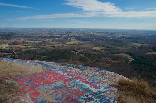
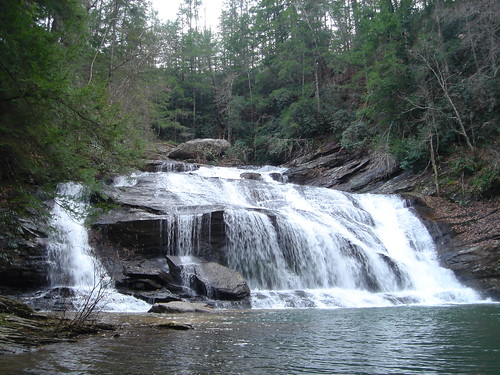
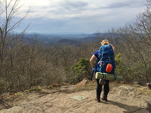
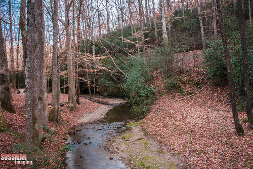
Fotos
Mapa de Dewberry Ln, Mt Airy, GA, EE. UU.
Buscar otro lugar
Lugares cercanos
Blacksnake Rd, Mt Airy, GA, EE. UU.
Windfield Ridge Dr, Mt Airy, GA, EE. UU.
Hazel Creek Rd, Mt Airy, GA, EE. UU.
J Kennedy Rd, Clarkesville, GA, EE. UU.
Railroad Ave, Clarkesville, GA, EE. UU.
New Liberty Rd, Clarkesville, GA, EE. UU.
Jess Kinney Rd, Mt Airy, GA, EE. UU.
Richard St, Clarkesville, GA, EE. UU.
Clarkesville, Georgia, EE. UU.
Camp Creek Rd, Mt Airy, GA, EE. UU.
E Mize Rd, Demorest, GA, EE. UU.
Meadowridge Dr, Mt Airy, GA, EE. UU.
Talmadge Drive, Talmadge Dr, Georgia, EE. UU.
Tommy Irvin Rd, Mt Airy, GA, EE. UU.
Talmadge Dr, Toccoa, GA, EE. UU.
Demorest, Georgia, EE. UU.
Old Hwy S, Mt Airy, GA, EE. UU.
Mount Airy, Georgia, EE. UU.
Petty John Lane, Petty John Ln, Mt Airy, GA, EE. UU.
Talmadge Dr, Toccoa, GA, EE. UU.
Búsquedas recientes
- Horas de salida y puesta de sol de Red Dog Mine, AK, USA
- Horas de salida y puesta de sol de Am Bahnhof, Am bhf, Borken, Germany
- Horas de salida y puesta de sol de 4th St E, Sonoma, CA, EE. UU.
- Horas de salida y puesta de sol de Oakland Ave, Williamsport, PA, EE. UU.
- Horas de salida y puesta de sol de Via Roma, Pieranica CR, Italia
- Horas de salida y puesta de sol de Torre del reloj, Grad, Dubrovnik (Ragusa), Croacia
- Horas de salida y puesta de sol de Trelew, Chubut, Argentina
- Horas de salida y puesta de sol de Hartfords Bluff Cir, Mt Pleasant, SC, EE. UU.
- Horas de salida y puesta de sol de Kita Ward, Kumamoto, Japón
- Horas de salida y puesta de sol de Pingtan Island, Pingtan County, Fuzhou, China
