Horas de salida y puesta de sol de Dale Rd, Corning, CA, EE. UU.
Location: Estados Unidos > California > Condado de Tehama > Corning >
Zona horaria:
America/Los_Angeles
Hora local:
2025-06-20 15:19:45
Longitud:
-122.1184917
Latitud:
39.9286391
Salida de sol de hoy:
05:40:11 AM
Puesta de sol de hoy:
08:40:43 PM
La duración del día hoy:
15h 0m 32s
Salida de sol de mañana:
05:40:27 AM
Puesta de sol de mañana:
08:40:54 PM
La duración del día mañana:
15h 0m 27s
Mostrar todas las fechas
| Fecha | Salida de sol | Puesta de sol | Duración del día |
|---|---|---|---|
| 01/01/2025 | 07:30:09 AM | 04:55:15 PM | 9h 25m 6s |
| 02/01/2025 | 07:30:12 AM | 04:56:07 PM | 9h 25m 55s |
| 03/01/2025 | 07:30:12 AM | 04:57:01 PM | 9h 26m 49s |
| 04/01/2025 | 07:30:11 AM | 04:57:56 PM | 9h 27m 45s |
| 05/01/2025 | 07:30:07 AM | 04:58:52 PM | 9h 28m 45s |
| 06/01/2025 | 07:30:01 AM | 04:59:49 PM | 9h 29m 48s |
| 07/01/2025 | 07:29:53 AM | 05:00:48 PM | 9h 30m 55s |
| 08/01/2025 | 07:29:43 AM | 05:01:48 PM | 9h 32m 5s |
| 09/01/2025 | 07:29:30 AM | 05:02:49 PM | 9h 33m 19s |
| 10/01/2025 | 07:29:15 AM | 05:03:51 PM | 9h 34m 36s |
| 11/01/2025 | 07:28:58 AM | 05:04:54 PM | 9h 35m 56s |
| 12/01/2025 | 07:28:39 AM | 05:05:58 PM | 9h 37m 19s |
| 13/01/2025 | 07:28:18 AM | 05:07:02 PM | 9h 38m 44s |
| 14/01/2025 | 07:27:55 AM | 05:08:08 PM | 9h 40m 13s |
| 15/01/2025 | 07:27:29 AM | 05:09:14 PM | 9h 41m 45s |
| 16/01/2025 | 07:27:01 AM | 05:10:21 PM | 9h 43m 20s |
| 17/01/2025 | 07:26:32 AM | 05:11:29 PM | 9h 44m 57s |
| 18/01/2025 | 07:26:00 AM | 05:12:37 PM | 9h 46m 37s |
| 19/01/2025 | 07:25:26 AM | 05:13:46 PM | 9h 48m 20s |
| 20/01/2025 | 07:24:50 AM | 05:14:55 PM | 9h 50m 5s |
| 21/01/2025 | 07:24:12 AM | 05:16:05 PM | 9h 51m 53s |
| 22/01/2025 | 07:23:33 AM | 05:17:15 PM | 9h 53m 42s |
| 23/01/2025 | 07:22:51 AM | 05:18:26 PM | 9h 55m 35s |
| 24/01/2025 | 07:22:07 AM | 05:19:36 PM | 9h 57m 29s |
| 25/01/2025 | 07:21:22 AM | 05:20:48 PM | 9h 59m 26s |
| 26/01/2025 | 07:20:34 AM | 05:21:59 PM | 10h 1m 25s |
| 27/01/2025 | 07:19:45 AM | 05:23:11 PM | 10h 3m 26s |
| 28/01/2025 | 07:18:54 AM | 05:24:22 PM | 10h 5m 28s |
| 29/01/2025 | 07:18:01 AM | 05:25:34 PM | 10h 7m 33s |
| 30/01/2025 | 07:17:07 AM | 05:26:46 PM | 10h 9m 39s |
| 31/01/2025 | 07:16:11 AM | 05:27:58 PM | 10h 11m 47s |
| 01/02/2025 | 07:15:13 AM | 05:29:10 PM | 10h 13m 57s |
| 02/02/2025 | 07:14:13 AM | 05:30:23 PM | 10h 16m 10s |
| 03/02/2025 | 07:13:12 AM | 05:31:35 PM | 10h 18m 23s |
| 04/02/2025 | 07:12:10 AM | 05:32:47 PM | 10h 20m 37s |
| 05/02/2025 | 07:11:06 AM | 05:33:58 PM | 10h 22m 52s |
| 06/02/2025 | 07:10:00 AM | 05:35:10 PM | 10h 25m 10s |
| 07/02/2025 | 07:08:53 AM | 05:36:22 PM | 10h 27m 29s |
| 08/02/2025 | 07:07:44 AM | 05:37:33 PM | 10h 29m 49s |
| 09/02/2025 | 07:06:35 AM | 05:38:45 PM | 10h 32m 10s |
| 10/02/2025 | 07:05:23 AM | 05:39:56 PM | 10h 34m 33s |
| 11/02/2025 | 07:04:11 AM | 05:41:07 PM | 10h 36m 56s |
| 12/02/2025 | 07:02:57 AM | 05:42:18 PM | 10h 39m 21s |
| 13/02/2025 | 07:01:42 AM | 05:43:28 PM | 10h 41m 46s |
| 14/02/2025 | 07:00:26 AM | 05:44:38 PM | 10h 44m 12s |
| 15/02/2025 | 06:59:08 AM | 05:45:48 PM | 10h 46m 40s |
| 16/02/2025 | 06:57:50 AM | 05:46:58 PM | 10h 49m 8s |
| 17/02/2025 | 06:56:30 AM | 05:48:08 PM | 10h 51m 38s |
| 18/02/2025 | 06:55:09 AM | 05:49:17 PM | 10h 54m 8s |
| 19/02/2025 | 06:53:48 AM | 05:50:26 PM | 10h 56m 38s |
| 20/02/2025 | 06:52:25 AM | 05:51:34 PM | 10h 59m 9s |
| 21/02/2025 | 06:51:01 AM | 05:52:42 PM | 11h 1m 41s |
| 22/02/2025 | 06:49:37 AM | 05:53:50 PM | 11h 4m 13s |
| 23/02/2025 | 06:48:11 AM | 05:54:58 PM | 11h 6m 47s |
| 24/02/2025 | 06:46:45 AM | 05:56:05 PM | 11h 9m 20s |
| 25/02/2025 | 06:45:18 AM | 05:57:12 PM | 11h 11m 54s |
| 26/02/2025 | 06:43:50 AM | 05:58:19 PM | 11h 14m 29s |
| 27/02/2025 | 06:42:21 AM | 05:59:26 PM | 11h 17m 5s |
| 28/02/2025 | 06:40:51 AM | 06:00:32 PM | 11h 19m 41s |
| 01/03/2025 | 06:39:21 AM | 06:01:37 PM | 11h 22m 16s |
| 02/03/2025 | 06:37:50 AM | 06:02:43 PM | 11h 24m 53s |
| 03/03/2025 | 06:36:19 AM | 06:03:48 PM | 11h 27m 29s |
| 04/03/2025 | 06:34:47 AM | 06:04:53 PM | 11h 30m 6s |
| 05/03/2025 | 06:33:14 AM | 06:05:58 PM | 11h 32m 44s |
| 06/03/2025 | 06:31:41 AM | 06:07:02 PM | 11h 35m 21s |
| 07/03/2025 | 06:30:08 AM | 06:08:07 PM | 11h 37m 59s |
| 08/03/2025 | 06:28:33 AM | 06:09:10 PM | 11h 40m 37s |
| 09/03/2025 | 07:27:03 AM | 07:10:11 PM | 11h 43m 8s |
| 10/03/2025 | 07:25:28 AM | 07:11:15 PM | 11h 45m 47s |
| 11/03/2025 | 07:23:53 AM | 07:12:18 PM | 11h 48m 25s |
| 12/03/2025 | 07:22:17 AM | 07:13:21 PM | 11h 51m 4s |
| 13/03/2025 | 07:20:41 AM | 07:14:24 PM | 11h 53m 43s |
| 14/03/2025 | 07:19:05 AM | 07:15:26 PM | 11h 56m 21s |
| 15/03/2025 | 07:17:29 AM | 07:16:29 PM | 11h 59m 0s |
| 16/03/2025 | 07:15:52 AM | 07:17:31 PM | 12h 1m 39s |
| 17/03/2025 | 07:14:15 AM | 07:18:33 PM | 12h 4m 18s |
| 18/03/2025 | 07:12:38 AM | 07:19:35 PM | 12h 6m 57s |
| 19/03/2025 | 07:11:01 AM | 07:20:36 PM | 12h 9m 35s |
| 20/03/2025 | 07:09:24 AM | 07:21:38 PM | 12h 12m 14s |
| 21/03/2025 | 07:07:47 AM | 07:22:39 PM | 12h 14m 52s |
| 22/03/2025 | 07:06:09 AM | 07:23:40 PM | 12h 17m 31s |
| 23/03/2025 | 07:04:32 AM | 07:24:42 PM | 12h 20m 10s |
| 24/03/2025 | 07:02:55 AM | 07:25:43 PM | 12h 22m 48s |
| 25/03/2025 | 07:01:18 AM | 07:26:44 PM | 12h 25m 26s |
| 26/03/2025 | 06:59:41 AM | 07:27:45 PM | 12h 28m 4s |
| 27/03/2025 | 06:58:04 AM | 07:28:45 PM | 12h 30m 41s |
| 28/03/2025 | 06:56:27 AM | 07:29:46 PM | 12h 33m 19s |
| 29/03/2025 | 06:54:50 AM | 07:30:47 PM | 12h 35m 57s |
| 30/03/2025 | 06:53:14 AM | 07:31:47 PM | 12h 38m 33s |
| 31/03/2025 | 06:51:37 AM | 07:32:48 PM | 12h 41m 11s |
| 01/04/2025 | 06:50:02 AM | 07:33:49 PM | 12h 43m 47s |
| 02/04/2025 | 06:48:26 AM | 07:34:49 PM | 12h 46m 23s |
| 03/04/2025 | 06:46:51 AM | 07:35:50 PM | 12h 48m 59s |
| 04/04/2025 | 06:45:16 AM | 07:36:50 PM | 12h 51m 34s |
| 05/04/2025 | 06:43:41 AM | 07:37:51 PM | 12h 54m 10s |
| 06/04/2025 | 06:42:07 AM | 07:38:51 PM | 12h 56m 44s |
| 07/04/2025 | 06:40:33 AM | 07:39:52 PM | 12h 59m 19s |
| 08/04/2025 | 06:39:00 AM | 07:40:52 PM | 13h 1m 52s |
| 09/04/2025 | 06:37:28 AM | 07:41:53 PM | 13h 4m 25s |
| 10/04/2025 | 06:35:55 AM | 07:42:54 PM | 13h 6m 59s |
| 11/04/2025 | 06:34:24 AM | 07:43:54 PM | 13h 9m 30s |
| 12/04/2025 | 06:32:53 AM | 07:44:55 PM | 13h 12m 2s |
| 13/04/2025 | 06:31:23 AM | 07:45:56 PM | 13h 14m 33s |
| 14/04/2025 | 06:29:53 AM | 07:46:56 PM | 13h 17m 3s |
| 15/04/2025 | 06:28:24 AM | 07:47:57 PM | 13h 19m 33s |
| 16/04/2025 | 06:26:56 AM | 07:48:58 PM | 13h 22m 2s |
| 17/04/2025 | 06:25:29 AM | 07:49:58 PM | 13h 24m 29s |
| 18/04/2025 | 06:24:02 AM | 07:50:59 PM | 13h 26m 57s |
| 19/04/2025 | 06:22:36 AM | 07:52:00 PM | 13h 29m 24s |
| 20/04/2025 | 06:21:11 AM | 07:53:01 PM | 13h 31m 50s |
| 21/04/2025 | 06:19:47 AM | 07:54:02 PM | 13h 34m 15s |
| 22/04/2025 | 06:18:24 AM | 07:55:02 PM | 13h 36m 38s |
| 23/04/2025 | 06:17:02 AM | 07:56:03 PM | 13h 39m 1s |
| 24/04/2025 | 06:15:41 AM | 07:57:04 PM | 13h 41m 23s |
| 25/04/2025 | 06:14:20 AM | 07:58:05 PM | 13h 43m 45s |
| 26/04/2025 | 06:13:01 AM | 07:59:05 PM | 13h 46m 4s |
| 27/04/2025 | 06:11:43 AM | 08:00:06 PM | 13h 48m 23s |
| 28/04/2025 | 06:10:26 AM | 08:01:07 PM | 13h 50m 41s |
| 29/04/2025 | 06:09:10 AM | 08:02:07 PM | 13h 52m 57s |
| 30/04/2025 | 06:07:56 AM | 08:03:07 PM | 13h 55m 11s |
| 01/05/2025 | 06:06:42 AM | 08:04:08 PM | 13h 57m 26s |
| 02/05/2025 | 06:05:30 AM | 08:05:08 PM | 13h 59m 38s |
| 03/05/2025 | 06:04:19 AM | 08:06:08 PM | 14h 1m 49s |
| 04/05/2025 | 06:03:10 AM | 08:07:07 PM | 14h 3m 57s |
| 05/05/2025 | 06:02:01 AM | 08:08:07 PM | 14h 6m 6s |
| 06/05/2025 | 06:00:54 AM | 08:09:06 PM | 14h 8m 12s |
| 07/05/2025 | 05:59:49 AM | 08:10:05 PM | 14h 10m 16s |
| 08/05/2025 | 05:58:44 AM | 08:11:04 PM | 14h 12m 20s |
| 09/05/2025 | 05:57:42 AM | 08:12:03 PM | 14h 14m 21s |
| 10/05/2025 | 05:56:40 AM | 08:13:01 PM | 14h 16m 21s |
| 11/05/2025 | 05:55:41 AM | 08:13:59 PM | 14h 18m 18s |
| 12/05/2025 | 05:54:42 AM | 08:14:56 PM | 14h 20m 14s |
| 13/05/2025 | 05:53:46 AM | 08:15:53 PM | 14h 22m 7s |
| 14/05/2025 | 05:52:51 AM | 08:16:50 PM | 14h 23m 59s |
| 15/05/2025 | 05:51:57 AM | 08:17:46 PM | 14h 25m 49s |
| 16/05/2025 | 05:51:05 AM | 08:18:42 PM | 14h 27m 37s |
| 17/05/2025 | 05:50:15 AM | 08:19:37 PM | 14h 29m 22s |
| 18/05/2025 | 05:49:27 AM | 08:20:31 PM | 14h 31m 4s |
| 19/05/2025 | 05:48:40 AM | 08:21:25 PM | 14h 32m 45s |
| 20/05/2025 | 05:47:55 AM | 08:22:18 PM | 14h 34m 23s |
| 21/05/2025 | 05:47:11 AM | 08:23:10 PM | 14h 35m 59s |
| 22/05/2025 | 05:46:30 AM | 08:24:02 PM | 14h 37m 32s |
| 23/05/2025 | 05:45:50 AM | 08:24:53 PM | 14h 39m 3s |
| 24/05/2025 | 05:45:12 AM | 08:25:43 PM | 14h 40m 31s |
| 25/05/2025 | 05:44:36 AM | 08:26:32 PM | 14h 41m 56s |
| 26/05/2025 | 05:44:02 AM | 08:27:21 PM | 14h 43m 19s |
| 27/05/2025 | 05:43:30 AM | 08:28:08 PM | 14h 44m 38s |
| 28/05/2025 | 05:42:59 AM | 08:28:55 PM | 14h 45m 56s |
| 29/05/2025 | 05:42:30 AM | 08:29:40 PM | 14h 47m 10s |
| 30/05/2025 | 05:42:04 AM | 08:30:24 PM | 14h 48m 20s |
| 31/05/2025 | 05:41:39 AM | 08:31:08 PM | 14h 49m 29s |
| 01/06/2025 | 05:41:16 AM | 08:31:50 PM | 14h 50m 34s |
| 02/06/2025 | 05:40:55 AM | 08:32:31 PM | 14h 51m 36s |
| 03/06/2025 | 05:40:36 AM | 08:33:10 PM | 14h 52m 34s |
| 04/06/2025 | 05:40:19 AM | 08:33:49 PM | 14h 53m 30s |
| 05/06/2025 | 05:40:04 AM | 08:34:26 PM | 14h 54m 22s |
| 06/06/2025 | 05:39:51 AM | 08:35:02 PM | 14h 55m 11s |
| 07/06/2025 | 05:39:39 AM | 08:35:36 PM | 14h 55m 57s |
| 08/06/2025 | 05:39:30 AM | 08:36:09 PM | 14h 56m 39s |
| 09/06/2025 | 05:39:23 AM | 08:36:40 PM | 14h 57m 17s |
| 10/06/2025 | 05:39:17 AM | 08:37:10 PM | 14h 57m 53s |
| 11/06/2025 | 05:39:14 AM | 08:37:38 PM | 14h 58m 24s |
| 12/06/2025 | 05:39:12 AM | 08:38:05 PM | 14h 58m 53s |
| 13/06/2025 | 05:39:12 AM | 08:38:30 PM | 14h 59m 18s |
| 14/06/2025 | 05:39:14 AM | 08:38:54 PM | 14h 59m 40s |
| 15/06/2025 | 05:39:18 AM | 08:39:16 PM | 14h 59m 58s |
| 16/06/2025 | 05:39:24 AM | 08:39:36 PM | 15h 0m 12s |
| 17/06/2025 | 05:39:32 AM | 08:39:54 PM | 15h 0m 22s |
| 18/06/2025 | 05:39:42 AM | 08:40:11 PM | 15h 0m 29s |
| 19/06/2025 | 05:39:53 AM | 08:40:26 PM | 15h 0m 33s |
| 20/06/2025 | 05:40:06 AM | 08:40:39 PM | 15h 0m 33s |
| 21/06/2025 | 05:40:21 AM | 08:40:50 PM | 15h 0m 29s |
| 22/06/2025 | 05:40:38 AM | 08:40:59 PM | 15h 0m 21s |
| 23/06/2025 | 05:40:56 AM | 08:41:07 PM | 15h 0m 11s |
| 24/06/2025 | 05:41:16 AM | 08:41:12 PM | 14h 59m 56s |
| 25/06/2025 | 05:41:37 AM | 08:41:16 PM | 14h 59m 39s |
| 26/06/2025 | 05:42:01 AM | 08:41:17 PM | 14h 59m 16s |
| 27/06/2025 | 05:42:25 AM | 08:41:17 PM | 14h 58m 52s |
| 28/06/2025 | 05:42:52 AM | 08:41:15 PM | 14h 58m 23s |
| 29/06/2025 | 05:43:20 AM | 08:41:11 PM | 14h 57m 51s |
| 30/06/2025 | 05:43:49 AM | 08:41:05 PM | 14h 57m 16s |
| 01/07/2025 | 05:44:20 AM | 08:40:56 PM | 14h 56m 36s |
| 02/07/2025 | 05:44:52 AM | 08:40:46 PM | 14h 55m 54s |
| 03/07/2025 | 05:45:25 AM | 08:40:34 PM | 14h 55m 9s |
| 04/07/2025 | 05:46:00 AM | 08:40:20 PM | 14h 54m 20s |
| 05/07/2025 | 05:46:36 AM | 08:40:04 PM | 14h 53m 28s |
| 06/07/2025 | 05:47:13 AM | 08:39:46 PM | 14h 52m 33s |
| 07/07/2025 | 05:47:52 AM | 08:39:26 PM | 14h 51m 34s |
| 08/07/2025 | 05:48:31 AM | 08:39:04 PM | 14h 50m 33s |
| 09/07/2025 | 05:49:12 AM | 08:38:40 PM | 14h 49m 28s |
| 10/07/2025 | 05:49:54 AM | 08:38:14 PM | 14h 48m 20s |
| 11/07/2025 | 05:50:37 AM | 08:37:46 PM | 14h 47m 9s |
| 12/07/2025 | 05:51:21 AM | 08:37:17 PM | 14h 45m 56s |
| 13/07/2025 | 05:52:05 AM | 08:36:45 PM | 14h 44m 40s |
| 14/07/2025 | 05:52:51 AM | 08:36:11 PM | 14h 43m 20s |
| 15/07/2025 | 05:53:38 AM | 08:35:36 PM | 14h 41m 58s |
| 16/07/2025 | 05:54:25 AM | 08:34:58 PM | 14h 40m 33s |
| 17/07/2025 | 05:55:13 AM | 08:34:19 PM | 14h 39m 6s |
| 18/07/2025 | 05:56:02 AM | 08:33:38 PM | 14h 37m 36s |
| 19/07/2025 | 05:56:52 AM | 08:32:55 PM | 14h 36m 3s |
| 20/07/2025 | 05:57:42 AM | 08:32:11 PM | 14h 34m 29s |
| 21/07/2025 | 05:58:33 AM | 08:31:24 PM | 14h 32m 51s |
| 22/07/2025 | 05:59:24 AM | 08:30:36 PM | 14h 31m 12s |
| 23/07/2025 | 06:00:16 AM | 08:29:46 PM | 14h 29m 30s |
| 24/07/2025 | 06:01:09 AM | 08:28:54 PM | 14h 27m 45s |
| 25/07/2025 | 06:02:02 AM | 08:28:01 PM | 14h 25m 59s |
| 26/07/2025 | 06:02:55 AM | 08:27:06 PM | 14h 24m 11s |
| 27/07/2025 | 06:03:49 AM | 08:26:10 PM | 14h 22m 21s |
| 28/07/2025 | 06:04:44 AM | 08:25:12 PM | 14h 20m 28s |
| 29/07/2025 | 06:05:38 AM | 08:24:12 PM | 14h 18m 34s |
| 30/07/2025 | 06:06:33 AM | 08:23:11 PM | 14h 16m 38s |
| 31/07/2025 | 06:07:28 AM | 08:22:08 PM | 14h 14m 40s |
| 01/08/2025 | 06:08:24 AM | 08:21:04 PM | 14h 12m 40s |
| 02/08/2025 | 06:09:20 AM | 08:19:58 PM | 14h 10m 38s |
| 03/08/2025 | 06:10:16 AM | 08:18:51 PM | 14h 8m 35s |
| 04/08/2025 | 06:11:12 AM | 08:17:42 PM | 14h 6m 30s |
| 05/08/2025 | 06:12:08 AM | 08:16:32 PM | 14h 4m 24s |
| 06/08/2025 | 06:13:05 AM | 08:15:21 PM | 14h 2m 16s |
| 07/08/2025 | 06:14:01 AM | 08:14:09 PM | 14h 0m 8s |
| 08/08/2025 | 06:14:58 AM | 08:12:55 PM | 13h 57m 57s |
| 09/08/2025 | 06:15:55 AM | 08:11:40 PM | 13h 55m 45s |
| 10/08/2025 | 06:16:52 AM | 08:10:24 PM | 13h 53m 32s |
| 11/08/2025 | 06:17:49 AM | 08:09:06 PM | 13h 51m 17s |
| 12/08/2025 | 06:18:46 AM | 08:07:48 PM | 13h 49m 2s |
| 13/08/2025 | 06:19:43 AM | 08:06:28 PM | 13h 46m 45s |
| 14/08/2025 | 06:20:40 AM | 08:05:07 PM | 13h 44m 27s |
| 15/08/2025 | 06:21:37 AM | 08:03:45 PM | 13h 42m 8s |
| 16/08/2025 | 06:22:34 AM | 08:02:22 PM | 13h 39m 48s |
| 17/08/2025 | 06:23:31 AM | 08:00:59 PM | 13h 37m 28s |
| 18/08/2025 | 06:24:28 AM | 07:59:34 PM | 13h 35m 6s |
| 19/08/2025 | 06:25:24 AM | 07:58:08 PM | 13h 32m 44s |
| 20/08/2025 | 06:26:21 AM | 07:56:41 PM | 13h 30m 20s |
| 21/08/2025 | 06:27:18 AM | 07:55:14 PM | 13h 27m 56s |
| 22/08/2025 | 06:28:15 AM | 07:53:46 PM | 13h 25m 31s |
| 23/08/2025 | 06:29:12 AM | 07:52:17 PM | 13h 23m 5s |
| 24/08/2025 | 06:30:08 AM | 07:50:47 PM | 13h 20m 39s |
| 25/08/2025 | 06:31:05 AM | 07:49:16 PM | 13h 18m 11s |
| 26/08/2025 | 06:32:02 AM | 07:47:45 PM | 13h 15m 43s |
| 27/08/2025 | 06:32:58 AM | 07:46:13 PM | 13h 13m 15s |
| 28/08/2025 | 06:33:55 AM | 07:44:40 PM | 13h 10m 45s |
| 29/08/2025 | 06:34:51 AM | 07:43:07 PM | 13h 8m 16s |
| 30/08/2025 | 06:35:47 AM | 07:41:33 PM | 13h 5m 46s |
| 31/08/2025 | 06:36:44 AM | 07:39:58 PM | 13h 3m 14s |
| 01/09/2025 | 06:37:40 AM | 07:38:23 PM | 13h 0m 43s |
| 02/09/2025 | 06:38:36 AM | 07:36:48 PM | 12h 58m 12s |
| 03/09/2025 | 06:39:32 AM | 07:35:12 PM | 12h 55m 40s |
| 04/09/2025 | 06:40:29 AM | 07:33:36 PM | 12h 53m 7s |
| 05/09/2025 | 06:41:25 AM | 07:31:59 PM | 12h 50m 34s |
| 06/09/2025 | 06:42:21 AM | 07:30:22 PM | 12h 48m 1s |
| 07/09/2025 | 06:43:17 AM | 07:28:44 PM | 12h 45m 27s |
| 08/09/2025 | 06:44:13 AM | 07:27:06 PM | 12h 42m 53s |
| 09/09/2025 | 06:45:09 AM | 07:25:28 PM | 12h 40m 19s |
| 10/09/2025 | 06:46:05 AM | 07:23:50 PM | 12h 37m 45s |
| 11/09/2025 | 06:47:01 AM | 07:22:11 PM | 12h 35m 10s |
| 12/09/2025 | 06:47:58 AM | 07:20:32 PM | 12h 32m 34s |
| 13/09/2025 | 06:48:54 AM | 07:18:53 PM | 12h 29m 59s |
| 14/09/2025 | 06:49:50 AM | 07:17:14 PM | 12h 27m 24s |
| 15/09/2025 | 06:50:47 AM | 07:15:35 PM | 12h 24m 48s |
| 16/09/2025 | 06:51:43 AM | 07:13:56 PM | 12h 22m 13s |
| 17/09/2025 | 06:52:39 AM | 07:12:16 PM | 12h 19m 37s |
| 18/09/2025 | 06:53:36 AM | 07:10:37 PM | 12h 17m 1s |
| 19/09/2025 | 06:54:33 AM | 07:08:57 PM | 12h 14m 24s |
| 20/09/2025 | 06:55:30 AM | 07:07:18 PM | 12h 11m 48s |
| 21/09/2025 | 06:56:27 AM | 07:05:39 PM | 12h 9m 12s |
| 22/09/2025 | 06:57:24 AM | 07:03:59 PM | 12h 6m 35s |
| 23/09/2025 | 06:58:21 AM | 07:02:20 PM | 12h 3m 59s |
| 24/09/2025 | 06:59:18 AM | 07:00:41 PM | 12h 1m 23s |
| 25/09/2025 | 07:00:16 AM | 06:59:03 PM | 11h 58m 47s |
| 26/09/2025 | 07:01:14 AM | 06:57:24 PM | 11h 56m 10s |
| 27/09/2025 | 07:02:12 AM | 06:55:46 PM | 11h 53m 34s |
| 28/09/2025 | 07:03:10 AM | 06:54:08 PM | 11h 50m 58s |
| 29/09/2025 | 07:04:08 AM | 06:52:30 PM | 11h 48m 22s |
| 30/09/2025 | 07:05:07 AM | 06:50:53 PM | 11h 45m 46s |
| 01/10/2025 | 07:06:06 AM | 06:49:16 PM | 11h 43m 10s |
| 02/10/2025 | 07:07:05 AM | 06:47:39 PM | 11h 40m 34s |
| 03/10/2025 | 07:08:05 AM | 06:46:03 PM | 11h 37m 58s |
| 04/10/2025 | 07:09:04 AM | 06:44:27 PM | 11h 35m 23s |
| 05/10/2025 | 07:10:04 AM | 06:42:52 PM | 11h 32m 48s |
| 06/10/2025 | 07:11:04 AM | 06:41:17 PM | 11h 30m 13s |
| 07/10/2025 | 07:12:05 AM | 06:39:43 PM | 11h 27m 38s |
| 08/10/2025 | 07:13:06 AM | 06:38:09 PM | 11h 25m 3s |
| 09/10/2025 | 07:14:07 AM | 06:36:36 PM | 11h 22m 29s |
| 10/10/2025 | 07:15:08 AM | 06:35:04 PM | 11h 19m 56s |
| 11/10/2025 | 07:16:10 AM | 06:33:32 PM | 11h 17m 22s |
| 12/10/2025 | 07:17:12 AM | 06:32:01 PM | 11h 14m 49s |
| 13/10/2025 | 07:18:14 AM | 06:30:31 PM | 11h 12m 17s |
| 14/10/2025 | 07:19:17 AM | 06:29:02 PM | 11h 9m 45s |
| 15/10/2025 | 07:20:20 AM | 06:27:33 PM | 11h 7m 13s |
| 16/10/2025 | 07:21:23 AM | 06:26:05 PM | 11h 4m 42s |
| 17/10/2025 | 07:22:27 AM | 06:24:38 PM | 11h 2m 11s |
| 18/10/2025 | 07:23:31 AM | 06:23:12 PM | 10h 59m 41s |
| 19/10/2025 | 07:24:35 AM | 06:21:47 PM | 10h 57m 12s |
| 20/10/2025 | 07:25:40 AM | 06:20:23 PM | 10h 54m 43s |
| 21/10/2025 | 07:26:45 AM | 06:19:00 PM | 10h 52m 15s |
| 22/10/2025 | 07:27:50 AM | 06:17:38 PM | 10h 49m 48s |
| 23/10/2025 | 07:28:56 AM | 06:16:17 PM | 10h 47m 21s |
| 24/10/2025 | 07:30:02 AM | 06:14:57 PM | 10h 44m 55s |
| 25/10/2025 | 07:31:08 AM | 06:13:39 PM | 10h 42m 31s |
| 26/10/2025 | 07:32:15 AM | 06:12:21 PM | 10h 40m 6s |
| 27/10/2025 | 07:33:22 AM | 06:11:05 PM | 10h 37m 43s |
| 28/10/2025 | 07:34:29 AM | 06:09:50 PM | 10h 35m 21s |
| 29/10/2025 | 07:35:36 AM | 06:08:36 PM | 10h 33m 0s |
| 30/10/2025 | 07:36:44 AM | 06:07:24 PM | 10h 30m 40s |
| 31/10/2025 | 07:37:51 AM | 06:06:13 PM | 10h 28m 22s |
| 01/11/2025 | 07:38:59 AM | 06:05:04 PM | 10h 26m 5s |
| 02/11/2025 | 06:40:10 AM | 05:03:53 PM | 10h 23m 43s |
| 03/11/2025 | 06:41:19 AM | 05:02:46 PM | 10h 21m 27s |
| 04/11/2025 | 06:42:27 AM | 05:01:41 PM | 10h 19m 14s |
| 05/11/2025 | 06:43:36 AM | 05:00:37 PM | 10h 17m 1s |
| 06/11/2025 | 06:44:45 AM | 04:59:35 PM | 10h 14m 50s |
| 07/11/2025 | 06:45:54 AM | 04:58:35 PM | 10h 12m 41s |
| 08/11/2025 | 06:47:02 AM | 04:57:36 PM | 10h 10m 34s |
| 09/11/2025 | 06:48:11 AM | 04:56:39 PM | 10h 8m 28s |
| 10/11/2025 | 06:49:20 AM | 04:55:44 PM | 10h 6m 24s |
| 11/11/2025 | 06:50:29 AM | 04:54:50 PM | 10h 4m 21s |
| 12/11/2025 | 06:51:38 AM | 04:53:58 PM | 10h 2m 20s |
| 13/11/2025 | 06:52:46 AM | 04:53:08 PM | 10h 0m 22s |
| 14/11/2025 | 06:53:55 AM | 04:52:20 PM | 9h 58m 25s |
| 15/11/2025 | 06:55:03 AM | 04:51:34 PM | 9h 56m 31s |
| 16/11/2025 | 06:56:11 AM | 04:50:49 PM | 9h 54m 38s |
| 17/11/2025 | 06:57:19 AM | 04:50:07 PM | 9h 52m 48s |
| 18/11/2025 | 06:58:26 AM | 04:49:27 PM | 9h 51m 1s |
| 19/11/2025 | 06:59:34 AM | 04:48:48 PM | 9h 49m 14s |
| 20/11/2025 | 07:00:40 AM | 04:48:12 PM | 9h 47m 32s |
| 21/11/2025 | 07:01:46 AM | 04:47:37 PM | 9h 45m 51s |
| 22/11/2025 | 07:02:52 AM | 04:47:05 PM | 9h 44m 13s |
| 23/11/2025 | 07:03:57 AM | 04:46:35 PM | 9h 42m 38s |
| 24/11/2025 | 07:05:02 AM | 04:46:06 PM | 9h 41m 4s |
| 25/11/2025 | 07:06:06 AM | 04:45:40 PM | 9h 39m 34s |
| 26/11/2025 | 07:07:09 AM | 04:45:17 PM | 9h 38m 8s |
| 27/11/2025 | 07:08:12 AM | 04:44:55 PM | 9h 36m 43s |
| 28/11/2025 | 07:09:13 AM | 04:44:35 PM | 9h 35m 22s |
| 29/11/2025 | 07:10:14 AM | 04:44:18 PM | 9h 34m 4s |
| 30/11/2025 | 07:11:14 AM | 04:44:03 PM | 9h 32m 49s |
| 01/12/2025 | 07:12:13 AM | 04:43:50 PM | 9h 31m 37s |
| 02/12/2025 | 07:13:11 AM | 04:43:40 PM | 9h 30m 29s |
| 03/12/2025 | 07:14:08 AM | 04:43:31 PM | 9h 29m 23s |
| 04/12/2025 | 07:15:04 AM | 04:43:25 PM | 9h 28m 21s |
| 05/12/2025 | 07:15:58 AM | 04:43:21 PM | 9h 27m 23s |
| 06/12/2025 | 07:16:51 AM | 04:43:20 PM | 9h 26m 29s |
| 07/12/2025 | 07:17:43 AM | 04:43:20 PM | 9h 25m 37s |
| 08/12/2025 | 07:18:34 AM | 04:43:23 PM | 9h 24m 49s |
| 09/12/2025 | 07:19:23 AM | 04:43:29 PM | 9h 24m 6s |
| 10/12/2025 | 07:20:11 AM | 04:43:36 PM | 9h 23m 25s |
| 11/12/2025 | 07:20:57 AM | 04:43:46 PM | 9h 22m 49s |
| 12/12/2025 | 07:21:42 AM | 04:43:57 PM | 9h 22m 15s |
| 13/12/2025 | 07:22:25 AM | 04:44:12 PM | 9h 21m 47s |
| 14/12/2025 | 07:23:07 AM | 04:44:28 PM | 9h 21m 21s |
| 15/12/2025 | 07:23:47 AM | 04:44:46 PM | 9h 20m 59s |
| 16/12/2025 | 07:24:25 AM | 04:45:07 PM | 9h 20m 42s |
| 17/12/2025 | 07:25:01 AM | 04:45:30 PM | 9h 20m 29s |
| 18/12/2025 | 07:25:35 AM | 04:45:54 PM | 9h 20m 19s |
| 19/12/2025 | 07:26:08 AM | 04:46:21 PM | 9h 20m 13s |
| 20/12/2025 | 07:26:39 AM | 04:46:50 PM | 9h 20m 11s |
| 21/12/2025 | 07:27:07 AM | 04:47:21 PM | 9h 20m 14s |
| 22/12/2025 | 07:27:34 AM | 04:47:54 PM | 9h 20m 20s |
| 23/12/2025 | 07:27:59 AM | 04:48:29 PM | 9h 20m 30s |
| 24/12/2025 | 07:28:22 AM | 04:49:06 PM | 9h 20m 44s |
| 25/12/2025 | 07:28:42 AM | 04:49:44 PM | 9h 21m 2s |
| 26/12/2025 | 07:29:01 AM | 04:50:25 PM | 9h 21m 24s |
| 27/12/2025 | 07:29:17 AM | 04:51:07 PM | 9h 21m 50s |
| 28/12/2025 | 07:29:32 AM | 04:51:51 PM | 9h 22m 19s |
| 29/12/2025 | 07:29:44 AM | 04:52:36 PM | 9h 22m 52s |
| 30/12/2025 | 07:29:54 AM | 04:53:23 PM | 9h 23m 29s |
| 31/12/2025 | 07:30:02 AM | 04:54:12 PM | 9h 24m 10s |
Fotos
Mendocinos at Dusk 2

UP 8092 North at Gerber, California
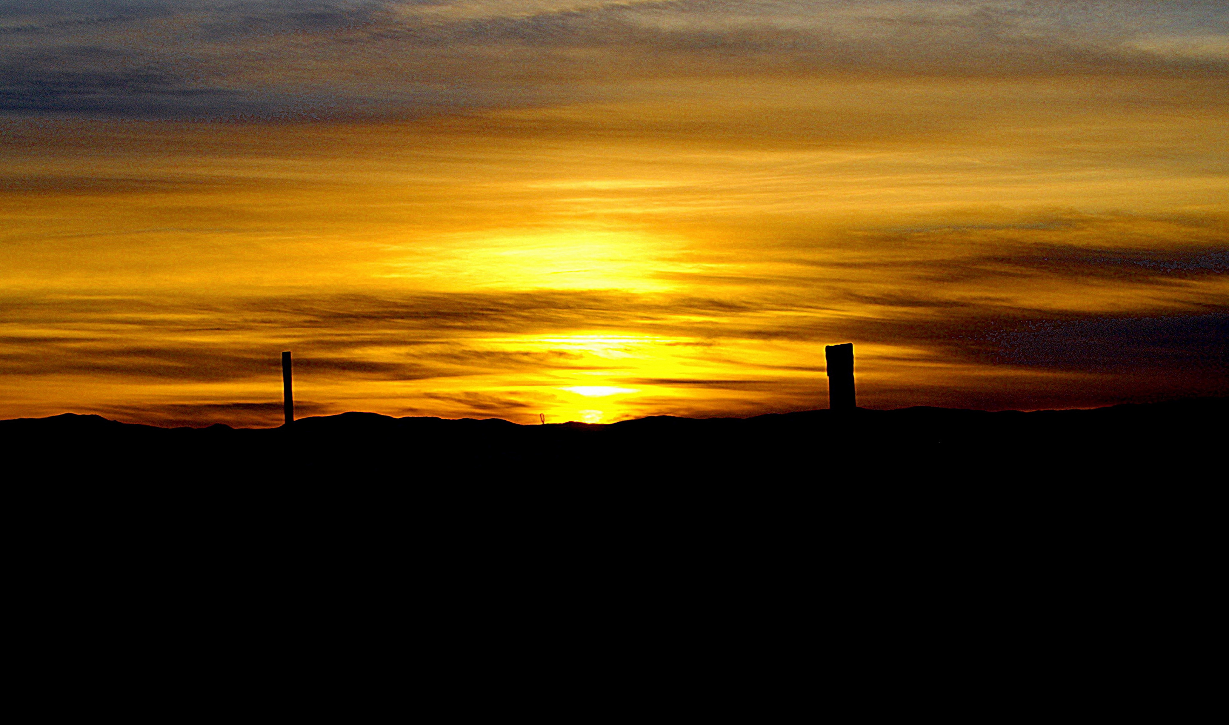
Corning sunset
TELL YA WHAT - #California #SystemofaDown #SunandClouds #SkyHigh #PicoftheDay #MyBest #PopIsFake #FuckIlluminatiPuppets #Worthy #LifeofaGinger #AVikingsWarpath #MovingDay #Moving #Sunny #Sun #PhotoWorthiness #Sunset
Getting The Mood

Trees in Bloom at Sunset
O'B12
country drive
The Shortcut

I-5 South - Exit 633
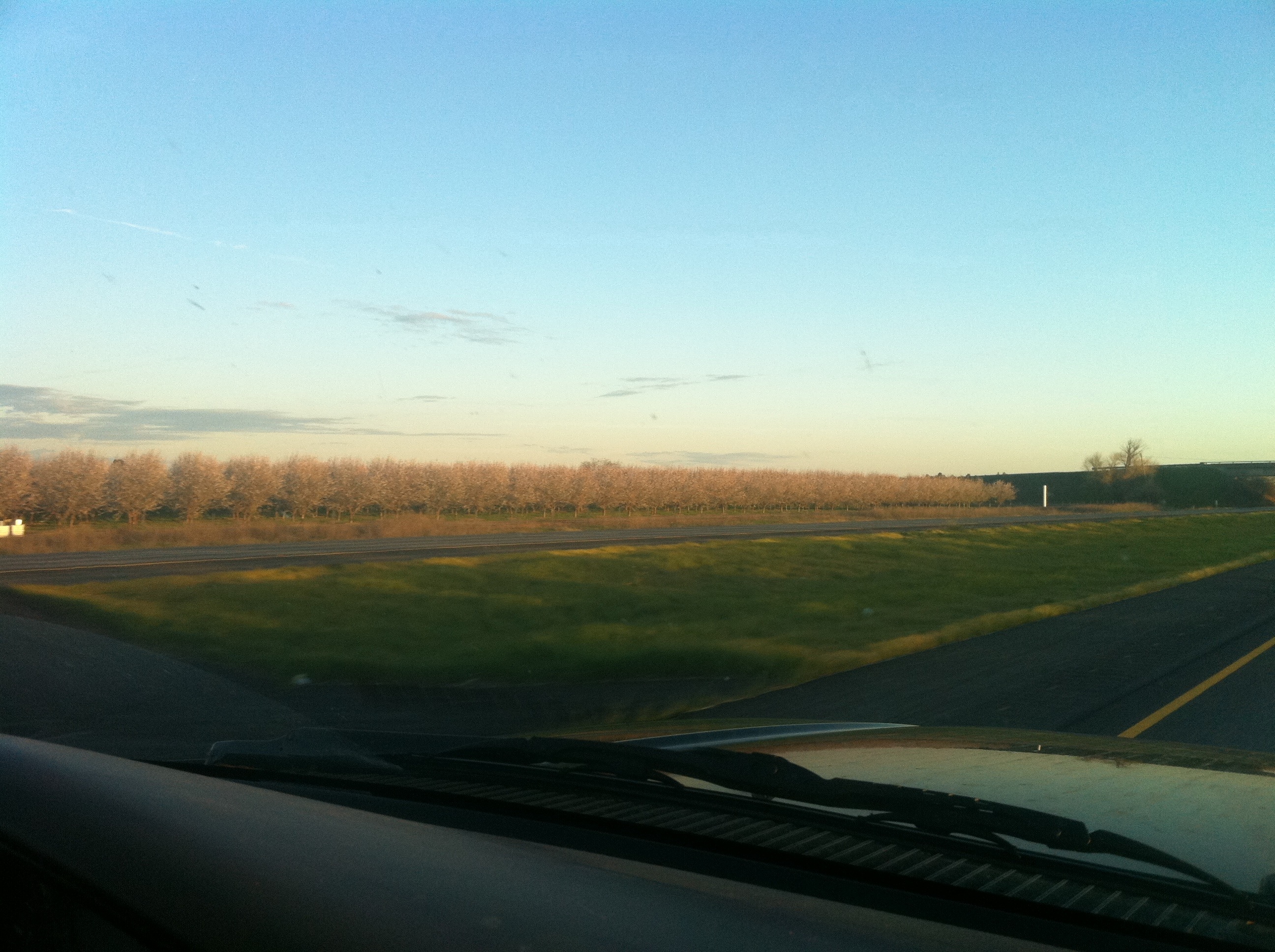
Trees in Bloom
44228 - USA - California - El Camino

Interstate 5 Southbound Glenn Valley Freeway approaching Orland 8 miles and San Francisco 162 miles with this roadside sign located at Glenn County - Orland, California.

Interstate 5 Southbound Tehama Valley Freeway approaches at Exit 636 - Tehama, Los Molinos, Gyle Road to County Route A-11 with this roadside sign located at Tehama County - Corning, California.

Picture A Day #114 - Carnival Ride
Yodelicious took a picture!
O'B (8)
Sacramento River park
O'B
O'B (13)
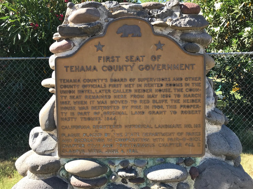
California Historical Landmark #183
California Historical Landmark #183
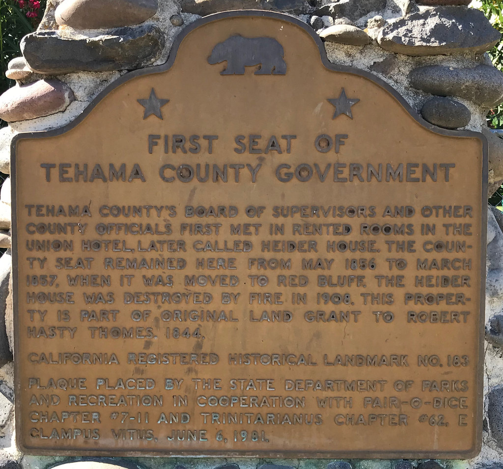
California Historical Landmark #183
20180614-LRC45995
20180614-LRC45993
20180614-LRC45990
20180614-LRC45980
20180614-LRC45960
20180614-LRC45957
Mapa de Dale Rd, Corning, CA, EE. UU.
Buscar otro lugar
Lugares cercanos
Hoag Road, Hoag Rd, Corning, CA, EE. UU.
Mary Ave, Corning, CA, EE. UU.
Mary Ave, Corning, CA, EE. UU.
Illinois Ave, Corning, CA, EE. UU.
Illinois Ave, Corning, CA, EE. UU.
Solano St, Corning, CA, EE. UU.
Corning, California, EE. UU.
Vina, California, EE. UU.
Golden State Hwy, Vina, CA, EE. UU.
McKinley Ave, Corning, CA, EE. UU.
Thomes Creek Rock Co, State Hwy 99w, Corning, CA, EE. UU.
Orland Ave, Corning, CA, EE. UU.
Los Molinos, California, EE. UU.
Tehama, California, EE. UU.
State Hwy 99w, Gerber, CA, EE. UU.
Fox St, Los Molinos, CA, EE. UU.
Ventura Ave, Gerber, CA, EE. UU.
Gerber, California, EE. UU.
Gerber-Las Flores, California, EE. UU.
Los Molinos, California, EE. UU.
Búsquedas recientes
- Horas de salida y puesta de sol de Red Dog Mine, AK, USA
- Horas de salida y puesta de sol de Am Bahnhof, Am bhf, Borken, Germany
- Horas de salida y puesta de sol de 4th St E, Sonoma, CA, EE. UU.
- Horas de salida y puesta de sol de Oakland Ave, Williamsport, PA, EE. UU.
- Horas de salida y puesta de sol de Via Roma, Pieranica CR, Italia
- Horas de salida y puesta de sol de Torre del reloj, Grad, Dubrovnik (Ragusa), Croacia
- Horas de salida y puesta de sol de Trelew, Chubut, Argentina
- Horas de salida y puesta de sol de Hartfords Bluff Cir, Mt Pleasant, SC, EE. UU.
- Horas de salida y puesta de sol de Kita Ward, Kumamoto, Japón
- Horas de salida y puesta de sol de Pingtan Island, Pingtan County, Fuzhou, China