Horas de salida y puesta de sol de Chemin McKendrick, Val-d'Amours, NB E3N 5K6, Canadá
Location: Canadá > Nuevo Brunswick > Restigouche County > Addington > Val-d'Amour >
Zona horaria:
America/Halifax
Hora local:
2025-07-08 02:12:20
Longitud:
-66.6827856
Latitud:
47.9140145
Salida de sol de hoy:
05:37:21 AM
Puesta de sol de hoy:
09:26:31 PM
La duración del día hoy:
15h 49m 10s
Salida de sol de mañana:
05:38:14 AM
Puesta de sol de mañana:
09:25:56 PM
La duración del día mañana:
15h 47m 42s
Mostrar todas las fechas
| Fecha | Salida de sol | Puesta de sol | Duración del día |
|---|---|---|---|
| 01/01/2025 | 08:16:00 AM | 04:45:37 PM | 8h 29m 37s |
| 02/01/2025 | 08:15:54 AM | 04:46:38 PM | 8h 30m 44s |
| 03/01/2025 | 08:15:45 AM | 04:47:41 PM | 8h 31m 56s |
| 04/01/2025 | 08:15:34 AM | 04:48:47 PM | 8h 33m 13s |
| 05/01/2025 | 08:15:19 AM | 04:49:54 PM | 8h 34m 35s |
| 06/01/2025 | 08:15:02 AM | 04:51:03 PM | 8h 36m 1s |
| 07/01/2025 | 08:14:42 AM | 04:52:14 PM | 8h 37m 32s |
| 08/01/2025 | 08:14:19 AM | 04:53:27 PM | 8h 39m 8s |
| 09/01/2025 | 08:13:53 AM | 04:54:42 PM | 8h 40m 49s |
| 10/01/2025 | 08:13:24 AM | 04:55:58 PM | 8h 42m 34s |
| 11/01/2025 | 08:12:53 AM | 04:57:15 PM | 8h 44m 22s |
| 12/01/2025 | 08:12:19 AM | 04:58:35 PM | 8h 46m 16s |
| 13/01/2025 | 08:11:42 AM | 04:59:55 PM | 8h 48m 13s |
| 14/01/2025 | 08:11:03 AM | 05:01:17 PM | 8h 50m 14s |
| 15/01/2025 | 08:10:21 AM | 05:02:41 PM | 8h 52m 20s |
| 16/01/2025 | 08:09:36 AM | 05:04:05 PM | 8h 54m 29s |
| 17/01/2025 | 08:08:49 AM | 05:05:31 PM | 8h 56m 42s |
| 18/01/2025 | 08:07:59 AM | 05:06:57 PM | 8h 58m 58s |
| 19/01/2025 | 08:07:07 AM | 05:08:25 PM | 9h 1m 18s |
| 20/01/2025 | 08:06:12 AM | 05:09:53 PM | 9h 3m 41s |
| 21/01/2025 | 08:05:15 AM | 05:11:23 PM | 9h 6m 8s |
| 22/01/2025 | 08:04:16 AM | 05:12:53 PM | 9h 8m 37s |
| 23/01/2025 | 08:03:14 AM | 05:14:24 PM | 9h 11m 10s |
| 24/01/2025 | 08:02:10 AM | 05:15:56 PM | 9h 13m 46s |
| 25/01/2025 | 08:01:04 AM | 05:17:28 PM | 9h 16m 24s |
| 26/01/2025 | 07:59:56 AM | 05:19:01 PM | 9h 19m 5s |
| 27/01/2025 | 07:58:46 AM | 05:20:34 PM | 9h 21m 48s |
| 28/01/2025 | 07:57:33 AM | 05:22:08 PM | 9h 24m 35s |
| 29/01/2025 | 07:56:19 AM | 05:23:42 PM | 9h 27m 23s |
| 30/01/2025 | 07:55:02 AM | 05:25:16 PM | 9h 30m 14s |
| 31/01/2025 | 07:53:44 AM | 05:26:51 PM | 9h 33m 7s |
| 01/02/2025 | 07:52:23 AM | 05:28:26 PM | 9h 36m 3s |
| 02/02/2025 | 07:51:01 AM | 05:30:02 PM | 9h 39m 1s |
| 03/02/2025 | 07:49:37 AM | 05:31:37 PM | 9h 42m 0s |
| 04/02/2025 | 07:48:12 AM | 05:33:13 PM | 9h 45m 1s |
| 05/02/2025 | 07:46:44 AM | 05:34:48 PM | 9h 48m 4s |
| 06/02/2025 | 07:45:15 AM | 05:36:24 PM | 9h 51m 9s |
| 07/02/2025 | 07:43:45 AM | 05:38:00 PM | 9h 54m 15s |
| 08/02/2025 | 07:42:12 AM | 05:39:36 PM | 9h 57m 24s |
| 09/02/2025 | 07:40:39 AM | 05:41:11 PM | 10h 0m 32s |
| 10/02/2025 | 07:39:03 AM | 05:42:47 PM | 10h 3m 44s |
| 11/02/2025 | 07:37:27 AM | 05:44:23 PM | 10h 6m 56s |
| 12/02/2025 | 07:35:49 AM | 05:45:58 PM | 10h 10m 9s |
| 13/02/2025 | 07:34:09 AM | 05:47:33 PM | 10h 13m 24s |
| 14/02/2025 | 07:32:29 AM | 05:49:08 PM | 10h 16m 39s |
| 15/02/2025 | 07:30:47 AM | 05:50:43 PM | 10h 19m 56s |
| 16/02/2025 | 07:29:03 AM | 05:52:18 PM | 10h 23m 15s |
| 17/02/2025 | 07:27:19 AM | 05:53:53 PM | 10h 26m 34s |
| 18/02/2025 | 07:25:34 AM | 05:55:27 PM | 10h 29m 53s |
| 19/02/2025 | 07:23:47 AM | 05:57:01 PM | 10h 33m 14s |
| 20/02/2025 | 07:21:59 AM | 05:58:35 PM | 10h 36m 36s |
| 21/02/2025 | 07:20:11 AM | 06:00:09 PM | 10h 39m 58s |
| 22/02/2025 | 07:18:21 AM | 06:01:42 PM | 10h 43m 21s |
| 23/02/2025 | 07:16:30 AM | 06:03:16 PM | 10h 46m 46s |
| 24/02/2025 | 07:14:39 AM | 06:04:48 PM | 10h 50m 9s |
| 25/02/2025 | 07:12:46 AM | 06:06:21 PM | 10h 53m 35s |
| 26/02/2025 | 07:10:53 AM | 06:07:53 PM | 10h 57m 0s |
| 27/02/2025 | 07:08:59 AM | 06:09:25 PM | 11h 0m 26s |
| 28/02/2025 | 07:07:04 AM | 06:10:57 PM | 11h 3m 53s |
| 01/03/2025 | 07:05:09 AM | 06:12:29 PM | 11h 7m 20s |
| 02/03/2025 | 07:03:13 AM | 06:14:00 PM | 11h 10m 47s |
| 03/03/2025 | 07:01:16 AM | 06:15:31 PM | 11h 14m 15s |
| 04/03/2025 | 06:59:18 AM | 06:17:01 PM | 11h 17m 43s |
| 05/03/2025 | 06:57:20 AM | 06:18:32 PM | 11h 21m 12s |
| 06/03/2025 | 06:55:22 AM | 06:20:02 PM | 11h 24m 40s |
| 07/03/2025 | 06:53:23 AM | 06:21:32 PM | 11h 28m 9s |
| 08/03/2025 | 06:51:23 AM | 06:23:01 PM | 11h 31m 38s |
| 09/03/2025 | 07:49:28 AM | 07:24:27 PM | 11h 34m 59s |
| 10/03/2025 | 07:47:28 AM | 07:25:56 PM | 11h 38m 28s |
| 11/03/2025 | 07:45:27 AM | 07:27:25 PM | 11h 41m 58s |
| 12/03/2025 | 07:43:26 AM | 07:28:54 PM | 11h 45m 28s |
| 13/03/2025 | 07:41:24 AM | 07:30:22 PM | 11h 48m 58s |
| 14/03/2025 | 07:39:23 AM | 07:31:50 PM | 11h 52m 27s |
| 15/03/2025 | 07:37:21 AM | 07:33:18 PM | 11h 55m 57s |
| 16/03/2025 | 07:35:18 AM | 07:34:46 PM | 11h 59m 28s |
| 17/03/2025 | 07:33:16 AM | 07:36:14 PM | 12h 2m 58s |
| 18/03/2025 | 07:31:13 AM | 07:37:42 PM | 12h 6m 29s |
| 19/03/2025 | 07:29:11 AM | 07:39:09 PM | 12h 9m 58s |
| 20/03/2025 | 07:27:08 AM | 07:40:36 PM | 12h 13m 28s |
| 21/03/2025 | 07:25:05 AM | 07:42:03 PM | 12h 16m 58s |
| 22/03/2025 | 07:23:02 AM | 07:43:30 PM | 12h 20m 28s |
| 23/03/2025 | 07:20:59 AM | 07:44:57 PM | 12h 23m 58s |
| 24/03/2025 | 07:18:56 AM | 07:46:24 PM | 12h 27m 28s |
| 25/03/2025 | 07:16:53 AM | 07:47:50 PM | 12h 30m 57s |
| 26/03/2025 | 07:14:51 AM | 07:49:17 PM | 12h 34m 26s |
| 27/03/2025 | 07:12:48 AM | 07:50:43 PM | 12h 37m 55s |
| 28/03/2025 | 07:10:46 AM | 07:52:10 PM | 12h 41m 24s |
| 29/03/2025 | 07:08:43 AM | 07:53:36 PM | 12h 44m 53s |
| 30/03/2025 | 07:06:41 AM | 07:55:02 PM | 12h 48m 21s |
| 31/03/2025 | 07:04:39 AM | 07:56:28 PM | 12h 51m 49s |
| 01/04/2025 | 07:02:38 AM | 07:57:54 PM | 12h 55m 16s |
| 02/04/2025 | 07:00:37 AM | 07:59:21 PM | 12h 58m 44s |
| 03/04/2025 | 06:58:36 AM | 08:00:47 PM | 13h 2m 11s |
| 04/04/2025 | 06:56:35 AM | 08:02:13 PM | 13h 5m 38s |
| 05/04/2025 | 06:54:35 AM | 08:03:39 PM | 13h 9m 4s |
| 06/04/2025 | 06:52:35 AM | 08:05:05 PM | 13h 12m 30s |
| 07/04/2025 | 06:50:36 AM | 08:06:31 PM | 13h 15m 55s |
| 08/04/2025 | 06:48:37 AM | 08:07:57 PM | 13h 19m 20s |
| 09/04/2025 | 06:46:39 AM | 08:09:23 PM | 13h 22m 44s |
| 10/04/2025 | 06:44:41 AM | 08:10:49 PM | 13h 26m 8s |
| 11/04/2025 | 06:42:44 AM | 08:12:14 PM | 13h 29m 30s |
| 12/04/2025 | 06:40:48 AM | 08:13:40 PM | 13h 32m 52s |
| 13/04/2025 | 06:38:52 AM | 08:15:06 PM | 13h 36m 14s |
| 14/04/2025 | 06:36:57 AM | 08:16:32 PM | 13h 39m 35s |
| 15/04/2025 | 06:35:03 AM | 08:17:58 PM | 13h 42m 55s |
| 16/04/2025 | 06:33:09 AM | 08:19:24 PM | 13h 46m 15s |
| 17/04/2025 | 06:31:17 AM | 08:20:50 PM | 13h 49m 33s |
| 18/04/2025 | 06:29:25 AM | 08:22:16 PM | 13h 52m 51s |
| 19/04/2025 | 06:27:34 AM | 08:23:41 PM | 13h 56m 7s |
| 20/04/2025 | 06:25:44 AM | 08:25:07 PM | 13h 59m 23s |
| 21/04/2025 | 06:23:54 AM | 08:26:33 PM | 14h 2m 39s |
| 22/04/2025 | 06:22:06 AM | 08:27:58 PM | 14h 5m 52s |
| 23/04/2025 | 06:20:19 AM | 08:29:24 PM | 14h 9m 5s |
| 24/04/2025 | 06:18:33 AM | 08:30:49 PM | 14h 12m 16s |
| 25/04/2025 | 06:16:48 AM | 08:32:14 PM | 14h 15m 26s |
| 26/04/2025 | 06:15:04 AM | 08:33:39 PM | 14h 18m 35s |
| 27/04/2025 | 06:13:21 AM | 08:35:04 PM | 14h 21m 43s |
| 28/04/2025 | 06:11:40 AM | 08:36:29 PM | 14h 24m 49s |
| 29/04/2025 | 06:10:00 AM | 08:37:53 PM | 14h 27m 53s |
| 30/04/2025 | 06:08:21 AM | 08:39:18 PM | 14h 30m 57s |
| 01/05/2025 | 06:06:43 AM | 08:40:42 PM | 14h 33m 59s |
| 02/05/2025 | 06:05:07 AM | 08:42:05 PM | 14h 36m 58s |
| 03/05/2025 | 06:03:32 AM | 08:43:29 PM | 14h 39m 57s |
| 04/05/2025 | 06:01:59 AM | 08:44:52 PM | 14h 42m 53s |
| 05/05/2025 | 06:00:27 AM | 08:46:15 PM | 14h 45m 48s |
| 06/05/2025 | 05:58:57 AM | 08:47:37 PM | 14h 48m 40s |
| 07/05/2025 | 05:57:28 AM | 08:48:59 PM | 14h 51m 31s |
| 08/05/2025 | 05:56:01 AM | 08:50:20 PM | 14h 54m 19s |
| 09/05/2025 | 05:54:35 AM | 08:51:41 PM | 14h 57m 6s |
| 10/05/2025 | 05:53:11 AM | 08:53:02 PM | 14h 59m 51s |
| 11/05/2025 | 05:51:49 AM | 08:54:21 PM | 15h 2m 32s |
| 12/05/2025 | 05:50:29 AM | 08:55:41 PM | 15h 5m 12s |
| 13/05/2025 | 05:49:11 AM | 08:56:59 PM | 15h 7m 48s |
| 14/05/2025 | 05:47:54 AM | 08:58:17 PM | 15h 10m 23s |
| 15/05/2025 | 05:46:39 AM | 08:59:34 PM | 15h 12m 55s |
| 16/05/2025 | 05:45:27 AM | 09:00:50 PM | 15h 15m 23s |
| 17/05/2025 | 05:44:16 AM | 09:02:05 PM | 15h 17m 49s |
| 18/05/2025 | 05:43:07 AM | 09:03:19 PM | 15h 20m 12s |
| 19/05/2025 | 05:42:00 AM | 09:04:33 PM | 15h 22m 33s |
| 20/05/2025 | 05:40:56 AM | 09:05:45 PM | 15h 24m 49s |
| 21/05/2025 | 05:39:53 AM | 09:06:56 PM | 15h 27m 3s |
| 22/05/2025 | 05:38:53 AM | 09:08:06 PM | 15h 29m 13s |
| 23/05/2025 | 05:37:55 AM | 09:09:15 PM | 15h 31m 20s |
| 24/05/2025 | 05:36:59 AM | 09:10:23 PM | 15h 33m 24s |
| 25/05/2025 | 05:36:06 AM | 09:11:29 PM | 15h 35m 23s |
| 26/05/2025 | 05:35:15 AM | 09:12:34 PM | 15h 37m 19s |
| 27/05/2025 | 05:34:26 AM | 09:13:38 PM | 15h 39m 12s |
| 28/05/2025 | 05:33:39 AM | 09:14:40 PM | 15h 41m 1s |
| 29/05/2025 | 05:32:55 AM | 09:15:41 PM | 15h 42m 46s |
| 30/05/2025 | 05:32:14 AM | 09:16:40 PM | 15h 44m 26s |
| 31/05/2025 | 05:31:34 AM | 09:17:37 PM | 15h 46m 3s |
| 01/06/2025 | 05:30:58 AM | 09:18:33 PM | 15h 47m 35s |
| 02/06/2025 | 05:30:24 AM | 09:19:27 PM | 15h 49m 3s |
| 03/06/2025 | 05:29:52 AM | 09:20:19 PM | 15h 50m 27s |
| 04/06/2025 | 05:29:23 AM | 09:21:09 PM | 15h 51m 46s |
| 05/06/2025 | 05:28:56 AM | 09:21:57 PM | 15h 53m 1s |
| 06/06/2025 | 05:28:32 AM | 09:22:43 PM | 15h 54m 11s |
| 07/06/2025 | 05:28:11 AM | 09:23:28 PM | 15h 55m 17s |
| 08/06/2025 | 05:27:52 AM | 09:24:10 PM | 15h 56m 18s |
| 09/06/2025 | 05:27:36 AM | 09:24:50 PM | 15h 57m 14s |
| 10/06/2025 | 05:27:23 AM | 09:25:28 PM | 15h 58m 5s |
| 11/06/2025 | 05:27:12 AM | 09:26:03 PM | 15h 58m 51s |
| 12/06/2025 | 05:27:03 AM | 09:26:37 PM | 15h 59m 34s |
| 13/06/2025 | 05:26:58 AM | 09:27:08 PM | 16h 0m 10s |
| 14/06/2025 | 05:26:55 AM | 09:27:36 PM | 16h 0m 41s |
| 15/06/2025 | 05:26:54 AM | 09:28:03 PM | 16h 1m 9s |
| 16/06/2025 | 05:26:56 AM | 09:28:26 PM | 16h 1m 30s |
| 17/06/2025 | 05:27:01 AM | 09:28:48 PM | 16h 1m 47s |
| 18/06/2025 | 05:27:08 AM | 09:29:07 PM | 16h 1m 59s |
| 19/06/2025 | 05:27:18 AM | 09:29:23 PM | 16h 2m 5s |
| 20/06/2025 | 05:27:30 AM | 09:29:37 PM | 16h 2m 7s |
| 21/06/2025 | 05:27:45 AM | 09:29:48 PM | 16h 2m 3s |
| 22/06/2025 | 05:28:03 AM | 09:29:57 PM | 16h 1m 54s |
| 23/06/2025 | 05:28:22 AM | 09:30:03 PM | 16h 1m 41s |
| 24/06/2025 | 05:28:44 AM | 09:30:06 PM | 16h 1m 22s |
| 25/06/2025 | 05:29:09 AM | 09:30:07 PM | 16h 0m 58s |
| 26/06/2025 | 05:29:36 AM | 09:30:05 PM | 16h 0m 29s |
| 27/06/2025 | 05:30:05 AM | 09:30:01 PM | 15h 59m 56s |
| 28/06/2025 | 05:30:37 AM | 09:29:53 PM | 15h 59m 16s |
| 29/06/2025 | 05:31:10 AM | 09:29:43 PM | 15h 58m 33s |
| 30/06/2025 | 05:31:46 AM | 09:29:31 PM | 15h 57m 45s |
| 01/07/2025 | 05:32:24 AM | 09:29:16 PM | 15h 56m 52s |
| 02/07/2025 | 05:33:04 AM | 09:28:58 PM | 15h 55m 54s |
| 03/07/2025 | 05:33:46 AM | 09:28:37 PM | 15h 54m 51s |
| 04/07/2025 | 05:34:30 AM | 09:28:14 PM | 15h 53m 44s |
| 05/07/2025 | 05:35:16 AM | 09:27:48 PM | 15h 52m 32s |
| 06/07/2025 | 05:36:04 AM | 09:27:20 PM | 15h 51m 16s |
| 07/07/2025 | 05:36:54 AM | 09:26:49 PM | 15h 49m 55s |
| 08/07/2025 | 05:37:45 AM | 09:26:15 PM | 15h 48m 30s |
| 09/07/2025 | 05:38:38 AM | 09:25:39 PM | 15h 47m 1s |
| 10/07/2025 | 05:39:33 AM | 09:25:01 PM | 15h 45m 28s |
| 11/07/2025 | 05:40:30 AM | 09:24:20 PM | 15h 43m 50s |
| 12/07/2025 | 05:41:28 AM | 09:23:36 PM | 15h 42m 8s |
| 13/07/2025 | 05:42:27 AM | 09:22:50 PM | 15h 40m 23s |
| 14/07/2025 | 05:43:28 AM | 09:22:02 PM | 15h 38m 34s |
| 15/07/2025 | 05:44:30 AM | 09:21:11 PM | 15h 36m 41s |
| 16/07/2025 | 05:45:34 AM | 09:20:18 PM | 15h 34m 44s |
| 17/07/2025 | 05:46:38 AM | 09:19:22 PM | 15h 32m 44s |
| 18/07/2025 | 05:47:44 AM | 09:18:24 PM | 15h 30m 40s |
| 19/07/2025 | 05:48:51 AM | 09:17:24 PM | 15h 28m 33s |
| 20/07/2025 | 05:50:00 AM | 09:16:22 PM | 15h 26m 22s |
| 21/07/2025 | 05:51:09 AM | 09:15:18 PM | 15h 24m 9s |
| 22/07/2025 | 05:52:19 AM | 09:14:11 PM | 15h 21m 52s |
| 23/07/2025 | 05:53:30 AM | 09:13:02 PM | 15h 19m 32s |
| 24/07/2025 | 05:54:42 AM | 09:11:52 PM | 15h 17m 10s |
| 25/07/2025 | 05:55:55 AM | 09:10:39 PM | 15h 14m 44s |
| 26/07/2025 | 05:57:09 AM | 09:09:24 PM | 15h 12m 15s |
| 27/07/2025 | 05:58:23 AM | 09:08:08 PM | 15h 9m 45s |
| 28/07/2025 | 05:59:38 AM | 09:06:49 PM | 15h 7m 11s |
| 29/07/2025 | 06:00:54 AM | 09:05:29 PM | 15h 4m 35s |
| 30/07/2025 | 06:02:10 AM | 09:04:07 PM | 15h 1m 57s |
| 31/07/2025 | 06:03:27 AM | 09:02:43 PM | 14h 59m 16s |
| 01/08/2025 | 06:04:44 AM | 09:01:17 PM | 14h 56m 33s |
| 02/08/2025 | 06:06:02 AM | 08:59:50 PM | 14h 53m 48s |
| 03/08/2025 | 06:07:20 AM | 08:58:21 PM | 14h 51m 1s |
| 04/08/2025 | 06:08:39 AM | 08:56:50 PM | 14h 48m 11s |
| 05/08/2025 | 06:09:58 AM | 08:55:18 PM | 14h 45m 20s |
| 06/08/2025 | 06:11:17 AM | 08:53:44 PM | 14h 42m 27s |
| 07/08/2025 | 06:12:37 AM | 08:52:09 PM | 14h 39m 32s |
| 08/08/2025 | 06:13:57 AM | 08:50:33 PM | 14h 36m 36s |
| 09/08/2025 | 06:15:17 AM | 08:48:55 PM | 14h 33m 38s |
| 10/08/2025 | 06:16:37 AM | 08:47:15 PM | 14h 30m 38s |
| 11/08/2025 | 06:17:58 AM | 08:45:35 PM | 14h 27m 37s |
| 12/08/2025 | 06:19:18 AM | 08:43:53 PM | 14h 24m 35s |
| 13/08/2025 | 06:20:39 AM | 08:42:10 PM | 14h 21m 31s |
| 14/08/2025 | 06:22:00 AM | 08:40:25 PM | 14h 18m 25s |
| 15/08/2025 | 06:23:21 AM | 08:38:40 PM | 14h 15m 19s |
| 16/08/2025 | 06:24:42 AM | 08:36:53 PM | 14h 12m 11s |
| 17/08/2025 | 06:26:04 AM | 08:35:05 PM | 14h 9m 1s |
| 18/08/2025 | 06:27:25 AM | 08:33:16 PM | 14h 5m 51s |
| 19/08/2025 | 06:28:46 AM | 08:31:26 PM | 14h 2m 40s |
| 20/08/2025 | 06:30:08 AM | 08:29:36 PM | 13h 59m 28s |
| 21/08/2025 | 06:31:29 AM | 08:27:44 PM | 13h 56m 15s |
| 22/08/2025 | 06:32:51 AM | 08:25:51 PM | 13h 53m 0s |
| 23/08/2025 | 06:34:12 AM | 08:23:58 PM | 13h 49m 46s |
| 24/08/2025 | 06:35:33 AM | 08:22:03 PM | 13h 46m 30s |
| 25/08/2025 | 06:36:55 AM | 08:20:08 PM | 13h 43m 13s |
| 26/08/2025 | 06:38:16 AM | 08:18:12 PM | 13h 39m 56s |
| 27/08/2025 | 06:39:38 AM | 08:16:16 PM | 13h 36m 38s |
| 28/08/2025 | 06:40:59 AM | 08:14:18 PM | 13h 33m 19s |
| 29/08/2025 | 06:42:20 AM | 08:12:20 PM | 13h 30m 0s |
| 30/08/2025 | 06:43:42 AM | 08:10:21 PM | 13h 26m 39s |
| 31/08/2025 | 06:45:03 AM | 08:08:22 PM | 13h 23m 19s |
| 01/09/2025 | 06:46:24 AM | 08:06:22 PM | 13h 19m 58s |
| 02/09/2025 | 06:47:46 AM | 08:04:22 PM | 13h 16m 36s |
| 03/09/2025 | 06:49:07 AM | 08:02:21 PM | 13h 13m 14s |
| 04/09/2025 | 06:50:28 AM | 08:00:20 PM | 13h 9m 52s |
| 05/09/2025 | 06:51:49 AM | 07:58:18 PM | 13h 6m 29s |
| 06/09/2025 | 06:53:11 AM | 07:56:16 PM | 13h 3m 5s |
| 07/09/2025 | 06:54:32 AM | 07:54:13 PM | 12h 59m 41s |
| 08/09/2025 | 06:55:53 AM | 07:52:11 PM | 12h 56m 18s |
| 09/09/2025 | 06:57:14 AM | 07:50:07 PM | 12h 52m 53s |
| 10/09/2025 | 06:58:36 AM | 07:48:04 PM | 12h 49m 28s |
| 11/09/2025 | 06:59:57 AM | 07:46:00 PM | 12h 46m 3s |
| 12/09/2025 | 07:01:18 AM | 07:43:56 PM | 12h 42m 38s |
| 13/09/2025 | 07:02:40 AM | 07:41:52 PM | 12h 39m 12s |
| 14/09/2025 | 07:04:01 AM | 07:39:48 PM | 12h 35m 47s |
| 15/09/2025 | 07:05:23 AM | 07:37:43 PM | 12h 32m 20s |
| 16/09/2025 | 07:06:44 AM | 07:35:39 PM | 12h 28m 55s |
| 17/09/2025 | 07:08:06 AM | 07:33:34 PM | 12h 25m 28s |
| 18/09/2025 | 07:09:28 AM | 07:31:29 PM | 12h 22m 1s |
| 19/09/2025 | 07:10:50 AM | 07:29:25 PM | 12h 18m 35s |
| 20/09/2025 | 07:12:12 AM | 07:27:20 PM | 12h 15m 8s |
| 21/09/2025 | 07:13:34 AM | 07:25:16 PM | 12h 11m 42s |
| 22/09/2025 | 07:14:56 AM | 07:23:11 PM | 12h 8m 15s |
| 23/09/2025 | 07:16:19 AM | 07:21:07 PM | 12h 4m 48s |
| 24/09/2025 | 07:17:42 AM | 07:19:02 PM | 12h 1m 20s |
| 25/09/2025 | 07:19:04 AM | 07:16:58 PM | 11h 57m 54s |
| 26/09/2025 | 07:20:27 AM | 07:14:54 PM | 11h 54m 27s |
| 27/09/2025 | 07:21:51 AM | 07:12:51 PM | 11h 51m 0s |
| 28/09/2025 | 07:23:14 AM | 07:10:47 PM | 11h 47m 33s |
| 29/09/2025 | 07:24:38 AM | 07:08:44 PM | 11h 44m 6s |
| 30/09/2025 | 07:26:01 AM | 07:06:42 PM | 11h 40m 41s |
| 01/10/2025 | 07:27:25 AM | 07:04:39 PM | 11h 37m 14s |
| 02/10/2025 | 07:28:50 AM | 07:02:37 PM | 11h 33m 47s |
| 03/10/2025 | 07:30:14 AM | 07:00:36 PM | 11h 30m 22s |
| 04/10/2025 | 07:31:39 AM | 06:58:34 PM | 11h 26m 55s |
| 05/10/2025 | 07:33:04 AM | 06:56:34 PM | 11h 23m 30s |
| 06/10/2025 | 07:34:30 AM | 06:54:34 PM | 11h 20m 4s |
| 07/10/2025 | 07:35:55 AM | 06:52:34 PM | 11h 16m 39s |
| 08/10/2025 | 07:37:21 AM | 06:50:35 PM | 11h 13m 14s |
| 09/10/2025 | 07:38:47 AM | 06:48:37 PM | 11h 9m 50s |
| 10/10/2025 | 07:40:14 AM | 06:46:39 PM | 11h 6m 25s |
| 11/10/2025 | 07:41:41 AM | 06:44:42 PM | 11h 3m 1s |
| 12/10/2025 | 07:43:08 AM | 06:42:45 PM | 10h 59m 37s |
| 13/10/2025 | 07:44:35 AM | 06:40:50 PM | 10h 56m 15s |
| 14/10/2025 | 07:46:03 AM | 06:38:55 PM | 10h 52m 52s |
| 15/10/2025 | 07:47:31 AM | 06:37:01 PM | 10h 49m 30s |
| 16/10/2025 | 07:48:59 AM | 06:35:08 PM | 10h 46m 9s |
| 17/10/2025 | 07:50:28 AM | 06:33:16 PM | 10h 42m 48s |
| 18/10/2025 | 07:51:57 AM | 06:31:24 PM | 10h 39m 27s |
| 19/10/2025 | 07:53:26 AM | 06:29:34 PM | 10h 36m 8s |
| 20/10/2025 | 07:54:55 AM | 06:27:45 PM | 10h 32m 50s |
| 21/10/2025 | 07:56:25 AM | 06:25:57 PM | 10h 29m 32s |
| 22/10/2025 | 07:57:55 AM | 06:24:10 PM | 10h 26m 15s |
| 23/10/2025 | 07:59:25 AM | 06:22:24 PM | 10h 22m 59s |
| 24/10/2025 | 08:00:56 AM | 06:20:39 PM | 10h 19m 43s |
| 25/10/2025 | 08:02:27 AM | 06:18:55 PM | 10h 16m 28s |
| 26/10/2025 | 08:03:58 AM | 06:17:13 PM | 10h 13m 15s |
| 27/10/2025 | 08:05:29 AM | 06:15:32 PM | 10h 10m 3s |
| 28/10/2025 | 08:07:00 AM | 06:13:52 PM | 10h 6m 52s |
| 29/10/2025 | 08:08:32 AM | 06:12:14 PM | 10h 3m 42s |
| 30/10/2025 | 08:10:03 AM | 06:10:37 PM | 10h 0m 34s |
| 31/10/2025 | 08:11:35 AM | 06:09:01 PM | 9h 57m 26s |
| 01/11/2025 | 08:13:07 AM | 06:07:27 PM | 9h 54m 20s |
| 02/11/2025 | 07:14:43 AM | 05:05:51 PM | 9h 51m 8s |
| 03/11/2025 | 07:16:15 AM | 05:04:20 PM | 9h 48m 5s |
| 04/11/2025 | 07:17:46 AM | 05:02:51 PM | 9h 45m 5s |
| 05/11/2025 | 07:19:18 AM | 05:01:24 PM | 9h 42m 6s |
| 06/11/2025 | 07:20:50 AM | 04:59:58 PM | 9h 39m 8s |
| 07/11/2025 | 07:22:22 AM | 04:58:34 PM | 9h 36m 12s |
| 08/11/2025 | 07:23:54 AM | 04:57:12 PM | 9h 33m 18s |
| 09/11/2025 | 07:25:25 AM | 04:55:52 PM | 9h 30m 27s |
| 10/11/2025 | 07:26:56 AM | 04:54:34 PM | 9h 27m 38s |
| 11/11/2025 | 07:28:27 AM | 04:53:18 PM | 9h 24m 51s |
| 12/11/2025 | 07:29:58 AM | 04:52:03 PM | 9h 22m 5s |
| 13/11/2025 | 07:31:28 AM | 04:50:51 PM | 9h 19m 23s |
| 14/11/2025 | 07:32:58 AM | 04:49:41 PM | 9h 16m 43s |
| 15/11/2025 | 07:34:27 AM | 04:48:33 PM | 9h 14m 6s |
| 16/11/2025 | 07:35:56 AM | 04:47:28 PM | 9h 11m 32s |
| 17/11/2025 | 07:37:24 AM | 04:46:24 PM | 9h 9m 0s |
| 18/11/2025 | 07:38:52 AM | 04:45:23 PM | 9h 6m 31s |
| 19/11/2025 | 07:40:19 AM | 04:44:24 PM | 9h 4m 5s |
| 20/11/2025 | 07:41:45 AM | 04:43:28 PM | 9h 1m 43s |
| 21/11/2025 | 07:43:10 AM | 04:42:34 PM | 8h 59m 24s |
| 22/11/2025 | 07:44:35 AM | 04:41:42 PM | 8h 57m 7s |
| 23/11/2025 | 07:45:58 AM | 04:40:53 PM | 8h 54m 55s |
| 24/11/2025 | 07:47:21 AM | 04:40:07 PM | 8h 52m 46s |
| 25/11/2025 | 07:48:42 AM | 04:39:23 PM | 8h 50m 41s |
| 26/11/2025 | 07:50:02 AM | 04:38:41 PM | 8h 48m 39s |
| 27/11/2025 | 07:51:21 AM | 04:38:03 PM | 8h 46m 42s |
| 28/11/2025 | 07:52:39 AM | 04:37:27 PM | 8h 44m 48s |
| 29/11/2025 | 07:53:55 AM | 04:36:54 PM | 8h 42m 59s |
| 30/11/2025 | 07:55:10 AM | 04:36:23 PM | 8h 41m 13s |
| 01/12/2025 | 07:56:23 AM | 04:35:56 PM | 8h 39m 33s |
| 02/12/2025 | 07:57:35 AM | 04:35:31 PM | 8h 37m 56s |
| 03/12/2025 | 07:58:45 AM | 04:35:09 PM | 8h 36m 24s |
| 04/12/2025 | 07:59:54 AM | 04:34:50 PM | 8h 34m 56s |
| 05/12/2025 | 08:01:00 AM | 04:34:34 PM | 8h 33m 34s |
| 06/12/2025 | 08:02:05 AM | 04:34:21 PM | 8h 32m 16s |
| 07/12/2025 | 08:03:07 AM | 04:34:10 PM | 8h 31m 3s |
| 08/12/2025 | 08:04:08 AM | 04:34:03 PM | 8h 29m 55s |
| 09/12/2025 | 08:05:07 AM | 04:33:58 PM | 8h 28m 51s |
| 10/12/2025 | 08:06:03 AM | 04:33:57 PM | 8h 27m 54s |
| 11/12/2025 | 08:06:57 AM | 04:33:58 PM | 8h 27m 1s |
| 12/12/2025 | 08:07:49 AM | 04:34:03 PM | 8h 26m 14s |
| 13/12/2025 | 08:08:39 AM | 04:34:10 PM | 8h 25m 31s |
| 14/12/2025 | 08:09:26 AM | 04:34:20 PM | 8h 24m 54s |
| 15/12/2025 | 08:10:11 AM | 04:34:34 PM | 8h 24m 23s |
| 16/12/2025 | 08:10:54 AM | 04:34:50 PM | 8h 23m 56s |
| 17/12/2025 | 08:11:33 AM | 04:35:09 PM | 8h 23m 36s |
| 18/12/2025 | 08:12:11 AM | 04:35:31 PM | 8h 23m 20s |
| 19/12/2025 | 08:12:45 AM | 04:35:56 PM | 8h 23m 11s |
| 20/12/2025 | 08:13:17 AM | 04:36:23 PM | 8h 23m 6s |
| 21/12/2025 | 08:13:46 AM | 04:36:54 PM | 8h 23m 8s |
| 22/12/2025 | 08:14:13 AM | 04:37:27 PM | 8h 23m 14s |
| 23/12/2025 | 08:14:36 AM | 04:38:03 PM | 8h 23m 27s |
| 24/12/2025 | 08:14:57 AM | 04:38:42 PM | 8h 23m 45s |
| 25/12/2025 | 08:15:15 AM | 04:39:23 PM | 8h 24m 8s |
| 26/12/2025 | 08:15:30 AM | 04:40:07 PM | 8h 24m 37s |
| 27/12/2025 | 08:15:43 AM | 04:40:53 PM | 8h 25m 10s |
| 28/12/2025 | 08:15:52 AM | 04:41:42 PM | 8h 25m 50s |
| 29/12/2025 | 08:15:59 AM | 04:42:34 PM | 8h 26m 35s |
| 30/12/2025 | 08:16:02 AM | 04:43:28 PM | 8h 27m 26s |
| 31/12/2025 | 08:16:03 AM | 04:44:24 PM | 8h 28m 21s |
Fotos
First and last sunlight of the day
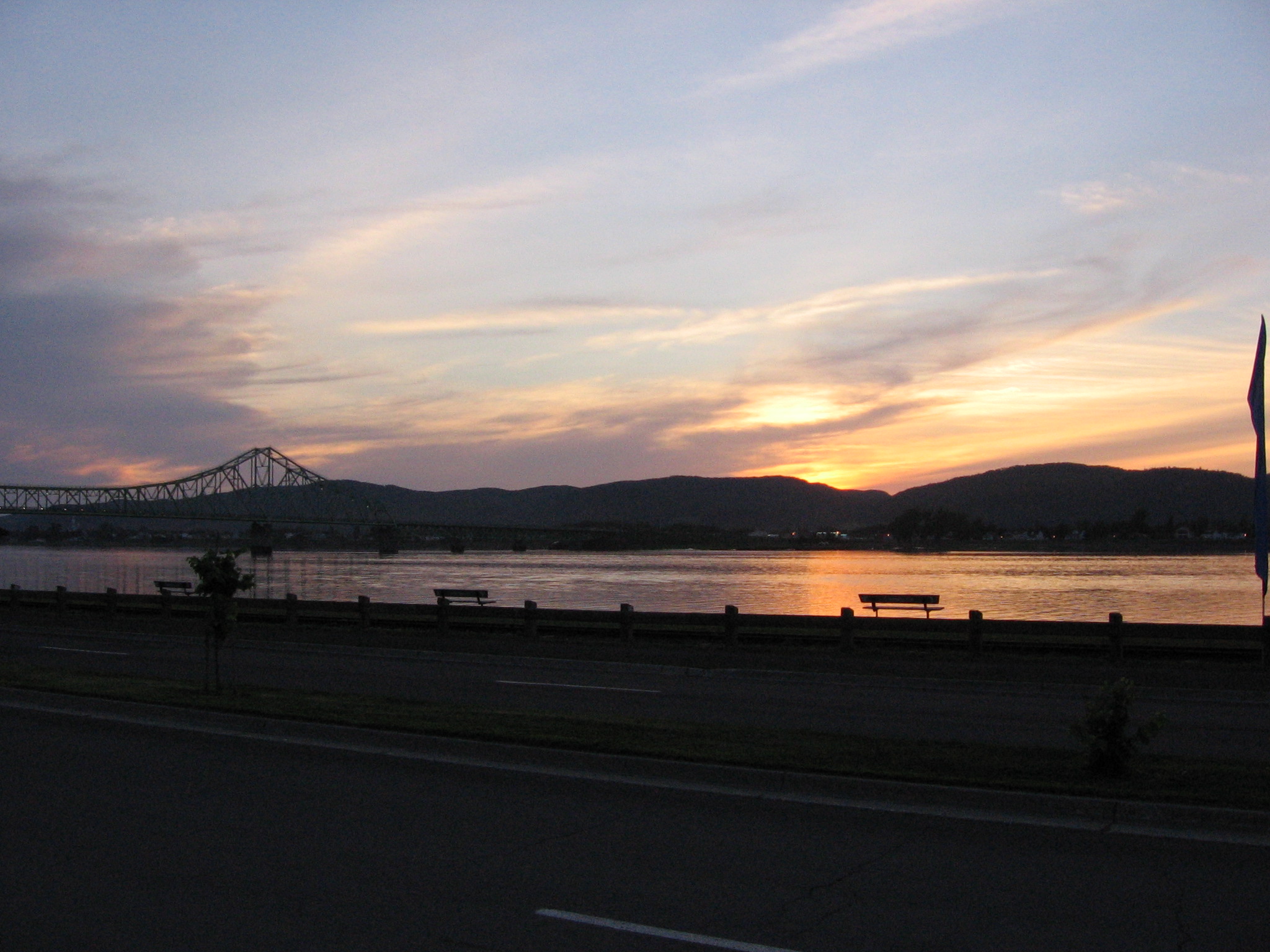
Campbellton sunset

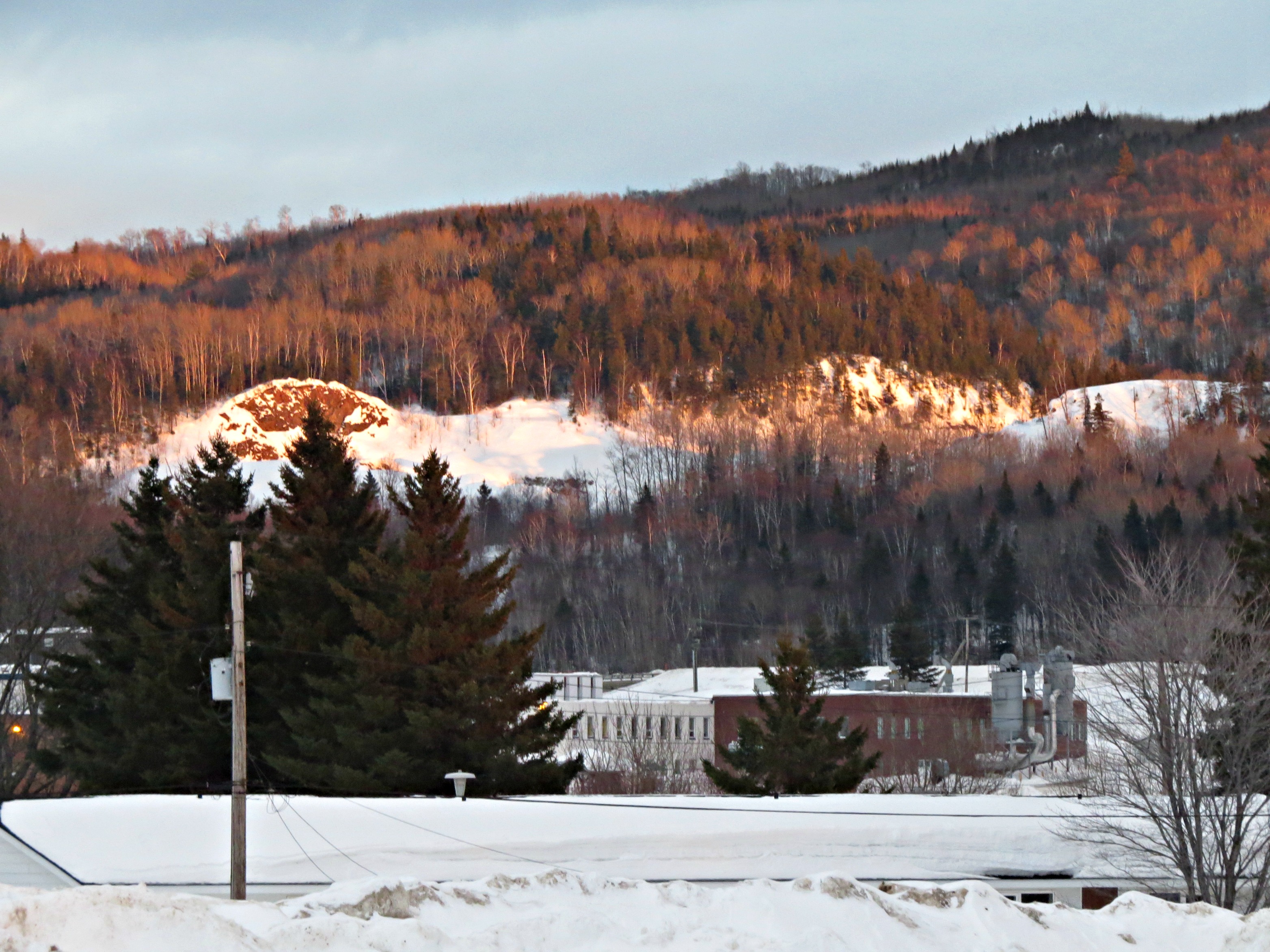
IMG_3831 Mont Sugarloaf Campbellton, N.B.

Pointe-à-la-Croix, Quebec

Restigouche River

TROISIÈME DES CHUTES À NORMAND

LA DEUXIÈME CHUTE À NORMAND

LA PREMIÈRE CHUTE À NORMAND

Road food - the ride home, 2018

Canada, au Québec, le viaduc Van Horne Bridge sur la Rivière Restigouche

World's Largest Atlantic Salmon
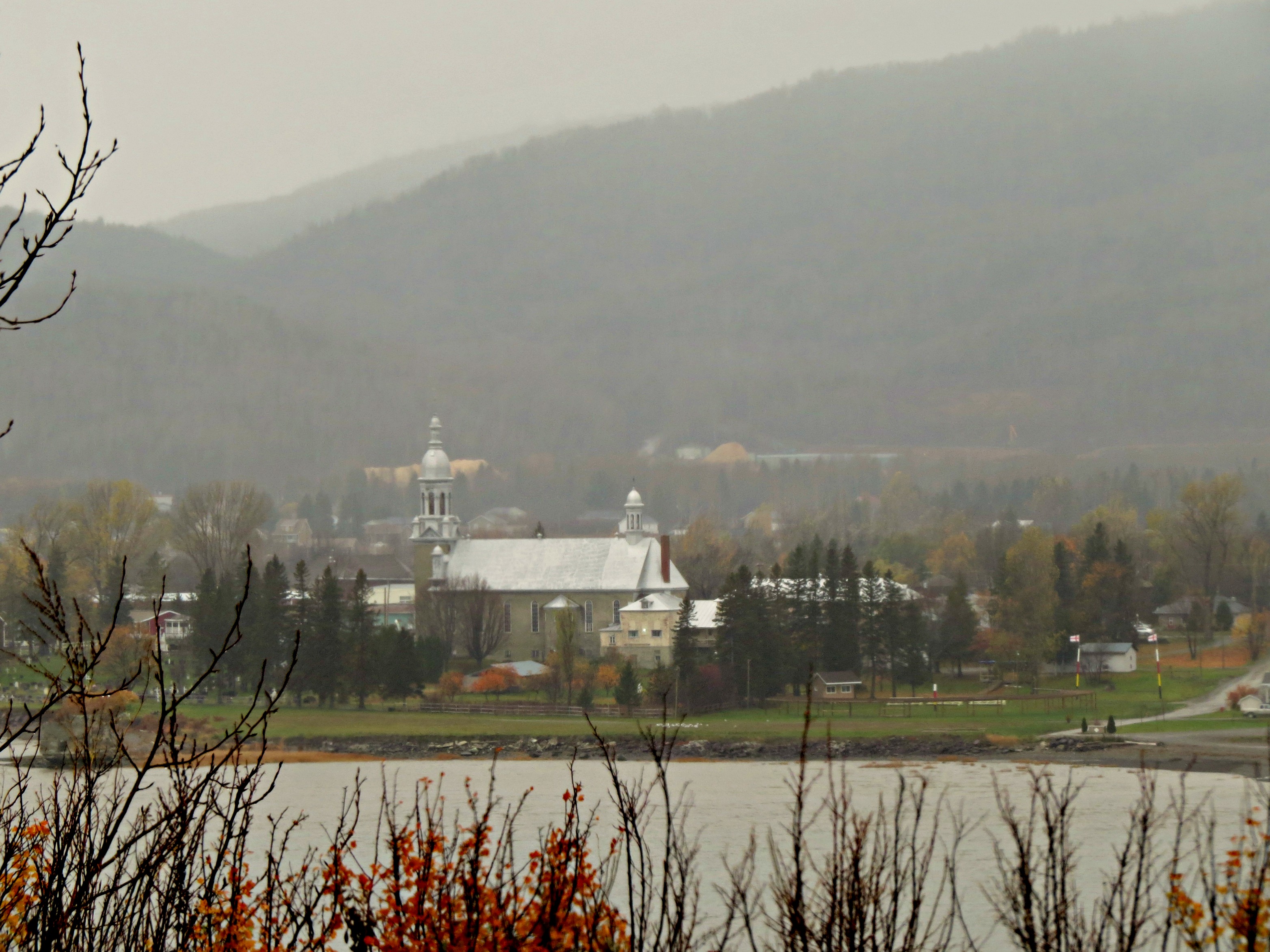
Rain and mist over the mountains and Church across the Restigouche River in Listuguj, Quebec from Atholville, New Brunswick

IMG_6375 Les prés, Pointe-à-la-Croix

IMG_6241 Bord de mer à Baie au Chêne, Pointe-à-la-Croix

IMG_6240 Les prés de Baie au Chêne, Pointe-à-la-Croix

IMG_5886 Vue sur les prés, Pointe-à-la-Croix

Andrew & Salmon; Stop / Arrêt

QUATRIÈME DES CHUTES À NORMAND

Canada, au Québec, reste de la frégate Machault au Musée Historique National

IMG_6369 Cheval libre, Pointe-à-la-Croix

IMG_6368 paysage, Pointe-à-la-Croix

IMG_6361 Paysage, Pointe-à-la-Croix

Arriving at Auberge de la Vallee

Towards a crossing
Mapa de Chemin McKendrick, Val-d'Amours, NB E3N 5K6, Canadá
Buscar otro lugar
Lugares cercanos
Chemin McKendrick, Val-d'Amours, NB E3N 5K6, Canadá
McKendrick, NB E3N 5E4, Canadá
Val-d'Amour, NB E3N, Canadá
Sugarloaf Provincial Park, Chemin Val d’Amour, Atholville, NB E3N 4C9, Canadá
25 Savoie Ave, Atholville, NB E3N 4A8, Canadá
Saint-Arthur, NB E3N, Canadá
Atholville, NB, Canadá
Sugarloaf Senior High School, Dover St, Campbellton, NB E3N 1R3, Canadá
Campbellton, NB E3N 2K4, Canadá
12 Comeau Ave, Atholville, NB E3N 4G1, Canadá
Campbellton, NB, Canadá
NB-, Saint-Arthur, NB E3N 5S4, Canadá
King Street, King St, Campbellton, NB E3N, Canadá
Pointe-à-la-Croix, QC, Canadá
Babcock St E, Tide Head, NB E3N 4K9, Canadá
88 Riverside Rd, Tide Head, NB E3N 4G7, Canadá
82 Riverside Rd, Tide Head, NB E3N 4G7, Canadá
Tide Head, NB, Canadá
Pointe-à-la-Croix, QC, Canadá
Glen Levit, NB E3N 5A1, Canadá
Búsquedas recientes
- Horas de salida y puesta de sol de Red Dog Mine, AK, USA
- Horas de salida y puesta de sol de Am Bahnhof, Am bhf, Borken, Germany
- Horas de salida y puesta de sol de 4th St E, Sonoma, CA, EE. UU.
- Horas de salida y puesta de sol de Oakland Ave, Williamsport, PA, EE. UU.
- Horas de salida y puesta de sol de Via Roma, Pieranica CR, Italia
- Horas de salida y puesta de sol de Torre del reloj, Grad, Dubrovnik (Ragusa), Croacia
- Horas de salida y puesta de sol de Trelew, Chubut, Argentina
- Horas de salida y puesta de sol de Hartfords Bluff Cir, Mt Pleasant, SC, EE. UU.
- Horas de salida y puesta de sol de Kita Ward, Kumamoto, Japón
- Horas de salida y puesta de sol de Pingtan Island, Pingtan County, Fuzhou, China