Horas de salida y puesta de sol de Capon Bridge, Virginia Occidental, EE. UU.
Location: Estados Unidos > Virginia Occidental > Condado de Hampshire > Capon Bridge >
Zona horaria:
America/New_York
Hora local:
2025-06-21 08:13:37
Longitud:
-78.4069732
Latitud:
39.3394916
Salida de sol de hoy:
05:47:13 AM
Puesta de sol de hoy:
08:43:57 PM
La duración del día hoy:
14h 56m 44s
Salida de sol de mañana:
05:47:29 AM
Puesta de sol de mañana:
08:44:07 PM
La duración del día mañana:
14h 56m 38s
Mostrar todas las fechas
| Fecha | Salida de sol | Puesta de sol | Duración del día |
|---|---|---|---|
| 01/01/2025 | 07:33:33 AM | 05:01:56 PM | 9h 28m 23s |
| 02/01/2025 | 07:33:37 AM | 05:02:47 PM | 9h 29m 10s |
| 03/01/2025 | 07:33:39 AM | 05:03:39 PM | 9h 30m 0s |
| 04/01/2025 | 07:33:39 AM | 05:04:33 PM | 9h 30m 54s |
| 05/01/2025 | 07:33:36 AM | 05:05:29 PM | 9h 31m 53s |
| 06/01/2025 | 07:33:31 AM | 05:06:25 PM | 9h 32m 54s |
| 07/01/2025 | 07:33:25 AM | 05:07:23 PM | 9h 33m 58s |
| 08/01/2025 | 07:33:16 AM | 05:08:21 PM | 9h 35m 5s |
| 09/01/2025 | 07:33:04 AM | 05:09:21 PM | 9h 36m 17s |
| 10/01/2025 | 07:32:51 AM | 05:10:22 PM | 9h 37m 31s |
| 11/01/2025 | 07:32:36 AM | 05:11:24 PM | 9h 38m 48s |
| 12/01/2025 | 07:32:18 AM | 05:12:26 PM | 9h 40m 8s |
| 13/01/2025 | 07:31:58 AM | 05:13:30 PM | 9h 41m 32s |
| 14/01/2025 | 07:31:36 AM | 05:14:34 PM | 9h 42m 58s |
| 15/01/2025 | 07:31:12 AM | 05:15:39 PM | 9h 44m 27s |
| 16/01/2025 | 07:30:46 AM | 05:16:45 PM | 9h 45m 59s |
| 17/01/2025 | 07:30:18 AM | 05:17:51 PM | 9h 47m 33s |
| 18/01/2025 | 07:29:48 AM | 05:18:58 PM | 9h 49m 10s |
| 19/01/2025 | 07:29:16 AM | 05:20:06 PM | 9h 50m 50s |
| 20/01/2025 | 07:28:42 AM | 05:21:14 PM | 9h 52m 32s |
| 21/01/2025 | 07:28:06 AM | 05:22:22 PM | 9h 54m 16s |
| 22/01/2025 | 07:27:27 AM | 05:23:31 PM | 9h 56m 4s |
| 23/01/2025 | 07:26:47 AM | 05:24:40 PM | 9h 57m 53s |
| 24/01/2025 | 07:26:06 AM | 05:25:50 PM | 9h 59m 44s |
| 25/01/2025 | 07:25:22 AM | 05:27:00 PM | 10h 1m 38s |
| 26/01/2025 | 07:24:36 AM | 05:28:10 PM | 10h 3m 34s |
| 27/01/2025 | 07:23:49 AM | 05:29:20 PM | 10h 5m 31s |
| 28/01/2025 | 07:23:00 AM | 05:30:30 PM | 10h 7m 30s |
| 29/01/2025 | 07:22:09 AM | 05:31:41 PM | 10h 9m 32s |
| 30/01/2025 | 07:21:16 AM | 05:32:52 PM | 10h 11m 36s |
| 31/01/2025 | 07:20:22 AM | 05:34:02 PM | 10h 13m 40s |
| 01/02/2025 | 07:19:26 AM | 05:35:13 PM | 10h 15m 47s |
| 02/02/2025 | 07:18:28 AM | 05:36:23 PM | 10h 17m 55s |
| 03/02/2025 | 07:17:29 AM | 05:37:34 PM | 10h 20m 5s |
| 04/02/2025 | 07:16:28 AM | 05:38:45 PM | 10h 22m 17s |
| 05/02/2025 | 07:15:26 AM | 05:39:55 PM | 10h 24m 29s |
| 06/02/2025 | 07:14:22 AM | 05:41:05 PM | 10h 26m 43s |
| 07/02/2025 | 07:13:17 AM | 05:42:16 PM | 10h 28m 59s |
| 08/02/2025 | 07:12:10 AM | 05:43:26 PM | 10h 31m 16s |
| 09/02/2025 | 07:11:02 AM | 05:44:36 PM | 10h 33m 34s |
| 10/02/2025 | 07:09:53 AM | 05:45:45 PM | 10h 35m 52s |
| 11/02/2025 | 07:08:42 AM | 05:46:55 PM | 10h 38m 13s |
| 12/02/2025 | 07:07:30 AM | 05:48:04 PM | 10h 40m 34s |
| 13/02/2025 | 07:06:17 AM | 05:49:13 PM | 10h 42m 56s |
| 14/02/2025 | 07:05:03 AM | 05:50:22 PM | 10h 45m 19s |
| 15/02/2025 | 07:03:47 AM | 05:51:30 PM | 10h 47m 43s |
| 16/02/2025 | 07:02:30 AM | 05:52:38 PM | 10h 50m 8s |
| 17/02/2025 | 07:01:13 AM | 05:53:46 PM | 10h 52m 33s |
| 18/02/2025 | 06:59:54 AM | 05:54:54 PM | 10h 55m 0s |
| 19/02/2025 | 06:58:34 AM | 05:56:01 PM | 10h 57m 27s |
| 20/02/2025 | 06:57:13 AM | 05:57:08 PM | 10h 59m 55s |
| 21/02/2025 | 06:55:51 AM | 05:58:15 PM | 11h 2m 24s |
| 22/02/2025 | 06:54:28 AM | 05:59:21 PM | 11h 4m 53s |
| 23/02/2025 | 06:53:05 AM | 06:00:28 PM | 11h 7m 23s |
| 24/02/2025 | 06:51:40 AM | 06:01:33 PM | 11h 9m 53s |
| 25/02/2025 | 06:50:15 AM | 06:02:39 PM | 11h 12m 24s |
| 26/02/2025 | 06:48:48 AM | 06:03:44 PM | 11h 14m 56s |
| 27/02/2025 | 06:47:22 AM | 06:04:49 PM | 11h 17m 27s |
| 28/02/2025 | 06:45:54 AM | 06:05:53 PM | 11h 19m 59s |
| 01/03/2025 | 06:44:25 AM | 06:06:58 PM | 11h 22m 33s |
| 02/03/2025 | 06:42:56 AM | 06:08:02 PM | 11h 25m 6s |
| 03/03/2025 | 06:41:27 AM | 06:09:05 PM | 11h 27m 38s |
| 04/03/2025 | 06:39:57 AM | 06:10:09 PM | 11h 30m 12s |
| 05/03/2025 | 06:38:26 AM | 06:11:12 PM | 11h 32m 46s |
| 06/03/2025 | 06:36:54 AM | 06:12:15 PM | 11h 35m 21s |
| 07/03/2025 | 06:35:23 AM | 06:13:17 PM | 11h 37m 54s |
| 08/03/2025 | 06:33:50 AM | 06:14:20 PM | 11h 40m 30s |
| 09/03/2025 | 07:32:21 AM | 07:15:19 PM | 11h 42m 58s |
| 10/03/2025 | 07:30:48 AM | 07:16:21 PM | 11h 45m 33s |
| 11/03/2025 | 07:29:15 AM | 07:17:23 PM | 11h 48m 8s |
| 12/03/2025 | 07:27:41 AM | 07:18:24 PM | 11h 50m 43s |
| 13/03/2025 | 07:26:07 AM | 07:19:25 PM | 11h 53m 18s |
| 14/03/2025 | 07:24:32 AM | 07:20:26 PM | 11h 55m 54s |
| 15/03/2025 | 07:22:57 AM | 07:21:27 PM | 11h 58m 30s |
| 16/03/2025 | 07:21:22 AM | 07:22:27 PM | 12h 1m 5s |
| 17/03/2025 | 07:19:47 AM | 07:23:28 PM | 12h 3m 41s |
| 18/03/2025 | 07:18:12 AM | 07:24:28 PM | 12h 6m 16s |
| 19/03/2025 | 07:16:37 AM | 07:25:28 PM | 12h 8m 51s |
| 20/03/2025 | 07:15:01 AM | 07:26:28 PM | 12h 11m 27s |
| 21/03/2025 | 07:13:25 AM | 07:27:28 PM | 12h 14m 3s |
| 22/03/2025 | 07:11:50 AM | 07:28:27 PM | 12h 16m 37s |
| 23/03/2025 | 07:10:14 AM | 07:29:27 PM | 12h 19m 13s |
| 24/03/2025 | 07:08:39 AM | 07:30:26 PM | 12h 21m 47s |
| 25/03/2025 | 07:07:03 AM | 07:31:26 PM | 12h 24m 23s |
| 26/03/2025 | 07:05:28 AM | 07:32:25 PM | 12h 26m 57s |
| 27/03/2025 | 07:03:52 AM | 07:33:24 PM | 12h 29m 32s |
| 28/03/2025 | 07:02:17 AM | 07:34:23 PM | 12h 32m 6s |
| 29/03/2025 | 07:00:42 AM | 07:35:22 PM | 12h 34m 40s |
| 30/03/2025 | 06:59:07 AM | 07:36:21 PM | 12h 37m 14s |
| 31/03/2025 | 06:57:32 AM | 07:37:20 PM | 12h 39m 48s |
| 01/04/2025 | 06:55:58 AM | 07:38:19 PM | 12h 42m 21s |
| 02/04/2025 | 06:54:24 AM | 07:39:18 PM | 12h 44m 54s |
| 03/04/2025 | 06:52:50 AM | 07:40:17 PM | 12h 47m 27s |
| 04/04/2025 | 06:51:17 AM | 07:41:16 PM | 12h 49m 59s |
| 05/04/2025 | 06:49:44 AM | 07:42:15 PM | 12h 52m 31s |
| 06/04/2025 | 06:48:11 AM | 07:43:14 PM | 12h 55m 3s |
| 07/04/2025 | 06:46:39 AM | 07:44:13 PM | 12h 57m 34s |
| 08/04/2025 | 06:45:07 AM | 07:45:12 PM | 13h 0m 5s |
| 09/04/2025 | 06:43:36 AM | 07:46:11 PM | 13h 2m 35s |
| 10/04/2025 | 06:42:06 AM | 07:47:10 PM | 13h 5m 4s |
| 11/04/2025 | 06:40:35 AM | 07:48:09 PM | 13h 7m 34s |
| 12/04/2025 | 06:39:06 AM | 07:49:08 PM | 13h 10m 2s |
| 13/04/2025 | 06:37:37 AM | 07:50:07 PM | 13h 12m 30s |
| 14/04/2025 | 06:36:09 AM | 07:51:06 PM | 13h 14m 57s |
| 15/04/2025 | 06:34:41 AM | 07:52:05 PM | 13h 17m 24s |
| 16/04/2025 | 06:33:15 AM | 07:53:04 PM | 13h 19m 49s |
| 17/04/2025 | 06:31:49 AM | 07:54:03 PM | 13h 22m 14s |
| 18/04/2025 | 06:30:23 AM | 07:55:03 PM | 13h 24m 40s |
| 19/04/2025 | 06:28:59 AM | 07:56:02 PM | 13h 27m 3s |
| 20/04/2025 | 06:27:35 AM | 07:57:01 PM | 13h 29m 26s |
| 21/04/2025 | 06:26:13 AM | 07:58:00 PM | 13h 31m 47s |
| 22/04/2025 | 06:24:51 AM | 07:59:00 PM | 13h 34m 9s |
| 23/04/2025 | 06:23:30 AM | 07:59:59 PM | 13h 36m 29s |
| 24/04/2025 | 06:22:10 AM | 08:00:58 PM | 13h 38m 48s |
| 25/04/2025 | 06:20:51 AM | 08:01:57 PM | 13h 41m 6s |
| 26/04/2025 | 06:19:33 AM | 08:02:56 PM | 13h 43m 23s |
| 27/04/2025 | 06:18:16 AM | 08:03:56 PM | 13h 45m 40s |
| 28/04/2025 | 06:17:01 AM | 08:04:55 PM | 13h 47m 54s |
| 29/04/2025 | 06:15:46 AM | 08:05:54 PM | 13h 50m 8s |
| 30/04/2025 | 06:14:33 AM | 08:06:52 PM | 13h 52m 19s |
| 01/05/2025 | 06:13:20 AM | 08:07:51 PM | 13h 54m 31s |
| 02/05/2025 | 06:12:09 AM | 08:08:50 PM | 13h 56m 41s |
| 03/05/2025 | 06:10:59 AM | 08:09:48 PM | 13h 58m 49s |
| 04/05/2025 | 06:09:51 AM | 08:10:47 PM | 14h 0m 56s |
| 05/05/2025 | 06:08:44 AM | 08:11:45 PM | 14h 3m 1s |
| 06/05/2025 | 06:07:38 AM | 08:12:43 PM | 14h 5m 5s |
| 07/05/2025 | 06:06:33 AM | 08:13:41 PM | 14h 7m 8s |
| 08/05/2025 | 06:05:30 AM | 08:14:38 PM | 14h 9m 8s |
| 09/05/2025 | 06:04:28 AM | 08:15:36 PM | 14h 11m 8s |
| 10/05/2025 | 06:03:28 AM | 08:16:33 PM | 14h 13m 5s |
| 11/05/2025 | 06:02:29 AM | 08:17:29 PM | 14h 15m 0s |
| 12/05/2025 | 06:01:32 AM | 08:18:25 PM | 14h 16m 53s |
| 13/05/2025 | 06:00:36 AM | 08:19:21 PM | 14h 18m 45s |
| 14/05/2025 | 05:59:42 AM | 08:20:17 PM | 14h 20m 35s |
| 15/05/2025 | 05:58:49 AM | 08:21:12 PM | 14h 22m 23s |
| 16/05/2025 | 05:57:58 AM | 08:22:06 PM | 14h 24m 8s |
| 17/05/2025 | 05:57:09 AM | 08:23:00 PM | 14h 25m 51s |
| 18/05/2025 | 05:56:21 AM | 08:23:53 PM | 14h 27m 32s |
| 19/05/2025 | 05:55:35 AM | 08:24:46 PM | 14h 29m 11s |
| 20/05/2025 | 05:54:51 AM | 08:25:38 PM | 14h 30m 47s |
| 21/05/2025 | 05:54:08 AM | 08:26:30 PM | 14h 32m 22s |
| 22/05/2025 | 05:53:27 AM | 08:27:21 PM | 14h 33m 54s |
| 23/05/2025 | 05:52:48 AM | 08:28:11 PM | 14h 35m 23s |
| 24/05/2025 | 05:52:11 AM | 08:29:00 PM | 14h 36m 49s |
| 25/05/2025 | 05:51:35 AM | 08:29:49 PM | 14h 38m 14s |
| 26/05/2025 | 05:51:01 AM | 08:30:36 PM | 14h 39m 35s |
| 27/05/2025 | 05:50:29 AM | 08:31:23 PM | 14h 40m 54s |
| 28/05/2025 | 05:49:59 AM | 08:32:09 PM | 14h 42m 10s |
| 29/05/2025 | 05:49:31 AM | 08:32:54 PM | 14h 43m 23s |
| 30/05/2025 | 05:49:05 AM | 08:33:37 PM | 14h 44m 32s |
| 31/05/2025 | 05:48:40 AM | 08:34:20 PM | 14h 45m 40s |
| 01/06/2025 | 05:48:18 AM | 08:35:02 PM | 14h 46m 44s |
| 02/06/2025 | 05:47:57 AM | 08:35:42 PM | 14h 47m 45s |
| 03/06/2025 | 05:47:38 AM | 08:36:21 PM | 14h 48m 43s |
| 04/06/2025 | 05:47:21 AM | 08:36:59 PM | 14h 49m 38s |
| 05/06/2025 | 05:47:06 AM | 08:37:36 PM | 14h 50m 30s |
| 06/06/2025 | 05:46:53 AM | 08:38:12 PM | 14h 51m 19s |
| 07/06/2025 | 05:46:42 AM | 08:38:46 PM | 14h 52m 4s |
| 08/06/2025 | 05:46:33 AM | 08:39:19 PM | 14h 52m 46s |
| 09/06/2025 | 05:46:25 AM | 08:39:50 PM | 14h 53m 25s |
| 10/06/2025 | 05:46:20 AM | 08:40:20 PM | 14h 54m 0s |
| 11/06/2025 | 05:46:16 AM | 08:40:48 PM | 14h 54m 32s |
| 12/06/2025 | 05:46:15 AM | 08:41:15 PM | 14h 55m 0s |
| 13/06/2025 | 05:46:15 AM | 08:41:40 PM | 14h 55m 25s |
| 14/06/2025 | 05:46:17 AM | 08:42:04 PM | 14h 55m 47s |
| 15/06/2025 | 05:46:20 AM | 08:42:26 PM | 14h 56m 6s |
| 16/06/2025 | 05:46:26 AM | 08:42:46 PM | 14h 56m 20s |
| 17/06/2025 | 05:46:33 AM | 08:43:05 PM | 14h 56m 32s |
| 18/06/2025 | 05:46:43 AM | 08:43:22 PM | 14h 56m 39s |
| 19/06/2025 | 05:46:54 AM | 08:43:37 PM | 14h 56m 43s |
| 20/06/2025 | 05:47:06 AM | 08:43:51 PM | 14h 56m 45s |
| 21/06/2025 | 05:47:21 AM | 08:44:02 PM | 14h 56m 41s |
| 22/06/2025 | 05:47:37 AM | 08:44:12 PM | 14h 56m 35s |
| 23/06/2025 | 05:47:55 AM | 08:44:20 PM | 14h 56m 25s |
| 24/06/2025 | 05:48:14 AM | 08:44:26 PM | 14h 56m 12s |
| 25/06/2025 | 05:48:35 AM | 08:44:30 PM | 14h 55m 55s |
| 26/06/2025 | 05:48:58 AM | 08:44:33 PM | 14h 55m 35s |
| 27/06/2025 | 05:49:22 AM | 08:44:33 PM | 14h 55m 11s |
| 28/06/2025 | 05:49:47 AM | 08:44:32 PM | 14h 54m 45s |
| 29/06/2025 | 05:50:14 AM | 08:44:29 PM | 14h 54m 15s |
| 30/06/2025 | 05:50:43 AM | 08:44:23 PM | 14h 53m 40s |
| 01/07/2025 | 05:51:13 AM | 08:44:16 PM | 14h 53m 3s |
| 02/07/2025 | 05:51:44 AM | 08:44:07 PM | 14h 52m 23s |
| 03/07/2025 | 05:52:17 AM | 08:43:56 PM | 14h 51m 39s |
| 04/07/2025 | 05:52:51 AM | 08:43:43 PM | 14h 50m 52s |
| 05/07/2025 | 05:53:26 AM | 08:43:28 PM | 14h 50m 2s |
| 06/07/2025 | 05:54:02 AM | 08:43:11 PM | 14h 49m 9s |
| 07/07/2025 | 05:54:40 AM | 08:42:52 PM | 14h 48m 12s |
| 08/07/2025 | 05:55:18 AM | 08:42:31 PM | 14h 47m 13s |
| 09/07/2025 | 05:55:58 AM | 08:42:09 PM | 14h 46m 11s |
| 10/07/2025 | 05:56:39 AM | 08:41:44 PM | 14h 45m 5s |
| 11/07/2025 | 05:57:20 AM | 08:41:18 PM | 14h 43m 58s |
| 12/07/2025 | 05:58:03 AM | 08:40:49 PM | 14h 42m 46s |
| 13/07/2025 | 05:58:47 AM | 08:40:19 PM | 14h 41m 32s |
| 14/07/2025 | 05:59:31 AM | 08:39:47 PM | 14h 40m 16s |
| 15/07/2025 | 06:00:17 AM | 08:39:12 PM | 14h 38m 55s |
| 16/07/2025 | 06:01:03 AM | 08:38:37 PM | 14h 37m 34s |
| 17/07/2025 | 06:01:50 AM | 08:37:59 PM | 14h 36m 9s |
| 18/07/2025 | 06:02:38 AM | 08:37:19 PM | 14h 34m 41s |
| 19/07/2025 | 06:03:26 AM | 08:36:38 PM | 14h 33m 12s |
| 20/07/2025 | 06:04:15 AM | 08:35:55 PM | 14h 31m 40s |
| 21/07/2025 | 06:05:05 AM | 08:35:10 PM | 14h 30m 5s |
| 22/07/2025 | 06:05:55 AM | 08:34:23 PM | 14h 28m 28s |
| 23/07/2025 | 06:06:46 AM | 08:33:35 PM | 14h 26m 49s |
| 24/07/2025 | 06:07:37 AM | 08:32:45 PM | 14h 25m 8s |
| 25/07/2025 | 06:08:29 AM | 08:31:53 PM | 14h 23m 24s |
| 26/07/2025 | 06:09:21 AM | 08:31:00 PM | 14h 21m 39s |
| 27/07/2025 | 06:10:13 AM | 08:30:05 PM | 14h 19m 52s |
| 28/07/2025 | 06:11:06 AM | 08:29:08 PM | 14h 18m 2s |
| 29/07/2025 | 06:11:59 AM | 08:28:10 PM | 14h 16m 11s |
| 30/07/2025 | 06:12:53 AM | 08:27:11 PM | 14h 14m 18s |
| 31/07/2025 | 06:13:47 AM | 08:26:10 PM | 14h 12m 23s |
| 01/08/2025 | 06:14:41 AM | 08:25:07 PM | 14h 10m 26s |
| 02/08/2025 | 06:15:35 AM | 08:24:03 PM | 14h 8m 28s |
| 03/08/2025 | 06:16:30 AM | 08:22:58 PM | 14h 6m 28s |
| 04/08/2025 | 06:17:25 AM | 08:21:51 PM | 14h 4m 26s |
| 05/08/2025 | 06:18:20 AM | 08:20:43 PM | 14h 2m 23s |
| 06/08/2025 | 06:19:15 AM | 08:19:33 PM | 14h 0m 18s |
| 07/08/2025 | 06:20:10 AM | 08:18:23 PM | 13h 58m 13s |
| 08/08/2025 | 06:21:05 AM | 08:17:11 PM | 13h 56m 6s |
| 09/08/2025 | 06:22:00 AM | 08:15:57 PM | 13h 53m 57s |
| 10/08/2025 | 06:22:56 AM | 08:14:43 PM | 13h 51m 47s |
| 11/08/2025 | 06:23:51 AM | 08:13:27 PM | 13h 49m 36s |
| 12/08/2025 | 06:24:47 AM | 08:12:10 PM | 13h 47m 23s |
| 13/08/2025 | 06:25:42 AM | 08:10:52 PM | 13h 45m 10s |
| 14/08/2025 | 06:26:38 AM | 08:09:33 PM | 13h 42m 55s |
| 15/08/2025 | 06:27:33 AM | 08:08:13 PM | 13h 40m 40s |
| 16/08/2025 | 06:28:29 AM | 08:06:52 PM | 13h 38m 23s |
| 17/08/2025 | 06:29:24 AM | 08:05:30 PM | 13h 36m 6s |
| 18/08/2025 | 06:30:20 AM | 08:04:07 PM | 13h 33m 47s |
| 19/08/2025 | 06:31:15 AM | 08:02:43 PM | 13h 31m 28s |
| 20/08/2025 | 06:32:10 AM | 08:01:18 PM | 13h 29m 8s |
| 21/08/2025 | 06:33:06 AM | 07:59:53 PM | 13h 26m 47s |
| 22/08/2025 | 06:34:01 AM | 07:58:26 PM | 13h 24m 25s |
| 23/08/2025 | 06:34:56 AM | 07:56:59 PM | 13h 22m 3s |
| 24/08/2025 | 06:35:51 AM | 07:55:30 PM | 13h 19m 39s |
| 25/08/2025 | 06:36:46 AM | 07:54:02 PM | 13h 17m 16s |
| 26/08/2025 | 06:37:41 AM | 07:52:32 PM | 13h 14m 51s |
| 27/08/2025 | 06:38:36 AM | 07:51:02 PM | 13h 12m 26s |
| 28/08/2025 | 06:39:31 AM | 07:49:31 PM | 13h 10m 0s |
| 29/08/2025 | 06:40:26 AM | 07:47:59 PM | 13h 7m 33s |
| 30/08/2025 | 06:41:21 AM | 07:46:27 PM | 13h 5m 6s |
| 31/08/2025 | 06:42:16 AM | 07:44:54 PM | 13h 2m 38s |
| 01/09/2025 | 06:43:10 AM | 07:43:21 PM | 13h 0m 11s |
| 02/09/2025 | 06:44:05 AM | 07:41:47 PM | 12h 57m 42s |
| 03/09/2025 | 06:45:00 AM | 07:40:13 PM | 12h 55m 13s |
| 04/09/2025 | 06:45:54 AM | 07:38:38 PM | 12h 52m 44s |
| 05/09/2025 | 06:46:49 AM | 07:37:03 PM | 12h 50m 14s |
| 06/09/2025 | 06:47:43 AM | 07:35:28 PM | 12h 47m 45s |
| 07/09/2025 | 06:48:38 AM | 07:33:52 PM | 12h 45m 14s |
| 08/09/2025 | 06:49:32 AM | 07:32:16 PM | 12h 42m 44s |
| 09/09/2025 | 06:50:27 AM | 07:30:39 PM | 12h 40m 12s |
| 10/09/2025 | 06:51:21 AM | 07:29:03 PM | 12h 37m 42s |
| 11/09/2025 | 06:52:16 AM | 07:27:26 PM | 12h 35m 10s |
| 12/09/2025 | 06:53:10 AM | 07:25:48 PM | 12h 32m 38s |
| 13/09/2025 | 06:54:05 AM | 07:24:11 PM | 12h 30m 6s |
| 14/09/2025 | 06:55:00 AM | 07:22:34 PM | 12h 27m 34s |
| 15/09/2025 | 06:55:54 AM | 07:20:56 PM | 12h 25m 2s |
| 16/09/2025 | 06:56:49 AM | 07:19:18 PM | 12h 22m 29s |
| 17/09/2025 | 06:57:44 AM | 07:17:41 PM | 12h 19m 57s |
| 18/09/2025 | 06:58:39 AM | 07:16:03 PM | 12h 17m 24s |
| 19/09/2025 | 06:59:34 AM | 07:14:25 PM | 12h 14m 51s |
| 20/09/2025 | 07:00:29 AM | 07:12:47 PM | 12h 12m 18s |
| 21/09/2025 | 07:01:25 AM | 07:11:09 PM | 12h 9m 44s |
| 22/09/2025 | 07:02:20 AM | 07:09:32 PM | 12h 7m 12s |
| 23/09/2025 | 07:03:16 AM | 07:07:54 PM | 12h 4m 38s |
| 24/09/2025 | 07:04:12 AM | 07:06:17 PM | 12h 2m 5s |
| 25/09/2025 | 07:05:07 AM | 07:04:40 PM | 11h 59m 33s |
| 26/09/2025 | 07:06:04 AM | 07:03:03 PM | 11h 56m 59s |
| 27/09/2025 | 07:07:00 AM | 07:01:26 PM | 11h 54m 26s |
| 28/09/2025 | 07:07:56 AM | 06:59:50 PM | 11h 51m 54s |
| 29/09/2025 | 07:08:53 AM | 06:58:13 PM | 11h 49m 20s |
| 30/09/2025 | 07:09:50 AM | 06:56:37 PM | 11h 46m 47s |
| 01/10/2025 | 07:10:47 AM | 06:55:02 PM | 11h 44m 15s |
| 02/10/2025 | 07:11:45 AM | 06:53:27 PM | 11h 41m 42s |
| 03/10/2025 | 07:12:43 AM | 06:51:52 PM | 11h 39m 9s |
| 04/10/2025 | 07:13:40 AM | 06:50:18 PM | 11h 36m 38s |
| 05/10/2025 | 07:14:39 AM | 06:48:44 PM | 11h 34m 5s |
| 06/10/2025 | 07:15:37 AM | 06:47:11 PM | 11h 31m 34s |
| 07/10/2025 | 07:16:36 AM | 06:45:38 PM | 11h 29m 2s |
| 08/10/2025 | 07:17:35 AM | 06:44:06 PM | 11h 26m 31s |
| 09/10/2025 | 07:18:35 AM | 06:42:35 PM | 11h 24m 0s |
| 10/10/2025 | 07:19:34 AM | 06:41:04 PM | 11h 21m 30s |
| 11/10/2025 | 07:20:34 AM | 06:39:33 PM | 11h 18m 59s |
| 12/10/2025 | 07:21:35 AM | 06:38:04 PM | 11h 16m 29s |
| 13/10/2025 | 07:22:35 AM | 06:36:35 PM | 11h 14m 0s |
| 14/10/2025 | 07:23:36 AM | 06:35:07 PM | 11h 11m 31s |
| 15/10/2025 | 07:24:38 AM | 06:33:40 PM | 11h 9m 2s |
| 16/10/2025 | 07:25:39 AM | 06:32:13 PM | 11h 6m 34s |
| 17/10/2025 | 07:26:41 AM | 06:30:48 PM | 11h 4m 7s |
| 18/10/2025 | 07:27:44 AM | 06:29:23 PM | 11h 1m 39s |
| 19/10/2025 | 07:28:47 AM | 06:28:00 PM | 10h 59m 13s |
| 20/10/2025 | 07:29:50 AM | 06:26:37 PM | 10h 56m 47s |
| 21/10/2025 | 07:30:53 AM | 06:25:15 PM | 10h 54m 22s |
| 22/10/2025 | 07:31:57 AM | 06:23:54 PM | 10h 51m 57s |
| 23/10/2025 | 07:33:01 AM | 06:22:35 PM | 10h 49m 34s |
| 24/10/2025 | 07:34:05 AM | 06:21:16 PM | 10h 47m 11s |
| 25/10/2025 | 07:35:09 AM | 06:19:59 PM | 10h 44m 50s |
| 26/10/2025 | 07:36:14 AM | 06:18:43 PM | 10h 42m 29s |
| 27/10/2025 | 07:37:20 AM | 06:17:28 PM | 10h 40m 8s |
| 28/10/2025 | 07:38:25 AM | 06:16:14 PM | 10h 37m 49s |
| 29/10/2025 | 07:39:31 AM | 06:15:01 PM | 10h 35m 30s |
| 30/10/2025 | 07:40:37 AM | 06:13:50 PM | 10h 33m 13s |
| 31/10/2025 | 07:41:43 AM | 06:12:40 PM | 10h 30m 57s |
| 01/11/2025 | 07:42:50 AM | 06:11:32 PM | 10h 28m 42s |
| 02/11/2025 | 06:43:59 AM | 05:10:22 PM | 10h 26m 23s |
| 03/11/2025 | 06:45:06 AM | 05:09:17 PM | 10h 24m 11s |
| 04/11/2025 | 06:46:13 AM | 05:08:13 PM | 10h 22m 0s |
| 05/11/2025 | 06:47:20 AM | 05:07:10 PM | 10h 19m 50s |
| 06/11/2025 | 06:48:27 AM | 05:06:09 PM | 10h 17m 42s |
| 07/11/2025 | 06:49:35 AM | 05:05:10 PM | 10h 15m 35s |
| 08/11/2025 | 06:50:42 AM | 05:04:12 PM | 10h 13m 30s |
| 09/11/2025 | 06:51:50 AM | 05:03:16 PM | 10h 11m 26s |
| 10/11/2025 | 06:52:57 AM | 05:02:22 PM | 10h 9m 25s |
| 11/11/2025 | 06:54:05 AM | 05:01:29 PM | 10h 7m 24s |
| 12/11/2025 | 06:55:12 AM | 05:00:38 PM | 10h 5m 26s |
| 13/11/2025 | 06:56:19 AM | 04:59:49 PM | 10h 3m 30s |
| 14/11/2025 | 06:57:27 AM | 04:59:02 PM | 10h 1m 35s |
| 15/11/2025 | 06:58:34 AM | 04:58:16 PM | 9h 59m 42s |
| 16/11/2025 | 06:59:41 AM | 04:57:33 PM | 9h 57m 52s |
| 17/11/2025 | 07:00:47 AM | 04:56:51 PM | 9h 56m 4s |
| 18/11/2025 | 07:01:53 AM | 04:56:11 PM | 9h 54m 18s |
| 19/11/2025 | 07:02:59 AM | 04:55:33 PM | 9h 52m 34s |
| 20/11/2025 | 07:04:05 AM | 04:54:58 PM | 9h 50m 53s |
| 21/11/2025 | 07:05:10 AM | 04:54:24 PM | 9h 49m 14s |
| 22/11/2025 | 07:06:15 AM | 04:53:52 PM | 9h 47m 37s |
| 23/11/2025 | 07:07:19 AM | 04:53:22 PM | 9h 46m 3s |
| 24/11/2025 | 07:08:23 AM | 04:52:55 PM | 9h 44m 32s |
| 25/11/2025 | 07:09:26 AM | 04:52:29 PM | 9h 43m 3s |
| 26/11/2025 | 07:10:28 AM | 04:52:06 PM | 9h 41m 38s |
| 27/11/2025 | 07:11:30 AM | 04:51:45 PM | 9h 40m 15s |
| 28/11/2025 | 07:12:31 AM | 04:51:26 PM | 9h 38m 55s |
| 29/11/2025 | 07:13:31 AM | 04:51:09 PM | 9h 37m 38s |
| 30/11/2025 | 07:14:31 AM | 04:50:54 PM | 9h 36m 23s |
| 01/12/2025 | 07:15:29 AM | 04:50:41 PM | 9h 35m 12s |
| 02/12/2025 | 07:16:26 AM | 04:50:31 PM | 9h 34m 5s |
| 03/12/2025 | 07:17:23 AM | 04:50:23 PM | 9h 33m 0s |
| 04/12/2025 | 07:18:18 AM | 04:50:17 PM | 9h 31m 59s |
| 05/12/2025 | 07:19:12 AM | 04:50:13 PM | 9h 31m 1s |
| 06/12/2025 | 07:20:05 AM | 04:50:12 PM | 9h 30m 7s |
| 07/12/2025 | 07:20:57 AM | 04:50:12 PM | 9h 29m 15s |
| 08/12/2025 | 07:21:47 AM | 04:50:15 PM | 9h 28m 28s |
| 09/12/2025 | 07:22:36 AM | 04:50:21 PM | 9h 27m 45s |
| 10/12/2025 | 07:23:24 AM | 04:50:28 PM | 9h 27m 4s |
| 11/12/2025 | 07:24:10 AM | 04:50:37 PM | 9h 26m 27s |
| 12/12/2025 | 07:24:55 AM | 04:50:49 PM | 9h 25m 54s |
| 13/12/2025 | 07:25:38 AM | 04:51:03 PM | 9h 25m 25s |
| 14/12/2025 | 07:26:20 AM | 04:51:19 PM | 9h 24m 59s |
| 15/12/2025 | 07:27:00 AM | 04:51:37 PM | 9h 24m 37s |
| 16/12/2025 | 07:27:38 AM | 04:51:58 PM | 9h 24m 20s |
| 17/12/2025 | 07:28:14 AM | 04:52:20 PM | 9h 24m 6s |
| 18/12/2025 | 07:28:49 AM | 04:52:44 PM | 9h 23m 55s |
| 19/12/2025 | 07:29:22 AM | 04:53:11 PM | 9h 23m 49s |
| 20/12/2025 | 07:29:53 AM | 04:53:39 PM | 9h 23m 46s |
| 21/12/2025 | 07:30:23 AM | 04:54:10 PM | 9h 23m 47s |
| 22/12/2025 | 07:30:50 AM | 04:54:42 PM | 9h 23m 52s |
| 23/12/2025 | 07:31:15 AM | 04:55:16 PM | 9h 24m 1s |
| 24/12/2025 | 07:31:39 AM | 04:55:52 PM | 9h 24m 13s |
| 25/12/2025 | 07:32:00 AM | 04:56:30 PM | 9h 24m 30s |
| 26/12/2025 | 07:32:19 AM | 04:57:10 PM | 9h 24m 51s |
| 27/12/2025 | 07:32:37 AM | 04:57:52 PM | 9h 25m 15s |
| 28/12/2025 | 07:32:52 AM | 04:58:35 PM | 9h 25m 43s |
| 29/12/2025 | 07:33:05 AM | 04:59:19 PM | 9h 26m 14s |
| 30/12/2025 | 07:33:16 AM | 05:00:06 PM | 9h 26m 50s |
| 31/12/2025 | 07:33:25 AM | 05:00:54 PM | 9h 27m 29s |
Fotos

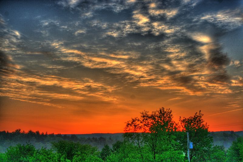
Sunset over NSSA

Sunsets and Reisling 2

Sunsets and Reisling
Sunrise over NSSA

IMG_2276.JPG

BIrds at Sunrise

ELEVATED SCENERY

Cacapon View

Gainsboro Hill (EXPLORED 071820)

Christmas Peace

Stretching across Back Creek Valley with 15 empties in tow, the Sandman turns towards US Route 50 and it's western terminus at Gore, VA on Tuesday, September 3rd, 2019.

On Tuesday, September 3rd, 2019 we find the Winchester and Western turning from Hogue Creek, the "Sandman" runs into Indian Hollow to begin the westward climb up Gainesboro Hill, the final natural barrier between Winchester, VA and Gore.

Thidawan and My New Camaro

Kevin and Camaro in High View

High View Post Office

Chevy Aveo
High View

SANDMAN ROLLING DOWNHILL

DSCN7079 150 Jct with Allegany View Spur

DSCN7078 150 Jct with Allegany View Spur

DSCN7077 150 Jct with Allegany View Spur

DSCN7076 150 Jct with Allegany View Spur

DSCN7084 152 Allegany View Sign

20191026_062347 (2)

USA Trip 2019 - 1

Driving Through Frederick County
Driving Through Frederick County

Field Near Capper Cemetery

Field Near Capper Cemetery
Mapa de Capon Bridge, Virginia Occidental, EE. UU.
Buscar otro lugar
Lugares cercanos
Bloomery, WV, EE. UU.
Bailey Lane, Bailey Ln, Capon Bridge, WV, EE. UU.
Capon Bridge, Virginia Occidental, EE. UU.
31 Monroe St, Capon Bridge, WV, EE. UU.
27 Sycamore Dr, Capon Bridge, WV, EE. UU.
Ice Mountain, Bloomery, WV, EE. UU.
Pioneer Lane, Pioneer Ln, Augusta, WV, EE. UU.
Knips Ln, Augusta, WV, EE. UU.
Ritters Valley Dr, Capon Bridge, WV, EE. UU.
North River Road, N River Rd, Gore, WV, EE. UU.
Coopers Run Road, Coopers Run Rd, Capon, WV, EE. UU.
Lehew, WV, EE. UU.
Cooper Mountain, Capon, WV, EE. UU.
Hanging Rock, WV, EE. UU.
Condado de Hampshire, Virginia Occidental, EE. UU.
Delray Rd, Augusta, WV, EE. UU.
Strawberry Lane, Strawberry Ln, Sherman, WV, EE. UU.
Augusta, WV, EE. UU.
Sugar Magnolia Way, Augusta, WV, EE. UU.
84 Ron's Dr, Augusta, WV, EE. UU.
Búsquedas recientes
- Horas de salida y puesta de sol de Red Dog Mine, AK, USA
- Horas de salida y puesta de sol de Am Bahnhof, Am bhf, Borken, Germany
- Horas de salida y puesta de sol de 4th St E, Sonoma, CA, EE. UU.
- Horas de salida y puesta de sol de Oakland Ave, Williamsport, PA, EE. UU.
- Horas de salida y puesta de sol de Via Roma, Pieranica CR, Italia
- Horas de salida y puesta de sol de Torre del reloj, Grad, Dubrovnik (Ragusa), Croacia
- Horas de salida y puesta de sol de Trelew, Chubut, Argentina
- Horas de salida y puesta de sol de Hartfords Bluff Cir, Mt Pleasant, SC, EE. UU.
- Horas de salida y puesta de sol de Kita Ward, Kumamoto, Japón
- Horas de salida y puesta de sol de Pingtan Island, Pingtan County, Fuzhou, China