Horas de salida y puesta de sol de Biswell Rd, Van Buren, AR, EE. UU.
Location: Estados Unidos > Arkansas > Condado de Crawford > Van Buren Township > Van Buren >
Zona horaria:
America/Chicago
Hora local:
2025-07-06 15:18:40
Longitud:
-94.444601
Latitud:
35.553395
Salida de sol de hoy:
06:09:20 AM
Puesta de sol de hoy:
08:36:21 PM
La duración del día hoy:
14h 27m 1s
Salida de sol de mañana:
06:09:54 AM
Puesta de sol de mañana:
08:36:05 PM
La duración del día mañana:
14h 26m 11s
Mostrar todas las fechas
| Fecha | Salida de sol | Puesta de sol | Duración del día |
|---|---|---|---|
| 01/01/2025 | 07:27:19 AM | 05:16:33 PM | 9h 49m 14s |
| 02/01/2025 | 07:27:26 AM | 05:17:21 PM | 9h 49m 55s |
| 03/01/2025 | 07:27:31 AM | 05:18:10 PM | 9h 50m 39s |
| 04/01/2025 | 07:27:35 AM | 05:19:00 PM | 9h 51m 25s |
| 05/01/2025 | 07:27:36 AM | 05:19:51 PM | 9h 52m 15s |
| 06/01/2025 | 07:27:35 AM | 05:20:43 PM | 9h 53m 8s |
| 07/01/2025 | 07:27:33 AM | 05:21:37 PM | 9h 54m 4s |
| 08/01/2025 | 07:27:29 AM | 05:22:31 PM | 9h 55m 2s |
| 09/01/2025 | 07:27:22 AM | 05:23:26 PM | 9h 56m 4s |
| 10/01/2025 | 07:27:14 AM | 05:24:21 PM | 9h 57m 7s |
| 11/01/2025 | 07:27:04 AM | 05:25:18 PM | 9h 58m 14s |
| 12/01/2025 | 07:26:51 AM | 05:26:15 PM | 9h 59m 24s |
| 13/01/2025 | 07:26:37 AM | 05:27:13 PM | 10h 0m 36s |
| 14/01/2025 | 07:26:21 AM | 05:28:11 PM | 10h 1m 50s |
| 15/01/2025 | 07:26:03 AM | 05:29:10 PM | 10h 3m 7s |
| 16/01/2025 | 07:25:43 AM | 05:30:09 PM | 10h 4m 26s |
| 17/01/2025 | 07:25:22 AM | 05:31:09 PM | 10h 5m 47s |
| 18/01/2025 | 07:24:58 AM | 05:32:10 PM | 10h 7m 12s |
| 19/01/2025 | 07:24:33 AM | 05:33:10 PM | 10h 8m 37s |
| 20/01/2025 | 07:24:05 AM | 05:34:11 PM | 10h 10m 6s |
| 21/01/2025 | 07:23:36 AM | 05:35:13 PM | 10h 11m 37s |
| 22/01/2025 | 07:23:05 AM | 05:36:14 PM | 10h 13m 9s |
| 23/01/2025 | 07:22:33 AM | 05:37:16 PM | 10h 14m 43s |
| 24/01/2025 | 07:21:58 AM | 05:38:18 PM | 10h 16m 20s |
| 25/01/2025 | 07:21:22 AM | 05:39:20 PM | 10h 17m 58s |
| 26/01/2025 | 07:20:44 AM | 05:40:22 PM | 10h 19m 38s |
| 27/01/2025 | 07:20:05 AM | 05:41:24 PM | 10h 21m 19s |
| 28/01/2025 | 07:19:23 AM | 05:42:27 PM | 10h 23m 4s |
| 29/01/2025 | 07:18:40 AM | 05:43:29 PM | 10h 24m 49s |
| 30/01/2025 | 07:17:56 AM | 05:44:31 PM | 10h 26m 35s |
| 31/01/2025 | 07:17:10 AM | 05:45:33 PM | 10h 28m 23s |
| 01/02/2025 | 07:16:22 AM | 05:46:35 PM | 10h 30m 13s |
| 02/02/2025 | 07:15:33 AM | 05:47:37 PM | 10h 32m 4s |
| 03/02/2025 | 07:14:42 AM | 05:48:39 PM | 10h 33m 57s |
| 04/02/2025 | 07:13:50 AM | 05:49:41 PM | 10h 35m 51s |
| 05/02/2025 | 07:12:57 AM | 05:50:43 PM | 10h 37m 46s |
| 06/02/2025 | 07:12:02 AM | 05:51:44 PM | 10h 39m 42s |
| 07/02/2025 | 07:11:06 AM | 05:52:45 PM | 10h 41m 39s |
| 08/02/2025 | 07:10:08 AM | 05:53:46 PM | 10h 43m 38s |
| 09/02/2025 | 07:09:09 AM | 05:54:47 PM | 10h 45m 38s |
| 10/02/2025 | 07:08:09 AM | 05:55:47 PM | 10h 47m 38s |
| 11/02/2025 | 07:07:07 AM | 05:56:47 PM | 10h 49m 40s |
| 12/02/2025 | 07:06:04 AM | 05:57:47 PM | 10h 51m 43s |
| 13/02/2025 | 07:05:01 AM | 05:58:47 PM | 10h 53m 46s |
| 14/02/2025 | 07:03:55 AM | 05:59:46 PM | 10h 55m 51s |
| 15/02/2025 | 07:02:49 AM | 06:00:45 PM | 10h 57m 56s |
| 16/02/2025 | 07:01:42 AM | 06:01:44 PM | 11h 0m 2s |
| 17/02/2025 | 07:00:34 AM | 06:02:42 PM | 11h 2m 8s |
| 18/02/2025 | 06:59:24 AM | 06:03:40 PM | 11h 4m 16s |
| 19/02/2025 | 06:58:14 AM | 06:04:38 PM | 11h 6m 24s |
| 20/02/2025 | 06:57:03 AM | 06:05:35 PM | 11h 8m 32s |
| 21/02/2025 | 06:55:50 AM | 06:06:32 PM | 11h 10m 42s |
| 22/02/2025 | 06:54:37 AM | 06:07:29 PM | 11h 12m 52s |
| 23/02/2025 | 06:53:23 AM | 06:08:25 PM | 11h 15m 2s |
| 24/02/2025 | 06:52:08 AM | 06:09:21 PM | 11h 17m 13s |
| 25/02/2025 | 06:50:53 AM | 06:10:17 PM | 11h 19m 24s |
| 26/02/2025 | 06:49:36 AM | 06:11:12 PM | 11h 21m 36s |
| 27/02/2025 | 06:48:19 AM | 06:12:08 PM | 11h 23m 49s |
| 28/02/2025 | 06:47:01 AM | 06:13:02 PM | 11h 26m 1s |
| 01/03/2025 | 06:45:43 AM | 06:13:57 PM | 11h 28m 14s |
| 02/03/2025 | 06:44:23 AM | 06:14:51 PM | 11h 30m 28s |
| 03/03/2025 | 06:43:04 AM | 06:15:44 PM | 11h 32m 40s |
| 04/03/2025 | 06:41:43 AM | 06:16:38 PM | 11h 34m 55s |
| 05/03/2025 | 06:40:22 AM | 06:17:31 PM | 11h 37m 9s |
| 06/03/2025 | 06:39:01 AM | 06:18:24 PM | 11h 39m 23s |
| 07/03/2025 | 06:37:39 AM | 06:19:17 PM | 11h 41m 38s |
| 08/03/2025 | 06:36:16 AM | 06:20:09 PM | 11h 43m 53s |
| 09/03/2025 | 07:34:57 AM | 07:20:59 PM | 11h 46m 2s |
| 10/03/2025 | 07:33:34 AM | 07:21:51 PM | 11h 48m 17s |
| 11/03/2025 | 07:32:10 AM | 07:22:42 PM | 11h 50m 32s |
| 12/03/2025 | 07:30:46 AM | 07:23:34 PM | 11h 52m 48s |
| 13/03/2025 | 07:29:22 AM | 07:24:25 PM | 11h 55m 3s |
| 14/03/2025 | 07:27:57 AM | 07:25:16 PM | 11h 57m 19s |
| 15/03/2025 | 07:26:33 AM | 07:26:07 PM | 11h 59m 34s |
| 16/03/2025 | 07:25:08 AM | 07:26:57 PM | 12h 1m 49s |
| 17/03/2025 | 07:23:42 AM | 07:27:48 PM | 12h 4m 6s |
| 18/03/2025 | 07:22:17 AM | 07:28:38 PM | 12h 6m 21s |
| 19/03/2025 | 07:20:52 AM | 07:29:28 PM | 12h 8m 36s |
| 20/03/2025 | 07:19:26 AM | 07:30:18 PM | 12h 10m 52s |
| 21/03/2025 | 07:18:00 AM | 07:31:08 PM | 12h 13m 8s |
| 22/03/2025 | 07:16:35 AM | 07:31:58 PM | 12h 15m 23s |
| 23/03/2025 | 07:15:09 AM | 07:32:47 PM | 12h 17m 38s |
| 24/03/2025 | 07:13:43 AM | 07:33:37 PM | 12h 19m 54s |
| 25/03/2025 | 07:12:18 AM | 07:34:26 PM | 12h 22m 8s |
| 26/03/2025 | 07:10:52 AM | 07:35:15 PM | 12h 24m 23s |
| 27/03/2025 | 07:09:27 AM | 07:36:05 PM | 12h 26m 38s |
| 28/03/2025 | 07:08:01 AM | 07:36:54 PM | 12h 28m 53s |
| 29/03/2025 | 07:06:36 AM | 07:37:43 PM | 12h 31m 7s |
| 30/03/2025 | 07:05:11 AM | 07:38:32 PM | 12h 33m 21s |
| 31/03/2025 | 07:03:46 AM | 07:39:21 PM | 12h 35m 35s |
| 01/04/2025 | 07:02:22 AM | 07:40:10 PM | 12h 37m 48s |
| 02/04/2025 | 07:00:58 AM | 07:41:00 PM | 12h 40m 2s |
| 03/04/2025 | 06:59:34 AM | 07:41:49 PM | 12h 42m 15s |
| 04/04/2025 | 06:58:10 AM | 07:42:38 PM | 12h 44m 28s |
| 05/04/2025 | 06:56:47 AM | 07:43:27 PM | 12h 46m 40s |
| 06/04/2025 | 06:55:24 AM | 07:44:16 PM | 12h 48m 52s |
| 07/04/2025 | 06:54:02 AM | 07:45:05 PM | 12h 51m 3s |
| 08/04/2025 | 06:52:40 AM | 07:45:54 PM | 12h 53m 14s |
| 09/04/2025 | 06:51:19 AM | 07:46:44 PM | 12h 55m 25s |
| 10/04/2025 | 06:49:58 AM | 07:47:33 PM | 12h 57m 35s |
| 11/04/2025 | 06:48:37 AM | 07:48:22 PM | 12h 59m 45s |
| 12/04/2025 | 06:47:18 AM | 07:49:12 PM | 13h 1m 54s |
| 13/04/2025 | 06:45:59 AM | 07:50:01 PM | 13h 4m 2s |
| 14/04/2025 | 06:44:40 AM | 07:50:50 PM | 13h 6m 10s |
| 15/04/2025 | 06:43:22 AM | 07:51:40 PM | 13h 8m 18s |
| 16/04/2025 | 06:42:05 AM | 07:52:30 PM | 13h 10m 25s |
| 17/04/2025 | 06:40:48 AM | 07:53:19 PM | 13h 12m 31s |
| 18/04/2025 | 06:39:33 AM | 07:54:09 PM | 13h 14m 36s |
| 19/04/2025 | 06:38:18 AM | 07:54:59 PM | 13h 16m 41s |
| 20/04/2025 | 06:37:04 AM | 07:55:49 PM | 13h 18m 45s |
| 21/04/2025 | 06:35:50 AM | 07:56:39 PM | 13h 20m 49s |
| 22/04/2025 | 06:34:38 AM | 07:57:29 PM | 13h 22m 51s |
| 23/04/2025 | 06:33:26 AM | 07:58:19 PM | 13h 24m 53s |
| 24/04/2025 | 06:32:16 AM | 07:59:09 PM | 13h 26m 53s |
| 25/04/2025 | 06:31:06 AM | 07:59:59 PM | 13h 28m 53s |
| 26/04/2025 | 06:29:57 AM | 08:00:49 PM | 13h 30m 52s |
| 27/04/2025 | 06:28:50 AM | 08:01:39 PM | 13h 32m 49s |
| 28/04/2025 | 06:27:43 AM | 08:02:29 PM | 13h 34m 46s |
| 29/04/2025 | 06:26:37 AM | 08:03:19 PM | 13h 36m 42s |
| 30/04/2025 | 06:25:33 AM | 08:04:09 PM | 13h 38m 36s |
| 01/05/2025 | 06:24:29 AM | 08:04:59 PM | 13h 40m 30s |
| 02/05/2025 | 06:23:27 AM | 08:05:49 PM | 13h 42m 22s |
| 03/05/2025 | 06:22:26 AM | 08:06:39 PM | 13h 44m 13s |
| 04/05/2025 | 06:21:26 AM | 08:07:29 PM | 13h 46m 3s |
| 05/05/2025 | 06:20:27 AM | 08:08:19 PM | 13h 47m 52s |
| 06/05/2025 | 06:19:30 AM | 08:09:08 PM | 13h 49m 38s |
| 07/05/2025 | 06:18:34 AM | 08:09:58 PM | 13h 51m 24s |
| 08/05/2025 | 06:17:39 AM | 08:10:47 PM | 13h 53m 8s |
| 09/05/2025 | 06:16:45 AM | 08:11:36 PM | 13h 54m 51s |
| 10/05/2025 | 06:15:53 AM | 08:12:25 PM | 13h 56m 32s |
| 11/05/2025 | 06:15:02 AM | 08:13:14 PM | 13h 58m 12s |
| 12/05/2025 | 06:14:13 AM | 08:14:02 PM | 13h 59m 49s |
| 13/05/2025 | 06:13:25 AM | 08:14:50 PM | 14h 1m 25s |
| 14/05/2025 | 06:12:38 AM | 08:15:38 PM | 14h 3m 0s |
| 15/05/2025 | 06:11:53 AM | 08:16:26 PM | 14h 4m 33s |
| 16/05/2025 | 06:11:10 AM | 08:17:13 PM | 14h 6m 3s |
| 17/05/2025 | 06:10:28 AM | 08:18:00 PM | 14h 7m 32s |
| 18/05/2025 | 06:09:47 AM | 08:18:46 PM | 14h 8m 59s |
| 19/05/2025 | 06:09:08 AM | 08:19:32 PM | 14h 10m 24s |
| 20/05/2025 | 06:08:30 AM | 08:20:18 PM | 14h 11m 48s |
| 21/05/2025 | 06:07:54 AM | 08:21:02 PM | 14h 13m 8s |
| 22/05/2025 | 06:07:20 AM | 08:21:47 PM | 14h 14m 27s |
| 23/05/2025 | 06:06:47 AM | 08:22:31 PM | 14h 15m 44s |
| 24/05/2025 | 06:06:16 AM | 08:23:14 PM | 14h 16m 58s |
| 25/05/2025 | 06:05:47 AM | 08:23:56 PM | 14h 18m 9s |
| 26/05/2025 | 06:05:19 AM | 08:24:38 PM | 14h 19m 19s |
| 27/05/2025 | 06:04:52 AM | 08:25:19 PM | 14h 20m 27s |
| 28/05/2025 | 06:04:28 AM | 08:26:00 PM | 14h 21m 32s |
| 29/05/2025 | 06:04:05 AM | 08:26:39 PM | 14h 22m 34s |
| 30/05/2025 | 06:03:44 AM | 08:27:18 PM | 14h 23m 34s |
| 31/05/2025 | 06:03:24 AM | 08:27:56 PM | 14h 24m 32s |
| 01/06/2025 | 06:03:06 AM | 08:28:33 PM | 14h 25m 27s |
| 02/06/2025 | 06:02:50 AM | 08:29:09 PM | 14h 26m 19s |
| 03/06/2025 | 06:02:35 AM | 08:29:44 PM | 14h 27m 9s |
| 04/06/2025 | 06:02:23 AM | 08:30:18 PM | 14h 27m 55s |
| 05/06/2025 | 06:02:11 AM | 08:30:51 PM | 14h 28m 40s |
| 06/06/2025 | 06:02:02 AM | 08:31:23 PM | 14h 29m 21s |
| 07/06/2025 | 06:01:54 AM | 08:31:54 PM | 14h 30m 0s |
| 08/06/2025 | 06:01:48 AM | 08:32:23 PM | 14h 30m 35s |
| 09/06/2025 | 06:01:44 AM | 08:32:52 PM | 14h 31m 8s |
| 10/06/2025 | 06:01:41 AM | 08:33:19 PM | 14h 31m 38s |
| 11/06/2025 | 06:01:40 AM | 08:33:45 PM | 14h 32m 5s |
| 12/06/2025 | 06:01:40 AM | 08:34:10 PM | 14h 32m 30s |
| 13/06/2025 | 06:01:42 AM | 08:34:33 PM | 14h 32m 51s |
| 14/06/2025 | 06:01:46 AM | 08:34:55 PM | 14h 33m 9s |
| 15/06/2025 | 06:01:51 AM | 08:35:16 PM | 14h 33m 25s |
| 16/06/2025 | 06:01:58 AM | 08:35:35 PM | 14h 33m 37s |
| 17/06/2025 | 06:02:06 AM | 08:35:53 PM | 14h 33m 47s |
| 18/06/2025 | 06:02:16 AM | 08:36:09 PM | 14h 33m 53s |
| 19/06/2025 | 06:02:27 AM | 08:36:24 PM | 14h 33m 57s |
| 20/06/2025 | 06:02:40 AM | 08:36:37 PM | 14h 33m 57s |
| 21/06/2025 | 06:02:55 AM | 08:36:49 PM | 14h 33m 54s |
| 22/06/2025 | 06:03:10 AM | 08:36:59 PM | 14h 33m 49s |
| 23/06/2025 | 06:03:28 AM | 08:37:07 PM | 14h 33m 39s |
| 24/06/2025 | 06:03:46 AM | 08:37:14 PM | 14h 33m 28s |
| 25/06/2025 | 06:04:06 AM | 08:37:20 PM | 14h 33m 14s |
| 26/06/2025 | 06:04:27 AM | 08:37:23 PM | 14h 32m 56s |
| 27/06/2025 | 06:04:50 AM | 08:37:25 PM | 14h 32m 35s |
| 28/06/2025 | 06:05:14 AM | 08:37:26 PM | 14h 32m 12s |
| 29/06/2025 | 06:05:39 AM | 08:37:24 PM | 14h 31m 45s |
| 30/06/2025 | 06:06:05 AM | 08:37:22 PM | 14h 31m 17s |
| 01/07/2025 | 06:06:32 AM | 08:37:17 PM | 14h 30m 45s |
| 02/07/2025 | 06:07:01 AM | 08:37:10 PM | 14h 30m 9s |
| 03/07/2025 | 06:07:30 AM | 08:37:02 PM | 14h 29m 32s |
| 04/07/2025 | 06:08:01 AM | 08:36:52 PM | 14h 28m 51s |
| 05/07/2025 | 06:08:32 AM | 08:36:41 PM | 14h 28m 9s |
| 06/07/2025 | 06:09:05 AM | 08:36:28 PM | 14h 27m 23s |
| 07/07/2025 | 06:09:39 AM | 08:36:13 PM | 14h 26m 34s |
| 08/07/2025 | 06:10:13 AM | 08:35:56 PM | 14h 25m 43s |
| 09/07/2025 | 06:10:49 AM | 08:35:37 PM | 14h 24m 48s |
| 10/07/2025 | 06:11:25 AM | 08:35:17 PM | 14h 23m 52s |
| 11/07/2025 | 06:12:02 AM | 08:34:55 PM | 14h 22m 53s |
| 12/07/2025 | 06:12:40 AM | 08:34:32 PM | 14h 21m 52s |
| 13/07/2025 | 06:13:18 AM | 08:34:07 PM | 14h 20m 49s |
| 14/07/2025 | 06:13:57 AM | 08:33:40 PM | 14h 19m 43s |
| 15/07/2025 | 06:14:37 AM | 08:33:11 PM | 14h 18m 34s |
| 16/07/2025 | 06:15:18 AM | 08:32:41 PM | 14h 17m 23s |
| 17/07/2025 | 06:15:59 AM | 08:32:09 PM | 14h 16m 10s |
| 18/07/2025 | 06:16:40 AM | 08:31:35 PM | 14h 14m 55s |
| 19/07/2025 | 06:17:23 AM | 08:31:00 PM | 14h 13m 37s |
| 20/07/2025 | 06:18:05 AM | 08:30:23 PM | 14h 12m 18s |
| 21/07/2025 | 06:18:48 AM | 08:29:45 PM | 14h 10m 57s |
| 22/07/2025 | 06:19:32 AM | 08:29:04 PM | 14h 9m 32s |
| 23/07/2025 | 06:20:16 AM | 08:28:23 PM | 14h 8m 7s |
| 24/07/2025 | 06:21:00 AM | 08:27:40 PM | 14h 6m 40s |
| 25/07/2025 | 06:21:45 AM | 08:26:55 PM | 14h 5m 10s |
| 26/07/2025 | 06:22:30 AM | 08:26:09 PM | 14h 3m 39s |
| 27/07/2025 | 06:23:15 AM | 08:25:21 PM | 14h 2m 6s |
| 28/07/2025 | 06:24:00 AM | 08:24:32 PM | 14h 0m 32s |
| 29/07/2025 | 06:24:46 AM | 08:23:42 PM | 13h 58m 56s |
| 30/07/2025 | 06:25:32 AM | 08:22:50 PM | 13h 57m 18s |
| 31/07/2025 | 06:26:18 AM | 08:21:56 PM | 13h 55m 38s |
| 01/08/2025 | 06:27:04 AM | 08:21:02 PM | 13h 53m 58s |
| 02/08/2025 | 06:27:50 AM | 08:20:05 PM | 13h 52m 15s |
| 03/08/2025 | 06:28:37 AM | 08:19:08 PM | 13h 50m 31s |
| 04/08/2025 | 06:29:23 AM | 08:18:09 PM | 13h 48m 46s |
| 05/08/2025 | 06:30:10 AM | 08:17:09 PM | 13h 46m 59s |
| 06/08/2025 | 06:30:57 AM | 08:16:08 PM | 13h 45m 11s |
| 07/08/2025 | 06:31:43 AM | 08:15:06 PM | 13h 43m 23s |
| 08/08/2025 | 06:32:30 AM | 08:14:02 PM | 13h 41m 32s |
| 09/08/2025 | 06:33:17 AM | 08:12:57 PM | 13h 39m 40s |
| 10/08/2025 | 06:34:03 AM | 08:11:52 PM | 13h 37m 49s |
| 11/08/2025 | 06:34:50 AM | 08:10:45 PM | 13h 35m 55s |
| 12/08/2025 | 06:35:37 AM | 08:09:36 PM | 13h 33m 59s |
| 13/08/2025 | 06:36:23 AM | 08:08:27 PM | 13h 32m 4s |
| 14/08/2025 | 06:37:10 AM | 08:07:17 PM | 13h 30m 7s |
| 15/08/2025 | 06:37:56 AM | 08:06:06 PM | 13h 28m 10s |
| 16/08/2025 | 06:38:43 AM | 08:04:54 PM | 13h 26m 11s |
| 17/08/2025 | 06:39:29 AM | 08:03:41 PM | 13h 24m 12s |
| 18/08/2025 | 06:40:16 AM | 08:02:27 PM | 13h 22m 11s |
| 19/08/2025 | 06:41:02 AM | 08:01:12 PM | 13h 20m 10s |
| 20/08/2025 | 06:41:48 AM | 07:59:56 PM | 13h 18m 8s |
| 21/08/2025 | 06:42:34 AM | 07:58:40 PM | 13h 16m 6s |
| 22/08/2025 | 06:43:20 AM | 07:57:22 PM | 13h 14m 2s |
| 23/08/2025 | 06:44:06 AM | 07:56:04 PM | 13h 11m 58s |
| 24/08/2025 | 06:44:52 AM | 07:54:45 PM | 13h 9m 53s |
| 25/08/2025 | 06:45:37 AM | 07:53:26 PM | 13h 7m 49s |
| 26/08/2025 | 06:46:23 AM | 07:52:06 PM | 13h 5m 43s |
| 27/08/2025 | 06:47:08 AM | 07:50:45 PM | 13h 3m 37s |
| 28/08/2025 | 06:47:54 AM | 07:49:23 PM | 13h 1m 29s |
| 29/08/2025 | 06:48:39 AM | 07:48:01 PM | 12h 59m 22s |
| 30/08/2025 | 06:49:24 AM | 07:46:39 PM | 12h 57m 15s |
| 31/08/2025 | 06:50:09 AM | 07:45:15 PM | 12h 55m 6s |
| 01/09/2025 | 06:50:54 AM | 07:43:52 PM | 12h 52m 58s |
| 02/09/2025 | 06:51:40 AM | 07:42:27 PM | 12h 50m 47s |
| 03/09/2025 | 06:52:25 AM | 07:41:03 PM | 12h 48m 38s |
| 04/09/2025 | 06:53:09 AM | 07:39:38 PM | 12h 46m 29s |
| 05/09/2025 | 06:53:54 AM | 07:38:12 PM | 12h 44m 18s |
| 06/09/2025 | 06:54:39 AM | 07:36:46 PM | 12h 42m 7s |
| 07/09/2025 | 06:55:24 AM | 07:35:20 PM | 12h 39m 56s |
| 08/09/2025 | 06:56:09 AM | 07:33:54 PM | 12h 37m 45s |
| 09/09/2025 | 06:56:54 AM | 07:32:27 PM | 12h 35m 33s |
| 10/09/2025 | 06:57:38 AM | 07:31:00 PM | 12h 33m 22s |
| 11/09/2025 | 06:58:23 AM | 07:29:33 PM | 12h 31m 10s |
| 12/09/2025 | 06:59:08 AM | 07:28:05 PM | 12h 28m 57s |
| 13/09/2025 | 06:59:53 AM | 07:26:38 PM | 12h 26m 45s |
| 14/09/2025 | 07:00:38 AM | 07:25:10 PM | 12h 24m 32s |
| 15/09/2025 | 07:01:23 AM | 07:23:42 PM | 12h 22m 19s |
| 16/09/2025 | 07:02:08 AM | 07:22:14 PM | 12h 20m 6s |
| 17/09/2025 | 07:02:53 AM | 07:20:46 PM | 12h 17m 53s |
| 18/09/2025 | 07:03:38 AM | 07:19:18 PM | 12h 15m 40s |
| 19/09/2025 | 07:04:23 AM | 07:17:50 PM | 12h 13m 27s |
| 20/09/2025 | 07:05:09 AM | 07:16:22 PM | 12h 11m 13s |
| 21/09/2025 | 07:05:54 AM | 07:14:54 PM | 12h 9m 0s |
| 22/09/2025 | 07:06:40 AM | 07:13:26 PM | 12h 6m 46s |
| 23/09/2025 | 07:07:26 AM | 07:11:59 PM | 12h 4m 33s |
| 24/09/2025 | 07:08:12 AM | 07:10:31 PM | 12h 2m 19s |
| 25/09/2025 | 07:08:58 AM | 07:09:04 PM | 12h 0m 6s |
| 26/09/2025 | 07:09:44 AM | 07:07:37 PM | 11h 57m 53s |
| 27/09/2025 | 07:10:31 AM | 07:06:10 PM | 11h 55m 39s |
| 28/09/2025 | 07:11:18 AM | 07:04:43 PM | 11h 53m 25s |
| 29/09/2025 | 07:12:05 AM | 07:03:17 PM | 11h 51m 12s |
| 30/09/2025 | 07:12:52 AM | 07:01:51 PM | 11h 48m 59s |
| 01/10/2025 | 07:13:39 AM | 07:00:25 PM | 11h 46m 46s |
| 02/10/2025 | 07:14:27 AM | 06:59:00 PM | 11h 44m 33s |
| 03/10/2025 | 07:15:15 AM | 06:57:35 PM | 11h 42m 20s |
| 04/10/2025 | 07:16:03 AM | 06:56:10 PM | 11h 40m 7s |
| 05/10/2025 | 07:16:51 AM | 06:54:46 PM | 11h 37m 55s |
| 06/10/2025 | 07:17:40 AM | 06:53:23 PM | 11h 35m 43s |
| 07/10/2025 | 07:18:29 AM | 06:52:00 PM | 11h 33m 31s |
| 08/10/2025 | 07:19:19 AM | 06:50:38 PM | 11h 31m 19s |
| 09/10/2025 | 07:20:08 AM | 06:49:16 PM | 11h 29m 8s |
| 10/10/2025 | 07:20:58 AM | 06:47:55 PM | 11h 26m 57s |
| 11/10/2025 | 07:21:49 AM | 06:46:34 PM | 11h 24m 45s |
| 12/10/2025 | 07:22:40 AM | 06:45:15 PM | 11h 22m 35s |
| 13/10/2025 | 07:23:31 AM | 06:43:56 PM | 11h 20m 25s |
| 14/10/2025 | 07:24:22 AM | 06:42:37 PM | 11h 18m 15s |
| 15/10/2025 | 07:25:14 AM | 06:41:20 PM | 11h 16m 6s |
| 16/10/2025 | 07:26:06 AM | 06:40:03 PM | 11h 13m 57s |
| 17/10/2025 | 07:26:58 AM | 06:38:47 PM | 11h 11m 49s |
| 18/10/2025 | 07:27:51 AM | 06:37:32 PM | 11h 9m 41s |
| 19/10/2025 | 07:28:44 AM | 06:36:18 PM | 11h 7m 34s |
| 20/10/2025 | 07:29:38 AM | 06:35:05 PM | 11h 5m 27s |
| 21/10/2025 | 07:30:32 AM | 06:33:53 PM | 11h 3m 21s |
| 22/10/2025 | 07:31:26 AM | 06:32:42 PM | 11h 1m 16s |
| 23/10/2025 | 07:32:21 AM | 06:31:32 PM | 10h 59m 11s |
| 24/10/2025 | 07:33:16 AM | 06:30:22 PM | 10h 57m 6s |
| 25/10/2025 | 07:34:11 AM | 06:29:15 PM | 10h 55m 4s |
| 26/10/2025 | 07:35:07 AM | 06:28:08 PM | 10h 53m 1s |
| 27/10/2025 | 07:36:03 AM | 06:27:02 PM | 10h 50m 59s |
| 28/10/2025 | 07:36:59 AM | 06:25:58 PM | 10h 48m 59s |
| 29/10/2025 | 07:37:56 AM | 06:24:54 PM | 10h 46m 58s |
| 30/10/2025 | 07:38:52 AM | 06:23:52 PM | 10h 45m 0s |
| 31/10/2025 | 07:39:50 AM | 06:22:52 PM | 10h 43m 2s |
| 01/11/2025 | 07:40:47 AM | 06:21:52 PM | 10h 41m 5s |
| 02/11/2025 | 06:41:47 AM | 05:20:52 PM | 10h 39m 5s |
| 03/11/2025 | 06:42:46 AM | 05:19:55 PM | 10h 37m 9s |
| 04/11/2025 | 06:43:44 AM | 05:19:00 PM | 10h 35m 16s |
| 05/11/2025 | 06:44:42 AM | 05:18:07 PM | 10h 33m 25s |
| 06/11/2025 | 06:45:41 AM | 05:17:14 PM | 10h 31m 33s |
| 07/11/2025 | 06:46:40 AM | 05:16:24 PM | 10h 29m 44s |
| 08/11/2025 | 06:47:39 AM | 05:15:34 PM | 10h 27m 55s |
| 09/11/2025 | 06:48:38 AM | 05:14:47 PM | 10h 26m 9s |
| 10/11/2025 | 06:49:37 AM | 05:14:01 PM | 10h 24m 24s |
| 11/11/2025 | 06:50:37 AM | 05:13:16 PM | 10h 22m 39s |
| 12/11/2025 | 06:51:36 AM | 05:12:34 PM | 10h 20m 58s |
| 13/11/2025 | 06:52:36 AM | 05:11:53 PM | 10h 19m 17s |
| 14/11/2025 | 06:53:35 AM | 05:11:13 PM | 10h 17m 38s |
| 15/11/2025 | 06:54:34 AM | 05:10:35 PM | 10h 16m 1s |
| 16/11/2025 | 06:55:34 AM | 05:10:00 PM | 10h 14m 26s |
| 17/11/2025 | 06:56:33 AM | 05:09:25 PM | 10h 12m 52s |
| 18/11/2025 | 06:57:32 AM | 05:08:53 PM | 10h 11m 21s |
| 19/11/2025 | 06:58:31 AM | 05:08:23 PM | 10h 9m 52s |
| 20/11/2025 | 06:59:29 AM | 05:07:54 PM | 10h 8m 25s |
| 21/11/2025 | 07:00:28 AM | 05:07:27 PM | 10h 6m 59s |
| 22/11/2025 | 07:01:26 AM | 05:07:02 PM | 10h 5m 36s |
| 23/11/2025 | 07:02:24 AM | 05:06:39 PM | 10h 4m 15s |
| 24/11/2025 | 07:03:21 AM | 05:06:18 PM | 10h 2m 57s |
| 25/11/2025 | 07:04:18 AM | 05:05:59 PM | 10h 1m 41s |
| 26/11/2025 | 07:05:14 AM | 05:05:42 PM | 10h 0m 28s |
| 27/11/2025 | 07:06:10 AM | 05:05:26 PM | 9h 59m 16s |
| 28/11/2025 | 07:07:05 AM | 05:05:13 PM | 9h 58m 8s |
| 29/11/2025 | 07:08:00 AM | 05:05:02 PM | 9h 57m 2s |
| 30/11/2025 | 07:08:54 AM | 05:04:52 PM | 9h 55m 58s |
| 01/12/2025 | 07:09:47 AM | 05:04:45 PM | 9h 54m 58s |
| 02/12/2025 | 07:10:40 AM | 05:04:39 PM | 9h 53m 59s |
| 03/12/2025 | 07:11:32 AM | 05:04:36 PM | 9h 53m 4s |
| 04/12/2025 | 07:12:23 AM | 05:04:35 PM | 9h 52m 12s |
| 05/12/2025 | 07:13:13 AM | 05:04:35 PM | 9h 51m 22s |
| 06/12/2025 | 07:14:02 AM | 05:04:38 PM | 9h 50m 36s |
| 07/12/2025 | 07:14:50 AM | 05:04:42 PM | 9h 49m 52s |
| 08/12/2025 | 07:15:37 AM | 05:04:49 PM | 9h 49m 12s |
| 09/12/2025 | 07:16:23 AM | 05:04:57 PM | 9h 48m 34s |
| 10/12/2025 | 07:17:07 AM | 05:05:07 PM | 9h 48m 0s |
| 11/12/2025 | 07:17:51 AM | 05:05:20 PM | 9h 47m 29s |
| 12/12/2025 | 07:18:33 AM | 05:05:34 PM | 9h 47m 1s |
| 13/12/2025 | 07:19:14 AM | 05:05:50 PM | 9h 46m 36s |
| 14/12/2025 | 07:19:54 AM | 05:06:08 PM | 9h 46m 14s |
| 15/12/2025 | 07:20:32 AM | 05:06:28 PM | 9h 45m 56s |
| 16/12/2025 | 07:21:09 AM | 05:06:50 PM | 9h 45m 41s |
| 17/12/2025 | 07:21:44 AM | 05:07:13 PM | 9h 45m 29s |
| 18/12/2025 | 07:22:18 AM | 05:07:38 PM | 9h 45m 20s |
| 19/12/2025 | 07:22:51 AM | 05:08:06 PM | 9h 45m 15s |
| 20/12/2025 | 07:23:21 AM | 05:08:34 PM | 9h 45m 13s |
| 21/12/2025 | 07:23:51 AM | 05:09:05 PM | 9h 45m 14s |
| 22/12/2025 | 07:24:18 AM | 05:09:37 PM | 9h 45m 19s |
| 23/12/2025 | 07:24:44 AM | 05:10:11 PM | 9h 45m 27s |
| 24/12/2025 | 07:25:08 AM | 05:10:46 PM | 9h 45m 38s |
| 25/12/2025 | 07:25:31 AM | 05:11:23 PM | 9h 45m 52s |
| 26/12/2025 | 07:25:51 AM | 05:12:01 PM | 9h 46m 10s |
| 27/12/2025 | 07:26:10 AM | 05:12:41 PM | 9h 46m 31s |
| 28/12/2025 | 07:26:27 AM | 05:13:23 PM | 9h 46m 56s |
| 29/12/2025 | 07:26:42 AM | 05:14:05 PM | 9h 47m 23s |
| 30/12/2025 | 07:26:56 AM | 05:14:49 PM | 9h 47m 53s |
| 31/12/2025 | 07:27:07 AM | 05:15:34 PM | 9h 48m 27s |
Fotos
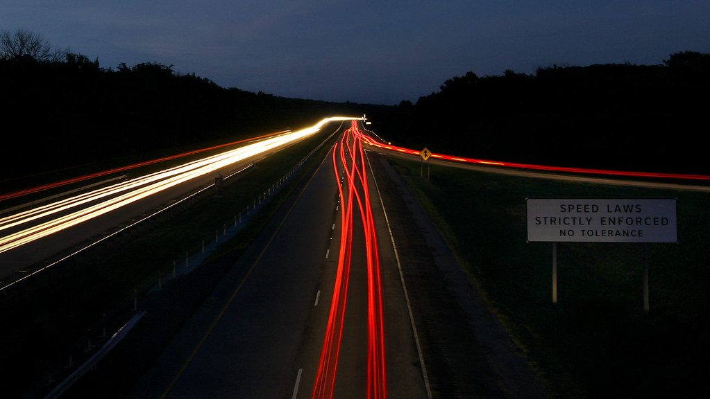
oncoming traffic

Natural Dam 1

Incoming Clouds

Drone Sunset

Peaceful Downtown Sunrise

Sailor Take Warning: Take II

Drone Sunset

Sailors Take Warning: Take I.

Van Buren Sunrise

Double Sunrise

Low Water Bridge

Low Water Bridge

For Kim

the natural dam

Natural Dam 2

Van Buren Arkansas railroad train sunset

Lake-side Sunset

The Way Back at Lee Creek Reservoir

Natural Dam at Sunrise

Natural Dam revisited

Sailor Take Warning: Take IV; Hawk

#sunriseweather #sunriseview #sunrise #oklahoma

Sailor Take Warning: Take III; Flight

Natural Dam at sunrise

Milkway in Arkansas

Natural Dam before sunrise

Natural Dam
Mapa de Biswell Rd, Van Buren, AR, EE. UU.
Buscar otro lugar
Lugares cercanos
Municipio de Uniontown, Arkansas, EE. UU.
Pine Hollow Rd, Van Buren, AR, EE. UU.
Uniontown Hwy, Van Buren, AR, EE. UU.
Cedarville, Arkansas, EE. UU.
AR-59, Cedarville, AR, EE. UU.
Cedarville Township, AR, EE. UU.
Dora Rd, Van Buren, AR, EE. UU.
Dora Township, AR, EE. UU.
Natural Dam, AR, EE. UU.
Peaceful Home Rd, Natural Dam, AR, EE. UU.
Kristi Ln, Van Buren, AR, EE. UU.
Somerset Way, Van Buren, AR, EE. UU.
Azure Hills Dr, Van Buren, AR, EE. UU.
Lees Creek Township, AR, EE. UU.
Condado de Crawford, Arkansas, EE. UU.
Williams Ln, Fort Smith, AR, EE. UU.
8 Sherwood St, Van Buren, AR, EE. UU.
Oliver Springs Township, AR, EE. UU.
Hobbtown Rd, Rudy, AR, EE. UU.
Bond Special Rd, Van Buren, AR, EE. UU.
Búsquedas recientes
- Horas de salida y puesta de sol de Red Dog Mine, AK, USA
- Horas de salida y puesta de sol de Am Bahnhof, Am bhf, Borken, Germany
- Horas de salida y puesta de sol de 4th St E, Sonoma, CA, EE. UU.
- Horas de salida y puesta de sol de Oakland Ave, Williamsport, PA, EE. UU.
- Horas de salida y puesta de sol de Via Roma, Pieranica CR, Italia
- Horas de salida y puesta de sol de Torre del reloj, Grad, Dubrovnik (Ragusa), Croacia
- Horas de salida y puesta de sol de Trelew, Chubut, Argentina
- Horas de salida y puesta de sol de Hartfords Bluff Cir, Mt Pleasant, SC, EE. UU.
- Horas de salida y puesta de sol de Kita Ward, Kumamoto, Japón
- Horas de salida y puesta de sol de Pingtan Island, Pingtan County, Fuzhou, China