Horas de salida y puesta de sol de Bennoch Rd, Lagrange, ME, EE. UU.
Location: Estados Unidos > Maine > Condado de Penobscot > Lagrange >
Zona horaria:
America/New_York
Hora local:
2025-07-15 00:09:41
Longitud:
-68.8145158
Latitud:
45.1162286
Salida de sol de hoy:
05:03:09 AM
Puesta de sol de hoy:
08:19:30 PM
La duración del día hoy:
15h 16m 21s
Salida de sol de mañana:
05:04:05 AM
Puesta de sol de mañana:
08:18:45 PM
La duración del día mañana:
15h 14m 40s
Mostrar todas las fechas
| Fecha | Salida de sol | Puesta de sol | Duración del día |
|---|---|---|---|
| 01/01/2025 | 07:13:49 AM | 04:04:53 PM | 8h 51m 4s |
| 02/01/2025 | 07:13:47 AM | 04:05:51 PM | 8h 52m 4s |
| 03/01/2025 | 07:13:42 AM | 04:06:50 PM | 8h 53m 8s |
| 04/01/2025 | 07:13:35 AM | 04:07:51 PM | 8h 54m 16s |
| 05/01/2025 | 07:13:25 AM | 04:08:54 PM | 8h 55m 29s |
| 06/01/2025 | 07:13:12 AM | 04:09:58 PM | 8h 56m 46s |
| 07/01/2025 | 07:12:57 AM | 04:11:04 PM | 8h 58m 7s |
| 08/01/2025 | 07:12:39 AM | 04:12:12 PM | 8h 59m 33s |
| 09/01/2025 | 07:12:19 AM | 04:13:21 PM | 9h 1m 2s |
| 10/01/2025 | 07:11:56 AM | 04:14:31 PM | 9h 2m 35s |
| 11/01/2025 | 07:11:31 AM | 04:15:43 PM | 9h 4m 12s |
| 12/01/2025 | 07:11:03 AM | 04:16:56 PM | 9h 5m 53s |
| 13/01/2025 | 07:10:32 AM | 04:18:11 PM | 9h 7m 39s |
| 14/01/2025 | 07:09:59 AM | 04:19:26 PM | 9h 9m 27s |
| 15/01/2025 | 07:09:24 AM | 04:20:42 PM | 9h 11m 18s |
| 16/01/2025 | 07:08:46 AM | 04:22:00 PM | 9h 13m 14s |
| 17/01/2025 | 07:08:06 AM | 04:23:18 PM | 9h 15m 12s |
| 18/01/2025 | 07:07:23 AM | 04:24:38 PM | 9h 17m 15s |
| 19/01/2025 | 07:06:39 AM | 04:25:58 PM | 9h 19m 19s |
| 20/01/2025 | 07:05:52 AM | 04:27:19 PM | 9h 21m 27s |
| 21/01/2025 | 07:05:02 AM | 04:28:40 PM | 9h 23m 38s |
| 22/01/2025 | 07:04:11 AM | 04:30:03 PM | 9h 25m 52s |
| 23/01/2025 | 07:03:17 AM | 04:31:26 PM | 9h 28m 9s |
| 24/01/2025 | 07:02:21 AM | 04:32:49 PM | 9h 30m 28s |
| 25/01/2025 | 07:01:23 AM | 04:34:13 PM | 9h 32m 50s |
| 26/01/2025 | 07:00:23 AM | 04:35:38 PM | 9h 35m 15s |
| 27/01/2025 | 06:59:22 AM | 04:37:02 PM | 9h 37m 40s |
| 28/01/2025 | 06:58:18 AM | 04:38:27 PM | 9h 40m 9s |
| 29/01/2025 | 06:57:12 AM | 04:39:53 PM | 9h 42m 41s |
| 30/01/2025 | 06:56:04 AM | 04:41:19 PM | 9h 45m 15s |
| 31/01/2025 | 06:54:54 AM | 04:42:45 PM | 9h 47m 51s |
| 01/02/2025 | 06:53:43 AM | 04:44:11 PM | 9h 50m 28s |
| 02/02/2025 | 06:52:30 AM | 04:45:37 PM | 9h 53m 7s |
| 03/02/2025 | 06:51:15 AM | 04:47:03 PM | 9h 55m 48s |
| 04/02/2025 | 06:49:58 AM | 04:48:30 PM | 9h 58m 32s |
| 05/02/2025 | 06:48:40 AM | 04:49:56 PM | 10h 1m 16s |
| 06/02/2025 | 06:47:20 AM | 04:51:23 PM | 10h 4m 3s |
| 07/02/2025 | 06:45:59 AM | 04:52:49 PM | 10h 6m 50s |
| 08/02/2025 | 06:44:36 AM | 04:54:15 PM | 10h 9m 39s |
| 09/02/2025 | 06:43:12 AM | 04:55:42 PM | 10h 12m 30s |
| 10/02/2025 | 06:41:46 AM | 04:57:08 PM | 10h 15m 22s |
| 11/02/2025 | 06:40:18 AM | 04:58:34 PM | 10h 18m 16s |
| 12/02/2025 | 06:38:50 AM | 05:00:00 PM | 10h 21m 10s |
| 13/02/2025 | 06:37:20 AM | 05:01:26 PM | 10h 24m 6s |
| 14/02/2025 | 06:35:49 AM | 05:02:51 PM | 10h 27m 2s |
| 15/02/2025 | 06:34:16 AM | 05:04:17 PM | 10h 30m 1s |
| 16/02/2025 | 06:32:43 AM | 05:05:42 PM | 10h 32m 59s |
| 17/02/2025 | 06:31:08 AM | 05:07:07 PM | 10h 35m 59s |
| 18/02/2025 | 06:29:32 AM | 05:08:31 PM | 10h 38m 59s |
| 19/02/2025 | 06:27:55 AM | 05:09:56 PM | 10h 42m 1s |
| 20/02/2025 | 06:26:17 AM | 05:11:20 PM | 10h 45m 3s |
| 21/02/2025 | 06:24:38 AM | 05:12:44 PM | 10h 48m 6s |
| 22/02/2025 | 06:22:58 AM | 05:14:07 PM | 10h 51m 9s |
| 23/02/2025 | 06:21:17 AM | 05:15:31 PM | 10h 54m 14s |
| 24/02/2025 | 06:19:35 AM | 05:16:54 PM | 10h 57m 19s |
| 25/02/2025 | 06:17:53 AM | 05:18:17 PM | 11h 0m 24s |
| 26/02/2025 | 06:16:09 AM | 05:19:39 PM | 11h 3m 30s |
| 27/02/2025 | 06:14:25 AM | 05:21:02 PM | 11h 6m 37s |
| 28/02/2025 | 06:12:40 AM | 05:22:23 PM | 11h 9m 43s |
| 01/03/2025 | 06:10:54 AM | 05:23:45 PM | 11h 12m 51s |
| 02/03/2025 | 06:09:08 AM | 05:25:07 PM | 11h 15m 59s |
| 03/03/2025 | 06:07:21 AM | 05:26:28 PM | 11h 19m 7s |
| 04/03/2025 | 06:05:33 AM | 05:27:49 PM | 11h 22m 16s |
| 05/03/2025 | 06:03:45 AM | 05:29:09 PM | 11h 25m 24s |
| 06/03/2025 | 06:01:56 AM | 05:30:29 PM | 11h 28m 33s |
| 07/03/2025 | 06:00:07 AM | 05:31:49 PM | 11h 31m 42s |
| 08/03/2025 | 05:58:17 AM | 05:33:09 PM | 11h 34m 52s |
| 09/03/2025 | 06:56:31 AM | 06:34:26 PM | 11h 37m 55s |
| 10/03/2025 | 06:54:41 AM | 06:35:45 PM | 11h 41m 4s |
| 11/03/2025 | 06:52:50 AM | 06:37:04 PM | 11h 44m 14s |
| 12/03/2025 | 06:50:58 AM | 06:38:23 PM | 11h 47m 25s |
| 13/03/2025 | 06:49:07 AM | 06:39:41 PM | 11h 50m 34s |
| 14/03/2025 | 06:47:15 AM | 06:41:00 PM | 11h 53m 45s |
| 15/03/2025 | 06:45:23 AM | 06:42:18 PM | 11h 56m 55s |
| 16/03/2025 | 06:43:30 AM | 06:43:36 PM | 12h 0m 6s |
| 17/03/2025 | 06:41:37 AM | 06:44:54 PM | 12h 3m 17s |
| 18/03/2025 | 06:39:45 AM | 06:46:12 PM | 12h 6m 27s |
| 19/03/2025 | 06:37:52 AM | 06:47:29 PM | 12h 9m 37s |
| 20/03/2025 | 06:35:59 AM | 06:48:47 PM | 12h 12m 48s |
| 21/03/2025 | 06:34:06 AM | 06:50:04 PM | 12h 15m 58s |
| 22/03/2025 | 06:32:12 AM | 06:51:21 PM | 12h 19m 9s |
| 23/03/2025 | 06:30:19 AM | 06:52:38 PM | 12h 22m 19s |
| 24/03/2025 | 06:28:26 AM | 06:53:55 PM | 12h 25m 29s |
| 25/03/2025 | 06:26:33 AM | 06:55:12 PM | 12h 28m 39s |
| 26/03/2025 | 06:24:40 AM | 06:56:29 PM | 12h 31m 49s |
| 27/03/2025 | 06:22:47 AM | 06:57:45 PM | 12h 34m 58s |
| 28/03/2025 | 06:20:55 AM | 06:59:02 PM | 12h 38m 7s |
| 29/03/2025 | 06:19:02 AM | 07:00:19 PM | 12h 41m 17s |
| 30/03/2025 | 06:17:10 AM | 07:01:35 PM | 12h 44m 25s |
| 31/03/2025 | 06:15:18 AM | 07:02:51 PM | 12h 47m 33s |
| 01/04/2025 | 06:13:26 AM | 07:04:08 PM | 12h 50m 42s |
| 02/04/2025 | 06:11:35 AM | 07:05:24 PM | 12h 53m 49s |
| 03/04/2025 | 06:09:44 AM | 07:06:40 PM | 12h 56m 56s |
| 04/04/2025 | 06:07:53 AM | 07:07:57 PM | 13h 0m 4s |
| 05/04/2025 | 06:06:02 AM | 07:09:13 PM | 13h 3m 11s |
| 06/04/2025 | 06:04:13 AM | 07:10:29 PM | 13h 6m 16s |
| 07/04/2025 | 06:02:23 AM | 07:11:45 PM | 13h 9m 22s |
| 08/04/2025 | 06:00:34 AM | 07:13:01 PM | 13h 12m 27s |
| 09/04/2025 | 05:58:46 AM | 07:14:18 PM | 13h 15m 32s |
| 10/04/2025 | 05:56:58 AM | 07:15:34 PM | 13h 18m 36s |
| 11/04/2025 | 05:55:11 AM | 07:16:50 PM | 13h 21m 39s |
| 12/04/2025 | 05:53:24 AM | 07:18:06 PM | 13h 24m 42s |
| 13/04/2025 | 05:51:38 AM | 07:19:22 PM | 13h 27m 44s |
| 14/04/2025 | 05:49:53 AM | 07:20:39 PM | 13h 30m 46s |
| 15/04/2025 | 05:48:08 AM | 07:21:55 PM | 13h 33m 47s |
| 16/04/2025 | 05:46:24 AM | 07:23:11 PM | 13h 36m 47s |
| 17/04/2025 | 05:44:41 AM | 07:24:27 PM | 13h 39m 46s |
| 18/04/2025 | 05:42:59 AM | 07:25:43 PM | 13h 42m 44s |
| 19/04/2025 | 05:41:18 AM | 07:26:59 PM | 13h 45m 41s |
| 20/04/2025 | 05:39:37 AM | 07:28:15 PM | 13h 48m 38s |
| 21/04/2025 | 05:37:58 AM | 07:29:31 PM | 13h 51m 33s |
| 22/04/2025 | 05:36:19 AM | 07:30:47 PM | 13h 54m 28s |
| 23/04/2025 | 05:34:42 AM | 07:32:03 PM | 13h 57m 21s |
| 24/04/2025 | 05:33:05 AM | 07:33:19 PM | 14h 0m 14s |
| 25/04/2025 | 05:31:30 AM | 07:34:35 PM | 14h 3m 5s |
| 26/04/2025 | 05:29:55 AM | 07:35:50 PM | 14h 5m 55s |
| 27/04/2025 | 05:28:22 AM | 07:37:06 PM | 14h 8m 44s |
| 28/04/2025 | 05:26:50 AM | 07:38:21 PM | 14h 11m 31s |
| 29/04/2025 | 05:25:19 AM | 07:39:36 PM | 14h 14m 17s |
| 30/04/2025 | 05:23:50 AM | 07:40:51 PM | 14h 17m 1s |
| 01/05/2025 | 05:22:22 AM | 07:42:06 PM | 14h 19m 44s |
| 02/05/2025 | 05:20:55 AM | 07:43:20 PM | 14h 22m 25s |
| 03/05/2025 | 05:19:29 AM | 07:44:35 PM | 14h 25m 6s |
| 04/05/2025 | 05:18:05 AM | 07:45:49 PM | 14h 27m 44s |
| 05/05/2025 | 05:16:42 AM | 07:47:02 PM | 14h 30m 20s |
| 06/05/2025 | 05:15:21 AM | 07:48:16 PM | 14h 32m 55s |
| 07/05/2025 | 05:14:01 AM | 07:49:29 PM | 14h 35m 28s |
| 08/05/2025 | 05:12:43 AM | 07:50:41 PM | 14h 37m 58s |
| 09/05/2025 | 05:11:26 AM | 07:51:53 PM | 14h 40m 27s |
| 10/05/2025 | 05:10:11 AM | 07:53:05 PM | 14h 42m 54s |
| 11/05/2025 | 05:08:58 AM | 07:54:16 PM | 14h 45m 18s |
| 12/05/2025 | 05:07:46 AM | 07:55:27 PM | 14h 47m 41s |
| 13/05/2025 | 05:06:36 AM | 07:56:37 PM | 14h 50m 1s |
| 14/05/2025 | 05:05:28 AM | 07:57:46 PM | 14h 52m 18s |
| 15/05/2025 | 05:04:22 AM | 07:58:55 PM | 14h 54m 33s |
| 16/05/2025 | 05:03:17 AM | 08:00:03 PM | 14h 56m 46s |
| 17/05/2025 | 05:02:14 AM | 08:01:10 PM | 14h 58m 56s |
| 18/05/2025 | 05:01:13 AM | 08:02:17 PM | 15h 1m 4s |
| 19/05/2025 | 05:00:15 AM | 08:03:22 PM | 15h 3m 7s |
| 20/05/2025 | 04:59:18 AM | 08:04:27 PM | 15h 5m 9s |
| 21/05/2025 | 04:58:23 AM | 08:05:31 PM | 15h 7m 8s |
| 22/05/2025 | 04:57:30 AM | 08:06:34 PM | 15h 9m 4s |
| 23/05/2025 | 04:56:39 AM | 08:07:35 PM | 15h 10m 56s |
| 24/05/2025 | 04:55:50 AM | 08:08:36 PM | 15h 12m 46s |
| 25/05/2025 | 04:55:03 AM | 08:09:36 PM | 15h 14m 33s |
| 26/05/2025 | 04:54:19 AM | 08:10:34 PM | 15h 16m 15s |
| 27/05/2025 | 04:53:36 AM | 08:11:31 PM | 15h 17m 55s |
| 28/05/2025 | 04:52:56 AM | 08:12:27 PM | 15h 19m 31s |
| 29/05/2025 | 04:52:18 AM | 08:13:22 PM | 15h 21m 4s |
| 30/05/2025 | 04:51:42 AM | 08:14:15 PM | 15h 22m 33s |
| 31/05/2025 | 04:51:09 AM | 08:15:07 PM | 15h 23m 58s |
| 01/06/2025 | 04:50:38 AM | 08:15:57 PM | 15h 25m 19s |
| 02/06/2025 | 04:50:09 AM | 08:16:46 PM | 15h 26m 37s |
| 03/06/2025 | 04:49:42 AM | 08:17:33 PM | 15h 27m 51s |
| 04/06/2025 | 04:49:18 AM | 08:18:18 PM | 15h 29m 0s |
| 05/06/2025 | 04:48:56 AM | 08:19:02 PM | 15h 30m 6s |
| 06/06/2025 | 04:48:36 AM | 08:19:44 PM | 15h 31m 8s |
| 07/06/2025 | 04:48:18 AM | 08:20:25 PM | 15h 32m 7s |
| 08/06/2025 | 04:48:03 AM | 08:21:03 PM | 15h 33m 0s |
| 09/06/2025 | 04:47:51 AM | 08:21:40 PM | 15h 33m 49s |
| 10/06/2025 | 04:47:40 AM | 08:22:14 PM | 15h 34m 34s |
| 11/06/2025 | 04:47:32 AM | 08:22:47 PM | 15h 35m 15s |
| 12/06/2025 | 04:47:26 AM | 08:23:18 PM | 15h 35m 52s |
| 13/06/2025 | 04:47:23 AM | 08:23:47 PM | 15h 36m 24s |
| 14/06/2025 | 04:47:22 AM | 08:24:13 PM | 15h 36m 51s |
| 15/06/2025 | 04:47:23 AM | 08:24:38 PM | 15h 37m 15s |
| 16/06/2025 | 04:47:27 AM | 08:25:01 PM | 15h 37m 34s |
| 17/06/2025 | 04:47:32 AM | 08:25:21 PM | 15h 37m 49s |
| 18/06/2025 | 04:47:40 AM | 08:25:39 PM | 15h 37m 59s |
| 19/06/2025 | 04:47:51 AM | 08:25:55 PM | 15h 38m 4s |
| 20/06/2025 | 04:48:03 AM | 08:26:08 PM | 15h 38m 5s |
| 21/06/2025 | 04:48:18 AM | 08:26:20 PM | 15h 38m 2s |
| 22/06/2025 | 04:48:35 AM | 08:26:29 PM | 15h 37m 54s |
| 23/06/2025 | 04:48:54 AM | 08:26:36 PM | 15h 37m 42s |
| 24/06/2025 | 04:49:15 AM | 08:26:40 PM | 15h 37m 25s |
| 25/06/2025 | 04:49:38 AM | 08:26:42 PM | 15h 37m 4s |
| 26/06/2025 | 04:50:04 AM | 08:26:42 PM | 15h 36m 38s |
| 27/06/2025 | 04:50:31 AM | 08:26:39 PM | 15h 36m 8s |
| 28/06/2025 | 04:51:00 AM | 08:26:34 PM | 15h 35m 34s |
| 29/06/2025 | 04:51:31 AM | 08:26:26 PM | 15h 34m 55s |
| 30/06/2025 | 04:52:05 AM | 08:26:17 PM | 15h 34m 12s |
| 01/07/2025 | 04:52:39 AM | 08:26:04 PM | 15h 33m 25s |
| 02/07/2025 | 04:53:16 AM | 08:25:50 PM | 15h 32m 34s |
| 03/07/2025 | 04:53:55 AM | 08:25:33 PM | 15h 31m 38s |
| 04/07/2025 | 04:54:35 AM | 08:25:14 PM | 15h 30m 39s |
| 05/07/2025 | 04:55:17 AM | 08:24:52 PM | 15h 29m 35s |
| 06/07/2025 | 04:56:00 AM | 08:24:28 PM | 15h 28m 28s |
| 07/07/2025 | 04:56:45 AM | 08:24:01 PM | 15h 27m 16s |
| 08/07/2025 | 04:57:32 AM | 08:23:33 PM | 15h 26m 1s |
| 09/07/2025 | 04:58:20 AM | 08:23:02 PM | 15h 24m 42s |
| 10/07/2025 | 04:59:10 AM | 08:22:28 PM | 15h 23m 18s |
| 11/07/2025 | 05:00:01 AM | 08:21:53 PM | 15h 21m 52s |
| 12/07/2025 | 05:00:53 AM | 08:21:15 PM | 15h 20m 22s |
| 13/07/2025 | 05:01:46 AM | 08:20:35 PM | 15h 18m 49s |
| 14/07/2025 | 05:02:41 AM | 08:19:52 PM | 15h 17m 11s |
| 15/07/2025 | 05:03:37 AM | 08:19:08 PM | 15h 15m 31s |
| 16/07/2025 | 05:04:34 AM | 08:18:21 PM | 15h 13m 47s |
| 17/07/2025 | 05:05:32 AM | 08:17:32 PM | 15h 12m 0s |
| 18/07/2025 | 05:06:31 AM | 08:16:41 PM | 15h 10m 10s |
| 19/07/2025 | 05:07:31 AM | 08:15:48 PM | 15h 8m 17s |
| 20/07/2025 | 05:08:32 AM | 08:14:53 PM | 15h 6m 21s |
| 21/07/2025 | 05:09:34 AM | 08:13:56 PM | 15h 4m 22s |
| 22/07/2025 | 05:10:37 AM | 08:12:57 PM | 15h 2m 20s |
| 23/07/2025 | 05:11:40 AM | 08:11:56 PM | 15h 0m 16s |
| 24/07/2025 | 05:12:45 AM | 08:10:53 PM | 14h 58m 8s |
| 25/07/2025 | 05:13:49 AM | 08:09:48 PM | 14h 55m 59s |
| 26/07/2025 | 05:14:55 AM | 08:08:41 PM | 14h 53m 46s |
| 27/07/2025 | 05:16:01 AM | 08:07:33 PM | 14h 51m 32s |
| 28/07/2025 | 05:17:08 AM | 08:06:22 PM | 14h 49m 14s |
| 29/07/2025 | 05:18:15 AM | 08:05:10 PM | 14h 46m 55s |
| 30/07/2025 | 05:19:23 AM | 08:03:56 PM | 14h 44m 33s |
| 31/07/2025 | 05:20:32 AM | 08:02:41 PM | 14h 42m 9s |
| 01/08/2025 | 05:21:40 AM | 08:01:24 PM | 14h 39m 44s |
| 02/08/2025 | 05:22:49 AM | 08:00:05 PM | 14h 37m 16s |
| 03/08/2025 | 05:23:59 AM | 07:58:45 PM | 14h 34m 46s |
| 04/08/2025 | 05:25:09 AM | 07:57:23 PM | 14h 32m 14s |
| 05/08/2025 | 05:26:19 AM | 07:56:00 PM | 14h 29m 41s |
| 06/08/2025 | 05:27:29 AM | 07:54:35 PM | 14h 27m 6s |
| 07/08/2025 | 05:28:40 AM | 07:53:09 PM | 14h 24m 29s |
| 08/08/2025 | 05:29:51 AM | 07:51:41 PM | 14h 21m 50s |
| 09/08/2025 | 05:31:02 AM | 07:50:12 PM | 14h 19m 10s |
| 10/08/2025 | 05:32:13 AM | 07:48:42 PM | 14h 16m 29s |
| 11/08/2025 | 05:33:24 AM | 07:47:10 PM | 14h 13m 46s |
| 12/08/2025 | 05:34:35 AM | 07:45:38 PM | 14h 11m 3s |
| 13/08/2025 | 05:35:47 AM | 07:44:04 PM | 14h 8m 17s |
| 14/08/2025 | 05:36:59 AM | 07:42:29 PM | 14h 5m 30s |
| 15/08/2025 | 05:38:10 AM | 07:40:52 PM | 14h 2m 42s |
| 16/08/2025 | 05:39:22 AM | 07:39:15 PM | 13h 59m 53s |
| 17/08/2025 | 05:40:34 AM | 07:37:37 PM | 13h 57m 3s |
| 18/08/2025 | 05:41:46 AM | 07:35:57 PM | 13h 54m 11s |
| 19/08/2025 | 05:42:58 AM | 07:34:17 PM | 13h 51m 19s |
| 20/08/2025 | 05:44:10 AM | 07:32:35 PM | 13h 48m 25s |
| 21/08/2025 | 05:45:22 AM | 07:30:53 PM | 13h 45m 31s |
| 22/08/2025 | 05:46:34 AM | 07:29:10 PM | 13h 42m 36s |
| 23/08/2025 | 05:47:45 AM | 07:27:26 PM | 13h 39m 41s |
| 24/08/2025 | 05:48:57 AM | 07:25:41 PM | 13h 36m 44s |
| 25/08/2025 | 05:50:09 AM | 07:23:55 PM | 13h 33m 46s |
| 26/08/2025 | 05:51:21 AM | 07:22:09 PM | 13h 30m 48s |
| 27/08/2025 | 05:52:33 AM | 07:20:22 PM | 13h 27m 49s |
| 28/08/2025 | 05:53:45 AM | 07:18:34 PM | 13h 24m 49s |
| 29/08/2025 | 05:54:56 AM | 07:16:46 PM | 13h 21m 50s |
| 30/08/2025 | 05:56:08 AM | 07:14:56 PM | 13h 18m 48s |
| 31/08/2025 | 05:57:20 AM | 07:13:07 PM | 13h 15m 47s |
| 01/09/2025 | 05:58:32 AM | 07:11:17 PM | 13h 12m 45s |
| 02/09/2025 | 05:59:43 AM | 07:09:26 PM | 13h 9m 43s |
| 03/09/2025 | 06:00:55 AM | 07:07:35 PM | 13h 6m 40s |
| 04/09/2025 | 06:02:06 AM | 07:05:43 PM | 13h 3m 37s |
| 05/09/2025 | 06:03:18 AM | 07:03:51 PM | 13h 0m 33s |
| 06/09/2025 | 06:04:30 AM | 07:01:58 PM | 12h 57m 28s |
| 07/09/2025 | 06:05:41 AM | 07:00:05 PM | 12h 54m 24s |
| 08/09/2025 | 06:06:53 AM | 06:58:12 PM | 12h 51m 19s |
| 09/09/2025 | 06:08:05 AM | 06:56:18 PM | 12h 48m 13s |
| 10/09/2025 | 06:09:16 AM | 06:54:24 PM | 12h 45m 8s |
| 11/09/2025 | 06:10:28 AM | 06:52:30 PM | 12h 42m 2s |
| 12/09/2025 | 06:11:40 AM | 06:50:36 PM | 12h 38m 56s |
| 13/09/2025 | 06:12:51 AM | 06:48:41 PM | 12h 35m 50s |
| 14/09/2025 | 06:14:03 AM | 06:46:47 PM | 12h 32m 44s |
| 15/09/2025 | 06:15:15 AM | 06:44:52 PM | 12h 29m 37s |
| 16/09/2025 | 06:16:27 AM | 06:42:57 PM | 12h 26m 30s |
| 17/09/2025 | 06:17:39 AM | 06:41:02 PM | 12h 23m 23s |
| 18/09/2025 | 06:18:52 AM | 06:39:07 PM | 12h 20m 15s |
| 19/09/2025 | 06:20:04 AM | 06:37:12 PM | 12h 17m 8s |
| 20/09/2025 | 06:21:16 AM | 06:35:17 PM | 12h 14m 1s |
| 21/09/2025 | 06:22:29 AM | 06:33:22 PM | 12h 10m 53s |
| 22/09/2025 | 06:23:41 AM | 06:31:27 PM | 12h 7m 46s |
| 23/09/2025 | 06:24:54 AM | 06:29:33 PM | 12h 4m 39s |
| 24/09/2025 | 06:26:07 AM | 06:27:38 PM | 12h 1m 31s |
| 25/09/2025 | 06:27:20 AM | 06:25:43 PM | 11h 58m 23s |
| 26/09/2025 | 06:28:34 AM | 06:23:49 PM | 11h 55m 15s |
| 27/09/2025 | 06:29:47 AM | 06:21:55 PM | 11h 52m 8s |
| 28/09/2025 | 06:31:01 AM | 06:20:02 PM | 11h 49m 1s |
| 29/09/2025 | 06:32:15 AM | 06:18:08 PM | 11h 45m 53s |
| 30/09/2025 | 06:33:29 AM | 06:16:15 PM | 11h 42m 46s |
| 01/10/2025 | 06:34:44 AM | 06:14:22 PM | 11h 39m 38s |
| 02/10/2025 | 06:35:58 AM | 06:12:30 PM | 11h 36m 32s |
| 03/10/2025 | 06:37:13 AM | 06:10:38 PM | 11h 33m 25s |
| 04/10/2025 | 06:38:28 AM | 06:08:47 PM | 11h 30m 19s |
| 05/10/2025 | 06:39:44 AM | 06:06:56 PM | 11h 27m 12s |
| 06/10/2025 | 06:41:00 AM | 06:05:05 PM | 11h 24m 5s |
| 07/10/2025 | 06:42:16 AM | 06:03:15 PM | 11h 20m 59s |
| 08/10/2025 | 06:43:32 AM | 06:01:26 PM | 11h 17m 54s |
| 09/10/2025 | 06:44:49 AM | 05:59:37 PM | 11h 14m 48s |
| 10/10/2025 | 06:46:05 AM | 05:57:49 PM | 11h 11m 44s |
| 11/10/2025 | 06:47:23 AM | 05:56:02 PM | 11h 8m 39s |
| 12/10/2025 | 06:48:40 AM | 05:54:15 PM | 11h 5m 35s |
| 13/10/2025 | 06:49:58 AM | 05:52:29 PM | 11h 2m 31s |
| 14/10/2025 | 06:51:16 AM | 05:50:44 PM | 10h 59m 28s |
| 15/10/2025 | 06:52:34 AM | 05:49:00 PM | 10h 56m 26s |
| 16/10/2025 | 06:53:53 AM | 05:47:16 PM | 10h 53m 23s |
| 17/10/2025 | 06:55:12 AM | 05:45:34 PM | 10h 50m 22s |
| 18/10/2025 | 06:56:31 AM | 05:43:52 PM | 10h 47m 21s |
| 19/10/2025 | 06:57:51 AM | 05:42:11 PM | 10h 44m 20s |
| 20/10/2025 | 06:59:11 AM | 05:40:32 PM | 10h 41m 21s |
| 21/10/2025 | 07:00:31 AM | 05:38:53 PM | 10h 38m 22s |
| 22/10/2025 | 07:01:52 AM | 05:37:16 PM | 10h 35m 24s |
| 23/10/2025 | 07:03:12 AM | 05:35:39 PM | 10h 32m 27s |
| 24/10/2025 | 07:04:33 AM | 05:34:04 PM | 10h 29m 31s |
| 25/10/2025 | 07:05:55 AM | 05:32:30 PM | 10h 26m 35s |
| 26/10/2025 | 07:07:16 AM | 05:30:57 PM | 10h 23m 41s |
| 27/10/2025 | 07:08:38 AM | 05:29:25 PM | 10h 20m 47s |
| 28/10/2025 | 07:10:00 AM | 05:27:55 PM | 10h 17m 55s |
| 29/10/2025 | 07:11:22 AM | 05:26:26 PM | 10h 15m 4s |
| 30/10/2025 | 07:12:44 AM | 05:24:59 PM | 10h 12m 15s |
| 31/10/2025 | 07:14:07 AM | 05:23:33 PM | 10h 9m 26s |
| 01/11/2025 | 07:15:29 AM | 05:22:08 PM | 10h 6m 39s |
| 02/11/2025 | 06:16:55 AM | 04:20:42 PM | 10h 3m 47s |
| 03/11/2025 | 06:18:18 AM | 04:19:20 PM | 10h 1m 2s |
| 04/11/2025 | 06:19:41 AM | 04:18:00 PM | 9h 58m 19s |
| 05/11/2025 | 06:21:04 AM | 04:16:42 PM | 9h 55m 38s |
| 06/11/2025 | 06:22:27 AM | 04:15:25 PM | 9h 52m 58s |
| 07/11/2025 | 06:23:49 AM | 04:14:11 PM | 9h 50m 22s |
| 08/11/2025 | 06:25:12 AM | 04:12:58 PM | 9h 47m 46s |
| 09/11/2025 | 06:26:35 AM | 04:11:46 PM | 9h 45m 11s |
| 10/11/2025 | 06:27:57 AM | 04:10:37 PM | 9h 42m 40s |
| 11/11/2025 | 06:29:20 AM | 04:09:29 PM | 9h 40m 9s |
| 12/11/2025 | 06:30:42 AM | 04:08:24 PM | 9h 37m 42s |
| 13/11/2025 | 06:32:03 AM | 04:07:20 PM | 9h 35m 17s |
| 14/11/2025 | 06:33:25 AM | 04:06:18 PM | 9h 32m 53s |
| 15/11/2025 | 06:34:46 AM | 04:05:19 PM | 9h 30m 33s |
| 16/11/2025 | 06:36:07 AM | 04:04:21 PM | 9h 28m 14s |
| 17/11/2025 | 06:37:27 AM | 04:03:26 PM | 9h 25m 59s |
| 18/11/2025 | 06:38:47 AM | 04:02:33 PM | 9h 23m 46s |
| 19/11/2025 | 06:40:06 AM | 04:01:42 PM | 9h 21m 36s |
| 20/11/2025 | 06:41:24 AM | 04:00:53 PM | 9h 19m 29s |
| 21/11/2025 | 06:42:42 AM | 04:00:07 PM | 9h 17m 25s |
| 22/11/2025 | 06:43:59 AM | 03:59:23 PM | 9h 15m 24s |
| 23/11/2025 | 06:45:15 AM | 03:58:41 PM | 9h 13m 26s |
| 24/11/2025 | 06:46:31 AM | 03:58:02 PM | 9h 11m 31s |
| 25/11/2025 | 06:47:45 AM | 03:57:25 PM | 9h 9m 40s |
| 26/11/2025 | 06:48:59 AM | 03:56:50 PM | 9h 7m 51s |
| 27/11/2025 | 06:50:11 AM | 03:56:18 PM | 9h 6m 7s |
| 28/11/2025 | 06:51:23 AM | 03:55:49 PM | 9h 4m 26s |
| 29/11/2025 | 06:52:33 AM | 03:55:21 PM | 9h 2m 48s |
| 30/11/2025 | 06:53:42 AM | 03:54:57 PM | 9h 1m 15s |
| 01/12/2025 | 06:54:49 AM | 03:54:35 PM | 8h 59m 46s |
| 02/12/2025 | 06:55:56 AM | 03:54:16 PM | 8h 58m 20s |
| 03/12/2025 | 06:57:01 AM | 03:53:59 PM | 8h 56m 58s |
| 04/12/2025 | 06:58:04 AM | 03:53:45 PM | 8h 55m 41s |
| 05/12/2025 | 06:59:06 AM | 03:53:34 PM | 8h 54m 28s |
| 06/12/2025 | 07:00:06 AM | 03:53:25 PM | 8h 53m 19s |
| 07/12/2025 | 07:01:04 AM | 03:53:19 PM | 8h 52m 15s |
| 08/12/2025 | 07:02:01 AM | 03:53:15 PM | 8h 51m 14s |
| 09/12/2025 | 07:02:56 AM | 03:53:15 PM | 8h 50m 19s |
| 10/12/2025 | 07:03:49 AM | 03:53:17 PM | 8h 49m 28s |
| 11/12/2025 | 07:04:41 AM | 03:53:21 PM | 8h 48m 40s |
| 12/12/2025 | 07:05:30 AM | 03:53:28 PM | 8h 47m 58s |
| 13/12/2025 | 07:06:17 AM | 03:53:38 PM | 8h 47m 21s |
| 14/12/2025 | 07:07:02 AM | 03:53:51 PM | 8h 46m 49s |
| 15/12/2025 | 07:07:45 AM | 03:54:06 PM | 8h 46m 21s |
| 16/12/2025 | 07:08:26 AM | 03:54:24 PM | 8h 45m 58s |
| 17/12/2025 | 07:09:04 AM | 03:54:44 PM | 8h 45m 40s |
| 18/12/2025 | 07:09:40 AM | 03:55:07 PM | 8h 45m 27s |
| 19/12/2025 | 07:10:14 AM | 03:55:33 PM | 8h 45m 19s |
| 20/12/2025 | 07:10:46 AM | 03:56:01 PM | 8h 45m 15s |
| 21/12/2025 | 07:11:15 AM | 03:56:31 PM | 8h 45m 16s |
| 22/12/2025 | 07:11:42 AM | 03:57:04 PM | 8h 45m 22s |
| 23/12/2025 | 07:12:06 AM | 03:57:40 PM | 8h 45m 34s |
| 24/12/2025 | 07:12:28 AM | 03:58:17 PM | 8h 45m 49s |
| 25/12/2025 | 07:12:47 AM | 03:58:57 PM | 8h 46m 10s |
| 26/12/2025 | 07:13:04 AM | 03:59:40 PM | 8h 46m 36s |
| 27/12/2025 | 07:13:18 AM | 04:00:25 PM | 8h 47m 7s |
| 28/12/2025 | 07:13:29 AM | 04:01:11 PM | 8h 47m 42s |
| 29/12/2025 | 07:13:38 AM | 04:02:00 PM | 8h 48m 22s |
| 30/12/2025 | 07:13:45 AM | 04:02:51 PM | 8h 49m 6s |
| 31/12/2025 | 07:13:48 AM | 04:03:44 PM | 8h 49m 56s |
Fotos

Maine_2012_017

Stevie Hasenfus

Rafting up for snacks on our last day of the #150thoreau-Wabanaki Expedition before arriving at Indian Island in Old Town, Maine. #canoe
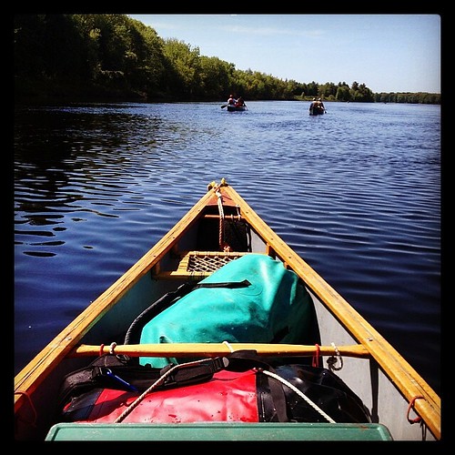
Had a #canoe to myself for a short stretch on the #150thoreau-Wabanaki Expedition. Peaceful, but a little more work to keep up w the double canoes.

Cooking breakfast. #150thoreau #Maine #camping #fire #kettle #bilby #dutchoven #boots
20120513 - Mother's Day - 016

I know it grooved...I feel it.
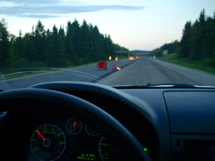
Do I stop for a downed pylon here?
NOT a Chicago box

Shots with the Mike man.

Enjoying this, too.
View from the front door.
2011 November 23 - Taking a drive down to Bangor, Maine on I-95
2011 08 23 181520
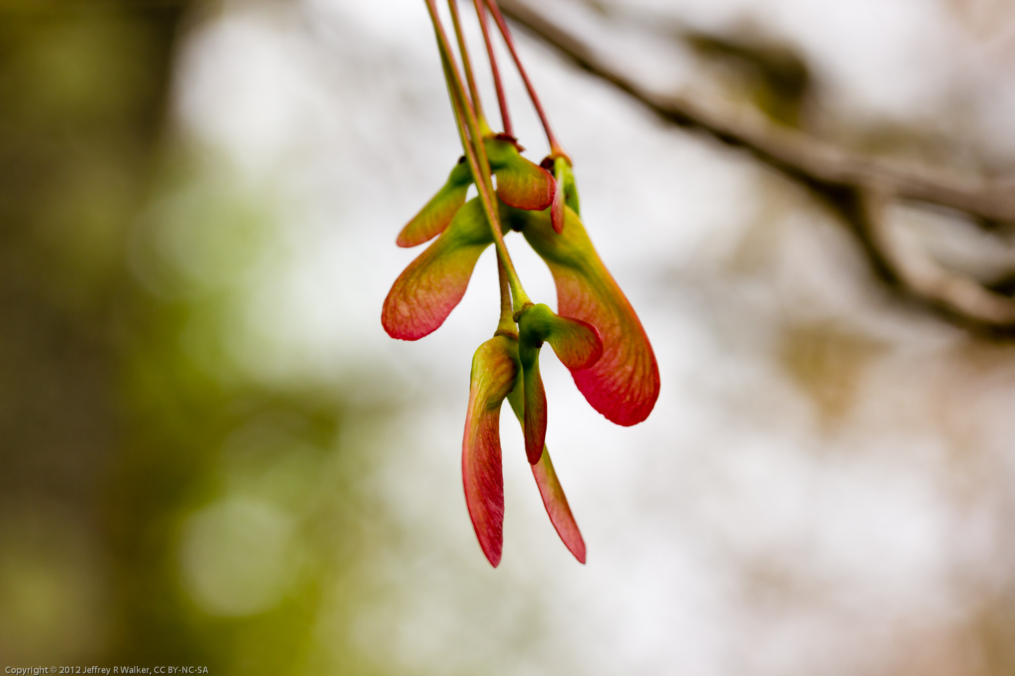
Umber Shadowdragon (Neurocordulia obsoleta) ♂
Mapa de Bennoch Rd, Lagrange, ME, EE. UU.
Buscar otro lugar
Lugares cercanos
Lagrange, Maine, EE. UU.
Medford Road, Medford Rd, Milo, ME, EE. UU.
ME-16, Milo, ME, EE. UU.
Argyle, Maine, EE. UU.
Hudson, Maine, EE. UU.
Edinburg, Maine, EE. UU.
ME-, Argyle, ME, EE. UU.
Greenbush, Maine, EE. UU.
River Rd, Lagrange, ME, EE. UU.
ME-, Edinburg, ME, EE. UU.
Main Rd, Passadumkeag, ME, EE. UU.
Cardville Road, Cardville Rd, Greenbush, ME, EE. UU.
65 Madden Ln, Greenbush, ME, EE. UU.
Seboeis Plantation, Maine, EE. UU.
Condado de Penobscot, Maine, EE. UU.
Enfield Road, Enfield Rd, Maine, EE. UU.
Greenfield, East Central Penobscot, ME, EE. UU.
Lowell, Maine, EE. UU.
99 River Rd, Lincoln, ME, EE. UU.
10 W Old Main Rd, Lowell, ME, EE. UU.
Búsquedas recientes
- Horas de salida y puesta de sol de Red Dog Mine, AK, USA
- Horas de salida y puesta de sol de Am Bahnhof, Am bhf, Borken, Germany
- Horas de salida y puesta de sol de 4th St E, Sonoma, CA, EE. UU.
- Horas de salida y puesta de sol de Oakland Ave, Williamsport, PA, EE. UU.
- Horas de salida y puesta de sol de Via Roma, Pieranica CR, Italia
- Horas de salida y puesta de sol de Torre del reloj, Grad, Dubrovnik (Ragusa), Croacia
- Horas de salida y puesta de sol de Trelew, Chubut, Argentina
- Horas de salida y puesta de sol de Hartfords Bluff Cir, Mt Pleasant, SC, EE. UU.
- Horas de salida y puesta de sol de Kita Ward, Kumamoto, Japón
- Horas de salida y puesta de sol de Pingtan Island, Pingtan County, Fuzhou, China