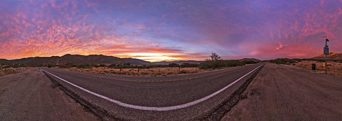
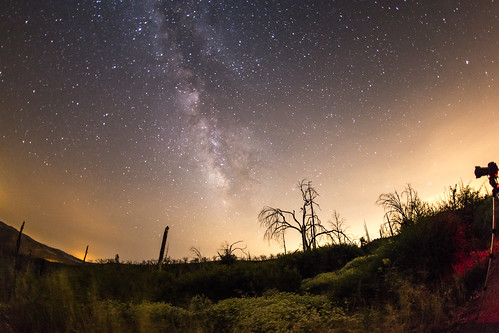
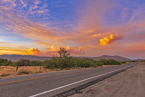
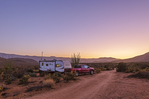
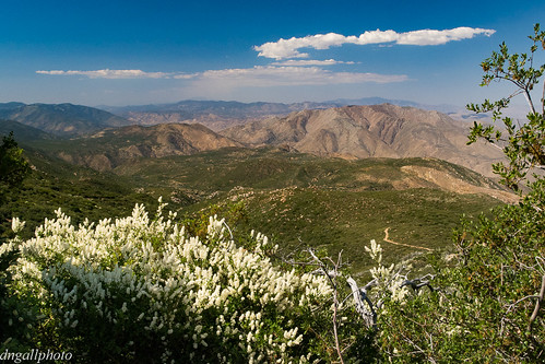
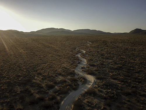
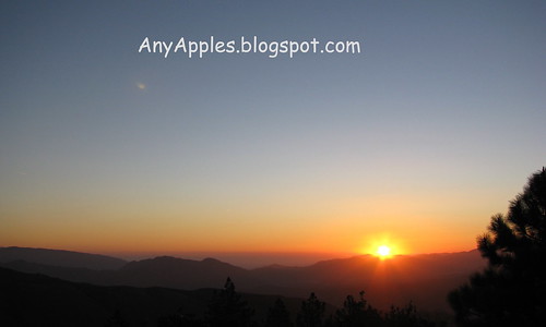
Horas de salida y puesta de sol de Banner, California, EE. UU.
Location: Estados Unidos > California > Condado de San Diego > Julián >
Zona horaria:
America/Los_Angeles
Hora local:
2025-07-08 13:51:21
Longitud:
-116.546593
Latitud:
33.068653
Salida de sol de hoy:
05:45:19 AM
Puesta de sol de hoy:
07:57:48 PM
La duración del día hoy:
14h 12m 29s
Salida de sol de mañana:
05:45:52 AM
Puesta de sol de mañana:
07:57:32 PM
La duración del día mañana:
14h 11m 40s
Mostrar todas las fechas
| Fecha | Salida de sol | Puesta de sol | Duración del día |
|---|---|---|---|
| 01/01/2025 | 06:49:30 AM | 04:51:18 PM | 10h 1m 48s |
| 02/01/2025 | 06:49:39 AM | 04:52:04 PM | 10h 2m 25s |
| 03/01/2025 | 06:49:46 AM | 04:52:51 PM | 10h 3m 5s |
| 04/01/2025 | 06:49:52 AM | 04:53:40 PM | 10h 3m 48s |
| 05/01/2025 | 06:49:55 AM | 04:54:28 PM | 10h 4m 33s |
| 06/01/2025 | 06:49:57 AM | 04:55:18 PM | 10h 5m 21s |
| 07/01/2025 | 06:49:57 AM | 04:56:09 PM | 10h 6m 12s |
| 08/01/2025 | 06:49:55 AM | 04:57:00 PM | 10h 7m 5s |
| 09/01/2025 | 06:49:51 AM | 04:57:52 PM | 10h 8m 1s |
| 10/01/2025 | 06:49:46 AM | 04:58:45 PM | 10h 8m 59s |
| 11/01/2025 | 06:49:38 AM | 04:59:38 PM | 10h 10m 0s |
| 12/01/2025 | 06:49:29 AM | 05:00:32 PM | 10h 11m 3s |
| 13/01/2025 | 06:49:18 AM | 05:01:27 PM | 10h 12m 9s |
| 14/01/2025 | 06:49:06 AM | 05:02:22 PM | 10h 13m 16s |
| 15/01/2025 | 06:48:51 AM | 05:03:17 PM | 10h 14m 26s |
| 16/01/2025 | 06:48:35 AM | 05:04:13 PM | 10h 15m 38s |
| 17/01/2025 | 06:48:17 AM | 05:05:09 PM | 10h 16m 52s |
| 18/01/2025 | 06:47:57 AM | 05:06:05 PM | 10h 18m 8s |
| 19/01/2025 | 06:47:35 AM | 05:07:02 PM | 10h 19m 27s |
| 20/01/2025 | 06:47:12 AM | 05:07:59 PM | 10h 20m 47s |
| 21/01/2025 | 06:46:47 AM | 05:08:56 PM | 10h 22m 9s |
| 22/01/2025 | 06:46:20 AM | 05:09:53 PM | 10h 23m 33s |
| 23/01/2025 | 06:45:51 AM | 05:10:50 PM | 10h 24m 59s |
| 24/01/2025 | 06:45:21 AM | 05:11:48 PM | 10h 26m 27s |
| 25/01/2025 | 06:44:49 AM | 05:12:45 PM | 10h 27m 56s |
| 26/01/2025 | 06:44:16 AM | 05:13:43 PM | 10h 29m 27s |
| 27/01/2025 | 06:43:41 AM | 05:14:40 PM | 10h 30m 59s |
| 28/01/2025 | 06:43:04 AM | 05:15:38 PM | 10h 32m 34s |
| 29/01/2025 | 06:42:26 AM | 05:16:35 PM | 10h 34m 9s |
| 30/01/2025 | 06:41:46 AM | 05:17:32 PM | 10h 35m 46s |
| 31/01/2025 | 06:41:05 AM | 05:18:29 PM | 10h 37m 24s |
| 01/02/2025 | 06:40:22 AM | 05:19:26 PM | 10h 39m 4s |
| 02/02/2025 | 06:39:38 AM | 05:20:23 PM | 10h 40m 45s |
| 03/02/2025 | 06:38:52 AM | 05:21:20 PM | 10h 42m 28s |
| 04/02/2025 | 06:38:05 AM | 05:22:16 PM | 10h 44m 11s |
| 05/02/2025 | 06:37:17 AM | 05:23:13 PM | 10h 45m 56s |
| 06/02/2025 | 06:36:27 AM | 05:24:09 PM | 10h 47m 42s |
| 07/02/2025 | 06:35:36 AM | 05:25:04 PM | 10h 49m 28s |
| 08/02/2025 | 06:34:44 AM | 05:26:00 PM | 10h 51m 16s |
| 09/02/2025 | 06:33:50 AM | 05:26:55 PM | 10h 53m 5s |
| 10/02/2025 | 06:32:55 AM | 05:27:50 PM | 10h 54m 55s |
| 11/02/2025 | 06:31:59 AM | 05:28:44 PM | 10h 56m 45s |
| 12/02/2025 | 06:31:01 AM | 05:29:39 PM | 10h 58m 38s |
| 13/02/2025 | 06:30:03 AM | 05:30:33 PM | 11h 0m 30s |
| 14/02/2025 | 06:29:03 AM | 05:31:26 PM | 11h 2m 23s |
| 15/02/2025 | 06:28:03 AM | 05:32:19 PM | 11h 4m 16s |
| 16/02/2025 | 06:27:01 AM | 05:33:12 PM | 11h 6m 11s |
| 17/02/2025 | 06:25:58 AM | 05:34:05 PM | 11h 8m 7s |
| 18/02/2025 | 06:24:55 AM | 05:34:57 PM | 11h 10m 2s |
| 19/02/2025 | 06:23:50 AM | 05:35:49 PM | 11h 11m 59s |
| 20/02/2025 | 06:22:44 AM | 05:36:40 PM | 11h 13m 56s |
| 21/02/2025 | 06:21:38 AM | 05:37:32 PM | 11h 15m 54s |
| 22/02/2025 | 06:20:30 AM | 05:38:22 PM | 11h 17m 52s |
| 23/02/2025 | 06:19:22 AM | 05:39:13 PM | 11h 19m 51s |
| 24/02/2025 | 06:18:13 AM | 05:40:03 PM | 11h 21m 50s |
| 25/02/2025 | 06:17:03 AM | 05:40:53 PM | 11h 23m 50s |
| 26/02/2025 | 06:15:52 AM | 05:41:42 PM | 11h 25m 50s |
| 27/02/2025 | 06:14:41 AM | 05:42:31 PM | 11h 27m 50s |
| 28/02/2025 | 06:13:29 AM | 05:43:20 PM | 11h 29m 51s |
| 01/03/2025 | 06:12:16 AM | 05:44:08 PM | 11h 31m 52s |
| 02/03/2025 | 06:11:03 AM | 05:44:56 PM | 11h 33m 53s |
| 03/03/2025 | 06:09:49 AM | 05:45:44 PM | 11h 35m 55s |
| 04/03/2025 | 06:08:35 AM | 05:46:31 PM | 11h 37m 56s |
| 05/03/2025 | 06:07:20 AM | 05:47:19 PM | 11h 39m 59s |
| 06/03/2025 | 06:06:04 AM | 05:48:05 PM | 11h 42m 1s |
| 07/03/2025 | 06:04:48 AM | 05:48:52 PM | 11h 44m 4s |
| 08/03/2025 | 06:03:32 AM | 05:49:38 PM | 11h 46m 6s |
| 09/03/2025 | 07:02:18 AM | 06:50:22 PM | 11h 48m 4s |
| 10/03/2025 | 07:01:01 AM | 06:51:08 PM | 11h 50m 7s |
| 11/03/2025 | 06:59:43 AM | 06:51:54 PM | 11h 52m 11s |
| 12/03/2025 | 06:58:25 AM | 06:52:39 PM | 11h 54m 14s |
| 13/03/2025 | 06:57:07 AM | 06:53:24 PM | 11h 56m 17s |
| 14/03/2025 | 06:55:48 AM | 06:54:09 PM | 11h 58m 21s |
| 15/03/2025 | 06:54:29 AM | 06:54:54 PM | 12h 0m 25s |
| 16/03/2025 | 06:53:10 AM | 06:55:38 PM | 12h 2m 28s |
| 17/03/2025 | 06:51:51 AM | 06:56:23 PM | 12h 4m 32s |
| 18/03/2025 | 06:50:32 AM | 06:57:07 PM | 12h 6m 35s |
| 19/03/2025 | 06:49:12 AM | 06:57:51 PM | 12h 8m 39s |
| 20/03/2025 | 06:47:53 AM | 06:58:35 PM | 12h 10m 42s |
| 21/03/2025 | 06:46:33 AM | 06:59:19 PM | 12h 12m 46s |
| 22/03/2025 | 06:45:14 AM | 07:00:02 PM | 12h 14m 48s |
| 23/03/2025 | 06:43:54 AM | 07:00:46 PM | 12h 16m 52s |
| 24/03/2025 | 06:42:34 AM | 07:01:29 PM | 12h 18m 55s |
| 25/03/2025 | 06:41:15 AM | 07:02:13 PM | 12h 20m 58s |
| 26/03/2025 | 06:39:55 AM | 07:02:56 PM | 12h 23m 1s |
| 27/03/2025 | 06:38:36 AM | 07:03:39 PM | 12h 25m 3s |
| 28/03/2025 | 06:37:16 AM | 07:04:23 PM | 12h 27m 7s |
| 29/03/2025 | 06:35:57 AM | 07:05:06 PM | 12h 29m 9s |
| 30/03/2025 | 06:34:38 AM | 07:05:49 PM | 12h 31m 11s |
| 31/03/2025 | 06:33:20 AM | 07:06:32 PM | 12h 33m 12s |
| 01/04/2025 | 06:32:01 AM | 07:07:15 PM | 12h 35m 14s |
| 02/04/2025 | 06:30:43 AM | 07:07:58 PM | 12h 37m 15s |
| 03/04/2025 | 06:29:25 AM | 07:08:41 PM | 12h 39m 16s |
| 04/04/2025 | 06:28:07 AM | 07:09:25 PM | 12h 41m 18s |
| 05/04/2025 | 06:26:50 AM | 07:10:08 PM | 12h 43m 18s |
| 06/04/2025 | 06:25:33 AM | 07:10:51 PM | 12h 45m 18s |
| 07/04/2025 | 06:24:17 AM | 07:11:34 PM | 12h 47m 17s |
| 08/04/2025 | 06:23:01 AM | 07:12:18 PM | 12h 49m 17s |
| 09/04/2025 | 06:21:46 AM | 07:13:01 PM | 12h 51m 15s |
| 10/04/2025 | 06:20:31 AM | 07:13:44 PM | 12h 53m 13s |
| 11/04/2025 | 06:19:16 AM | 07:14:28 PM | 12h 55m 12s |
| 12/04/2025 | 06:18:02 AM | 07:15:12 PM | 12h 57m 10s |
| 13/04/2025 | 06:16:49 AM | 07:15:55 PM | 12h 59m 6s |
| 14/04/2025 | 06:15:36 AM | 07:16:39 PM | 13h 1m 3s |
| 15/04/2025 | 06:14:24 AM | 07:17:23 PM | 13h 2m 59s |
| 16/04/2025 | 06:13:13 AM | 07:18:07 PM | 13h 4m 54s |
| 17/04/2025 | 06:12:02 AM | 07:18:51 PM | 13h 6m 49s |
| 18/04/2025 | 06:10:52 AM | 07:19:35 PM | 13h 8m 43s |
| 19/04/2025 | 06:09:43 AM | 07:20:19 PM | 13h 10m 36s |
| 20/04/2025 | 06:08:35 AM | 07:21:03 PM | 13h 12m 28s |
| 21/04/2025 | 06:07:27 AM | 07:21:47 PM | 13h 14m 20s |
| 22/04/2025 | 06:06:20 AM | 07:22:32 PM | 13h 16m 12s |
| 23/04/2025 | 06:05:15 AM | 07:23:16 PM | 13h 18m 1s |
| 24/04/2025 | 06:04:10 AM | 07:24:01 PM | 13h 19m 51s |
| 25/04/2025 | 06:03:05 AM | 07:24:45 PM | 13h 21m 40s |
| 26/04/2025 | 06:02:02 AM | 07:25:30 PM | 13h 23m 28s |
| 27/04/2025 | 06:01:00 AM | 07:26:15 PM | 13h 25m 15s |
| 28/04/2025 | 05:59:59 AM | 07:27:00 PM | 13h 27m 1s |
| 29/04/2025 | 05:58:59 AM | 07:27:44 PM | 13h 28m 45s |
| 30/04/2025 | 05:58:00 AM | 07:28:29 PM | 13h 30m 29s |
| 01/05/2025 | 05:57:02 AM | 07:29:14 PM | 13h 32m 12s |
| 02/05/2025 | 05:56:05 AM | 07:29:59 PM | 13h 33m 54s |
| 03/05/2025 | 05:55:09 AM | 07:30:43 PM | 13h 35m 34s |
| 04/05/2025 | 05:54:14 AM | 07:31:28 PM | 13h 37m 14s |
| 05/05/2025 | 05:53:21 AM | 07:32:13 PM | 13h 38m 52s |
| 06/05/2025 | 05:52:29 AM | 07:32:58 PM | 13h 40m 29s |
| 07/05/2025 | 05:51:37 AM | 07:33:42 PM | 13h 42m 5s |
| 08/05/2025 | 05:50:48 AM | 07:34:27 PM | 13h 43m 39s |
| 09/05/2025 | 05:49:59 AM | 07:35:11 PM | 13h 45m 12s |
| 10/05/2025 | 05:49:12 AM | 07:35:55 PM | 13h 46m 43s |
| 11/05/2025 | 05:48:26 AM | 07:36:39 PM | 13h 48m 13s |
| 12/05/2025 | 05:47:41 AM | 07:37:23 PM | 13h 49m 42s |
| 13/05/2025 | 05:46:58 AM | 07:38:07 PM | 13h 51m 9s |
| 14/05/2025 | 05:46:16 AM | 07:38:50 PM | 13h 52m 34s |
| 15/05/2025 | 05:45:35 AM | 07:39:33 PM | 13h 53m 58s |
| 16/05/2025 | 05:44:56 AM | 07:40:16 PM | 13h 55m 20s |
| 17/05/2025 | 05:44:19 AM | 07:40:59 PM | 13h 56m 40s |
| 18/05/2025 | 05:43:42 AM | 07:41:41 PM | 13h 57m 59s |
| 19/05/2025 | 05:43:07 AM | 07:42:23 PM | 13h 59m 16s |
| 20/05/2025 | 05:42:34 AM | 07:43:04 PM | 14h 0m 30s |
| 21/05/2025 | 05:42:02 AM | 07:43:45 PM | 14h 1m 43s |
| 22/05/2025 | 05:41:32 AM | 07:44:26 PM | 14h 2m 54s |
| 23/05/2025 | 05:41:03 AM | 07:45:06 PM | 14h 4m 3s |
| 24/05/2025 | 05:40:35 AM | 07:45:45 PM | 14h 5m 10s |
| 25/05/2025 | 05:40:10 AM | 07:46:24 PM | 14h 6m 14s |
| 26/05/2025 | 05:39:45 AM | 07:47:03 PM | 14h 7m 18s |
| 27/05/2025 | 05:39:22 AM | 07:47:41 PM | 14h 8m 19s |
| 28/05/2025 | 05:39:01 AM | 07:48:18 PM | 14h 9m 17s |
| 29/05/2025 | 05:38:41 AM | 07:48:54 PM | 14h 10m 13s |
| 30/05/2025 | 05:38:23 AM | 07:49:30 PM | 14h 11m 7s |
| 31/05/2025 | 05:38:07 AM | 07:50:05 PM | 14h 11m 58s |
| 01/06/2025 | 05:37:52 AM | 07:50:39 PM | 14h 12m 47s |
| 02/06/2025 | 05:37:38 AM | 07:51:13 PM | 14h 13m 35s |
| 03/06/2025 | 05:37:26 AM | 07:51:45 PM | 14h 14m 19s |
| 04/06/2025 | 05:37:16 AM | 07:52:17 PM | 14h 15m 1s |
| 05/06/2025 | 05:37:07 AM | 07:52:48 PM | 14h 15m 41s |
| 06/06/2025 | 05:37:00 AM | 07:53:17 PM | 14h 16m 17s |
| 07/06/2025 | 05:36:54 AM | 07:53:46 PM | 14h 16m 52s |
| 08/06/2025 | 05:36:50 AM | 07:54:14 PM | 14h 17m 24s |
| 09/06/2025 | 05:36:47 AM | 07:54:41 PM | 14h 17m 54s |
| 10/06/2025 | 05:36:46 AM | 07:55:06 PM | 14h 18m 20s |
| 11/06/2025 | 05:36:47 AM | 07:55:31 PM | 14h 18m 44s |
| 12/06/2025 | 05:36:48 AM | 07:55:54 PM | 14h 19m 6s |
| 13/06/2025 | 05:36:52 AM | 07:56:16 PM | 14h 19m 24s |
| 14/06/2025 | 05:36:56 AM | 07:56:37 PM | 14h 19m 41s |
| 15/06/2025 | 05:37:03 AM | 07:56:57 PM | 14h 19m 54s |
| 16/06/2025 | 05:37:10 AM | 07:57:15 PM | 14h 20m 5s |
| 17/06/2025 | 05:37:19 AM | 07:57:32 PM | 14h 20m 13s |
| 18/06/2025 | 05:37:30 AM | 07:57:48 PM | 14h 20m 18s |
| 19/06/2025 | 05:37:41 AM | 07:58:02 PM | 14h 20m 21s |
| 20/06/2025 | 05:37:54 AM | 07:58:15 PM | 14h 20m 21s |
| 21/06/2025 | 05:38:09 AM | 07:58:27 PM | 14h 20m 18s |
| 22/06/2025 | 05:38:25 AM | 07:58:37 PM | 14h 20m 12s |
| 23/06/2025 | 05:38:41 AM | 07:58:46 PM | 14h 20m 5s |
| 24/06/2025 | 05:39:00 AM | 07:58:53 PM | 14h 19m 53s |
| 25/06/2025 | 05:39:19 AM | 07:58:59 PM | 14h 19m 40s |
| 26/06/2025 | 05:39:40 AM | 07:59:04 PM | 14h 19m 24s |
| 27/06/2025 | 05:40:01 AM | 07:59:06 PM | 14h 19m 5s |
| 28/06/2025 | 05:40:24 AM | 07:59:08 PM | 14h 18m 44s |
| 29/06/2025 | 05:40:48 AM | 07:59:07 PM | 14h 18m 19s |
| 30/06/2025 | 05:41:13 AM | 07:59:06 PM | 14h 17m 53s |
| 01/07/2025 | 05:41:39 AM | 07:59:02 PM | 14h 17m 23s |
| 02/07/2025 | 05:42:06 AM | 07:58:57 PM | 14h 16m 51s |
| 03/07/2025 | 05:42:34 AM | 07:58:51 PM | 14h 16m 17s |
| 04/07/2025 | 05:43:03 AM | 07:58:43 PM | 14h 15m 40s |
| 05/07/2025 | 05:43:32 AM | 07:58:33 PM | 14h 15m 1s |
| 06/07/2025 | 05:44:03 AM | 07:58:22 PM | 14h 14m 19s |
| 07/07/2025 | 05:44:34 AM | 07:58:09 PM | 14h 13m 35s |
| 08/07/2025 | 05:45:06 AM | 07:57:54 PM | 14h 12m 48s |
| 09/07/2025 | 05:45:39 AM | 07:57:38 PM | 14h 11m 59s |
| 10/07/2025 | 05:46:13 AM | 07:57:21 PM | 14h 11m 8s |
| 11/07/2025 | 05:46:47 AM | 07:57:01 PM | 14h 10m 14s |
| 12/07/2025 | 05:47:22 AM | 07:56:40 PM | 14h 9m 18s |
| 13/07/2025 | 05:47:58 AM | 07:56:18 PM | 14h 8m 20s |
| 14/07/2025 | 05:48:34 AM | 07:55:54 PM | 14h 7m 20s |
| 15/07/2025 | 05:49:10 AM | 07:55:28 PM | 14h 6m 18s |
| 16/07/2025 | 05:49:48 AM | 07:55:01 PM | 14h 5m 13s |
| 17/07/2025 | 05:50:25 AM | 07:54:32 PM | 14h 4m 7s |
| 18/07/2025 | 05:51:03 AM | 07:54:02 PM | 14h 2m 59s |
| 19/07/2025 | 05:51:42 AM | 07:53:30 PM | 14h 1m 48s |
| 20/07/2025 | 05:52:21 AM | 07:52:57 PM | 14h 0m 36s |
| 21/07/2025 | 05:53:00 AM | 07:52:22 PM | 13h 59m 22s |
| 22/07/2025 | 05:53:40 AM | 07:51:46 PM | 13h 58m 6s |
| 23/07/2025 | 05:54:20 AM | 07:51:08 PM | 13h 56m 48s |
| 24/07/2025 | 05:55:00 AM | 07:50:29 PM | 13h 55m 29s |
| 25/07/2025 | 05:55:40 AM | 07:49:48 PM | 13h 54m 8s |
| 26/07/2025 | 05:56:21 AM | 07:49:06 PM | 13h 52m 45s |
| 27/07/2025 | 05:57:02 AM | 07:48:23 PM | 13h 51m 21s |
| 28/07/2025 | 05:57:43 AM | 07:47:38 PM | 13h 49m 55s |
| 29/07/2025 | 05:58:24 AM | 07:46:52 PM | 13h 48m 28s |
| 30/07/2025 | 05:59:05 AM | 07:46:04 PM | 13h 46m 59s |
| 31/07/2025 | 05:59:47 AM | 07:45:15 PM | 13h 45m 28s |
| 01/08/2025 | 06:00:28 AM | 07:44:25 PM | 13h 43m 57s |
| 02/08/2025 | 06:01:10 AM | 07:43:33 PM | 13h 42m 23s |
| 03/08/2025 | 06:01:51 AM | 07:42:41 PM | 13h 40m 50s |
| 04/08/2025 | 06:02:33 AM | 07:41:47 PM | 13h 39m 14s |
| 05/08/2025 | 06:03:15 AM | 07:40:52 PM | 13h 37m 37s |
| 06/08/2025 | 06:03:56 AM | 07:39:55 PM | 13h 35m 59s |
| 07/08/2025 | 06:04:38 AM | 07:38:58 PM | 13h 34m 20s |
| 08/08/2025 | 06:05:20 AM | 07:37:59 PM | 13h 32m 39s |
| 09/08/2025 | 06:06:01 AM | 07:36:59 PM | 13h 30m 58s |
| 10/08/2025 | 06:06:43 AM | 07:35:58 PM | 13h 29m 15s |
| 11/08/2025 | 06:07:24 AM | 07:34:56 PM | 13h 27m 32s |
| 12/08/2025 | 06:08:05 AM | 07:33:53 PM | 13h 25m 48s |
| 13/08/2025 | 06:08:47 AM | 07:32:49 PM | 13h 24m 2s |
| 14/08/2025 | 06:09:28 AM | 07:31:45 PM | 13h 22m 17s |
| 15/08/2025 | 06:10:09 AM | 07:30:39 PM | 13h 20m 30s |
| 16/08/2025 | 06:10:50 AM | 07:29:32 PM | 13h 18m 42s |
| 17/08/2025 | 06:11:31 AM | 07:28:24 PM | 13h 16m 53s |
| 18/08/2025 | 06:12:12 AM | 07:27:15 PM | 13h 15m 3s |
| 19/08/2025 | 06:12:53 AM | 07:26:06 PM | 13h 13m 13s |
| 20/08/2025 | 06:13:33 AM | 07:24:56 PM | 13h 11m 23s |
| 21/08/2025 | 06:14:14 AM | 07:23:45 PM | 13h 9m 31s |
| 22/08/2025 | 06:14:54 AM | 07:22:33 PM | 13h 7m 39s |
| 23/08/2025 | 06:15:34 AM | 07:21:20 PM | 13h 5m 46s |
| 24/08/2025 | 06:16:14 AM | 07:20:07 PM | 13h 3m 53s |
| 25/08/2025 | 06:16:54 AM | 07:18:53 PM | 13h 1m 59s |
| 26/08/2025 | 06:17:34 AM | 07:17:38 PM | 13h 0m 4s |
| 27/08/2025 | 06:18:14 AM | 07:16:23 PM | 12h 58m 9s |
| 28/08/2025 | 06:18:54 AM | 07:15:07 PM | 12h 56m 13s |
| 29/08/2025 | 06:19:33 AM | 07:13:51 PM | 12h 54m 18s |
| 30/08/2025 | 06:20:13 AM | 07:12:34 PM | 12h 52m 21s |
| 31/08/2025 | 06:20:52 AM | 07:11:16 PM | 12h 50m 24s |
| 01/09/2025 | 06:21:31 AM | 07:09:58 PM | 12h 48m 27s |
| 02/09/2025 | 06:22:11 AM | 07:08:40 PM | 12h 46m 29s |
| 03/09/2025 | 06:22:50 AM | 07:07:21 PM | 12h 44m 31s |
| 04/09/2025 | 06:23:29 AM | 07:06:01 PM | 12h 42m 32s |
| 05/09/2025 | 06:24:08 AM | 07:04:42 PM | 12h 40m 34s |
| 06/09/2025 | 06:24:47 AM | 07:03:22 PM | 12h 38m 35s |
| 07/09/2025 | 06:25:26 AM | 07:02:01 PM | 12h 36m 35s |
| 08/09/2025 | 06:26:05 AM | 07:00:41 PM | 12h 34m 36s |
| 09/09/2025 | 06:26:44 AM | 06:59:20 PM | 12h 32m 36s |
| 10/09/2025 | 06:27:23 AM | 06:57:59 PM | 12h 30m 36s |
| 11/09/2025 | 06:28:02 AM | 06:56:37 PM | 12h 28m 35s |
| 12/09/2025 | 06:28:41 AM | 06:55:16 PM | 12h 26m 35s |
| 13/09/2025 | 06:29:19 AM | 06:53:54 PM | 12h 24m 35s |
| 14/09/2025 | 06:29:59 AM | 06:52:32 PM | 12h 22m 33s |
| 15/09/2025 | 06:30:38 AM | 06:51:10 PM | 12h 20m 32s |
| 16/09/2025 | 06:31:17 AM | 06:49:48 PM | 12h 18m 31s |
| 17/09/2025 | 06:31:56 AM | 06:48:26 PM | 12h 16m 30s |
| 18/09/2025 | 06:32:35 AM | 06:47:04 PM | 12h 14m 29s |
| 19/09/2025 | 06:33:15 AM | 06:45:42 PM | 12h 12m 27s |
| 20/09/2025 | 06:33:54 AM | 06:44:20 PM | 12h 10m 26s |
| 21/09/2025 | 06:34:34 AM | 06:42:58 PM | 12h 8m 24s |
| 22/09/2025 | 06:35:13 AM | 06:41:36 PM | 12h 6m 23s |
| 23/09/2025 | 06:35:53 AM | 06:40:14 PM | 12h 4m 21s |
| 24/09/2025 | 06:36:33 AM | 06:38:53 PM | 12h 2m 20s |
| 25/09/2025 | 06:37:14 AM | 06:37:31 PM | 12h 0m 17s |
| 26/09/2025 | 06:37:54 AM | 06:36:10 PM | 11h 58m 16s |
| 27/09/2025 | 06:38:35 AM | 06:34:49 PM | 11h 56m 14s |
| 28/09/2025 | 06:39:15 AM | 06:33:28 PM | 11h 54m 13s |
| 29/09/2025 | 06:39:56 AM | 06:32:08 PM | 11h 52m 12s |
| 30/09/2025 | 06:40:38 AM | 06:30:48 PM | 11h 50m 10s |
| 01/10/2025 | 06:41:19 AM | 06:29:28 PM | 11h 48m 9s |
| 02/10/2025 | 06:42:01 AM | 06:28:09 PM | 11h 46m 8s |
| 03/10/2025 | 06:42:43 AM | 06:26:50 PM | 11h 44m 7s |
| 04/10/2025 | 06:43:25 AM | 06:25:32 PM | 11h 42m 7s |
| 05/10/2025 | 06:44:08 AM | 06:24:14 PM | 11h 40m 6s |
| 06/10/2025 | 06:44:51 AM | 06:22:56 PM | 11h 38m 5s |
| 07/10/2025 | 06:45:34 AM | 06:21:39 PM | 11h 36m 5s |
| 08/10/2025 | 06:46:18 AM | 06:20:23 PM | 11h 34m 5s |
| 09/10/2025 | 06:47:02 AM | 06:19:07 PM | 11h 32m 5s |
| 10/10/2025 | 06:47:46 AM | 06:17:52 PM | 11h 30m 6s |
| 11/10/2025 | 06:48:30 AM | 06:16:38 PM | 11h 28m 8s |
| 12/10/2025 | 06:49:15 AM | 06:15:24 PM | 11h 26m 9s |
| 13/10/2025 | 06:50:01 AM | 06:14:11 PM | 11h 24m 10s |
| 14/10/2025 | 06:50:46 AM | 06:12:58 PM | 11h 22m 12s |
| 15/10/2025 | 06:51:32 AM | 06:11:47 PM | 11h 20m 15s |
| 16/10/2025 | 06:52:19 AM | 06:10:36 PM | 11h 18m 17s |
| 17/10/2025 | 06:53:05 AM | 06:09:26 PM | 11h 16m 21s |
| 18/10/2025 | 06:53:52 AM | 06:08:17 PM | 11h 14m 25s |
| 19/10/2025 | 06:54:40 AM | 06:07:09 PM | 11h 12m 29s |
| 20/10/2025 | 06:55:28 AM | 06:06:01 PM | 11h 10m 33s |
| 21/10/2025 | 06:56:16 AM | 06:04:55 PM | 11h 8m 39s |
| 22/10/2025 | 06:57:05 AM | 06:03:50 PM | 11h 6m 45s |
| 23/10/2025 | 06:57:54 AM | 06:02:45 PM | 11h 4m 51s |
| 24/10/2025 | 06:58:43 AM | 06:01:42 PM | 11h 2m 59s |
| 25/10/2025 | 06:59:33 AM | 06:00:40 PM | 11h 1m 7s |
| 26/10/2025 | 07:00:23 AM | 05:59:39 PM | 10h 59m 16s |
| 27/10/2025 | 07:01:13 AM | 05:58:39 PM | 10h 57m 26s |
| 28/10/2025 | 07:02:04 AM | 05:57:40 PM | 10h 55m 36s |
| 29/10/2025 | 07:02:55 AM | 05:56:43 PM | 10h 53m 48s |
| 30/10/2025 | 07:03:47 AM | 05:55:46 PM | 10h 51m 59s |
| 31/10/2025 | 07:04:39 AM | 05:54:51 PM | 10h 50m 12s |
| 01/11/2025 | 07:05:31 AM | 05:53:57 PM | 10h 48m 26s |
| 02/11/2025 | 06:06:26 AM | 04:53:03 PM | 10h 46m 37s |
| 03/11/2025 | 06:07:19 AM | 04:52:12 PM | 10h 44m 53s |
| 04/11/2025 | 06:08:12 AM | 04:51:22 PM | 10h 43m 10s |
| 05/11/2025 | 06:09:05 AM | 04:50:34 PM | 10h 41m 29s |
| 06/11/2025 | 06:09:59 AM | 04:49:47 PM | 10h 39m 48s |
| 07/11/2025 | 06:10:53 AM | 04:49:01 PM | 10h 38m 8s |
| 08/11/2025 | 06:11:47 AM | 04:48:17 PM | 10h 36m 30s |
| 09/11/2025 | 06:12:41 AM | 04:47:35 PM | 10h 34m 54s |
| 10/11/2025 | 06:13:35 AM | 04:46:54 PM | 10h 33m 19s |
| 11/11/2025 | 06:14:30 AM | 04:46:15 PM | 10h 31m 45s |
| 12/11/2025 | 06:15:24 AM | 04:45:37 PM | 10h 30m 13s |
| 13/11/2025 | 06:16:19 AM | 04:45:01 PM | 10h 28m 42s |
| 14/11/2025 | 06:17:14 AM | 04:44:26 PM | 10h 27m 12s |
| 15/11/2025 | 06:18:09 AM | 04:43:53 PM | 10h 25m 44s |
| 16/11/2025 | 06:19:04 AM | 04:43:22 PM | 10h 24m 18s |
| 17/11/2025 | 06:19:58 AM | 04:42:53 PM | 10h 22m 55s |
| 18/11/2025 | 06:20:53 AM | 04:42:25 PM | 10h 21m 32s |
| 19/11/2025 | 06:21:48 AM | 04:41:59 PM | 10h 20m 11s |
| 20/11/2025 | 06:22:42 AM | 04:41:35 PM | 10h 18m 53s |
| 21/11/2025 | 06:23:37 AM | 04:41:12 PM | 10h 17m 35s |
| 22/11/2025 | 06:24:31 AM | 04:40:51 PM | 10h 16m 20s |
| 23/11/2025 | 06:25:24 AM | 04:40:32 PM | 10h 15m 8s |
| 24/11/2025 | 06:26:18 AM | 04:40:15 PM | 10h 13m 57s |
| 25/11/2025 | 06:27:11 AM | 04:40:00 PM | 10h 12m 49s |
| 26/11/2025 | 06:28:04 AM | 04:39:46 PM | 10h 11m 42s |
| 27/11/2025 | 06:28:57 AM | 04:39:35 PM | 10h 10m 38s |
| 28/11/2025 | 06:29:49 AM | 04:39:25 PM | 10h 9m 36s |
| 29/11/2025 | 06:30:40 AM | 04:39:17 PM | 10h 8m 37s |
| 30/11/2025 | 06:31:31 AM | 04:39:11 PM | 10h 7m 40s |
| 01/12/2025 | 06:32:21 AM | 04:39:07 PM | 10h 6m 46s |
| 02/12/2025 | 06:33:11 AM | 04:39:04 PM | 10h 5m 53s |
| 03/12/2025 | 06:34:00 AM | 04:39:04 PM | 10h 5m 4s |
| 04/12/2025 | 06:34:48 AM | 04:39:05 PM | 10h 4m 17s |
| 05/12/2025 | 06:35:36 AM | 04:39:08 PM | 10h 3m 32s |
| 06/12/2025 | 06:36:22 AM | 04:39:13 PM | 10h 2m 51s |
| 07/12/2025 | 06:37:08 AM | 04:39:20 PM | 10h 2m 12s |
| 08/12/2025 | 06:37:53 AM | 04:39:29 PM | 10h 1m 36s |
| 09/12/2025 | 06:38:37 AM | 04:39:39 PM | 10h 1m 2s |
| 10/12/2025 | 06:39:20 AM | 04:39:52 PM | 10h 0m 32s |
| 11/12/2025 | 06:40:02 AM | 04:40:06 PM | 10h 0m 4s |
| 12/12/2025 | 06:40:43 AM | 04:40:22 PM | 9h 59m 39s |
| 13/12/2025 | 06:41:22 AM | 04:40:39 PM | 9h 59m 17s |
| 14/12/2025 | 06:42:01 AM | 04:40:59 PM | 9h 58m 58s |
| 15/12/2025 | 06:42:38 AM | 04:41:20 PM | 9h 58m 42s |
| 16/12/2025 | 06:43:14 AM | 04:41:42 PM | 9h 58m 28s |
| 17/12/2025 | 06:43:48 AM | 04:42:07 PM | 9h 58m 19s |
| 18/12/2025 | 06:44:22 AM | 04:42:33 PM | 9h 58m 11s |
| 19/12/2025 | 06:44:54 AM | 04:43:00 PM | 9h 58m 6s |
| 20/12/2025 | 06:45:24 AM | 04:43:29 PM | 9h 58m 5s |
| 21/12/2025 | 06:45:53 AM | 04:44:00 PM | 9h 58m 7s |
| 22/12/2025 | 06:46:21 AM | 04:44:32 PM | 9h 58m 11s |
| 23/12/2025 | 06:46:47 AM | 04:45:06 PM | 9h 58m 19s |
| 24/12/2025 | 06:47:11 AM | 04:45:41 PM | 9h 58m 30s |
| 25/12/2025 | 06:47:34 AM | 04:46:17 PM | 9h 58m 43s |
| 26/12/2025 | 06:47:55 AM | 04:46:55 PM | 9h 59m 0s |
| 27/12/2025 | 06:48:15 AM | 04:47:34 PM | 9h 59m 19s |
| 28/12/2025 | 06:48:33 AM | 04:48:14 PM | 9h 59m 41s |
| 29/12/2025 | 06:48:49 AM | 04:48:56 PM | 10h 0m 7s |
| 30/12/2025 | 06:49:04 AM | 04:49:38 PM | 10h 0m 34s |
| 31/12/2025 | 06:49:17 AM | 04:50:22 PM | 10h 1m 5s |
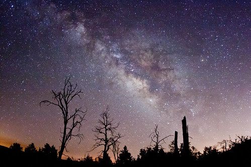
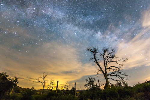
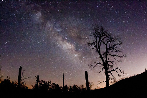
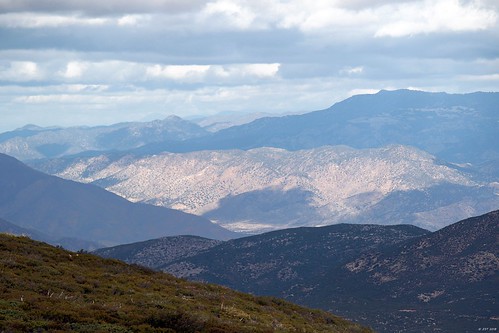
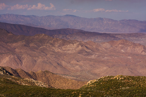
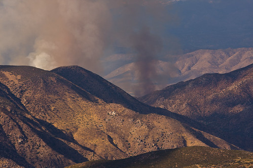
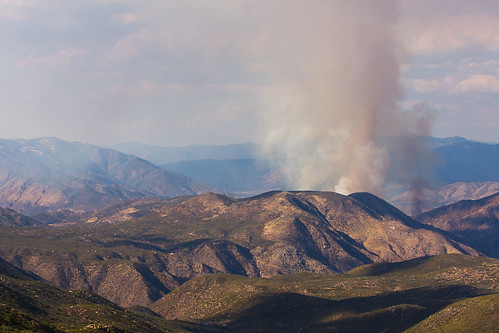
Fotos
Mapa de Banner, California, EE. UU.
Buscar otro lugar
Lugares cercanos
Banner, California, EE. UU.
CA-78, Julian, CA, EE. UU.
Crescent Dr, Julian, CA, EE. UU.
Salton Vista Dr, Julian, CA, EE. UU.
Inspiration Point Road, Inspiration Point Rd, Julian, CA, EE. UU.
Hacienda Dr, Julian, CA, EE. UU.
Woodland Rd, Julian, CA, EE. UU.
Salton View Dr, Julian, CA, EE. UU.
Slumbering Oaks Trail, Julian, CA, EE. UU.
Villa De Valor Hildreth House Circa Hotel, 3rd St, Julian, CA, EE. UU.
Main St, Ramona, CA, EE. UU.
3rd St, Julian, CA, EE. UU.
Julián, California, EE. UU.
Ticanu Dr, Julian, CA, EE. UU.
Scissors Crossing, CA, EE. UU.
Wells Fargo Trail, Julian, CA, EE. UU.
Surrey Trail, Julian, CA, EE. UU.
Shelter Valley Citizens Co-Op, Great Southern Overland Stage Route, Julian, CA, EE. UU.
Shelter Valley, CA, EE. UU.
Mountainbrook Rd, Santa Ysabel, CA, EE. UU.
Búsquedas recientes
- Horas de salida y puesta de sol de Red Dog Mine, AK, USA
- Horas de salida y puesta de sol de Am Bahnhof, Am bhf, Borken, Germany
- Horas de salida y puesta de sol de 4th St E, Sonoma, CA, EE. UU.
- Horas de salida y puesta de sol de Oakland Ave, Williamsport, PA, EE. UU.
- Horas de salida y puesta de sol de Via Roma, Pieranica CR, Italia
- Horas de salida y puesta de sol de Torre del reloj, Grad, Dubrovnik (Ragusa), Croacia
- Horas de salida y puesta de sol de Trelew, Chubut, Argentina
- Horas de salida y puesta de sol de Hartfords Bluff Cir, Mt Pleasant, SC, EE. UU.
- Horas de salida y puesta de sol de Kita Ward, Kumamoto, Japón
- Horas de salida y puesta de sol de Pingtan Island, Pingtan County, Fuzhou, China
