Horas de salida y puesta de sol de 85 The Way West Rd, Cody, WY, EE. UU.
Location: Estados Unidos > Wyoming > Condado de Park > Cody >
Zona horaria:
America/Denver
Hora local:
2025-06-21 10:01:59
Longitud:
-109.451149
Latitud:
44.763629
Salida de sol de hoy:
05:32:25 AM
Puesta de sol de hoy:
09:07:34 PM
La duración del día hoy:
15h 35m 9s
Salida de sol de mañana:
05:32:43 AM
Puesta de sol de mañana:
09:07:42 PM
La duración del día mañana:
15h 34m 59s
Mostrar todas las fechas
| Fecha | Salida de sol | Puesta de sol | Duración del día |
|---|---|---|---|
| 01/01/2025 | 07:55:06 AM | 04:48:53 PM | 8h 53m 47s |
| 02/01/2025 | 07:55:04 AM | 04:49:50 PM | 8h 54m 46s |
| 03/01/2025 | 07:54:59 AM | 04:50:49 PM | 8h 55m 50s |
| 04/01/2025 | 07:54:52 AM | 04:51:50 PM | 8h 56m 58s |
| 05/01/2025 | 07:54:42 AM | 04:52:53 PM | 8h 58m 11s |
| 06/01/2025 | 07:54:29 AM | 04:53:57 PM | 8h 59m 28s |
| 07/01/2025 | 07:54:14 AM | 04:55:03 PM | 9h 0m 49s |
| 08/01/2025 | 07:53:57 AM | 04:56:10 PM | 9h 2m 13s |
| 09/01/2025 | 07:53:36 AM | 04:57:19 PM | 9h 3m 43s |
| 10/01/2025 | 07:53:14 AM | 04:58:29 PM | 9h 5m 15s |
| 11/01/2025 | 07:52:48 AM | 04:59:40 PM | 9h 6m 52s |
| 12/01/2025 | 07:52:21 AM | 05:00:53 PM | 9h 8m 32s |
| 13/01/2025 | 07:51:50 AM | 05:02:06 PM | 9h 10m 16s |
| 14/01/2025 | 07:51:18 AM | 05:03:21 PM | 9h 12m 3s |
| 15/01/2025 | 07:50:43 AM | 05:04:37 PM | 9h 13m 54s |
| 16/01/2025 | 07:50:05 AM | 05:05:54 PM | 9h 15m 49s |
| 17/01/2025 | 07:49:26 AM | 05:07:12 PM | 9h 17m 46s |
| 18/01/2025 | 07:48:43 AM | 05:08:30 PM | 9h 19m 47s |
| 19/01/2025 | 07:47:59 AM | 05:09:50 PM | 9h 21m 51s |
| 20/01/2025 | 07:47:12 AM | 05:11:10 PM | 9h 23m 58s |
| 21/01/2025 | 07:46:24 AM | 05:12:31 PM | 9h 26m 7s |
| 22/01/2025 | 07:45:33 AM | 05:13:52 PM | 9h 28m 19s |
| 23/01/2025 | 07:44:39 AM | 05:15:14 PM | 9h 30m 35s |
| 24/01/2025 | 07:43:44 AM | 05:16:37 PM | 9h 32m 53s |
| 25/01/2025 | 07:42:47 AM | 05:18:00 PM | 9h 35m 13s |
| 26/01/2025 | 07:41:48 AM | 05:19:24 PM | 9h 37m 36s |
| 27/01/2025 | 07:40:46 AM | 05:20:48 PM | 9h 40m 2s |
| 28/01/2025 | 07:39:43 AM | 05:22:12 PM | 9h 42m 29s |
| 29/01/2025 | 07:38:38 AM | 05:23:36 PM | 9h 44m 58s |
| 30/01/2025 | 07:37:31 AM | 05:25:01 PM | 9h 47m 30s |
| 31/01/2025 | 07:36:22 AM | 05:26:26 PM | 9h 50m 4s |
| 01/02/2025 | 07:35:11 AM | 05:27:51 PM | 9h 52m 40s |
| 02/02/2025 | 07:33:59 AM | 05:29:16 PM | 9h 55m 17s |
| 03/02/2025 | 07:32:44 AM | 05:30:41 PM | 9h 57m 57s |
| 04/02/2025 | 07:31:29 AM | 05:32:07 PM | 10h 0m 38s |
| 05/02/2025 | 07:30:11 AM | 05:33:32 PM | 10h 3m 21s |
| 06/02/2025 | 07:28:52 AM | 05:34:58 PM | 10h 6m 6s |
| 07/02/2025 | 07:27:31 AM | 05:36:23 PM | 10h 8m 52s |
| 08/02/2025 | 07:26:09 AM | 05:37:48 PM | 10h 11m 39s |
| 09/02/2025 | 07:24:46 AM | 05:39:13 PM | 10h 14m 27s |
| 10/02/2025 | 07:23:21 AM | 05:40:38 PM | 10h 17m 17s |
| 11/02/2025 | 07:21:54 AM | 05:42:03 PM | 10h 20m 9s |
| 12/02/2025 | 07:20:27 AM | 05:43:28 PM | 10h 23m 1s |
| 13/02/2025 | 07:18:58 AM | 05:44:53 PM | 10h 25m 55s |
| 14/02/2025 | 07:17:27 AM | 05:46:17 PM | 10h 28m 50s |
| 15/02/2025 | 07:15:56 AM | 05:47:41 PM | 10h 31m 45s |
| 16/02/2025 | 07:14:23 AM | 05:49:05 PM | 10h 34m 42s |
| 17/02/2025 | 07:12:49 AM | 05:50:29 PM | 10h 37m 40s |
| 18/02/2025 | 07:11:14 AM | 05:51:52 PM | 10h 40m 38s |
| 19/02/2025 | 07:09:38 AM | 05:53:16 PM | 10h 43m 38s |
| 20/02/2025 | 07:08:01 AM | 05:54:39 PM | 10h 46m 38s |
| 21/02/2025 | 07:06:23 AM | 05:56:01 PM | 10h 49m 38s |
| 22/02/2025 | 07:04:44 AM | 05:57:24 PM | 10h 52m 40s |
| 23/02/2025 | 07:03:04 AM | 05:58:46 PM | 10h 55m 42s |
| 24/02/2025 | 07:01:23 AM | 06:00:08 PM | 10h 58m 45s |
| 25/02/2025 | 06:59:42 AM | 06:01:29 PM | 11h 1m 47s |
| 26/02/2025 | 06:57:59 AM | 06:02:51 PM | 11h 4m 52s |
| 27/02/2025 | 06:56:16 AM | 06:04:12 PM | 11h 7m 56s |
| 28/02/2025 | 06:54:32 AM | 06:05:32 PM | 11h 11m 0s |
| 01/03/2025 | 06:52:47 AM | 06:06:53 PM | 11h 14m 6s |
| 02/03/2025 | 06:51:02 AM | 06:08:13 PM | 11h 17m 11s |
| 03/03/2025 | 06:49:16 AM | 06:09:33 PM | 11h 20m 17s |
| 04/03/2025 | 06:47:29 AM | 06:10:53 PM | 11h 23m 24s |
| 05/03/2025 | 06:45:42 AM | 06:12:12 PM | 11h 26m 30s |
| 06/03/2025 | 06:43:54 AM | 06:13:31 PM | 11h 29m 37s |
| 07/03/2025 | 06:42:06 AM | 06:14:50 PM | 11h 32m 44s |
| 08/03/2025 | 06:40:17 AM | 06:16:08 PM | 11h 35m 51s |
| 09/03/2025 | 07:38:33 AM | 07:17:24 PM | 11h 38m 51s |
| 10/03/2025 | 07:36:43 AM | 07:18:42 PM | 11h 41m 59s |
| 11/03/2025 | 07:34:53 AM | 07:20:00 PM | 11h 45m 7s |
| 12/03/2025 | 07:33:03 AM | 07:21:17 PM | 11h 48m 14s |
| 13/03/2025 | 07:31:13 AM | 07:22:35 PM | 11h 51m 22s |
| 14/03/2025 | 07:29:22 AM | 07:23:52 PM | 11h 54m 30s |
| 15/03/2025 | 07:27:31 AM | 07:25:09 PM | 11h 57m 38s |
| 16/03/2025 | 07:25:39 AM | 07:26:26 PM | 12h 0m 47s |
| 17/03/2025 | 07:23:48 AM | 07:27:43 PM | 12h 3m 55s |
| 18/03/2025 | 07:21:56 AM | 07:28:59 PM | 12h 7m 3s |
| 19/03/2025 | 07:20:04 AM | 07:30:15 PM | 12h 10m 11s |
| 20/03/2025 | 07:18:12 AM | 07:31:32 PM | 12h 13m 20s |
| 21/03/2025 | 07:16:21 AM | 07:32:48 PM | 12h 16m 27s |
| 22/03/2025 | 07:14:29 AM | 07:34:04 PM | 12h 19m 35s |
| 23/03/2025 | 07:12:37 AM | 07:35:20 PM | 12h 22m 43s |
| 24/03/2025 | 07:10:45 AM | 07:36:35 PM | 12h 25m 50s |
| 25/03/2025 | 07:08:53 AM | 07:37:51 PM | 12h 28m 58s |
| 26/03/2025 | 07:07:01 AM | 07:39:07 PM | 12h 32m 6s |
| 27/03/2025 | 07:05:09 AM | 07:40:22 PM | 12h 35m 13s |
| 28/03/2025 | 07:03:18 AM | 07:41:37 PM | 12h 38m 19s |
| 29/03/2025 | 07:01:27 AM | 07:42:53 PM | 12h 41m 26s |
| 30/03/2025 | 06:59:36 AM | 07:44:08 PM | 12h 44m 32s |
| 31/03/2025 | 06:57:45 AM | 07:45:23 PM | 12h 47m 38s |
| 01/04/2025 | 06:55:54 AM | 07:46:38 PM | 12h 50m 44s |
| 02/04/2025 | 06:54:04 AM | 07:47:54 PM | 12h 53m 50s |
| 03/04/2025 | 06:52:14 AM | 07:49:09 PM | 12h 56m 55s |
| 04/04/2025 | 06:50:25 AM | 07:50:24 PM | 12h 59m 59s |
| 05/04/2025 | 06:48:35 AM | 07:51:39 PM | 13h 3m 4s |
| 06/04/2025 | 06:46:47 AM | 07:52:54 PM | 13h 6m 7s |
| 07/04/2025 | 06:44:59 AM | 07:54:09 PM | 13h 9m 10s |
| 08/04/2025 | 06:43:11 AM | 07:55:24 PM | 13h 12m 13s |
| 09/04/2025 | 06:41:24 AM | 07:56:39 PM | 13h 15m 15s |
| 10/04/2025 | 06:39:37 AM | 07:57:54 PM | 13h 18m 17s |
| 11/04/2025 | 06:37:51 AM | 07:59:09 PM | 13h 21m 18s |
| 12/04/2025 | 06:36:06 AM | 08:00:24 PM | 13h 24m 18s |
| 13/04/2025 | 06:34:21 AM | 08:01:39 PM | 13h 27m 18s |
| 14/04/2025 | 06:32:37 AM | 08:02:54 PM | 13h 30m 17s |
| 15/04/2025 | 06:30:54 AM | 08:04:09 PM | 13h 33m 15s |
| 16/04/2025 | 06:29:11 AM | 08:05:24 PM | 13h 36m 13s |
| 17/04/2025 | 06:27:29 AM | 08:06:39 PM | 13h 39m 10s |
| 18/04/2025 | 06:25:49 AM | 08:07:54 PM | 13h 42m 5s |
| 19/04/2025 | 06:24:09 AM | 08:09:09 PM | 13h 45m 0s |
| 20/04/2025 | 06:22:29 AM | 08:10:24 PM | 13h 47m 55s |
| 21/04/2025 | 06:20:51 AM | 08:11:39 PM | 13h 50m 48s |
| 22/04/2025 | 06:19:14 AM | 08:12:54 PM | 13h 53m 40s |
| 23/04/2025 | 06:17:38 AM | 08:14:09 PM | 13h 56m 31s |
| 24/04/2025 | 06:16:03 AM | 08:15:23 PM | 13h 59m 20s |
| 25/04/2025 | 06:14:28 AM | 08:16:38 PM | 14h 2m 10s |
| 26/04/2025 | 06:12:55 AM | 08:17:52 PM | 14h 4m 57s |
| 27/04/2025 | 06:11:24 AM | 08:19:07 PM | 14h 7m 43s |
| 28/04/2025 | 06:09:53 AM | 08:20:21 PM | 14h 10m 28s |
| 29/04/2025 | 06:08:23 AM | 08:21:35 PM | 14h 13m 12s |
| 30/04/2025 | 06:06:55 AM | 08:22:49 PM | 14h 15m 54s |
| 01/05/2025 | 06:05:28 AM | 08:24:02 PM | 14h 18m 34s |
| 02/05/2025 | 06:04:03 AM | 08:25:16 PM | 14h 21m 13s |
| 03/05/2025 | 06:02:39 AM | 08:26:29 PM | 14h 23m 50s |
| 04/05/2025 | 06:01:16 AM | 08:27:42 PM | 14h 26m 26s |
| 05/05/2025 | 05:59:54 AM | 08:28:54 PM | 14h 29m 0s |
| 06/05/2025 | 05:58:34 AM | 08:30:06 PM | 14h 31m 32s |
| 07/05/2025 | 05:57:16 AM | 08:31:18 PM | 14h 34m 2s |
| 08/05/2025 | 05:55:59 AM | 08:32:30 PM | 14h 36m 31s |
| 09/05/2025 | 05:54:44 AM | 08:33:41 PM | 14h 38m 57s |
| 10/05/2025 | 05:53:30 AM | 08:34:51 PM | 14h 41m 21s |
| 11/05/2025 | 05:52:18 AM | 08:36:01 PM | 14h 43m 43s |
| 12/05/2025 | 05:51:08 AM | 08:37:11 PM | 14h 46m 3s |
| 13/05/2025 | 05:49:59 AM | 08:38:20 PM | 14h 48m 21s |
| 14/05/2025 | 05:48:52 AM | 08:39:28 PM | 14h 50m 36s |
| 15/05/2025 | 05:47:47 AM | 08:40:36 PM | 14h 52m 49s |
| 16/05/2025 | 05:46:44 AM | 08:41:42 PM | 14h 54m 58s |
| 17/05/2025 | 05:45:42 AM | 08:42:49 PM | 14h 57m 7s |
| 18/05/2025 | 05:44:43 AM | 08:43:54 PM | 14h 59m 11s |
| 19/05/2025 | 05:43:45 AM | 08:44:59 PM | 15h 1m 14s |
| 20/05/2025 | 05:42:49 AM | 08:46:02 PM | 15h 3m 13s |
| 21/05/2025 | 05:41:56 AM | 08:47:05 PM | 15h 5m 9s |
| 22/05/2025 | 05:41:04 AM | 08:48:07 PM | 15h 7m 3s |
| 23/05/2025 | 05:40:14 AM | 08:49:08 PM | 15h 8m 54s |
| 24/05/2025 | 05:39:27 AM | 08:50:07 PM | 15h 10m 40s |
| 25/05/2025 | 05:38:41 AM | 08:51:06 PM | 15h 12m 25s |
| 26/05/2025 | 05:37:58 AM | 08:52:03 PM | 15h 14m 5s |
| 27/05/2025 | 05:37:17 AM | 08:53:00 PM | 15h 15m 43s |
| 28/05/2025 | 05:36:38 AM | 08:53:55 PM | 15h 17m 17s |
| 29/05/2025 | 05:36:01 AM | 08:54:48 PM | 15h 18m 47s |
| 30/05/2025 | 05:35:26 AM | 08:55:40 PM | 15h 20m 14s |
| 31/05/2025 | 05:34:54 AM | 08:56:31 PM | 15h 21m 37s |
| 01/06/2025 | 05:34:23 AM | 08:57:21 PM | 15h 22m 58s |
| 02/06/2025 | 05:33:55 AM | 08:58:08 PM | 15h 24m 13s |
| 03/06/2025 | 05:33:30 AM | 08:58:55 PM | 15h 25m 25s |
| 04/06/2025 | 05:33:06 AM | 08:59:39 PM | 15h 26m 33s |
| 05/06/2025 | 05:32:45 AM | 09:00:22 PM | 15h 27m 37s |
| 06/06/2025 | 05:32:26 AM | 09:01:04 PM | 15h 28m 38s |
| 07/06/2025 | 05:32:10 AM | 09:01:43 PM | 15h 29m 33s |
| 08/06/2025 | 05:31:56 AM | 09:02:21 PM | 15h 30m 25s |
| 09/06/2025 | 05:31:44 AM | 09:02:57 PM | 15h 31m 13s |
| 10/06/2025 | 05:31:34 AM | 09:03:31 PM | 15h 31m 57s |
| 11/06/2025 | 05:31:27 AM | 09:04:03 PM | 15h 32m 36s |
| 12/06/2025 | 05:31:22 AM | 09:04:33 PM | 15h 33m 11s |
| 13/06/2025 | 05:31:19 AM | 09:05:01 PM | 15h 33m 42s |
| 14/06/2025 | 05:31:19 AM | 09:05:27 PM | 15h 34m 8s |
| 15/06/2025 | 05:31:20 AM | 09:05:51 PM | 15h 34m 31s |
| 16/06/2025 | 05:31:25 AM | 09:06:13 PM | 15h 34m 48s |
| 17/06/2025 | 05:31:31 AM | 09:06:33 PM | 15h 35m 2s |
| 18/06/2025 | 05:31:39 AM | 09:06:51 PM | 15h 35m 12s |
| 19/06/2025 | 05:31:50 AM | 09:07:06 PM | 15h 35m 16s |
| 20/06/2025 | 05:32:03 AM | 09:07:19 PM | 15h 35m 16s |
| 21/06/2025 | 05:32:18 AM | 09:07:30 PM | 15h 35m 12s |
| 22/06/2025 | 05:32:36 AM | 09:07:39 PM | 15h 35m 3s |
| 23/06/2025 | 05:32:55 AM | 09:07:45 PM | 15h 34m 50s |
| 24/06/2025 | 05:33:16 AM | 09:07:49 PM | 15h 34m 33s |
| 25/06/2025 | 05:33:40 AM | 09:07:51 PM | 15h 34m 11s |
| 26/06/2025 | 05:34:05 AM | 09:07:50 PM | 15h 33m 45s |
| 27/06/2025 | 05:34:33 AM | 09:07:48 PM | 15h 33m 15s |
| 28/06/2025 | 05:35:02 AM | 09:07:42 PM | 15h 32m 40s |
| 29/06/2025 | 05:35:33 AM | 09:07:35 PM | 15h 32m 2s |
| 30/06/2025 | 05:36:07 AM | 09:07:25 PM | 15h 31m 18s |
| 01/07/2025 | 05:36:42 AM | 09:07:12 PM | 15h 30m 30s |
| 02/07/2025 | 05:37:18 AM | 09:06:58 PM | 15h 29m 40s |
| 03/07/2025 | 05:37:57 AM | 09:06:41 PM | 15h 28m 44s |
| 04/07/2025 | 05:38:37 AM | 09:06:21 PM | 15h 27m 44s |
| 05/07/2025 | 05:39:18 AM | 09:06:00 PM | 15h 26m 42s |
| 06/07/2025 | 05:40:02 AM | 09:05:36 PM | 15h 25m 34s |
| 07/07/2025 | 05:40:47 AM | 09:05:09 PM | 15h 24m 22s |
| 08/07/2025 | 05:41:33 AM | 09:04:41 PM | 15h 23m 8s |
| 09/07/2025 | 05:42:21 AM | 09:04:10 PM | 15h 21m 49s |
| 10/07/2025 | 05:43:10 AM | 09:03:37 PM | 15h 20m 27s |
| 11/07/2025 | 05:44:00 AM | 09:03:01 PM | 15h 19m 1s |
| 12/07/2025 | 05:44:52 AM | 09:02:24 PM | 15h 17m 32s |
| 13/07/2025 | 05:45:45 AM | 09:01:44 PM | 15h 15m 59s |
| 14/07/2025 | 05:46:40 AM | 09:01:02 PM | 15h 14m 22s |
| 15/07/2025 | 05:47:35 AM | 09:00:17 PM | 15h 12m 42s |
| 16/07/2025 | 05:48:31 AM | 08:59:31 PM | 15h 11m 0s |
| 17/07/2025 | 05:49:29 AM | 08:58:43 PM | 15h 9m 14s |
| 18/07/2025 | 05:50:27 AM | 08:57:52 PM | 15h 7m 25s |
| 19/07/2025 | 05:51:27 AM | 08:56:59 PM | 15h 5m 32s |
| 20/07/2025 | 05:52:27 AM | 08:56:05 PM | 15h 3m 38s |
| 21/07/2025 | 05:53:28 AM | 08:55:08 PM | 15h 1m 40s |
| 22/07/2025 | 05:54:30 AM | 08:54:09 PM | 14h 59m 39s |
| 23/07/2025 | 05:55:33 AM | 08:53:09 PM | 14h 57m 36s |
| 24/07/2025 | 05:56:37 AM | 08:52:06 PM | 14h 55m 29s |
| 25/07/2025 | 05:57:41 AM | 08:51:02 PM | 14h 53m 21s |
| 26/07/2025 | 05:58:46 AM | 08:49:56 PM | 14h 51m 10s |
| 27/07/2025 | 05:59:51 AM | 08:48:48 PM | 14h 48m 57s |
| 28/07/2025 | 06:00:57 AM | 08:47:38 PM | 14h 46m 41s |
| 29/07/2025 | 06:02:03 AM | 08:46:27 PM | 14h 44m 24s |
| 30/07/2025 | 06:03:10 AM | 08:45:14 PM | 14h 42m 4s |
| 31/07/2025 | 06:04:18 AM | 08:43:59 PM | 14h 39m 41s |
| 01/08/2025 | 06:05:25 AM | 08:42:42 PM | 14h 37m 17s |
| 02/08/2025 | 06:06:34 AM | 08:41:24 PM | 14h 34m 50s |
| 03/08/2025 | 06:07:42 AM | 08:40:05 PM | 14h 32m 23s |
| 04/08/2025 | 06:08:51 AM | 08:38:44 PM | 14h 29m 53s |
| 05/08/2025 | 06:10:00 AM | 08:37:21 PM | 14h 27m 21s |
| 06/08/2025 | 06:11:09 AM | 08:35:57 PM | 14h 24m 48s |
| 07/08/2025 | 06:12:19 AM | 08:34:32 PM | 14h 22m 13s |
| 08/08/2025 | 06:13:29 AM | 08:33:05 PM | 14h 19m 36s |
| 09/08/2025 | 06:14:39 AM | 08:31:37 PM | 14h 16m 58s |
| 10/08/2025 | 06:15:49 AM | 08:30:07 PM | 14h 14m 18s |
| 11/08/2025 | 06:16:59 AM | 08:28:37 PM | 14h 11m 38s |
| 12/08/2025 | 06:18:10 AM | 08:27:05 PM | 14h 8m 55s |
| 13/08/2025 | 06:19:20 AM | 08:25:32 PM | 14h 6m 12s |
| 14/08/2025 | 06:20:31 AM | 08:23:58 PM | 14h 3m 27s |
| 15/08/2025 | 06:21:41 AM | 08:22:22 PM | 14h 0m 41s |
| 16/08/2025 | 06:22:52 AM | 08:20:46 PM | 13h 57m 54s |
| 17/08/2025 | 06:24:03 AM | 08:19:08 PM | 13h 55m 5s |
| 18/08/2025 | 06:25:14 AM | 08:17:30 PM | 13h 52m 16s |
| 19/08/2025 | 06:26:24 AM | 08:15:50 PM | 13h 49m 26s |
| 20/08/2025 | 06:27:35 AM | 08:14:10 PM | 13h 46m 35s |
| 21/08/2025 | 06:28:46 AM | 08:12:28 PM | 13h 43m 42s |
| 22/08/2025 | 06:29:57 AM | 08:10:46 PM | 13h 40m 49s |
| 23/08/2025 | 06:31:07 AM | 08:09:03 PM | 13h 37m 56s |
| 24/08/2025 | 06:32:18 AM | 08:07:19 PM | 13h 35m 1s |
| 25/08/2025 | 06:33:29 AM | 08:05:34 PM | 13h 32m 5s |
| 26/08/2025 | 06:34:40 AM | 08:03:49 PM | 13h 29m 9s |
| 27/08/2025 | 06:35:50 AM | 08:02:03 PM | 13h 26m 13s |
| 28/08/2025 | 06:37:01 AM | 08:00:16 PM | 13h 23m 15s |
| 29/08/2025 | 06:38:12 AM | 07:58:29 PM | 13h 20m 17s |
| 30/08/2025 | 06:39:22 AM | 07:56:41 PM | 13h 17m 19s |
| 31/08/2025 | 06:40:33 AM | 07:54:52 PM | 13h 14m 19s |
| 01/09/2025 | 06:41:43 AM | 07:53:03 PM | 13h 11m 20s |
| 02/09/2025 | 06:42:54 AM | 07:51:13 PM | 13h 8m 19s |
| 03/09/2025 | 06:44:04 AM | 07:49:23 PM | 13h 5m 19s |
| 04/09/2025 | 06:45:15 AM | 07:47:32 PM | 13h 2m 17s |
| 05/09/2025 | 06:46:25 AM | 07:45:41 PM | 12h 59m 16s |
| 06/09/2025 | 06:47:36 AM | 07:43:50 PM | 12h 56m 14s |
| 07/09/2025 | 06:48:46 AM | 07:41:58 PM | 12h 53m 12s |
| 08/09/2025 | 06:49:57 AM | 07:40:05 PM | 12h 50m 8s |
| 09/09/2025 | 06:51:07 AM | 07:38:13 PM | 12h 47m 6s |
| 10/09/2025 | 06:52:18 AM | 07:36:20 PM | 12h 44m 2s |
| 11/09/2025 | 06:53:28 AM | 07:34:27 PM | 12h 40m 59s |
| 12/09/2025 | 06:54:39 AM | 07:32:34 PM | 12h 37m 55s |
| 13/09/2025 | 06:55:50 AM | 07:30:41 PM | 12h 34m 51s |
| 14/09/2025 | 06:57:00 AM | 07:28:47 PM | 12h 31m 47s |
| 15/09/2025 | 06:58:11 AM | 07:26:53 PM | 12h 28m 42s |
| 16/09/2025 | 06:59:22 AM | 07:25:00 PM | 12h 25m 38s |
| 17/09/2025 | 07:00:33 AM | 07:23:06 PM | 12h 22m 33s |
| 18/09/2025 | 07:01:44 AM | 07:21:12 PM | 12h 19m 28s |
| 19/09/2025 | 07:02:55 AM | 07:19:18 PM | 12h 16m 23s |
| 20/09/2025 | 07:04:06 AM | 07:17:24 PM | 12h 13m 18s |
| 21/09/2025 | 07:05:18 AM | 07:15:30 PM | 12h 10m 12s |
| 22/09/2025 | 07:06:29 AM | 07:13:37 PM | 12h 7m 8s |
| 23/09/2025 | 07:07:41 AM | 07:11:43 PM | 12h 4m 2s |
| 24/09/2025 | 07:08:53 AM | 07:09:50 PM | 12h 0m 57s |
| 25/09/2025 | 07:10:05 AM | 07:07:56 PM | 11h 57m 51s |
| 26/09/2025 | 07:11:17 AM | 07:06:03 PM | 11h 54m 46s |
| 27/09/2025 | 07:12:30 AM | 07:04:11 PM | 11h 51m 41s |
| 28/09/2025 | 07:13:42 AM | 07:02:18 PM | 11h 48m 36s |
| 29/09/2025 | 07:14:55 AM | 07:00:26 PM | 11h 45m 31s |
| 30/09/2025 | 07:16:08 AM | 06:58:34 PM | 11h 42m 26s |
| 01/10/2025 | 07:17:22 AM | 06:56:42 PM | 11h 39m 20s |
| 02/10/2025 | 07:18:35 AM | 06:54:51 PM | 11h 36m 16s |
| 03/10/2025 | 07:19:49 AM | 06:53:01 PM | 11h 33m 12s |
| 04/10/2025 | 07:21:03 AM | 06:51:10 PM | 11h 30m 7s |
| 05/10/2025 | 07:22:18 AM | 06:49:21 PM | 11h 27m 3s |
| 06/10/2025 | 07:23:32 AM | 06:47:31 PM | 11h 23m 59s |
| 07/10/2025 | 07:24:47 AM | 06:45:43 PM | 11h 20m 56s |
| 08/10/2025 | 07:26:02 AM | 06:43:55 PM | 11h 17m 53s |
| 09/10/2025 | 07:27:18 AM | 06:42:07 PM | 11h 14m 49s |
| 10/10/2025 | 07:28:33 AM | 06:40:20 PM | 11h 11m 47s |
| 11/10/2025 | 07:29:50 AM | 06:38:34 PM | 11h 8m 44s |
| 12/10/2025 | 07:31:06 AM | 06:36:49 PM | 11h 5m 43s |
| 13/10/2025 | 07:32:23 AM | 06:35:04 PM | 11h 2m 41s |
| 14/10/2025 | 07:33:40 AM | 06:33:21 PM | 10h 59m 41s |
| 15/10/2025 | 07:34:57 AM | 06:31:38 PM | 10h 56m 41s |
| 16/10/2025 | 07:36:15 AM | 06:29:55 PM | 10h 53m 40s |
| 17/10/2025 | 07:37:33 AM | 06:28:14 PM | 10h 50m 41s |
| 18/10/2025 | 07:38:51 AM | 06:26:34 PM | 10h 47m 43s |
| 19/10/2025 | 07:40:09 AM | 06:24:55 PM | 10h 44m 46s |
| 20/10/2025 | 07:41:28 AM | 06:23:16 PM | 10h 41m 48s |
| 21/10/2025 | 07:42:47 AM | 06:21:39 PM | 10h 38m 52s |
| 22/10/2025 | 07:44:07 AM | 06:20:03 PM | 10h 35m 56s |
| 23/10/2025 | 07:45:26 AM | 06:18:28 PM | 10h 33m 2s |
| 24/10/2025 | 07:46:46 AM | 06:16:54 PM | 10h 30m 8s |
| 25/10/2025 | 07:48:06 AM | 06:15:21 PM | 10h 27m 15s |
| 26/10/2025 | 07:49:27 AM | 06:13:50 PM | 10h 24m 23s |
| 27/10/2025 | 07:50:48 AM | 06:12:19 PM | 10h 21m 31s |
| 28/10/2025 | 07:52:08 AM | 06:10:51 PM | 10h 18m 43s |
| 29/10/2025 | 07:53:30 AM | 06:09:23 PM | 10h 15m 53s |
| 30/10/2025 | 07:54:51 AM | 06:07:57 PM | 10h 13m 6s |
| 31/10/2025 | 07:56:12 AM | 06:06:32 PM | 10h 10m 20s |
| 01/11/2025 | 07:57:34 AM | 06:05:09 PM | 10h 7m 35s |
| 02/11/2025 | 06:58:59 AM | 05:03:44 PM | 10h 4m 45s |
| 03/11/2025 | 07:00:20 AM | 05:02:24 PM | 10h 2m 4s |
| 04/11/2025 | 07:01:42 AM | 05:01:05 PM | 9h 59m 23s |
| 05/11/2025 | 07:03:04 AM | 04:59:49 PM | 9h 56m 45s |
| 06/11/2025 | 07:04:26 AM | 04:58:33 PM | 9h 54m 7s |
| 07/11/2025 | 07:05:48 AM | 04:57:20 PM | 9h 51m 32s |
| 08/11/2025 | 07:07:09 AM | 04:56:08 PM | 9h 48m 59s |
| 09/11/2025 | 07:08:31 AM | 04:54:58 PM | 9h 46m 27s |
| 10/11/2025 | 07:09:52 AM | 04:53:50 PM | 9h 43m 58s |
| 11/11/2025 | 07:11:13 AM | 04:52:44 PM | 9h 41m 31s |
| 12/11/2025 | 07:12:34 AM | 04:51:40 PM | 9h 39m 6s |
| 13/11/2025 | 07:13:55 AM | 04:50:38 PM | 9h 36m 43s |
| 14/11/2025 | 07:15:16 AM | 04:49:37 PM | 9h 34m 21s |
| 15/11/2025 | 07:16:36 AM | 04:48:39 PM | 9h 32m 3s |
| 16/11/2025 | 07:17:55 AM | 04:47:43 PM | 9h 29m 48s |
| 17/11/2025 | 07:19:14 AM | 04:46:49 PM | 9h 27m 35s |
| 18/11/2025 | 07:20:33 AM | 04:45:57 PM | 9h 25m 24s |
| 19/11/2025 | 07:21:51 AM | 04:45:08 PM | 9h 23m 17s |
| 20/11/2025 | 07:23:09 AM | 04:44:20 PM | 9h 21m 11s |
| 21/11/2025 | 07:24:26 AM | 04:43:35 PM | 9h 19m 9s |
| 22/11/2025 | 07:25:42 AM | 04:42:52 PM | 9h 17m 10s |
| 23/11/2025 | 07:26:57 AM | 04:42:12 PM | 9h 15m 15s |
| 24/11/2025 | 07:28:11 AM | 04:41:34 PM | 9h 13m 23s |
| 25/11/2025 | 07:29:25 AM | 04:40:58 PM | 9h 11m 33s |
| 26/11/2025 | 07:30:37 AM | 04:40:25 PM | 9h 9m 48s |
| 27/11/2025 | 07:31:49 AM | 04:39:54 PM | 9h 8m 5s |
| 28/11/2025 | 07:32:59 AM | 04:39:26 PM | 9h 6m 27s |
| 29/11/2025 | 07:34:09 AM | 04:39:00 PM | 9h 4m 51s |
| 30/11/2025 | 07:35:17 AM | 04:38:37 PM | 9h 3m 20s |
| 01/12/2025 | 07:36:23 AM | 04:38:16 PM | 9h 1m 53s |
| 02/12/2025 | 07:37:29 AM | 04:37:58 PM | 9h 0m 29s |
| 03/12/2025 | 07:38:33 AM | 04:37:42 PM | 8h 59m 9s |
| 04/12/2025 | 07:39:35 AM | 04:37:29 PM | 8h 57m 54s |
| 05/12/2025 | 07:40:36 AM | 04:37:19 PM | 8h 56m 43s |
| 06/12/2025 | 07:41:36 AM | 04:37:11 PM | 8h 55m 35s |
| 07/12/2025 | 07:42:33 AM | 04:37:06 PM | 8h 54m 33s |
| 08/12/2025 | 07:43:29 AM | 04:37:03 PM | 8h 53m 34s |
| 09/12/2025 | 07:44:24 AM | 04:37:04 PM | 8h 52m 40s |
| 10/12/2025 | 07:45:16 AM | 04:37:06 PM | 8h 51m 50s |
| 11/12/2025 | 07:46:06 AM | 04:37:12 PM | 8h 51m 6s |
| 12/12/2025 | 07:46:55 AM | 04:37:20 PM | 8h 50m 25s |
| 13/12/2025 | 07:47:41 AM | 04:37:31 PM | 8h 49m 50s |
| 14/12/2025 | 07:48:26 AM | 04:37:44 PM | 8h 49m 18s |
| 15/12/2025 | 07:49:08 AM | 04:38:00 PM | 8h 48m 52s |
| 16/12/2025 | 07:49:48 AM | 04:38:18 PM | 8h 48m 30s |
| 17/12/2025 | 07:50:26 AM | 04:38:39 PM | 8h 48m 13s |
| 18/12/2025 | 07:51:02 AM | 04:39:03 PM | 8h 48m 1s |
| 19/12/2025 | 07:51:35 AM | 04:39:29 PM | 8h 47m 54s |
| 20/12/2025 | 07:52:06 AM | 04:39:57 PM | 8h 47m 51s |
| 21/12/2025 | 07:52:35 AM | 04:40:28 PM | 8h 47m 53s |
| 22/12/2025 | 07:53:01 AM | 04:41:02 PM | 8h 48m 1s |
| 23/12/2025 | 07:53:25 AM | 04:41:38 PM | 8h 48m 13s |
| 24/12/2025 | 07:53:47 AM | 04:42:16 PM | 8h 48m 29s |
| 25/12/2025 | 07:54:05 AM | 04:42:56 PM | 8h 48m 51s |
| 26/12/2025 | 07:54:22 AM | 04:43:39 PM | 8h 49m 17s |
| 27/12/2025 | 07:54:36 AM | 04:44:24 PM | 8h 49m 48s |
| 28/12/2025 | 07:54:47 AM | 04:45:11 PM | 8h 50m 24s |
| 29/12/2025 | 07:54:56 AM | 04:46:00 PM | 8h 51m 4s |
| 30/12/2025 | 07:55:02 AM | 04:46:51 PM | 8h 51m 49s |
| 31/12/2025 | 07:55:05 AM | 04:47:44 PM | 8h 52m 39s |
Fotos

Moon Rise Over Bald Ridge
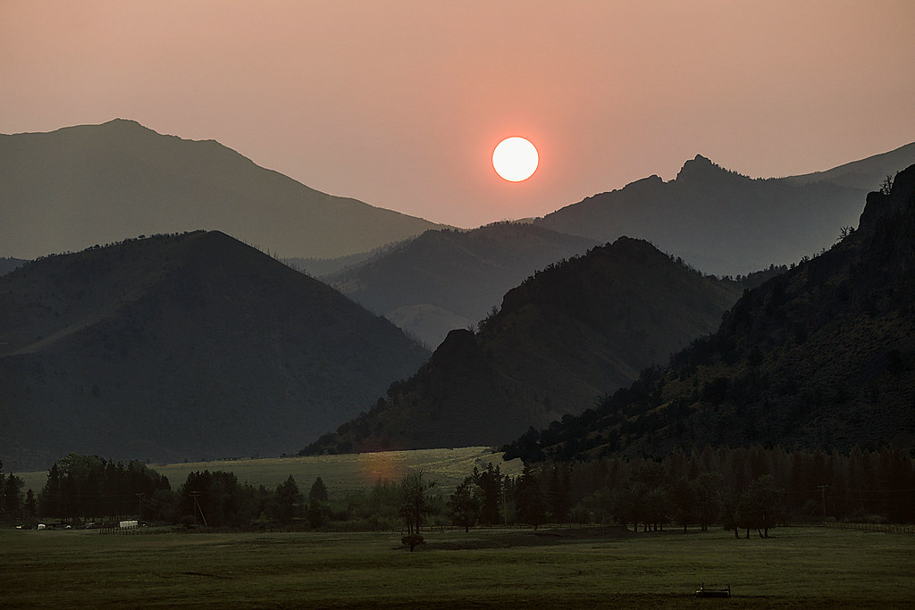
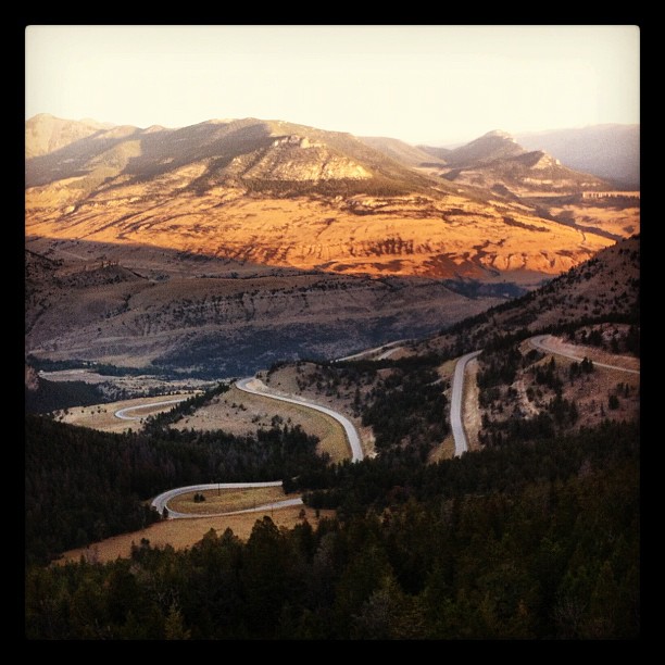
Smokey Sunset

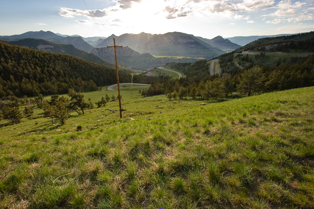
Twlight On The Switchbacks
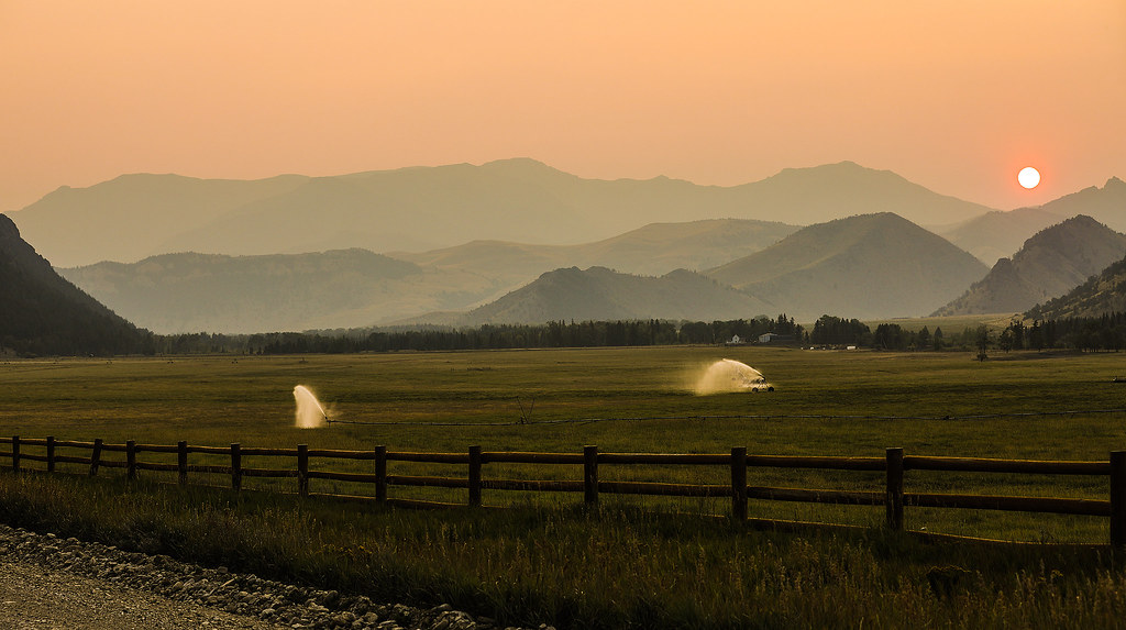
Hazy Sunset
Dead Indian Pass
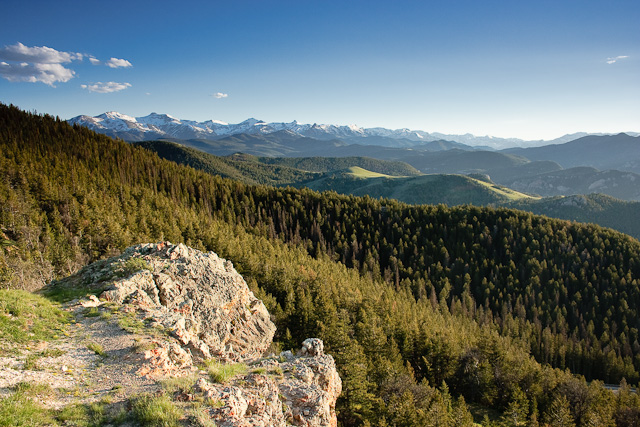
Dead Indian Pass
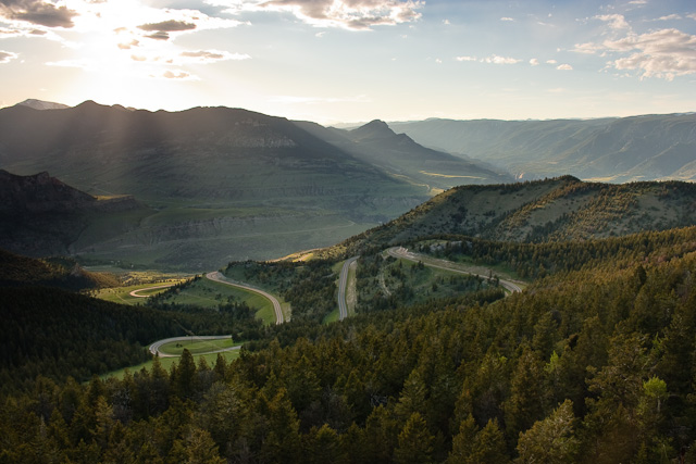
Dead Indian Pass
Dead Indian Pass
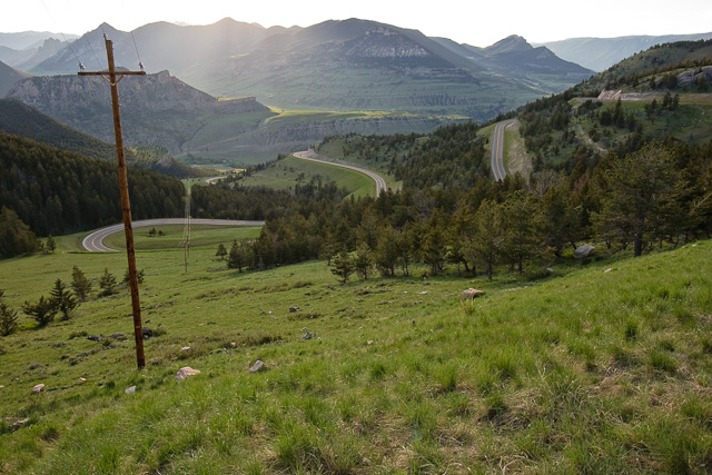
Dead Indian Pass
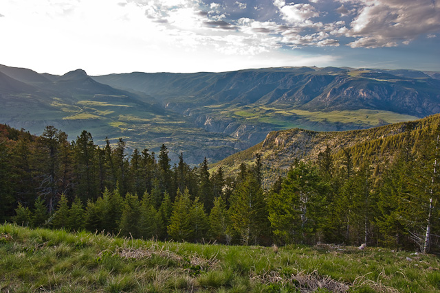
One never tires of this amazing view
Mapa de 85 The Way West Rd, Cody, WY, EE. UU.
Buscar otro lugar
Lugares cercanos
Sunlight Rd, Cody, WY, EE. UU.
Dead Indian Summit Overlook, Chief Joseph Hwy, Cody, WY, EE. UU.
Condado de Park, Wyoming, EE. UU.
Sawtooth Mountain, Wyoming, EE. UU.
Beartooth Highway, Beartooth Hwy, Estados Unidos
The Wall, Wyoming, EE. UU.
Bear Tooth Pass Highway, Bear Tooth Pass Hwy, Cody, WY, EE. UU.
52 Moore Rd, Powell, WY, EE. UU.
N Fork Hwy, Cody, WY, EE. UU.
Wapiti, WY, EE. UU.
1 Streamside Dr, Wapiti, WY, EE. UU.
29 Pack Saddle Trail, Cody, WY, EE. UU.
81 Rd 6Cu, Cody, WY, EE. UU.
24 Rd 6Cu, Cody, WY, EE. UU.
86 N Wapiti Estates Drives, Cody, WY, EE. UU.
26 Talon Dr, Cody, WY, EE. UU.
Stagecoach Trail, Cody, WY, EE. UU.
59 Green Creek Rd, Cody, WY, EE. UU.
Buffalo Bill State Park, N Fork Hwy, Cody, WY, EE. UU.
Badger Basin, Wyoming, EE. UU.
Búsquedas recientes
- Horas de salida y puesta de sol de Red Dog Mine, AK, USA
- Horas de salida y puesta de sol de Am Bahnhof, Am bhf, Borken, Germany
- Horas de salida y puesta de sol de 4th St E, Sonoma, CA, EE. UU.
- Horas de salida y puesta de sol de Oakland Ave, Williamsport, PA, EE. UU.
- Horas de salida y puesta de sol de Via Roma, Pieranica CR, Italia
- Horas de salida y puesta de sol de Torre del reloj, Grad, Dubrovnik (Ragusa), Croacia
- Horas de salida y puesta de sol de Trelew, Chubut, Argentina
- Horas de salida y puesta de sol de Hartfords Bluff Cir, Mt Pleasant, SC, EE. UU.
- Horas de salida y puesta de sol de Kita Ward, Kumamoto, Japón
- Horas de salida y puesta de sol de Pingtan Island, Pingtan County, Fuzhou, China