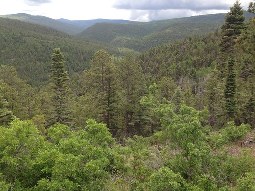
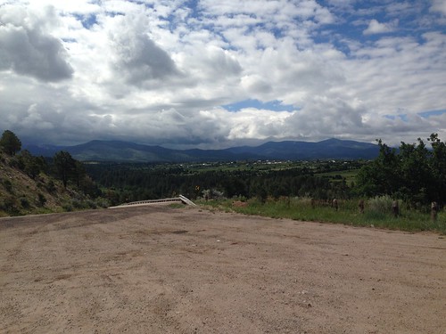
Horas de salida y puesta de sol de 54 Cam De Abajo, Vadito, NM, EE. UU.
Location: Estados Unidos > Nuevo México > Condado de Taos > Vadito >
Zona horaria:
America/Denver
Hora local:
2025-06-22 15:39:10
Longitud:
-105.6554417
Latitud:
36.1297924
Salida de sol de hoy:
05:46:30 AM
Puesta de sol de hoy:
08:23:33 PM
La duración del día hoy:
14h 37m 3s
Salida de sol de mañana:
05:46:48 AM
Puesta de sol de mañana:
08:23:40 PM
La duración del día mañana:
14h 36m 52s
Mostrar todas las fechas
| Fecha | Salida de sol | Puesta de sol | Duración del día |
|---|---|---|---|
| 01/01/2025 | 07:13:40 AM | 04:59:56 PM | 9h 46m 16s |
| 02/01/2025 | 07:13:47 AM | 05:00:45 PM | 9h 46m 58s |
| 03/01/2025 | 07:13:52 AM | 05:01:34 PM | 9h 47m 42s |
| 04/01/2025 | 07:13:54 AM | 05:02:25 PM | 9h 48m 31s |
| 05/01/2025 | 07:13:55 AM | 05:03:17 PM | 9h 49m 22s |
| 06/01/2025 | 07:13:54 AM | 05:04:10 PM | 9h 50m 16s |
| 07/01/2025 | 07:13:50 AM | 05:05:04 PM | 9h 51m 14s |
| 08/01/2025 | 07:13:45 AM | 05:05:59 PM | 9h 52m 14s |
| 09/01/2025 | 07:13:38 AM | 05:06:55 PM | 9h 53m 17s |
| 10/01/2025 | 07:13:29 AM | 05:07:51 PM | 9h 54m 22s |
| 11/01/2025 | 07:13:18 AM | 05:08:48 PM | 9h 55m 30s |
| 12/01/2025 | 07:13:04 AM | 05:09:46 PM | 9h 56m 42s |
| 13/01/2025 | 07:12:49 AM | 05:10:45 PM | 9h 57m 56s |
| 14/01/2025 | 07:12:32 AM | 05:11:44 PM | 9h 59m 12s |
| 15/01/2025 | 07:12:13 AM | 05:12:44 PM | 10h 0m 31s |
| 16/01/2025 | 07:11:52 AM | 05:13:44 PM | 10h 1m 52s |
| 17/01/2025 | 07:11:30 AM | 05:14:45 PM | 10h 3m 15s |
| 18/01/2025 | 07:11:05 AM | 05:15:47 PM | 10h 4m 42s |
| 19/01/2025 | 07:10:38 AM | 05:16:48 PM | 10h 6m 10s |
| 20/01/2025 | 07:10:10 AM | 05:17:50 PM | 10h 7m 40s |
| 21/01/2025 | 07:09:40 AM | 05:18:53 PM | 10h 9m 13s |
| 22/01/2025 | 07:09:07 AM | 05:19:55 PM | 10h 10m 48s |
| 23/01/2025 | 07:08:33 AM | 05:20:58 PM | 10h 12m 25s |
| 24/01/2025 | 07:07:58 AM | 05:22:01 PM | 10h 14m 3s |
| 25/01/2025 | 07:07:20 AM | 05:23:04 PM | 10h 15m 44s |
| 26/01/2025 | 07:06:41 AM | 05:24:08 PM | 10h 17m 27s |
| 27/01/2025 | 07:06:00 AM | 05:25:11 PM | 10h 19m 11s |
| 28/01/2025 | 07:05:18 AM | 05:26:15 PM | 10h 20m 57s |
| 29/01/2025 | 07:04:34 AM | 05:27:18 PM | 10h 22m 44s |
| 30/01/2025 | 07:03:48 AM | 05:28:22 PM | 10h 24m 34s |
| 31/01/2025 | 07:03:00 AM | 05:29:25 PM | 10h 26m 25s |
| 01/02/2025 | 07:02:11 AM | 05:30:28 PM | 10h 28m 17s |
| 02/02/2025 | 07:01:21 AM | 05:31:32 PM | 10h 30m 11s |
| 03/02/2025 | 07:00:29 AM | 05:32:35 PM | 10h 32m 6s |
| 04/02/2025 | 06:59:35 AM | 05:33:38 PM | 10h 34m 3s |
| 05/02/2025 | 06:58:41 AM | 05:34:41 PM | 10h 36m 0s |
| 06/02/2025 | 06:57:44 AM | 05:35:43 PM | 10h 37m 59s |
| 07/02/2025 | 06:56:47 AM | 05:36:46 PM | 10h 39m 59s |
| 08/02/2025 | 06:55:47 AM | 05:37:48 PM | 10h 42m 1s |
| 09/02/2025 | 06:54:47 AM | 05:38:50 PM | 10h 44m 3s |
| 10/02/2025 | 06:53:45 AM | 05:39:52 PM | 10h 46m 7s |
| 11/02/2025 | 06:52:42 AM | 05:40:53 PM | 10h 48m 11s |
| 12/02/2025 | 06:51:38 AM | 05:41:54 PM | 10h 50m 16s |
| 13/02/2025 | 06:50:33 AM | 05:42:55 PM | 10h 52m 22s |
| 14/02/2025 | 06:49:26 AM | 05:43:56 PM | 10h 54m 30s |
| 15/02/2025 | 06:48:19 AM | 05:44:56 PM | 10h 56m 37s |
| 16/02/2025 | 06:47:10 AM | 05:45:56 PM | 10h 58m 46s |
| 17/02/2025 | 06:46:00 AM | 05:46:56 PM | 11h 0m 56s |
| 18/02/2025 | 06:44:49 AM | 05:47:56 PM | 11h 3m 7s |
| 19/02/2025 | 06:43:37 AM | 05:48:55 PM | 11h 5m 18s |
| 20/02/2025 | 06:42:25 AM | 05:49:53 PM | 11h 7m 28s |
| 21/02/2025 | 06:41:11 AM | 05:50:52 PM | 11h 9m 41s |
| 22/02/2025 | 06:39:56 AM | 05:51:50 PM | 11h 11m 54s |
| 23/02/2025 | 06:38:41 AM | 05:52:48 PM | 11h 14m 7s |
| 24/02/2025 | 06:37:24 AM | 05:53:45 PM | 11h 16m 21s |
| 25/02/2025 | 06:36:07 AM | 05:54:42 PM | 11h 18m 35s |
| 26/02/2025 | 06:34:49 AM | 05:55:39 PM | 11h 20m 50s |
| 27/02/2025 | 06:33:31 AM | 05:56:35 PM | 11h 23m 4s |
| 28/02/2025 | 06:32:11 AM | 05:57:31 PM | 11h 25m 20s |
| 01/03/2025 | 06:30:51 AM | 05:58:27 PM | 11h 27m 36s |
| 02/03/2025 | 06:29:31 AM | 05:59:23 PM | 11h 29m 52s |
| 03/03/2025 | 06:28:09 AM | 06:00:18 PM | 11h 32m 9s |
| 04/03/2025 | 06:26:47 AM | 06:01:13 PM | 11h 34m 26s |
| 05/03/2025 | 06:25:25 AM | 06:02:07 PM | 11h 36m 42s |
| 06/03/2025 | 06:24:02 AM | 06:03:02 PM | 11h 39m 0s |
| 07/03/2025 | 06:22:39 AM | 06:03:56 PM | 11h 41m 17s |
| 08/03/2025 | 06:21:15 AM | 06:04:50 PM | 11h 43m 35s |
| 09/03/2025 | 07:19:54 AM | 07:05:41 PM | 11h 45m 47s |
| 10/03/2025 | 07:18:29 AM | 07:06:34 PM | 11h 48m 5s |
| 11/03/2025 | 07:17:04 AM | 07:07:27 PM | 11h 50m 23s |
| 12/03/2025 | 07:15:39 AM | 07:08:20 PM | 11h 52m 41s |
| 13/03/2025 | 07:14:13 AM | 07:09:13 PM | 11h 55m 0s |
| 14/03/2025 | 07:12:47 AM | 07:10:05 PM | 11h 57m 18s |
| 15/03/2025 | 07:11:21 AM | 07:10:57 PM | 11h 59m 36s |
| 16/03/2025 | 07:09:54 AM | 07:11:49 PM | 12h 1m 55s |
| 17/03/2025 | 07:08:28 AM | 07:12:41 PM | 12h 4m 13s |
| 18/03/2025 | 07:07:01 AM | 07:13:33 PM | 12h 6m 32s |
| 19/03/2025 | 07:05:34 AM | 07:14:24 PM | 12h 8m 50s |
| 20/03/2025 | 07:04:07 AM | 07:15:16 PM | 12h 11m 9s |
| 21/03/2025 | 07:02:40 AM | 07:16:07 PM | 12h 13m 27s |
| 22/03/2025 | 07:01:13 AM | 07:16:58 PM | 12h 15m 45s |
| 23/03/2025 | 06:59:45 AM | 07:17:49 PM | 12h 18m 4s |
| 24/03/2025 | 06:58:18 AM | 07:18:40 PM | 12h 20m 22s |
| 25/03/2025 | 06:56:51 AM | 07:19:31 PM | 12h 22m 40s |
| 26/03/2025 | 06:55:24 AM | 07:20:22 PM | 12h 24m 58s |
| 27/03/2025 | 06:53:57 AM | 07:21:13 PM | 12h 27m 16s |
| 28/03/2025 | 06:52:31 AM | 07:22:03 PM | 12h 29m 32s |
| 29/03/2025 | 06:51:04 AM | 07:22:54 PM | 12h 31m 50s |
| 30/03/2025 | 06:49:38 AM | 07:23:44 PM | 12h 34m 6s |
| 31/03/2025 | 06:48:11 AM | 07:24:35 PM | 12h 36m 24s |
| 01/04/2025 | 06:46:46 AM | 07:25:25 PM | 12h 38m 39s |
| 02/04/2025 | 06:45:20 AM | 07:26:16 PM | 12h 40m 56s |
| 03/04/2025 | 06:43:55 AM | 07:27:07 PM | 12h 43m 12s |
| 04/04/2025 | 06:42:30 AM | 07:27:57 PM | 12h 45m 27s |
| 05/04/2025 | 06:41:05 AM | 07:28:48 PM | 12h 47m 43s |
| 06/04/2025 | 06:39:41 AM | 07:29:38 PM | 12h 49m 57s |
| 07/04/2025 | 06:38:17 AM | 07:30:29 PM | 12h 52m 12s |
| 08/04/2025 | 06:36:54 AM | 07:31:19 PM | 12h 54m 25s |
| 09/04/2025 | 06:35:31 AM | 07:32:10 PM | 12h 56m 39s |
| 10/04/2025 | 06:34:09 AM | 07:33:01 PM | 12h 58m 52s |
| 11/04/2025 | 06:32:47 AM | 07:33:51 PM | 13h 1m 4s |
| 12/04/2025 | 06:31:26 AM | 07:34:42 PM | 13h 3m 16s |
| 13/04/2025 | 06:30:05 AM | 07:35:33 PM | 13h 5m 28s |
| 14/04/2025 | 06:28:46 AM | 07:36:24 PM | 13h 7m 38s |
| 15/04/2025 | 06:27:26 AM | 07:37:15 PM | 13h 9m 49s |
| 16/04/2025 | 06:26:08 AM | 07:38:06 PM | 13h 11m 58s |
| 17/04/2025 | 06:24:50 AM | 07:38:57 PM | 13h 14m 7s |
| 18/04/2025 | 06:23:33 AM | 07:39:48 PM | 13h 16m 15s |
| 19/04/2025 | 06:22:17 AM | 07:40:39 PM | 13h 18m 22s |
| 20/04/2025 | 06:21:01 AM | 07:41:31 PM | 13h 20m 30s |
| 21/04/2025 | 06:19:47 AM | 07:42:22 PM | 13h 22m 35s |
| 22/04/2025 | 06:18:33 AM | 07:43:13 PM | 13h 24m 40s |
| 23/04/2025 | 06:17:20 AM | 07:44:04 PM | 13h 26m 44s |
| 24/04/2025 | 06:16:08 AM | 07:44:56 PM | 13h 28m 48s |
| 25/04/2025 | 06:14:57 AM | 07:45:47 PM | 13h 30m 50s |
| 26/04/2025 | 06:13:47 AM | 07:46:39 PM | 13h 32m 52s |
| 27/04/2025 | 06:12:38 AM | 07:47:30 PM | 13h 34m 52s |
| 28/04/2025 | 06:11:31 AM | 07:48:21 PM | 13h 36m 50s |
| 29/04/2025 | 06:10:24 AM | 07:49:13 PM | 13h 38m 49s |
| 30/04/2025 | 06:09:18 AM | 07:50:04 PM | 13h 40m 46s |
| 01/05/2025 | 06:08:13 AM | 07:50:55 PM | 13h 42m 42s |
| 02/05/2025 | 06:07:10 AM | 07:51:47 PM | 13h 44m 37s |
| 03/05/2025 | 06:06:08 AM | 07:52:38 PM | 13h 46m 30s |
| 04/05/2025 | 06:05:07 AM | 07:53:29 PM | 13h 48m 22s |
| 05/05/2025 | 06:04:07 AM | 07:54:20 PM | 13h 50m 13s |
| 06/05/2025 | 06:03:08 AM | 07:55:11 PM | 13h 52m 3s |
| 07/05/2025 | 06:02:11 AM | 07:56:01 PM | 13h 53m 50s |
| 08/05/2025 | 06:01:15 AM | 07:56:52 PM | 13h 55m 37s |
| 09/05/2025 | 06:00:20 AM | 07:57:42 PM | 13h 57m 22s |
| 10/05/2025 | 05:59:27 AM | 07:58:32 PM | 13h 59m 5s |
| 11/05/2025 | 05:58:35 AM | 07:59:22 PM | 14h 0m 47s |
| 12/05/2025 | 05:57:45 AM | 08:00:11 PM | 14h 2m 26s |
| 13/05/2025 | 05:56:56 AM | 08:01:01 PM | 14h 4m 5s |
| 14/05/2025 | 05:56:08 AM | 08:01:50 PM | 14h 5m 42s |
| 15/05/2025 | 05:55:22 AM | 08:02:38 PM | 14h 7m 16s |
| 16/05/2025 | 05:54:38 AM | 08:03:26 PM | 14h 8m 48s |
| 17/05/2025 | 05:53:55 AM | 08:04:14 PM | 14h 10m 19s |
| 18/05/2025 | 05:53:13 AM | 08:05:02 PM | 14h 11m 49s |
| 19/05/2025 | 05:52:33 AM | 08:05:48 PM | 14h 13m 15s |
| 20/05/2025 | 05:51:55 AM | 08:06:35 PM | 14h 14m 40s |
| 21/05/2025 | 05:51:18 AM | 08:07:21 PM | 14h 16m 3s |
| 22/05/2025 | 05:50:43 AM | 08:08:06 PM | 14h 17m 23s |
| 23/05/2025 | 05:50:09 AM | 08:08:51 PM | 14h 18m 42s |
| 24/05/2025 | 05:49:38 AM | 08:09:35 PM | 14h 19m 57s |
| 25/05/2025 | 05:49:07 AM | 08:10:18 PM | 14h 21m 11s |
| 26/05/2025 | 05:48:39 AM | 08:11:00 PM | 14h 22m 21s |
| 27/05/2025 | 05:48:12 AM | 08:11:42 PM | 14h 23m 30s |
| 28/05/2025 | 05:47:47 AM | 08:12:23 PM | 14h 24m 36s |
| 29/05/2025 | 05:47:23 AM | 08:13:04 PM | 14h 25m 41s |
| 30/05/2025 | 05:47:01 AM | 08:13:43 PM | 14h 26m 42s |
| 31/05/2025 | 05:46:41 AM | 08:14:22 PM | 14h 27m 41s |
| 01/06/2025 | 05:46:23 AM | 08:14:59 PM | 14h 28m 36s |
| 02/06/2025 | 05:46:06 AM | 08:15:36 PM | 14h 29m 30s |
| 03/06/2025 | 05:45:51 AM | 08:16:11 PM | 14h 30m 20s |
| 04/06/2025 | 05:45:38 AM | 08:16:46 PM | 14h 31m 8s |
| 05/06/2025 | 05:45:26 AM | 08:17:19 PM | 14h 31m 53s |
| 06/06/2025 | 05:45:16 AM | 08:17:52 PM | 14h 32m 36s |
| 07/06/2025 | 05:45:08 AM | 08:18:23 PM | 14h 33m 15s |
| 08/06/2025 | 05:45:02 AM | 08:18:53 PM | 14h 33m 51s |
| 09/06/2025 | 05:44:57 AM | 08:19:21 PM | 14h 34m 24s |
| 10/06/2025 | 05:44:54 AM | 08:19:49 PM | 14h 34m 55s |
| 11/06/2025 | 05:44:53 AM | 08:20:15 PM | 14h 35m 22s |
| 12/06/2025 | 05:44:53 AM | 08:20:40 PM | 14h 35m 47s |
| 13/06/2025 | 05:44:55 AM | 08:21:03 PM | 14h 36m 8s |
| 14/06/2025 | 05:44:58 AM | 08:21:26 PM | 14h 36m 28s |
| 15/06/2025 | 05:45:03 AM | 08:21:46 PM | 14h 36m 43s |
| 16/06/2025 | 05:45:10 AM | 08:22:05 PM | 14h 36m 55s |
| 17/06/2025 | 05:45:19 AM | 08:22:23 PM | 14h 37m 4s |
| 18/06/2025 | 05:45:28 AM | 08:22:39 PM | 14h 37m 11s |
| 19/06/2025 | 05:45:40 AM | 08:22:54 PM | 14h 37m 14s |
| 20/06/2025 | 05:45:53 AM | 08:23:07 PM | 14h 37m 14s |
| 21/06/2025 | 05:46:07 AM | 08:23:19 PM | 14h 37m 12s |
| 22/06/2025 | 05:46:23 AM | 08:23:29 PM | 14h 37m 6s |
| 23/06/2025 | 05:46:41 AM | 08:23:37 PM | 14h 36m 56s |
| 24/06/2025 | 05:47:00 AM | 08:23:44 PM | 14h 36m 44s |
| 25/06/2025 | 05:47:20 AM | 08:23:49 PM | 14h 36m 29s |
| 26/06/2025 | 05:47:41 AM | 08:23:52 PM | 14h 36m 11s |
| 27/06/2025 | 05:48:04 AM | 08:23:54 PM | 14h 35m 50s |
| 28/06/2025 | 05:48:28 AM | 08:23:54 PM | 14h 35m 26s |
| 29/06/2025 | 05:48:54 AM | 08:23:52 PM | 14h 34m 58s |
| 30/06/2025 | 05:49:20 AM | 08:23:49 PM | 14h 34m 29s |
| 01/07/2025 | 05:49:48 AM | 08:23:44 PM | 14h 33m 56s |
| 02/07/2025 | 05:50:17 AM | 08:23:37 PM | 14h 33m 20s |
| 03/07/2025 | 05:50:47 AM | 08:23:28 PM | 14h 32m 41s |
| 04/07/2025 | 05:51:18 AM | 08:23:18 PM | 14h 32m 0s |
| 05/07/2025 | 05:51:51 AM | 08:23:05 PM | 14h 31m 14s |
| 06/07/2025 | 05:52:24 AM | 08:22:51 PM | 14h 30m 27s |
| 07/07/2025 | 05:52:58 AM | 08:22:36 PM | 14h 29m 38s |
| 08/07/2025 | 05:53:33 AM | 08:22:18 PM | 14h 28m 45s |
| 09/07/2025 | 05:54:09 AM | 08:21:59 PM | 14h 27m 50s |
| 10/07/2025 | 05:54:46 AM | 08:21:38 PM | 14h 26m 52s |
| 11/07/2025 | 05:55:24 AM | 08:21:15 PM | 14h 25m 51s |
| 12/07/2025 | 05:56:03 AM | 08:20:51 PM | 14h 24m 48s |
| 13/07/2025 | 05:56:42 AM | 08:20:25 PM | 14h 23m 43s |
| 14/07/2025 | 05:57:22 AM | 08:19:57 PM | 14h 22m 35s |
| 15/07/2025 | 05:58:03 AM | 08:19:27 PM | 14h 21m 24s |
| 16/07/2025 | 05:58:44 AM | 08:18:56 PM | 14h 20m 12s |
| 17/07/2025 | 05:59:26 AM | 08:18:23 PM | 14h 18m 57s |
| 18/07/2025 | 06:00:09 AM | 08:17:49 PM | 14h 17m 40s |
| 19/07/2025 | 06:00:52 AM | 08:17:12 PM | 14h 16m 20s |
| 20/07/2025 | 06:01:35 AM | 08:16:34 PM | 14h 14m 59s |
| 21/07/2025 | 06:02:20 AM | 08:15:55 PM | 14h 13m 35s |
| 22/07/2025 | 06:03:04 AM | 08:15:14 PM | 14h 12m 10s |
| 23/07/2025 | 06:03:49 AM | 08:14:31 PM | 14h 10m 42s |
| 24/07/2025 | 06:04:34 AM | 08:13:47 PM | 14h 9m 13s |
| 25/07/2025 | 06:05:20 AM | 08:13:01 PM | 14h 7m 41s |
| 26/07/2025 | 06:06:06 AM | 08:12:14 PM | 14h 6m 8s |
| 27/07/2025 | 06:06:52 AM | 08:11:25 PM | 14h 4m 33s |
| 28/07/2025 | 06:07:39 AM | 08:10:35 PM | 14h 2m 56s |
| 29/07/2025 | 06:08:26 AM | 08:09:43 PM | 14h 1m 17s |
| 30/07/2025 | 06:09:13 AM | 08:08:50 PM | 13h 59m 37s |
| 31/07/2025 | 06:10:00 AM | 08:07:55 PM | 13h 57m 55s |
| 01/08/2025 | 06:10:47 AM | 08:06:59 PM | 13h 56m 12s |
| 02/08/2025 | 06:11:35 AM | 08:06:02 PM | 13h 54m 27s |
| 03/08/2025 | 06:12:22 AM | 08:05:03 PM | 13h 52m 41s |
| 04/08/2025 | 06:13:10 AM | 08:04:03 PM | 13h 50m 53s |
| 05/08/2025 | 06:13:58 AM | 08:03:02 PM | 13h 49m 4s |
| 06/08/2025 | 06:14:46 AM | 08:01:59 PM | 13h 47m 13s |
| 07/08/2025 | 06:15:33 AM | 08:00:56 PM | 13h 45m 23s |
| 08/08/2025 | 06:16:21 AM | 07:59:51 PM | 13h 43m 30s |
| 09/08/2025 | 06:17:09 AM | 07:58:45 PM | 13h 41m 36s |
| 10/08/2025 | 06:17:57 AM | 07:57:37 PM | 13h 39m 40s |
| 11/08/2025 | 06:18:45 AM | 07:56:29 PM | 13h 37m 44s |
| 12/08/2025 | 06:19:33 AM | 07:55:20 PM | 13h 35m 47s |
| 13/08/2025 | 06:20:21 AM | 07:54:09 PM | 13h 33m 48s |
| 14/08/2025 | 06:21:09 AM | 07:52:58 PM | 13h 31m 49s |
| 15/08/2025 | 06:21:57 AM | 07:51:45 PM | 13h 29m 48s |
| 16/08/2025 | 06:22:45 AM | 07:50:31 PM | 13h 27m 46s |
| 17/08/2025 | 06:23:32 AM | 07:49:17 PM | 13h 25m 45s |
| 18/08/2025 | 06:24:20 AM | 07:48:02 PM | 13h 23m 42s |
| 19/08/2025 | 06:25:07 AM | 07:46:45 PM | 13h 21m 38s |
| 20/08/2025 | 06:25:55 AM | 07:45:28 PM | 13h 19m 33s |
| 21/08/2025 | 06:26:42 AM | 07:44:10 PM | 13h 17m 28s |
| 22/08/2025 | 06:27:30 AM | 07:42:52 PM | 13h 15m 22s |
| 23/08/2025 | 06:28:17 AM | 07:41:32 PM | 13h 13m 15s |
| 24/08/2025 | 06:29:04 AM | 07:40:12 PM | 13h 11m 8s |
| 25/08/2025 | 06:29:51 AM | 07:38:51 PM | 13h 9m 0s |
| 26/08/2025 | 06:30:38 AM | 07:37:29 PM | 13h 6m 51s |
| 27/08/2025 | 06:31:25 AM | 07:36:07 PM | 13h 4m 42s |
| 28/08/2025 | 06:32:12 AM | 07:34:44 PM | 13h 2m 32s |
| 29/08/2025 | 06:32:58 AM | 07:33:20 PM | 13h 0m 22s |
| 30/08/2025 | 06:33:45 AM | 07:31:56 PM | 12h 58m 11s |
| 31/08/2025 | 06:34:31 AM | 07:30:32 PM | 12h 56m 1s |
| 01/09/2025 | 06:35:18 AM | 07:29:07 PM | 12h 53m 49s |
| 02/09/2025 | 06:36:04 AM | 07:27:41 PM | 12h 51m 37s |
| 03/09/2025 | 06:36:51 AM | 07:26:15 PM | 12h 49m 24s |
| 04/09/2025 | 06:37:37 AM | 07:24:48 PM | 12h 47m 11s |
| 05/09/2025 | 06:38:23 AM | 07:23:21 PM | 12h 44m 58s |
| 06/09/2025 | 06:39:10 AM | 07:21:54 PM | 12h 42m 44s |
| 07/09/2025 | 06:39:56 AM | 07:20:27 PM | 12h 40m 31s |
| 08/09/2025 | 06:40:42 AM | 07:18:59 PM | 12h 38m 17s |
| 09/09/2025 | 06:41:28 AM | 07:17:30 PM | 12h 36m 2s |
| 10/09/2025 | 06:42:14 AM | 07:16:02 PM | 12h 33m 48s |
| 11/09/2025 | 06:43:01 AM | 07:14:33 PM | 12h 31m 32s |
| 12/09/2025 | 06:43:47 AM | 07:13:04 PM | 12h 29m 17s |
| 13/09/2025 | 06:44:33 AM | 07:11:35 PM | 12h 27m 2s |
| 14/09/2025 | 06:45:20 AM | 07:10:06 PM | 12h 24m 46s |
| 15/09/2025 | 06:46:06 AM | 07:08:37 PM | 12h 22m 31s |
| 16/09/2025 | 06:46:52 AM | 07:07:08 PM | 12h 20m 16s |
| 17/09/2025 | 06:47:39 AM | 07:05:38 PM | 12h 17m 59s |
| 18/09/2025 | 06:48:26 AM | 07:04:09 PM | 12h 15m 43s |
| 19/09/2025 | 06:49:12 AM | 07:02:39 PM | 12h 13m 27s |
| 20/09/2025 | 06:49:59 AM | 07:01:10 PM | 12h 11m 11s |
| 21/09/2025 | 06:50:46 AM | 06:59:41 PM | 12h 8m 55s |
| 22/09/2025 | 06:51:33 AM | 06:58:11 PM | 12h 6m 38s |
| 23/09/2025 | 06:52:21 AM | 06:56:42 PM | 12h 4m 21s |
| 24/09/2025 | 06:53:08 AM | 06:55:13 PM | 12h 2m 5s |
| 25/09/2025 | 06:53:56 AM | 06:53:44 PM | 11h 59m 48s |
| 26/09/2025 | 06:54:43 AM | 06:52:16 PM | 11h 57m 33s |
| 27/09/2025 | 06:55:31 AM | 06:50:48 PM | 11h 55m 17s |
| 28/09/2025 | 06:56:19 AM | 06:49:19 PM | 11h 53m 0s |
| 29/09/2025 | 06:57:08 AM | 06:47:52 PM | 11h 50m 44s |
| 30/09/2025 | 06:57:57 AM | 06:46:24 PM | 11h 48m 27s |
| 01/10/2025 | 06:58:45 AM | 06:44:57 PM | 11h 46m 12s |
| 02/10/2025 | 06:59:35 AM | 06:43:31 PM | 11h 43m 56s |
| 03/10/2025 | 07:00:24 AM | 06:42:04 PM | 11h 41m 40s |
| 04/10/2025 | 07:01:14 AM | 06:40:38 PM | 11h 39m 24s |
| 05/10/2025 | 07:02:04 AM | 06:39:13 PM | 11h 37m 9s |
| 06/10/2025 | 07:02:54 AM | 06:37:48 PM | 11h 34m 54s |
| 07/10/2025 | 07:03:44 AM | 06:36:24 PM | 11h 32m 40s |
| 08/10/2025 | 07:04:35 AM | 06:35:00 PM | 11h 30m 25s |
| 09/10/2025 | 07:05:26 AM | 06:33:37 PM | 11h 28m 11s |
| 10/10/2025 | 07:06:18 AM | 06:32:15 PM | 11h 25m 57s |
| 11/10/2025 | 07:07:10 AM | 06:30:53 PM | 11h 23m 43s |
| 12/10/2025 | 07:08:02 AM | 06:29:32 PM | 11h 21m 30s |
| 13/10/2025 | 07:08:54 AM | 06:28:11 PM | 11h 19m 17s |
| 14/10/2025 | 07:09:47 AM | 06:26:52 PM | 11h 17m 5s |
| 15/10/2025 | 07:10:40 AM | 06:25:33 PM | 11h 14m 53s |
| 16/10/2025 | 07:11:34 AM | 06:24:15 PM | 11h 12m 41s |
| 17/10/2025 | 07:12:28 AM | 06:22:57 PM | 11h 10m 29s |
| 18/10/2025 | 07:13:22 AM | 06:21:41 PM | 11h 8m 19s |
| 19/10/2025 | 07:14:16 AM | 06:20:26 PM | 11h 6m 10s |
| 20/10/2025 | 07:15:11 AM | 06:19:11 PM | 11h 4m 0s |
| 21/10/2025 | 07:16:07 AM | 06:17:58 PM | 11h 1m 51s |
| 22/10/2025 | 07:17:02 AM | 06:16:45 PM | 10h 59m 43s |
| 23/10/2025 | 07:17:58 AM | 06:15:34 PM | 10h 57m 36s |
| 24/10/2025 | 07:18:55 AM | 06:14:24 PM | 10h 55m 29s |
| 25/10/2025 | 07:19:51 AM | 06:13:14 PM | 10h 53m 23s |
| 26/10/2025 | 07:20:48 AM | 06:12:06 PM | 10h 51m 18s |
| 27/10/2025 | 07:21:46 AM | 06:10:59 PM | 10h 49m 13s |
| 28/10/2025 | 07:22:43 AM | 06:09:54 PM | 10h 47m 11s |
| 29/10/2025 | 07:23:41 AM | 06:08:49 PM | 10h 45m 8s |
| 30/10/2025 | 07:24:40 AM | 06:07:46 PM | 10h 43m 6s |
| 31/10/2025 | 07:25:38 AM | 06:06:44 PM | 10h 41m 6s |
| 01/11/2025 | 07:26:37 AM | 06:05:44 PM | 10h 39m 7s |
| 02/11/2025 | 06:27:39 AM | 05:04:42 PM | 10h 37m 3s |
| 03/11/2025 | 06:28:38 AM | 05:03:44 PM | 10h 35m 6s |
| 04/11/2025 | 06:29:38 AM | 05:02:48 PM | 10h 33m 10s |
| 05/11/2025 | 06:30:37 AM | 05:01:53 PM | 10h 31m 16s |
| 06/11/2025 | 06:31:37 AM | 05:01:00 PM | 10h 29m 23s |
| 07/11/2025 | 06:32:38 AM | 05:00:08 PM | 10h 27m 30s |
| 08/11/2025 | 06:33:38 AM | 04:59:18 PM | 10h 25m 40s |
| 09/11/2025 | 06:34:38 AM | 04:58:29 PM | 10h 23m 51s |
| 10/11/2025 | 06:35:39 AM | 04:57:42 PM | 10h 22m 3s |
| 11/11/2025 | 06:36:39 AM | 04:56:56 PM | 10h 20m 17s |
| 12/11/2025 | 06:37:40 AM | 04:56:13 PM | 10h 18m 33s |
| 13/11/2025 | 06:38:40 AM | 04:55:30 PM | 10h 16m 50s |
| 14/11/2025 | 06:39:41 AM | 04:54:50 PM | 10h 15m 9s |
| 15/11/2025 | 06:40:41 AM | 04:54:11 PM | 10h 13m 30s |
| 16/11/2025 | 06:41:42 AM | 04:53:35 PM | 10h 11m 53s |
| 17/11/2025 | 06:42:42 AM | 04:53:00 PM | 10h 10m 18s |
| 18/11/2025 | 06:43:42 AM | 04:52:26 PM | 10h 8m 44s |
| 19/11/2025 | 06:44:42 AM | 04:51:55 PM | 10h 7m 13s |
| 20/11/2025 | 06:45:41 AM | 04:51:25 PM | 10h 5m 44s |
| 21/11/2025 | 06:46:41 AM | 04:50:58 PM | 10h 4m 17s |
| 22/11/2025 | 06:47:40 AM | 04:50:32 PM | 10h 2m 52s |
| 23/11/2025 | 06:48:38 AM | 04:50:08 PM | 10h 1m 30s |
| 24/11/2025 | 06:49:37 AM | 04:49:46 PM | 10h 0m 9s |
| 25/11/2025 | 06:50:34 AM | 04:49:26 PM | 9h 58m 52s |
| 26/11/2025 | 06:51:32 AM | 04:49:08 PM | 9h 57m 36s |
| 27/11/2025 | 06:52:28 AM | 04:48:52 PM | 9h 56m 24s |
| 28/11/2025 | 06:53:24 AM | 04:48:38 PM | 9h 55m 14s |
| 29/11/2025 | 06:54:20 AM | 04:48:26 PM | 9h 54m 6s |
| 30/11/2025 | 06:55:14 AM | 04:48:16 PM | 9h 53m 2s |
| 01/12/2025 | 06:56:08 AM | 04:48:08 PM | 9h 52m 0s |
| 02/12/2025 | 06:57:02 AM | 04:48:03 PM | 9h 51m 1s |
| 03/12/2025 | 06:57:54 AM | 04:47:59 PM | 9h 50m 5s |
| 04/12/2025 | 06:58:45 AM | 04:47:57 PM | 9h 49m 12s |
| 05/12/2025 | 06:59:36 AM | 04:47:57 PM | 9h 48m 21s |
| 06/12/2025 | 07:00:25 AM | 04:47:59 PM | 9h 47m 34s |
| 07/12/2025 | 07:01:14 AM | 04:48:03 PM | 9h 46m 49s |
| 08/12/2025 | 07:02:01 AM | 04:48:09 PM | 9h 46m 8s |
| 09/12/2025 | 07:02:47 AM | 04:48:17 PM | 9h 45m 30s |
| 10/12/2025 | 07:03:32 AM | 04:48:27 PM | 9h 44m 55s |
| 11/12/2025 | 07:04:16 AM | 04:48:39 PM | 9h 44m 23s |
| 12/12/2025 | 07:04:59 AM | 04:48:54 PM | 9h 43m 55s |
| 13/12/2025 | 07:05:40 AM | 04:49:10 PM | 9h 43m 30s |
| 14/12/2025 | 07:06:20 AM | 04:49:27 PM | 9h 43m 7s |
| 15/12/2025 | 07:06:58 AM | 04:49:47 PM | 9h 42m 49s |
| 16/12/2025 | 07:07:35 AM | 04:50:09 PM | 9h 42m 34s |
| 17/12/2025 | 07:08:11 AM | 04:50:32 PM | 9h 42m 21s |
| 18/12/2025 | 07:08:45 AM | 04:50:58 PM | 9h 42m 13s |
| 19/12/2025 | 07:09:17 AM | 04:51:25 PM | 9h 42m 8s |
| 20/12/2025 | 07:09:48 AM | 04:51:54 PM | 9h 42m 6s |
| 21/12/2025 | 07:10:17 AM | 04:52:24 PM | 9h 42m 7s |
| 22/12/2025 | 07:10:44 AM | 04:52:57 PM | 9h 42m 13s |
| 23/12/2025 | 07:11:10 AM | 04:53:31 PM | 9h 42m 21s |
| 24/12/2025 | 07:11:33 AM | 04:54:06 PM | 9h 42m 33s |
| 25/12/2025 | 07:11:56 AM | 04:54:43 PM | 9h 42m 47s |
| 26/12/2025 | 07:12:16 AM | 04:55:22 PM | 9h 43m 6s |
| 27/12/2025 | 07:12:34 AM | 04:56:02 PM | 9h 43m 28s |
| 28/12/2025 | 07:12:51 AM | 04:56:44 PM | 9h 43m 53s |
| 29/12/2025 | 07:13:06 AM | 04:57:27 PM | 9h 44m 21s |
| 30/12/2025 | 07:13:19 AM | 04:58:12 PM | 9h 44m 53s |
| 31/12/2025 | 07:13:29 AM | 04:58:57 PM | 9h 45m 28s |
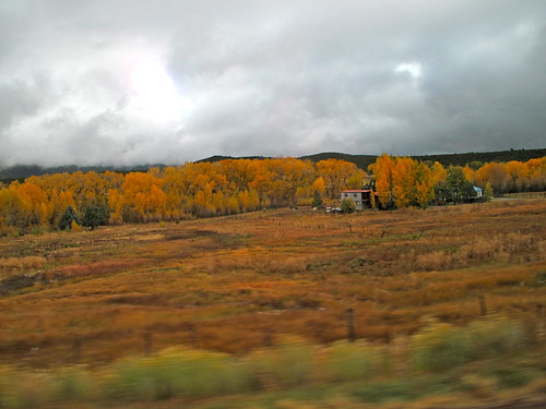
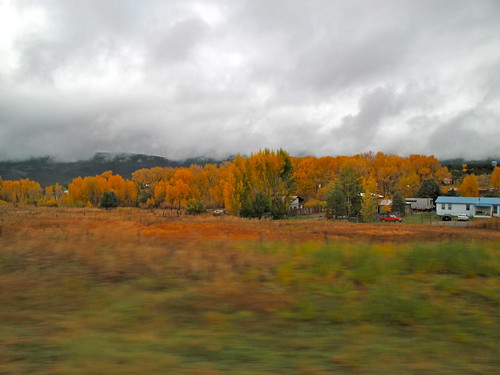
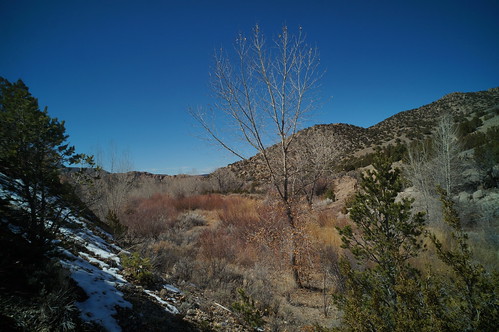
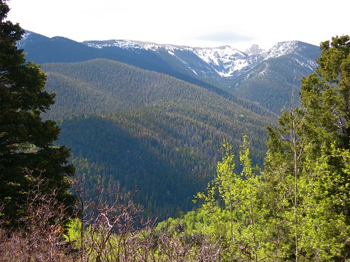
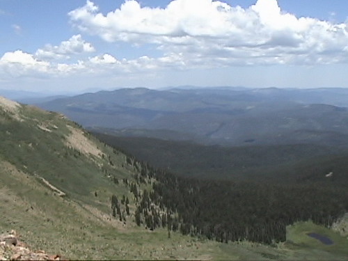
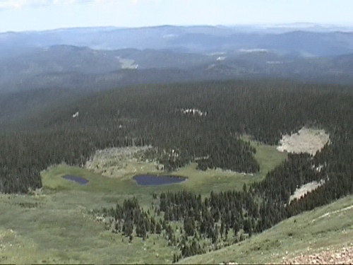
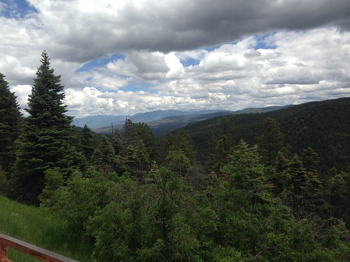
Fotos
Mapa de 54 Cam De Abajo, Vadito, NM, EE. UU.
Buscar otro lugar
Lugares cercanos
Rodarte, NM, EE. UU.
Peñasco, Nuevo México, EE. UU.
Two Gray Hares Disc Golf Course, Vadito, Nuevo México, EE. UU.
Rockwall at NM-75 & NM-, Nuevo México, EE. UU.
Vadito, Nuevo México, EE. UU.
Santa Barbara Campground, Vadito, NM, EE. UU.
Comales Campground, Vadito, Nuevo México, EE. UU.
NM-, Vadito, NM, EE. UU.
Pueblo Road, Pueblo Rd, Peñasco, NM, EE. UU.
Chamisal, Nuevo México, EE. UU.
Trampas Peak, New Mexico, EE. UU.
Sipapu, NM, EE. UU.
Vadito, Nuevo México, EE. UU.
Sipapu Ski & Summer Resort, NM-, Vadito, NM, EE. UU.
Jicarita Peak, New Mexico, EE. UU.
Ojo Sarco, NM, EE. UU.
Agua Piedra Campground, Forest Service Rd, Vadito, NM, EE. UU.
Tres Ritos, NM, EE. UU.
The Knob, New Mexico, EE. UU.
Serpent Lake, New Mexico, EE. UU.
Búsquedas recientes
- Horas de salida y puesta de sol de Red Dog Mine, AK, USA
- Horas de salida y puesta de sol de Am Bahnhof, Am bhf, Borken, Germany
- Horas de salida y puesta de sol de 4th St E, Sonoma, CA, EE. UU.
- Horas de salida y puesta de sol de Oakland Ave, Williamsport, PA, EE. UU.
- Horas de salida y puesta de sol de Via Roma, Pieranica CR, Italia
- Horas de salida y puesta de sol de Torre del reloj, Grad, Dubrovnik (Ragusa), Croacia
- Horas de salida y puesta de sol de Trelew, Chubut, Argentina
- Horas de salida y puesta de sol de Hartfords Bluff Cir, Mt Pleasant, SC, EE. UU.
- Horas de salida y puesta de sol de Kita Ward, Kumamoto, Japón
- Horas de salida y puesta de sol de Pingtan Island, Pingtan County, Fuzhou, China
