Timezone:Papua New Guinea Time
Current Time:Sunday, November 15, 2026 6:06 AM
Longitude:145.6689636
Latitude:-6.5861674
Sunrise Time Today:5:50:54 AM
Sunset Time Today:6:15:32 PM
Daylength Today:12h 24m 37s
Sunrise Time Tomorrow:5:50:57 AM
Sunset Time Tomorrow:6:15:51 PM
Daylength Tomorrow:12h 24m 53s

: Show All Dates

Date Sunrise Time Sunset Time Daylength
Jan 1, 2026 6:06:49 AM 6:36:39 PM 12h 29m 49s
Feb 1, 2026 6:20:19 AM 6:43:48 PM 12h 23m 28s
Mar 1, 2026 6:24:16 AM 6:38:17 PM 12h 14m 1s
Apr 1, 2026 6:21:10 AM 6:23:53 PM 12h 2m 43s
May 1, 2026 6:19:16 AM 6:12:07 PM 11h 52m 51s
Jun 1, 2026 6:23:35 AM 6:09:27 PM 11h 45m 52s
Jul 1, 2026 6:29:52 AM 6:14:32 PM 11h 44m 40s
Aug 1, 2026 6:30:03 AM 6:19:45 PM 11h 49m 42s
Sep 1, 2026 6:19:37 AM 6:18:31 PM 11h 58m 53s
Oct 1, 2026 6:03:42 AM 6:13:10 PM 12h 9m 27s
Nov 1, 2026 5:51:58 AM 6:12:20 PM 12h 20m 21s
Nov 15, 2026 5:50:54 AM 6:15:32 PM 12h 24m 37s
Nov 16, 2026 5:50:57 AM 6:15:51 PM 12h 24m 53s
Dec 1, 2026 5:53:27 AM 6:21:46 PM 12h 28m 18s

Sunrise & Sunset Photos

Winter in Zhob, Balochistan, Pakistan - February 2011 by SaffyH, <a href="http://www.khyber.org/places/2005/ZhobDistrict.shtml" rel="nofollow">www.khyber.org/places/
Winter in Zhob, Balochistan, Pakistan - February 2011 by SaffyH
Saudi Arabia / اَلْعَرَبِيَّةُ ٱلسًّعُودِيَّة  / Arábia Saudita by Hugo Carriço, Saudi Arabia (officially Kingdom of Saudi Arabia) is the largest Arab country of the Middle East. It
Saudi Arabia / اَلْعَرَبِيَّةُ ٱلسًّعُودِيَّة / Arábia Saudita by Hugo Carriço
Talgebtan mebrdzoli by Mikheil Samkharadze (kesha), <a href="http://www.samkharadze.inf.ge" rel="nofollow">www.samkharadze.inf.ge</a>

Adjara (Georgian:
Talgebtan mebrdzoli by Mikheil Samkharadze (kesha)
Colorado River, Marble Canyon, Navajo Nation Territory, USA. by millicand@rocketmail.com, The Colorado River (Spanish: Río Colorado) is one of the principal rivers (along with the Rio Grande
Colorado River, Marble Canyon, Navajo Nation Territory, USA. by [email protected]
U.S. Route 89A, Navajo Bridge, Colorado River, Marble Canyon, Navajo Nation Territory, USA. by millicand@rocketmail.com, Navajo Bridge is the name of twin steel spandrel arch bridges that cross the Colorado River in the G
U.S. Route 89A, Navajo Bridge, Colorado River, Marble Canyon, Navajo Nation Territory, USA. by [email protected]
Colorado River, Marble Canyon, Navajo Nation Territory, USA. by millicand@rocketmail.com, The Colorado River (Spanish: Río Colorado) is one of the principal rivers (along with the Rio Grande
Colorado River, Marble Canyon, Navajo Nation Territory, USA. by [email protected]
U.S. Route 89A, Navajo Bridge, Colorado River, Marble Canyon, Navajo Nation Territory, USA. by millicand@rocketmail.com, Navajo Bridge is the name of twin steel spandrel arch bridges that cross the Colorado River in the G
U.S. Route 89A, Navajo Bridge, Colorado River, Marble Canyon, Navajo Nation Territory, USA. by [email protected]
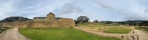
The Temple to the Sun God (el Templo del Sol), the Ingapirca Fortress is an Archaeological Complex (authentically Incan-Cañari construction) at 3,180 meters (10,433 ft) above sea level, Cañar Province by ER's Eyes - Our planet is so beautiful., The most important building, not only of the monumental complex of Ingapirca but also of the entire
The Temple to the Sun God (el Templo del Sol), the Ingapirca Fortress is an Archaeological Complex (authentically Incan-Cañari construction) at 3,180 meters (10,433 ft) above sea level, Cañar Province by ER's Eyes - Our planet is so beautiful.
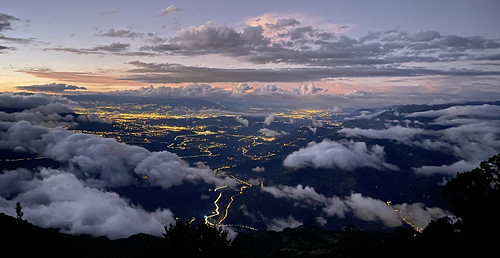
El Refugio del Volcán at 3,830 meters (12,565 feet) above sea level, Climbing the Summit of the Active and Mighty Stratovolcano 'Tungurahua' ('Throat of Fire' volcano) at 5,023 meters (16,479 feet) ab by ER's Eyes - Our planet is so beautiful., Tungurahua 5,023 metres (16,480 ft) is located in the Cordillera Oriental of the Andes of central Ec
El Refugio del Volcán at 3,830 meters (12,565 feet) above sea level, Climbing the Summit of the Active and Mighty Stratovolcano 'Tungurahua' ('Throat of Fire' volcano) at 5,023 meters (16,479 feet) ab by ER's Eyes - Our planet is so beautiful.
El Refugio del Volcán at 3,830 meters (12,565 feet) above sea level, Climbing the Summit of the Active and Mighty Stratovolcano 'Tungurahua' ('Throat of Fire' volcano) at 5,023 meters (16,479 feet) ab by ER's Eyes - Our planet is so beautiful., Pachamama is usually translated as Mother Earth, but a more literal translation would be "World
El Refugio del Volcán at 3,830 meters (12,565 feet) above sea level, Climbing the Summit of the Active and Mighty Stratovolcano 'Tungurahua' ('Throat of Fire' volcano) at 5,023 meters (16,479 feet) ab by ER's Eyes - Our planet is so beautiful.
The Crater, Climbing the Summit of the Active and Mighty Stratovolcano 'Tungurahua' ('Throat of Fire' volcano) at 5,023 meters (16,479 feet) above sea level, Baños, the Central Highlands, Ecuador. by ER's Eyes - Our planet is so beautiful., It has a 600 ft. (183 m) wide crater. 
Most of the volcano is covered by snow.
After the Arenal, cli
The Crater, Climbing the Summit of the Active and Mighty Stratovolcano 'Tungurahua' ('Throat of Fire' volcano) at 5,023 meters (16,479 feet) above sea level, Baños, the Central Highlands, Ecuador. by ER's Eyes - Our planet is so beautiful.
Sunrise, Climbing the Summit of the Active and Mighty Stratovolcano 'Tungurahua' ('Throat of Fire' volcano) at 5,023 meters (16,479 feet) above sea level, Baños, the Central Highlands, Ecuador. by ER's Eyes - Our planet is so beautiful., The sun rises with its strength and light ...

Passing the rim of the crater in smoke.
The force of
Sunrise, Climbing the Summit of the Active and Mighty Stratovolcano 'Tungurahua' ('Throat of Fire' volcano) at 5,023 meters (16,479 feet) above sea level, Baños, the Central Highlands, Ecuador. by ER's Eyes - Our planet is so beautiful.
Climbing the Summit of the Active and Mighty Stratovolcano 'Tungurahua' ('Throat of Fire' volcano) at 5,023 meters (16,479 feet) above sea level, Baños, the Central Highlands, Ecuador. by ER's Eyes - Our planet is so beautiful., At 4,600 meters (15,091 feet) above sea level at 4:43 am at this moment. We left the Refugio (hut) a
Climbing the Summit of the Active and Mighty Stratovolcano 'Tungurahua' ('Throat of Fire' volcano) at 5,023 meters (16,479 feet) above sea level, Baños, the Central Highlands, Ecuador. by ER's Eyes - Our planet is so beautiful.
Parque Aventura San Martin at 1,800 meters (5,905 ft) above sea level, Baños, Ecuador. by ER's Eyes - Our planet is so beautiful., A two day hiking and climbing.
It is no longer acclimatization to high altitudes. It's a serious cli
Parque Aventura San Martin at 1,800 meters (5,905 ft) above sea level, Baños, Ecuador. by ER's Eyes - Our planet is so beautiful.
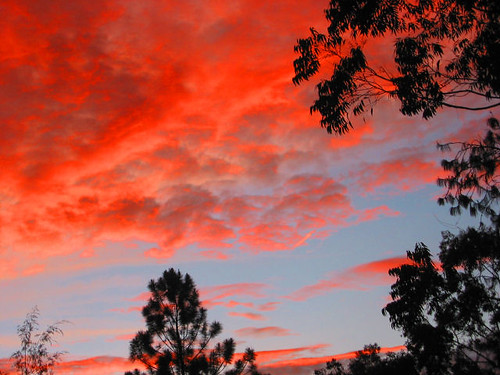
Ukarumpa Sunrise by kahunapulej, Sunrise in the Eastern Highlands Province of Papua New Guinea

UkarumpaHomeSunrise640clouds sunris
Ukarumpa Sunrise by kahunapulej
MANU by vertigotravelperuagency, Paradise blessed with the greatest biodiversity in the world, inhabited by native communities that s
MANU by vertigotravelperuagency
MANU by vertigotravelperuagency, Paradise blessed with the greatest biodiversity in the world, inhabited by native communities that s
MANU by vertigotravelperuagency
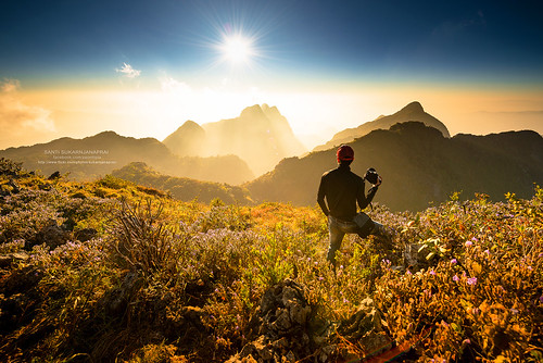
Doi Luang Chiang Dao by Sukarnjanaprai, Doi Luang Chiang Dao is a 2,175 m high mountain in Chiang Mai Province, Thailand. It is one of the h
Doi Luang Chiang Dao by Sukarnjanaprai

MANU by vertigotravelperuagency, Paradise blessed with the greatest biodiversity in the world, inhabited by native communities that s
MANU by vertigotravelperuagency
Doi Luang Chiang Dao 3 by Sukarnjanaprai, Doi Luang Chiang Dao is a 2,175 m high mountain in Chiang Mai Province, Thailand. It is one of the h
Doi Luang Chiang Dao 3 by Sukarnjanaprai
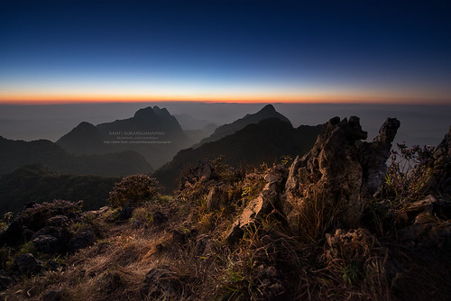
Sunset, Doi Luang Chiang Dao by Sukarnjanaprai, Doi Luang Chiang Dao is a 2,175 m high mountain in Chiang Mai Province, Thailand. It is one of the h
Sunset, Doi Luang Chiang Dao by Sukarnjanaprai
Phu Chee Fa, Chiang Rai by Sukarnjanaprai, Phu Chee Fah, is a mountain in Thailand located at the eastern edge of Thoeng District, Chiang Rai P
Phu Chee Fa, Chiang Rai by Sukarnjanaprai
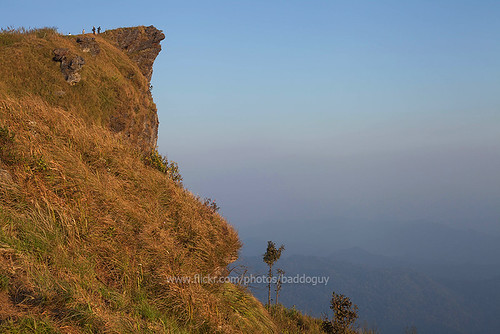
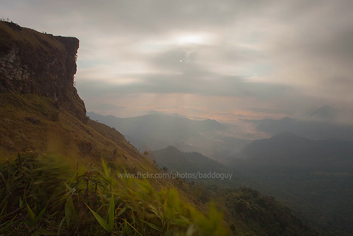
Phu Chi Fa at Sunrise by baddoguy, Phu Chi Fa, also Phu Chee Fah, is a mountain in Thailand located at the eastern edge of Thoeng Distr
Phu Chi Fa at Sunrise by baddoguy
Sea of Fog and Golden Light by baddoguy, Thought there was too many cloud covering and I could not see sunrise as expected but there was shot
Sea of Fog and Golden Light by baddoguy
Sunset by 10b travelling (sorry: glitch, so resubmitting), The Goroka Show is  the most famous tribal gathering and cultural event in Papua New Guinea. It is a
Sunset by 10b travelling (sorry: glitch, so resubmitting)
Rainbow hiding in the clouds by eomer1, Taken a year ago (March 2018) in the Eastern Highlands Province of Papua New Guinea.papuanewguinea c
Rainbow hiding in the clouds by eomer1
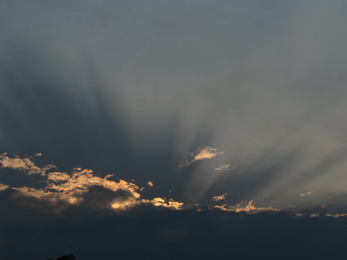
Clouds and light by kahunapulej, Light rayslight sunset sky clouds png papuanewguinea ehp niugini easternhighlandsprovince kahunapule
Clouds and light by kahunapulej
Stephen Plummer, PNG by AYAD Program, In 2008 I was based in Goroka in the Eastern Highlands Province of Papua New Guinea as a Juvenile Co
Stephen Plummer, PNG by AYAD Program
Phu Chee Fah (evening) by baddoguy, Phu Chi Fa (Thai: ภูชี้ฟ้า), also Phu Chee Fah, is a mountain in Thailand located at the eastern edg
Phu Chee Fah (evening) by baddoguy
Phu Chee Fah (morning) by baddoguy, Phu Chi Fa (Thai: ภูชี้ฟ้า), also Phu Chee Fah, is a mountain in Thailand located at the eastern edg
Phu Chee Fah (morning) by baddoguy
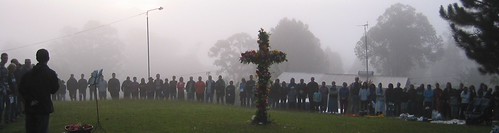
Sunrise Service in Ukarumpa by kahunapulej, Easter morning sunrise service in Ukarumpa, Eastern Highlands Province, Papua New Guineaeaster png p
Sunrise Service in Ukarumpa by kahunapulej
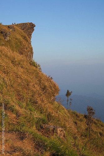
Phu Chee Fah (evening) by baddoguy, Phu Chi Fa (Thai: ภูชี้ฟ้า), also Phu Chee Fah, is a mountain in Thailand located at the eastern edg
Phu Chee Fah (evening) by baddoguy
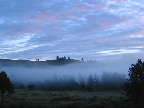
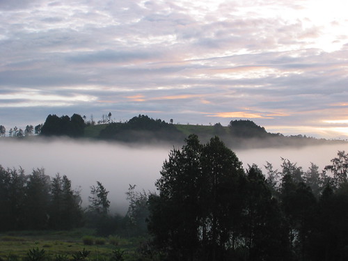
Morning Mist Sunrise by kahunapulej, Morning view from just behind what is now the Ukarumpa International School, Primary Campus, in Ukar
Morning Mist Sunrise by kahunapulej
Foggy Sunrise in Ukarumpa by kahunapulej, Tiny drops of water, trees, grass, and hills artistically arranged by God.new guinea png papuanewgui
Foggy Sunrise in Ukarumpa by kahunapulej
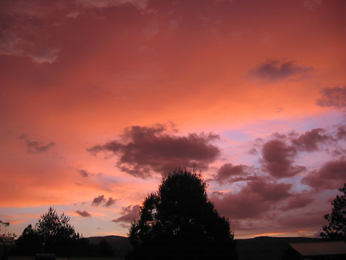
Sunset in Ukarumpa by kahunapulej, Sunset behind my house in Ukarumpanew sunset guinea png papuanewguinea papua ehp ukarumpa easternhig
Sunset in Ukarumpa by kahunapulej
38 - Gathering by ethnosax, This theme stumped me. I thought of "gathering clouds," and went with this picture of suns
38 - Gathering by ethnosax
Shenandoah Valley, Interstate 81 Between Harrisonburg and Roanoke, Virginia by Ken Lund, The Shenandoah Valley is a geographic valley and cultural region of western Virginia and the Eastern
Shenandoah Valley, Interstate 81 Between Harrisonburg and Roanoke, Virginia by Ken Lund