Zeitzone:Pakistanische Normalzeit
Ortszeit:Montag, 9. November 2026 19:12
Länge:73.3325516
Breite:36.3693535
Sonnenaufgang Heute:06:38:36
Sonnenuntergang Heute:17:04:59
Tageslänge heute:10h 26m 23s
Sonnenaufgang morgen:06:39:37
Sonnenuntergang Morgen:17:04:09
Tageslänge von morgen:10h 24m 31s

: Alle Termine anzeigen

Datum Sonnenaufgang Sonnenuntergang Tageslänge
1. Jan. 2026 07:19:14 17:02:11 9h 42m 56s
1. Feb. 2026 07:10:28 17:32:06 10h 21m 37s
1. März 2026 06:40:38 18:00:55 11h 20m 16s
1. Apr. 2026 05:56:06 18:28:08 12h 32m 1s
1. Mai 2026 05:16:19 18:53:56 13h 37m 36s
1. Juni 2026 04:52:19 19:19:11 14h 26m 52s
1. Juli 2026 04:53:04 19:29:43 14h 36m 39s
1. Aug. 2026 05:13:12 19:15:21 14h 2m 9s
1. Sep. 2026 05:38:20 18:38:59 13h 0m 38s
1. Okt. 2026 06:01:44 17:54:22 11h 52m 37s
1. Nov. 2026 06:29:28 17:13:34 10h 44m 6s
9. Nov. 2026 06:37:34 17:05:50 10h 28m 16s
10. Nov. 2026 06:38:36 17:04:59 10h 26m 23s
1. Dez. 2026 06:59:47 16:53:34 9h 53m 47s

Fotos von Sonnenaufgang und Sonnenuntergang

Early Morning Sunshine On The Mountains, Sandhi, Pakistan by Rowan Castle, sandhi pakistan naltar yasin trek rowan castle highquality asia trekking northernareas coolestphotog
Early Morning Sunshine On The Mountains, Sandhi, Pakistan by Rowan Castle
Evening view of Gamubar Zom by Asad Sheikh, Shot from campsite after sunset at Darkutdarkut gamubarzom gilgitbaltistan yasinvalley glaciers nort
Evening view of Gamubar Zom by Asad Sheikh
Phandar Lake by Irresistible!, Evening View of PTDC motel from the lake bank at Phandar, Ghizar Valley, Gilgit Baltistanblue pakist
Phandar Lake by Irresistible!
Khalti Lake and Village by gilgit2, Khalti, Ghizer, Gilgit-Baltistan, Pakistantrees pakistan lake building water canon landscape geotagg
Khalti Lake and Village by gilgit2
Pak_051 Yasin Valley by Roger Nix's Travel Collection, View to peaks on the far-side of the Yasin Valley, from the ruins of Mooduri Fort (Moduri Fort, Mudu
Pak_051 Yasin Valley by Roger Nix's Travel Collection
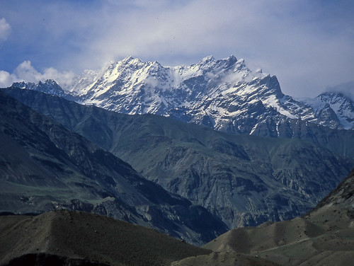
Pak_051A Yasin Valley by Roger Nix's Travel Collection, View to peaks on the far-side of the Yasin Valley, from the ruins of Mooduri Fort (Moduri Fort, Mudu
Pak_051A Yasin Valley by Roger Nix's Travel Collection
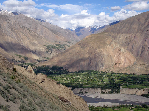
Pak_057 Yasin Valley by Roger Nix's Travel Collection, A day-walk on the eastern side of the Yasin valley.

This picture shows Thawoos village, which occup
Pak_057 Yasin Valley by Roger Nix's Travel Collection
Pak_052 Yasin Valley by Roger Nix's Travel Collection, Yasin valley - looking down-valley (south-west) from Mooduri Fort (Moduri Fort, Muduri Fort).

The r
Pak_052 Yasin Valley by Roger Nix's Travel Collection
Gilgit River by gilgit2, Gilgit River at Gupis, Ghizer, Gilgit-Baltistan, Pakistantrees pakistan mountains water canon river
Gilgit River by gilgit2
Pak_054B Yasin Valley by Roger Nix's Travel Collection, Upper Yasin valley. The snow-clad peaks at the head of the valley lie north-east of Darkot (Darkut).
Pak_054B Yasin Valley by Roger Nix's Travel Collection
Pak_054 Yasin Valley by Roger Nix's Travel Collection, View up the Yasin valley from near Sandhipakistan nwfp yasin northwestfrontier chitral hinduraj
Pak_054 Yasin Valley by Roger Nix's Travel Collection
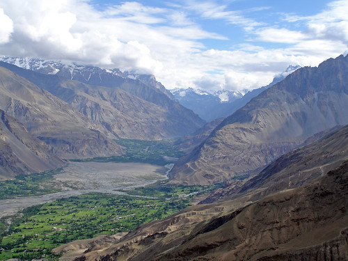
Pak_059 Yasin Valley by Roger Nix's Travel Collection, Yasin valley, view towards Darkotpakistan nwfp northwestfrontier chitral
Pak_059 Yasin Valley by Roger Nix's Travel Collection
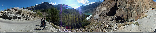
Khalti Lake, Ghizer by gilgit2, pakistan sky panorama clouds landscape geotagged wideangle tags location elements ultrawide stitched
Khalti Lake, Ghizer by gilgit2
Khalti Lake and Village by gilgit2, Khalti, Ghizer, Gilgit-Baltistan, Pakistantrees pakistan lake building water canon river landscape g
Khalti Lake and Village by gilgit2
Khalti by gilgit2, Khalti, Ghizer, Gilgit-Baltistan, Pakistantrees pakistan mountains water canon river landscape geota
Khalti by gilgit2
Pak_058C Yasin Valley by Roger Nix's Travel Collection, High above the Yasin valley, looking up-valley. The Thut Gol (formed in-part by the rivers flowing d
Pak_058C Yasin Valley by Roger Nix's Travel Collection
Khalti by gilgit2, Khalti, Ghizer, Gilgit-Baltistan, Pakistantrees pakistan lake mountains water canon landscape geotag
Khalti by gilgit2
Khalti Lake, Ghizer by gilgit2, pakistan sky panorama clouds landscape geotagged wideangle tags location elements ultrawide stitched
Khalti Lake, Ghizer by gilgit2
Pak_067 Yasin to Shandur by Roger Nix's Travel Collection, The Ghizer River, from the road between Yasin and Phander.pakistan nwfp yasin northwestfrontier chit
Pak_067 Yasin to Shandur by Roger Nix's Travel Collection
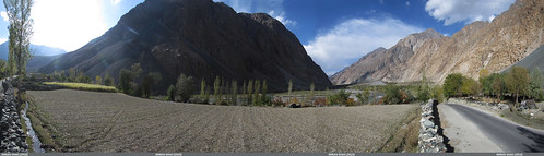
Entering Yasin Valley by gilgit2, pakistan sky panorama clouds landscape geotagged wideangle tags location elements ultrawide stitched
Entering Yasin Valley by gilgit2
Junction of Barkolti and Thoi Valley, Yasin by gilgit2, pakistan sky panorama clouds landscape geotagged wideangle tags location elements ultrawide stitched
Junction of Barkolti and Thoi Valley, Yasin by gilgit2
Somewhere in front of Sandhi, Yasin by gilgit2, pakistan sky panorama clouds landscape geotagged wideangle tags location elements ultrawide stitched
Somewhere in front of Sandhi, Yasin by gilgit2
Pak_063 Yasin Valley by Roger Nix's Travel Collection, The lower-section of the trail (that leads to the excellent viewpoints above the Yasin valley) can b
Pak_063 Yasin Valley by Roger Nix's Travel Collection
Khalti by gilgit2, Khalti, Ghizer, Gilgit-Baltistan, Pakistanbridge pakistan water canon river landscape geotagged rock
Khalti by gilgit2
Khalti Lake from PTDC, Jandrot. by gilgit2, Khalti, Ghizer, Gilgit-Baltistan, Pakistantrees pakistan sky panorama lake mountains water clouds ca
Khalti Lake from PTDC, Jandrot. by gilgit2