| Zeitzone: | Rocky-Mountains-Normalzeit |
|---|---|
| Ortszeit: | Montag, 9. November 2026 16:18 |
| Länge: | -113.517656 |
| Breite: | 46.8446 |
| Sonnenaufgang Heute: | 07:29:31 |
| Sonnenuntergang Heute: | 17:08:58 |
| Tageslänge heute: | 9h 39m 27s |
| Sonnenaufgang morgen: | 07:31:00 |
| Sonnenuntergang Morgen: | 17:07:42 |
| Tageslänge von morgen: | 9h 36m 42s |
: Alle Termine anzeigen
| Datum | Sonnenaufgang | Sonnenuntergang | Tageslänge |
|---|---|---|---|
| 1. Jan. 2026 | 08:20:30 | 16:56:12 | 8h 35m 41s |
| 1. Feb. 2026 | 08:01:09 | 17:36:23 | 9h 35m 13s |
| 1. März 2026 | 07:17:10 | 18:18:59 | 11h 1m 49s |
| 1. Apr. 2026 | 07:16:25 | 20:02:18 | 12h 45m 53s |
| 1. Mai 2026 | 06:21:37 | 20:43:19 | 14h 21m 41s |
| 1. Juni 2026 | 05:45:37 | 21:20:50 | 15h 35m 13s |
| 1. Juli 2026 | 05:44:18 | 21:33:29 | 15h 49m 10s |
| 1. Aug. 2026 | 06:13:55 | 21:09:25 | 14h 55m 29s |
| 1. Sep. 2026 | 06:53:50 | 20:17:58 | 13h 24m 7s |
| 1. Okt. 2026 | 07:32:36 | 19:17:57 | 11h 45m 21s |
| 1. Nov. 2026 | 08:16:07 | 18:21:41 | 10h 5m 34s |
| 10. Nov. 2026 | 07:29:31 | 17:08:58 | 9h 39m 27s |
| 11. Nov. 2026 | 07:31:00 | 17:07:42 | 9h 36m 42s |
| 1. Dez. 2026 | 07:58:47 | 16:49:44 | 8h 50m 57s |
Fotos von Sonnenaufgang und Sonnenuntergang

A River Runs Through It by Mark Payton Photography

Greenough, Montana 59836 by Postmarks from Montana

Sunset, Montana by Postmarks from Montana

Mountain View by Piedmont Fossil

Coloma Sunrise by schatham421

Blackfoot Fall Scene by edtkeith

Blackfoot Fall Scene by edtkeith
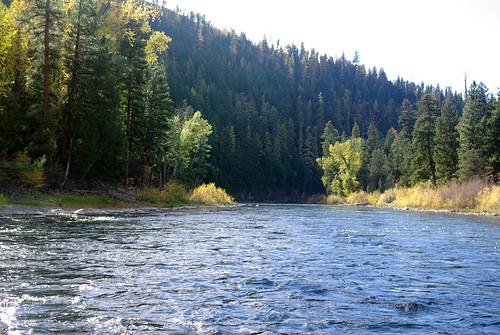
Blackfoot Fall Scene by edtkeith

#montana by LOGO

Blackfoot Fall Scene by edtkeith

Ranch Sunset by Potomac Rover

Sunset behind teepee and campfire at Beavertail Hill state park, Clinton, MT by jtpenny

Ranch Sunset by Potomac Rover

Ranch at Sunset by Potomac Rover

Sunrise on the Blackfoot by LOGO

Sunset at Blackfoot River by LOGO

Sunset behind Teepee at Beavertail Hill state park, Clinton, MT by jtpenny

#montana #sunset #chuckwagon by LOGO

IMAG1021 by Lemonade Magnate

undefined by LOGO