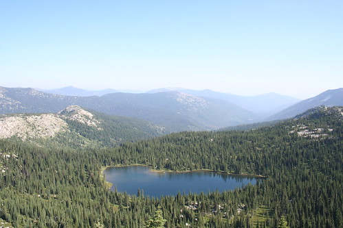
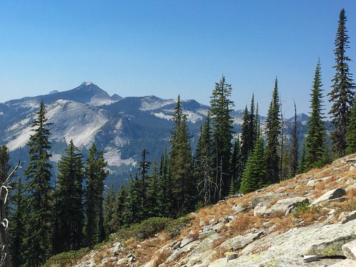
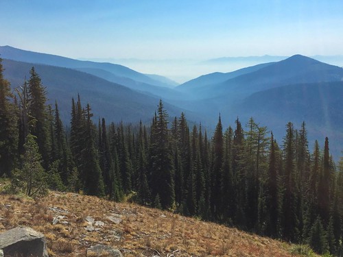
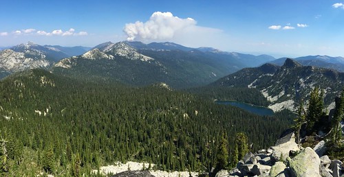
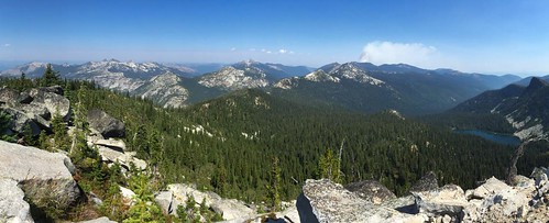
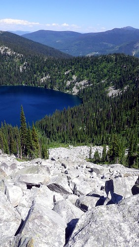
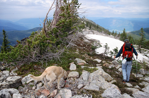
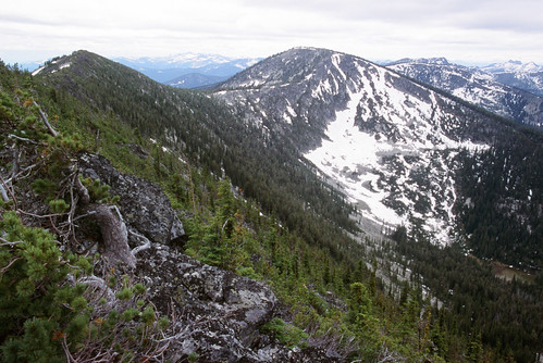
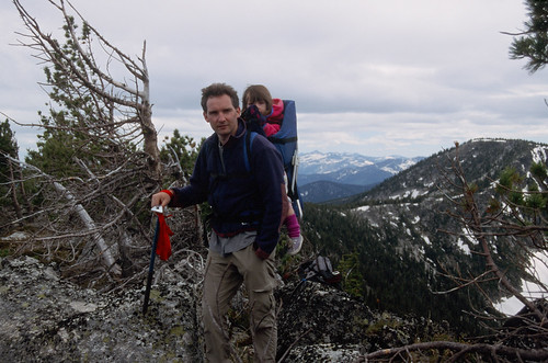
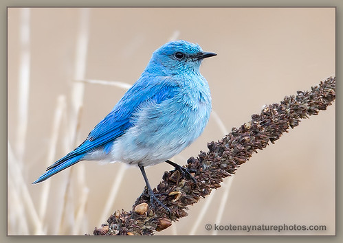
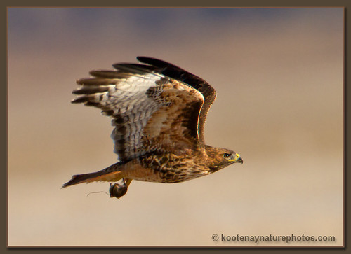
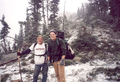
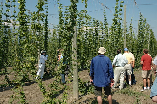
Parker Peak, Idaho, USA Sonnenaufgang Sonnenuntergang Zeiten
Location: USA > Idaho > Bonners Ferry >
Zeitzone:
America/Los_Angeles
Ortszeit:
2025-06-18 01:39:05
Länge:
-116.5877147
Breite:
48.8738302
Sonnenaufgang Heute:
04:42:12 AM
Sonnenuntergang Heute:
08:53:09 PM
Tageslänge heute:
16h 10m 57s
Sonnenaufgang morgen:
04:42:21 AM
Sonnenuntergang Morgen:
08:53:26 PM
Tageslänge von morgen:
16h 11m 5s
Alle Termine anzeigen
| Datum | Sonnenaufgang | Sonnenuntergang | Tageslänge |
|---|---|---|---|
| 2025-01-01 | 07:39:35 AM | 04:01:33 PM | 8h 21m 58s |
| 2025-01-02 | 07:39:27 AM | 04:02:36 PM | 8h 23m 9s |
| 2025-01-03 | 07:39:16 AM | 04:03:42 PM | 8h 24m 26s |
| 2025-01-04 | 07:39:02 AM | 04:04:49 PM | 8h 25m 47s |
| 2025-01-05 | 07:38:44 AM | 04:05:59 PM | 8h 27m 15s |
| 2025-01-06 | 07:38:24 AM | 04:07:11 PM | 8h 28m 47s |
| 2025-01-07 | 07:38:01 AM | 04:08:24 PM | 8h 30m 23s |
| 2025-01-08 | 07:37:35 AM | 04:09:40 PM | 8h 32m 5s |
| 2025-01-09 | 07:37:06 AM | 04:10:57 PM | 8h 33m 51s |
| 2025-01-10 | 07:36:35 AM | 04:12:16 PM | 8h 35m 41s |
| 2025-01-11 | 07:36:00 AM | 04:13:36 PM | 8h 37m 36s |
| 2025-01-12 | 07:35:23 AM | 04:14:59 PM | 8h 39m 36s |
| 2025-01-13 | 07:34:43 AM | 04:16:22 PM | 8h 41m 39s |
| 2025-01-14 | 07:34:00 AM | 04:17:47 PM | 8h 43m 47s |
| 2025-01-15 | 07:33:14 AM | 04:19:13 PM | 8h 45m 59s |
| 2025-01-16 | 07:32:26 AM | 04:20:41 PM | 8h 48m 15s |
| 2025-01-17 | 07:31:36 AM | 04:22:09 PM | 8h 50m 33s |
| 2025-01-18 | 07:30:42 AM | 04:23:39 PM | 8h 52m 57s |
| 2025-01-19 | 07:29:47 AM | 04:25:10 PM | 8h 55m 23s |
| 2025-01-20 | 07:28:48 AM | 04:26:42 PM | 8h 57m 54s |
| 2025-01-21 | 07:27:48 AM | 04:28:14 PM | 9h 0m 26s |
| 2025-01-22 | 07:26:44 AM | 04:29:48 PM | 9h 3m 4s |
| 2025-01-23 | 07:25:39 AM | 04:31:22 PM | 9h 5m 43s |
| 2025-01-24 | 07:24:31 AM | 04:32:57 PM | 9h 8m 26s |
| 2025-01-25 | 07:23:21 AM | 04:34:33 PM | 9h 11m 12s |
| 2025-01-26 | 07:22:09 AM | 04:36:09 PM | 9h 14m 0s |
| 2025-01-27 | 07:20:55 AM | 04:37:46 PM | 9h 16m 51s |
| 2025-01-28 | 07:19:39 AM | 04:39:23 PM | 9h 19m 44s |
| 2025-01-29 | 07:18:20 AM | 04:41:00 PM | 9h 22m 40s |
| 2025-01-30 | 07:17:00 AM | 04:42:38 PM | 9h 25m 38s |
| 2025-01-31 | 07:15:38 AM | 04:44:16 PM | 9h 28m 38s |
| 2025-02-01 | 07:14:13 AM | 04:45:55 PM | 9h 31m 42s |
| 2025-02-02 | 07:12:47 AM | 04:47:34 PM | 9h 34m 47s |
| 2025-02-03 | 07:11:19 AM | 04:49:13 PM | 9h 37m 54s |
| 2025-02-04 | 07:09:50 AM | 04:50:52 PM | 9h 41m 2s |
| 2025-02-05 | 07:08:18 AM | 04:52:31 PM | 9h 44m 13s |
| 2025-02-06 | 07:06:45 AM | 04:54:10 PM | 9h 47m 25s |
| 2025-02-07 | 07:05:11 AM | 04:55:49 PM | 9h 50m 38s |
| 2025-02-08 | 07:03:34 AM | 04:57:29 PM | 9h 53m 55s |
| 2025-02-09 | 07:01:57 AM | 04:59:08 PM | 9h 57m 11s |
| 2025-02-10 | 07:00:18 AM | 05:00:47 PM | 10h 0m 29s |
| 2025-02-11 | 06:58:37 AM | 05:02:26 PM | 10h 3m 49s |
| 2025-02-12 | 06:56:55 AM | 05:04:05 PM | 10h 7m 10s |
| 2025-02-13 | 06:55:12 AM | 05:05:44 PM | 10h 10m 32s |
| 2025-02-14 | 06:53:27 AM | 05:07:23 PM | 10h 13m 56s |
| 2025-02-15 | 06:51:41 AM | 05:09:01 PM | 10h 17m 20s |
| 2025-02-16 | 06:49:54 AM | 05:10:39 PM | 10h 20m 45s |
| 2025-02-17 | 06:48:06 AM | 05:12:18 PM | 10h 24m 12s |
| 2025-02-18 | 06:46:16 AM | 05:13:55 PM | 10h 27m 39s |
| 2025-02-19 | 06:44:26 AM | 05:15:33 PM | 10h 31m 7s |
| 2025-02-20 | 06:42:34 AM | 05:17:11 PM | 10h 34m 37s |
| 2025-02-21 | 06:40:41 AM | 05:18:48 PM | 10h 38m 7s |
| 2025-02-22 | 06:38:48 AM | 05:20:25 PM | 10h 41m 37s |
| 2025-02-23 | 06:36:53 AM | 05:22:01 PM | 10h 45m 8s |
| 2025-02-24 | 06:34:58 AM | 05:23:38 PM | 10h 48m 40s |
| 2025-02-25 | 06:33:02 AM | 05:25:14 PM | 10h 52m 12s |
| 2025-02-26 | 06:31:05 AM | 05:26:50 PM | 10h 55m 45s |
| 2025-02-27 | 06:29:07 AM | 05:28:25 PM | 10h 59m 18s |
| 2025-02-28 | 06:27:08 AM | 05:30:00 PM | 11h 2m 52s |
| 2025-03-01 | 06:25:09 AM | 05:31:35 PM | 11h 6m 26s |
| 2025-03-02 | 06:23:09 AM | 05:33:10 PM | 11h 10m 1s |
| 2025-03-03 | 06:21:08 AM | 05:34:45 PM | 11h 13m 37s |
| 2025-03-04 | 06:19:07 AM | 05:36:19 PM | 11h 17m 12s |
| 2025-03-05 | 06:17:05 AM | 05:37:53 PM | 11h 20m 48s |
| 2025-03-06 | 06:15:03 AM | 05:39:26 PM | 11h 24m 23s |
| 2025-03-07 | 06:13:00 AM | 05:41:00 PM | 11h 28m 0s |
| 2025-03-08 | 06:10:57 AM | 05:42:33 PM | 11h 31m 36s |
| 2025-03-09 | 07:08:58 AM | 06:44:02 PM | 11h 35m 4s |
| 2025-03-10 | 07:06:54 AM | 06:45:35 PM | 11h 38m 41s |
| 2025-03-11 | 07:04:49 AM | 06:47:07 PM | 11h 42m 18s |
| 2025-03-12 | 07:02:45 AM | 06:48:39 PM | 11h 45m 54s |
| 2025-03-13 | 07:00:39 AM | 06:50:11 PM | 11h 49m 32s |
| 2025-03-14 | 06:58:34 AM | 06:51:43 PM | 11h 53m 9s |
| 2025-03-15 | 06:56:28 AM | 06:53:15 PM | 11h 56m 47s |
| 2025-03-16 | 06:54:22 AM | 06:54:46 PM | 12h 0m 24s |
| 2025-03-17 | 06:52:16 AM | 06:56:17 PM | 12h 4m 1s |
| 2025-03-18 | 06:50:10 AM | 06:57:49 PM | 12h 7m 39s |
| 2025-03-19 | 06:48:04 AM | 06:59:19 PM | 12h 11m 15s |
| 2025-03-20 | 06:45:57 AM | 07:00:50 PM | 12h 14m 53s |
| 2025-03-21 | 06:43:51 AM | 07:02:21 PM | 12h 18m 30s |
| 2025-03-22 | 06:41:44 AM | 07:03:51 PM | 12h 22m 7s |
| 2025-03-23 | 06:39:38 AM | 07:05:22 PM | 12h 25m 44s |
| 2025-03-24 | 06:37:31 AM | 07:06:52 PM | 12h 29m 21s |
| 2025-03-25 | 06:35:25 AM | 07:08:22 PM | 12h 32m 57s |
| 2025-03-26 | 06:33:19 AM | 07:09:52 PM | 12h 36m 33s |
| 2025-03-27 | 06:31:12 AM | 07:11:22 PM | 12h 40m 10s |
| 2025-03-28 | 06:29:06 AM | 07:12:52 PM | 12h 43m 46s |
| 2025-03-29 | 06:27:00 AM | 07:14:22 PM | 12h 47m 22s |
| 2025-03-30 | 06:24:55 AM | 07:15:52 PM | 12h 50m 57s |
| 2025-03-31 | 06:22:49 AM | 07:17:22 PM | 12h 54m 33s |
| 2025-04-01 | 06:20:44 AM | 07:18:52 PM | 12h 58m 8s |
| 2025-04-02 | 06:18:40 AM | 07:20:21 PM | 13h 1m 41s |
| 2025-04-03 | 06:16:35 AM | 07:21:51 PM | 13h 5m 16s |
| 2025-04-04 | 06:14:31 AM | 07:23:21 PM | 13h 8m 50s |
| 2025-04-05 | 06:12:28 AM | 07:24:50 PM | 13h 12m 22s |
| 2025-04-06 | 06:10:24 AM | 07:26:20 PM | 13h 15m 56s |
| 2025-04-07 | 06:08:22 AM | 07:27:49 PM | 13h 19m 27s |
| 2025-04-08 | 06:06:20 AM | 07:29:19 PM | 13h 22m 59s |
| 2025-04-09 | 06:04:18 AM | 07:30:48 PM | 13h 26m 30s |
| 2025-04-10 | 06:02:17 AM | 07:32:18 PM | 13h 30m 1s |
| 2025-04-11 | 06:00:16 AM | 07:33:48 PM | 13h 33m 32s |
| 2025-04-12 | 05:58:16 AM | 07:35:17 PM | 13h 37m 1s |
| 2025-04-13 | 05:56:17 AM | 07:36:47 PM | 13h 40m 30s |
| 2025-04-14 | 05:54:19 AM | 07:38:16 PM | 13h 43m 57s |
| 2025-04-15 | 05:52:21 AM | 07:39:46 PM | 13h 47m 25s |
| 2025-04-16 | 05:50:24 AM | 07:41:15 PM | 13h 50m 51s |
| 2025-04-17 | 05:48:28 AM | 07:42:44 PM | 13h 54m 16s |
| 2025-04-18 | 05:46:33 AM | 07:44:14 PM | 13h 57m 41s |
| 2025-04-19 | 05:44:39 AM | 07:45:43 PM | 14h 1m 4s |
| 2025-04-20 | 05:42:45 AM | 07:47:12 PM | 14h 4m 27s |
| 2025-04-21 | 05:40:53 AM | 07:48:42 PM | 14h 7m 49s |
| 2025-04-22 | 05:39:01 AM | 07:50:11 PM | 14h 11m 10s |
| 2025-04-23 | 05:37:11 AM | 07:51:40 PM | 14h 14m 29s |
| 2025-04-24 | 05:35:22 AM | 07:53:08 PM | 14h 17m 46s |
| 2025-04-25 | 05:33:33 AM | 07:54:37 PM | 14h 21m 4s |
| 2025-04-26 | 05:31:46 AM | 07:56:06 PM | 14h 24m 20s |
| 2025-04-27 | 05:30:01 AM | 07:57:34 PM | 14h 27m 33s |
| 2025-04-28 | 05:28:16 AM | 07:59:02 PM | 14h 30m 46s |
| 2025-04-29 | 05:26:33 AM | 08:00:30 PM | 14h 33m 57s |
| 2025-04-30 | 05:24:51 AM | 08:01:58 PM | 14h 37m 7s |
| 2025-05-01 | 05:23:10 AM | 08:03:25 PM | 14h 40m 15s |
| 2025-05-02 | 05:21:31 AM | 08:04:53 PM | 14h 43m 22s |
| 2025-05-03 | 05:19:53 AM | 08:06:19 PM | 14h 46m 26s |
| 2025-05-04 | 05:18:16 AM | 08:07:46 PM | 14h 49m 30s |
| 2025-05-05 | 05:16:42 AM | 08:09:12 PM | 14h 52m 30s |
| 2025-05-06 | 05:15:08 AM | 08:10:38 PM | 14h 55m 30s |
| 2025-05-07 | 05:13:37 AM | 08:12:03 PM | 14h 58m 26s |
| 2025-05-08 | 05:12:07 AM | 08:13:27 PM | 15h 1m 20s |
| 2025-05-09 | 05:10:38 AM | 08:14:51 PM | 15h 4m 13s |
| 2025-05-10 | 05:09:12 AM | 08:16:15 PM | 15h 7m 3s |
| 2025-05-11 | 05:07:47 AM | 08:17:38 PM | 15h 9m 51s |
| 2025-05-12 | 05:06:24 AM | 08:19:00 PM | 15h 12m 36s |
| 2025-05-13 | 05:05:03 AM | 08:20:21 PM | 15h 15m 18s |
| 2025-05-14 | 05:03:44 AM | 08:21:42 PM | 15h 17m 58s |
| 2025-05-15 | 05:02:27 AM | 08:23:02 PM | 15h 20m 35s |
| 2025-05-16 | 05:01:11 AM | 08:24:21 PM | 15h 23m 10s |
| 2025-05-17 | 04:59:58 AM | 08:25:39 PM | 15h 25m 41s |
| 2025-05-18 | 04:58:47 AM | 08:26:56 PM | 15h 28m 9s |
| 2025-05-19 | 04:57:38 AM | 08:28:12 PM | 15h 30m 34s |
| 2025-05-20 | 04:56:31 AM | 08:29:26 PM | 15h 32m 55s |
| 2025-05-21 | 04:55:27 AM | 08:30:40 PM | 15h 35m 13s |
| 2025-05-22 | 04:54:24 AM | 08:31:53 PM | 15h 37m 29s |
| 2025-05-23 | 04:53:24 AM | 08:33:04 PM | 15h 39m 40s |
| 2025-05-24 | 04:52:27 AM | 08:34:14 PM | 15h 41m 47s |
| 2025-05-25 | 04:51:31 AM | 08:35:22 PM | 15h 43m 51s |
| 2025-05-26 | 04:50:38 AM | 08:36:30 PM | 15h 45m 52s |
| 2025-05-27 | 04:49:48 AM | 08:37:35 PM | 15h 47m 47s |
| 2025-05-28 | 04:49:00 AM | 08:38:39 PM | 15h 49m 39s |
| 2025-05-29 | 04:48:14 AM | 08:39:42 PM | 15h 51m 28s |
| 2025-05-30 | 04:47:31 AM | 08:40:42 PM | 15h 53m 11s |
| 2025-05-31 | 04:46:50 AM | 08:41:41 PM | 15h 54m 51s |
| 2025-06-01 | 04:46:12 AM | 08:42:38 PM | 15h 56m 26s |
| 2025-06-02 | 04:45:37 AM | 08:43:34 PM | 15h 57m 57s |
| 2025-06-03 | 04:45:04 AM | 08:44:27 PM | 15h 59m 23s |
| 2025-06-04 | 04:44:34 AM | 08:45:18 PM | 16h 0m 44s |
| 2025-06-05 | 04:44:07 AM | 08:46:08 PM | 16h 2m 1s |
| 2025-06-06 | 04:43:42 AM | 08:46:55 PM | 16h 3m 13s |
| 2025-06-07 | 04:43:20 AM | 08:47:40 PM | 16h 4m 20s |
| 2025-06-08 | 04:43:01 AM | 08:48:23 PM | 16h 5m 22s |
| 2025-06-09 | 04:42:44 AM | 08:49:04 PM | 16h 6m 20s |
| 2025-06-10 | 04:42:30 AM | 08:49:42 PM | 16h 7m 12s |
| 2025-06-11 | 04:42:19 AM | 08:50:18 PM | 16h 7m 59s |
| 2025-06-12 | 04:42:11 AM | 08:50:51 PM | 16h 8m 40s |
| 2025-06-13 | 04:42:05 AM | 08:51:23 PM | 16h 9m 18s |
| 2025-06-14 | 04:42:02 AM | 08:51:51 PM | 16h 9m 49s |
| 2025-06-15 | 04:42:02 AM | 08:52:17 PM | 16h 10m 15s |
| 2025-06-16 | 04:42:04 AM | 08:52:41 PM | 16h 10m 37s |
| 2025-06-17 | 04:42:09 AM | 08:53:02 PM | 16h 10m 53s |
| 2025-06-18 | 04:42:17 AM | 08:53:20 PM | 16h 11m 3s |
| 2025-06-19 | 04:42:28 AM | 08:53:36 PM | 16h 11m 8s |
| 2025-06-20 | 04:42:41 AM | 08:53:49 PM | 16h 11m 8s |
| 2025-06-21 | 04:42:56 AM | 08:53:59 PM | 16h 11m 3s |
| 2025-06-22 | 04:43:15 AM | 08:54:07 PM | 16h 10m 52s |
| 2025-06-23 | 04:43:36 AM | 08:54:12 PM | 16h 10m 36s |
| 2025-06-24 | 04:43:59 AM | 08:54:14 PM | 16h 10m 15s |
| 2025-06-25 | 04:44:25 AM | 08:54:13 PM | 16h 9m 48s |
| 2025-06-26 | 04:44:53 AM | 08:54:10 PM | 16h 9m 17s |
| 2025-06-27 | 04:45:24 AM | 08:54:04 PM | 16h 8m 40s |
| 2025-06-28 | 04:45:57 AM | 08:53:55 PM | 16h 7m 58s |
| 2025-06-29 | 04:46:32 AM | 08:53:43 PM | 16h 7m 11s |
| 2025-06-30 | 04:47:10 AM | 08:53:28 PM | 16h 6m 18s |
| 2025-07-01 | 04:47:50 AM | 08:53:11 PM | 16h 5m 21s |
| 2025-07-02 | 04:48:32 AM | 08:52:51 PM | 16h 4m 19s |
| 2025-07-03 | 04:49:16 AM | 08:52:28 PM | 16h 3m 12s |
| 2025-07-04 | 04:50:02 AM | 08:52:03 PM | 16h 2m 1s |
| 2025-07-05 | 04:50:50 AM | 08:51:35 PM | 16h 0m 45s |
| 2025-07-06 | 04:51:41 AM | 08:51:04 PM | 15h 59m 23s |
| 2025-07-07 | 04:52:33 AM | 08:50:30 PM | 15h 57m 57s |
| 2025-07-08 | 04:53:27 AM | 08:49:54 PM | 15h 56m 27s |
| 2025-07-09 | 04:54:22 AM | 08:49:15 PM | 15h 54m 53s |
| 2025-07-10 | 04:55:20 AM | 08:48:33 PM | 15h 53m 13s |
| 2025-07-11 | 04:56:19 AM | 08:47:49 PM | 15h 51m 30s |
| 2025-07-12 | 04:57:19 AM | 08:47:03 PM | 15h 49m 44s |
| 2025-07-13 | 04:58:22 AM | 08:46:14 PM | 15h 47m 52s |
| 2025-07-14 | 04:59:25 AM | 08:45:22 PM | 15h 45m 57s |
| 2025-07-15 | 05:00:30 AM | 08:44:28 PM | 15h 43m 58s |
| 2025-07-16 | 05:01:37 AM | 08:43:32 PM | 15h 41m 55s |
| 2025-07-17 | 05:02:45 AM | 08:42:33 PM | 15h 39m 48s |
| 2025-07-18 | 05:03:54 AM | 08:41:32 PM | 15h 37m 38s |
| 2025-07-19 | 05:05:04 AM | 08:40:28 PM | 15h 35m 24s |
| 2025-07-20 | 05:06:15 AM | 08:39:22 PM | 15h 33m 7s |
| 2025-07-21 | 05:07:28 AM | 08:38:15 PM | 15h 30m 47s |
| 2025-07-22 | 05:08:41 AM | 08:37:04 PM | 15h 28m 23s |
| 2025-07-23 | 05:09:55 AM | 08:35:52 PM | 15h 25m 57s |
| 2025-07-24 | 05:11:11 AM | 08:34:38 PM | 15h 23m 27s |
| 2025-07-25 | 05:12:27 AM | 08:33:22 PM | 15h 20m 55s |
| 2025-07-26 | 05:13:44 AM | 08:32:03 PM | 15h 18m 19s |
| 2025-07-27 | 05:15:01 AM | 08:30:43 PM | 15h 15m 42s |
| 2025-07-28 | 05:16:20 AM | 08:29:21 PM | 15h 13m 1s |
| 2025-07-29 | 05:17:39 AM | 08:27:57 PM | 15h 10m 18s |
| 2025-07-30 | 05:18:58 AM | 08:26:31 PM | 15h 7m 33s |
| 2025-07-31 | 05:20:19 AM | 08:25:03 PM | 15h 4m 44s |
| 2025-08-01 | 05:21:39 AM | 08:23:33 PM | 15h 1m 54s |
| 2025-08-02 | 05:23:01 AM | 08:22:02 PM | 14h 59m 1s |
| 2025-08-03 | 05:24:22 AM | 08:20:30 PM | 14h 56m 8s |
| 2025-08-04 | 05:25:44 AM | 08:18:55 PM | 14h 53m 11s |
| 2025-08-05 | 05:27:07 AM | 08:17:19 PM | 14h 50m 12s |
| 2025-08-06 | 05:28:30 AM | 08:15:42 PM | 14h 47m 12s |
| 2025-08-07 | 05:29:53 AM | 08:14:03 PM | 14h 44m 10s |
| 2025-08-08 | 05:31:16 AM | 08:12:22 PM | 14h 41m 6s |
| 2025-08-09 | 05:32:40 AM | 08:10:40 PM | 14h 38m 0s |
| 2025-08-10 | 05:34:04 AM | 08:08:57 PM | 14h 34m 53s |
| 2025-08-11 | 05:35:28 AM | 08:07:13 PM | 14h 31m 45s |
| 2025-08-12 | 05:36:52 AM | 08:05:27 PM | 14h 28m 35s |
| 2025-08-13 | 05:38:16 AM | 08:03:40 PM | 14h 25m 24s |
| 2025-08-14 | 05:39:41 AM | 08:01:51 PM | 14h 22m 10s |
| 2025-08-15 | 05:41:06 AM | 08:00:02 PM | 14h 18m 56s |
| 2025-08-16 | 05:42:30 AM | 07:58:11 PM | 14h 15m 41s |
| 2025-08-17 | 05:43:55 AM | 07:56:20 PM | 14h 12m 25s |
| 2025-08-18 | 05:45:20 AM | 07:54:27 PM | 14h 9m 7s |
| 2025-08-19 | 05:46:45 AM | 07:52:33 PM | 14h 5m 48s |
| 2025-08-20 | 05:48:10 AM | 07:50:39 PM | 14h 2m 29s |
| 2025-08-21 | 05:49:35 AM | 07:48:43 PM | 13h 59m 8s |
| 2025-08-22 | 05:51:00 AM | 07:46:47 PM | 13h 55m 47s |
| 2025-08-23 | 05:52:25 AM | 07:44:49 PM | 13h 52m 24s |
| 2025-08-24 | 05:53:50 AM | 07:42:51 PM | 13h 49m 1s |
| 2025-08-25 | 05:55:15 AM | 07:40:52 PM | 13h 45m 37s |
| 2025-08-26 | 05:56:40 AM | 07:38:53 PM | 13h 42m 13s |
| 2025-08-27 | 05:58:04 AM | 07:36:52 PM | 13h 38m 48s |
| 2025-08-28 | 05:59:29 AM | 07:34:51 PM | 13h 35m 22s |
| 2025-08-29 | 06:00:54 AM | 07:32:49 PM | 13h 31m 55s |
| 2025-08-30 | 06:02:19 AM | 07:30:47 PM | 13h 28m 28s |
| 2025-08-31 | 06:03:44 AM | 07:28:44 PM | 13h 25m 0s |
| 2025-09-01 | 06:05:09 AM | 07:26:40 PM | 13h 21m 31s |
| 2025-09-02 | 06:06:34 AM | 07:24:36 PM | 13h 18m 2s |
| 2025-09-03 | 06:07:59 AM | 07:22:32 PM | 13h 14m 33s |
| 2025-09-04 | 06:09:23 AM | 07:20:27 PM | 13h 11m 4s |
| 2025-09-05 | 06:10:48 AM | 07:18:21 PM | 13h 7m 33s |
| 2025-09-06 | 06:12:13 AM | 07:16:15 PM | 13h 4m 2s |
| 2025-09-07 | 06:13:38 AM | 07:14:09 PM | 13h 0m 31s |
| 2025-09-08 | 06:15:03 AM | 07:12:03 PM | 12h 57m 0s |
| 2025-09-09 | 06:16:27 AM | 07:09:56 PM | 12h 53m 29s |
| 2025-09-10 | 06:17:52 AM | 07:07:49 PM | 12h 49m 57s |
| 2025-09-11 | 06:19:17 AM | 07:05:41 PM | 12h 46m 24s |
| 2025-09-12 | 06:20:42 AM | 07:03:34 PM | 12h 42m 52s |
| 2025-09-13 | 06:22:07 AM | 07:01:26 PM | 12h 39m 19s |
| 2025-09-14 | 06:23:32 AM | 06:59:18 PM | 12h 35m 46s |
| 2025-09-15 | 06:24:57 AM | 06:57:10 PM | 12h 32m 13s |
| 2025-09-16 | 06:26:22 AM | 06:55:02 PM | 12h 28m 40s |
| 2025-09-17 | 06:27:48 AM | 06:52:54 PM | 12h 25m 6s |
| 2025-09-18 | 06:29:13 AM | 06:50:46 PM | 12h 21m 33s |
| 2025-09-19 | 06:30:39 AM | 06:48:37 PM | 12h 17m 58s |
| 2025-09-20 | 06:32:04 AM | 06:46:29 PM | 12h 14m 25s |
| 2025-09-21 | 06:33:30 AM | 06:44:21 PM | 12h 10m 51s |
| 2025-09-22 | 06:34:56 AM | 06:42:13 PM | 12h 7m 17s |
| 2025-09-23 | 06:36:22 AM | 06:40:05 PM | 12h 3m 43s |
| 2025-09-24 | 06:37:48 AM | 06:37:57 PM | 12h 0m 9s |
| 2025-09-25 | 06:39:15 AM | 06:35:50 PM | 11h 56m 35s |
| 2025-09-26 | 06:40:41 AM | 06:33:42 PM | 11h 53m 1s |
| 2025-09-27 | 06:42:08 AM | 06:31:35 PM | 11h 49m 27s |
| 2025-09-28 | 06:43:35 AM | 06:29:28 PM | 11h 45m 53s |
| 2025-09-29 | 06:45:02 AM | 06:27:22 PM | 11h 42m 20s |
| 2025-09-30 | 06:46:30 AM | 06:25:16 PM | 11h 38m 46s |
| 2025-10-01 | 06:47:58 AM | 06:23:10 PM | 11h 35m 12s |
| 2025-10-02 | 06:49:25 AM | 06:21:04 PM | 11h 31m 39s |
| 2025-10-03 | 06:50:54 AM | 06:18:59 PM | 11h 28m 5s |
| 2025-10-04 | 06:52:22 AM | 06:16:55 PM | 11h 24m 33s |
| 2025-10-05 | 06:53:51 AM | 06:14:51 PM | 11h 21m 0s |
| 2025-10-06 | 06:55:20 AM | 06:12:47 PM | 11h 17m 27s |
| 2025-10-07 | 06:56:49 AM | 06:10:44 PM | 11h 13m 55s |
| 2025-10-08 | 06:58:19 AM | 06:08:42 PM | 11h 10m 23s |
| 2025-10-09 | 06:59:49 AM | 06:06:40 PM | 11h 6m 51s |
| 2025-10-10 | 07:01:19 AM | 06:04:39 PM | 11h 3m 20s |
| 2025-10-11 | 07:02:49 AM | 06:02:39 PM | 10h 59m 50s |
| 2025-10-12 | 07:04:20 AM | 06:00:39 PM | 10h 56m 19s |
| 2025-10-13 | 07:05:51 AM | 05:58:40 PM | 10h 52m 49s |
| 2025-10-14 | 07:07:22 AM | 05:56:42 PM | 10h 49m 20s |
| 2025-10-15 | 07:08:54 AM | 05:54:45 PM | 10h 45m 51s |
| 2025-10-16 | 07:10:26 AM | 05:52:48 PM | 10h 42m 22s |
| 2025-10-17 | 07:11:58 AM | 05:50:53 PM | 10h 38m 55s |
| 2025-10-18 | 07:13:31 AM | 05:48:58 PM | 10h 35m 27s |
| 2025-10-19 | 07:15:04 AM | 05:47:05 PM | 10h 32m 1s |
| 2025-10-20 | 07:16:37 AM | 05:45:12 PM | 10h 28m 35s |
| 2025-10-21 | 07:18:10 AM | 05:43:21 PM | 10h 25m 11s |
| 2025-10-22 | 07:19:44 AM | 05:41:30 PM | 10h 21m 46s |
| 2025-10-23 | 07:21:18 AM | 05:39:41 PM | 10h 18m 23s |
| 2025-10-24 | 07:22:52 AM | 05:37:53 PM | 10h 15m 1s |
| 2025-10-25 | 07:24:26 AM | 05:36:06 PM | 10h 11m 40s |
| 2025-10-26 | 07:26:01 AM | 05:34:21 PM | 10h 8m 20s |
| 2025-10-27 | 07:27:35 AM | 05:32:37 PM | 10h 5m 2s |
| 2025-10-28 | 07:29:10 AM | 05:30:54 PM | 10h 1m 44s |
| 2025-10-29 | 07:30:45 AM | 05:29:13 PM | 9h 58m 28s |
| 2025-10-30 | 07:32:20 AM | 05:27:33 PM | 9h 55m 13s |
| 2025-10-31 | 07:33:56 AM | 05:25:54 PM | 9h 51m 58s |
| 2025-11-01 | 07:35:31 AM | 05:24:17 PM | 9h 48m 46s |
| 2025-11-02 | 06:37:10 AM | 04:22:38 PM | 9h 45m 28s |
| 2025-11-03 | 06:38:46 AM | 04:21:04 PM | 9h 42m 18s |
| 2025-11-04 | 06:40:21 AM | 04:19:32 PM | 9h 39m 11s |
| 2025-11-05 | 06:41:56 AM | 04:18:02 PM | 9h 36m 6s |
| 2025-11-06 | 06:43:32 AM | 04:16:33 PM | 9h 33m 1s |
| 2025-11-07 | 06:45:07 AM | 04:15:07 PM | 9h 30m 0s |
| 2025-11-08 | 06:46:42 AM | 04:13:42 PM | 9h 27m 0s |
| 2025-11-09 | 06:48:16 AM | 04:12:19 PM | 9h 24m 3s |
| 2025-11-10 | 06:49:51 AM | 04:10:58 PM | 9h 21m 7s |
| 2025-11-11 | 06:51:25 AM | 04:09:39 PM | 9h 18m 14s |
| 2025-11-12 | 06:52:59 AM | 04:08:22 PM | 9h 15m 23s |
| 2025-11-13 | 06:54:32 AM | 04:07:08 PM | 9h 12m 36s |
| 2025-11-14 | 06:56:05 AM | 04:05:55 PM | 9h 9m 50s |
| 2025-11-15 | 06:57:37 AM | 04:04:45 PM | 9h 7m 8s |
| 2025-11-16 | 06:59:09 AM | 04:03:37 PM | 9h 4m 28s |
| 2025-11-17 | 07:00:40 AM | 04:02:31 PM | 9h 1m 51s |
| 2025-11-18 | 07:02:10 AM | 04:01:28 PM | 8h 59m 18s |
| 2025-11-19 | 07:03:40 AM | 04:00:26 PM | 8h 56m 46s |
| 2025-11-20 | 07:05:09 AM | 03:59:28 PM | 8h 54m 19s |
| 2025-11-21 | 07:06:37 AM | 03:58:32 PM | 8h 51m 55s |
| 2025-11-22 | 07:08:03 AM | 03:57:38 PM | 8h 49m 35s |
| 2025-11-23 | 07:09:29 AM | 03:56:47 PM | 8h 47m 18s |
| 2025-11-24 | 07:10:54 AM | 03:55:59 PM | 8h 45m 5s |
| 2025-11-25 | 07:12:18 AM | 03:55:13 PM | 8h 42m 55s |
| 2025-11-26 | 07:13:40 AM | 03:54:30 PM | 8h 40m 50s |
| 2025-11-27 | 07:15:01 AM | 03:53:50 PM | 8h 38m 49s |
| 2025-11-28 | 07:16:21 AM | 03:53:13 PM | 8h 36m 52s |
| 2025-11-29 | 07:17:39 AM | 03:52:38 PM | 8h 34m 59s |
| 2025-11-30 | 07:18:55 AM | 03:52:06 PM | 8h 33m 11s |
| 2025-12-01 | 07:20:10 AM | 03:51:37 PM | 8h 31m 27s |
| 2025-12-02 | 07:21:24 AM | 03:51:11 PM | 8h 29m 47s |
| 2025-12-03 | 07:22:35 AM | 03:50:48 PM | 8h 28m 13s |
| 2025-12-04 | 07:23:45 AM | 03:50:28 PM | 8h 26m 43s |
| 2025-12-05 | 07:24:52 AM | 03:50:11 PM | 8h 25m 19s |
| 2025-12-06 | 07:25:58 AM | 03:49:57 PM | 8h 23m 59s |
| 2025-12-07 | 07:27:02 AM | 03:49:46 PM | 8h 22m 44s |
| 2025-12-08 | 07:28:03 AM | 03:49:38 PM | 8h 21m 35s |
| 2025-12-09 | 07:29:03 AM | 03:49:33 PM | 8h 20m 30s |
| 2025-12-10 | 07:30:00 AM | 03:49:32 PM | 8h 19m 32s |
| 2025-12-11 | 07:30:54 AM | 03:49:33 PM | 8h 18m 39s |
| 2025-12-12 | 07:31:47 AM | 03:49:37 PM | 8h 17m 50s |
| 2025-12-13 | 07:32:37 AM | 03:49:45 PM | 8h 17m 8s |
| 2025-12-14 | 07:33:24 AM | 03:49:55 PM | 8h 16m 31s |
| 2025-12-15 | 07:34:09 AM | 03:50:09 PM | 8h 16m 0s |
| 2025-12-16 | 07:34:51 AM | 03:50:25 PM | 8h 15m 34s |
| 2025-12-17 | 07:35:30 AM | 03:50:45 PM | 8h 15m 15s |
| 2025-12-18 | 07:36:07 AM | 03:51:07 PM | 8h 15m 0s |
| 2025-12-19 | 07:36:41 AM | 03:51:33 PM | 8h 14m 52s |
| 2025-12-20 | 07:37:12 AM | 03:52:01 PM | 8h 14m 49s |
| 2025-12-21 | 07:37:40 AM | 03:52:33 PM | 8h 14m 53s |
| 2025-12-22 | 07:38:06 AM | 03:53:07 PM | 8h 15m 1s |
| 2025-12-23 | 07:38:28 AM | 03:53:44 PM | 8h 15m 16s |
| 2025-12-24 | 07:38:48 AM | 03:54:24 PM | 8h 15m 36s |
| 2025-12-25 | 07:39:04 AM | 03:55:06 PM | 8h 16m 2s |
| 2025-12-26 | 07:39:18 AM | 03:55:52 PM | 8h 16m 34s |
| 2025-12-27 | 07:39:29 AM | 03:56:40 PM | 8h 17m 11s |
| 2025-12-28 | 07:39:36 AM | 03:57:30 PM | 8h 17m 54s |
| 2025-12-29 | 07:39:41 AM | 03:58:24 PM | 8h 18m 43s |
| 2025-12-30 | 07:39:42 AM | 03:59:19 PM | 8h 19m 37s |
| 2025-12-31 | 07:39:41 AM | 04:00:17 PM | 8h 20m 36s |
Fotos
Parker Peak, Idaho, USA Karte
Suchen Sie einen anderen Ort
Nahe Plätze
Boundary County HP, Idaho, USA
Boundary County, Idaho, USA
Eneas Peak, Idaho, USA
Smith Falls, Idaho, USA
Farnham Peak, Idaho, USA
Lone Tree Peak, Idaho, USA
Reclamation Road, Reclamation Rd, Creston, BC V0B, Kanada
Porthill Rd, Creston, BC V0B 1G2, Kanada
Leaning Tree Rd, Creston, BC V0B 1G2, Kanada
Farm to Market Rd, Bonners Ferry, ID, USA
Harrison Peak, Idaho, USA
16 Ave S, Creston, BC V0B 1G5, Kanada
Creston, BC V0B, Kanada
19 Ave S, Creston, BC V0B 1G5, Kanada
Town Of Creston, 10th Ave N, Creston, BC V0B 1G0, Kanada
Hillside St, Creston, BC V0B 1G4, Kanada
Myrtle Falls Trail, West Side Rd, Bonners Ferry, ID, USA
16 Ave N, Creston, BC V0B 1G5, Kanada
Roman Nose Lakes, Idaho, USA
Teetzel Rd, Creston, BC V0B 1G7, Kanada
Letzte Suche
- Red Dog Mine, AK, USA Sonnenaufgang Sonnenuntergang Zeiten
- Am Bahnhof, Am bhf, Borken, Germany Sonnenaufgang Sonnenuntergang Zeiten
- 4th St E, Sonoma, CA, USA Sonnenaufgang Sonnenuntergang Zeiten
- Oakland Ave, Williamsport, PA, USA Sonnenaufgang Sonnenuntergang Zeiten
- Via Roma, Pieranica CR, Italien Sonnenaufgang Sonnenuntergang Zeiten
- Glockenturm, Grad, Dubrovnik, Kroatien Sonnenaufgang Sonnenuntergang Zeiten
- Trelew, Chubut Province, Argentina Sonnenaufgang Sonnenuntergang Zeiten
- Hartfords Bluff Cir, Mt Pleasant, SC, USA Sonnenaufgang Sonnenuntergang Zeiten
- Kita-ku, Kumamoto, Präfektur Kumamoto, Japan Sonnenaufgang Sonnenuntergang Zeiten
- Pingtan Island, Pingtan County, Fuzhou, China Sonnenaufgang Sonnenuntergang Zeiten
