Zeitzone:Indische Normalzeit
Ortszeit:Montag, 9. November 2026 16:19
Länge:77.7874026
Breite:33.1299062
Sonnenaufgang Heute:06:45:03
Sonnenuntergang Heute:17:22:54
Tageslänge heute:10h 37m 50s
Sonnenaufgang morgen:06:45:58
Sonnenuntergang Morgen:17:22:10
Tageslänge von morgen:10h 36m 12s

: Alle Termine anzeigen

Datum Sonnenaufgang Sonnenuntergang Tageslänge
1. Jan. 2026 07:23:04 17:22:42 9h 59m 38s
1. Feb. 2026 07:16:39 17:50:16 10h 33m 36s
1. März 2026 06:50:15 18:15:40 11h 25m 24s
1. Apr. 2026 06:09:49 18:38:48 12h 28m 58s
1. Mai 2026 05:33:49 19:00:49 13h 26m 59s
1. Juni 2026 05:12:45 19:23:06 14h 10m 20s
1. Juli 2026 05:14:06 19:33:03 14h 18m 57s
1. Aug. 2026 05:32:08 19:20:48 13h 48m 39s
1. Sep. 2026 05:53:40 18:48:02 12h 54m 21s
1. Okt. 2026 06:13:11 18:07:17 11h 54m 6s
1. Nov. 2026 06:36:58 17:30:26 10h 53m 28s
9. Nov. 2026 06:44:08 17:23:38 10h 39m 30s
10. Nov. 2026 06:45:03 17:22:54 10h 37m 50s
1. Dez. 2026 07:04:16 17:13:26 10h 9m 9s

Fotos von Sonnenaufgang und Sonnenuntergang

Sarchu Valley, India 2016 by reurinkjan, Sarchu (also known as Sir Bhum Chun) is a major halt point with tented accommodation in the Himalaya
Sarchu Valley, India 2016 by reurinkjan
Sarchu Valley, India 2016 by reurinkjan, Sarchu (also known as Sir Bhum Chun) is a major halt point with tented accommodation in the Himalaya
Sarchu Valley, India 2016 by reurinkjan
Sarchu Valley, India 2016 by reurinkjan, Sarchu (also known as Sir Bhum Chun) is a major halt point with tented accommodation in the Himalaya
Sarchu Valley, India 2016 by reurinkjan
Sarchu Valley, India 2016 by reurinkjan, Sarchu (also known as Sir Bhum Chun) is a major halt point with tented accommodation in the Himalaya
Sarchu Valley, India 2016 by reurinkjan
Sarchu Valley, India 2016 by reurinkjan, Sarchu (also known as Sir Bhum Chun) is a major halt point with tented accommodation in the Himalaya
Sarchu Valley, India 2016 by reurinkjan
Hillside landscape, India 2016 by reurinkjan, Sarchu (also known as Sir Bhum Chun) is a major halt point with tented accommodation in the Himalaya
Hillside landscape, India 2016 by reurinkjan
The plain of More, India 2016 by reurinkjan, More plains is crossed by the road from Leh to Manali. This stretch of 40 km falls in between Leh an
The plain of More, India 2016 by reurinkjan
The plain of More, India 2016 by reurinkjan, More plains is crossed by the road from Leh to Manali. This stretch of 40 km falls in between Leh an
The plain of More, India 2016 by reurinkjan
Sarchu Valley, India 2016 by reurinkjan, Sarchu (also known as Sir Bhum Chun) is a major halt point with tented accommodation in the Himalaya
Sarchu Valley, India 2016 by reurinkjan
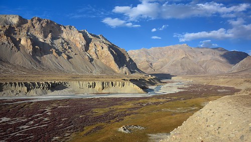
Sarchu Valley, India 2016 by reurinkjan, Sarchu (also known as Sir Bhum Chun) is a major halt point with tented accommodation in the Himalaya
Sarchu Valley, India 2016 by reurinkjan
The plain of More, India 2016 by reurinkjan, More plains is crossed by the road from Leh to Manali. This stretch of 40 km falls in between Leh an
The plain of More, India 2016 by reurinkjan
Sarchu Valley, India 2016 by reurinkjan, Sarchu (also known as Sir Bhum Chun) is a major halt point with tented accommodation in the Himalaya
Sarchu Valley, India 2016 by reurinkjan
The plain of More, India 2016 by reurinkjan, More plains is crossed by the road from Leh to Manali. This stretch of 40 km falls in between Leh an
The plain of More, India 2016 by reurinkjan
Bharal, Himalayan blue sheep, India 2016 by reurinkjan, Pseudois nayaur 

      Bharal, Himalayan blue sheep 

The Bharal is known as the Himalayan blue she
Bharal, Himalayan blue sheep, India 2016 by reurinkjan
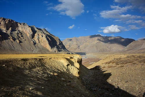
Sarchu Valley, India 2016 by reurinkjan, Sarchu (also known as Sir Bhum Chun) is a major halt point with tented accommodation in the Himalaya
Sarchu Valley, India 2016 by reurinkjan
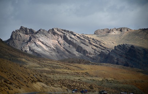
Landscape near Lachlung La pass, India 2016 by reurinkjan, india 2016 ©janreurink himachalpradesh spiti kinaur ladakh kargil jammuandkashmir lachlungpass lachl
Landscape near Lachlung La pass, India 2016 by reurinkjan
Tso Kar the brackish water lake by T Ξ Ξ J Ξ, It is about 250 km southeast of Leh and around 50 km from Tsomoriri, the highest brackish water lake
Tso Kar the brackish water lake by T Ξ Ξ J Ξ
Tso Kar (Kar Lake), Ladakh by kr.vikas, Tso Kar (Kar Lake), Ladakhmorning bw lake monochrome clouds sunrise trek nikon leh ladakh tsokar nik
Tso Kar (Kar Lake), Ladakh by kr.vikas
LDK-3872-20130704And2more copy.jpg by Miki Badt, india ladakh ind
LDK-3872-20130704And2more copy.jpg by Miki Badt
Ladakh Cycle Tour by Ouestef, The Manali - Leh Highway

More on <a href="http://www.ouestef.com" rel="nofollow">www.ouestef.com</a
Ladakh Cycle Tour by Ouestef
Ladakh Cycle Tour by Ouestef, The Manali - Leh Highway

More on <a href="http://www.ouestef.com" rel="nofollow">www.ouestef.com</a
Ladakh Cycle Tour by Ouestef
2013-07-24_20h14m22s by Gzu136,
2013-07-24_20h14m22s by Gzu136