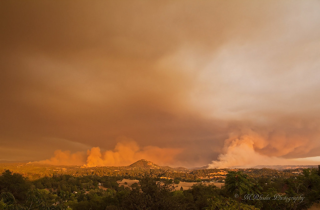
Mt Zion Lookout Fire, Mt Zion Rd, Pine Grove, CA, USA Sonnenaufgang Sonnenuntergang Zeiten
Location: USA > Kalifornien > Amador County > Pine Grove >
Zeitzone:
America/Los_Angeles
Ortszeit:
2025-07-09 01:28:08
Länge:
-120.6521881
Breite:
38.3893141
Sonnenaufgang Heute:
05:47:29 AM
Sonnenuntergang Heute:
08:28:28 PM
Tageslänge heute:
14h 40m 59s
Sonnenaufgang morgen:
05:48:09 AM
Sonnenuntergang Morgen:
08:28:06 PM
Tageslänge von morgen:
14h 39m 57s
Alle Termine anzeigen
| Datum | Sonnenaufgang | Sonnenuntergang | Tageslänge |
|---|---|---|---|
| 2025-01-01 | 07:19:50 AM | 04:53:50 PM | 9h 34m 0s |
| 2025-01-02 | 07:19:54 AM | 04:54:41 PM | 9h 34m 47s |
| 2025-01-03 | 07:19:56 AM | 04:55:33 PM | 9h 35m 37s |
| 2025-01-04 | 07:19:57 AM | 04:56:26 PM | 9h 36m 29s |
| 2025-01-05 | 07:19:55 AM | 04:57:20 PM | 9h 37m 25s |
| 2025-01-06 | 07:19:51 AM | 04:58:16 PM | 9h 38m 25s |
| 2025-01-07 | 07:19:45 AM | 04:59:12 PM | 9h 39m 27s |
| 2025-01-08 | 07:19:36 AM | 05:00:10 PM | 9h 40m 34s |
| 2025-01-09 | 07:19:26 AM | 05:01:09 PM | 9h 41m 43s |
| 2025-01-10 | 07:19:13 AM | 05:02:09 PM | 9h 42m 56s |
| 2025-01-11 | 07:18:59 AM | 05:03:09 PM | 9h 44m 10s |
| 2025-01-12 | 07:18:42 AM | 05:04:11 PM | 9h 45m 29s |
| 2025-01-13 | 07:18:24 AM | 05:05:13 PM | 9h 46m 49s |
| 2025-01-14 | 07:18:03 AM | 05:06:16 PM | 9h 48m 13s |
| 2025-01-15 | 07:17:40 AM | 05:07:19 PM | 9h 49m 39s |
| 2025-01-16 | 07:17:15 AM | 05:08:23 PM | 9h 51m 8s |
| 2025-01-17 | 07:16:48 AM | 05:09:28 PM | 9h 52m 40s |
| 2025-01-18 | 07:16:19 AM | 05:10:34 PM | 9h 54m 15s |
| 2025-01-19 | 07:15:49 AM | 05:11:39 PM | 9h 55m 50s |
| 2025-01-20 | 07:15:16 AM | 05:12:46 PM | 9h 57m 30s |
| 2025-01-21 | 07:14:41 AM | 05:13:52 PM | 9h 59m 11s |
| 2025-01-22 | 07:14:04 AM | 05:14:59 PM | 10h 0m 55s |
| 2025-01-23 | 07:13:26 AM | 05:16:07 PM | 10h 2m 41s |
| 2025-01-24 | 07:12:46 AM | 05:17:14 PM | 10h 4m 28s |
| 2025-01-25 | 07:12:03 AM | 05:18:22 PM | 10h 6m 19s |
| 2025-01-26 | 07:11:19 AM | 05:19:30 PM | 10h 8m 11s |
| 2025-01-27 | 07:10:34 AM | 05:20:38 PM | 10h 10m 4s |
| 2025-01-28 | 07:09:46 AM | 05:21:46 PM | 10h 12m 0s |
| 2025-01-29 | 07:08:57 AM | 05:22:55 PM | 10h 13m 58s |
| 2025-01-30 | 07:08:06 AM | 05:24:03 PM | 10h 15m 57s |
| 2025-01-31 | 07:07:14 AM | 05:25:12 PM | 10h 17m 58s |
| 2025-02-01 | 07:06:19 AM | 05:26:20 PM | 10h 20m 1s |
| 2025-02-02 | 07:05:24 AM | 05:27:28 PM | 10h 22m 4s |
| 2025-02-03 | 07:04:26 AM | 05:28:37 PM | 10h 24m 11s |
| 2025-02-04 | 07:03:27 AM | 05:29:45 PM | 10h 26m 18s |
| 2025-02-05 | 07:02:27 AM | 05:30:53 PM | 10h 28m 26s |
| 2025-02-06 | 07:01:25 AM | 05:32:01 PM | 10h 30m 36s |
| 2025-02-07 | 07:00:22 AM | 05:33:09 PM | 10h 32m 47s |
| 2025-02-08 | 06:59:18 AM | 05:34:16 PM | 10h 34m 58s |
| 2025-02-09 | 06:58:12 AM | 05:35:24 PM | 10h 37m 12s |
| 2025-02-10 | 06:57:04 AM | 05:36:31 PM | 10h 39m 27s |
| 2025-02-11 | 06:55:56 AM | 05:37:38 PM | 10h 41m 42s |
| 2025-02-12 | 06:54:46 AM | 05:38:45 PM | 10h 43m 59s |
| 2025-02-13 | 06:53:35 AM | 05:39:51 PM | 10h 46m 16s |
| 2025-02-14 | 06:52:23 AM | 05:40:57 PM | 10h 48m 34s |
| 2025-02-15 | 06:51:10 AM | 05:42:03 PM | 10h 50m 53s |
| 2025-02-16 | 06:49:55 AM | 05:43:09 PM | 10h 53m 14s |
| 2025-02-17 | 06:48:39 AM | 05:44:14 PM | 10h 55m 35s |
| 2025-02-18 | 06:47:23 AM | 05:45:19 PM | 10h 57m 56s |
| 2025-02-19 | 06:46:05 AM | 05:46:24 PM | 11h 0m 19s |
| 2025-02-20 | 06:44:47 AM | 05:47:29 PM | 11h 2m 42s |
| 2025-02-21 | 06:43:27 AM | 05:48:33 PM | 11h 5m 6s |
| 2025-02-22 | 06:42:07 AM | 05:49:37 PM | 11h 7m 30s |
| 2025-02-23 | 06:40:45 AM | 05:50:40 PM | 11h 9m 55s |
| 2025-02-24 | 06:39:23 AM | 05:51:43 PM | 11h 12m 20s |
| 2025-02-25 | 06:38:00 AM | 05:52:46 PM | 11h 14m 46s |
| 2025-02-26 | 06:36:36 AM | 05:53:49 PM | 11h 17m 13s |
| 2025-02-27 | 06:35:12 AM | 05:54:51 PM | 11h 19m 39s |
| 2025-02-28 | 06:33:46 AM | 05:55:53 PM | 11h 22m 7s |
| 2025-03-01 | 06:32:20 AM | 05:56:54 PM | 11h 24m 34s |
| 2025-03-02 | 06:30:54 AM | 05:57:56 PM | 11h 27m 2s |
| 2025-03-03 | 06:29:27 AM | 05:58:57 PM | 11h 29m 30s |
| 2025-03-04 | 06:27:59 AM | 05:59:58 PM | 11h 31m 59s |
| 2025-03-05 | 06:26:30 AM | 06:00:58 PM | 11h 34m 28s |
| 2025-03-06 | 06:25:02 AM | 06:01:58 PM | 11h 36m 56s |
| 2025-03-07 | 06:23:32 AM | 06:02:58 PM | 11h 39m 26s |
| 2025-03-08 | 06:22:02 AM | 06:03:58 PM | 11h 41m 56s |
| 2025-03-09 | 07:20:36 AM | 07:04:55 PM | 11h 44m 19s |
| 2025-03-10 | 07:19:05 AM | 07:05:54 PM | 11h 46m 49s |
| 2025-03-11 | 07:17:34 AM | 07:06:53 PM | 11h 49m 19s |
| 2025-03-12 | 07:16:03 AM | 07:07:52 PM | 11h 51m 49s |
| 2025-03-13 | 07:14:31 AM | 07:08:50 PM | 11h 54m 19s |
| 2025-03-14 | 07:12:59 AM | 07:09:48 PM | 11h 56m 49s |
| 2025-03-15 | 07:11:27 AM | 07:10:47 PM | 11h 59m 20s |
| 2025-03-16 | 07:09:55 AM | 07:11:44 PM | 12h 1m 49s |
| 2025-03-17 | 07:08:22 AM | 07:12:42 PM | 12h 4m 20s |
| 2025-03-18 | 07:06:49 AM | 07:13:40 PM | 12h 6m 51s |
| 2025-03-19 | 07:05:17 AM | 07:14:37 PM | 12h 9m 20s |
| 2025-03-20 | 07:03:44 AM | 07:15:34 PM | 12h 11m 50s |
| 2025-03-21 | 07:02:11 AM | 07:16:32 PM | 12h 14m 21s |
| 2025-03-22 | 07:00:37 AM | 07:17:29 PM | 12h 16m 52s |
| 2025-03-23 | 06:59:04 AM | 07:18:26 PM | 12h 19m 22s |
| 2025-03-24 | 06:57:31 AM | 07:19:22 PM | 12h 21m 51s |
| 2025-03-25 | 06:55:58 AM | 07:20:19 PM | 12h 24m 21s |
| 2025-03-26 | 06:54:26 AM | 07:21:16 PM | 12h 26m 50s |
| 2025-03-27 | 06:52:53 AM | 07:22:12 PM | 12h 29m 19s |
| 2025-03-28 | 06:51:20 AM | 07:23:09 PM | 12h 31m 49s |
| 2025-03-29 | 06:49:48 AM | 07:24:05 PM | 12h 34m 17s |
| 2025-03-30 | 06:48:16 AM | 07:25:02 PM | 12h 36m 46s |
| 2025-03-31 | 06:46:44 AM | 07:25:58 PM | 12h 39m 14s |
| 2025-04-01 | 06:45:12 AM | 07:26:55 PM | 12h 41m 43s |
| 2025-04-02 | 06:43:40 AM | 07:27:51 PM | 12h 44m 11s |
| 2025-04-03 | 06:42:09 AM | 07:28:47 PM | 12h 46m 38s |
| 2025-04-04 | 06:40:39 AM | 07:29:44 PM | 12h 49m 5s |
| 2025-04-05 | 06:39:08 AM | 07:30:40 PM | 12h 51m 32s |
| 2025-04-06 | 06:37:38 AM | 07:31:36 PM | 12h 53m 58s |
| 2025-04-07 | 06:36:09 AM | 07:32:33 PM | 12h 56m 24s |
| 2025-04-08 | 06:34:40 AM | 07:33:29 PM | 12h 58m 49s |
| 2025-04-09 | 06:33:11 AM | 07:34:26 PM | 13h 1m 15s |
| 2025-04-10 | 06:31:43 AM | 07:35:22 PM | 13h 3m 39s |
| 2025-04-11 | 06:30:16 AM | 07:36:19 PM | 13h 6m 3s |
| 2025-04-12 | 06:28:49 AM | 07:37:15 PM | 13h 8m 26s |
| 2025-04-13 | 06:27:23 AM | 07:38:12 PM | 13h 10m 49s |
| 2025-04-14 | 06:25:57 AM | 07:39:08 PM | 13h 13m 11s |
| 2025-04-15 | 06:24:33 AM | 07:40:05 PM | 13h 15m 32s |
| 2025-04-16 | 06:23:08 AM | 07:41:02 PM | 13h 17m 54s |
| 2025-04-17 | 06:21:45 AM | 07:41:58 PM | 13h 20m 13s |
| 2025-04-18 | 06:20:23 AM | 07:42:55 PM | 13h 22m 32s |
| 2025-04-19 | 06:19:01 AM | 07:43:52 PM | 13h 24m 51s |
| 2025-04-20 | 06:17:40 AM | 07:44:49 PM | 13h 27m 9s |
| 2025-04-21 | 06:16:20 AM | 07:45:45 PM | 13h 29m 25s |
| 2025-04-22 | 06:15:01 AM | 07:46:42 PM | 13h 31m 41s |
| 2025-04-23 | 06:13:42 AM | 07:47:39 PM | 13h 33m 57s |
| 2025-04-24 | 06:12:25 AM | 07:48:36 PM | 13h 36m 11s |
| 2025-04-25 | 06:11:09 AM | 07:49:33 PM | 13h 38m 24s |
| 2025-04-26 | 06:09:54 AM | 07:50:29 PM | 13h 40m 35s |
| 2025-04-27 | 06:08:39 AM | 07:51:26 PM | 13h 42m 47s |
| 2025-04-28 | 06:07:26 AM | 07:52:23 PM | 13h 44m 57s |
| 2025-04-29 | 06:06:14 AM | 07:53:19 PM | 13h 47m 5s |
| 2025-04-30 | 06:05:03 AM | 07:54:16 PM | 13h 49m 13s |
| 2025-05-01 | 06:03:54 AM | 07:55:12 PM | 13h 51m 18s |
| 2025-05-02 | 06:02:45 AM | 07:56:09 PM | 13h 53m 24s |
| 2025-05-03 | 06:01:38 AM | 07:57:05 PM | 13h 55m 27s |
| 2025-05-04 | 06:00:32 AM | 07:58:01 PM | 13h 57m 29s |
| 2025-05-05 | 05:59:27 AM | 07:58:57 PM | 13h 59m 30s |
| 2025-05-06 | 05:58:24 AM | 07:59:53 PM | 14h 1m 29s |
| 2025-05-07 | 05:57:22 AM | 08:00:48 PM | 14h 3m 26s |
| 2025-05-08 | 05:56:21 AM | 08:01:44 PM | 14h 5m 23s |
| 2025-05-09 | 05:55:22 AM | 08:02:39 PM | 14h 7m 17s |
| 2025-05-10 | 05:54:24 AM | 08:03:33 PM | 14h 9m 9s |
| 2025-05-11 | 05:53:28 AM | 08:04:28 PM | 14h 11m 0s |
| 2025-05-12 | 05:52:33 AM | 08:05:22 PM | 14h 12m 49s |
| 2025-05-13 | 05:51:39 AM | 08:06:16 PM | 14h 14m 37s |
| 2025-05-14 | 05:50:48 AM | 08:07:09 PM | 14h 16m 21s |
| 2025-05-15 | 05:49:57 AM | 08:08:02 PM | 14h 18m 5s |
| 2025-05-16 | 05:49:08 AM | 08:08:54 PM | 14h 19m 46s |
| 2025-05-17 | 05:48:21 AM | 08:09:46 PM | 14h 21m 25s |
| 2025-05-18 | 05:47:36 AM | 08:10:38 PM | 14h 23m 2s |
| 2025-05-19 | 05:46:52 AM | 08:11:29 PM | 14h 24m 37s |
| 2025-05-20 | 05:46:10 AM | 08:12:19 PM | 14h 26m 9s |
| 2025-05-21 | 05:45:29 AM | 08:13:09 PM | 14h 27m 40s |
| 2025-05-22 | 05:44:51 AM | 08:13:58 PM | 14h 29m 7s |
| 2025-05-23 | 05:44:14 AM | 08:14:46 PM | 14h 30m 32s |
| 2025-05-24 | 05:43:38 AM | 08:15:33 PM | 14h 31m 55s |
| 2025-05-25 | 05:43:05 AM | 08:16:20 PM | 14h 33m 15s |
| 2025-05-26 | 05:42:33 AM | 08:17:06 PM | 14h 34m 33s |
| 2025-05-27 | 05:42:03 AM | 08:17:51 PM | 14h 35m 48s |
| 2025-05-28 | 05:41:35 AM | 08:18:35 PM | 14h 37m 0s |
| 2025-05-29 | 05:41:08 AM | 08:19:18 PM | 14h 38m 10s |
| 2025-05-30 | 05:40:44 AM | 08:20:01 PM | 14h 39m 17s |
| 2025-05-31 | 05:40:21 AM | 08:20:42 PM | 14h 40m 21s |
| 2025-06-01 | 05:40:00 AM | 08:21:22 PM | 14h 41m 22s |
| 2025-06-02 | 05:39:41 AM | 08:22:01 PM | 14h 42m 20s |
| 2025-06-03 | 05:39:24 AM | 08:22:39 PM | 14h 43m 15s |
| 2025-06-04 | 05:39:08 AM | 08:23:16 PM | 14h 44m 8s |
| 2025-06-05 | 05:38:55 AM | 08:23:51 PM | 14h 44m 56s |
| 2025-06-06 | 05:38:43 AM | 08:24:25 PM | 14h 45m 42s |
| 2025-06-07 | 05:38:33 AM | 08:24:58 PM | 14h 46m 25s |
| 2025-06-08 | 05:38:25 AM | 08:25:30 PM | 14h 47m 5s |
| 2025-06-09 | 05:38:19 AM | 08:26:00 PM | 14h 47m 41s |
| 2025-06-10 | 05:38:14 AM | 08:26:29 PM | 14h 48m 15s |
| 2025-06-11 | 05:38:12 AM | 08:26:56 PM | 14h 48m 44s |
| 2025-06-12 | 05:38:11 AM | 08:27:22 PM | 14h 49m 11s |
| 2025-06-13 | 05:38:12 AM | 08:27:47 PM | 14h 49m 35s |
| 2025-06-14 | 05:38:15 AM | 08:28:10 PM | 14h 49m 55s |
| 2025-06-15 | 05:38:19 AM | 08:28:31 PM | 14h 50m 12s |
| 2025-06-16 | 05:38:26 AM | 08:28:51 PM | 14h 50m 25s |
| 2025-06-17 | 05:38:34 AM | 08:29:09 PM | 14h 50m 35s |
| 2025-06-18 | 05:38:44 AM | 08:29:25 PM | 14h 50m 41s |
| 2025-06-19 | 05:38:55 AM | 08:29:40 PM | 14h 50m 45s |
| 2025-06-20 | 05:39:08 AM | 08:29:53 PM | 14h 50m 45s |
| 2025-06-21 | 05:39:23 AM | 08:30:04 PM | 14h 50m 41s |
| 2025-06-22 | 05:39:39 AM | 08:30:14 PM | 14h 50m 35s |
| 2025-06-23 | 05:39:57 AM | 08:30:21 PM | 14h 50m 24s |
| 2025-06-24 | 05:40:17 AM | 08:30:27 PM | 14h 50m 10s |
| 2025-06-25 | 05:40:38 AM | 08:30:31 PM | 14h 49m 53s |
| 2025-06-26 | 05:41:00 AM | 08:30:34 PM | 14h 49m 34s |
| 2025-06-27 | 05:41:24 AM | 08:30:34 PM | 14h 49m 10s |
| 2025-06-28 | 05:41:50 AM | 08:30:33 PM | 14h 48m 43s |
| 2025-06-29 | 05:42:17 AM | 08:30:30 PM | 14h 48m 13s |
| 2025-06-30 | 05:42:45 AM | 08:30:25 PM | 14h 47m 40s |
| 2025-07-01 | 05:43:14 AM | 08:30:18 PM | 14h 47m 4s |
| 2025-07-02 | 05:43:45 AM | 08:30:09 PM | 14h 46m 24s |
| 2025-07-03 | 05:44:17 AM | 08:29:58 PM | 14h 45m 41s |
| 2025-07-04 | 05:44:50 AM | 08:29:46 PM | 14h 44m 56s |
| 2025-07-05 | 05:45:25 AM | 08:29:31 PM | 14h 44m 6s |
| 2025-07-06 | 05:46:01 AM | 08:29:15 PM | 14h 43m 14s |
| 2025-07-07 | 05:46:37 AM | 08:28:57 PM | 14h 42m 20s |
| 2025-07-08 | 05:47:15 AM | 08:28:36 PM | 14h 41m 21s |
| 2025-07-09 | 05:47:54 AM | 08:28:14 PM | 14h 40m 20s |
| 2025-07-10 | 05:48:34 AM | 08:27:51 PM | 14h 39m 17s |
| 2025-07-11 | 05:49:14 AM | 08:27:25 PM | 14h 38m 11s |
| 2025-07-12 | 05:49:56 AM | 08:26:57 PM | 14h 37m 1s |
| 2025-07-13 | 05:50:38 AM | 08:26:28 PM | 14h 35m 50s |
| 2025-07-14 | 05:51:22 AM | 08:25:57 PM | 14h 34m 35s |
| 2025-07-15 | 05:52:06 AM | 08:25:24 PM | 14h 33m 18s |
| 2025-07-16 | 05:52:51 AM | 08:24:49 PM | 14h 31m 58s |
| 2025-07-17 | 05:53:36 AM | 08:24:12 PM | 14h 30m 36s |
| 2025-07-18 | 05:54:23 AM | 08:23:34 PM | 14h 29m 11s |
| 2025-07-19 | 05:55:09 AM | 08:22:54 PM | 14h 27m 45s |
| 2025-07-20 | 05:55:57 AM | 08:22:12 PM | 14h 26m 15s |
| 2025-07-21 | 05:56:45 AM | 08:21:28 PM | 14h 24m 43s |
| 2025-07-22 | 05:57:33 AM | 08:20:43 PM | 14h 23m 10s |
| 2025-07-23 | 05:58:23 AM | 08:19:56 PM | 14h 21m 33s |
| 2025-07-24 | 05:59:12 AM | 08:19:08 PM | 14h 19m 56s |
| 2025-07-25 | 06:00:02 AM | 08:18:17 PM | 14h 18m 15s |
| 2025-07-26 | 06:00:52 AM | 08:17:26 PM | 14h 16m 34s |
| 2025-07-27 | 06:01:43 AM | 08:16:32 PM | 14h 14m 49s |
| 2025-07-28 | 06:02:34 AM | 08:15:37 PM | 14h 13m 3s |
| 2025-07-29 | 06:03:25 AM | 08:14:41 PM | 14h 11m 16s |
| 2025-07-30 | 06:04:17 AM | 08:13:43 PM | 14h 9m 26s |
| 2025-07-31 | 06:05:09 AM | 08:12:44 PM | 14h 7m 35s |
| 2025-08-01 | 06:06:01 AM | 08:11:43 PM | 14h 5m 42s |
| 2025-08-02 | 06:06:53 AM | 08:10:41 PM | 14h 3m 48s |
| 2025-08-03 | 06:07:46 AM | 08:09:37 PM | 14h 1m 51s |
| 2025-08-04 | 06:08:38 AM | 08:08:32 PM | 13h 59m 54s |
| 2025-08-05 | 06:09:31 AM | 08:07:26 PM | 13h 57m 55s |
| 2025-08-06 | 06:10:24 AM | 08:06:18 PM | 13h 55m 54s |
| 2025-08-07 | 06:11:17 AM | 08:05:09 PM | 13h 53m 52s |
| 2025-08-08 | 06:12:10 AM | 08:03:59 PM | 13h 51m 49s |
| 2025-08-09 | 06:13:03 AM | 08:02:48 PM | 13h 49m 45s |
| 2025-08-10 | 06:13:56 AM | 08:01:35 PM | 13h 47m 39s |
| 2025-08-11 | 06:14:49 AM | 08:00:22 PM | 13h 45m 33s |
| 2025-08-12 | 06:15:42 AM | 07:59:07 PM | 13h 43m 25s |
| 2025-08-13 | 06:16:35 AM | 07:57:51 PM | 13h 41m 16s |
| 2025-08-14 | 06:17:29 AM | 07:56:34 PM | 13h 39m 5s |
| 2025-08-15 | 06:18:22 AM | 07:55:16 PM | 13h 36m 54s |
| 2025-08-16 | 06:19:15 AM | 07:53:57 PM | 13h 34m 42s |
| 2025-08-17 | 06:20:08 AM | 07:52:37 PM | 13h 32m 29s |
| 2025-08-18 | 06:21:01 AM | 07:51:17 PM | 13h 30m 16s |
| 2025-08-19 | 06:21:54 AM | 07:49:55 PM | 13h 28m 1s |
| 2025-08-20 | 06:22:47 AM | 07:48:32 PM | 13h 25m 45s |
| 2025-08-21 | 06:23:40 AM | 07:47:09 PM | 13h 23m 29s |
| 2025-08-22 | 06:24:33 AM | 07:45:44 PM | 13h 21m 11s |
| 2025-08-23 | 06:25:25 AM | 07:44:19 PM | 13h 18m 54s |
| 2025-08-24 | 06:26:18 AM | 07:42:53 PM | 13h 16m 35s |
| 2025-08-25 | 06:27:11 AM | 07:41:27 PM | 13h 14m 16s |
| 2025-08-26 | 06:28:03 AM | 07:39:59 PM | 13h 11m 56s |
| 2025-08-27 | 06:28:56 AM | 07:38:32 PM | 13h 9m 36s |
| 2025-08-28 | 06:29:48 AM | 07:37:03 PM | 13h 7m 15s |
| 2025-08-29 | 06:30:40 AM | 07:35:34 PM | 13h 4m 54s |
| 2025-08-30 | 06:31:33 AM | 07:34:04 PM | 13h 2m 31s |
| 2025-08-31 | 06:32:25 AM | 07:32:33 PM | 13h 0m 8s |
| 2025-09-01 | 06:33:17 AM | 07:31:03 PM | 12h 57m 46s |
| 2025-09-02 | 06:34:09 AM | 07:29:31 PM | 12h 55m 22s |
| 2025-09-03 | 06:35:01 AM | 07:27:59 PM | 12h 52m 58s |
| 2025-09-04 | 06:35:53 AM | 07:26:27 PM | 12h 50m 34s |
| 2025-09-05 | 06:36:45 AM | 07:24:54 PM | 12h 48m 9s |
| 2025-09-06 | 06:37:37 AM | 07:23:21 PM | 12h 45m 44s |
| 2025-09-07 | 06:38:29 AM | 07:21:48 PM | 12h 43m 19s |
| 2025-09-08 | 06:39:21 AM | 07:20:14 PM | 12h 40m 53s |
| 2025-09-09 | 06:40:13 AM | 07:18:40 PM | 12h 38m 27s |
| 2025-09-10 | 06:41:05 AM | 07:17:06 PM | 12h 36m 1s |
| 2025-09-11 | 06:41:57 AM | 07:15:32 PM | 12h 33m 35s |
| 2025-09-12 | 06:42:49 AM | 07:13:57 PM | 12h 31m 8s |
| 2025-09-13 | 06:43:41 AM | 07:12:22 PM | 12h 28m 41s |
| 2025-09-14 | 06:44:34 AM | 07:10:47 PM | 12h 26m 13s |
| 2025-09-15 | 06:45:26 AM | 07:09:12 PM | 12h 23m 46s |
| 2025-09-16 | 06:46:18 AM | 07:07:37 PM | 12h 21m 19s |
| 2025-09-17 | 06:47:10 AM | 07:06:02 PM | 12h 18m 52s |
| 2025-09-18 | 06:48:03 AM | 07:04:26 PM | 12h 16m 23s |
| 2025-09-19 | 06:48:55 AM | 07:02:51 PM | 12h 13m 56s |
| 2025-09-20 | 06:49:48 AM | 07:01:16 PM | 12h 11m 28s |
| 2025-09-21 | 06:50:41 AM | 06:59:41 PM | 12h 9m 0s |
| 2025-09-22 | 06:51:34 AM | 06:58:06 PM | 12h 6m 32s |
| 2025-09-23 | 06:52:27 AM | 06:56:31 PM | 12h 4m 4s |
| 2025-09-24 | 06:53:20 AM | 06:54:56 PM | 12h 1m 36s |
| 2025-09-25 | 06:54:14 AM | 06:53:21 PM | 11h 59m 7s |
| 2025-09-26 | 06:55:07 AM | 06:51:47 PM | 11h 56m 40s |
| 2025-09-27 | 06:56:01 AM | 06:50:13 PM | 11h 54m 12s |
| 2025-09-28 | 06:56:55 AM | 06:48:39 PM | 11h 51m 44s |
| 2025-09-29 | 06:57:49 AM | 06:47:06 PM | 11h 49m 17s |
| 2025-09-30 | 06:58:44 AM | 06:45:32 PM | 11h 46m 48s |
| 2025-10-01 | 06:59:38 AM | 06:43:59 PM | 11h 44m 21s |
| 2025-10-02 | 07:00:33 AM | 06:42:27 PM | 11h 41m 54s |
| 2025-10-03 | 07:01:29 AM | 06:40:55 PM | 11h 39m 26s |
| 2025-10-04 | 07:02:24 AM | 06:39:23 PM | 11h 36m 59s |
| 2025-10-05 | 07:03:20 AM | 06:37:52 PM | 11h 34m 32s |
| 2025-10-06 | 07:04:16 AM | 06:36:22 PM | 11h 32m 6s |
| 2025-10-07 | 07:05:12 AM | 06:34:52 PM | 11h 29m 40s |
| 2025-10-08 | 07:06:09 AM | 06:33:22 PM | 11h 27m 13s |
| 2025-10-09 | 07:07:06 AM | 06:31:53 PM | 11h 24m 47s |
| 2025-10-10 | 07:08:03 AM | 06:30:25 PM | 11h 22m 22s |
| 2025-10-11 | 07:09:01 AM | 06:28:58 PM | 11h 19m 57s |
| 2025-10-12 | 07:09:59 AM | 06:27:31 PM | 11h 17m 32s |
| 2025-10-13 | 07:10:57 AM | 06:26:05 PM | 11h 15m 8s |
| 2025-10-14 | 07:11:55 AM | 06:24:39 PM | 11h 12m 44s |
| 2025-10-15 | 07:12:54 AM | 06:23:15 PM | 11h 10m 21s |
| 2025-10-16 | 07:13:54 AM | 06:21:51 PM | 11h 7m 57s |
| 2025-10-17 | 07:14:53 AM | 06:20:28 PM | 11h 5m 35s |
| 2025-10-18 | 07:15:53 AM | 06:19:07 PM | 11h 3m 14s |
| 2025-10-19 | 07:16:53 AM | 06:17:46 PM | 11h 0m 53s |
| 2025-10-20 | 07:17:54 AM | 06:16:26 PM | 10h 58m 32s |
| 2025-10-21 | 07:18:55 AM | 06:15:07 PM | 10h 56m 12s |
| 2025-10-22 | 07:19:56 AM | 06:13:49 PM | 10h 53m 53s |
| 2025-10-23 | 07:20:58 AM | 06:12:32 PM | 10h 51m 34s |
| 2025-10-24 | 07:22:00 AM | 06:11:16 PM | 10h 49m 16s |
| 2025-10-25 | 07:23:02 AM | 06:10:01 PM | 10h 46m 59s |
| 2025-10-26 | 07:24:05 AM | 06:08:48 PM | 10h 44m 43s |
| 2025-10-27 | 07:25:07 AM | 06:07:35 PM | 10h 42m 28s |
| 2025-10-28 | 07:26:11 AM | 06:06:24 PM | 10h 40m 13s |
| 2025-10-29 | 07:27:14 AM | 06:05:15 PM | 10h 38m 1s |
| 2025-10-30 | 07:28:18 AM | 06:04:06 PM | 10h 35m 48s |
| 2025-10-31 | 07:29:22 AM | 06:02:59 PM | 10h 33m 37s |
| 2025-11-01 | 07:30:26 AM | 06:01:53 PM | 10h 31m 27s |
| 2025-11-02 | 06:31:33 AM | 05:00:46 PM | 10h 29m 13s |
| 2025-11-03 | 06:32:38 AM | 04:59:43 PM | 10h 27m 5s |
| 2025-11-04 | 06:33:42 AM | 04:58:42 PM | 10h 25m 0s |
| 2025-11-05 | 06:34:47 AM | 04:57:42 PM | 10h 22m 55s |
| 2025-11-06 | 06:35:52 AM | 04:56:44 PM | 10h 20m 52s |
| 2025-11-07 | 06:36:57 AM | 04:55:47 PM | 10h 18m 50s |
| 2025-11-08 | 06:38:03 AM | 04:54:52 PM | 10h 16m 49s |
| 2025-11-09 | 06:39:08 AM | 04:53:59 PM | 10h 14m 51s |
| 2025-11-10 | 06:40:13 AM | 04:53:07 PM | 10h 12m 54s |
| 2025-11-11 | 06:41:19 AM | 04:52:17 PM | 10h 10m 58s |
| 2025-11-12 | 06:42:24 AM | 04:51:28 PM | 10h 9m 4s |
| 2025-11-13 | 06:43:29 AM | 04:50:42 PM | 10h 7m 13s |
| 2025-11-14 | 06:44:34 AM | 04:49:57 PM | 10h 5m 23s |
| 2025-11-15 | 06:45:39 AM | 04:49:14 PM | 10h 3m 35s |
| 2025-11-16 | 06:46:44 AM | 04:48:33 PM | 10h 1m 49s |
| 2025-11-17 | 06:47:49 AM | 04:47:53 PM | 10h 0m 4s |
| 2025-11-18 | 06:48:53 AM | 04:47:16 PM | 9h 58m 23s |
| 2025-11-19 | 06:49:57 AM | 04:46:40 PM | 9h 56m 43s |
| 2025-11-20 | 06:51:01 AM | 04:46:07 PM | 9h 55m 6s |
| 2025-11-21 | 06:52:04 AM | 04:45:36 PM | 9h 53m 32s |
| 2025-11-22 | 06:53:07 AM | 04:45:06 PM | 9h 51m 59s |
| 2025-11-23 | 06:54:09 AM | 04:44:39 PM | 9h 50m 30s |
| 2025-11-24 | 06:55:11 AM | 04:44:13 PM | 9h 49m 2s |
| 2025-11-25 | 06:56:13 AM | 04:43:50 PM | 9h 47m 37s |
| 2025-11-26 | 06:57:13 AM | 04:43:28 PM | 9h 46m 15s |
| 2025-11-27 | 06:58:13 AM | 04:43:09 PM | 9h 44m 56s |
| 2025-11-28 | 06:59:13 AM | 04:42:52 PM | 9h 43m 39s |
| 2025-11-29 | 07:00:11 AM | 04:42:37 PM | 9h 42m 26s |
| 2025-11-30 | 07:01:09 AM | 04:42:24 PM | 9h 41m 15s |
| 2025-12-01 | 07:02:06 AM | 04:42:14 PM | 9h 40m 8s |
| 2025-12-02 | 07:03:02 AM | 04:42:05 PM | 9h 39m 3s |
| 2025-12-03 | 07:03:56 AM | 04:41:59 PM | 9h 38m 3s |
| 2025-12-04 | 07:04:50 AM | 04:41:54 PM | 9h 37m 4s |
| 2025-12-05 | 07:05:43 AM | 04:41:52 PM | 9h 36m 9s |
| 2025-12-06 | 07:06:35 AM | 04:41:52 PM | 9h 35m 17s |
| 2025-12-07 | 07:07:25 AM | 04:41:54 PM | 9h 34m 29s |
| 2025-12-08 | 07:08:14 AM | 04:41:59 PM | 9h 33m 45s |
| 2025-12-09 | 07:09:02 AM | 04:42:05 PM | 9h 33m 3s |
| 2025-12-10 | 07:09:49 AM | 04:42:14 PM | 9h 32m 25s |
| 2025-12-11 | 07:10:34 AM | 04:42:25 PM | 9h 31m 51s |
| 2025-12-12 | 07:11:18 AM | 04:42:38 PM | 9h 31m 20s |
| 2025-12-13 | 07:12:00 AM | 04:42:52 PM | 9h 30m 52s |
| 2025-12-14 | 07:12:41 AM | 04:43:10 PM | 9h 30m 29s |
| 2025-12-15 | 07:13:20 AM | 04:43:29 PM | 9h 30m 9s |
| 2025-12-16 | 07:13:58 AM | 04:43:50 PM | 9h 29m 52s |
| 2025-12-17 | 07:14:34 AM | 04:44:13 PM | 9h 29m 39s |
| 2025-12-18 | 07:15:08 AM | 04:44:38 PM | 9h 29m 30s |
| 2025-12-19 | 07:15:40 AM | 04:45:05 PM | 9h 29m 25s |
| 2025-12-20 | 07:16:11 AM | 04:45:34 PM | 9h 29m 23s |
| 2025-12-21 | 07:16:40 AM | 04:46:05 PM | 9h 29m 25s |
| 2025-12-22 | 07:17:07 AM | 04:46:37 PM | 9h 29m 30s |
| 2025-12-23 | 07:17:32 AM | 04:47:12 PM | 9h 29m 40s |
| 2025-12-24 | 07:17:55 AM | 04:47:48 PM | 9h 29m 53s |
| 2025-12-25 | 07:18:16 AM | 04:48:26 PM | 9h 30m 10s |
| 2025-12-26 | 07:18:35 AM | 04:49:06 PM | 9h 30m 31s |
| 2025-12-27 | 07:18:53 AM | 04:49:47 PM | 9h 30m 54s |
| 2025-12-28 | 07:19:08 AM | 04:50:30 PM | 9h 31m 22s |
| 2025-12-29 | 07:19:21 AM | 04:51:15 PM | 9h 31m 54s |
| 2025-12-30 | 07:19:32 AM | 04:52:01 PM | 9h 32m 29s |
| 2025-12-31 | 07:19:41 AM | 04:52:49 PM | 9h 33m 8s |
Fotos

El Campo Casa

The Veins of an Oak at Sunset - Sutter Creek, CA

Butte Fire heads south around Jackson Peak

sunset skies, Red Mule Ranch, Fiddletown,
Butte Fire, Amador and Calaveras Counties

Cowboy Campfire, Dave Stamey, Hopkins, torch, sunset, Red Mule Ranch, Fiddletown,

Sunset Window

Dave Stamey sings western and cowboy songs at Bella Grace Tasting Room, sunset

Sunset in Jackson

Sunset Over Sutter Creek

Jackson Sunset

Rise and Shine

Painted Sky

Question Mark

Sunset Ahead

Clouds at Sunset

Another Sunset at the Fence

Red Sun

First Sunset

Living Color

A Final Sunset at the Fence

Sunrise through the trees in Amador County

Sunrise through the trees in Amador County

Sunrise through the trees in Amador County

Sunrise through the trees in Amador County

Sunrise through the trees in Amador County

Sunrise through the trees in Amador County

Sunrise through the trees in Amador County

Sunrise through the trees in Amador County

Sunrise through the trees in Amador County

Sunrise through the trees in Amador County

Sunrise Behind the Trees Amador County

Sunrise through the trees in Amador County

Sunrise through the trees in Amador County
Mt Zion Lookout Fire, Mt Zion Rd, Pine Grove, CA, USA Karte
Suchen Sie einen anderen Ort
Nahe Plätze
Mount Zion, Mt Zion, Pine Grove, CA, USA
Old Spring Rd, Pine Grove, CA, USA
Oak Ln, Pine Grove, CA, USA
Country Ct, Pine Grove, CA, USA
Tabeaud Rd, Pine Grove, CA, USA
Oak Ln, Pine Grove, CA, USA
Burnt Cedar Ln, Pine Grove, CA, USA
Tabeaud Rd, Pine Grove, CA, USA
Vista Sierra Ct, Pine Grove, CA, USA
Vista Amorosa Ct, Pine Grove, CA, USA
Pitts Dr, Pine Grove, CA, USA
Irish Town Road, Irish Town Rd, Pine Grove, CA, USA
Big Oak Ct, Pine Grove, CA, USA
Mierkey Court, Mierkey Ct, Jackson, CA, USA
E Clinton Rd, Jackson, CA, USA
Gold View Way, Pine Grove, CA, USA
Mierkey Ct, Jackson, CA, USA
Jackson Pines Drive, Jackson Pines Dr, Jackson, CA, USA
Gold View Way, Pine Grove, CA, USA
Quail Dr, Pine Grove, CA, USA
Letzte Suche
- Red Dog Mine, AK, USA Sonnenaufgang Sonnenuntergang Zeiten
- Am Bahnhof, Am bhf, Borken, Germany Sonnenaufgang Sonnenuntergang Zeiten
- 4th St E, Sonoma, CA, USA Sonnenaufgang Sonnenuntergang Zeiten
- Oakland Ave, Williamsport, PA, USA Sonnenaufgang Sonnenuntergang Zeiten
- Via Roma, Pieranica CR, Italien Sonnenaufgang Sonnenuntergang Zeiten
- Glockenturm, Grad, Dubrovnik, Kroatien Sonnenaufgang Sonnenuntergang Zeiten
- Trelew, Chubut Province, Argentina Sonnenaufgang Sonnenuntergang Zeiten
- Hartfords Bluff Cir, Mt Pleasant, SC, USA Sonnenaufgang Sonnenuntergang Zeiten
- Kita-ku, Kumamoto, Präfektur Kumamoto, Japan Sonnenaufgang Sonnenuntergang Zeiten
- Pingtan Island, Pingtan County, Fuzhou, China Sonnenaufgang Sonnenuntergang Zeiten