Louie Pollock Road, Louie Pollock Rd, La Grange, NC, USA Sonnenaufgang Sonnenuntergang Zeiten
Location: USA > North Carolina > Lenoir County > Falling Creek >
Zeitzone:
America/New_York
Ortszeit:
2025-07-13 05:27:03
Länge:
-77.723408
Breite:
35.2428442
Sonnenaufgang Heute:
06:06:50 AM
Sonnenuntergang Heute:
08:26:41 PM
Tageslänge heute:
14h 19m 51s
Sonnenaufgang morgen:
06:07:29 AM
Sonnenuntergang Morgen:
08:26:15 PM
Tageslänge von morgen:
14h 18m 46s
Alle Termine anzeigen
| Datum | Sonnenaufgang | Sonnenuntergang | Tageslänge |
|---|---|---|---|
| 2025-01-01 | 07:19:37 AM | 05:10:24 PM | 9h 50m 47s |
| 2025-01-02 | 07:19:44 AM | 05:11:11 PM | 9h 51m 27s |
| 2025-01-03 | 07:19:50 AM | 05:12:00 PM | 9h 52m 10s |
| 2025-01-04 | 07:19:54 AM | 05:12:50 PM | 9h 52m 56s |
| 2025-01-05 | 07:19:56 AM | 05:13:41 PM | 9h 53m 45s |
| 2025-01-06 | 07:19:56 AM | 05:14:32 PM | 9h 54m 36s |
| 2025-01-07 | 07:19:54 AM | 05:15:25 PM | 9h 55m 31s |
| 2025-01-08 | 07:19:50 AM | 05:16:19 PM | 9h 56m 29s |
| 2025-01-09 | 07:19:44 AM | 05:17:13 PM | 9h 57m 29s |
| 2025-01-10 | 07:19:36 AM | 05:18:08 PM | 9h 58m 32s |
| 2025-01-11 | 07:19:27 AM | 05:19:04 PM | 9h 59m 37s |
| 2025-01-12 | 07:19:15 AM | 05:20:01 PM | 10h 0m 46s |
| 2025-01-13 | 07:19:02 AM | 05:20:58 PM | 10h 1m 56s |
| 2025-01-14 | 07:18:46 AM | 05:21:56 PM | 10h 3m 10s |
| 2025-01-15 | 07:18:29 AM | 05:22:55 PM | 10h 4m 26s |
| 2025-01-16 | 07:18:10 AM | 05:23:54 PM | 10h 5m 44s |
| 2025-01-17 | 07:17:49 AM | 05:24:53 PM | 10h 7m 4s |
| 2025-01-18 | 07:17:26 AM | 05:25:53 PM | 10h 8m 27s |
| 2025-01-19 | 07:17:01 AM | 05:26:53 PM | 10h 9m 52s |
| 2025-01-20 | 07:16:34 AM | 05:27:53 PM | 10h 11m 19s |
| 2025-01-21 | 07:16:06 AM | 05:28:54 PM | 10h 12m 48s |
| 2025-01-22 | 07:15:36 AM | 05:29:55 PM | 10h 14m 19s |
| 2025-01-23 | 07:15:04 AM | 05:30:56 PM | 10h 15m 52s |
| 2025-01-24 | 07:14:30 AM | 05:31:57 PM | 10h 17m 27s |
| 2025-01-25 | 07:13:55 AM | 05:32:59 PM | 10h 19m 4s |
| 2025-01-26 | 07:13:17 AM | 05:34:00 PM | 10h 20m 43s |
| 2025-01-27 | 07:12:39 AM | 05:35:02 PM | 10h 22m 23s |
| 2025-01-28 | 07:11:58 AM | 05:36:04 PM | 10h 24m 6s |
| 2025-01-29 | 07:11:16 AM | 05:37:05 PM | 10h 25m 49s |
| 2025-01-30 | 07:10:32 AM | 05:38:07 PM | 10h 27m 35s |
| 2025-01-31 | 07:09:47 AM | 05:39:09 PM | 10h 29m 22s |
| 2025-02-01 | 07:09:00 AM | 05:40:10 PM | 10h 31m 10s |
| 2025-02-02 | 07:08:12 AM | 05:41:11 PM | 10h 32m 59s |
| 2025-02-03 | 07:07:22 AM | 05:42:13 PM | 10h 34m 51s |
| 2025-02-04 | 07:06:31 AM | 05:43:14 PM | 10h 36m 43s |
| 2025-02-05 | 07:05:38 AM | 05:44:15 PM | 10h 38m 37s |
| 2025-02-06 | 07:04:44 AM | 05:45:15 PM | 10h 40m 31s |
| 2025-02-07 | 07:03:48 AM | 05:46:16 PM | 10h 42m 28s |
| 2025-02-08 | 07:02:52 AM | 05:47:16 PM | 10h 44m 24s |
| 2025-02-09 | 07:01:53 AM | 05:48:16 PM | 10h 46m 23s |
| 2025-02-10 | 07:00:54 AM | 05:49:16 PM | 10h 48m 22s |
| 2025-02-11 | 06:59:53 AM | 05:50:15 PM | 10h 50m 22s |
| 2025-02-12 | 06:58:51 AM | 05:51:15 PM | 10h 52m 24s |
| 2025-02-13 | 06:57:48 AM | 05:52:14 PM | 10h 54m 26s |
| 2025-02-14 | 06:56:44 AM | 05:53:12 PM | 10h 56m 28s |
| 2025-02-15 | 06:55:39 AM | 05:54:10 PM | 10h 58m 31s |
| 2025-02-16 | 06:54:32 AM | 05:55:08 PM | 11h 0m 36s |
| 2025-02-17 | 06:53:25 AM | 05:56:06 PM | 11h 2m 41s |
| 2025-02-18 | 06:52:16 AM | 05:57:03 PM | 11h 4m 47s |
| 2025-02-19 | 06:51:07 AM | 05:58:00 PM | 11h 6m 53s |
| 2025-02-20 | 06:49:56 AM | 05:58:57 PM | 11h 9m 1s |
| 2025-02-21 | 06:48:45 AM | 05:59:53 PM | 11h 11m 8s |
| 2025-02-22 | 06:47:32 AM | 06:00:49 PM | 11h 13m 17s |
| 2025-02-23 | 06:46:19 AM | 06:01:45 PM | 11h 15m 26s |
| 2025-02-24 | 06:45:05 AM | 06:02:40 PM | 11h 17m 35s |
| 2025-02-25 | 06:43:50 AM | 06:03:35 PM | 11h 19m 45s |
| 2025-02-26 | 06:42:35 AM | 06:04:30 PM | 11h 21m 55s |
| 2025-02-27 | 06:41:18 AM | 06:05:24 PM | 11h 24m 6s |
| 2025-02-28 | 06:40:01 AM | 06:06:18 PM | 11h 26m 17s |
| 2025-03-01 | 06:38:44 AM | 06:07:12 PM | 11h 28m 28s |
| 2025-03-02 | 06:37:25 AM | 06:08:05 PM | 11h 30m 40s |
| 2025-03-03 | 06:36:06 AM | 06:08:58 PM | 11h 32m 52s |
| 2025-03-04 | 06:34:47 AM | 06:09:51 PM | 11h 35m 4s |
| 2025-03-05 | 06:33:26 AM | 06:10:43 PM | 11h 37m 17s |
| 2025-03-06 | 06:32:06 AM | 06:11:35 PM | 11h 39m 29s |
| 2025-03-07 | 06:30:45 AM | 06:12:27 PM | 11h 41m 42s |
| 2025-03-08 | 06:29:23 AM | 06:13:19 PM | 11h 43m 56s |
| 2025-03-09 | 07:28:04 AM | 07:14:08 PM | 11h 46m 4s |
| 2025-03-10 | 07:26:42 AM | 07:14:59 PM | 11h 48m 17s |
| 2025-03-11 | 07:25:19 AM | 07:15:50 PM | 11h 50m 31s |
| 2025-03-12 | 07:23:56 AM | 07:16:41 PM | 11h 52m 45s |
| 2025-03-13 | 07:22:33 AM | 07:17:31 PM | 11h 54m 58s |
| 2025-03-14 | 07:21:09 AM | 07:18:21 PM | 11h 57m 12s |
| 2025-03-15 | 07:19:45 AM | 07:19:11 PM | 11h 59m 26s |
| 2025-03-16 | 07:18:21 AM | 07:20:01 PM | 12h 1m 40s |
| 2025-03-17 | 07:16:56 AM | 07:20:51 PM | 12h 3m 55s |
| 2025-03-18 | 07:15:32 AM | 07:21:40 PM | 12h 6m 8s |
| 2025-03-19 | 07:14:07 AM | 07:22:30 PM | 12h 8m 23s |
| 2025-03-20 | 07:12:42 AM | 07:23:19 PM | 12h 10m 37s |
| 2025-03-21 | 07:11:17 AM | 07:24:08 PM | 12h 12m 51s |
| 2025-03-22 | 07:09:52 AM | 07:24:57 PM | 12h 15m 5s |
| 2025-03-23 | 07:08:27 AM | 07:25:46 PM | 12h 17m 19s |
| 2025-03-24 | 07:07:03 AM | 07:26:34 PM | 12h 19m 31s |
| 2025-03-25 | 07:05:38 AM | 07:27:23 PM | 12h 21m 45s |
| 2025-03-26 | 07:04:13 AM | 07:28:12 PM | 12h 23m 59s |
| 2025-03-27 | 07:02:48 AM | 07:29:00 PM | 12h 26m 12s |
| 2025-03-28 | 07:01:24 AM | 07:29:49 PM | 12h 28m 25s |
| 2025-03-29 | 06:59:59 AM | 07:30:37 PM | 12h 30m 38s |
| 2025-03-30 | 06:58:35 AM | 07:31:25 PM | 12h 32m 50s |
| 2025-03-31 | 06:57:11 AM | 07:32:14 PM | 12h 35m 3s |
| 2025-04-01 | 06:55:47 AM | 07:33:02 PM | 12h 37m 15s |
| 2025-04-02 | 06:54:24 AM | 07:33:50 PM | 12h 39m 26s |
| 2025-04-03 | 06:53:01 AM | 07:34:39 PM | 12h 41m 38s |
| 2025-04-04 | 06:51:38 AM | 07:35:27 PM | 12h 43m 49s |
| 2025-04-05 | 06:50:15 AM | 07:36:15 PM | 12h 46m 0s |
| 2025-04-06 | 06:48:53 AM | 07:37:04 PM | 12h 48m 11s |
| 2025-04-07 | 06:47:32 AM | 07:37:52 PM | 12h 50m 20s |
| 2025-04-08 | 06:46:11 AM | 07:38:41 PM | 12h 52m 30s |
| 2025-04-09 | 06:44:50 AM | 07:39:29 PM | 12h 54m 39s |
| 2025-04-10 | 06:43:30 AM | 07:40:18 PM | 12h 56m 48s |
| 2025-04-11 | 06:42:10 AM | 07:41:06 PM | 12h 58m 56s |
| 2025-04-12 | 06:40:51 AM | 07:41:55 PM | 13h 1m 4s |
| 2025-04-13 | 06:39:32 AM | 07:42:43 PM | 13h 3m 11s |
| 2025-04-14 | 06:38:15 AM | 07:43:32 PM | 13h 5m 17s |
| 2025-04-15 | 06:36:57 AM | 07:44:21 PM | 13h 7m 24s |
| 2025-04-16 | 06:35:41 AM | 07:45:10 PM | 13h 9m 29s |
| 2025-04-17 | 06:34:25 AM | 07:45:59 PM | 13h 11m 34s |
| 2025-04-18 | 06:33:10 AM | 07:46:48 PM | 13h 13m 38s |
| 2025-04-19 | 06:31:56 AM | 07:47:37 PM | 13h 15m 41s |
| 2025-04-20 | 06:30:42 AM | 07:48:26 PM | 13h 17m 44s |
| 2025-04-21 | 06:29:30 AM | 07:49:15 PM | 13h 19m 45s |
| 2025-04-22 | 06:28:18 AM | 07:50:04 PM | 13h 21m 46s |
| 2025-04-23 | 06:27:07 AM | 07:50:54 PM | 13h 23m 47s |
| 2025-04-24 | 06:25:57 AM | 07:51:43 PM | 13h 25m 46s |
| 2025-04-25 | 06:24:48 AM | 07:52:32 PM | 13h 27m 44s |
| 2025-04-26 | 06:23:40 AM | 07:53:22 PM | 13h 29m 42s |
| 2025-04-27 | 06:22:33 AM | 07:54:11 PM | 13h 31m 38s |
| 2025-04-28 | 06:21:26 AM | 07:55:01 PM | 13h 33m 35s |
| 2025-04-29 | 06:20:21 AM | 07:55:50 PM | 13h 35m 29s |
| 2025-04-30 | 06:19:18 AM | 07:56:39 PM | 13h 37m 21s |
| 2025-05-01 | 06:18:15 AM | 07:57:29 PM | 13h 39m 14s |
| 2025-05-02 | 06:17:13 AM | 07:58:18 PM | 13h 41m 5s |
| 2025-05-03 | 06:16:12 AM | 07:59:07 PM | 13h 42m 55s |
| 2025-05-04 | 06:15:13 AM | 07:59:57 PM | 13h 44m 44s |
| 2025-05-05 | 06:14:15 AM | 08:00:46 PM | 13h 46m 31s |
| 2025-05-06 | 06:13:18 AM | 08:01:35 PM | 13h 48m 17s |
| 2025-05-07 | 06:12:22 AM | 08:02:23 PM | 13h 50m 1s |
| 2025-05-08 | 06:11:28 AM | 08:03:12 PM | 13h 51m 44s |
| 2025-05-09 | 06:10:35 AM | 08:04:01 PM | 13h 53m 26s |
| 2025-05-10 | 06:09:43 AM | 08:04:49 PM | 13h 55m 6s |
| 2025-05-11 | 06:08:53 AM | 08:05:37 PM | 13h 56m 44s |
| 2025-05-12 | 06:08:04 AM | 08:06:25 PM | 13h 58m 21s |
| 2025-05-13 | 06:07:17 AM | 08:07:13 PM | 13h 59m 56s |
| 2025-05-14 | 06:06:30 AM | 08:08:00 PM | 14h 1m 30s |
| 2025-05-15 | 06:05:46 AM | 08:08:47 PM | 14h 3m 1s |
| 2025-05-16 | 06:05:03 AM | 08:09:34 PM | 14h 4m 31s |
| 2025-05-17 | 06:04:21 AM | 08:10:20 PM | 14h 5m 59s |
| 2025-05-18 | 06:03:41 AM | 08:11:06 PM | 14h 7m 25s |
| 2025-05-19 | 06:03:02 AM | 08:11:51 PM | 14h 8m 49s |
| 2025-05-20 | 06:02:25 AM | 08:12:36 PM | 14h 10m 11s |
| 2025-05-21 | 06:01:49 AM | 08:13:21 PM | 14h 11m 32s |
| 2025-05-22 | 06:01:15 AM | 08:14:05 PM | 14h 12m 50s |
| 2025-05-23 | 06:00:43 AM | 08:14:48 PM | 14h 14m 5s |
| 2025-05-24 | 06:00:12 AM | 08:15:31 PM | 14h 15m 19s |
| 2025-05-25 | 05:59:43 AM | 08:16:13 PM | 14h 16m 30s |
| 2025-05-26 | 05:59:15 AM | 08:16:54 PM | 14h 17m 39s |
| 2025-05-27 | 05:58:49 AM | 08:17:35 PM | 14h 18m 46s |
| 2025-05-28 | 05:58:25 AM | 08:18:15 PM | 14h 19m 50s |
| 2025-05-29 | 05:58:02 AM | 08:18:55 PM | 14h 20m 53s |
| 2025-05-30 | 05:57:41 AM | 08:19:33 PM | 14h 21m 52s |
| 2025-05-31 | 05:57:22 AM | 08:20:11 PM | 14h 22m 49s |
| 2025-06-01 | 05:57:04 AM | 08:20:47 PM | 14h 23m 43s |
| 2025-06-02 | 05:56:48 AM | 08:21:23 PM | 14h 24m 35s |
| 2025-06-03 | 05:56:34 AM | 08:21:58 PM | 14h 25m 24s |
| 2025-06-04 | 05:56:21 AM | 08:22:32 PM | 14h 26m 11s |
| 2025-06-05 | 05:56:10 AM | 08:23:05 PM | 14h 26m 55s |
| 2025-06-06 | 05:56:00 AM | 08:23:36 PM | 14h 27m 36s |
| 2025-06-07 | 05:55:53 AM | 08:24:07 PM | 14h 28m 14s |
| 2025-06-08 | 05:55:47 AM | 08:24:37 PM | 14h 28m 50s |
| 2025-06-09 | 05:55:42 AM | 08:25:05 PM | 14h 29m 23s |
| 2025-06-10 | 05:55:39 AM | 08:25:32 PM | 14h 29m 53s |
| 2025-06-11 | 05:55:38 AM | 08:25:58 PM | 14h 30m 20s |
| 2025-06-12 | 05:55:39 AM | 08:26:23 PM | 14h 30m 44s |
| 2025-06-13 | 05:55:41 AM | 08:26:46 PM | 14h 31m 5s |
| 2025-06-14 | 05:55:44 AM | 08:27:08 PM | 14h 31m 24s |
| 2025-06-15 | 05:55:50 AM | 08:27:28 PM | 14h 31m 38s |
| 2025-06-16 | 05:55:56 AM | 08:27:48 PM | 14h 31m 52s |
| 2025-06-17 | 05:56:05 AM | 08:28:05 PM | 14h 32m 0s |
| 2025-06-18 | 05:56:14 AM | 08:28:22 PM | 14h 32m 8s |
| 2025-06-19 | 05:56:26 AM | 08:28:37 PM | 14h 32m 11s |
| 2025-06-20 | 05:56:39 AM | 08:28:50 PM | 14h 32m 11s |
| 2025-06-21 | 05:56:53 AM | 08:29:02 PM | 14h 32m 9s |
| 2025-06-22 | 05:57:08 AM | 08:29:12 PM | 14h 32m 4s |
| 2025-06-23 | 05:57:25 AM | 08:29:21 PM | 14h 31m 56s |
| 2025-06-24 | 05:57:44 AM | 08:29:28 PM | 14h 31m 44s |
| 2025-06-25 | 05:58:03 AM | 08:29:34 PM | 14h 31m 31s |
| 2025-06-26 | 05:58:24 AM | 08:29:38 PM | 14h 31m 14s |
| 2025-06-27 | 05:58:47 AM | 08:29:40 PM | 14h 30m 53s |
| 2025-06-28 | 05:59:10 AM | 08:29:41 PM | 14h 30m 31s |
| 2025-06-29 | 05:59:35 AM | 08:29:40 PM | 14h 30m 5s |
| 2025-06-30 | 06:00:01 AM | 08:29:37 PM | 14h 29m 36s |
| 2025-07-01 | 06:00:28 AM | 08:29:33 PM | 14h 29m 5s |
| 2025-07-02 | 06:00:56 AM | 08:29:27 PM | 14h 28m 31s |
| 2025-07-03 | 06:01:25 AM | 08:29:19 PM | 14h 27m 54s |
| 2025-07-04 | 06:01:56 AM | 08:29:10 PM | 14h 27m 14s |
| 2025-07-05 | 06:02:27 AM | 08:28:59 PM | 14h 26m 32s |
| 2025-07-06 | 06:02:59 AM | 08:28:46 PM | 14h 25m 47s |
| 2025-07-07 | 06:03:32 AM | 08:28:31 PM | 14h 24m 59s |
| 2025-07-08 | 06:04:07 AM | 08:28:15 PM | 14h 24m 8s |
| 2025-07-09 | 06:04:42 AM | 08:27:57 PM | 14h 23m 15s |
| 2025-07-10 | 06:05:17 AM | 08:27:37 PM | 14h 22m 20s |
| 2025-07-11 | 06:05:54 AM | 08:27:16 PM | 14h 21m 22s |
| 2025-07-12 | 06:06:31 AM | 08:26:53 PM | 14h 20m 22s |
| 2025-07-13 | 06:07:09 AM | 08:26:28 PM | 14h 19m 19s |
| 2025-07-14 | 06:07:48 AM | 08:26:02 PM | 14h 18m 14s |
| 2025-07-15 | 06:08:27 AM | 08:25:34 PM | 14h 17m 7s |
| 2025-07-16 | 06:09:07 AM | 08:25:04 PM | 14h 15m 57s |
| 2025-07-17 | 06:09:48 AM | 08:24:33 PM | 14h 14m 45s |
| 2025-07-18 | 06:10:29 AM | 08:24:00 PM | 14h 13m 31s |
| 2025-07-19 | 06:11:11 AM | 08:23:25 PM | 14h 12m 14s |
| 2025-07-20 | 06:11:53 AM | 08:22:49 PM | 14h 10m 56s |
| 2025-07-21 | 06:12:35 AM | 08:22:11 PM | 14h 9m 36s |
| 2025-07-22 | 06:13:18 AM | 08:21:31 PM | 14h 8m 13s |
| 2025-07-23 | 06:14:02 AM | 08:20:51 PM | 14h 6m 49s |
| 2025-07-24 | 06:14:46 AM | 08:20:08 PM | 14h 5m 22s |
| 2025-07-25 | 06:15:30 AM | 08:19:24 PM | 14h 3m 54s |
| 2025-07-26 | 06:16:14 AM | 08:18:39 PM | 14h 2m 25s |
| 2025-07-27 | 06:16:59 AM | 08:17:52 PM | 14h 0m 53s |
| 2025-07-28 | 06:17:43 AM | 08:17:03 PM | 13h 59m 20s |
| 2025-07-29 | 06:18:28 AM | 08:16:13 PM | 13h 57m 45s |
| 2025-07-30 | 06:19:14 AM | 08:15:22 PM | 13h 56m 8s |
| 2025-07-31 | 06:19:59 AM | 08:14:29 PM | 13h 54m 30s |
| 2025-08-01 | 06:20:45 AM | 08:13:35 PM | 13h 52m 50s |
| 2025-08-02 | 06:21:30 AM | 08:12:40 PM | 13h 51m 10s |
| 2025-08-03 | 06:22:16 AM | 08:11:43 PM | 13h 49m 27s |
| 2025-08-04 | 06:23:02 AM | 08:10:46 PM | 13h 47m 44s |
| 2025-08-05 | 06:23:48 AM | 08:09:46 PM | 13h 45m 58s |
| 2025-08-06 | 06:24:34 AM | 08:08:46 PM | 13h 44m 12s |
| 2025-08-07 | 06:25:20 AM | 08:07:44 PM | 13h 42m 24s |
| 2025-08-08 | 06:26:06 AM | 08:06:41 PM | 13h 40m 35s |
| 2025-08-09 | 06:26:52 AM | 08:05:37 PM | 13h 38m 45s |
| 2025-08-10 | 06:27:38 AM | 08:04:32 PM | 13h 36m 54s |
| 2025-08-11 | 06:28:24 AM | 08:03:26 PM | 13h 35m 2s |
| 2025-08-12 | 06:29:10 AM | 08:02:19 PM | 13h 33m 9s |
| 2025-08-13 | 06:29:56 AM | 08:01:10 PM | 13h 31m 14s |
| 2025-08-14 | 06:30:42 AM | 08:00:01 PM | 13h 29m 19s |
| 2025-08-15 | 06:31:28 AM | 07:58:51 PM | 13h 27m 23s |
| 2025-08-16 | 06:32:14 AM | 07:57:39 PM | 13h 25m 25s |
| 2025-08-17 | 06:32:59 AM | 07:56:27 PM | 13h 23m 28s |
| 2025-08-18 | 06:33:45 AM | 07:55:14 PM | 13h 21m 29s |
| 2025-08-19 | 06:34:30 AM | 07:54:00 PM | 13h 19m 30s |
| 2025-08-20 | 06:35:16 AM | 07:52:45 PM | 13h 17m 29s |
| 2025-08-21 | 06:36:01 AM | 07:51:29 PM | 13h 15m 28s |
| 2025-08-22 | 06:36:46 AM | 07:50:13 PM | 13h 13m 27s |
| 2025-08-23 | 06:37:32 AM | 07:48:55 PM | 13h 11m 23s |
| 2025-08-24 | 06:38:17 AM | 07:47:37 PM | 13h 9m 20s |
| 2025-08-25 | 06:39:02 AM | 07:46:18 PM | 13h 7m 16s |
| 2025-08-26 | 06:39:46 AM | 07:44:59 PM | 13h 5m 13s |
| 2025-08-27 | 06:40:31 AM | 07:43:39 PM | 13h 3m 8s |
| 2025-08-28 | 06:41:16 AM | 07:42:18 PM | 13h 1m 2s |
| 2025-08-29 | 06:42:00 AM | 07:40:57 PM | 12h 58m 57s |
| 2025-08-30 | 06:42:45 AM | 07:39:35 PM | 12h 56m 50s |
| 2025-08-31 | 06:43:29 AM | 07:38:13 PM | 12h 54m 44s |
| 2025-09-01 | 06:44:14 AM | 07:36:50 PM | 12h 52m 36s |
| 2025-09-02 | 06:44:58 AM | 07:35:26 PM | 12h 50m 28s |
| 2025-09-03 | 06:45:42 AM | 07:34:02 PM | 12h 48m 20s |
| 2025-09-04 | 06:46:27 AM | 07:32:38 PM | 12h 46m 11s |
| 2025-09-05 | 06:47:11 AM | 07:31:13 PM | 12h 44m 2s |
| 2025-09-06 | 06:47:55 AM | 07:29:48 PM | 12h 41m 53s |
| 2025-09-07 | 06:48:39 AM | 07:28:23 PM | 12h 39m 44s |
| 2025-09-08 | 06:49:23 AM | 07:26:57 PM | 12h 37m 34s |
| 2025-09-09 | 06:50:07 AM | 07:25:31 PM | 12h 35m 24s |
| 2025-09-10 | 06:50:51 AM | 07:24:05 PM | 12h 33m 14s |
| 2025-09-11 | 06:51:35 AM | 07:22:38 PM | 12h 31m 3s |
| 2025-09-12 | 06:52:19 AM | 07:21:12 PM | 12h 28m 53s |
| 2025-09-13 | 06:53:03 AM | 07:19:45 PM | 12h 26m 42s |
| 2025-09-14 | 06:53:47 AM | 07:18:18 PM | 12h 24m 31s |
| 2025-09-15 | 06:54:32 AM | 07:16:51 PM | 12h 22m 19s |
| 2025-09-16 | 06:55:16 AM | 07:15:24 PM | 12h 20m 8s |
| 2025-09-17 | 06:56:00 AM | 07:13:56 PM | 12h 17m 56s |
| 2025-09-18 | 06:56:45 AM | 07:12:29 PM | 12h 15m 44s |
| 2025-09-19 | 06:57:29 AM | 07:11:02 PM | 12h 13m 33s |
| 2025-09-20 | 06:58:14 AM | 07:09:35 PM | 12h 11m 21s |
| 2025-09-21 | 06:58:59 AM | 07:08:08 PM | 12h 9m 9s |
| 2025-09-22 | 06:59:43 AM | 07:06:41 PM | 12h 6m 58s |
| 2025-09-23 | 07:00:28 AM | 07:05:14 PM | 12h 4m 46s |
| 2025-09-24 | 07:01:14 AM | 07:03:47 PM | 12h 2m 33s |
| 2025-09-25 | 07:01:59 AM | 07:02:20 PM | 12h 0m 21s |
| 2025-09-26 | 07:02:45 AM | 07:00:54 PM | 11h 58m 9s |
| 2025-09-27 | 07:03:30 AM | 06:59:28 PM | 11h 55m 58s |
| 2025-09-28 | 07:04:16 AM | 06:58:02 PM | 11h 53m 46s |
| 2025-09-29 | 07:05:02 AM | 06:56:36 PM | 11h 51m 34s |
| 2025-09-30 | 07:05:49 AM | 06:55:11 PM | 11h 49m 22s |
| 2025-10-01 | 07:06:36 AM | 06:53:46 PM | 11h 47m 10s |
| 2025-10-02 | 07:07:22 AM | 06:52:21 PM | 11h 44m 59s |
| 2025-10-03 | 07:08:10 AM | 06:50:57 PM | 11h 42m 47s |
| 2025-10-04 | 07:08:57 AM | 06:49:33 PM | 11h 40m 36s |
| 2025-10-05 | 07:09:45 AM | 06:48:10 PM | 11h 38m 25s |
| 2025-10-06 | 07:10:33 AM | 06:46:47 PM | 11h 36m 14s |
| 2025-10-07 | 07:11:21 AM | 06:45:25 PM | 11h 34m 4s |
| 2025-10-08 | 07:12:10 AM | 06:44:04 PM | 11h 31m 54s |
| 2025-10-09 | 07:12:59 AM | 06:42:43 PM | 11h 29m 44s |
| 2025-10-10 | 07:13:48 AM | 06:41:22 PM | 11h 27m 34s |
| 2025-10-11 | 07:14:37 AM | 06:40:02 PM | 11h 25m 25s |
| 2025-10-12 | 07:15:27 AM | 06:38:43 PM | 11h 23m 16s |
| 2025-10-13 | 07:16:18 AM | 06:37:25 PM | 11h 21m 7s |
| 2025-10-14 | 07:17:08 AM | 06:36:07 PM | 11h 18m 59s |
| 2025-10-15 | 07:17:59 AM | 06:34:50 PM | 11h 16m 51s |
| 2025-10-16 | 07:18:50 AM | 06:33:34 PM | 11h 14m 44s |
| 2025-10-17 | 07:19:42 AM | 06:32:19 PM | 11h 12m 37s |
| 2025-10-18 | 07:20:34 AM | 06:31:05 PM | 11h 10m 31s |
| 2025-10-19 | 07:21:27 AM | 06:29:51 PM | 11h 8m 24s |
| 2025-10-20 | 07:22:19 AM | 06:28:39 PM | 11h 6m 20s |
| 2025-10-21 | 07:23:13 AM | 06:27:27 PM | 11h 4m 14s |
| 2025-10-22 | 07:24:06 AM | 06:26:17 PM | 11h 2m 11s |
| 2025-10-23 | 07:25:00 AM | 06:25:07 PM | 11h 0m 7s |
| 2025-10-24 | 07:25:54 AM | 06:23:59 PM | 10h 58m 5s |
| 2025-10-25 | 07:26:49 AM | 06:22:52 PM | 10h 56m 3s |
| 2025-10-26 | 07:27:44 AM | 06:21:45 PM | 10h 54m 1s |
| 2025-10-27 | 07:28:39 AM | 06:20:40 PM | 10h 52m 1s |
| 2025-10-28 | 07:29:34 AM | 06:19:37 PM | 10h 50m 3s |
| 2025-10-29 | 07:30:30 AM | 06:18:34 PM | 10h 48m 4s |
| 2025-10-30 | 07:31:27 AM | 06:17:33 PM | 10h 46m 6s |
| 2025-10-31 | 07:32:23 AM | 06:16:32 PM | 10h 44m 9s |
| 2025-11-01 | 07:33:20 AM | 06:15:34 PM | 10h 42m 14s |
| 2025-11-02 | 06:34:19 AM | 05:14:34 PM | 10h 40m 15s |
| 2025-11-03 | 06:35:17 AM | 05:13:38 PM | 10h 38m 21s |
| 2025-11-04 | 06:36:14 AM | 05:12:43 PM | 10h 36m 29s |
| 2025-11-05 | 06:37:12 AM | 05:11:50 PM | 10h 34m 38s |
| 2025-11-06 | 06:38:10 AM | 05:10:58 PM | 10h 32m 48s |
| 2025-11-07 | 06:39:08 AM | 05:10:08 PM | 10h 31m 0s |
| 2025-11-08 | 06:40:07 AM | 05:09:20 PM | 10h 29m 13s |
| 2025-11-09 | 06:41:05 AM | 05:08:32 PM | 10h 27m 27s |
| 2025-11-10 | 06:42:04 AM | 05:07:47 PM | 10h 25m 43s |
| 2025-11-11 | 06:43:03 AM | 05:07:03 PM | 10h 24m 0s |
| 2025-11-12 | 06:44:01 AM | 05:06:21 PM | 10h 22m 20s |
| 2025-11-13 | 06:45:00 AM | 05:05:40 PM | 10h 20m 40s |
| 2025-11-14 | 06:45:59 AM | 05:05:01 PM | 10h 19m 2s |
| 2025-11-15 | 06:46:58 AM | 05:04:24 PM | 10h 17m 26s |
| 2025-11-16 | 06:47:57 AM | 05:03:48 PM | 10h 15m 51s |
| 2025-11-17 | 06:48:55 AM | 05:03:15 PM | 10h 14m 20s |
| 2025-11-18 | 06:49:54 AM | 05:02:43 PM | 10h 12m 49s |
| 2025-11-19 | 06:50:52 AM | 05:02:13 PM | 10h 11m 21s |
| 2025-11-20 | 06:51:50 AM | 05:01:44 PM | 10h 9m 54s |
| 2025-11-21 | 06:52:48 AM | 05:01:18 PM | 10h 8m 30s |
| 2025-11-22 | 06:53:46 AM | 05:00:53 PM | 10h 7m 7s |
| 2025-11-23 | 06:54:43 AM | 05:00:31 PM | 10h 5m 48s |
| 2025-11-24 | 06:55:40 AM | 05:00:10 PM | 10h 4m 30s |
| 2025-11-25 | 06:56:36 AM | 04:59:51 PM | 10h 3m 15s |
| 2025-11-26 | 06:57:32 AM | 04:59:34 PM | 10h 2m 2s |
| 2025-11-27 | 06:58:28 AM | 04:59:19 PM | 10h 0m 51s |
| 2025-11-28 | 06:59:23 AM | 04:59:06 PM | 9h 59m 43s |
| 2025-11-29 | 07:00:17 AM | 04:58:55 PM | 9h 58m 38s |
| 2025-11-30 | 07:01:11 AM | 04:58:46 PM | 9h 57m 35s |
| 2025-12-01 | 07:02:04 AM | 04:58:38 PM | 9h 56m 34s |
| 2025-12-02 | 07:02:56 AM | 04:58:33 PM | 9h 55m 37s |
| 2025-12-03 | 07:03:47 AM | 04:58:30 PM | 9h 54m 43s |
| 2025-12-04 | 07:04:38 AM | 04:58:29 PM | 9h 53m 51s |
| 2025-12-05 | 07:05:28 AM | 04:58:29 PM | 9h 53m 1s |
| 2025-12-06 | 07:06:17 AM | 04:58:32 PM | 9h 52m 15s |
| 2025-12-07 | 07:07:05 AM | 04:58:36 PM | 9h 51m 31s |
| 2025-12-08 | 07:07:51 AM | 04:58:43 PM | 9h 50m 52s |
| 2025-12-09 | 07:08:37 AM | 04:58:51 PM | 9h 50m 14s |
| 2025-12-10 | 07:09:22 AM | 04:59:02 PM | 9h 49m 40s |
| 2025-12-11 | 07:10:05 AM | 04:59:14 PM | 9h 49m 9s |
| 2025-12-12 | 07:10:47 AM | 04:59:28 PM | 9h 48m 41s |
| 2025-12-13 | 07:11:28 AM | 04:59:45 PM | 9h 48m 17s |
| 2025-12-14 | 07:12:08 AM | 05:00:03 PM | 9h 47m 55s |
| 2025-12-15 | 07:12:46 AM | 05:00:22 PM | 9h 47m 36s |
| 2025-12-16 | 07:13:23 AM | 05:00:44 PM | 9h 47m 21s |
| 2025-12-17 | 07:13:59 AM | 05:01:08 PM | 9h 47m 9s |
| 2025-12-18 | 07:14:33 AM | 05:01:33 PM | 9h 47m 0s |
| 2025-12-19 | 07:15:05 AM | 05:02:00 PM | 9h 46m 55s |
| 2025-12-20 | 07:15:36 AM | 05:02:28 PM | 9h 46m 52s |
| 2025-12-21 | 07:16:05 AM | 05:02:59 PM | 9h 46m 54s |
| 2025-12-22 | 07:16:33 AM | 05:03:31 PM | 9h 46m 58s |
| 2025-12-23 | 07:16:59 AM | 05:04:04 PM | 9h 47m 5s |
| 2025-12-24 | 07:17:23 AM | 05:04:39 PM | 9h 47m 16s |
| 2025-12-25 | 07:17:46 AM | 05:05:16 PM | 9h 47m 30s |
| 2025-12-26 | 07:18:07 AM | 05:05:54 PM | 9h 47m 47s |
| 2025-12-27 | 07:18:26 AM | 05:06:34 PM | 9h 48m 8s |
| 2025-12-28 | 07:18:43 AM | 05:07:15 PM | 9h 48m 32s |
| 2025-12-29 | 07:18:59 AM | 05:07:57 PM | 9h 48m 58s |
| 2025-12-30 | 07:19:13 AM | 05:08:41 PM | 9h 49m 28s |
| 2025-12-31 | 07:19:25 AM | 05:09:26 PM | 9h 50m 1s |
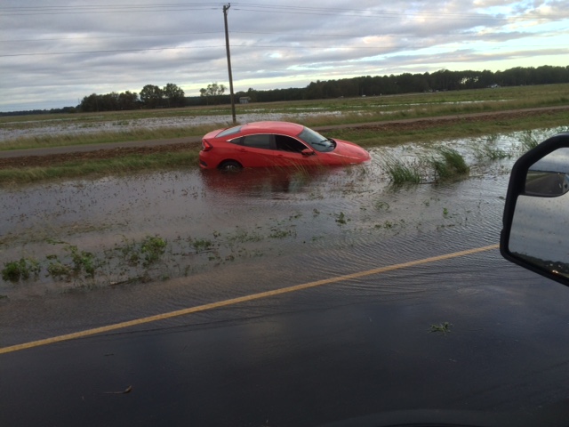
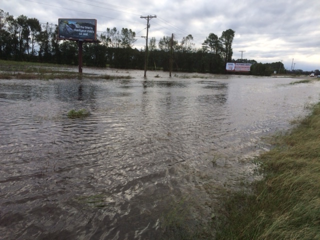
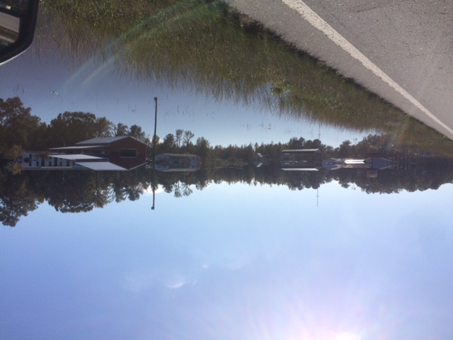
Fotos
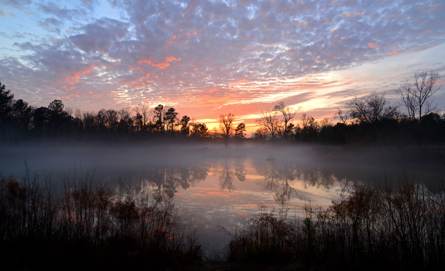
Foggy Sunset (1-11-13) | Kinston, NC

The After Light | Kinston, NC

'Southern Lights' | Kinston, NC
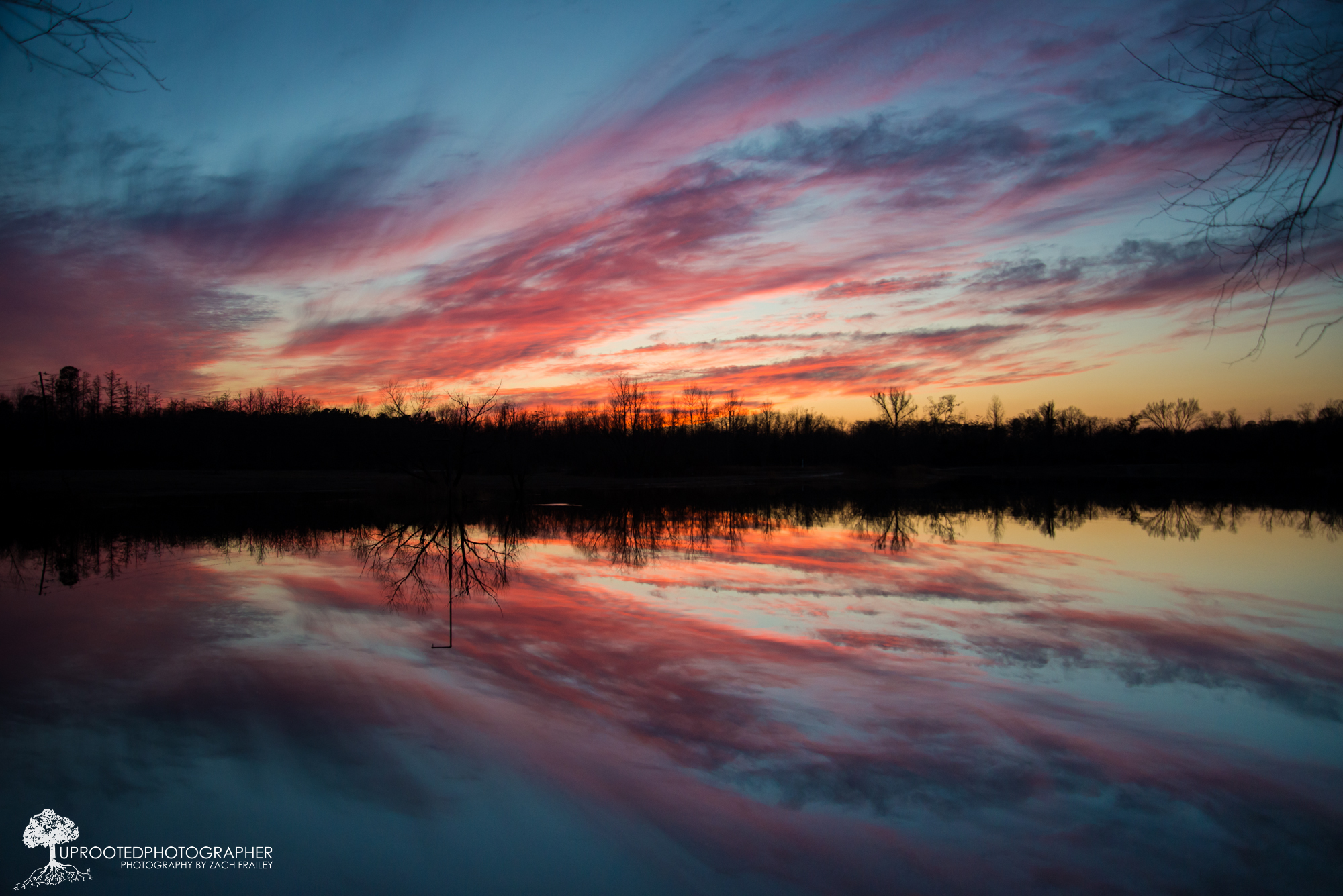
Reflected Sunset | Kinston, NC
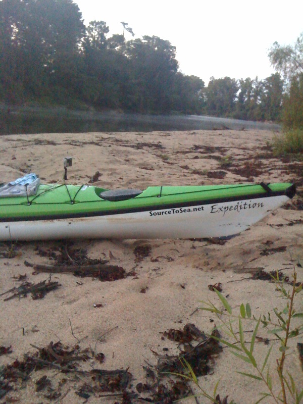
Sunrise on the Neuse River
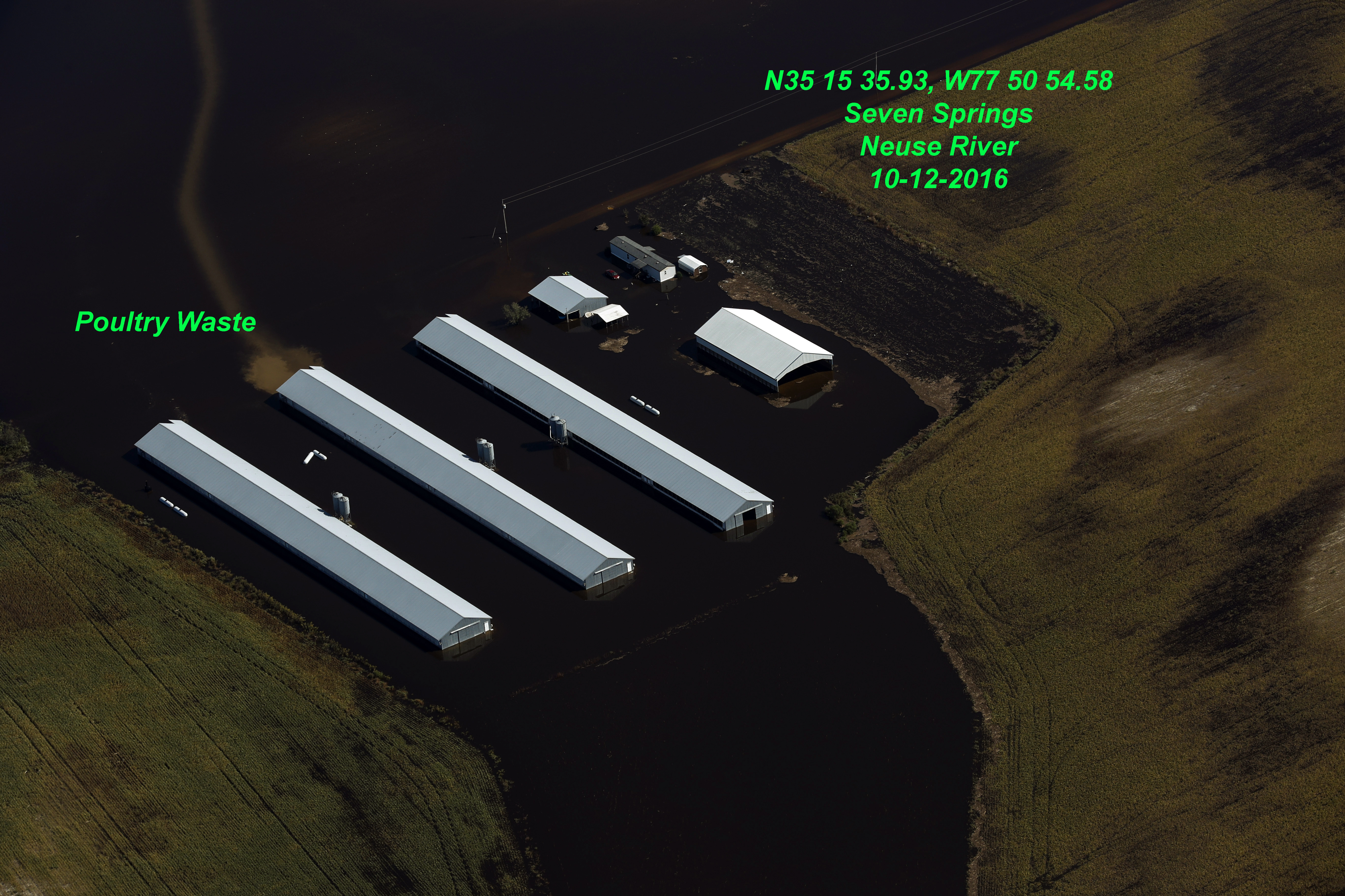
Rick Dove 101216_T4I2522
Rick Dove 101216_T4I2531
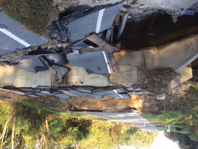
NC 55 south of Sandy Bottom
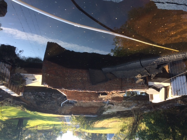
NC 55 Southern Lenoir County

US-70 Bypass in Kinston
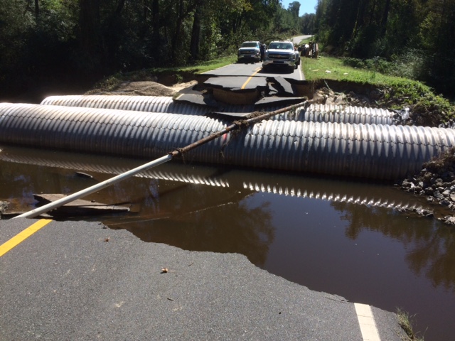
NC 903 south of LaGrange
US 70 west of Kinston
U.S. 70
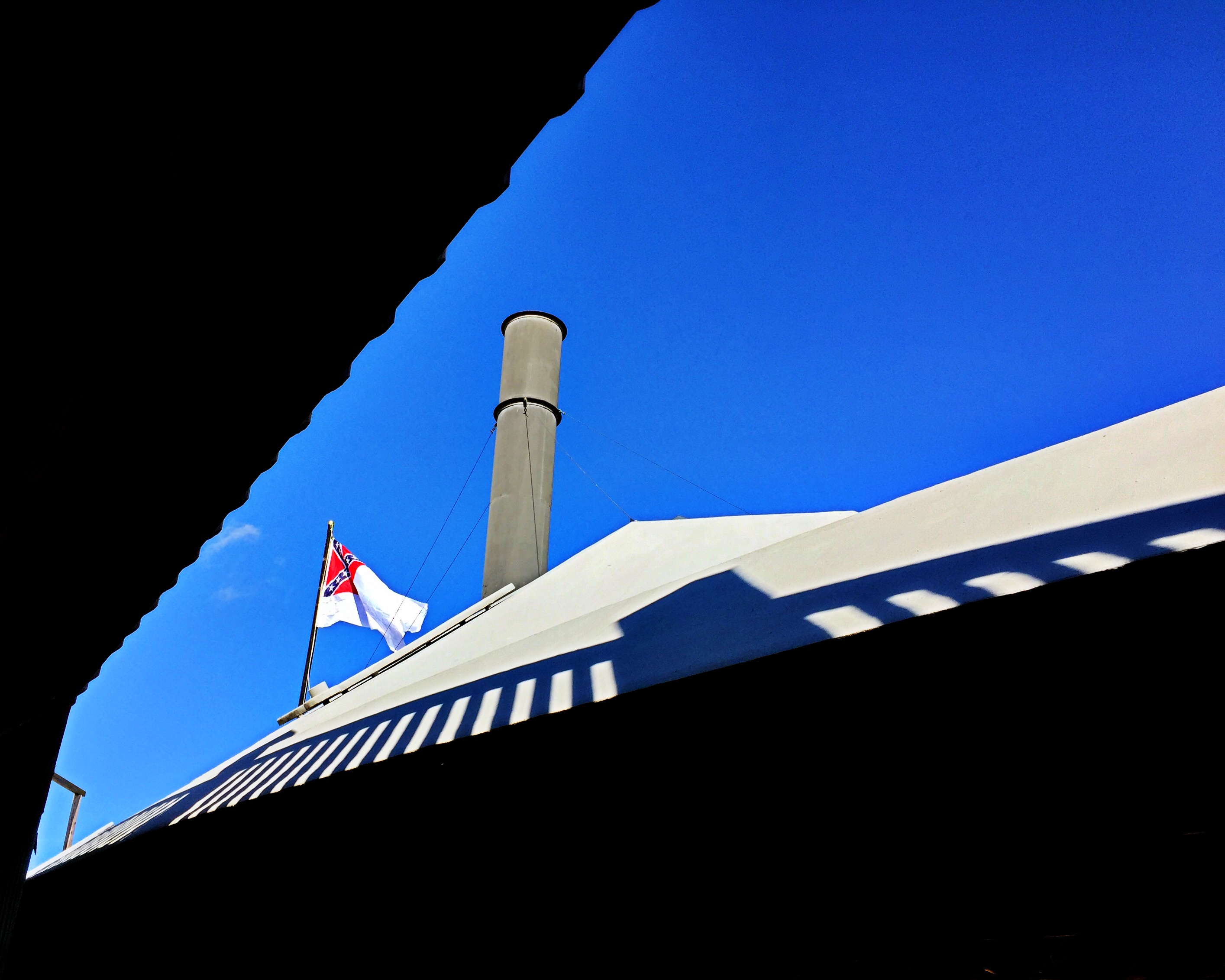
CSS Neuse

4 28 2015 48C MP EC-20.7 Sanderson Farms Feed Mill Rail Loop.

4 3 2015 92Q MP EC-11 Hartsoe Pass Sliding, County Line Road A48rpn1

4 3 2015 92Q MP EC-11 Hartsoe Pass Sliding, County Line Road A125

Familjen Paul
US-70 Bypass in Kinston
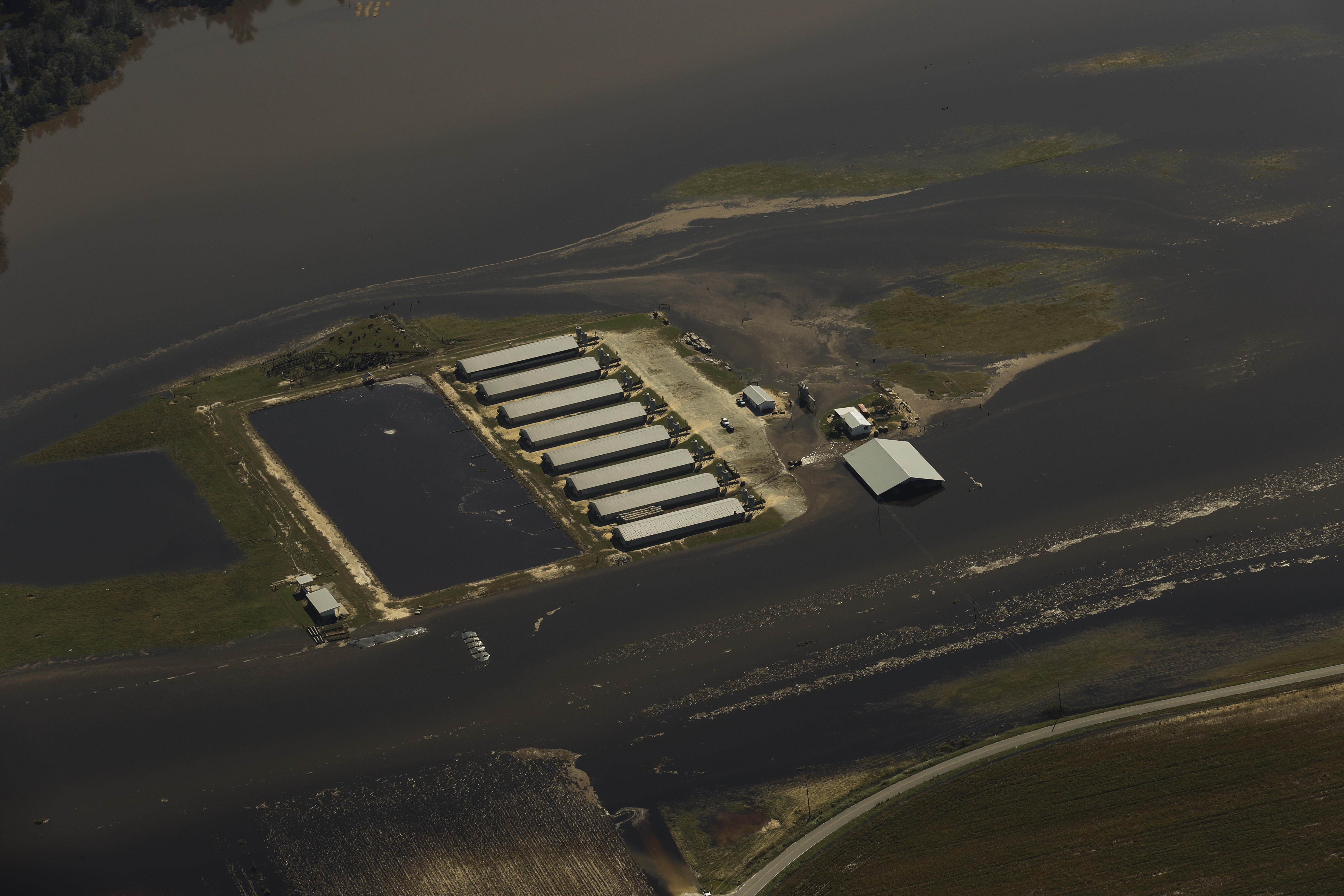
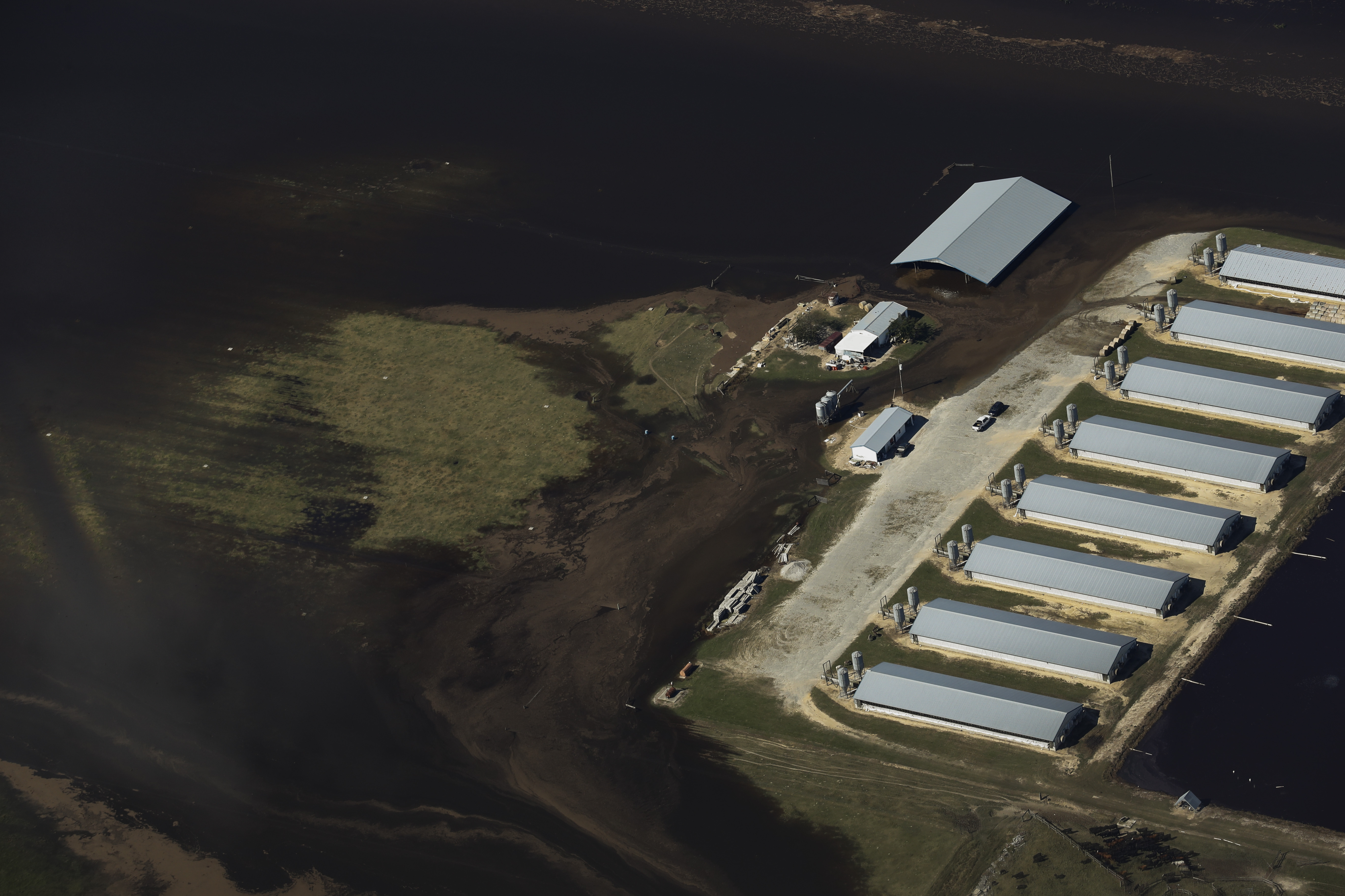
CAFO 14

#TBT

anhinga, Kinston, NC, Nov. 2012

looking over the ironclad CSS Neuse full-scale replica toward Herritage Street and downtown Kinston, NC

live oak on north edge of town

building detail, Herritage Street, Kinston, NC

red-tailed hawk
Louie Pollock Road, Louie Pollock Rd, La Grange, NC, USA Karte
Suchen Sie einen anderen Ort
Nahe Plätze
Davis-Hardy Rd, Kinston, NC, USA
Moseley Hall, NC, USA
Trent, NC, USA
Moss Hill Ruritan Building, NC-55, Seven Springs, NC, USA
La Grange, North Carolina, USA
West Washington Street, W Washington St, La Grange, NC, USA
Main St, Seven Springs, NC, USA
Seven Springs, NC, USA
Grace's Farm Road, Grace's Farm Rd, New Hope, NC, USA
Ellington Way, La Grange, NC, USA
Walnut Creek, NC, USA
Clay Rd, Goldsboro, NC, USA
Sevendales Dr, Goldsboro, NC, USA
NC-, Seven Springs, NC, USA
Lakeshore Dr, Goldsboro, NC, USA
Lakeshore Dr, Goldsboro, NC, USA
Solara Dr, Goldsboro, NC, USA
Leafwood Dr, Goldsboro, NC, USA
New Hope, NC, USA
Indian Springs Rd, Seven Springs, NC, USA
Letzte Suche
- Red Dog Mine, AK, USA Sonnenaufgang Sonnenuntergang Zeiten
- Am Bahnhof, Am bhf, Borken, Germany Sonnenaufgang Sonnenuntergang Zeiten
- 4th St E, Sonoma, CA, USA Sonnenaufgang Sonnenuntergang Zeiten
- Oakland Ave, Williamsport, PA, USA Sonnenaufgang Sonnenuntergang Zeiten
- Via Roma, Pieranica CR, Italien Sonnenaufgang Sonnenuntergang Zeiten
- Glockenturm, Grad, Dubrovnik, Kroatien Sonnenaufgang Sonnenuntergang Zeiten
- Trelew, Chubut Province, Argentina Sonnenaufgang Sonnenuntergang Zeiten
- Hartfords Bluff Cir, Mt Pleasant, SC, USA Sonnenaufgang Sonnenuntergang Zeiten
- Kita-ku, Kumamoto, Präfektur Kumamoto, Japan Sonnenaufgang Sonnenuntergang Zeiten
- Pingtan Island, Pingtan County, Fuzhou, China Sonnenaufgang Sonnenuntergang Zeiten