| Zeitzone: | Brasília-Normalzeit |
|---|---|
| Ortszeit: | Mittwoch, 16. September 2026 11:53 |
| Länge: | -41.7208243 |
| Breite: | -20.4621533 |
| Sonnenaufgang Heute: | 05:43:37 |
| Sonnenuntergang Heute: | 17:42:48 |
| Tageslänge heute: | 11h 59m 10s |
| Sonnenaufgang morgen: | 05:42:40 |
| Sonnenuntergang Morgen: | 17:43:00 |
| Tageslänge von morgen: | 12h 0m 19s |
: Alle Termine anzeigen
| Datum | Sonnenaufgang | Sonnenuntergang | Tageslänge |
|---|---|---|---|
| 1. Jan. 2026 | 05:10:33 | 18:31:36 | 13h 21m 2s |
| 1. Feb. 2026 | 05:30:57 | 18:32:09 | 13h 1m 11s |
| 1. März 2026 | 05:45:20 | 18:16:31 | 12h 31m 10s |
| 1. Apr. 2026 | 05:54:52 | 17:49:37 | 11h 54m 45s |
| 1. Mai 2026 | 06:04:11 | 17:26:26 | 11h 22m 14s |
| 1. Juni 2026 | 06:16:40 | 17:15:21 | 10h 58m 41s |
| 1. Juli 2026 | 06:24:31 | 17:18:49 | 10h 54m 17s |
| 1. Aug. 2026 | 06:19:01 | 17:29:56 | 11h 10m 54s |
| 1. Sep. 2026 | 05:58:12 | 17:39:21 | 11h 41m 8s |
| 16. Sep. 2026 | 05:44:34 | 17:42:35 | 11h 58m 1s |
| 17. Sep. 2026 | 05:43:37 | 17:42:48 | 11h 59m 10s |
| 1. Okt. 2026 | 05:30:26 | 17:45:52 | 12h 15m 25s |
| 1. Nov. 2026 | 05:06:33 | 17:56:54 | 12h 50m 21s |
| 1. Dez. 2026 | 04:59:05 | 18:14:55 | 13h 15m 49s |
Fotos von Sonnenaufgang und Sonnenuntergang

Sunrise from the Summit at Pico da Bandeira (Flag Peak) at 2,892 m (9,488 ft) MSL, Caparaó National Park, on the border between the municipalities of Ibitirama (Espírito Santo State) and Alto Caparaó by ER's Eyes - Our planet is so beautiful.

Sete Pilões Waterfall (Seven Pylons) at 1,855 m (6,085 ft) MSL, Acampamento da Macieira (Apple Tree Camp), Caparaó National Park, Alto Caparaó, Minas Gerais State, Brazil. by ER's Eyes - Our planet is so beautiful.

Climbing down Pico do Cristal (Crystal Peak) at 2,770 m (9,087 ft) MSL, Caparaó National Park, Alto Caparaó, Minas Gerais State, Brazil. by ER's Eyes - Our planet is so beautiful.

Camp Casa Queimada at 2,190 m (7,185 ft) MSL, Caparaó National Park, Dores do Rio Preto, Espírito Santo, Brazil. by ER's Eyes - Our planet is so beautiful.

Twilight from the Summit at Pico da Bandeira (Flag Peak) at 2,892 m (9,488 ft) MSL, Caparaó National Park, on the border between the municipalities of Ibitirama (Espírito Santo State) and Alto Caparaó by ER's Eyes - Our planet is so beautiful.

Sunrise from the Summit at Pico da Bandeira (Flag Peak) at 2,892 m (9,488 ft) MSL, Caparaó National Park, on the border between the municipalities of Ibitirama (Espírito Santo State) and Alto Caparaó by ER's Eyes - Our planet is so beautiful.

Sunrise from the Summit at Pico da Bandeira (Flag Peak) at 2,892 m (9,488 ft) MSL, Caparaó National Park, on the border between the municipalities of Ibitirama (Espírito Santo State) and Alto Caparaó by ER's Eyes - Our planet is so beautiful.

Sunrise from the Summit at Pico da Bandeira (Flag Peak) at 2,892 m (9,488 ft) MSL, Caparaó National Park, on the border between the municipalities of Ibitirama (Espírito Santo State) and Alto Caparaó by ER's Eyes - Our planet is so beautiful.

Sunrise from the Summit at Pico da Bandeira (Flag Peak) at 2,892 m (9,488 ft) MSL, Caparaó National Park, on the border between the municipalities of Ibitirama (Espírito Santo State) and Alto Caparaó by ER's Eyes - Our planet is so beautiful.

Twilight from the Summit at Pico da Bandeira (Flag Peak) at 2,892 m (9,488 ft) MSL, Caparaó National Park, on the border between the municipalities of Ibitirama (Espírito Santo State) and Alto Caparaó by ER's Eyes - Our planet is so beautiful.

Pico da Bandeira (Flag Peak) seen from the Summit of Pico do Calçado (Shoe Peak) at 2,849 m (9,347 ft), Caparaó National Park, on the border between the municipalities of Ibitirama (Espírito Santo Sta by ER's Eyes - Our planet is so beautiful.

Sunrise from the Summit at Pico da Bandeira (Flag Peak) at 2,892 m (9,488 ft) MSL, Caparaó National Park, on the border between the municipalities of Ibitirama (Espírito Santo State) and Alto Caparaó by ER's Eyes - Our planet is so beautiful.

Sunrise from the Cruzeiro at the Summit at Pico da Bandeira (Flag Peak) at 2,892 m (9,488 ft) MSL, Caparaó National Park, on the border between the municipalities of Ibitirama (Espírito Santo State) a by ER's Eyes - Our planet is so beautiful.

Sunrise from the Summit at Pico da Bandeira (Flag Peak) at 2,892 m (9,488 ft) MSL, Caparaó National Park, on the border between the municipalities of Ibitirama (Espírito Santo State) and Alto Caparaó by ER's Eyes - Our planet is so beautiful.

Sunrise from the Summit at Pico da Bandeira (Flag Peak) at 2,892 m (9,488 ft) MSL, Caparaó National Park, on the border between the municipalities of Ibitirama (Espírito Santo State) and Alto Caparaó by ER's Eyes - Our planet is so beautiful.

Trail by way of Caparaó-Capixaba at 2,480 m (8,136 ft) MSL, Caparaó National Park, Dores do Rio Preto, Espírito Santo State, Brazil. by ER's Eyes - Our planet is so beautiful.

Trail by way of Caparaó-Capixaba at 2,540 m (8,333 ft) MSL, Caparaó National Park, Dores do Rio Preto, Espírito Santo State, Brazil. by ER's Eyes - Our planet is so beautiful.

Casa da Serra Caparaó (Caparao Mountain Range House) at 1,220 m (4,002 ft) MSL, Forquilha do Rio, Minas Gerais State, Brazil. by ER's Eyes - Our planet is so beautiful.

Visitor Center at 1,420 m (4,658 ft) MSL, Caparaó National Park, Pedra Menina, Espírito Santo, Brazil. by ER's Eyes - Our planet is so beautiful.

Casa da Serra Caparaó (Caparao Mountain Range House) at 1,220 m (4,002 ft) MSL, Forquilha do Rio, Minas Gerais State, Brazil. by ER's Eyes - Our planet is so beautiful.

Guest Houses, Casa da Serra Caparaó at 1,220 m (4,002 ft) MSL, Forquilha do Rio, Minas Gerais, Brazil. by ER's Eyes - Our planet is so beautiful.

2010 - Trilha ao Pico da Bandeira, Alto Caparaó e Natividade, Inverno by Wilson Moura

2010 - Trilha ao Pico da Bandeira, Alto Caparaó e Natividade, Inverno by Wilson Moura

2010 - Trilha ao Pico da Bandeira, Alto Caparaó e Natividade, Inverno by Wilson Moura

Por do Sol by bodimes
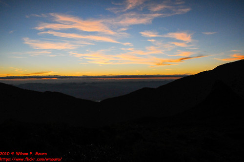
2010 - Trilha ao Pico da Bandeira, Alto Caparaó e Natividade, Inverno by Wilson Moura

2010 - Trilha ao Pico da Bandeira, Alto Caparaó e Natividade, Inverno by Wilson Moura

2010 - Trilha ao Pico da Bandeira, Alto Caparaó e Natividade, Inverno by Wilson Moura

Por-do-sol ... Pedra Menina by Tody Macedo

2010 - Trilha ao Pico da Bandeira, Alto Caparaó e Natividade, Inverno by Wilson Moura

Vamos assistir o Pôr do Sol e o chegar da noite by Roberto Junioor Scoralich

2010 - Trilha ao Pico da Bandeira, Alto Caparaó e Natividade, Inverno by Wilson Moura

2010 - Trilha ao Pico da Bandeira, Alto Caparaó e Natividade, Inverno by Wilson Moura

2010 - Trilha ao Pico da Bandeira, Alto Caparaó e Natividade, Inverno by Wilson Moura

2010 - Trilha ao Pico da Bandeira, Alto Caparaó e Natividade, Inverno by Wilson Moura

Paisagens by ab_tavaresfotos

Sun Rising by OPEN YOUR EYES TO THE WORLD

Sunset in "Dores do Rio Preto" by Helder_Carelli

noite no Pico da Bandeira by André Valério

Sunset by honey&i

foto 3 by Zumerle

20120907_172538 by hugoloureiro

20120907_172713 by hugoloureiro